Items Similar to Antique Map of the Low Countries by Cary, 1813

Want more images or videos?
Request additional images or videos from the seller
1 of 5
Antique Map of the Low Countries by Cary, 1813
About the Item
Antique map of the Netherlands titled 'A New Map of the United Provinces comprehending Holland, Zealand, Utrecht, Gelders, Over Yssel, Friesland and Groningen (..)'. Scarce re-edition of a large-sized general map of the Low Countries published by the English cartographer John Cary (1755-1835). Printed on 4 leaves.
Artists and Engravers: Published by J. Cary, London.
Condition: Good, general age-related toning. Some wear including small tears in the margins, slightly affecting image (partly repaired). Shipped in tube. Please study image carefully.
Date: 1813
Overall size: 90 x 68.5 cm.
Image size: 85 x 62.5 cm.
We sell original antique maps to collectors, historians, educators and interior decorators all over the world. Our collection includes a wide range of authentic antique maps from the 16th to the 20th centuries. Buying and collecting antique maps is a tradition that goes back hundreds of years. Antique maps have proved a richly rewarding investment over the past decade, thanks to a growing appreciation of their unique historical appeal. Today the decorative qualities of antique maps are widely recognized by interior designers who appreciate their beauty and design flexibility. Depending on the individual map, presentation, and context, a rare or antique map can be modern, traditional, abstract, figurative, serious or whimsical. We offer a wide range of authentic antique maps for any budget
- Dimensions:Height: 26.97 in (68.5 cm)Width: 35.44 in (90 cm)Depth: 0 in (0.01 mm)
- Materials and Techniques:
- Period:
- Date of Manufacture:1813
- Condition:
- Seller Location:Langweer, NL
- Reference Number:Seller: BGJC-3411stDibs: LU3054327829392
About the Seller
5.0
Recognized Seller
These prestigious sellers are industry leaders and represent the highest echelon for item quality and design.
Gold Seller
Premium sellers maintaining a 4.3+ rating and 24-hour response times
Established in 2009
1stDibs seller since 2017
2,467 sales on 1stDibs
Typical response time: 1 hour
- ShippingRetrieving quote...Shipping from: Langweer, Netherlands
- Return Policy
Authenticity Guarantee
In the unlikely event there’s an issue with an item’s authenticity, contact us within 1 year for a full refund. DetailsMoney-Back Guarantee
If your item is not as described, is damaged in transit, or does not arrive, contact us within 7 days for a full refund. Details24-Hour Cancellation
You have a 24-hour grace period in which to reconsider your purchase, with no questions asked.Vetted Professional Sellers
Our world-class sellers must adhere to strict standards for service and quality, maintaining the integrity of our listings.Price-Match Guarantee
If you find that a seller listed the same item for a lower price elsewhere, we’ll match it.Trusted Global Delivery
Our best-in-class carrier network provides specialized shipping options worldwide, including custom delivery.More From This Seller
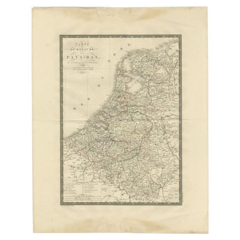
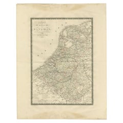
View AllAntique Map of the Low Countries by Brué, 1822
Located in Langweer, NL
Antique map titled 'Carte du Royaume des Pays-Bas'. Large format map of the Low Countries. This map originates from 'Atlas Universel', published 1822...
Category
Antique 19th Century Maps
Materials
Paper
$160 Sale Price
20% Off
Antique Map of the Low Countries by Seutter, c.1745
Located in Langweer, NL
Antique map titled ‘XVII Provinciae Belgii sive Germaniae Inferioris (..)’. Detailed hand colored map of the Low Countries. Includes colored decorative cartouche, compass rose and co...
Category
Antique 18th Century Maps
Materials
Paper

$463 Sale Price
20% Off
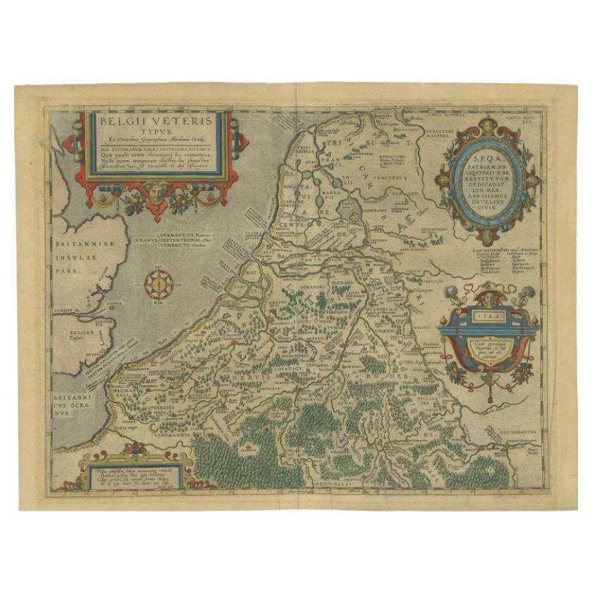
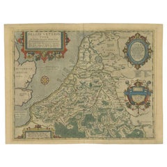
Antique Map of the Low Countries by Ortelius, 1584
By Abraham Ortelius
Located in Langweer, NL
Antique map titled 'Belgii Veteris Typus'. Beautiful map of the Low Countries, extending to the English Channel and part of Britain. This map originates from Ortelius' 'Theatrum Orbi...
Category
Antique 16th Century Maps
Materials
Paper
$549 Sale Price
20% Off
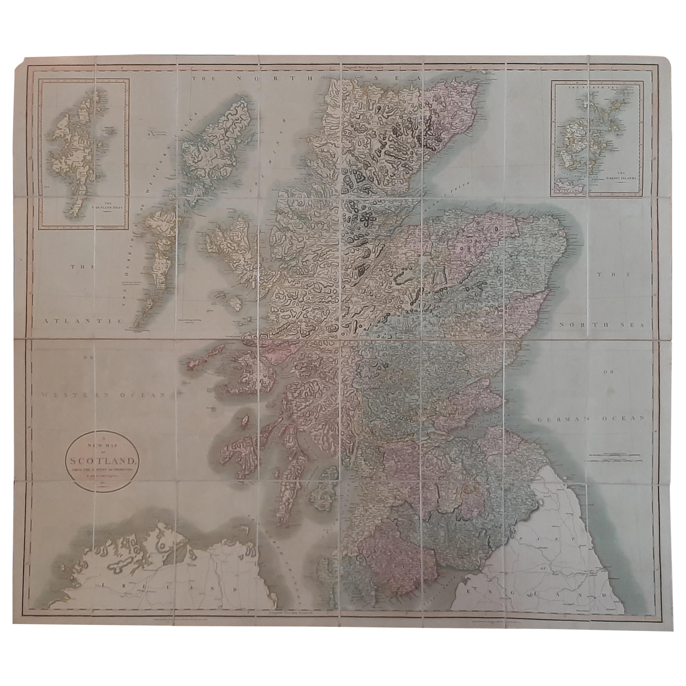
Antique Map of Scotland by Cary, '1811'
Located in Langweer, NL
Antique map titled 'A New Map of Scotland from the Latest Authorities':
**Title**: A New Map of Scotland from the Latest Authorities
**Publisher**: J....
Category
Antique Early 19th Century Maps
Materials
Linen, Paper

$744 Sale Price
20% Off
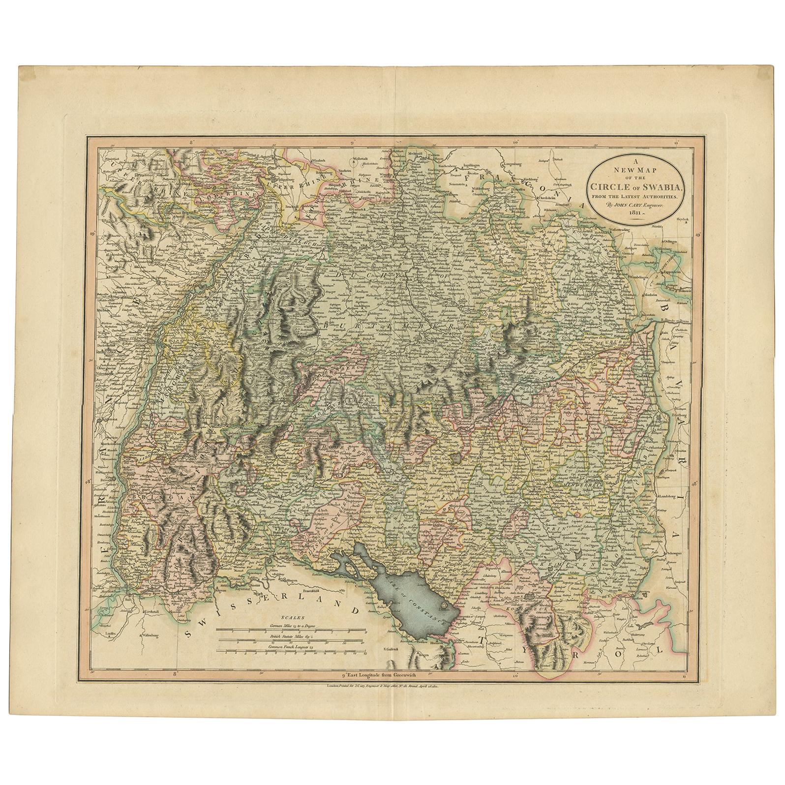
Antique Map of the Swabia Region of Germany by Cary, '1811'
By John Cary
Located in Langweer, NL
Antique map titled 'A New Map of the Circle of Swabia'. Antique map of Swabia in Southwestern Germany. Covers from the Upper Rhine region south as far as Switzerland, Lake Constance ...
Category
Antique Early 19th Century Maps
Materials
Paper

$232 Sale Price
20% Off
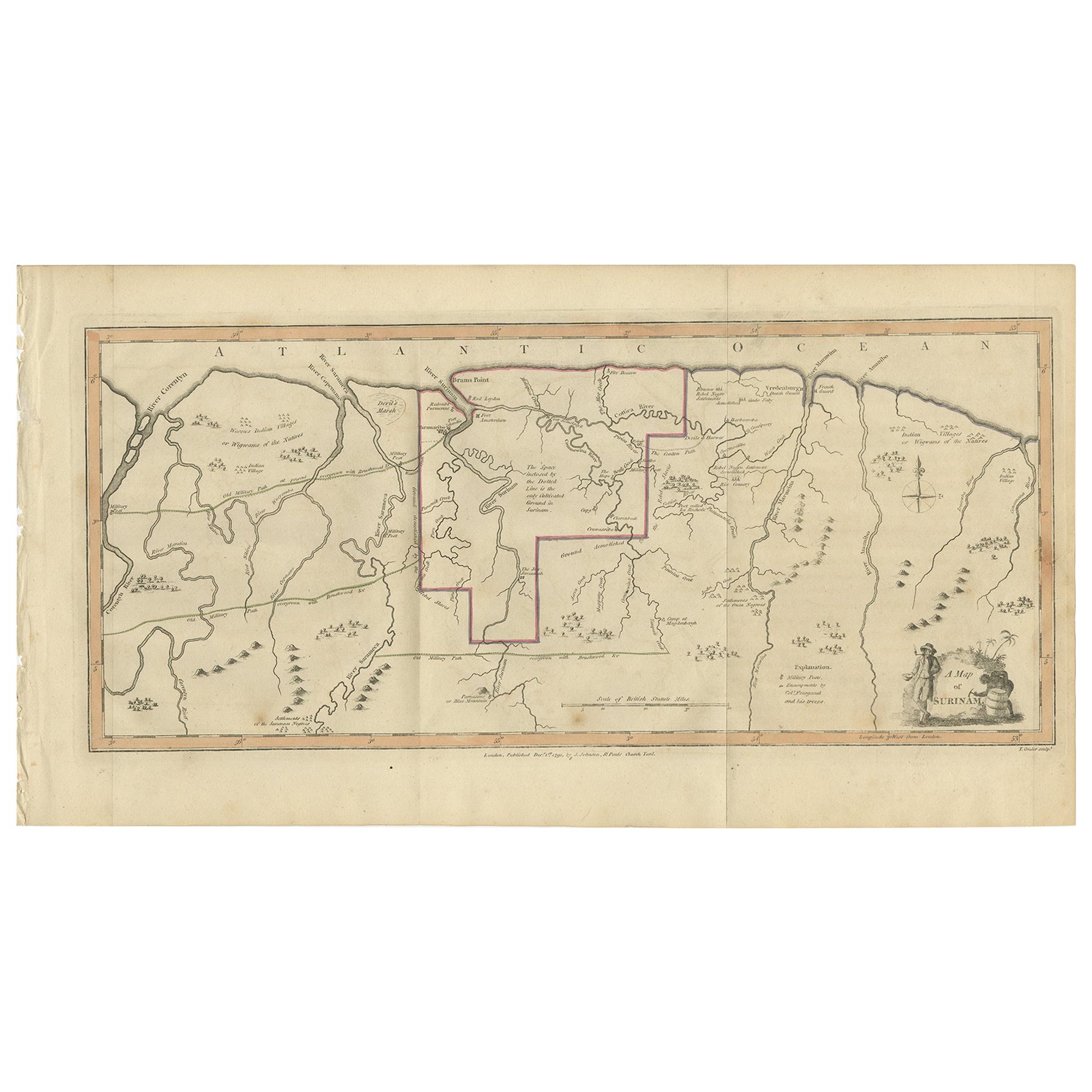
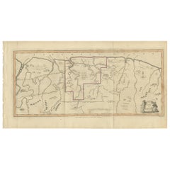
Antique Map of Surinam by Stedman '1813'
Located in Langweer, NL
Antique map titled 'A Map of Surinam'. Original antique map of Surinam, showing Dutch settlements, military posts, rebel Maroon camps and native villages. This map originates from 'N...
Category
Antique Early 19th Century Maps
Materials
Paper
$465 Sale Price
20% Off
You May Also Like
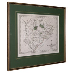
Antique County Map, Rutlandshire, Framed Atlas Cartography, John Cary, Georgian
Located in Hele, Devon, GB
This is an antique county map of Rutlandshire. An English, framed atlas engraving of cartographic interest, dating to the Georgian period and later, circa 1790.
Superb cartography ...
Category
Antique Late 18th Century British Georgian Maps
Materials
Glass, Wood, Paper
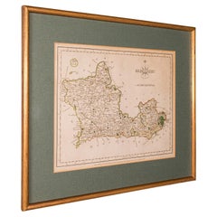
Antique County Map, Berkshire, English, Framed, Cartography, John Cary, C.1790
Located in Hele, Devon, GB
This is an antique county map of Berkshire. An English, framed atlas engraving of cartographic interest by John Cary, dating to the late 18th century and later.
Superb lithography ...
Category
Antique Late 18th Century British George III Maps
Materials
Glass, Wood, Paper
Gold Leaf Foil Pictorial Plan Map of the West Country of England Antique Style
Located in West Sussex, Pulborough
We are delighted to offer for sale this lovely Antique style pictorial plan map of the West Country of England etched in gold leaf foil
This is a very interesting and decorative p...
Category
20th Century English Adam Style Maps
Materials
Gold Leaf

$303 Sale Price
20% Off
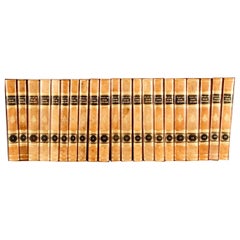
1813 The Plays of William Shakespeare
By William Shakespeare
Located in Bath, GB
An exceptionally bright example of the scarce 1813 twenty-one volume set of the plays of Shakespeare, supplemented with a wealth of comments and critical notices.
The very scarce complete 1813 twenty-one volume edition of the plays of Shakespeare. Referred to as the Reed Edition of 1813, this is also known as Johnson-Steevens-Reed 6, the "sixth edition" by Johnson-Steevens, or the "second variorum edition".
With notes by Samuel Johnson and George Steevens, this edition was revised and augmented by Isaac Reed.
Consisting of:
Volume I - Prefatory material and critical analysis by Reed, Richardson, and Malone. Illustrated with a portrait frontispiece, and four plates.
Volume II - Essays by Farmer, Colman, lists of Editions, lists of Criticism, Commendatory verses, Malones "Attempt to Ascertain the Order of Shakespeare's Plays," Malone's essay on Ford's pamphlet, Steevens's remarks on the same.
Volume III - Malone's Historical Account of the English Stage, and the Further Historical Account by Chalmers. With four folding plates.
Volume IV - The Tempest; Two Gentlemen of Verona; Midsummer Night's Dream.
Volume V - Merry Wives of Windsor; Twelfth Night.
Volume VI - Much Ado About Nothing; Measure for Measure.
Volume VII - Love's Labour's Lost; Merchant of Venice.
Volume VIII - As You Like It; All's Well That Ends Well.
Volume IX - Taming of the Shrew; Winter's Tale.
Volume X - Macbeth; King John.
Volume XI - King Richard II; King Henry IV, Part 1. With a folding plate.
Volume XII - King Henry IV, Part 2; King Henry V.
Volume XIII - King Henry VI, Part 1; King Henry IV, Part 2.
Volume XIV - King Henry VI, Part 3; Dissertation, &c.; King Richard III.
Volume XV - King Henry VIII; Troilus and Cressida.
Volume XVI - Coriolanus; Julius Caesar.
Volume XVII - Antony and Cleopatra; King Lear.
Volume XVIII - Hamlet; Cymbeline.
Volume XIX - Timon of Athens; Othello.
Volume XX - Romeo and Juliet; Comedy of Errors.
Volume XXI - Titus Andronicus...
Category
Antique 1810s British Books
Materials
Paper
Original Antique Map of The Philippines. C.1900
Located in St Annes, Lancashire
Fabulous map of The Philippines
Original color.
Engraved and printed by the George F. Cram Company, Indianapolis.
Published, C.1900.
Unframed.
Free shipping.
Category
Antique 1890s American Maps
Materials
Paper

Original Antique Map of The World by Thomas Clerk, 1817
Located in St Annes, Lancashire
Great map of The Eastern and Western Hemispheres
On 2 sheets
Copper-plate engraving
Drawn and engraved by Thomas Clerk, Edinburgh.
Published by Mackenzie And Dent, 1817
...
Category
Antique 1810s English Maps
Materials
Paper

Recently Viewed
View AllMore Ways To Browse
Manuel Canovas
Maple Slab Coffee Table
Marcel Breuer B32 Cesca Chairs
Marcel Breuer B34
Marenco Mobilgirgi
Marmo Console
Massage Table
Max Id Ny
Mcguire Bamboo Sofa
Mcguire Ottoman
Mcm Round Coffee Table
Medici Chair
Medieval Cup
Memphis Bar Cart
Memphis Bar Stool
Mendel Furniture
Mendini Proust
Meret Oppenheim Traccia Table