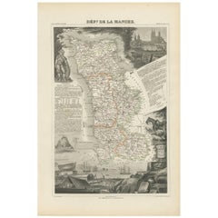
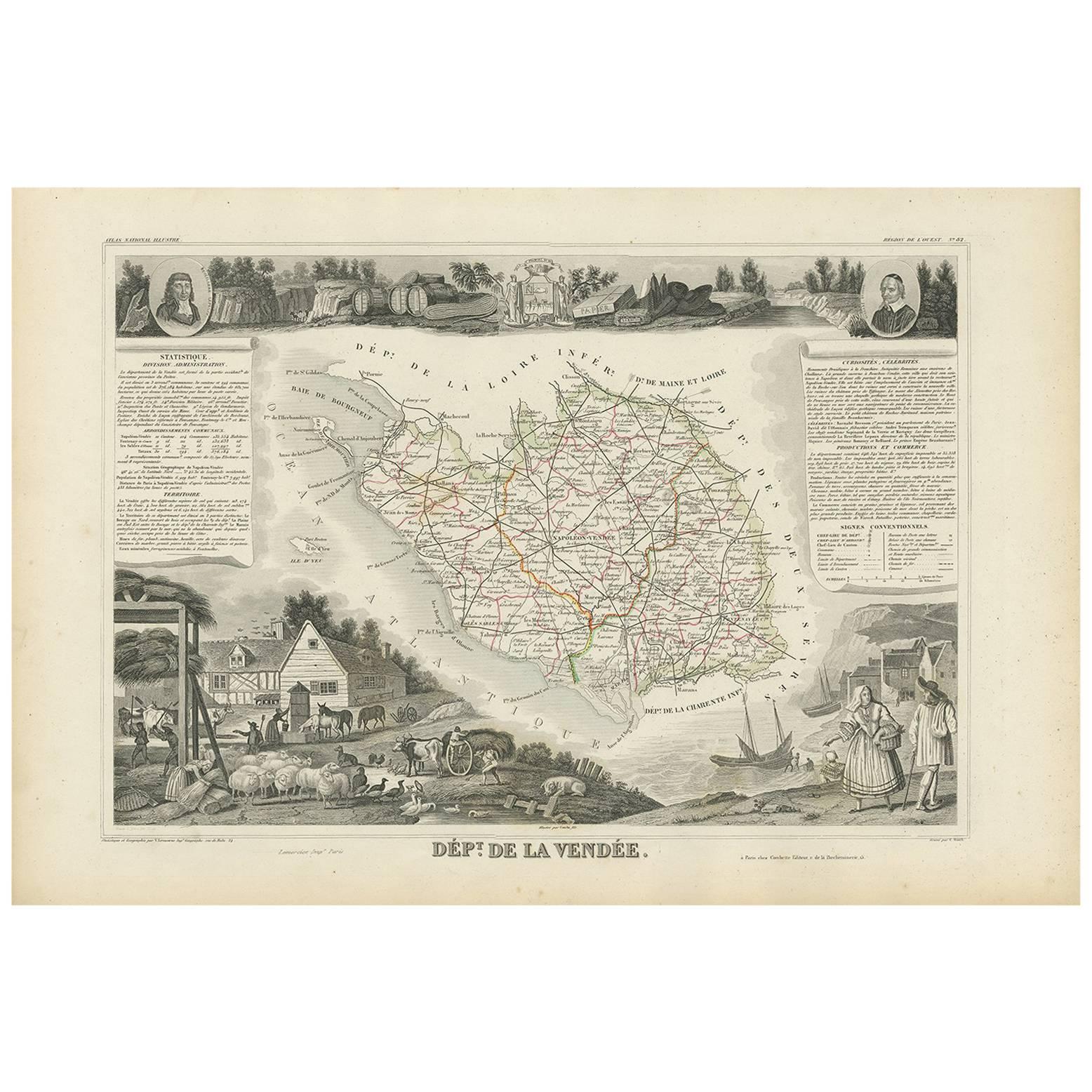
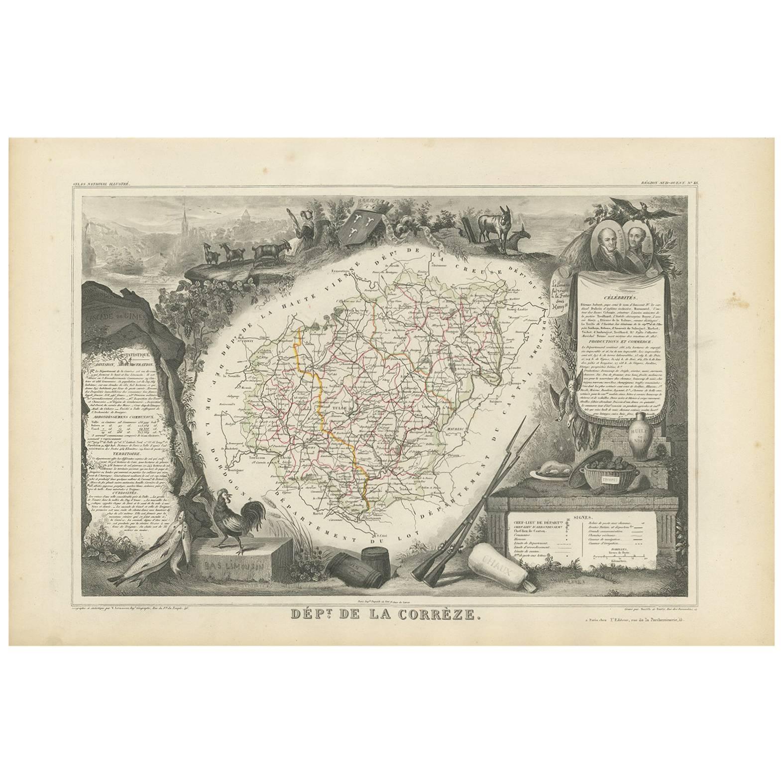
Antique Map of Manche ‘France’ by V. Levasseur, 1854
View Similar Items


Want more images or videos?
Request additional images or videos from the seller
1 of 5
Antique Map of Manche ‘France’ by V. Levasseur, 1854
About the Item
- Dimensions:Height: 13.98 in (35.5 cm)Width: 20.67 in (52.5 cm)Depth: 0.02 in (0.5 mm)
- Materials and Techniques:
- Period:
- Date of Manufacture:1854
- Condition:General age-related toning. Please study image carefully.
- Seller Location:Langweer, NL
- Reference Number:Seller: BG-05614/741stDibs: LU3054310764721
About the Seller
5.0
Platinum Seller
These expertly vetted sellers are 1stDibs' most experienced sellers and are rated highest by our customers.
Established in 2009
1stDibs seller since 2017
1,948 sales on 1stDibs
More From This SellerView All
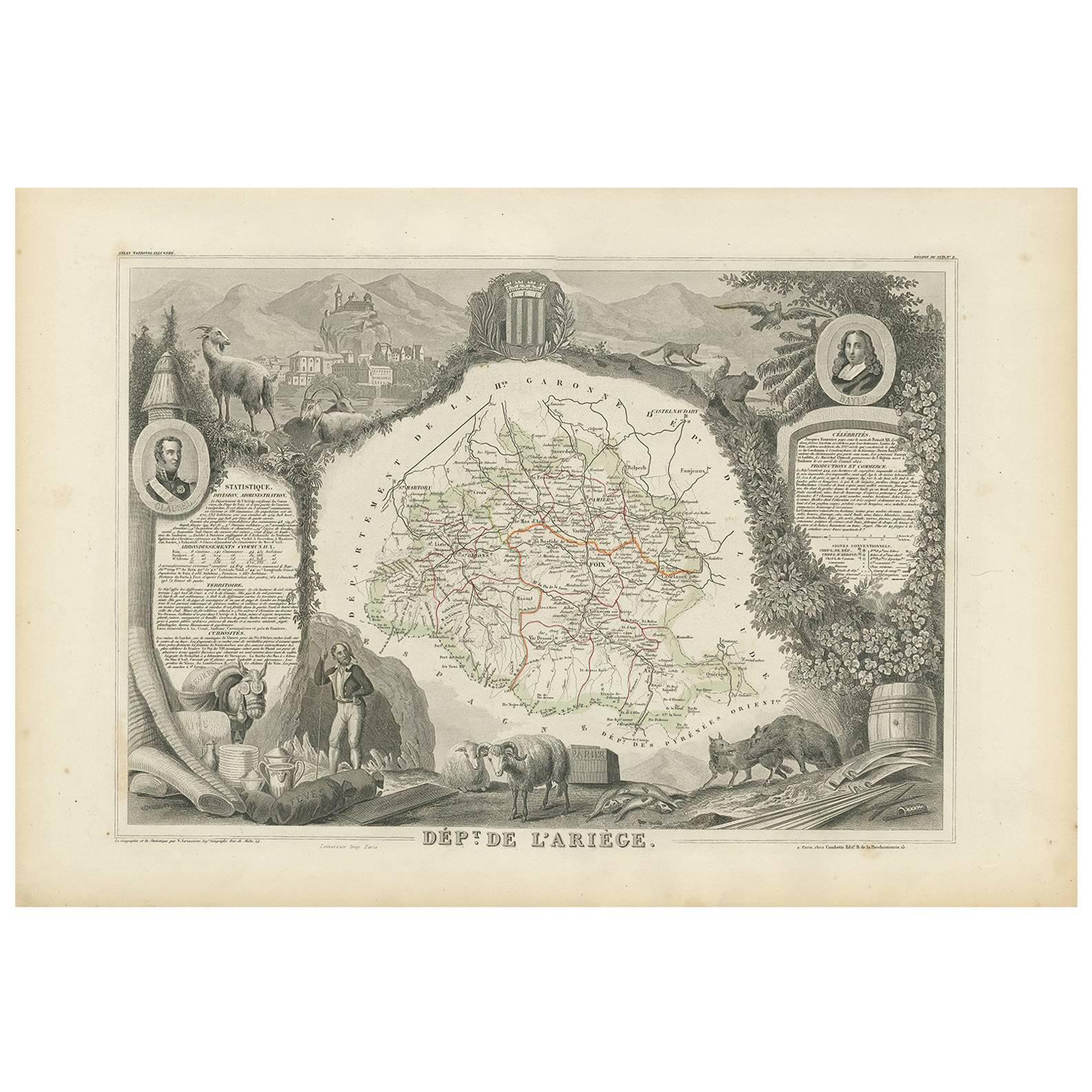
- Antique Map of Landes ‘France’ by V. Levasseur, 1854By Victor LevasseurLocated in Langweer, NLAntique map titled 'Dépt. des Landes'. Map of the French department Landes, France. This area is known for its production of Chalossais, a white cow cheese with a gentle, acidic edge...Category
Antique Mid-19th Century Maps
MaterialsPaper
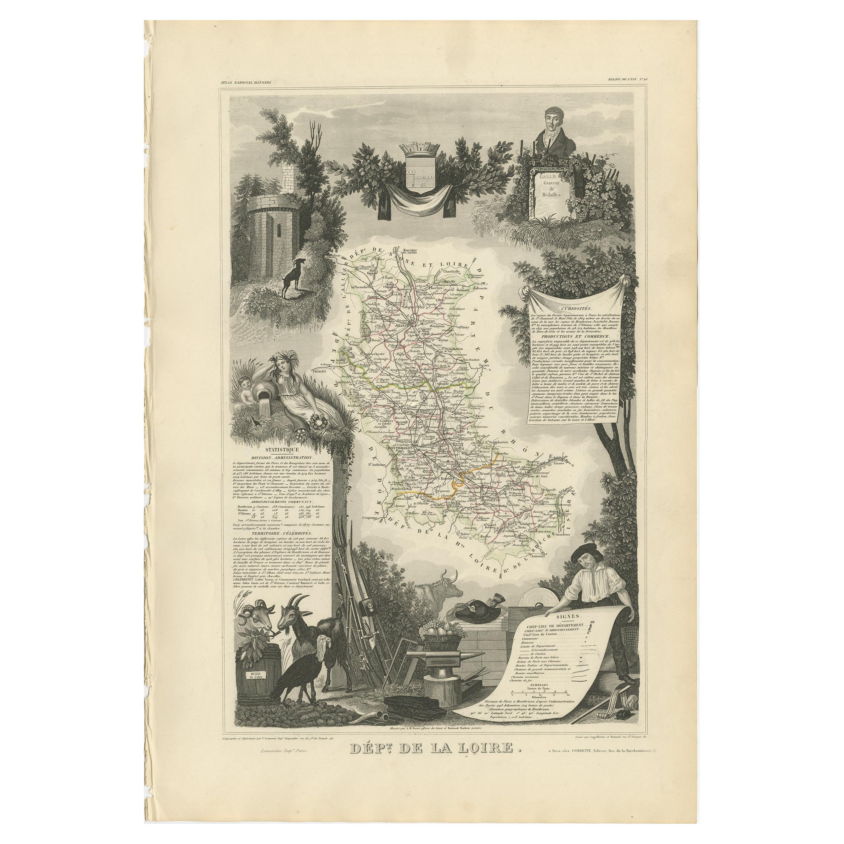
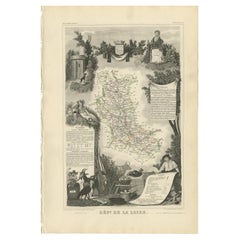
- Antique Map of Loire ‘France’ by V. Levasseur, 1854Located in Langweer, NLAntique map titled 'Dépt. de la Loire'. Map of the French department of Loire, France. This area of France is part of the Loire Valley wine growing region...Category
Antique Mid-19th Century Maps
MaterialsPaper
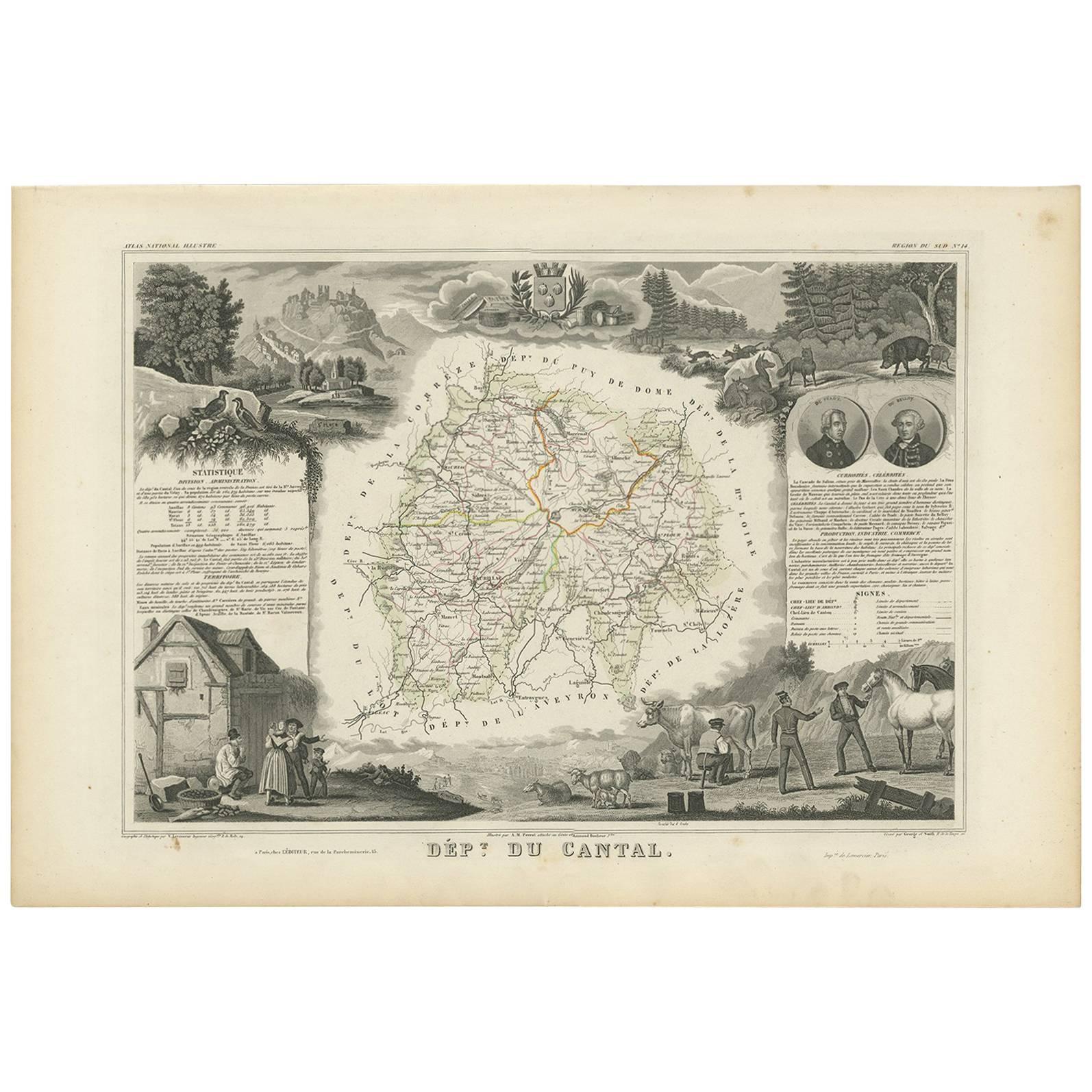
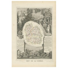
- Antique Map of Lozère ‘France’ by V. Levasseur, 1854Located in Langweer, NLAntique map titled 'Dépt. de la Lozère'. Map of the French department of Lozere, France. This remote mountainous part of Languedoc is rural, sparcely populated, and extremely beautif...Category
Antique Mid-19th Century Maps
MaterialsPaper
 $148 Sale Price25% Off
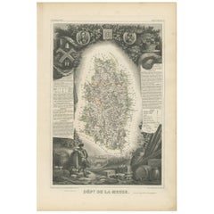
 - Antique Map of Meuse ‘France’ by V. Levasseur, 1854Located in Langweer, NLAntique map titled 'Dépt. de la Meuse'. Map of the French department of Meuse, France. This area part of the Lorraine or Alsace-Lorraine wine regions. It is also known for its produc...Category
Antique Mid-19th Century Maps
MaterialsPaper
 $148 Sale Price25% Off
 - Antique Map of Nièvre ‘France’ by V. Levasseur, 1854Located in Langweer, NLAntique map titled 'Dépt. de la Nièvre'. Map of the French department of Nievre, France. Part of the prestiegous Burgundy or Bourgogne wine region this area is known for its producti...Category
Antique Mid-19th Century Maps
MaterialsPaper
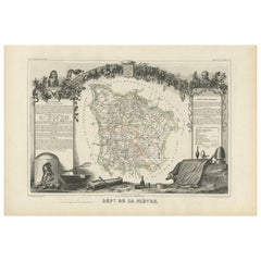 $148 Sale Price25% Off
 - Antique Map of Morbihan ‘France’ by V. Levasseur, 1854Located in Langweer, NLAntique map titled 'Dépt. du Morbihan'. Map of the French department of Morbihan, France. This map originates from ‘Atlas National de la France Illustré’. Published by A. Combette, P...Category
Antique Mid-19th Century Maps
MaterialsPaper
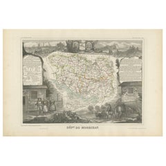 $148 Sale Price25% Off

You May Also Like
- Antique Map of Italy by Andriveau-Goujon, 1843By Andriveau-GoujonLocated in New York, NYAntique Map of Italy by Andriveau-Goujon, 1843. Map of Italy in two parts by Andriveau-Goujon for the Library of Prince Carini at Palazzo Carini i...Category
Antique 1840s French Maps
MaterialsLinen, Paper
 $3,350 / set
 - Antique Map of Principality of MonacoBy Antonio Vallardi EditoreLocated in Alessandria, PiemonteST/619 - "Old Geographical Atlas of Italy - Topographic map of ex-Principality of Monaco" - ediz Vallardi - Milano - A somewhat special edition ---Category
Antique Late 19th Century Italian Other Prints
MaterialsPaper
 $228 Sale Price74% Off
 - Original Antique Map of Russia By Arrowsmith. 1820Located in St Annes, LancashireGreat map of Russia Drawn under the direction of Arrowsmith Copper-plate engraving Published by Longman, Hurst, Rees, Orme and Brown, 1820 Unframed.Category
Antique 1820s English Maps
MaterialsPaper

- Original Antique Map of Belgium by Tallis, Circa 1850Located in St Annes, LancashireGreat map of Belgium Steel engraving Many lovely vignettes Published by London Printing & Publishing Co. ( Formerly Tallis ), C.1850 Origin...Category
Antique 1850s English Maps
MaterialsPaper
- Original Antique Map of Sweden, Engraved by Barlow, 1806Located in St Annes, LancashireGreat map of Sweden Copper-plate engraving by Barlow Published by Brightly & Kinnersly, Bungay, Suffolk. 1806 Unframed.Category
Antique Early 1800s English Maps
MaterialsPaper
- Original Antique Map of China by Thomas Clerk, 1817Located in St Annes, LancashireGreat map of China Copper-plate engraving Drawn and engraved by Thomas Clerk, Edinburgh. Published by Mackenzie And Dent, 1817 Unframed.Category
Antique 1810s English Maps
MaterialsPaper


