Items Similar to Antique Map of the Moluccas and Irian Jaya (Papua), Indonesia, 1900


Want more images or videos?
Request additional images or videos from the seller
1 of 6
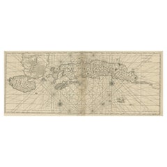
Antique Map of the Moluccas and Irian Jaya (Papua), Indonesia, 1900
About the Item
Antique map titled 'De Moluksche Eilanden en Nieuw Guinea'. Old map of the Moluccas or Maluku Islands, also showing part of New Guinea. This map originates from 'Atlas van Nederlandsch Oost- en West-Indië' by I. Dornseiffen.
Artists and Engravers: Published by Seyffardt's Boekhandel, Amsterdam.
Condition: Very good, general age-related toning. Please study image carefully.
Date: 1900
Overall size: 52.2 x 38.9 cm.
Image size: 44.3 x 34.7 cm.
We sell original antique maps to collectors, historians, educators and interior decorators all over the world. Our collection includes a wide range of authentic antique maps from the 16th to the 20th centuries. Buying and collecting antique maps is a tradition that goes back hundreds of years. Antique maps have proved a richly rewarding investment over the past decade, thanks to a growing appreciation of their unique historical appeal. Today the decorative qualities of antique maps are widely recognized by interior designers who appreciate their beauty and design flexibility. Depending on the individual map, presentation, and context, a rare or antique map can be modern, traditional, abstract, figurative, serious or whimsical. We offer a wide range of authentic antique maps for any budget.
- Dimensions:Height: 15.32 in (38.9 cm)Width: 20.56 in (52.2 cm)Depth: 0 in (0.01 mm)
- Materials and Techniques:
- Period:
- Date of Manufacture:1900
- Condition:Condition: Very good, general age-related toning. Please study image carefully.
- Seller Location:Langweer, NL
- Reference Number:Seller: BG-06669-231stDibs: LU3054327830462
About the Seller
5.0
Platinum Seller
These expertly vetted sellers are 1stDibs' most experienced sellers and are rated highest by our customers.
Established in 2009
1stDibs seller since 2017
1,940 sales on 1stDibs
Typical response time: <1 hour
- ShippingRetrieving quote...Ships From: Langweer, Netherlands
- Return PolicyA return for this item may be initiated within 14 days of delivery.
More From This SellerView All
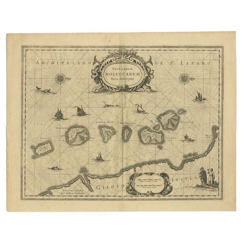
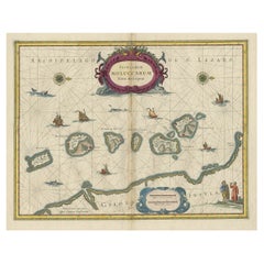
- Antique Map of the Moluccas in Indonesia by Janssonius, C.1650By Johannes JanssoniusLocated in Langweer, NLAntique map titled 'Insularum Moluccarum Nova Descriptio.' Old map of the Moluccas. The famous Spice Islands, the cornerstone of the Dutch trading ...Category
Antique 17th Century Maps
MaterialsPaper
- Antique Map of the Moluccas or the Famed Spice Islands of Indonesia, 1724Located in Langweer, NLAntique map Spice Islands titled 'De landvoogdy van Amboina met de elf onderhoorige Eylanden'. This map depicts the central islands of the Maluku Arc...Category
Antique 1720s Maps
MaterialsPaper
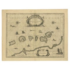
- Beautiful Antique Map of the Moluccas or Spice Islands, Indonesia, ca.1650Located in Langweer, NLAntique map titled 'Insularum Moluccarum Nova Descriptio.' Beautiful map of the Moluccas. The famous Spice Islands, the cornerstone of the Dutc...Category
Antique 1650s Maps
MaterialsPaper
- Antique Map of the Spice Islands 'Moluccas', Indonesia by W. Blaeu, circa 1640By Willem BlaeuLocated in Langweer, NLAntique map titled 'Moluccae Insulae Celeberrimae'. Highly decorative antique map of the Spice Islands (Moluccas) published by W. Blaeu (circa 1640). This map features a large inset ...Category
Antique Mid-17th Century Maps
MaterialsPaper
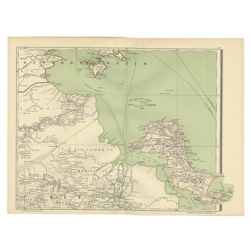
- Antique Map of the Region of Banjarmasin, Indonesia 1900Located in Langweer, NLAntique Map of the Region of Banyuasin, Sumatra. Also depicting Bangka/Banka island. This map originates from 'Atlas van Nederlandsch Oost- en West-Indië' by I. Dornseiffen. Artist...Category
20th Century Maps
MaterialsPaper
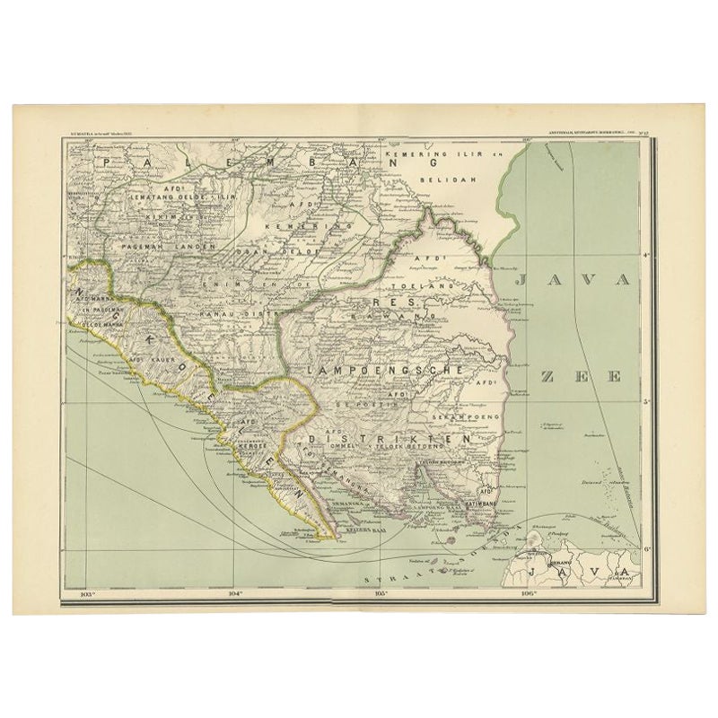
- Antique Map of the Region of Lampung, Sumatra, Indonesia, 1900Located in Langweer, NLAntique map of the region of Lampung, Sumatra. Also depicting part of Palembang and Java. This map originates from 'Atlas van Nederlandsch Oost- en West-Indië' by I. Dornseiffen. A...Category
20th Century Maps
MaterialsPaper


You May Also Like
- Map of the Republic of GenoaLocated in New York, NYFramed antique hand-coloured map of the Republic of Genoa including the duchies of Mantua, Modena, and Parma. Europe, late 18th century. Dimension: 25...Category
Antique Late 18th Century European Maps
- Antique Map of Principality of MonacoBy Antonio Vallardi EditoreLocated in Alessandria, PiemonteST/619 - "Old Geographical Atlas of Italy - Topographic map of ex-Principality of Monaco" - ediz Vallardi - Milano - A somewhat special edition ---Category
Antique Late 19th Century Italian Other Prints
MaterialsPaper
- Original Antique Map of The World by Thomas Clerk, 1817Located in St Annes, LancashireGreat map of The Eastern and Western Hemispheres On 2 sheets Copper-plate engraving Drawn and engraved by Thomas Clerk, Edinburgh. Published by Mackenzie And Dent, 1817 ...Category
Antique 1810s English Maps
MaterialsPaper
- Antique 18th Century Map of the Province of Pensilvania 'Pennsylvania State'Located in Philadelphia, PAA fine antique of the colony of Pennsylvania. Noted at the top of the sheet as a 'Map of the province of Pensilvania'. This undated and anonymous map is thought to be from the Gentleman's Magazine, London, circa 1775, although the general appearance could date it to the 1760's. The southern boundary reflects the Mason-Dixon survey (1768), the western boundary is placed just west of Pittsburgh, and the northern boundary is not marked. The map has a number of reference points that likely refer to companion text and appear to be connected to boundaries. The western and southern boundaries are marked Q, R, S, for example. A diagonal line runs from the Susquehanna R to the Lake Erie P. A broken line marked by many letters A, B, N, O, etc., appears in the east. There are no latitude or longitude markings, blank verso. Framed in a shaped contemporary gilt wooden frame and matted under a cream colored matte. Bearing an old Graham Arader Gallery...Category
Antique 18th Century British American Colonial Maps
MaterialsPaper
- Map "Estuary- Mouth of the Thames"Located in Alessandria, PiemonteST/426 - Antique French Map of the estuary of the Thames, map dated 1769 - "Mape of the entrance of the Thames. Designed by filing of Navy cards fo...Category
Antique Mid-18th Century French Other Prints
MaterialsPaper
- Original Antique Map of Spain and Portugal, circa 1790Located in St Annes, LancashireSuper map of Spain and Portugal Copper plate engraving by A. Bell Published, circa 1790. Unframed.Category
Antique 1790s English Other Maps
MaterialsPaper


Recently Viewed
View AllMore Ways To Browse
Map New Amsterdam
Indonesia Vintage Map
Indonesia Map Vintage
Irian Jaya
Antique Prints Of A Cross
Portuguese 16th
Pirate Furniture
Antique In Philippines
Victorian Book Ends
Denmark Map
18th Century Maps America
Pediment Metal
Map Hondius
Russian Antique Book
Map Of Egypt
Latin Book
Antique In The Philippines
Antique Furniture In Philippines