
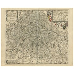
Antique Map of Naples Italy by F. de Wit, circa 1690
View Similar Items


Want more images or videos?
Request additional images or videos from the seller
1 of 5
Antique Map of Naples Italy by F. de Wit, circa 1690
About the Item
- Dimensions:Height: 20.67 in (52.5 cm)Width: 24.81 in (63 cm)Depth: 0.02 in (0.5 mm)
- Materials and Techniques:
- Period:Late 17th Century
- Date of Manufacture:circa 1690
- Condition:Minor fading. Minor folding. Please study image carefully.
- Seller Location:Langweer, NL
- Reference Number:Seller: BG-091861stDibs: LU305439943861
About the Seller
5.0
Platinum Seller
These expertly vetted sellers are 1stDibs' most experienced sellers and are rated highest by our customers.
Established in 2009
1stDibs seller since 2017
1,933 sales on 1stDibs
More From This SellerView All
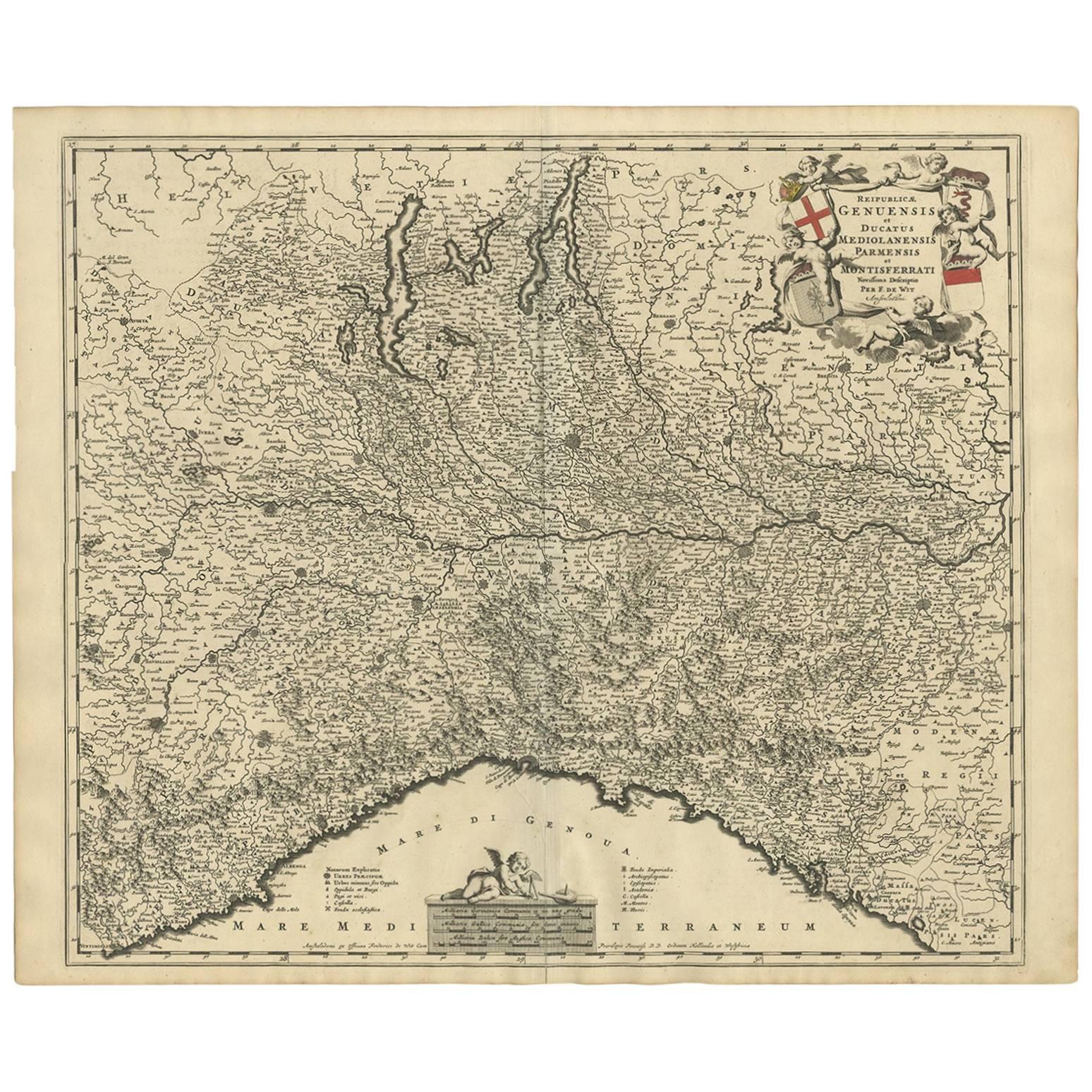
- Antique Map of Northern Italy by F. de Wit, 1690Located in Langweer, NLA very decorative map centered on Genua, and including the towns of Milan, Torino, Parma, Cremona, etc. Decorative title cartouche upper right, five putti holding the arms of the reg...Category
Antique Late 17th Century Maps
MaterialsPaper
 $466 Sale Price22% Off
 - Antique Map of Austria by F. de Wit, 1690Located in Langweer, NLAntique map titled 'Circuli Austriaci pars Septentrionalis in qua Archiducatus'. Decorative and detailed map of Austria by F. de Wit.Category
Antique Late 17th Century Maps
MaterialsPaper
- Antique Map of Flanders 'Belgium' by F. de Wit, circa 1680Located in Langweer, NLAntique map titled 'Comitatus Flandriae Tabula, in Lucem Edita'. Large map of Flanders, Belgium. Published by F. de Wit, circa 1680.Category
Antique Late 17th Century Maps
MaterialsPaper
 $527 Sale Price20% Off
 - Antique Map of Southern Germany by F. de Wit, circa 1680Located in Langweer, NLThis antique map depicts a portion of southern Germany that included the historic regions of Bavaria, the Palatinate, Prussia-Brandenburg, the Rhineland and Saxony. Regensberg, Freis...Category
Antique Late 17th Century Maps
MaterialsPaper
 $610 Sale Price20% Off
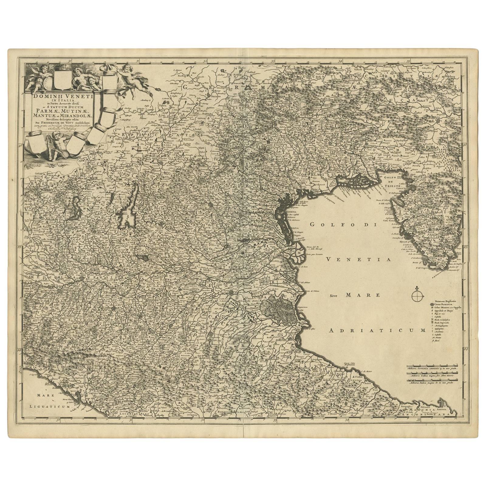
 - Antique Map of the Region of Venice, Italy by F. De Wit, circa 1700Located in Langweer, NLAntique map of the Dominion of Venice, extending from Stato di Milano and Genoa to Istria. Including Lake Garda, Venice and Istria.Category
Antique Early 18th Century Maps
MaterialsPaper
 $486 Sale Price24% Off
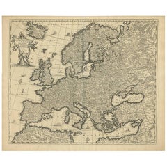
 - Antique Map of Europe by F. de Wit, circa 1690Located in Langweer, NLAn attractive map of all Europe by Frederick de Wit. This detailed map has a decorative cartouche featuring the figure of "Europa" sitting on a bull.Category
Antique Late 17th Century Maps
MaterialsPaper
 $667 Sale Price20% Off

You May Also Like
- Germany West of the Rhine: A Hand-colored 18th Century Map by de WitBy Frederick de WitLocated in Alamo, CAThis original 18th century hand-colored map of the county of Moers, Germany entitled "Illustrissimo Celsissmo Principi GUILIELMO HENRICO D.G. Arausionum Principi Domino suo Clementis...Category
Antique Early 18th Century Dutch Maps
MaterialsPaper
- Large 17th Century Hand Colored Map of England and the British Isles by de WitBy Frederick de WitLocated in Alamo, CAA large hand colored 17th century map of England and the British Isles by Frederick de Wit entitled "Accuratissima Angliæ Regni et Walliæ Principatus", published in Amsterdam in 1680. It is a highly detailed map of England, Scotland, the Scottish Isles...Category
Antique Late 17th Century Dutch Maps
MaterialsPaper
- Antique Map of Italy by Andriveau-Goujon, 1843By Andriveau-GoujonLocated in New York, NYAntique Map of Italy by Andriveau-Goujon, 1843. Map of Italy in two parts by Andriveau-Goujon for the Library of Prince Carini at Palazzo Carini i...Category
Antique 1840s French Maps
MaterialsLinen, Paper
 $3,350 / set
 - Original Antique Map of Belgium by Tallis, Circa 1850Located in St Annes, LancashireGreat map of Belgium Steel engraving Many lovely vignettes Published by London Printing & Publishing Co. ( Formerly Tallis ), C.1850 Origin...Category
Antique 1850s English Maps
MaterialsPaper
- Original Antique Map of Italy. C.1780Located in St Annes, LancashireGreat map of Italy Copper-plate engraving Published C.1780 Unframed.Category
Antique Early 1800s English Georgian Maps
MaterialsPaper

- The Kingdom of Naples and Southern Italy: A Hand-Colored 18th Century Homann MapBy Johann Baptist HomannLocated in Alamo, CA"Novissima & exactissimus Totius Regni Neapolis Tabula Presentis Belli Satui Accommo Data" is a hand colored map of southern Italy and the ancient Kingdom of Naples created by Johann...Category
Antique Early 18th Century German Maps
MaterialsPaper


