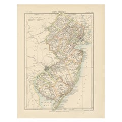
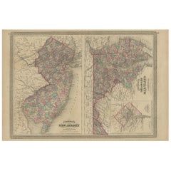
Antique Map of New Jersey
View Similar Items


Want more images or videos?
Request additional images or videos from the seller
1 of 6
Antique Map of New Jersey
About the Item
- Dimensions:Height: 10.63 in (27 cm)Width: 8.27 in (21 cm)Depth: 0.02 in (0.5 mm)
- Materials and Techniques:
- Period:
- Date of Manufacture:1884
- Condition:Wear consistent with age and use. General age-related toning, minor wear. Blank verso. Please study image carefully.
- Seller Location:Langweer, NL
- Reference Number:Seller: BG-13321-81stDibs: LU3054331250562
About the Seller
5.0
Platinum Seller
These expertly vetted sellers are 1stDibs' most experienced sellers and are rated highest by our customers.
Established in 2009
1stDibs seller since 2017
1,933 sales on 1stDibs
More From This SellerView All
- Antique Map of New JerseyLocated in Langweer, NLAntique map titled 'Colton's New Jersey'. This rare hand colored map of New Jersey is a copper plate engraving dating to 1855. Produced by the import...Category
Antique Mid-19th Century Maps
MaterialsPaper
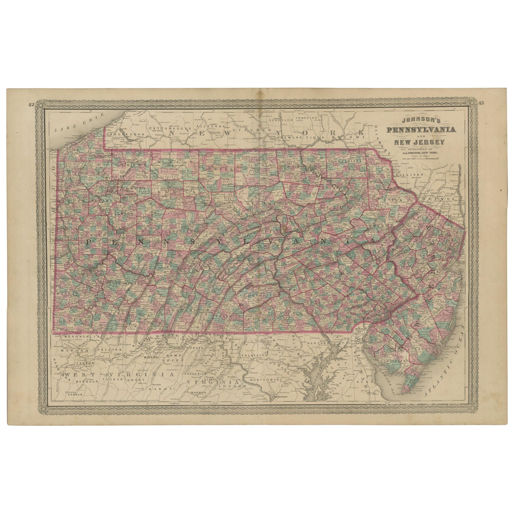
- Antique Map of Pennsylvania and New Jersey by Johnson, 1872Located in Langweer, NLAntique map titled 'Johnson's Pennsylvania and New Jersey'. Original map showing Pennsylvania and New Jersey. This map originates from 'Johnson's New Illustrated Family Atlas of the ...Category
Antique Late 19th Century Maps
MaterialsPaper
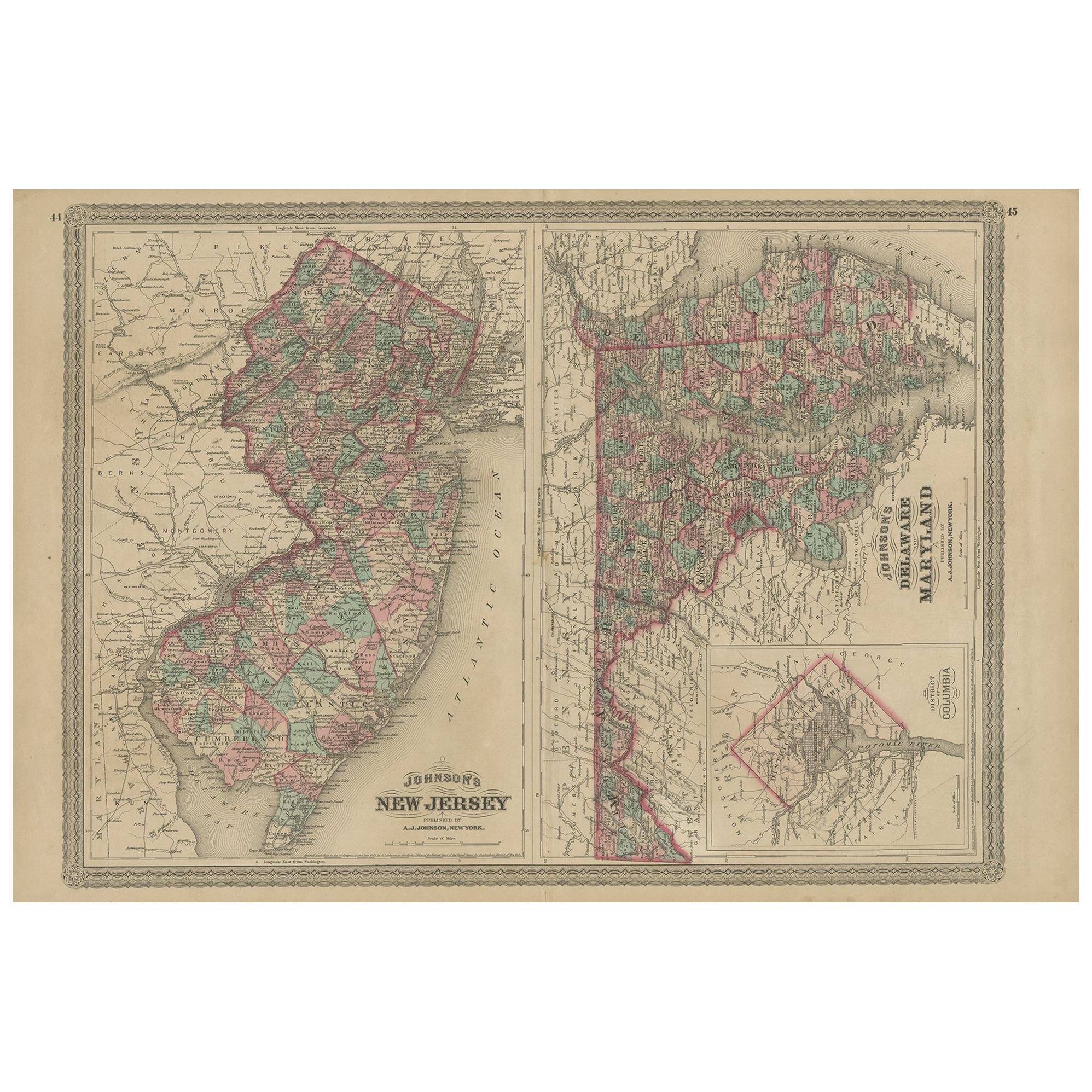
- Antique Map of New Jersey, Delaware and Maryland by Johnson, 1872Located in Langweer, NLAntique map titled 'Johnson's New Jersey (..). Two maps on one sheet showing New Jersey, Delaware and Maryland. With inset map of the district of Columbia...Category
Antique Late 19th Century Maps
MaterialsPaper
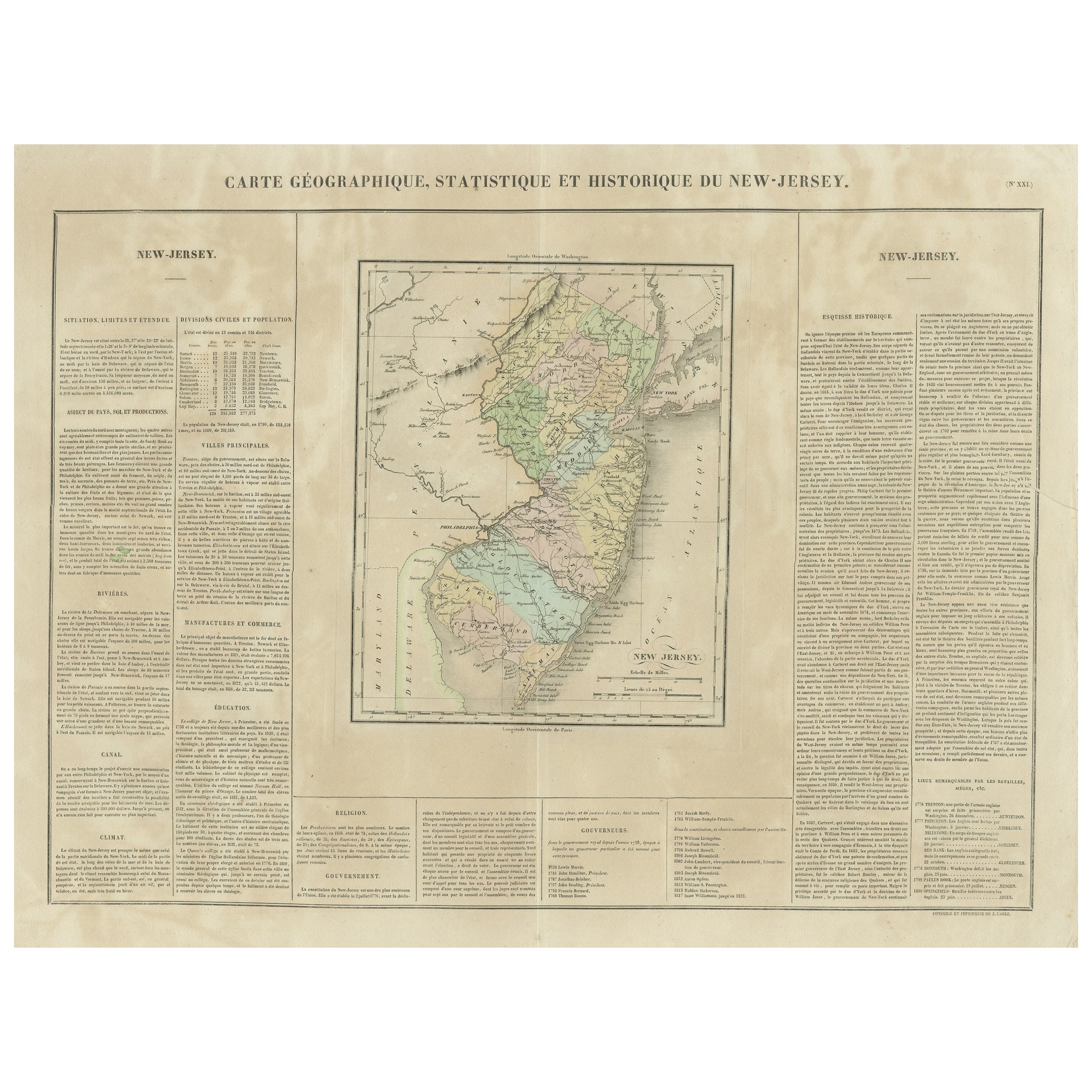
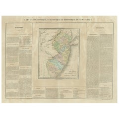
- Original Antique Map of the State of New Jersey Published in FranceLocated in Langweer, NLOriginal antique map titled 'Carte Géographique Statistique et Historique du New-Jersey'. One of the earliest obtainable maps of the State of New Jersey published outside of the Unit...Category
Antique Early 19th Century Maps
MaterialsPaper
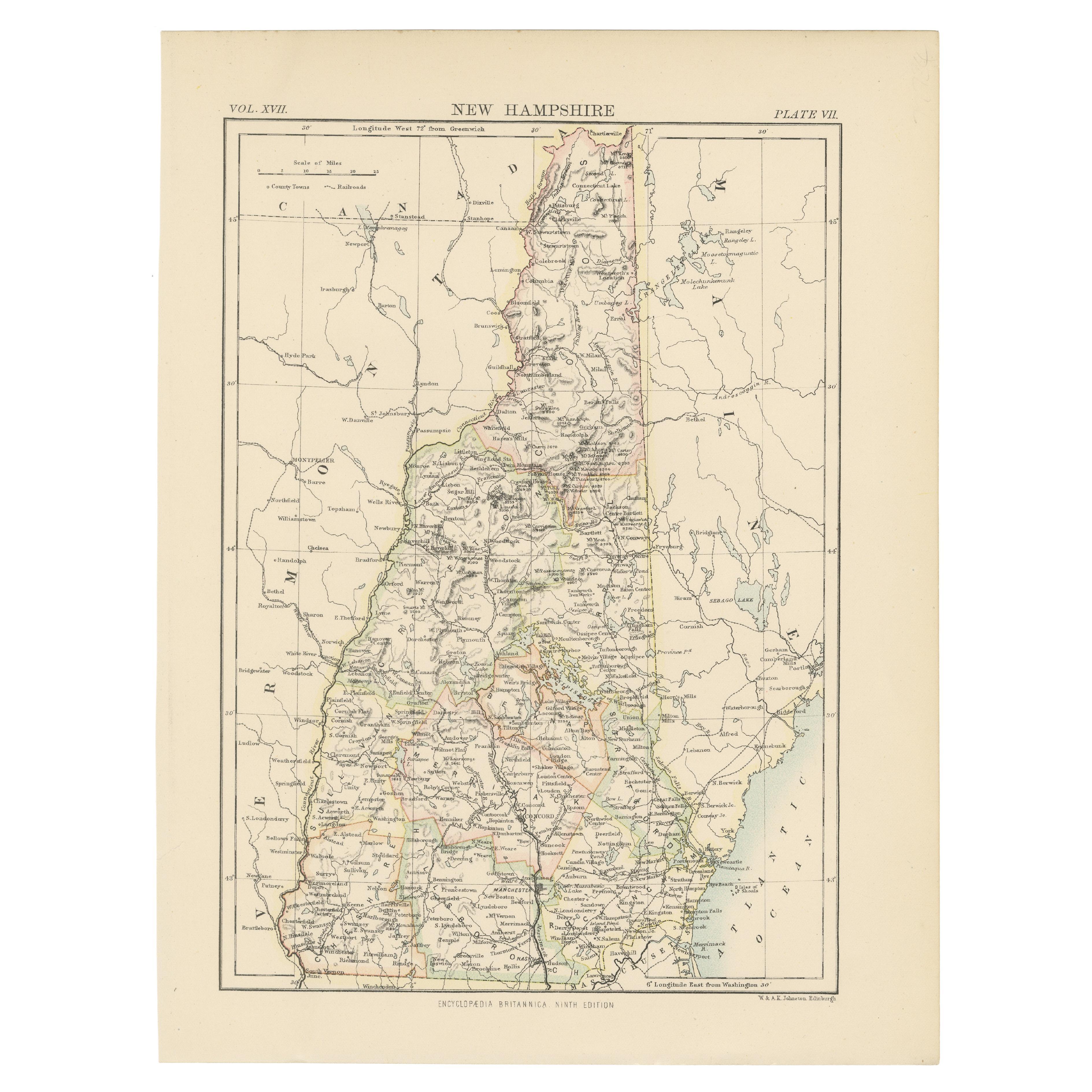
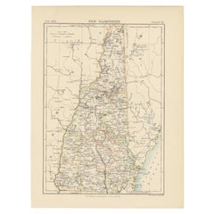
- Antique Map of New HampshireLocated in Langweer, NLAntique map titled 'New Hampshire'. Original antique map of New Hampshire, United States. This print originates from 'Encyclopaedia Britan...Category
Antique Late 19th Century Maps
MaterialsPaper
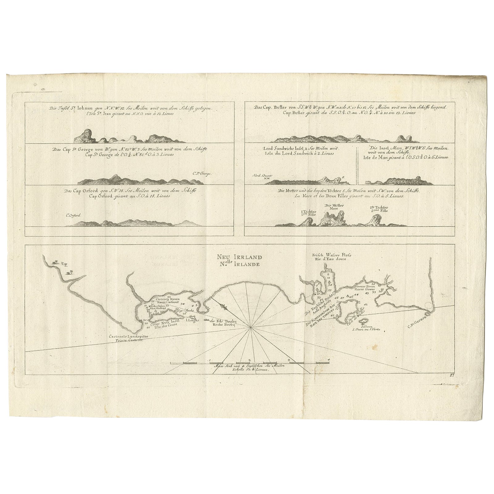
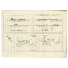
- Antique Map of New Ireland, 1774Located in Langweer, NLAntique print titled 'Neu Irrland (..)'. Antique map of New Ireland with 7 coastal profiles, Papua New Guinea. Originates from 'Geschichte der See-Reisen u...Category
Antique 18th Century Maps
MaterialsPaper


You May Also Like
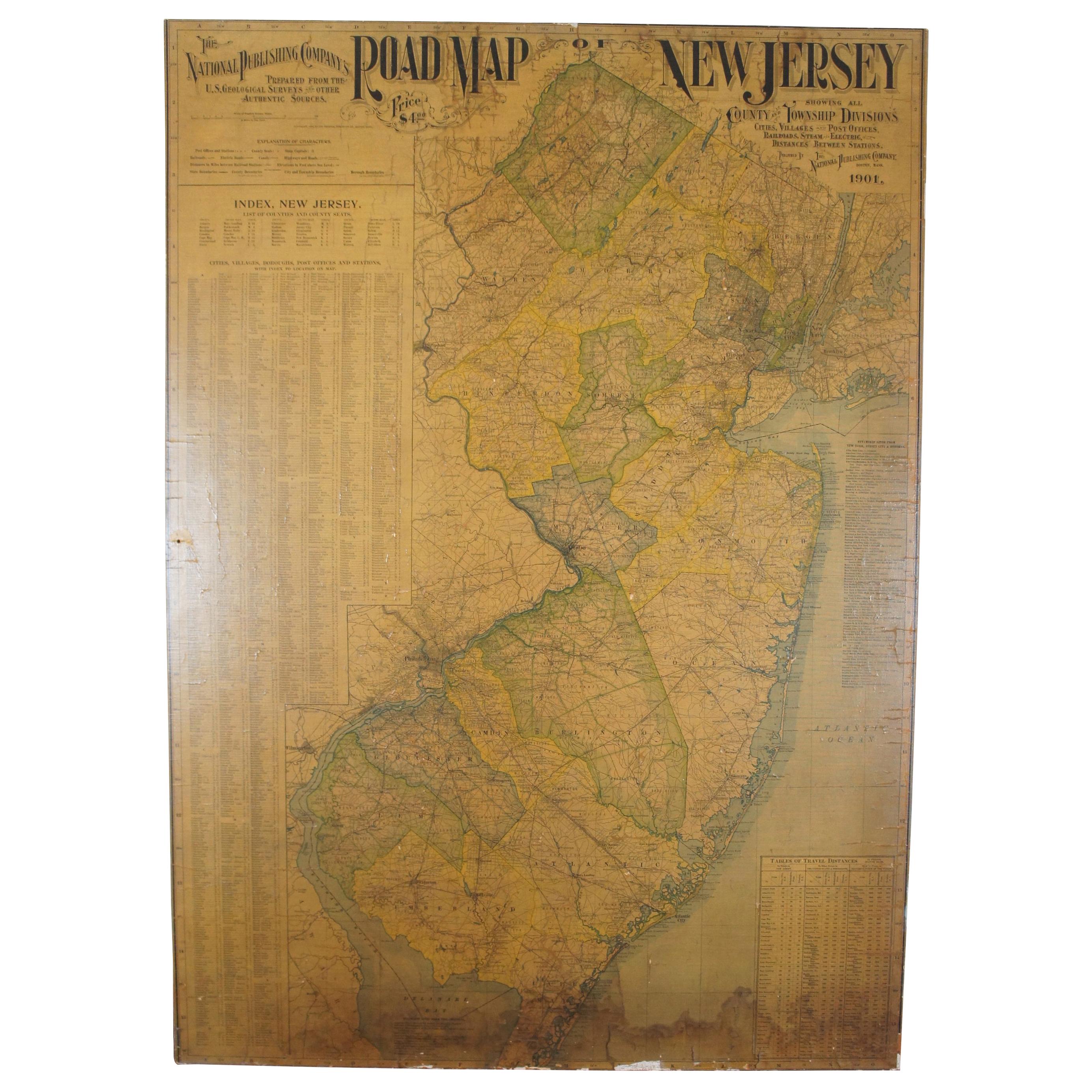
- Antique 1901 National Publishing Company's Road Map of New Jersey GeologicalLocated in Dayton, OHThe National Publishing Company's road map of New Jersey, showing all county and township divisions, cities villages and post-offices, railroads, ste...Category
Antique Early 1900s Victorian Prints
MaterialsPaper
- Antique Map of Principality of MonacoBy Antonio Vallardi EditoreLocated in Alessandria, PiemonteST/619 - "Old Geographical Atlas of Italy - Topographic map of ex-Principality of Monaco" - ediz Vallardi - Milano - A somewhat special edition ---Category
Antique Late 19th Century Italian Other Prints
MaterialsPaper
 $228 Sale Price74% Off
 - Original Antique Map of Italy. C.1780Located in St Annes, LancashireGreat map of Italy Copper-plate engraving Published C.1780 Unframed.Category
Antique Early 1800s English Georgian Maps
MaterialsPaper

- Original Antique Map of Asia. C.1780Located in St Annes, LancashireGreat map of Asia Copper-plate engraving Published C.1780 Two small worm holes to right side of map Unframed.Category
Antique Early 1800s English Georgian Maps
MaterialsPaper

- Original Antique Map of India. C.1780Located in St Annes, LancashireGreat map of India Copper-plate engraving Published C.1780 Three small worm holes to right side of map and one bottom left corner Unframed.Category
Antique Early 1800s English Georgian Maps
MaterialsPaper

- Original Antique Map of China, Arrowsmith, 1820Located in St Annes, LancashireGreat map of China Drawn under the direction of Arrowsmith Copper-plate engraving Published by Longman, Hurst, Rees, Orme and Brown, 1820 Unfr...Category
Antique 1820s English Maps
MaterialsPaper


Recently Viewed
View AllMore Ways To Browse
Antique New Furniture
Antique Furniture New
New Antique Furniture
New Jersey Furniture
New Jersey Used Furniture
Office Organization
Antique Work Tools
Antique Spinning
Antique Optical
Antique Encyclopedias
Encyclopedia Antique
Antique Media Furniture
Optical Antiques
New Jersey 19th Century
Antique Encyclopedia
Map New Jersey
Map Of New Jersey
Multi Tool