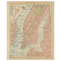
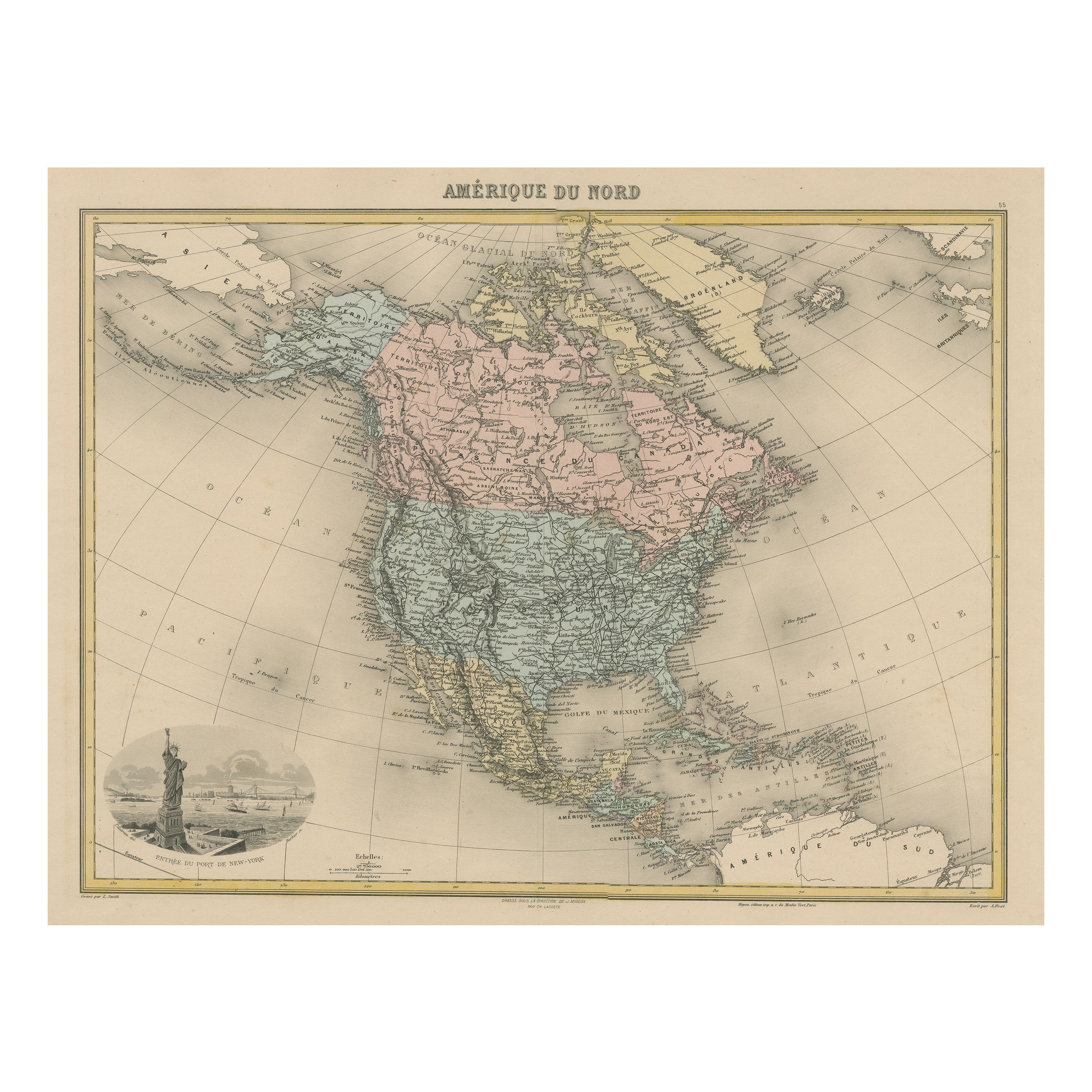
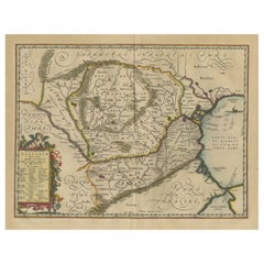
Antique Map of New York, centered on Manhattan
View Similar Items


Want more images or videos?
Request additional images or videos from the seller
1 of 6
Antique Map of New York, centered on Manhattan
About the Item
- Dimensions:Height: 12.09 in (30.7 cm)Width: 9.85 in (25 cm)Depth: 0.02 in (0.5 mm)
- Materials and Techniques:
- Period:
- Date of Manufacture:circa 1908
- Condition:Age-related toning. Original folding line, with small splits. Some wear, English text on verso. Please study image carefully.
- Seller Location:Langweer, NL
- Reference Number:Seller: NS-000751stDibs: LU3054333529352
About the Seller
5.0
Platinum Seller
These expertly vetted sellers are 1stDibs' most experienced sellers and are rated highest by our customers.
Established in 2009
1stDibs seller since 2017
1,919 sales on 1stDibs
More From This SellerView All
- Antique Map of New York by Johnson '1872'Located in Langweer, NLAntique map titled 'Johnson's New York'. Original map showing New York, with an inset map of Long Island. This map originates from 'Johnson's New Il...Category
Antique Late 19th Century Maps
MaterialsPaper
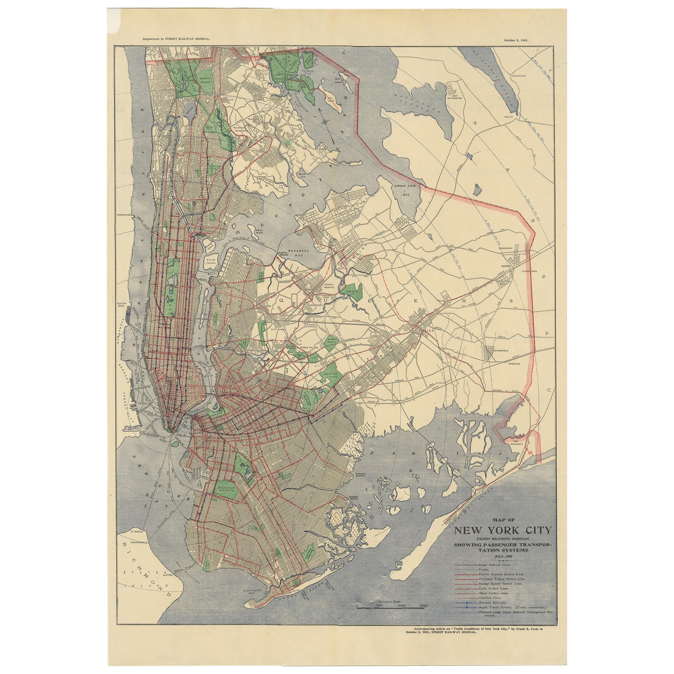
- Antique Map of the Passenger Transportation Systems of New York, 1901Located in Langweer, NLAntique map titled 'Map of New York City except Richmond Borough showing Passenger Transportation Systems'. Map of New York City showing passenger...Category
20th Century Maps
MaterialsPaper
 $480 Sale Price20% Off
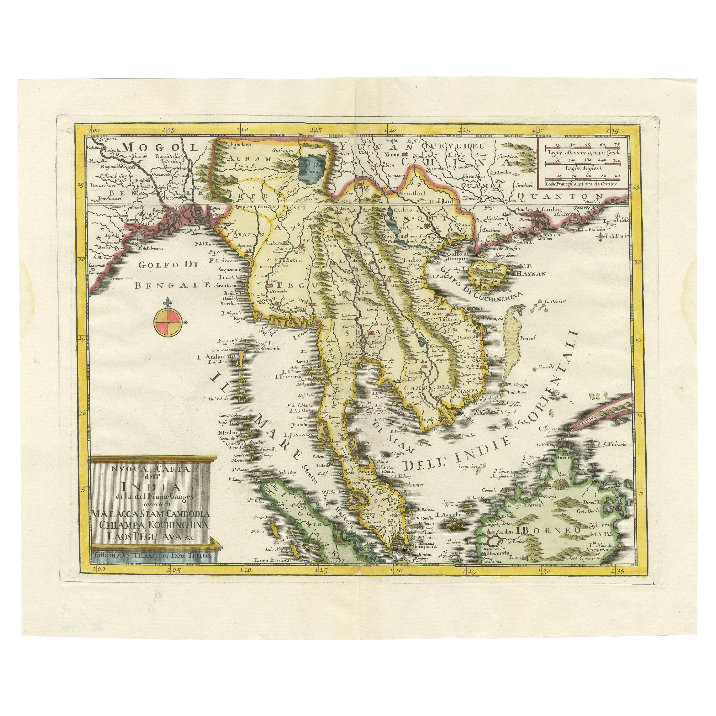
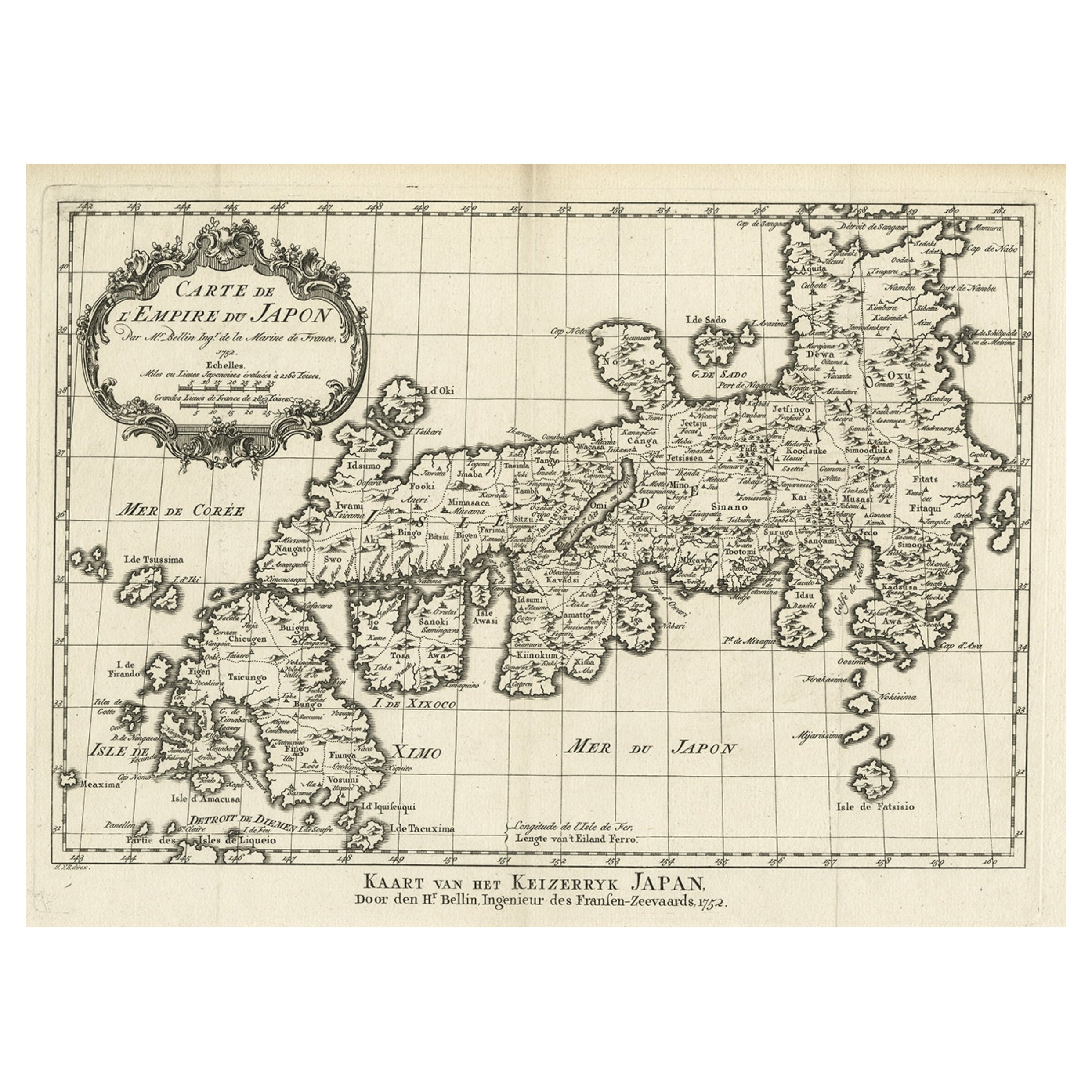
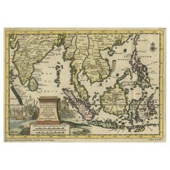
 - Striking Antique Map Centered on the Malay PeninsulaBy Pieter Van Der AaLocated in Langweer, NLAntique map titled 'D'Indiaanze Landschappen Zeen en Eylanden, van Couchin af tot in de Moluccos (...)'. Striking map of the region from the Philippines and Formosa to India and the ...Category
Antique Early 18th Century Maps
MaterialsPaper
- Antique Map of New JerseyLocated in Langweer, NLAntique map titled 'Colton's New Jersey'. This rare hand colored map of New Jersey is a copper plate engraving dating to 1855. Produced by the import...Category
Antique Mid-19th Century Maps
MaterialsPaper
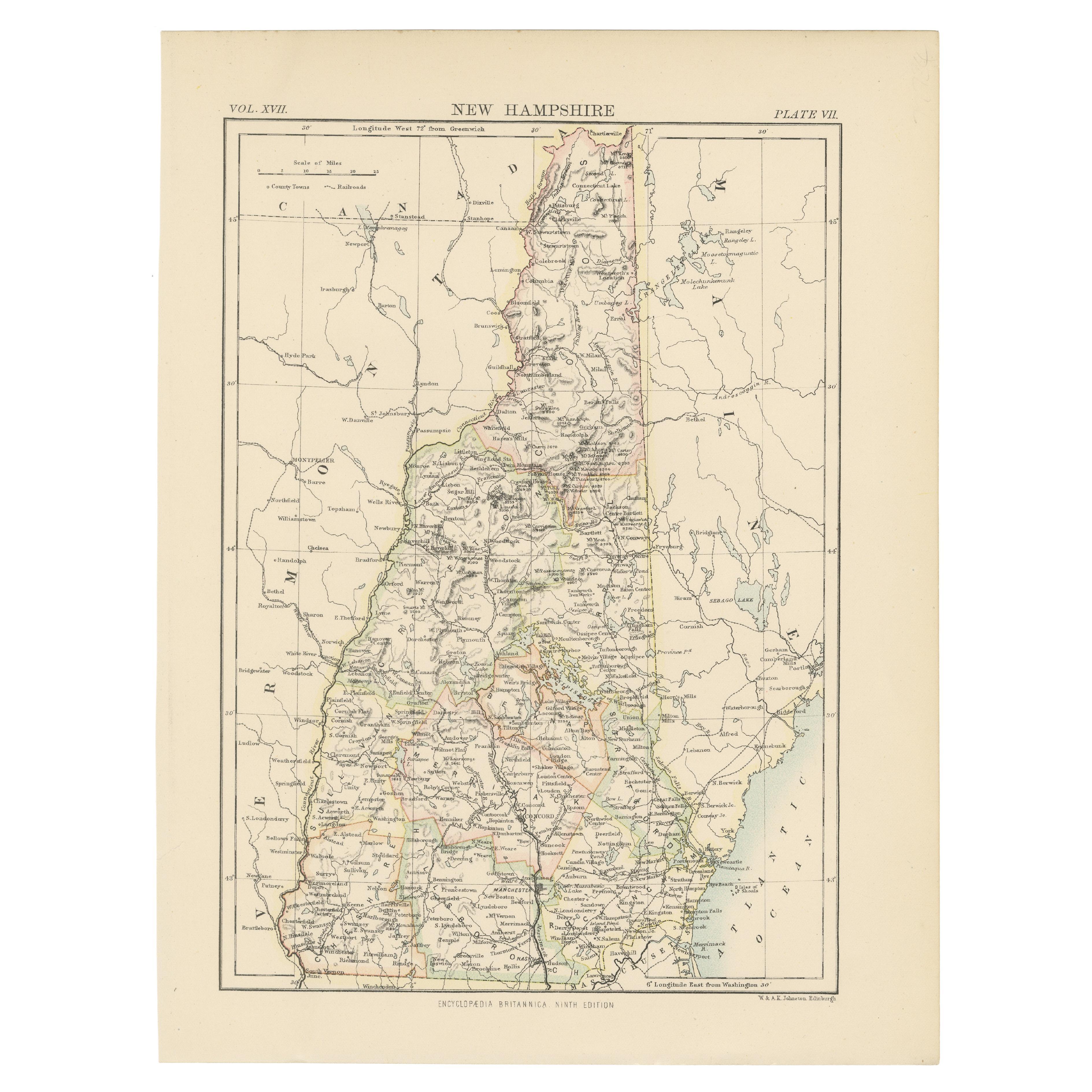
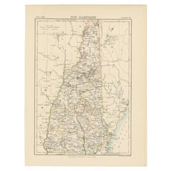
- Antique Map of New HampshireLocated in Langweer, NLAntique map titled 'New Hampshire'. Original antique map of New Hampshire, United States. This print originates from 'Encyclopaedia Britan...Category
Antique Late 19th Century Maps
MaterialsPaper
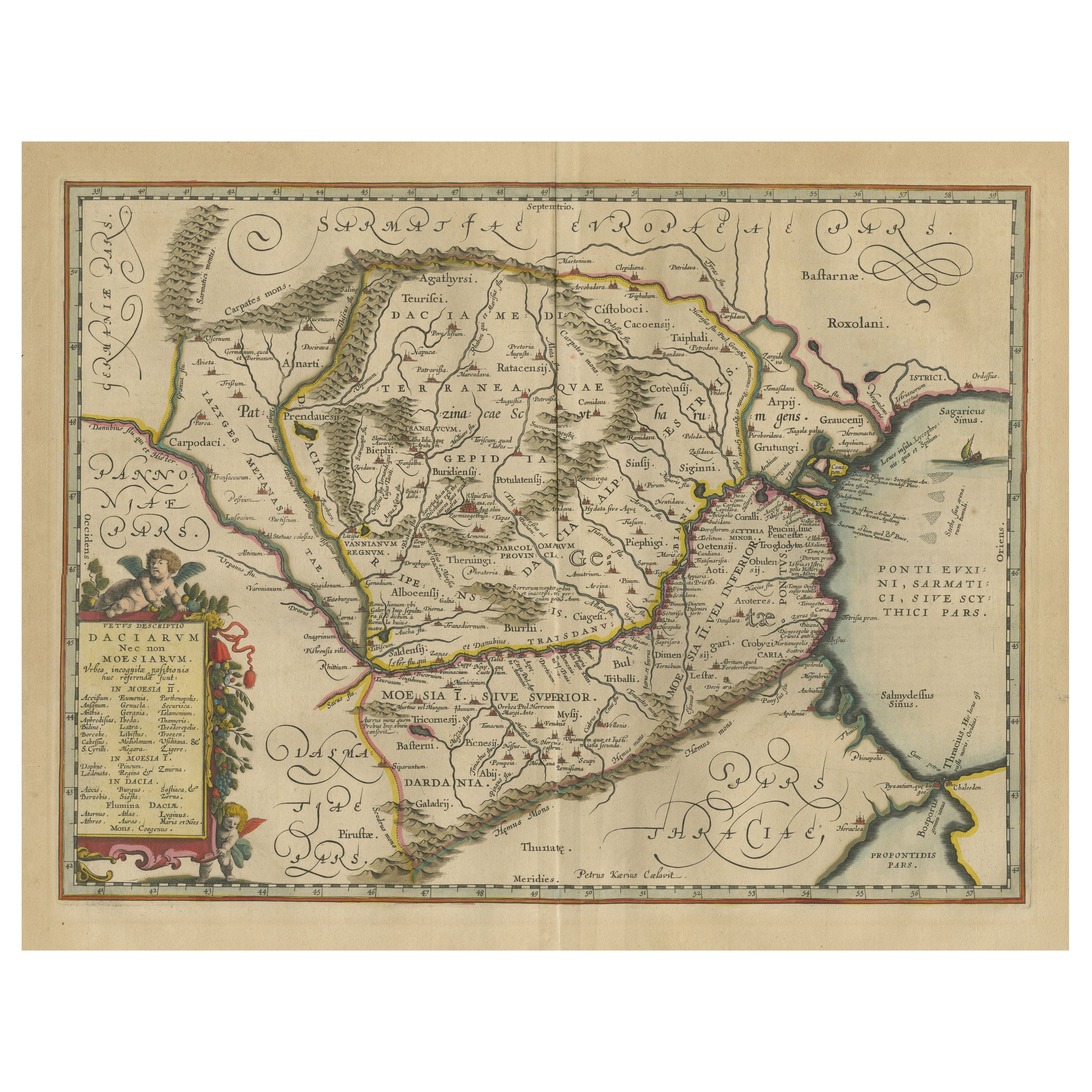
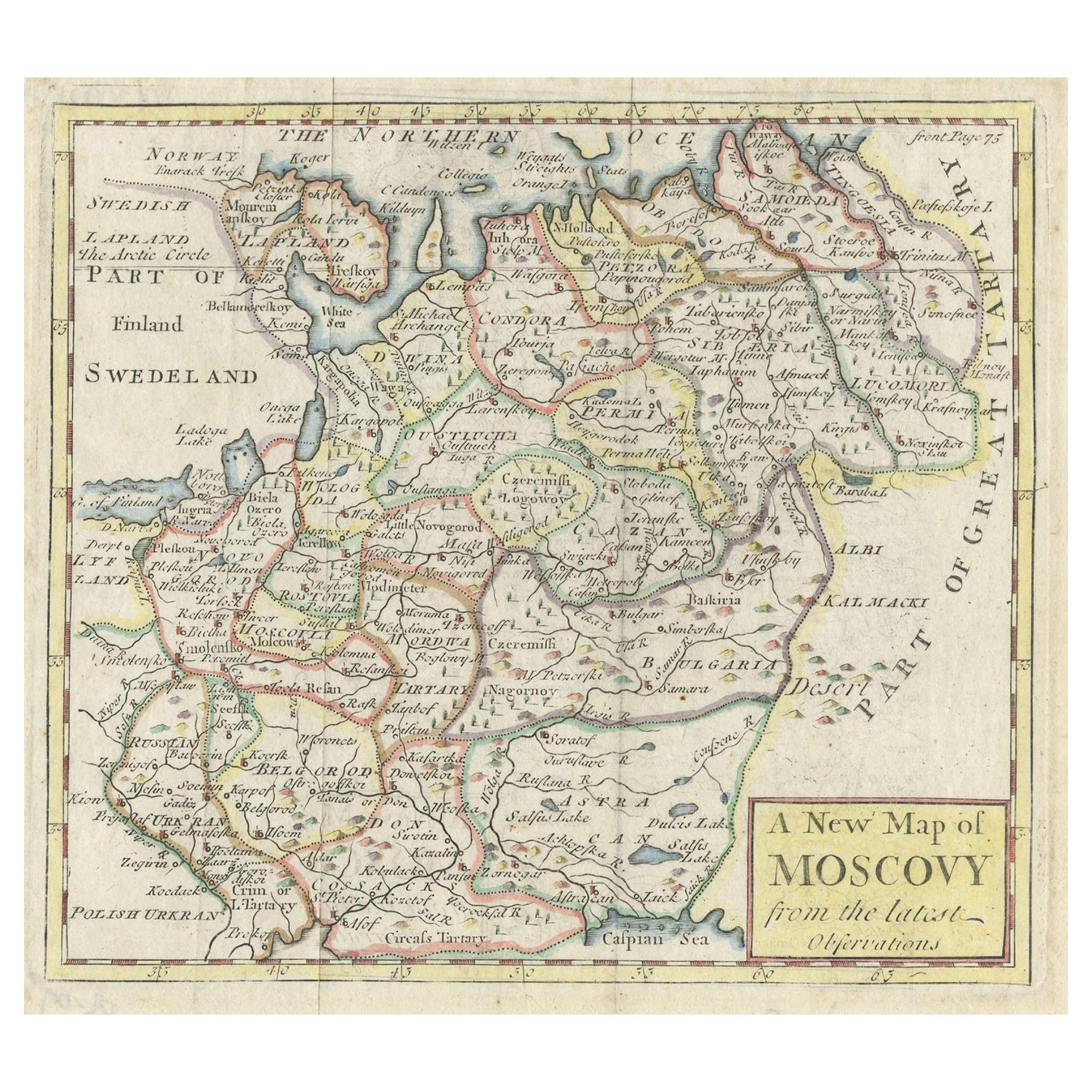
- Antique Map of Romania and Bulgaria Centered on the Danube RiverLocated in Langweer, NLAntique map titled 'Vetus descriptio Daciarum nec non Moesiarum'. Impressive map of the area of Romania and Bulgaria centered on the Danube River. The map is based on Ortelius' map o...Category
Antique Mid-17th Century Maps
MaterialsPaper


You May Also Like
- Antique 1901 National Publishing Company's Road Map of New Jersey GeologicalLocated in Dayton, OHThe National Publishing Company's road map of New Jersey, showing all county and township divisions, cities villages and post-offices, railroads, ste...Category
Antique Early 1900s Victorian Prints
MaterialsPaper
- Antique Map of Principality of MonacoBy Antonio Vallardi EditoreLocated in Alessandria, PiemonteST/619 - "Old Geographical Atlas of Italy - Topographic map of ex-Principality of Monaco" - ediz Vallardi - Milano - A somewhat special edition ---Category
Antique Late 19th Century Italian Other Prints
MaterialsPaper
 $227 Sale Price74% Off
 - Original Antique Map of Italy. C.1780Located in St Annes, LancashireGreat map of Italy Copper-plate engraving Published C.1780 Unframed.Category
Antique Early 1800s English Georgian Maps
MaterialsPaper

- Original Antique Map of Asia. C.1780Located in St Annes, LancashireGreat map of Asia Copper-plate engraving Published C.1780 Two small worm holes to right side of map Unframed.Category
Antique Early 1800s English Georgian Maps
MaterialsPaper

- Original Antique Map of India. C.1780Located in St Annes, LancashireGreat map of India Copper-plate engraving Published C.1780 Three small worm holes to right side of map and one bottom left corner Unframed.Category
Antique Early 1800s English Georgian Maps
MaterialsPaper

- Vintage "View of the Center of Paris Taken from the Air" Lithograph MapLocated in San Diego, CAA very stylish "View of the Center of Paris Taken from the Air" lithograph map published by the Paris Ministry of Tourism, circa early 1950s. The piece measures 27" x 43" and shows...Category
20th Century French Mid-Century Modern Prints
MaterialsPaper


Recently Viewed
View AllMore Ways To Browse
New York City Furniture
New York City Used Furniture
Manhattan Used Furniture
Antique Furniture New York City
New York City Antique Furniture
Hudson Furniture New York
Manhattan Antiques
Antique Furniture Manhattan
Antique Hudson River
Antique Manhattan Map
Antique Map Manhattan
Manhattan Antique Map
Antique Maps Manhattan
Large Map Of London
18th Century Antique Mexican
Victorian Compass
Caribbean Antiques
Framed Atlas Map