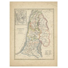
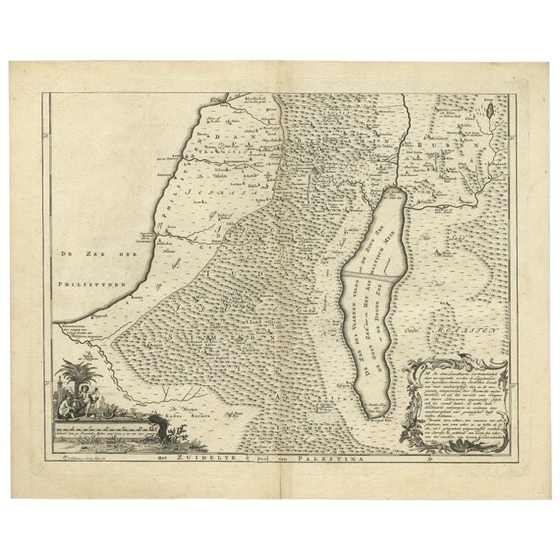
Antique Map of Palestine by Petri, 1852
View Similar Items


Want more images or videos?
Request additional images or videos from the seller
1 of 5
Antique Map of Palestine by Petri, 1852
About the Item
- Dimensions:Height: 13.59 in (34.5 cm)Width: 10.63 in (27 cm)Depth: 0 in (0.01 mm)
- Materials and Techniques:
- Period:
- Date of Manufacture:1852
- Condition:
- Seller Location:Langweer, NL
- Reference Number:Seller: BG-05294-221stDibs: LU3054327623362
About the Seller
5.0
Platinum Seller
These expertly vetted sellers are 1stDibs' most experienced sellers and are rated highest by our customers.
Established in 2009
1stDibs seller since 2017
1,919 sales on 1stDibs
More From This SellerView All
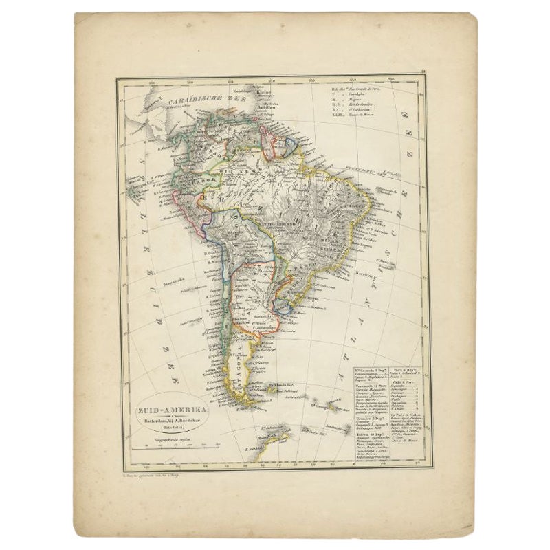
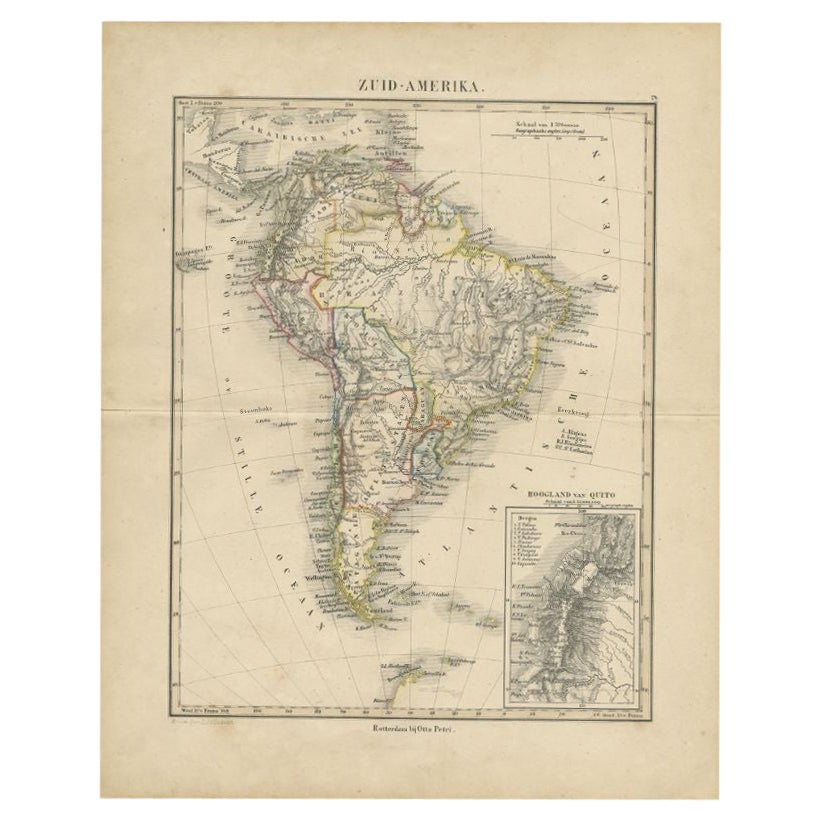
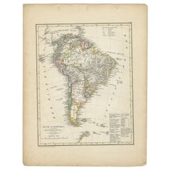
- Antique Map of South America by Petri, 1852By Thomas KitchinLocated in Langweer, NLAntique map titled 'Zuid-Amerika'. Map of South America. This map originates from 'School-Atlas van alle deelen der Aarde' by Otto Petri. Artists and Engrav...Category
Antique 19th Century Maps
MaterialsPaper
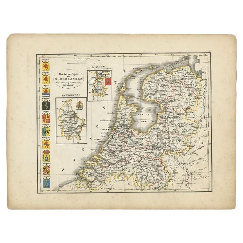
- Antique Map of the Netherlands by Petri, 1852Located in Langweer, NLAntique map titled 'Het Koninkrijk der Nederlanden'. Map of the Netherlands, with coats of arms of all Dutch provinces. Also includes a small inset map of Luxembourg...Category
Antique 19th Century Maps
MaterialsPaper
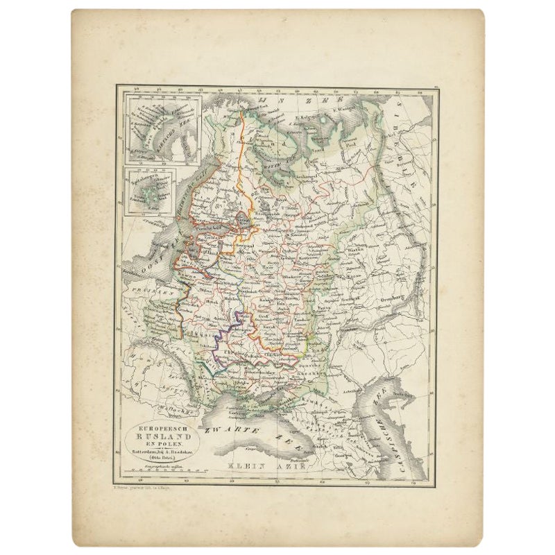
- Antique Map of Russia and Poland by Petri, 1852Located in Langweer, NLAntique map titled 'Europeesch Rusland en Polen'. Map of Russia in Europe and Poland. This map originates from 'School-Atlas van alle deelen der Aarde' by Otto Petri...Category
Antique 19th Century Maps
MaterialsPaper
- Antique Map of Sweden and Norway by Petri, 1852Located in Langweer, NLAntique map titled 'Zweden en Noorwegen'. Map of Sweden and Norway. This map originates from 'School-Atlas van alle deelen der Aarde' by Otto Petri. Artists...Category
Antique 19th Century Maps
MaterialsPaper
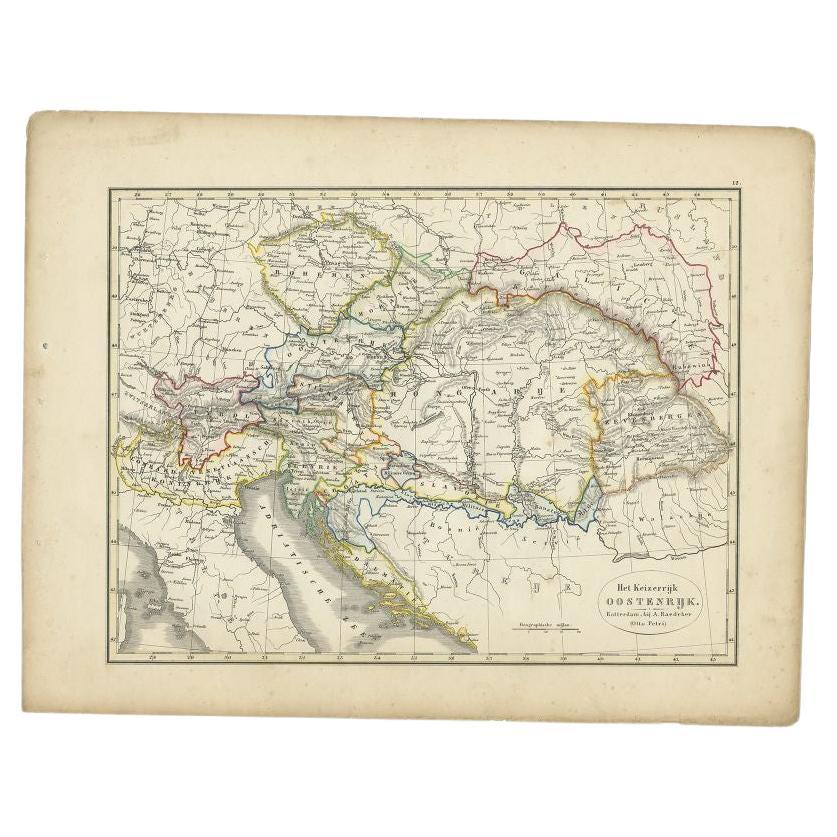
- Antique Map of the Austrian Empire by Petri, 1852Located in Langweer, NLAntique map titled 'Het Keizerrijk Oostenrijk'. Map of the Austrian Empire. This map originates from 'School-Atlas van alle deelen der Aarde' by Otto Petri....Category
Antique 19th Century Maps
MaterialsPaper
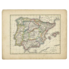
- Antique Map of Spain and Portugal by Petri, 1852Located in Langweer, NLAntique map titled 'Spanje en Portugal'. Map of Spain and Portugal. This map originates from 'School-Atlas van alle deelen der Aarde' by Otto Petri. Artists and Engravers: Published ...Category
Antique 19th Century Maps
MaterialsPaper


You May Also Like
- Large1852 Map "Russian Empire" Ric.r0011Located in Norton, MALarge 1852 map "Russian Empire" George Phillips & Son 1852 Ric.r0011 Dimension: Paper: 67 cm W x 52 cm H ; Sight: 60cm W x 50 cm H Condition: Good Condition with aged tonin...Category
Antique 19th Century Unknown Maps
MaterialsPaper
- 1861 Topographical Map of the District of Columbia, by Boschke, Antique MapLocated in Colorado Springs, COPresented is an original map of Albert Boschke's extremely sought-after "Topographical Map of the District of Columbia Surveyed in the Years 1856 ...Category
Antique 1860s American Historical Memorabilia
MaterialsPaper
- 1907 Map of Colorado, Antique Topographical Map, by Louis NellLocated in Colorado Springs, COThis highly detailed pocket map is a topographical map of the state of Colorado by Louis Nell from 1907. The map "has been complied from all availabl...Category
Antique Early 1900s American Maps
MaterialsPaper
- Antique Map of Italy by Andriveau-Goujon, 1843By Andriveau-GoujonLocated in New York, NYAntique Map of Italy by Andriveau-Goujon, 1843. Map of Italy in two parts by Andriveau-Goujon for the Library of Prince Carini at Palazzo Carini i...Category
Antique 1840s French Maps
MaterialsLinen, Paper
 $3,350 / set
 - Antique Map of Principality of MonacoBy Antonio Vallardi EditoreLocated in Alessandria, PiemonteST/619 - "Old Geographical Atlas of Italy - Topographic map of ex-Principality of Monaco" - ediz Vallardi - Milano - A somewhat special edition ---Category
Antique Late 19th Century Italian Other Prints
MaterialsPaper
 $227 Sale Price74% Off
 - Original Antique Map of Russia By Arrowsmith. 1820Located in St Annes, LancashireGreat map of Russia Drawn under the direction of Arrowsmith Copper-plate engraving Published by Longman, Hurst, Rees, Orme and Brown, 1820 Unframed.Category
Antique 1820s English Maps
MaterialsPaper


Recently Viewed
View AllMore Ways To Browse
1859 Asia Map
Antique Map Antilles
Edens Whale
Inland Empire
Map Cleveland
Map Of Charlevoix
Map Of Maine Et Loire
Mapp Plate
Marthas Vineyard Map
Nantucket Chart
Native American Mountie
Nicolaes Visscher II On Sale
Union Pacific Map
Vintage Marthas Vineyard Map
W. & A.K. Johnston On Sale
Yemen 1789
Yugoslavia Map
Antique Map Of Republic Of Texas