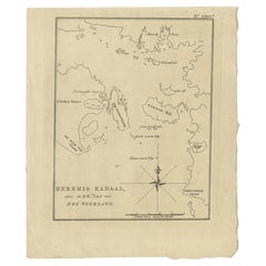
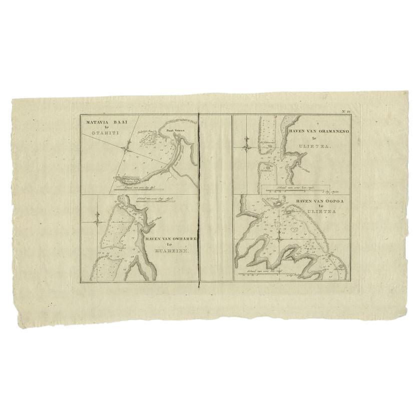
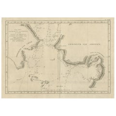
Antique Map of Part of the Strait of Magellan, South America, by Cook, 1803
View Similar Items


Want more images or videos?
Request additional images or videos from the seller
1 of 5
Antique Map of Part of the Strait of Magellan, South America, by Cook, 1803
About the Item
- Dimensions:Height: 10.44 in (26.5 cm)Width: 8.67 in (22 cm)Depth: 0 in (0.01 mm)
- Materials and Techniques:
- Period:
- Date of Manufacture:1803
- Condition:Condition: Very good, general age-related toning. Please study image carefully.
- Seller Location:Langweer, NL
- Reference Number:Seller: BG-11487-491stDibs: LU3054327623512
About the Seller
5.0
Platinum Seller
These expertly vetted sellers are 1stDibs' most experienced sellers and are rated highest by our customers.
Established in 2009
1stDibs seller since 2017
1,951 sales on 1stDibs
More From This SellerView All
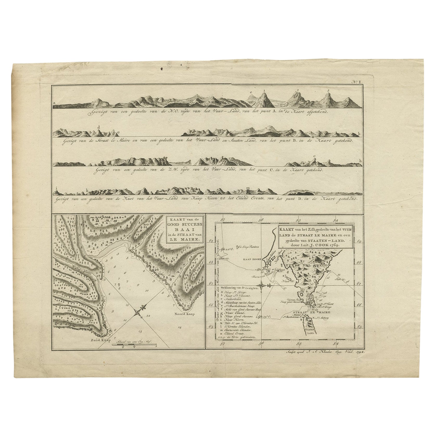
- Antique Map of the Strait of Le Maire by Cook, 1803Located in Langweer, NLAntique map titled 'Kaart van de Good Success Baai in de Straat van Le Maire (..)'. Antique map of the Strait of Le Maire between Terra Fuego and Staten Island. On top, various coast...Category
Antique 19th Century Maps
MaterialsPaper
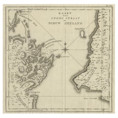
- Antique Map of Cook's Strait in New Zealand, 1803Located in Langweer, NLAntique map New Zealand titled 'Kaart van Cooks Straat in Nieuw Zeeland'. Antique map of Cook's Strait in New Zealand. Originates from 'Reizen ...Category
Antique 19th Century Maps
MaterialsPaper
 $575 Sale Price20% Off
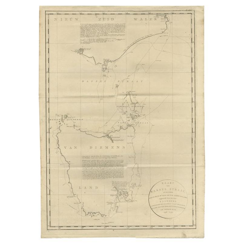
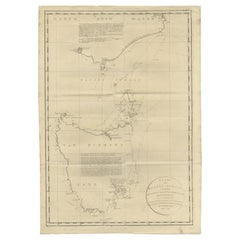
 - Large Antique Map of Bass Strait, Tasmania, Australia by Cook, 1803Located in Langweer, NLAntique map Australia titled 'Kaart van Basses Straat tusschen Nieuw Zuid Wales en van Diemensland (..)'. Large chart of Bass Strait and one of t...Category
Antique 19th Century Maps
MaterialsPaper
 $3,738 Sale Price25% Off
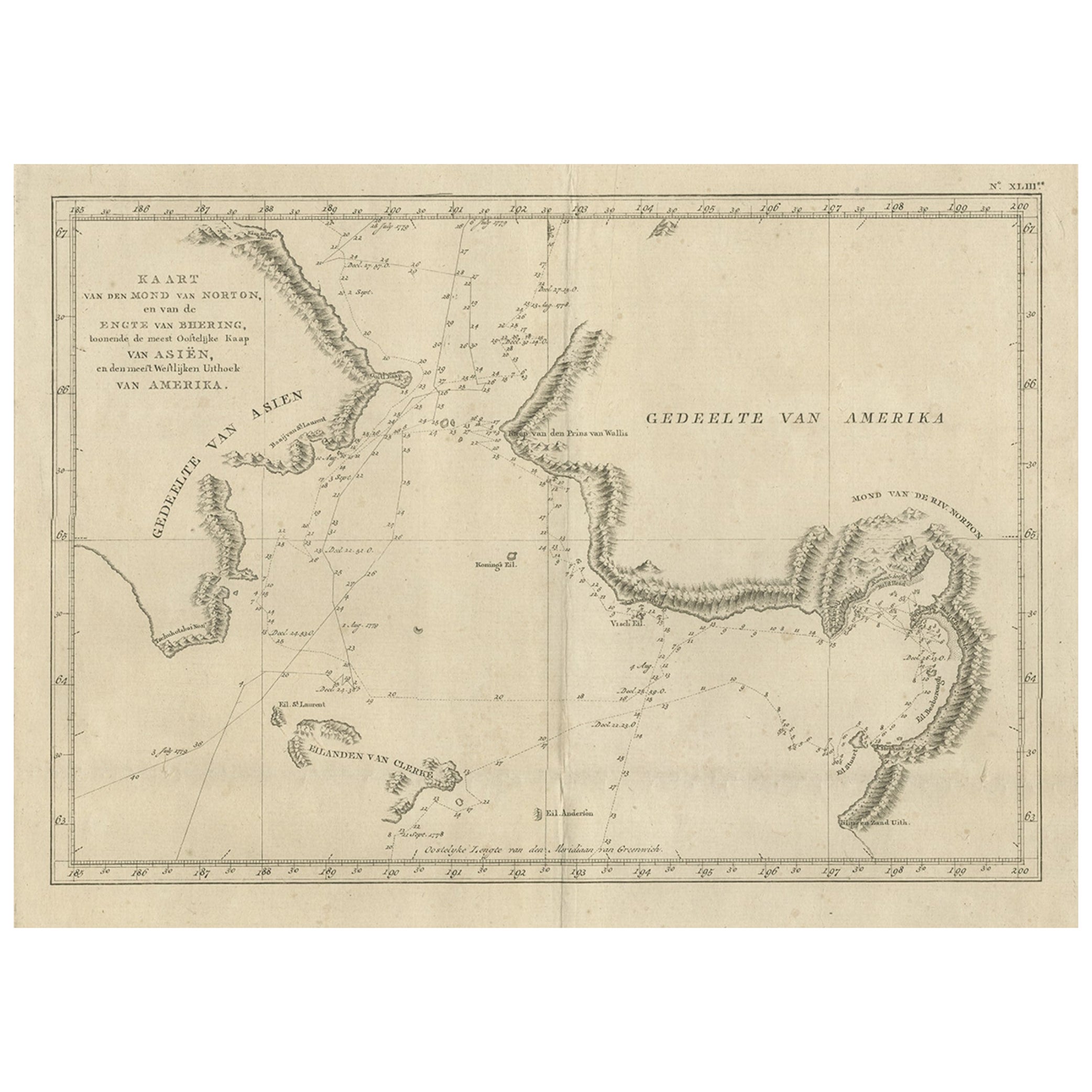
 - Original Copper Engraved Map of the Bering Strait by Captain Cook, 1803Located in Langweer, NLAntique map titled 'Kaart van den Mond van Norton, en van de Engte van Bhering, toonende de meest Oostlijke Kaap van Asien, en den meest Westlijken Urthoek van Amerika'. Map of t...Category
Antique Early 1800s Maps
MaterialsPaper
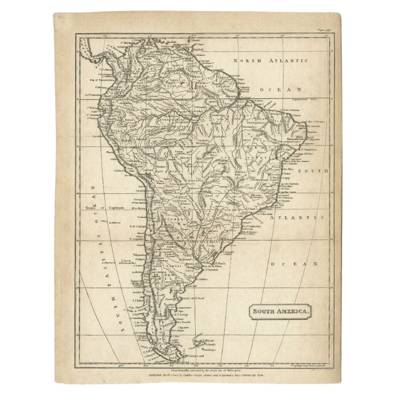
- Antique Map of South America by J. Cook (1775)Located in Langweer, NLAntique map titled 'Kaart van het Zuidlyk Eind van Amerika'. Map of the sourthern part of South America, focusing on Cook's tracks around the Cape Horn and Tierra del Fuego in 1775. ...Category
Antique Late 18th Century Maps
MaterialsPaper
 $524 Sale Price20% Off
 - Antique Map of South America by J. Cook, 1775Located in Langweer, NLAntique map titled 'Kaart van het Zuidlyk Eind van Amerika'. Map of the sourthern part of South America, focusing on Cook's tracks around the Cape Horn and T...Category
Antique Mid-18th Century Maps
MaterialsPaper
 $708 Sale Price24% Off

You May Also Like
- Original Antique Map of South America. C.1780Located in St Annes, LancashireGreat map of South America Copper-plate engraving Published C.1780 Two small worm holes to left side of map Unframed.Category
Antique Early 1800s English Georgian Maps
MaterialsPaper

- Original Antique Map of South America, circa 1830Located in St Annes, LancashireGreat map of South America Copper plate engraving Published by Butterworth, Livesey & Co., circa 1830 Unframed.Category
Antique Early 1800s English Other Maps
MaterialsPaper

- Original Antique Decorative Map of South America-West Coast, Fullarton, C.1870Located in St Annes, LancashireGreat map of Chili, Peru and part of Bolivia Wonderful figural border From the celebrated Royal Illustrated Atlas Lithograph. Original color. Published by Fullarton, Edi...Category
Antique 1870s Scottish Maps
MaterialsPaper
- Antique Lithography Map, South America, English, Framed, Cartography, VictorianLocated in Hele, Devon, GBThis is an antique lithography map of South America. An English, framed atlas engraving of cartographic interest by John Rapkin , dating to the early Victorian period and later, circ...Category
Antique Mid-19th Century British Early Victorian Maps
MaterialsWood
- Antique 1803 Italian Map of Asia Including China Indoneseia IndiaLocated in Amsterdam, Noord HollandAntique 1803 Italian Map of Asia Including China Indoneseia India Very nice map of Asia. 1803. Additional information: Type: Map Country of Manufacturing: Europe Period: 19th centu...Category
Antique 19th Century European Maps
MaterialsPaper
 $584 Sale Price20% Off
 - Original Antique Map of the American State of Pennsylvania, 1889Located in St Annes, LancashireGreat map of Pennsylvania Drawn and Engraved by W. & A.K. Johnston Published By A & C Black, Edinburgh. Original colour Unframed. Repair to a minor tear on bottom edge.Category
Antique 1880s Scottish Victorian Maps
MaterialsPaper


Recently Viewed
View AllMore Ways To Browse
Wood Cook
Antique Map South America
Antique Maps South America
Antique South America Map
South America Antique Map
Antique Map Of South America
Antique Maps Of South America
Antique Z
Antique Van Cleef
James Cook Map
Magellan Map
Patagonia Map
Antique Maps Of New York
Antique Map Of New York
Rare Compass
Map Of United Kingdom
Antique Presentation Plates
Antique Map Fair