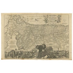
Antique Map Travel Children of Israel by Keur, 1748
View Similar Items


Want more images or videos?
Request additional images or videos from the seller
1 of 5
Antique Map Travel Children of Israel by Keur, 1748
About the Item
- Creator:H. Keur (Artist)
- Dimensions:Height: 12.6 in (32 cm)Width: 19.3 in (49 cm)Depth: 0.02 in (0.5 mm)
- Materials and Techniques:Paper,Engraved
- Place of Origin:
- Period:
- Date of Manufacture:1748
- Condition:Minor defects from handling. Few tears and repairs, Dutch text on verso. please study image carefully.
- Seller Location:Langweer, NL
- Reference Number:Seller: BGI-011041stDibs: LU3054312474972
About the Seller
5.0
Recognized Seller
These prestigious sellers are industry leaders and represent the highest echelon for item quality and design.
Platinum Seller
Premium sellers with a 4.7+ rating and 24-hour response times
Established in 2009
1stDibs seller since 2017
2,442 sales on 1stDibs
Typical response time: 1 hour
Authenticity Guarantee
In the unlikely event there’s an issue with an item’s authenticity, contact us within 1 year for a full refund. DetailsMoney-Back Guarantee
If your item is not as described, is damaged in transit, or does not arrive, contact us within 7 days for a full refund. Details24-Hour Cancellation
You have a 24-hour grace period in which to reconsider your purchase, with no questions asked.Vetted Professional Sellers
Our world-class sellers must adhere to strict standards for service and quality, maintaining the integrity of our listings.Price-Match Guarantee
If you find that a seller listed the same item for a lower price elsewhere, we’ll match it.Trusted Global Delivery
Our best-in-class carrier network provides specialized shipping options worldwide, including custom delivery.More From This Seller
View AllAntique Map of the Holy Land by Keur, 1748
Located in Langweer, NL
Antique Map Holy Land titled 'De Gelegentheyd van t'Paradys ende t'Landt Canaan, Mitsgaders d'eerst bewoonde Landen der Patriarchen'. Includes five decorative vignettes, including No...
Category
Antique 18th Century Maps
Materials
Paper

$322 Sale Price
20% Off
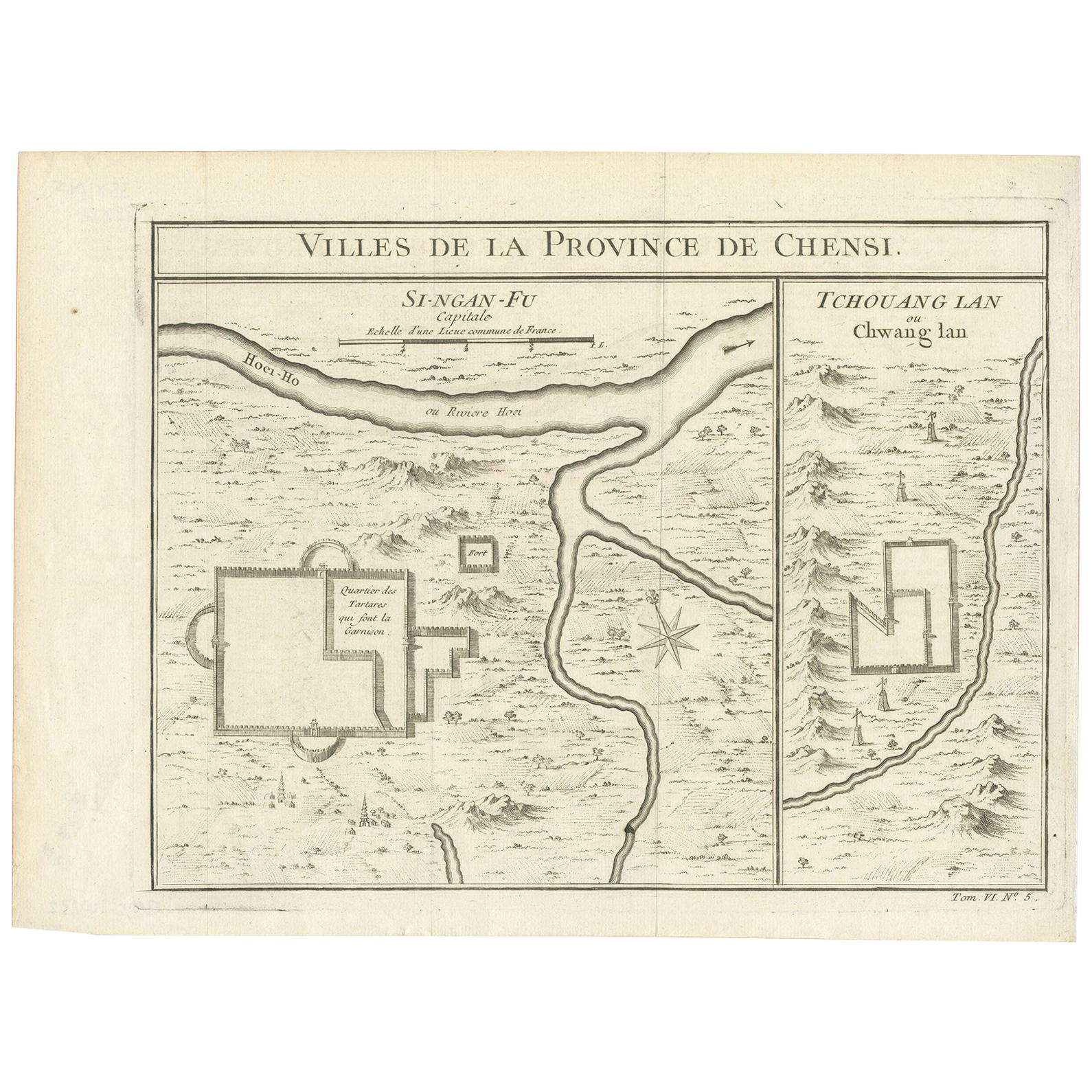
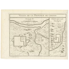
Antique Map of Si-Ngan-fu and Tchang Lan 'China' by Bellin '1748'
By Jacques-Nicolas Bellin
Located in Langweer, NL
Antique map China titled ‘Villes de la Province de Chensi’. Interesting set of two local town plans of "Si-Ngan-Fu: Capitale, Hoofdstad." and "Tchang...
Category
Antique Mid-18th Century Maps
Materials
Paper
$138 Sale Price
20% Off
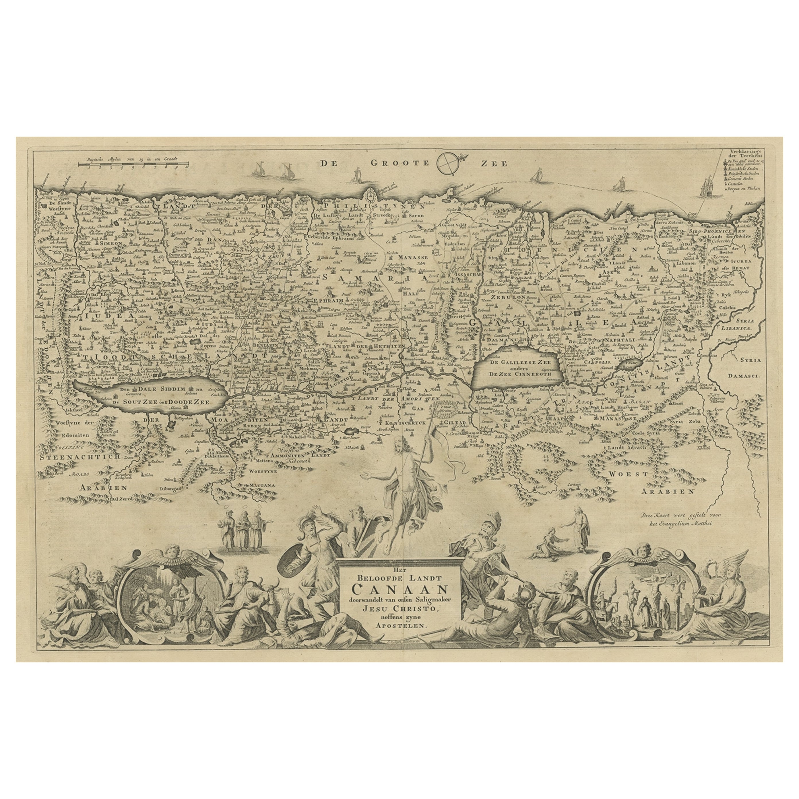
Antique Map of Israel Filled with Biblical Scenes, Published in 1748
Located in Langweer, NL
Antique map Holy Land titled 'Het beloofde landt Canaan doorwandelt van onsen Saligmaker Jesu Christo neffens zyne Apostelen'.
Antique map of Israel ...
Category
Antique 1740s Maps
Materials
Paper
$731 Sale Price
20% Off
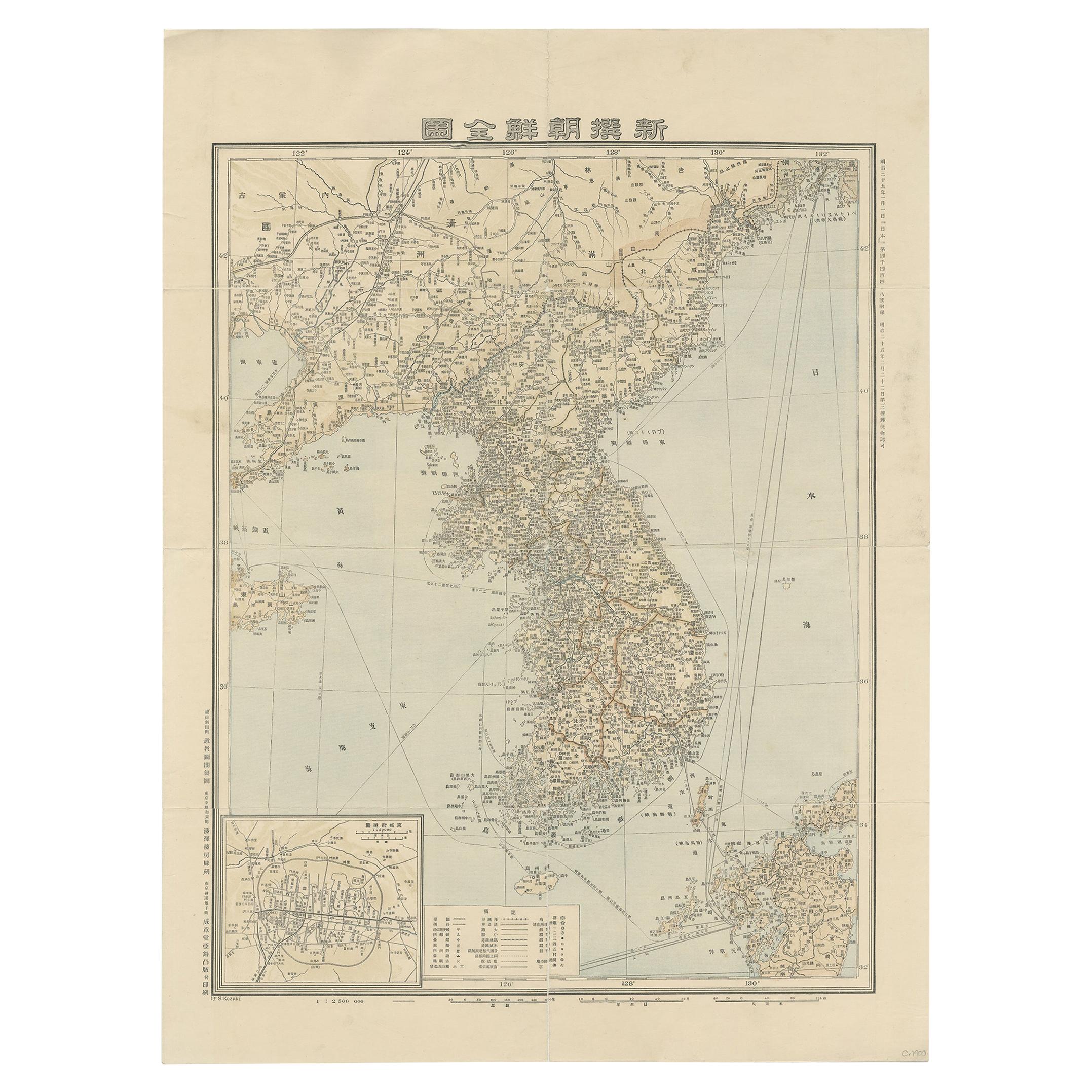
Antique Map of Korea by Kozaki, 1903
Located in Langweer, NL
Old map of Korea by S. Kozaki. Restored and mounted.
Category
20th Century Maps
Materials
Paper

$879 Sale Price
20% Off
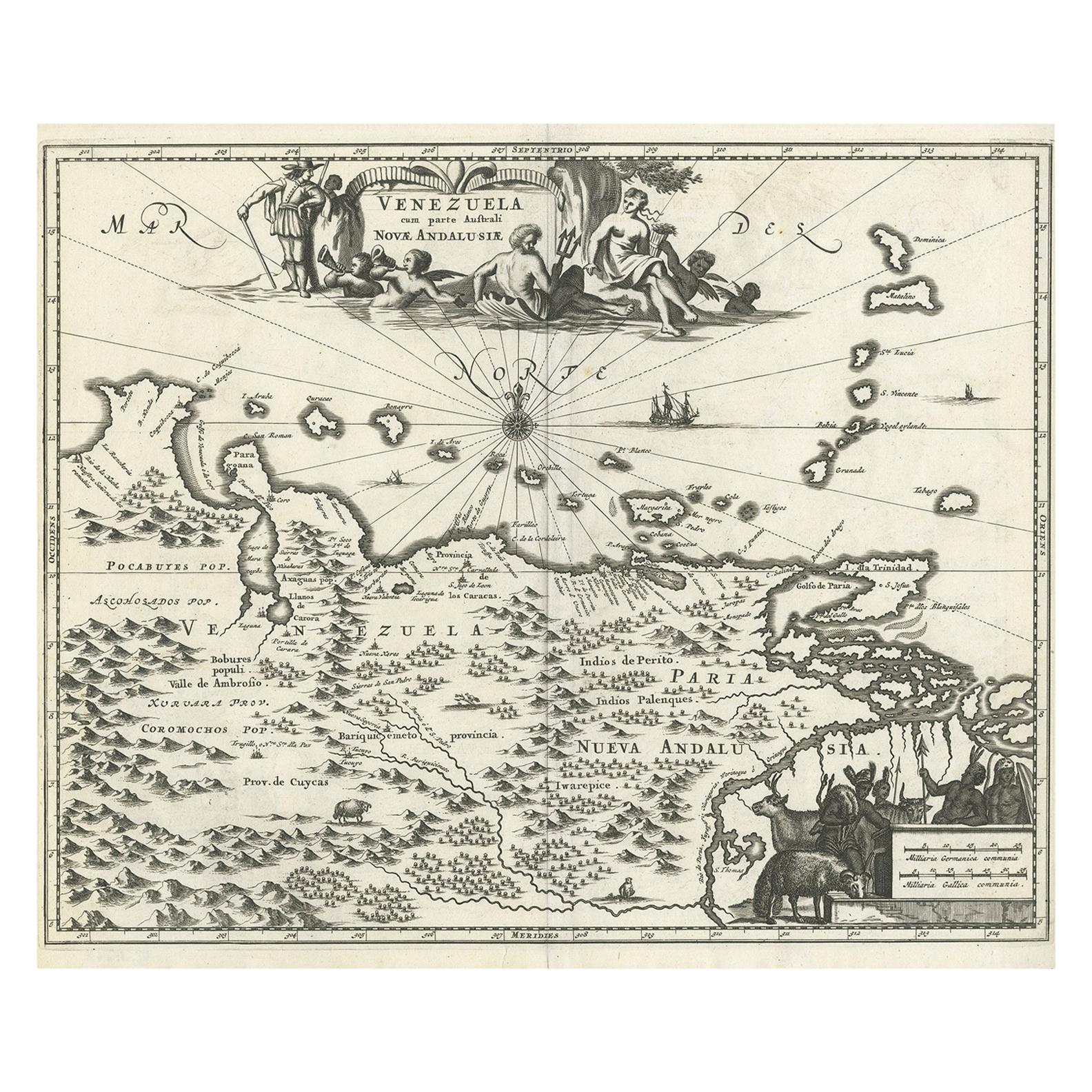
Antique Map of Venezuela by Montanus, 1671
By Arnoldus Montanus
Located in Langweer, NL
Antique map titled 'Venezuela cum parte Australi Novae Andalusiae'. The map extends from Coquibocoa to the Orinoque River, centered on Bariquicemento and Cape de Curiacao. Large cart...
Category
Antique Mid-17th Century English Maps
Materials
Paper

$555 Sale Price
20% Off
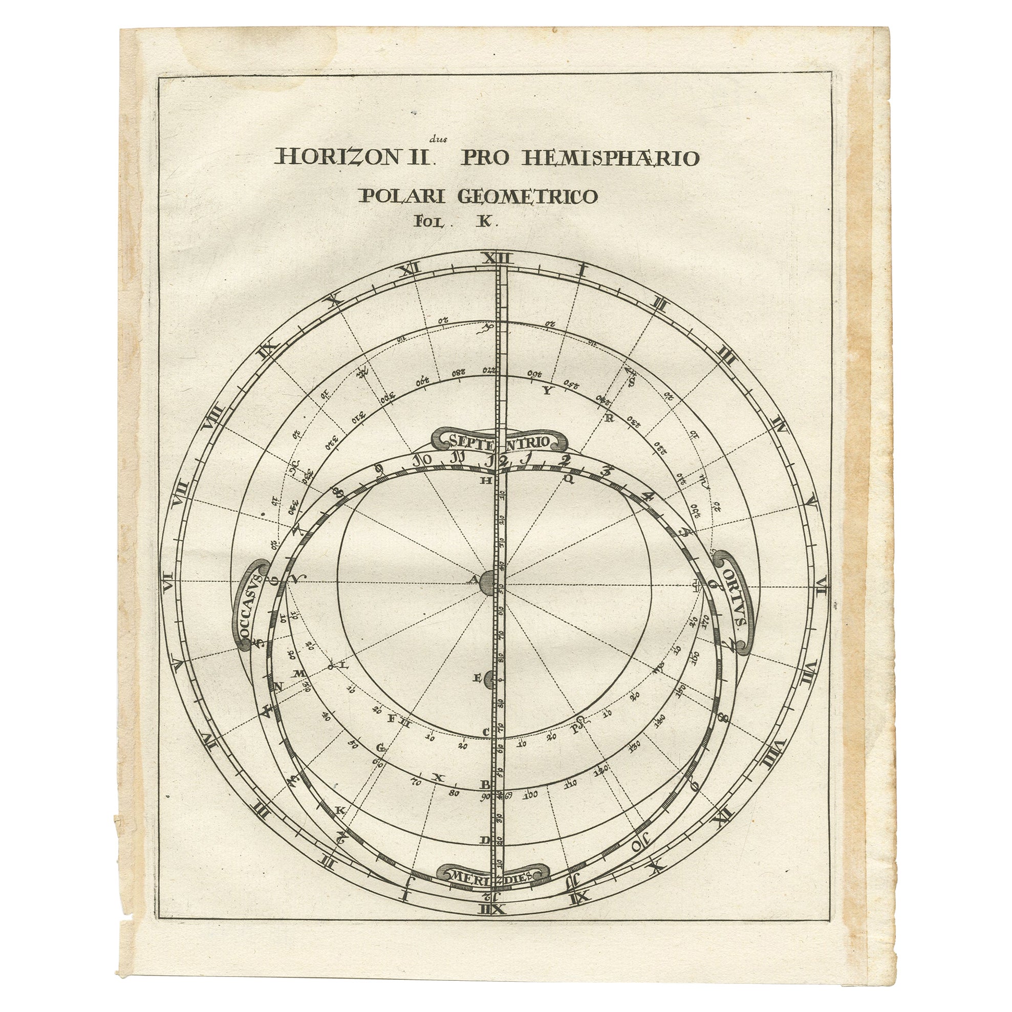
Antique Map of a Hemisphere by Scherer, c.1703
Located in Langweer, NL
Antique map depiciting a horizon/hemisphere. Printed for Scherer's 'Atlas Novus' (1702-1710).
Artists and Engravers: Heinrich Scherer (1628-1704) was a Professor of Hebrew, Mathematics and Ethics at the University of Dillingen until about 1680. Thereafter he obtained important positions as Official Tutor to the Royal Princes...
Category
Antique 18th Century Maps
Materials
Paper

$175 Sale Price
20% Off
You May Also Like
Large Original Vintage Map of Israel, circa 1920
Located in St Annes, Lancashire
Great map of Israel
Original color.
Good condition
Published by Alexander Gross
Unframed.
Category
Vintage 1920s English Edwardian Maps
Materials
Paper

Large Original Antique Map of Australia by Sidney Hall, 1847
Located in St Annes, Lancashire
Great map of Australia
Drawn and engraved by Sidney Hall
Steel engraving
Original colour outline
Published by A & C Black. 1847
Unframed
Free shipping.
Category
Antique 1840s Scottish Maps
Materials
Paper

Large Original Antique Map of Poland by Sidney Hall, 1847
Located in St Annes, Lancashire
Great map of Poland
Drawn and engraved by Sidney Hall
Steel engraving
Original colour outline
Published by A & C Black. 1847
Unframed
...
Category
Antique 1840s Scottish Maps
Materials
Paper

Large Original Antique Map of Europe by Sidney Hall, 1847
Located in St Annes, Lancashire
Great map of Europe
Drawn and engraved by Sidney Hall
Steel engraving
Original colour outline
Published by A & C Black. 1847
Unframed
Free shipping.
Category
Antique 1840s Scottish Maps
Materials
Paper

Large Original Antique Map of Asia by Sidney Hall, 1847
Located in St Annes, Lancashire
Great map of Asia
Drawn and engraved by Sidney Hall
Steel engraving
Original colour outline
Published by A & C Black. 1847
Unframed
Free shipping
Category
Antique 1840s Scottish Maps
Materials
Paper

Large Original Antique Map of Madagascar. 1894
Located in St Annes, Lancashire
Superb Antique map of Madagascar
Published Edward Stanford, Charing Cross, London 1894
Original colour
Good condition
Unframed.
Free shipping
Category
Antique 1890s English Maps
Materials
Paper

Recently Viewed
View AllMore Ways To Browse
Biblical Maps
Antique Maps Of Israel
Map Of Israel
Map Of Arabia
New Zealand Map
Map Tibet
Antique Map Of Egypt
British Empire Map
18th Century French Globe
Antique Map Ortelius
Antique Nautical Maps
Roman Empire Map
Voc Ship
16th Century Globe
Map Of Singapore
Antique Map Of Middle East
Hand Painted Antique Map
Railroad Collectibles