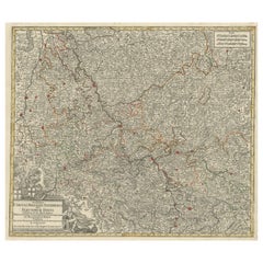
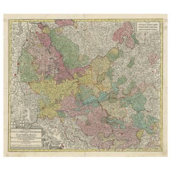
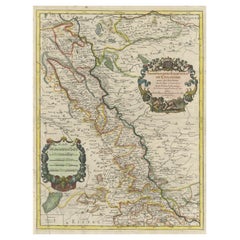
Antique Map of Trier, Mainz, Cologne and surroundings, Germany
View Similar Items


Want more images or videos?
Request additional images or videos from the seller
1 of 6
Antique Map of Trier, Mainz, Cologne and surroundings, Germany
About the Item
- Dimensions:Height: 20.87 in (53 cm)Width: 24.22 in (61.5 cm)Depth: 0.02 in (0.5 mm)
- Materials and Techniques:
- Period:
- Date of Manufacture:c.1730
- Condition:General age-related toning. Minor wear and soiling. Manuscript number added top right. Blank verso. Please study image carefully.
- Seller Location:Langweer, NL
- Reference Number:Seller: BG-13442-151stDibs: LU3054335045932
About the Seller
5.0
Platinum Seller
These expertly vetted sellers are 1stDibs' most experienced sellers and are rated highest by our customers.
Established in 2009
1stDibs seller since 2017
1,957 sales on 1stDibs
More From This SellerView All
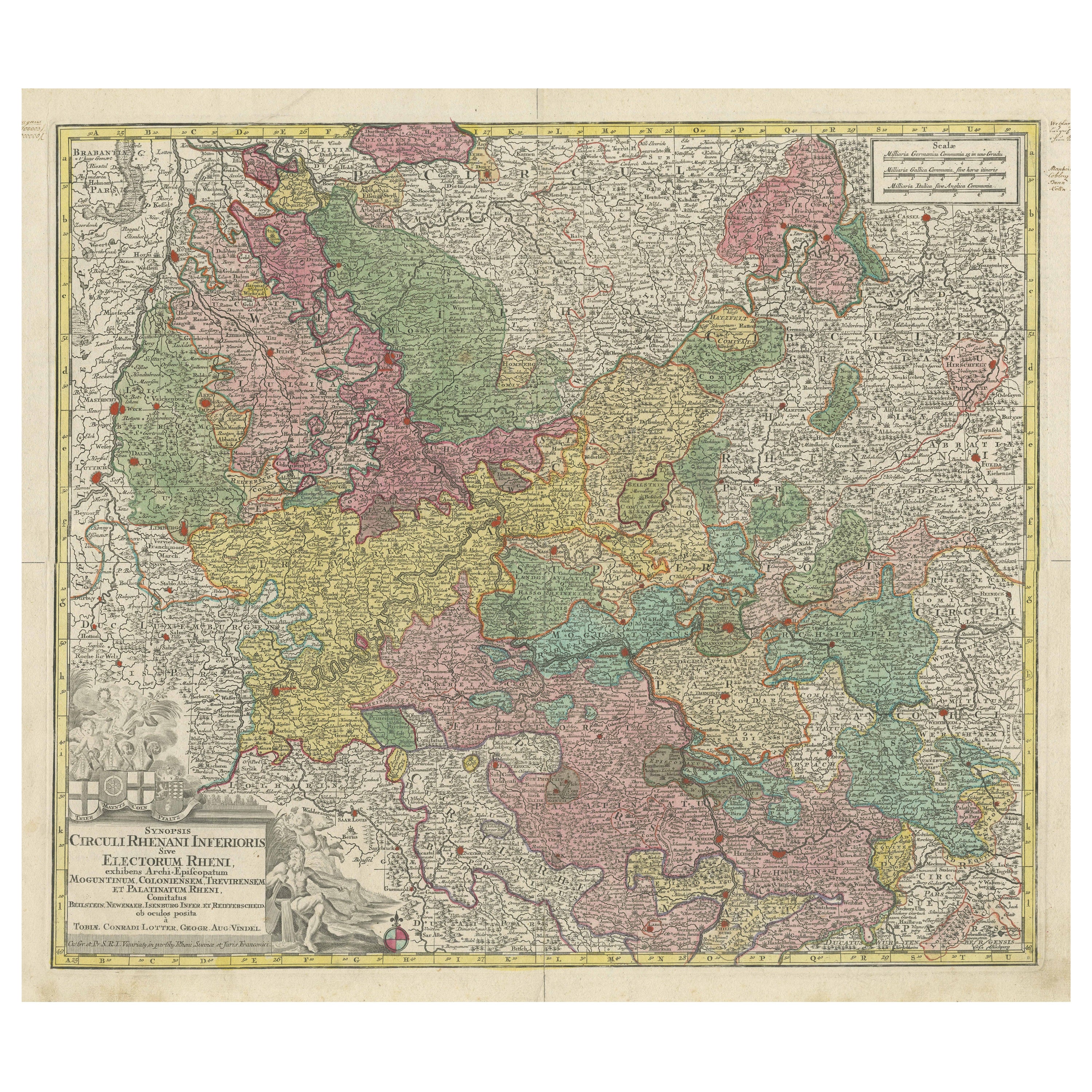
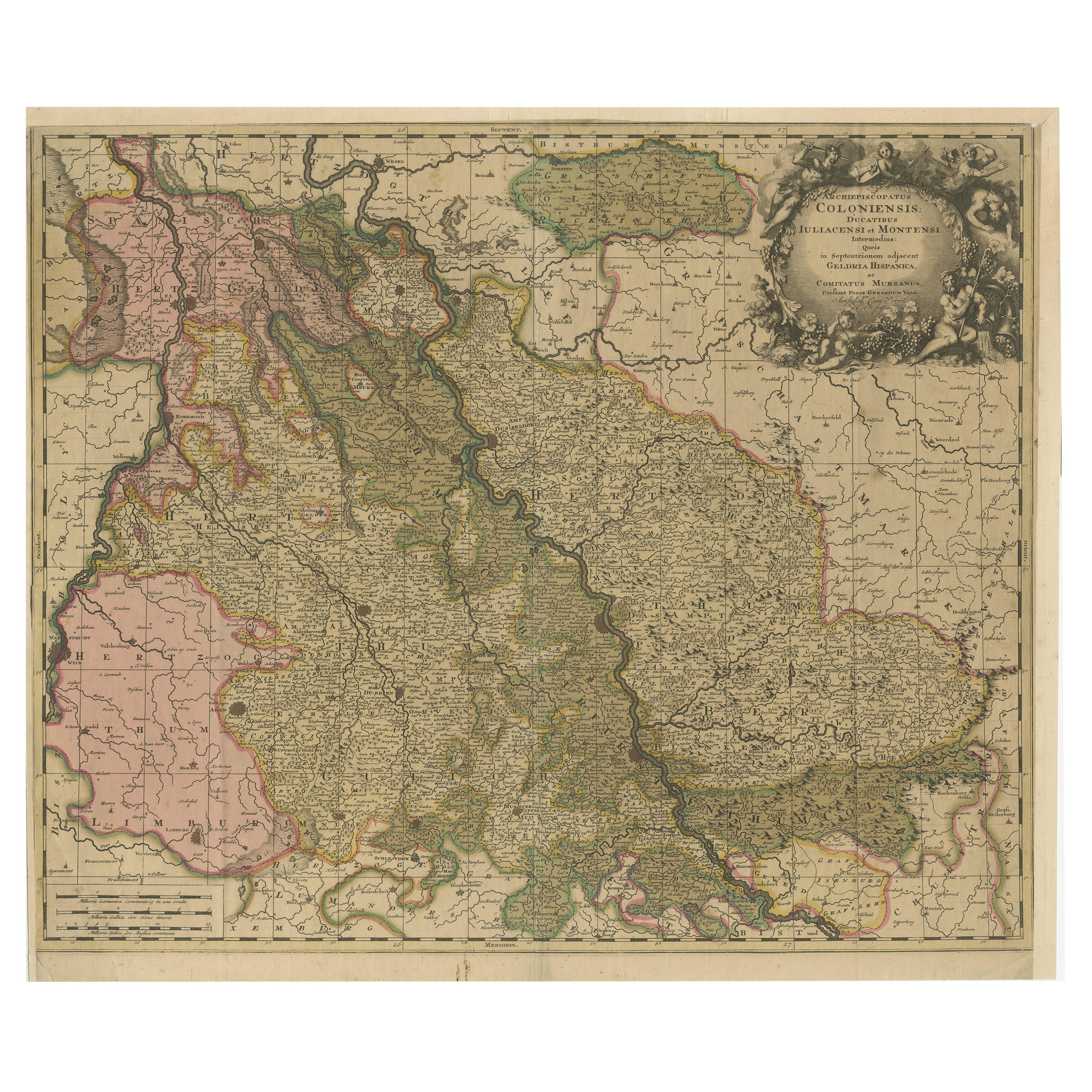
- Antique Map of the region of Trier, Mainz and Cologne, GermanyLocated in Langweer, NLAntique map titled 'Synopsis Circuli Rhenani Inferioris sive Electorum Rheni (..)'. Original antique map of the region of Trier, Mainz and Cologne, Germany. Published by T.C. Lotter,...Category
Antique Late 18th Century Maps
MaterialsPaper
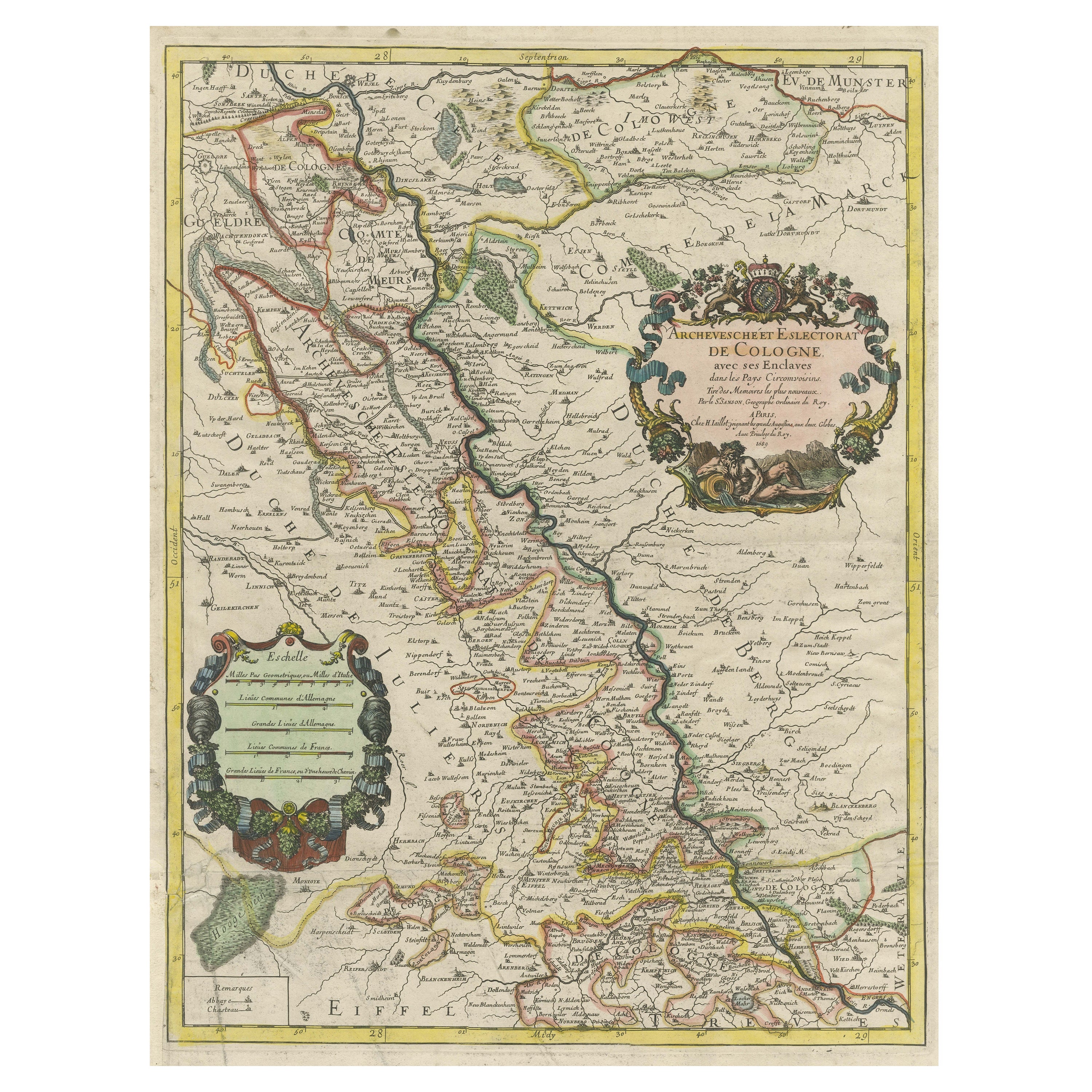
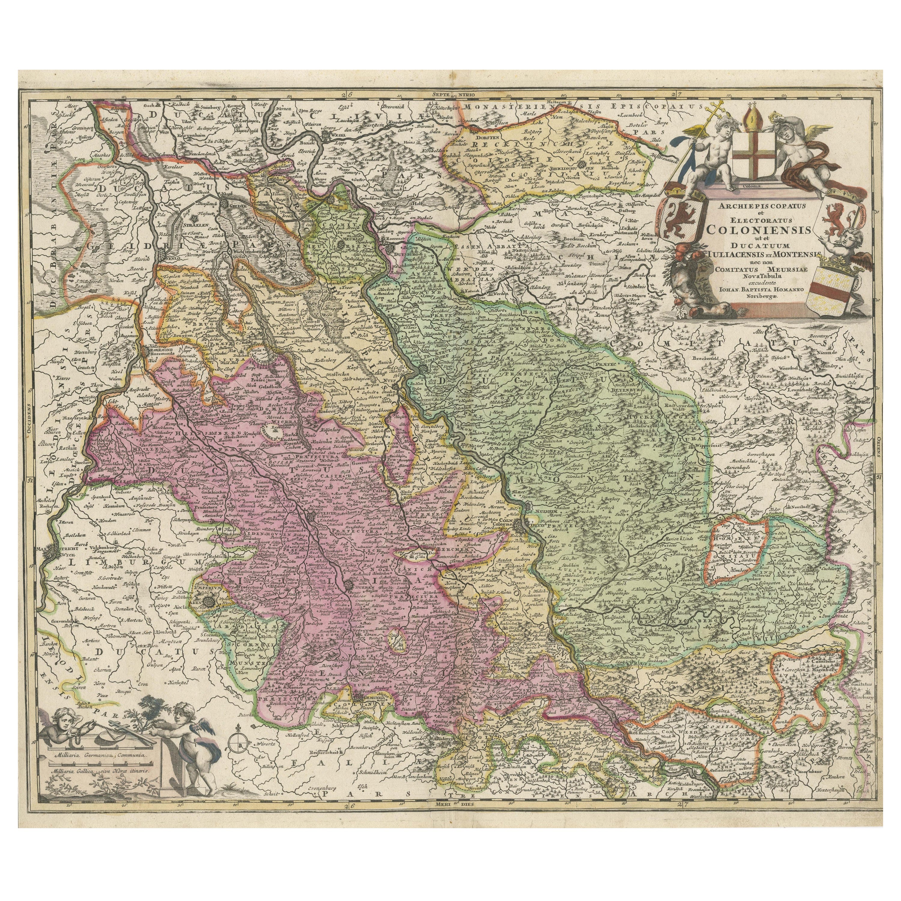
- Antique Map of the Archdiocese of Cologne, GermanyLocated in Langweer, NLAntique map titled 'Archevesche et Eslectorat de Cologne avec ses Enclaves'. Original old map of the Archdiocese of Cologne with the course of the Rhine from Andernach to Wesel with ...Category
Antique Late 17th Century Maps
MaterialsPaper
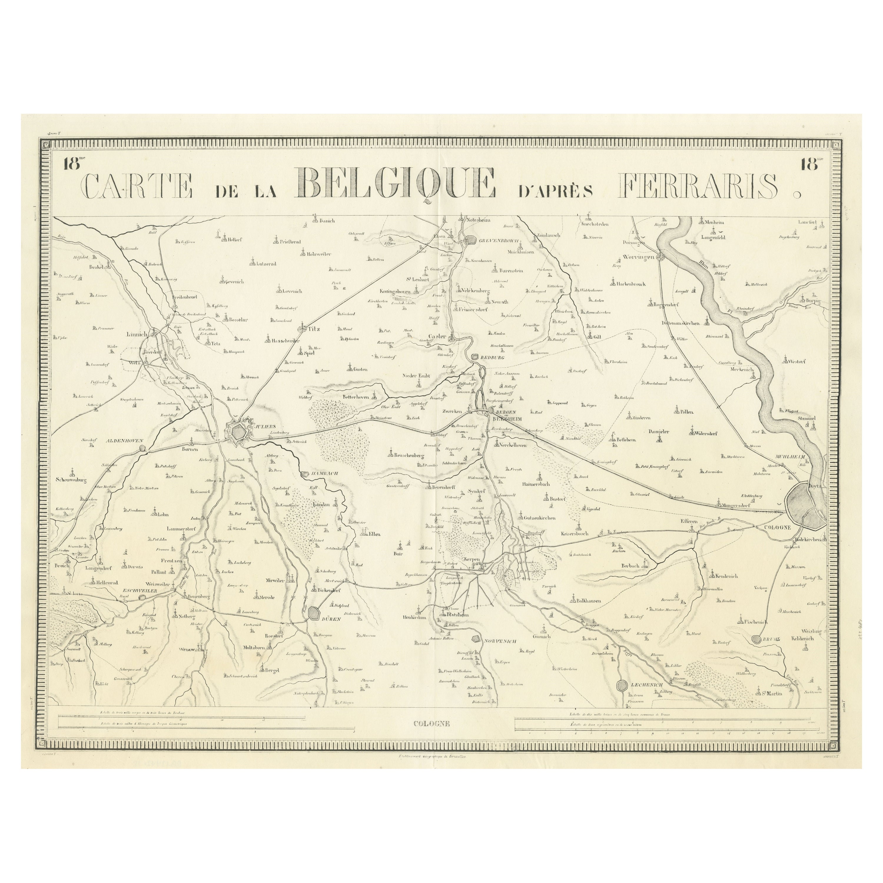
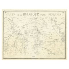
- Antique Map of the Region near Cologne, GermanyLocated in Langweer, NLAntique map titled 'Carte de la Belgique d'après Ferraris'. Original antique map of the region near Cologne, Germany. Cologne is the largest city of the German western state of North...Category
Antique Mid-19th Century Maps
MaterialsPaper
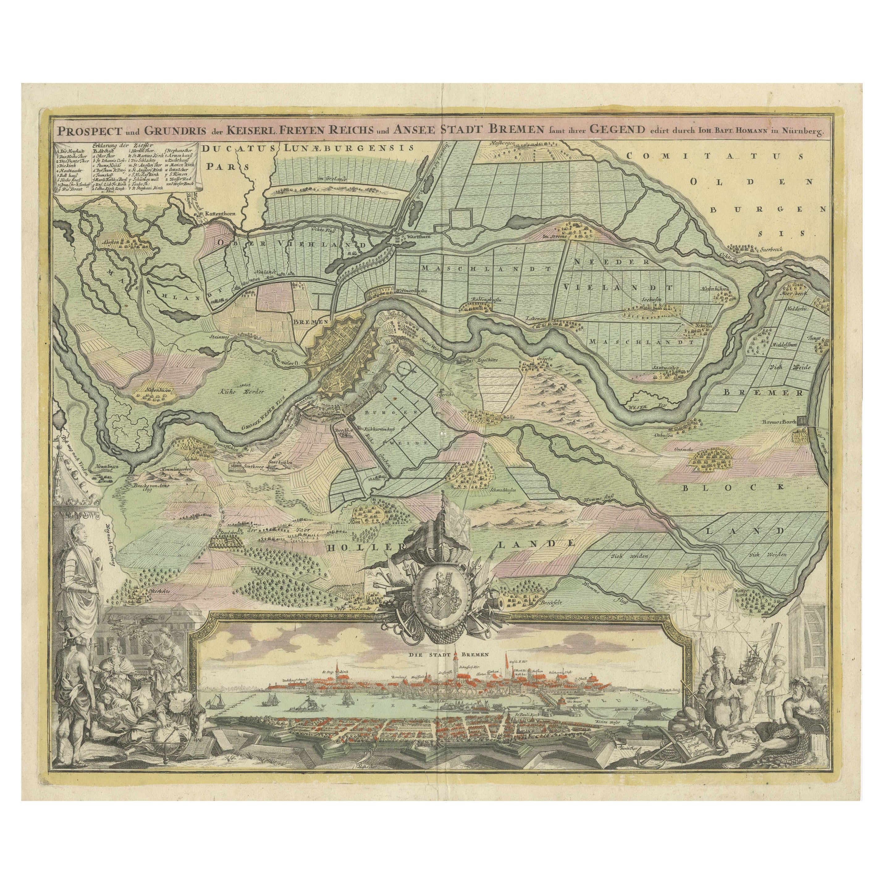
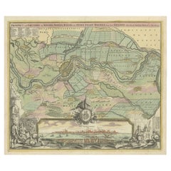
- Large Antique Map of the City of Bremen and Surroundings, GermanyLocated in Langweer, NLOriginal antique map titled 'Prospect und Grundris der Keiserl Freyen Reichs und Ansee Stadt Bremen (..)'. This is a superb chart of the city of Bremen and the surrounding small vill...Category
Antique Early 18th Century Maps
MaterialsPaper
 $1,195 Sale Price20% Off
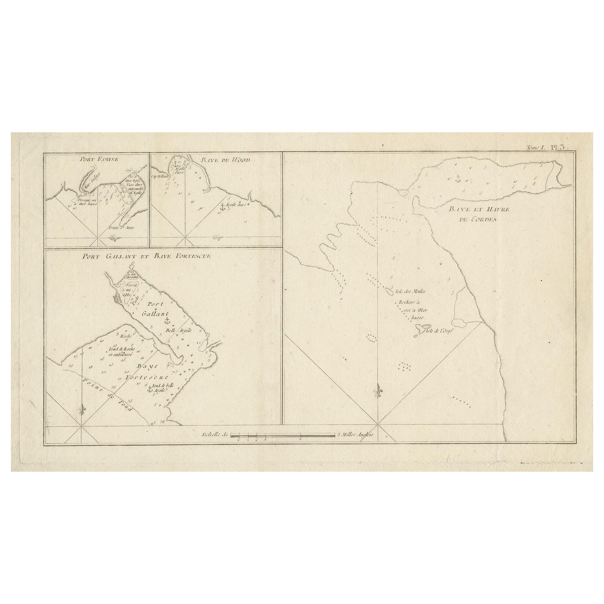
 - Antique Map of Cordes Bay and SurroundingsLocated in Langweer, NLAntique map titled 'Baye et Havre de Cordes (..)'. Four maps on the one sheet of; Cordes Bay, Port Famine, Woods Pay, Port Gallant, Fortescue Bay, Chile based on the voyage of John B...Category
Antique Late 18th Century Maps
MaterialsPaper
- Antique Map of Afghanistan and Surroundings, '1845'Located in Langweer, NLAntique map titled 'Map of Persia and Caubul'. Original antique map of Afghanistan and surroundings. This map originates from 'An Atlas of the World, Comprehending Separate Maps of...Category
Antique Mid-19th Century Maps
MaterialsPaper
 $177 Sale Price20% Off
You May Also LikeView All
- East German MapBy VEB Hermann HaackLocated in Baltimore, MDA brilliantly colourful map of the Leipzig, Karl Marx Stadt and Dresden area in the former German Democratic Republic by VEB Hermann Haack of Gotha.Category
Vintage 1970s German Maps
 $295 Sale Price25% Off
 - Set of 4 Antique Geographical Maps French-German War 1870-71Located in Casale Monferrato, ITElegant late 19th century set of four antique geographical maps relating to the positioning of the armies in the Franco-German War 1870-71. A...Category
Antique 1890s Italian Maps
MaterialsPaper
- Antique German Hartleben's Volks Atlas Book World MapsLocated in Seguin, TXAntique circa 1900 A. Hartleben's Volks-Atlas. Published by A. Hartleben's, Germany. Folio hardcover with decorated olive cloth binding and brown leather spine. Gilt title to spine...Category
Early 20th Century German Aesthetic Movement Maps
MaterialsPaper
- Cologne Cathedral Church Souvenir Building Ashtray Vintage, German, 1960sLocated in Nuernberg, DEA 1960s souvenir building architectural model Ashtray. Some wear with a nice patina, but this is old-age. Made of metal. A beautiful nice desktop item or just a display item in your ...Category
Mid-20th Century German Mid-Century Modern Architectural Models
MaterialsMetal
- 1854 Map of Massachusetts, Connecticut and Rhode Island, Antique Wall MapLocated in Colorado Springs, COThis striking wall map was published in 1854 by Ensign, Bridgman & Fanning and has both full original hand-coloring and original hardware. This impression is both informative and highly decorative. The states are divided into counties, outlined in red, green, and black, and subdivided into towns. Roads, canals, and railroad lines are prominently depicted, although they are not all labeled. The mapmakers also marked lighthouses, banks, churches, and prominent buildings, with a key at right. The map is an informative and comprehensive overview of the infrastructural development of New England prior to the Civil War. Physical geographies depicted include elevation, conveyed with hachure marks, rivers and lakes. The impression features an inset map of Boston...Category
Antique 19th Century American Maps
MaterialsPaper
- Antique Map of Principality of MonacoBy Antonio Vallardi EditoreLocated in Alessandria, PiemonteST/619 - "Old Geographical Atlas of Italy - Topographic map of ex-Principality of Monaco" - ediz Vallardi - Milano - A somewhat special edition ---Category
Antique Late 19th Century Italian Other Prints
MaterialsPaper
 $230 Sale Price74% Off


Recently Viewed
View AllMore Ways To Browse
Atlas Indu
Staffordshire Antique Map
Staffordshire Map
Antique Furniture Manitoba
Yugoslavia Map
Antique Maps Surrey
Antique Maps Of Puerto Rico
Cheshire Antique Map
Auge En Pierre
Montreal Map
Aigue Marine
Antique Furniture Perth Australia
Antique Maps Perth
Antique Route 66
Moldova Antique Map
Barbados Map
H Chatelain 1719
Nova Hollandia