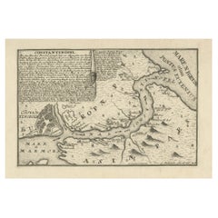
Constantinople: An 18th Century Cartographic Masterpiece by Gabriel Bodenehr
View Similar Items


Want more images or videos?
Request additional images or videos from the seller
1 of 7
Constantinople: An 18th Century Cartographic Masterpiece by Gabriel Bodenehr
About the Item
- Dimensions:Height: 7.49 in (19 cm)Width: 11.82 in (30 cm)Depth: 0.01 in (0.2 mm)
- Materials and Techniques:Paper,Engraved
- Period:1730-1739
- Date of Manufacture:1730
- Condition:Condition: Good. A tiny, hardly visible vertical wrinkle. Image otherwise clean and sharp. considering age. Please study image carefully.
- Seller Location:Langweer, NL
- Reference Number:Seller: BG-13803-31stDibs: LU3054340258552
About the Seller
5.0
Recognized Seller
These prestigious sellers are industry leaders and represent the highest echelon for item quality and design.
Platinum Seller
Premium sellers with a 4.7+ rating and 24-hour response times
Established in 2009
1stDibs seller since 2017
2,439 sales on 1stDibs
Typical response time: 1 hour
Authenticity Guarantee
In the unlikely event there’s an issue with an item’s authenticity, contact us within 1 year for a full refund. DetailsMoney-Back Guarantee
If your item is not as described, is damaged in transit, or does not arrive, contact us within 7 days for a full refund. Details24-Hour Cancellation
You have a 24-hour grace period in which to reconsider your purchase, with no questions asked.Vetted Professional Sellers
Our world-class sellers must adhere to strict standards for service and quality, maintaining the integrity of our listings.Price-Match Guarantee
If you find that a seller listed the same item for a lower price elsewhere, we’ll match it.Trusted Global Delivery
Our best-in-class carrier network provides specialized shipping options worldwide, including custom delivery.More From This Seller
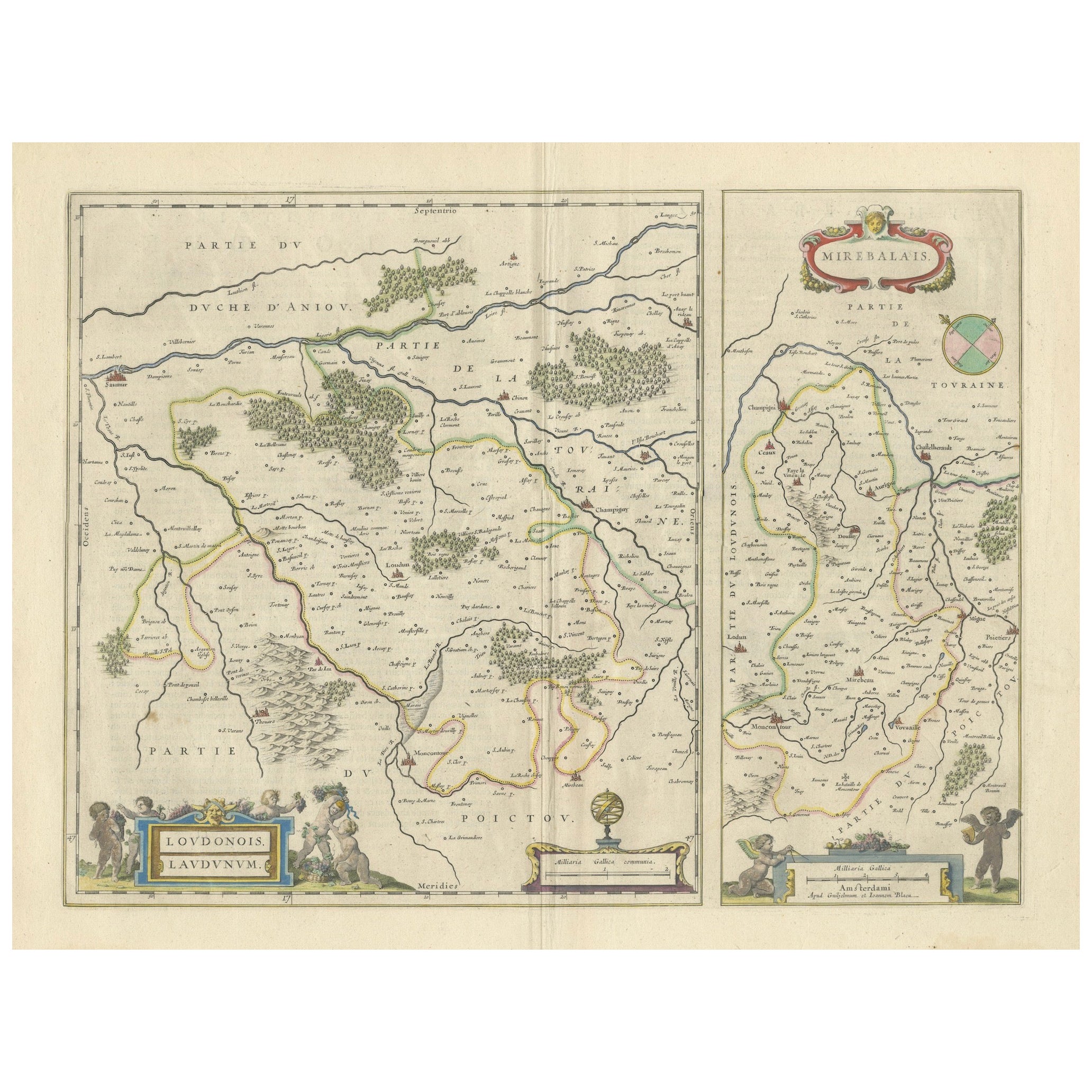
View AllLoudun and Mirebeau: A Cartographic Masterpiece of 17th Century France by Blaeu
Located in Langweer, NL
Cartography, 17th century. Willem (1571-1638) and Joan Blaeu (1596-1673), Theatrum Orbis Terrarum sive Atlas Novus..., 1635. Figure: Loudonois. Laudunum (Loudun); Mirebalais (Mirebea...
Category
Antique 1650s Maps
Materials
Paper
$403 Sale Price
20% Off
Free Shipping
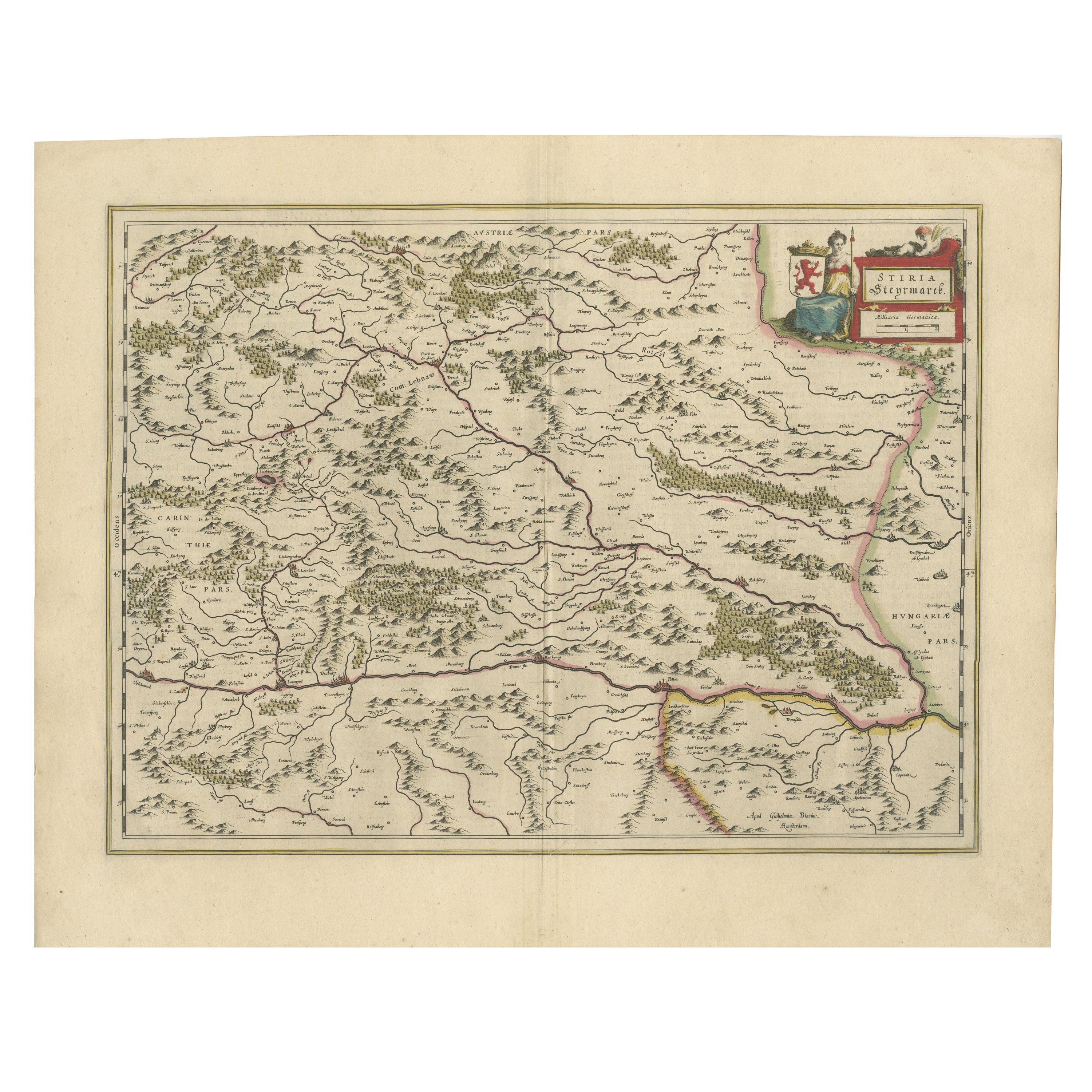
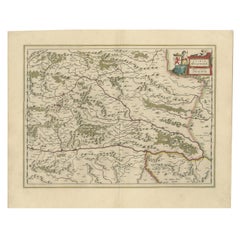
Map of Styria by William Blaeu, 1645: A Masterpiece of 17th-Century Cartography
Located in Langweer, NL
This 1645 map, created by Willem Janszoon Blaeu, represents Styria (Steyrmark), a historical region in present-day Austria, located in the Alpine regions. Blaeu, one of the most sign...
Category
Antique 1640s Maps
Materials
Paper
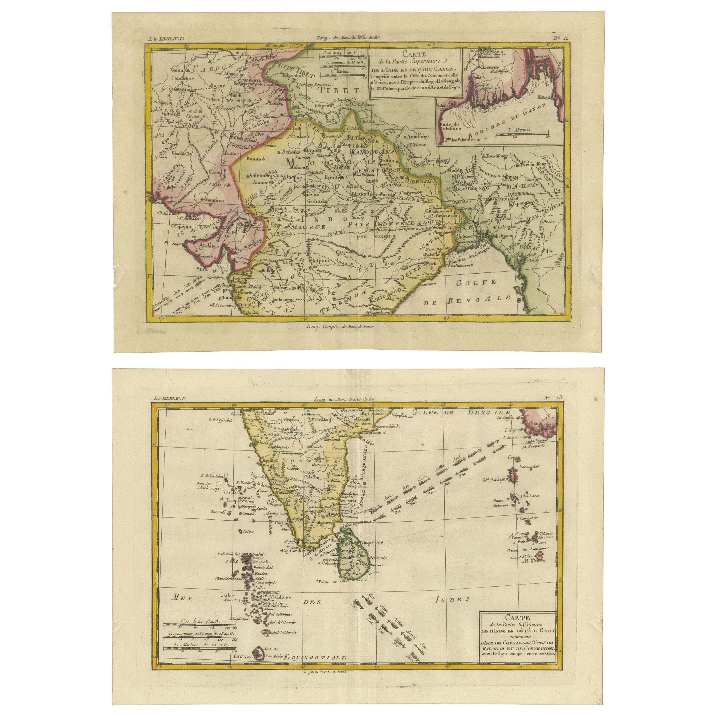
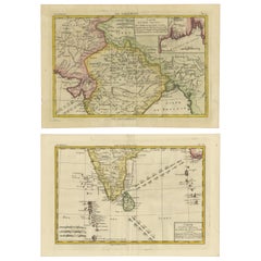
18th Century Cartographic Depiction of Upper India and Ceylon, 1835
Located in Langweer, NL
An exquisite set of two maps, 'Carte de la Partie Superieure De L'Inde en de Cadu Gange,' masterfully crafted by the renowned 18th-century French cartographer, Charles Marie Rigobert...
Category
Antique 1830s Maps
Materials
Paper
$403 Sale Price
20% Off
Free Shipping
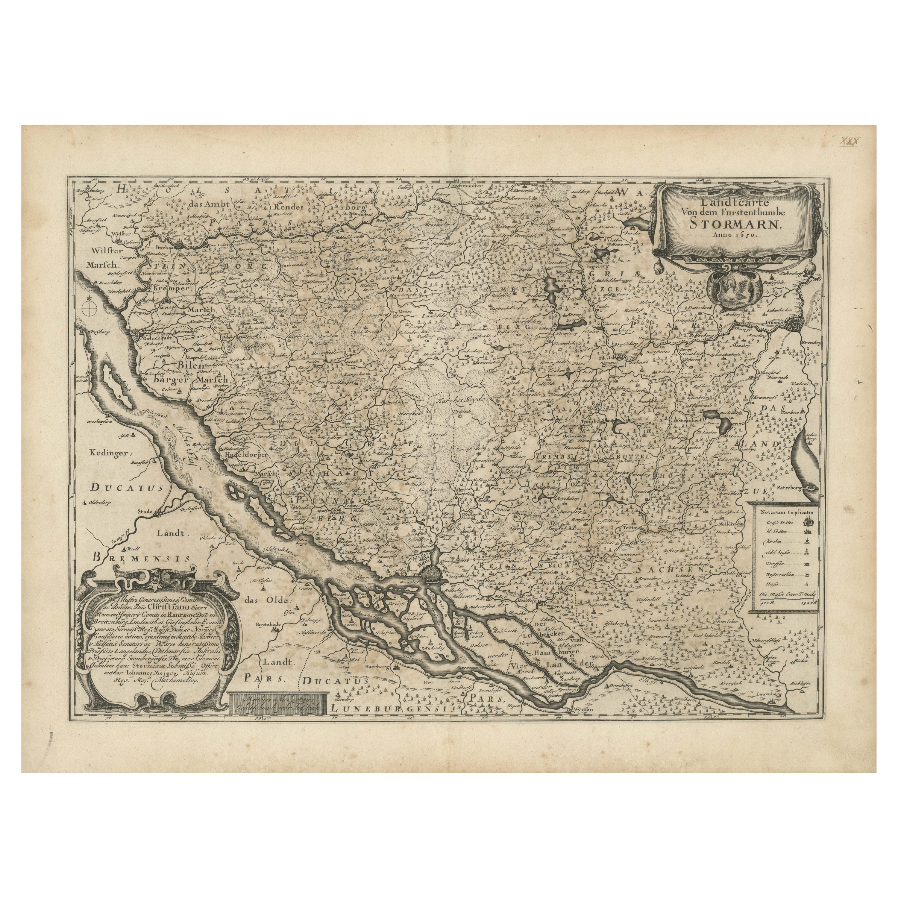
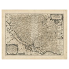
Mapping Stormarn: Johannes Meier's 1650 Cartographic Masterpiece
Located in Langweer, NL
This detailed description enhances our understanding of the historical map titled "Landtcarte von dem Furstenthumbe Stormarn," a copper etching by Johannes Meier (Mejer), dated to 16...
Category
Antique 1650s Maps
Materials
Paper
$569 Sale Price
20% Off
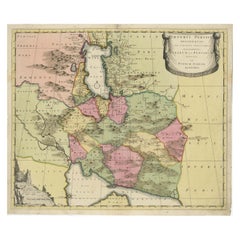
Imperii Persici Delineatio: A 1722 Cartographic Masterpiece of Persia by Schenk
Located in Langweer, NL
Title: IMPERII PERCICI delineatio ex scriptis potissimum geographicis Arabum et Persarum
Cartographer: Petrus Schenk (Pieter Schenk), 1722
An original antique hand-colored engraved...
Category
Antique 1720s Maps
Materials
Paper
$1,055 Sale Price
20% Off
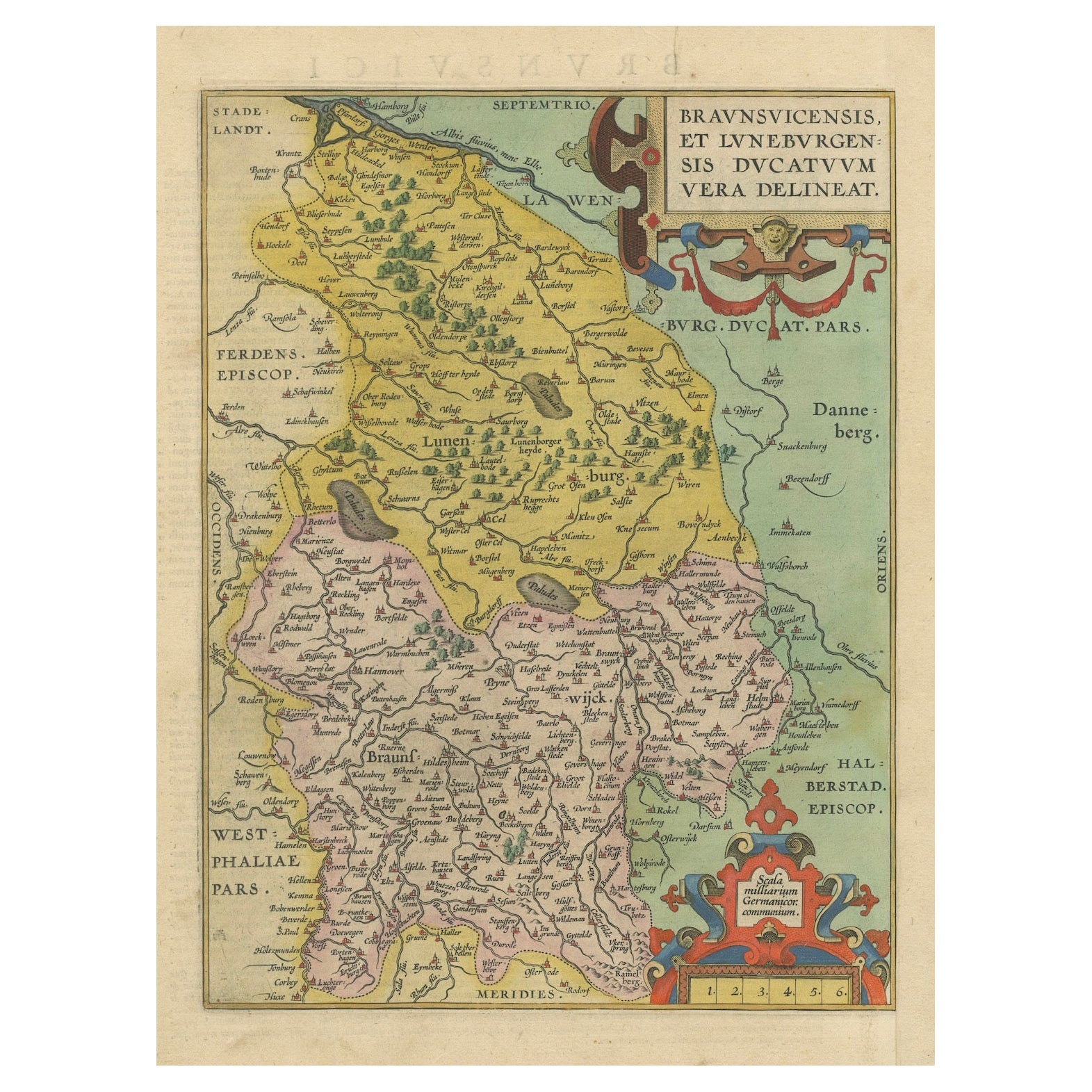
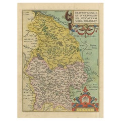
Duchy of Brunswick-Lüneburg, 1595: A Renaissance Cartographic Masterpiece
Located in Langweer, NL
Title: "Braunschweig and Lüneburg Duchies: Authentic Depiction by Abraham Ortelius"
This is an exquisite example of Abraham Ortelius’s cartographic craftsmanship: an original antiqu...
Category
Antique 16th Century Maps
Materials
Paper
$321 Sale Price
20% Off
You May Also Like
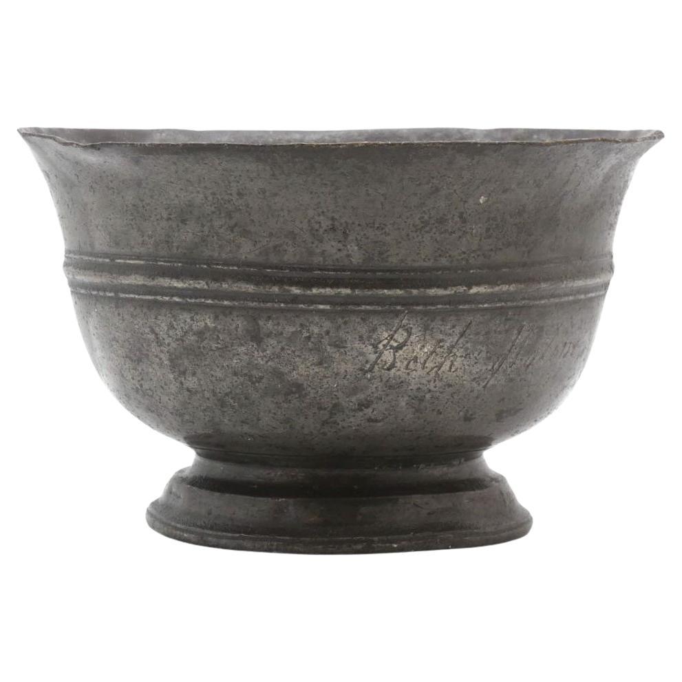
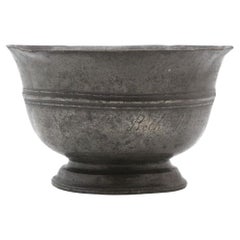
An 18th Century Pewter Beit Cholim Charity Bowl
Located in New York, NY
This rare and historically significant 18th-century pewter Beit Cholim charity bowl embodies the spirit of communal care and generosity. Inscribed in elegant cursive English on both ...
Category
Antique 18th Century Religious Items
Materials
Pewter
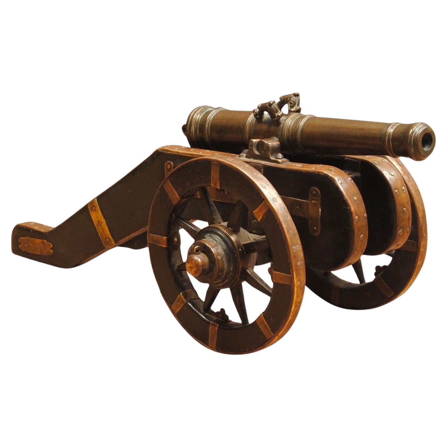
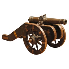
An 18th Century Model Field Cannon With Bronze Barrel
Located in Lincolnshire, GB
An 18th century bronze model of a field cannon, mounted on a brass bound oak carriage
The cannon with dolphin handles and good patiation. Possibly originally used as a starter cannon
Category
Antique 18th Century European Arms, Armor and Weapons
Materials
Brass, Bronze
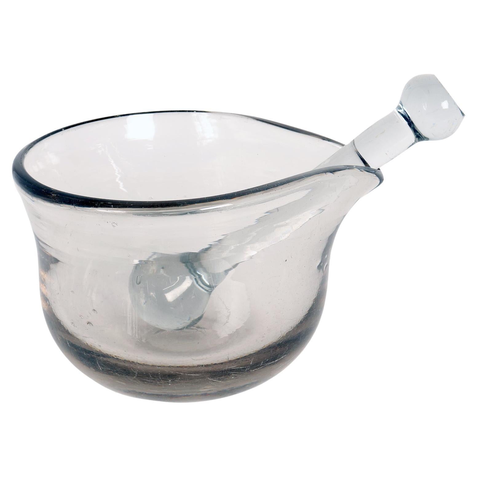
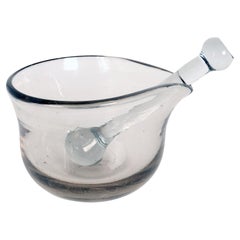
An apothecary glass mortar and pestle, Italy 18th century.
Located in Milan, IT
Apothecary glass mortar, fitted with glass pestle. Italy early 18th century.
Category
Antique Early 18th Century Italian Scientific Instruments
Materials
Glass
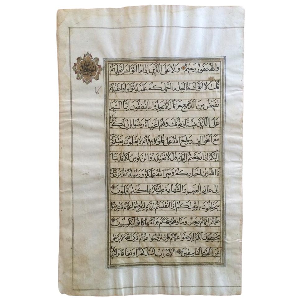
North Indian Illuminated Calligraphy Qur'an Leaf, 18th-19th Century
Located in Stamford, CT
A single two-sided Qur'an manuscript leaf with beautiful hand inked calligraphy with gilt borders and a gilt cartouche with calligraphic decoration. No...
Category
Antique Early 19th Century Indian Islamic Religious Items
Materials
Paper

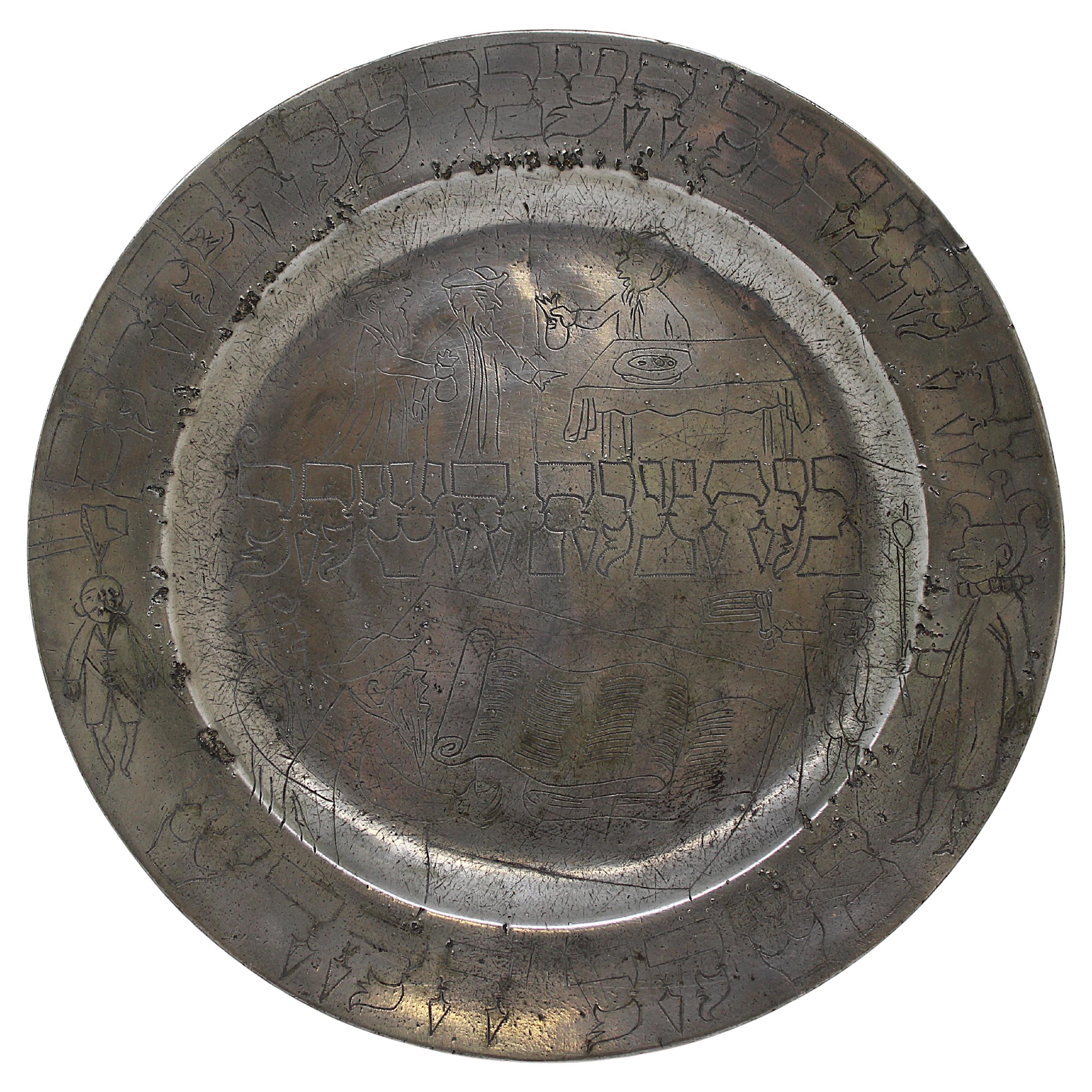
An 18th Century European Purim Pewter Plate for Collecting Alms
Located in New York, NY
This 18th-century pewter Purim plate is a rare and historically significant item associated with Jewish traditions. It features decorative engravings likely used for collecting alms,...
Category
Antique 18th Century European Religious Items
Materials
Pewter
West Coast of Africa, Guinea & Sierra Leone: An 18th Century Map by Bellin
By Jacques-Nicolas Bellin
Located in Alamo, CA
Jacques Bellin's copper-plate map entitled "Partie de la Coste de Guinee Dupuis la Riviere de Sierra Leona Jusquau Cap das Palmas", depicting the coast of Guinea and Sierra Leone in ...
Category
Antique Mid-18th Century French Maps
Materials
Paper

Recently Viewed
View AllMore Ways To Browse
Ottoman Horn
Byzantine Emperor
Huber Ottoman
G Plan Ottoman
Fabric Patterned Bench
Floating Console Table
Floral Pitchers
Frank Lloyd Wright Copper
Freight Elevator
French Colonial Table
French Dining Chairs Louis Xv
Glass Cylindrical Side Tables
Gold Moroccan Caftan
Golden Oak Chairs
Hammered Spoon
Hans Egg
Hat Rack Umbrella Stand
Henriot Quimper France