Items Similar to Decorative 1850s Map of Eastern Canada and New Brunswick with Historic Vignettes

Want more images or videos?
Request additional images or videos from the seller
1 of 6
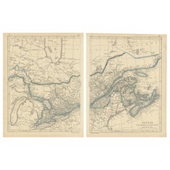
Decorative 1850s Map of Eastern Canada and New Brunswick with Historic Vignettes
$202.79
£149.93
€170
CA$278.94
A$310.06
CHF 162.53
MX$3,786.59
NOK 2,029.06
SEK 1,908.96
DKK 1,294.21
About the Item
Decorative 1850s Map of Eastern Canada and New Brunswick with Historic Vignettes
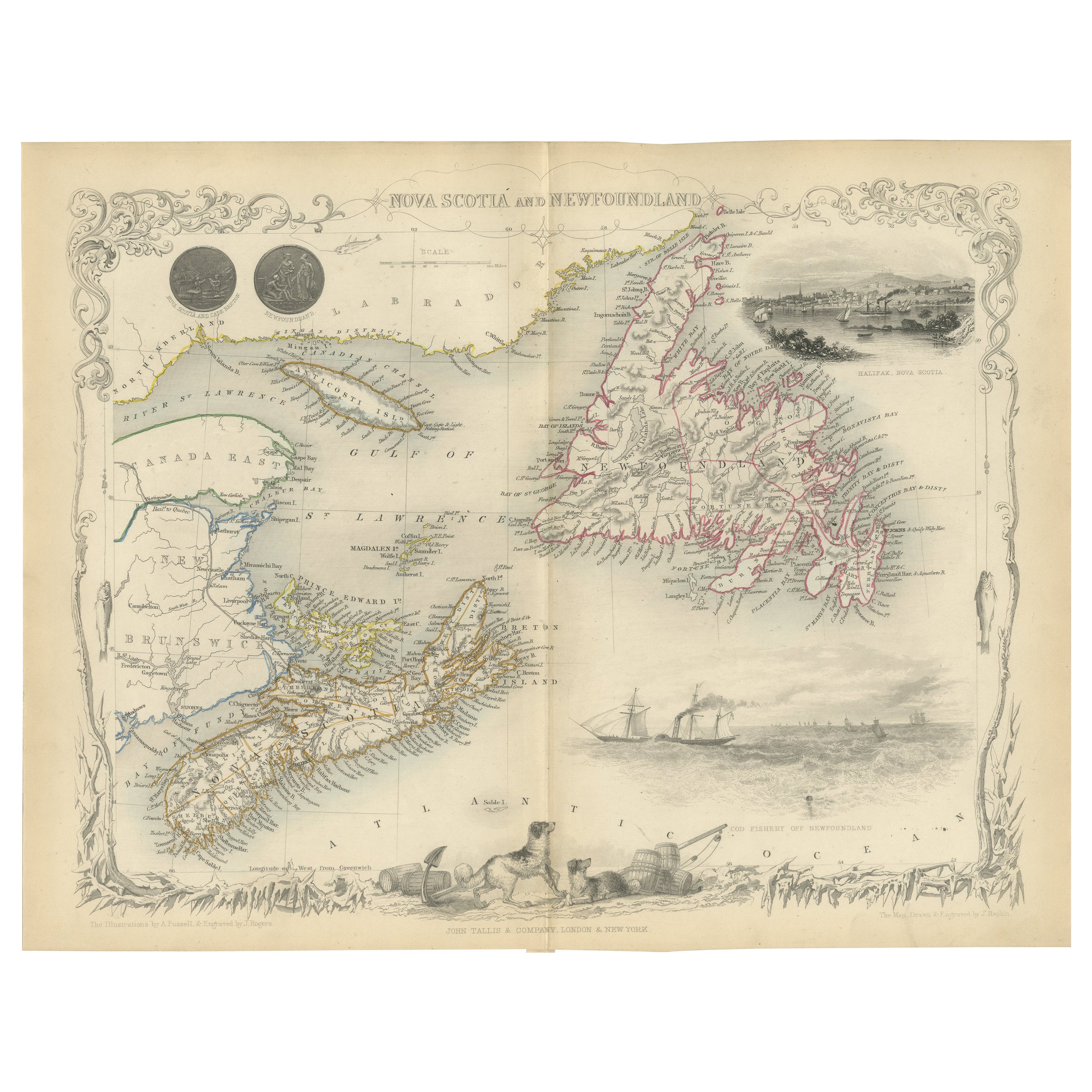
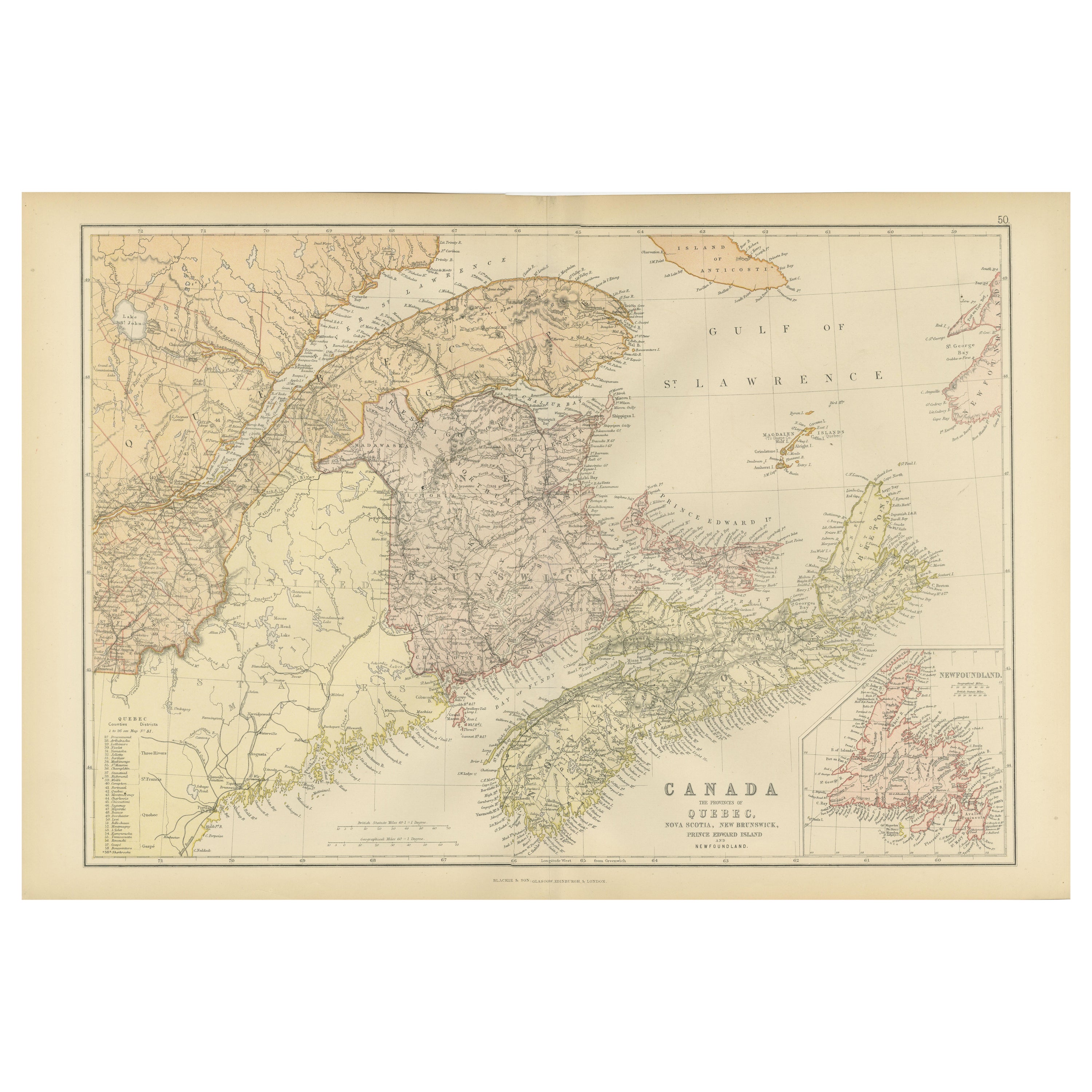
This beautifully crafted 19th-century map of Eastern Canada and New Brunswick, drawn and engraved by J. Rapkin and published by J & F Tallis, showcases the intricate geography of the region during the Victorian era. Highlighted with hand-colored borders, the map delineates towns, cities, and significant waterways, including the St. Lawrence River and the Gulf of St. Lawrence.
The map is enriched with stunning illustrations by H. Warren, engraved by J. H. Rogers. These vignettes include a dramatic view of Quebec City with sailing ships in the foreground, a scene of North American Indigenous peoples, and a depiction of a bison in its natural habitat. The ornate border further enhances the map's aesthetic appeal, reflecting the artistic style of Victorian cartography.
Produced during a period of exploration and expansion, this map provides a fascinating historical snapshot of Eastern Canada and New Brunswick, making it a valuable piece for collectors of antique maps or enthusiasts of Canadian history.
Circa 1850s
Condition: Very goo with vibrant hand-coloring, sharp engraving details, and minimal signs of aging. Perfect for display or collection.
**Keywords:** Eastern Canada, New Brunswick, antique map, Victorian cartography, 19th-century map, J. Rapkin, J & F Tallis, Quebec, St. Lawrence River, Gulf of St. Lawrence, hand-colored map, historical geography, Indigenous peoples, bison, illustrated cartography, Victorian-era maps, Canadian history, decorative map, antique prints.
- Dimensions:Height: 10.95 in (27.8 cm)Width: 14.26 in (36.2 cm)Depth: 0.01 in (0.2 mm)
- Materials and Techniques:Paper,Engraved
- Period:
- Date of Manufacture:circa 1850
- Condition:Condition: Very good with vibrant hand-coloring, clear engraving details, and minimal signs of age-related wear. Ideal for display or collection.
- Seller Location:Langweer, NL
- Reference Number:Seller: BG-13999-321stDibs: LU3054342854452
About the Seller
5.0
Recognized Seller
These prestigious sellers are industry leaders and represent the highest echelon for item quality and design.
Platinum Seller
Premium sellers with a 4.7+ rating and 24-hour response times
Established in 2009
1stDibs seller since 2017
2,604 sales on 1stDibs
Typical response time: <1 hour
- ShippingRetrieving quote...Shipping from: Langweer, Netherlands
- Return Policy
Authenticity Guarantee
In the unlikely event there’s an issue with an item’s authenticity, contact us within 1 year for a full refund. DetailsMoney-Back Guarantee
If your item is not as described, is damaged in transit, or does not arrive, contact us within 7 days for a full refund. Details24-Hour Cancellation
You have a 24-hour grace period in which to reconsider your purchase, with no questions asked.Vetted Professional Sellers
Our world-class sellers must adhere to strict standards for service and quality, maintaining the integrity of our listings.Price-Match Guarantee
If you find that a seller listed the same item for a lower price elsewhere, we’ll match it.Trusted Global Delivery
Our best-in-class carrier network provides specialized shipping options worldwide, including custom delivery.More From This Seller
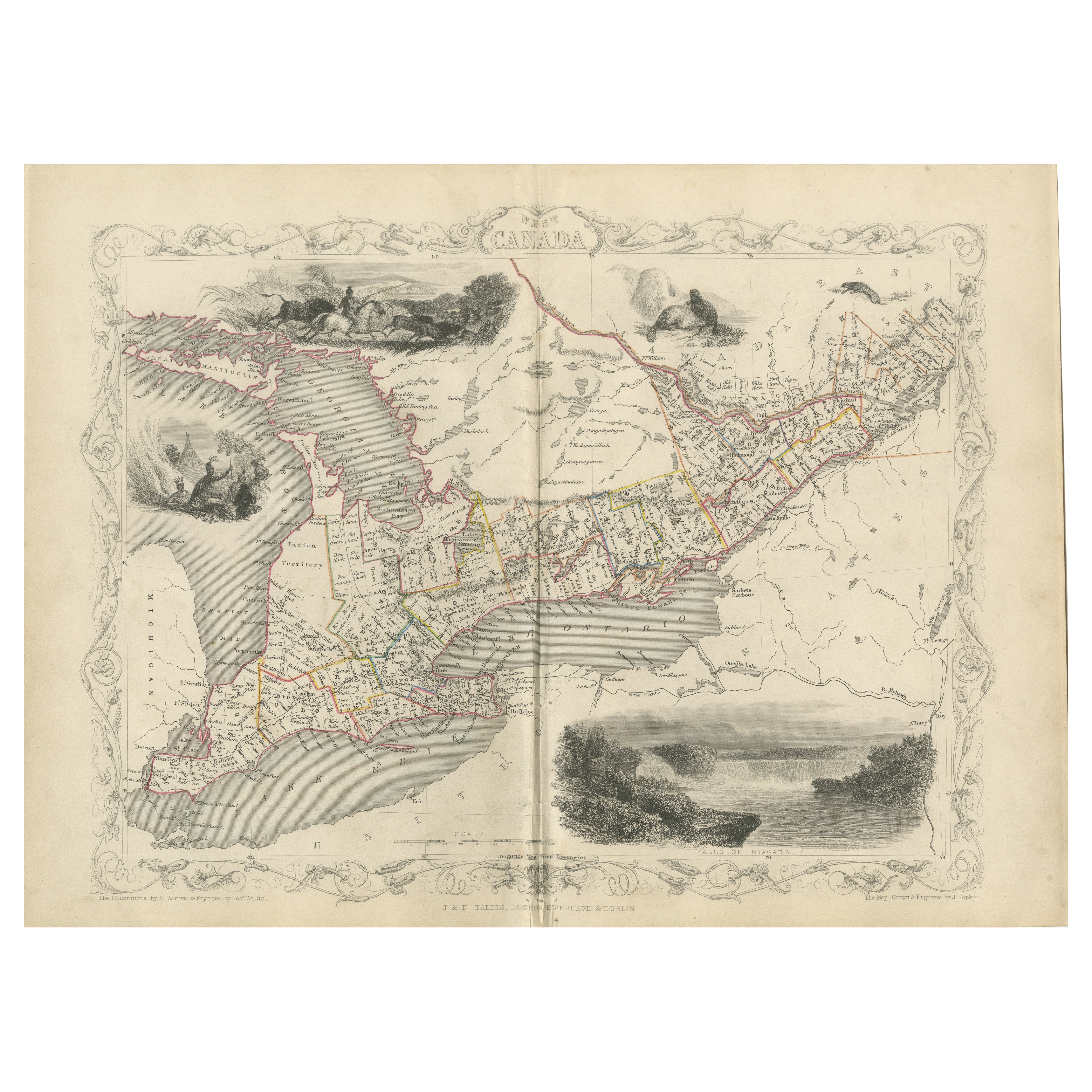
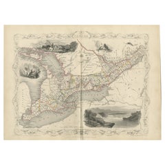
View AllA 19th-Century Map of West Canada with Niagara Falls and Indigenous Scenes
Located in Langweer, NL
Decorative 19th-Century Map of West Canada with Niagara Falls and Indigenous Scenes
This detailed 19th-century map of West Canada, drawn and engraved by J. Rapkin and published by...
Category
Antique 1850s Maps
Materials
Paper
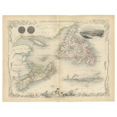
A Decorative Map of Nova Scotia and Newfoundland by John Tallis, 1851
Located in Langweer, NL
The map is part of the series created by John Tallis & Company, known for their mid-19th-century maps. This particular map illustrates the regions of Nova Scotia and Newfoundland and...
Category
Antique 1850s English Maps
Materials
Paper
Antique Map of New Brunswick, Nova Scotia and Surroundings by Johnson, 1872
Located in Langweer, NL
Antique map titled 'Johnson's Quebec, of the dominion of Canada (..)'. Original map of New Brunswick, Nova Scotia, Newfoundland and Prince Edward Island....
Category
Antique Late 19th Century Maps
Materials
Paper

$334 Sale Price
20% Off
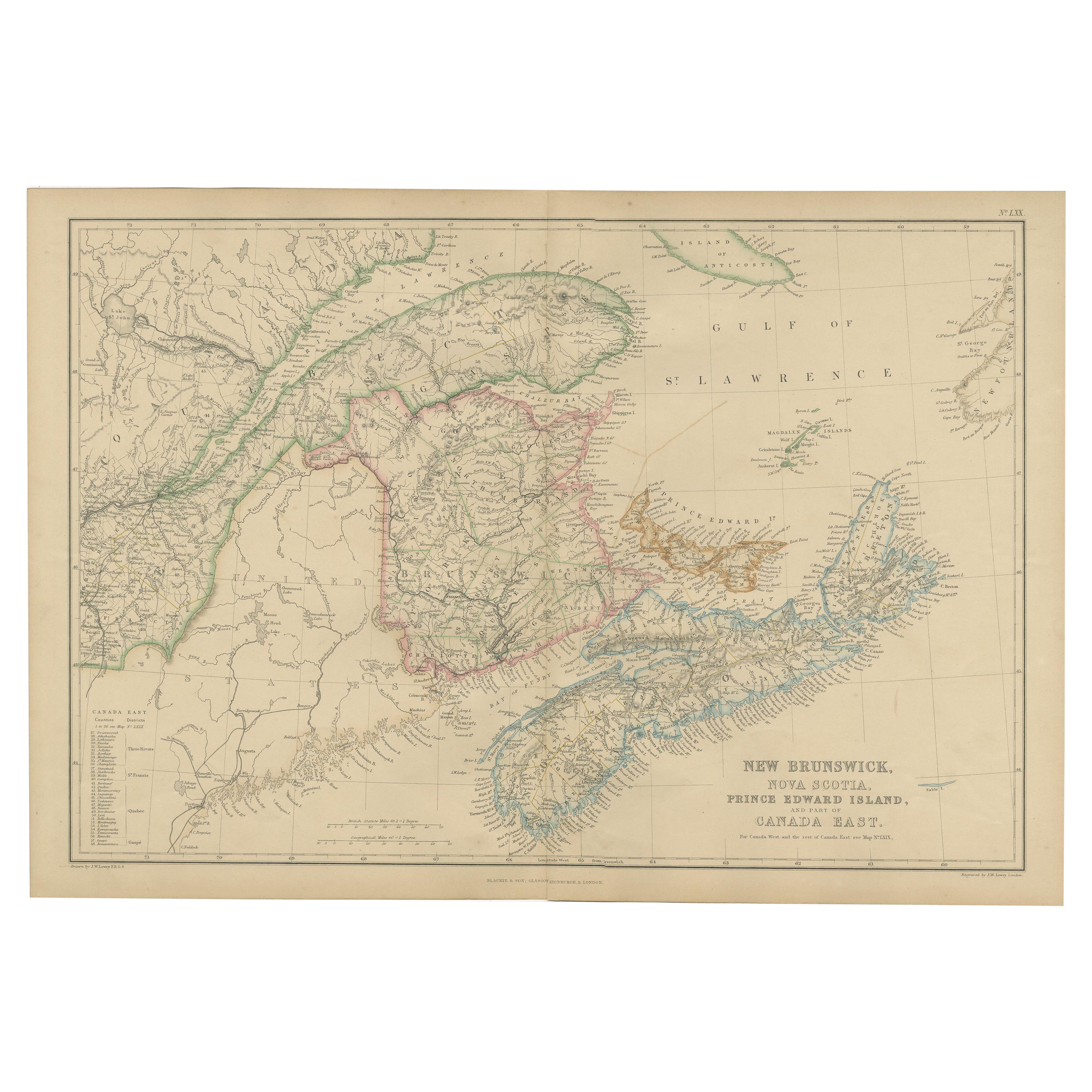
Antique Map of New Brunswick by W. G. Blackie, 1859
Located in Langweer, NL
Antique map titled 'New Brunswick, Nova Scotia, Prince Edward Island and Part of Canada east'. Original antique map of New Brunswick, Nova Scotia,...
Category
Antique Mid-19th Century Maps
Materials
Paper
$238 Sale Price
20% Off
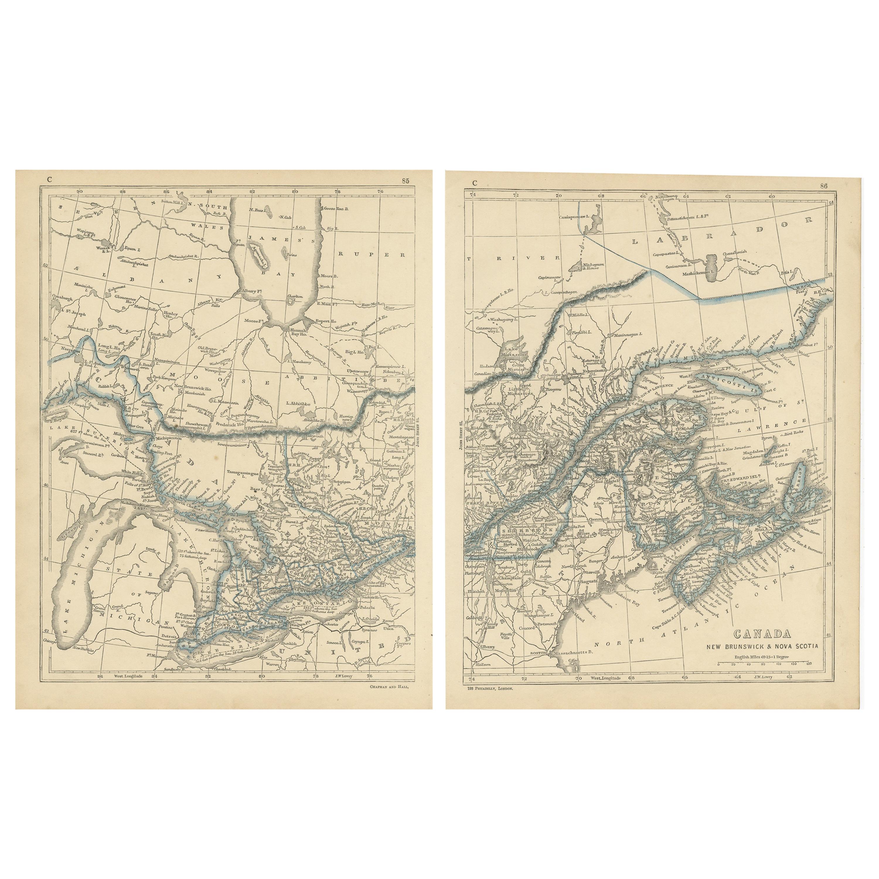
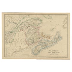
Antique Map of Canada, New Brunswick and Nova Scotia by Lowry, 1852
Located in Langweer, NL
Antique map titled 'Canada, New Brunswick & Nova Scotia'. Two individual sheets of Canada, New Brunswick and Nova Scotia. This map originates from 'Lowry...
Category
Antique Mid-19th Century Maps
Materials
Paper
$190 Sale Price / set
20% Off
Decorative Antique Map of Eastern Canada, Published in 1882
Located in Langweer, NL
This is a historical map from the 1882 Blackie Atlas, focused on eastern Canada and the maritime provinces. The map is titled "Canada. No. 2. Provinces of Nova Scotia, New Brunswick,...
Category
Antique 1880s Maps
Materials
Paper

You May Also Like
Original Antique Map of New Brunswick and Nova Scotia, 1889
Located in St Annes, Lancashire
Great map of New Brunswick and Nova Scotia
Drawn and Engraved by W. & A.K. Johnston
Published By A & C Black, Edinburgh.
Original colour
Unfr...
Category
Antique 1880s Scottish Victorian Maps
Materials
Paper

English Engraved Hand Colored Map of the North Eastern United States, circa 1817
Located in Charleston, SC
English copper engraved hand colored map of the North Eastern United States matted under glass in a gilt frame, Early 19th Century. Drawn and Engraved for Thomson's New General Atlas...
Category
Antique 1810s English George III Maps
Materials
Glass, Giltwood, Paint, Paper

1858 Colton's Map of New York, Ric.B011
Located in Norton, MA
An 1858 Colton's map of New York
Ric.b011
Colton’s New York, 1858 - A large original color engraved and very detailed map of the state of New York,...
Category
Antique 19th Century Unknown Maps
Materials
Paper

New Brunswick, Nova Scotia and Prince Edward Island, Canada. Century Atlas map
Located in Melbourne, Victoria
'The Century Atlas. New Brunswick, Nova Scotia and Prince Edward Island, Canada.'
Original antique map, 1903.
Inset map of Newfoundland.
Central...
Category
Early 20th Century Victorian More Prints
Materials
Lithograph
Large Original Antique City Plan of Montreal, Canada, circa 1900
By Rand McNally & Co.
Located in St Annes, Lancashire
Fabulous colorful map of Montreal
Original color
By Rand, McNally & Co.
Published, circa 1900
Unframed
Minor edge tears
Free shipping.
Category
Antique Early 1900s American Maps
Materials
Paper

Quebec. Canada. Century Atlas antique vintage map
Located in Melbourne, Victoria
'The Century Atlas. Quebec'
Original antique map, 1903.
Inset maps 'Sketch Map of Quebec', Quebec and Vicinity; and 'Montreal and Vicinity'.
Central fo...
Category
Early 20th Century Victorian More Prints
Materials
Lithograph

More Ways To Browse
Canadian Antique Furniture
Quebec Furniture
Antique Rogers
Antique Furniture Brunswick
Antique Bison
Red Retro Dining Set
Antique Silver Glasses Case
Carlo Scarpa 1934 Chairs
Christofle Marly
1900 Antique Chairs
Glass Table Italian Round
Mid Century Colonial
Alvar Aalto Poster
Geometric Metal Table
Post Modern High Chairs
United Nations
Vintage Vine Rug
Cancel An Order