Items Similar to Large Antique Map of Ancient Spain and Portugal, Published in circa 1760


Want more images or videos?
Request additional images or videos from the seller
1 of 6
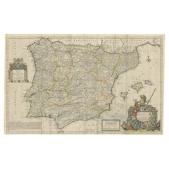
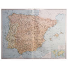
Large Antique Map of Ancient Spain and Portugal, Published in circa 1760
About the Item
Antique map titled 'Hispania Antiqua (..)'. Map of ancient Spain and Portugal. Engraved by G. Delahaye. Published circa 1760, by or after Sanson & Vaugondy.
- Dimensions:Height: 20.16 in (51.2 cm)Width: 26.86 in (68.2 cm)Depth: 0.02 in (0.5 mm)
- Materials and Techniques:
- Period:
- Date of Manufacture:c.1760
- Condition:Repaired: Very small repair left of title cartouche. General age-related toning. Original folding line. Shows some wear and soiling. Few stains affecting image. Blank verso. Please study image carefully.
- Seller Location:Langweer, NL
- Reference Number:Seller: BG-13433-21stDibs: LU3054336227332
About the Seller
5.0
Recognized Seller
These prestigious sellers are industry leaders and represent the highest echelon for item quality and design.
Gold Seller
Premium sellers maintaining a 4.3+ rating and 24-hour response times
Established in 2009
1stDibs seller since 2017
2,452 sales on 1stDibs
Typical response time: <1 hour
- ShippingRetrieving quote...Shipping from: Langweer, Netherlands
- Return Policy
Authenticity Guarantee
In the unlikely event there’s an issue with an item’s authenticity, contact us within 1 year for a full refund. DetailsMoney-Back Guarantee
If your item is not as described, is damaged in transit, or does not arrive, contact us within 7 days for a full refund. Details24-Hour Cancellation
You have a 24-hour grace period in which to reconsider your purchase, with no questions asked.Vetted Professional Sellers
Our world-class sellers must adhere to strict standards for service and quality, maintaining the integrity of our listings.Price-Match Guarantee
If you find that a seller listed the same item for a lower price elsewhere, we’ll match it.Trusted Global Delivery
Our best-in-class carrier network provides specialized shipping options worldwide, including custom delivery.More From This Seller
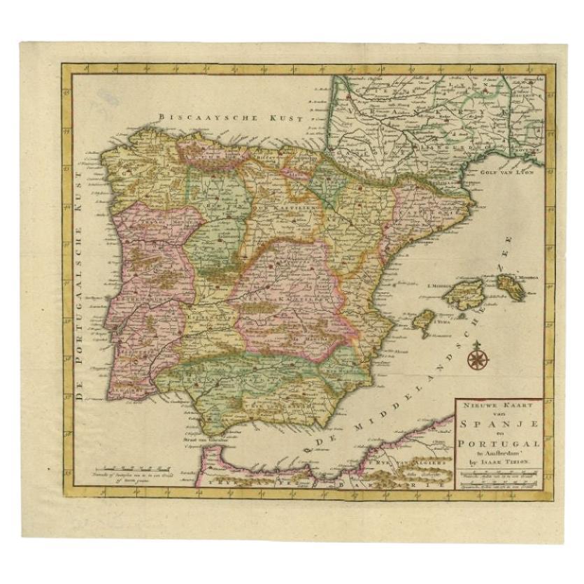
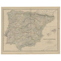
View AllAntique Map of Spain and Portugal by Tirion, c.1760
Located in Langweer, NL
Antique map titled 'Nieuwe Kaart van Spanje en Portugal.' Attractive detailed map showing Spain and Portugal. Including Majorca, Minorca and Ibiza. Title in block-style cartouche wit...
Category
Antique 18th Century Maps
Materials
Paper
$254 Sale Price
20% Off
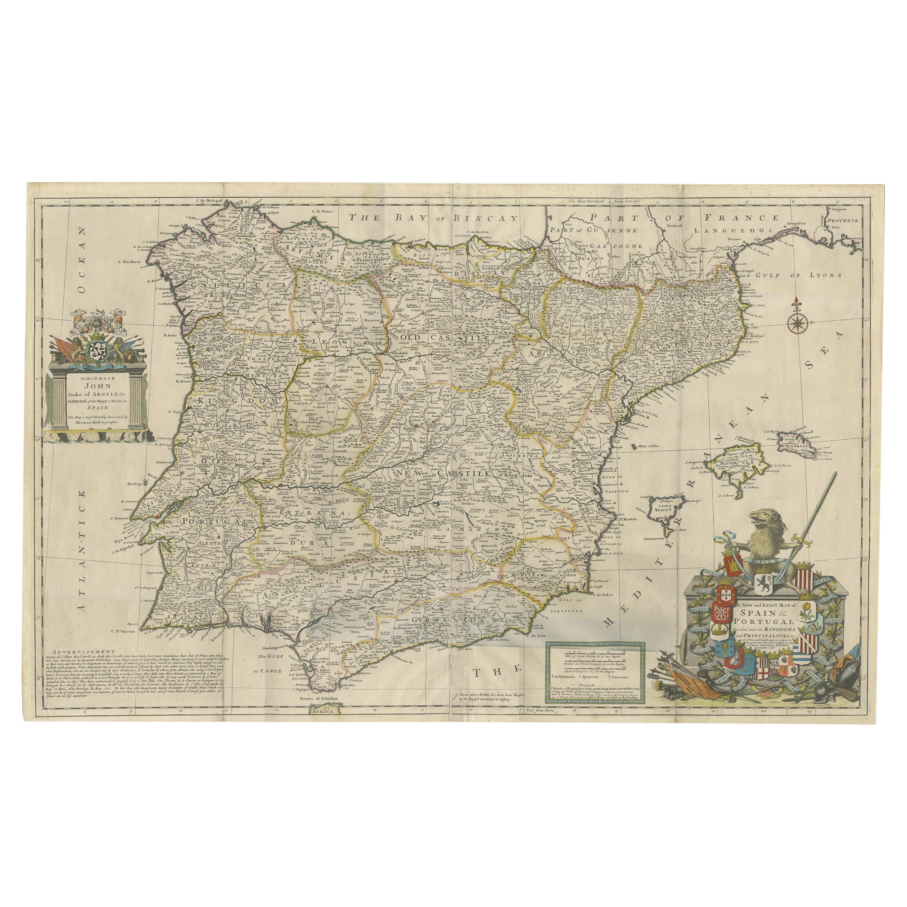
Beautiful Large Scale Map of Spain and Portugal Published by Herman Moll in 1711
Located in Langweer, NL
Title: A New and Exact Map of Spain & Portugal
Author: Herman Moll
Date: 1711
Medium: Hand-colored copperplate engraving
Herman Moll (c. 1654-1732) was one of the most important London mapmakers in the first half of the eighteenth century. Moll was probably born in Bremen, Germany, around 1654. He moved to London to escape the Scanian Wars. His earliest work was as an engraver for Moses Pitt on the production of the English Atlas, a failed work which landed Pitt in debtor's prison. Moll also engraved for Sir Jonas Moore, Grenville Collins, John Adair, and the Seller & Price firm. He published his first original maps in the early 1680s and had set up his own shop by the 1690s.
Moll's work quickly helped him become a member of a group which congregated at Jonathan's Coffee House at Number 20 Exchange Alley, Cornhill, where speculators met to trade stock. Moll's circle included the scientist Robert Hooke...
Category
Antique 1710s Maps
Materials
Paper
$2,333 Sale Price
20% Off
Antique Map of Spain and Portugal, 1882
Located in Langweer, NL
"Antique map titled 'Spain & Portugal'.
Old map of Spain and Portugal. This map originates from 'The Royal Atlas of Modern Geography, Exhibiting, in a S...
Category
Antique 19th Century Maps
Materials
Paper
$214 Sale Price
20% Off
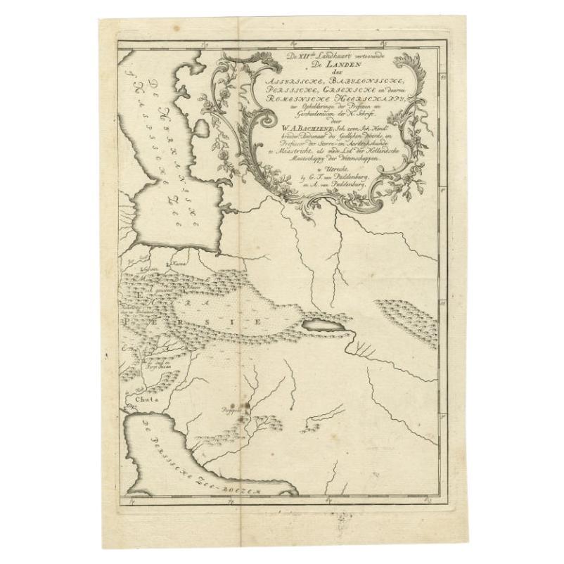
Antique Map of Ancient Persia, Assyria and surroundings, c.1760
Located in Langweer, NL
Antique map titled 'De XII de Landkaart vertoonende de Landen der Assyrische, Babylonische, Persische, Grieksche en daarna Romeinsche Heerschappy.' Map of ancient Persia...
Category
Antique 18th Century Maps
Materials
Paper
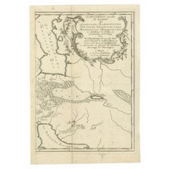
$317 Sale Price
20% Off
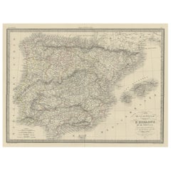
Antique Map of Spain and Portugal by Tardieu, circa 1795
Located in Langweer, NL
The image is an antique map titled "Hispanie Betique et Lusitanie", which depicts the Iberian Peninsula during the Roman times, highlighting the provinces of Hispania Baetica (Betiqu...
Category
Antique Late 18th Century Maps
Materials
Paper

$233 Sale Price
20% Off
Antique Decorative Map of Portugal and Spain, 1842
Located in Langweer, NL
Antique map titled 'Carte de la Peninsule comprenant l'Espagne et le Portugal'.
Map of Spain and Portugal. This map originates from 'Atlas universel de géographie ancienne et mod...
Category
Antique 1840s Maps
Materials
Paper
You May Also Like
Original Antique Map of Spain and Portugal, circa 1790
Located in St Annes, Lancashire
Super map of Spain and Portugal
Copper plate engraving by A. Bell
Published, circa 1790.
Unframed.
Category
Antique 1790s English Other Maps
Materials
Paper

Large Original Vintage Map of Spain, circa 1920
Located in St Annes, Lancashire
Great map of Spain
Original color.
Good condition
Published by Alexander Gross
Unframed.
Category
Vintage 1920s English Maps
Materials
Paper
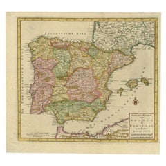
18th Century Hand Colored Map of Spain and Portugal by Visscher
By Nicolaes Visscher II
Located in Alamo, CA
This is an early 18th century map of Spain and Portugal, with attractive original hand-coloring, entitled "Hispaniae et Portugalliae Regna per Nicolaum Visscher cum Privilegio Ordinu...
Category
Antique Early 18th Century Dutch Maps
Materials
Paper

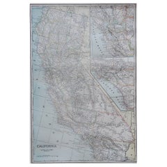
Large Original Antique Map of California, USA, circa 1900
Located in St Annes, Lancashire
Fabulous map of California
Original color
Engraved and printed by the George F. Cram Company, Indianapolis.
Published, circa 1900
Unframed
Free shipping.
Category
Antique 1890s American Maps
Materials
Paper
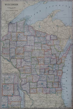
Large Original Antique Map of Wisconsin, USA, circa 1900
Located in St Annes, Lancashire
Fabulous map of Wisconsin
Original color
Engraved and printed by the George F. Cram Company, Indianapolis.
Published, circa 1900
Unframed
Category
Antique 1890s American Maps
Materials
Paper
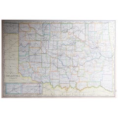
Large Original Antique Map of Oklahoma, USA, circa 1900
Located in St Annes, Lancashire
Fabulous map of Oklahoma
Original color
Engraved and printed by the George F. Cram Company, Indianapolis.
Published, circa 1900
Unframed
Repair to...
Category
Antique 1890s American Maps
Materials
Paper
Recently Viewed
View AllMore Ways To Browse
Niels Moller Teak Dining Chairs
Off White Cocktail Table
Oval English Dining Table
Oversized Afghan Rugs
Pair Bent Wood Chairs
Pairs Of Antique Empire Chairs
Pink Mid Century Side Table
Pj Rare
Porcelain Teacup Set
Poul Kjaerholm Coffee Table
Pretzel Chairs
Purple Vintage Oushak
Rasmus Denmark
Rattan Two Tier
Red Leather Swivel Chair
Rosewood Vintage Armchair
Royal Sienna
Rush Back Armchairs