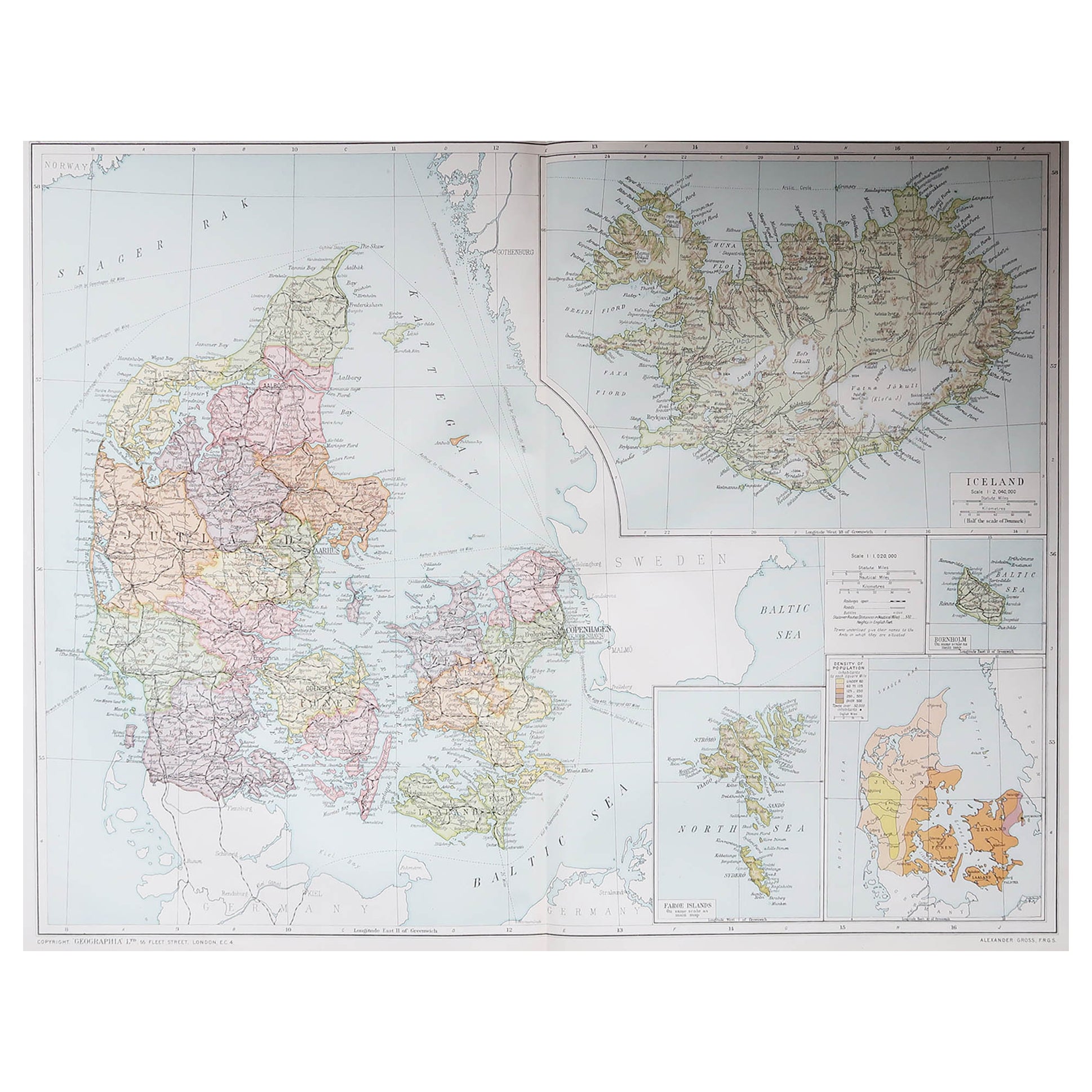
Items Similar to Large Original Vintage Map of British Island Possessions, circa 1920


Want more images or videos?
Request additional images or videos from the seller
1 of 5
Large Original Vintage Map of British Island Possessions, circa 1920
About the Item
Great map of British Island Possessions
Original color. Good condition
Published by Alexander Gross
Unframed.
- Dimensions:Height: 19.5 in (49.53 cm)Width: 25 in (63.5 cm)Depth: 0.07 in (1.78 mm)
- Materials and Techniques:Paper,Other
- Place of Origin:
- Period:
- Date of Manufacture:1920
- Condition:Wear consistent with age and use.
- Seller Location:St Annes, GB
- Reference Number:1stDibs: LU1836331325412
About the Seller
4.9
Platinum Seller
Premium sellers with a 4.7+ rating and 24-hour response times
1stDibs seller since 2016
3,081 sales on 1stDibs
Typical response time: 1 hour
Associations
International Confederation of Art and Antique Dealers' Associations
- ShippingRetrieving quote...Shipping from: St Annes, United Kingdom
- Return Policy
Authenticity Guarantee
In the unlikely event there’s an issue with an item’s authenticity, contact us within 1 year for a full refund. DetailsMoney-Back Guarantee
If your item is not as described, is damaged in transit, or does not arrive, contact us within 7 days for a full refund. Details24-Hour Cancellation
You have a 24-hour grace period in which to reconsider your purchase, with no questions asked.Vetted Professional Sellers
Our world-class sellers must adhere to strict standards for service and quality, maintaining the integrity of our listings.Price-Match Guarantee
If you find that a seller listed the same item for a lower price elsewhere, we’ll match it.Trusted Global Delivery
Our best-in-class carrier network provides specialized shipping options worldwide, including custom delivery.More From This Seller
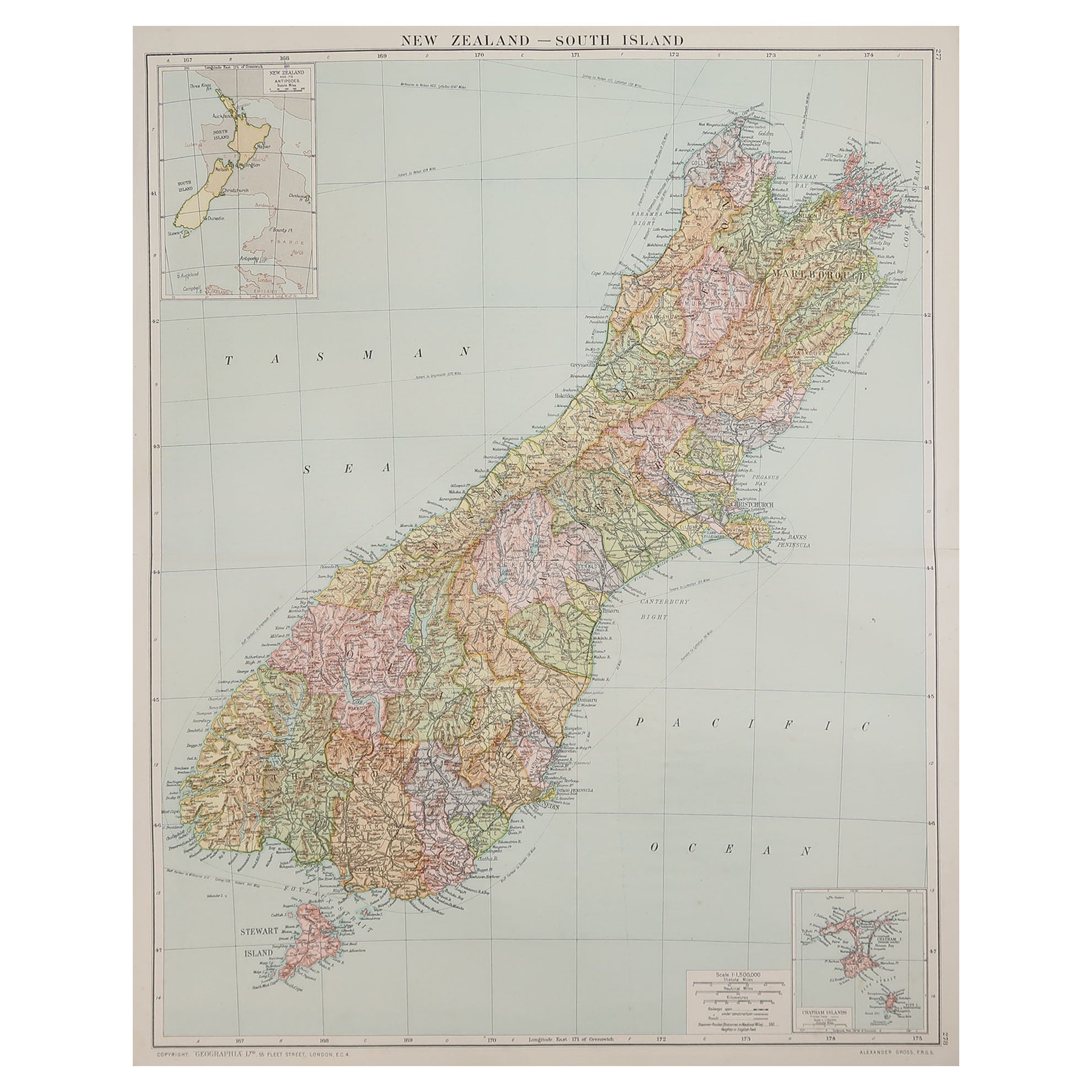
View AllLarge Original Vintage Map of New Zealand, South Island, circa 1920
Located in St Annes, Lancashire
Great map of South Island, New Zealand
Original color.
Good condition / repair to a minor tear on right edge
Published by Alexander Gross
Unframed.
Category
Vintage 1920s English Edwardian Maps
Materials
Paper

Large Original Vintage Map of New Zealand, North Island, circa 1920
Located in St Annes, Lancashire
Great map of North Island, New Zealand
Original color.
Good condition / minor foxing to right edge
Published by Alexander Gross
Unframed.
Category
Vintage 1920s English Edwardian Maps
Materials
Paper

Large Original Vintage Map of Japan, circa 1920
Located in St Annes, Lancashire
Great map of Japan
Original color. Good condition
Published by Alexander Gross
Unframed.
Category
Vintage 1920s English Maps
Materials
Paper

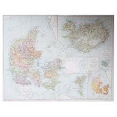
Large Original Vintage Map of Iceland, circa 1920
Located in St Annes, Lancashire
Great map of Iceland
Original color. Good condition
Published by Alexander Gross
Unframed.
Category
Vintage 1920s English Victorian Maps
Materials
Paper
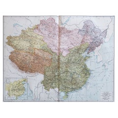
Large Original Vintage Map of China, circa 1920
Located in St Annes, Lancashire
Great map of China.
Original color. Good condition.
Published by Alexander Gross
Unframed.
Category
Vintage 1920s English Edwardian Maps
Materials
Paper
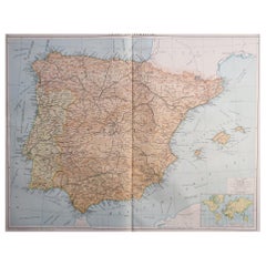
Large Original Vintage Map of Spain, circa 1920
Located in St Annes, Lancashire
Great map of Spain
Original color.
Good condition
Published by Alexander Gross
Unframed.
Category
Vintage 1920s English Maps
Materials
Paper
You May Also Like
Antique Map of the Island of Borneo by Janssonius, circa 1650
Located in Langweer, NL
Antique map titled 'Insula Borneo et Occidentalis pars Celebis cum adjacentibus Insulis'. Rare sea chart of the island of Borneo. Published by J. Janssonius, circa 1650.
Category
Antique Mid-17th Century Maps
Materials
Paper

$1,710 Sale Price
24% Off
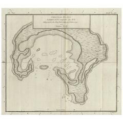
Antique Map of Christmas Island by Cook, C.1781
Located in Langweer, NL
Antique map Kiribati titled 'Christmas Island (..)'. Antique map of Christmas Island, also known as Kiritimati. Originates from an edition of Cook's Voyages.
Artists and Engravers: Engraved by Duff.
Condition: Good, some wear and age-related toning. Please study image carefully.
Date: c.1781
Overall size: 27.5 x 21.5 cm.
Image size: 20.5 x 18 cm.
We sell original antique maps to collectors, historians, educators and interior decorators all over the world. Our collection includes a wide range of authentic antique maps...
Category
Antique 18th Century Maps
Materials
Paper
$222 Sale Price
20% Off
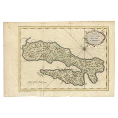
Antique Map of Coiba Island, Panama, South America, C.1740
Located in Langweer, NL
Antique map titled 'Plan de la partie orientale de l'Isle de Quibo'. Map of the eastside of Coiba Island (Quibo), Panama, showing the shoreline around Port de Dames indicating soft s...
Category
Antique 18th Century Maps
Materials
Paper

$315 Sale Price
20% Off
Antique Map of Celebes 'Sulawesi', Island in Indonesia, c.1750
By Jacques-Nicolas Bellin
Located in Langweer, NL
Antique map titled 'Carte De L'Isle Celebes ou Macassar'. Detailed copper engraved map of Celebes (Sulawesi, Indonesia), showing Makassar, which was the most important trading city o...
Category
Antique 18th Century Maps
Materials
Paper

$166 Sale Price
20% Off
Antique Map of Ambon Island in the Moluccas, Indonesia, c.1760
Located in Langweer, NL
Antique map Ambon titled 'Carte Particuliere de l 'Isle Amboine'. Old map showing Ambon, in the Moluccas Islands, better known as the Spice Islands. Ambon was the headquarters of the...
Category
Antique 18th Century Maps
Materials
Paper
$222 Sale Price
20% Off
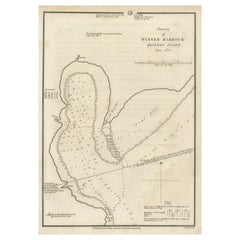
Map of Winter Harbour on Melville Island, Australia by Parry's Expedition, 1821
Located in Langweer, NL
Antique print titled 'Survey of Winter Harbour Melville Island, June 1820'.
Chart of the bay or harbor on Melville Island where William Parry's expedit...
Category
Antique 1820s Maps
Materials
Paper
$241 Sale Price
20% Off
Recently Viewed
View AllMore Ways To Browse
Large Neutral Oushak Rugs
Louis Xv Style Side Tables With Marble Top
Lustre China
Madsen Leather Chair
Maison Jansen Stamped
Manchester Wool
Marcel Gascoin C Chair
Matching Loveseats
Mcguire Furniture Vintage
Medal Medallions
Metal Reclining Chair
Mid Century Glass Decanter Bottles
Mid Century Gondola
Mid Century Italian Wood Arm Chair
Mid Century Modern Pull Out Desk
Mid Century Vintage Day Bed
Midcentury Modern Dining Chairs Chrome And Black Leather
Modern Pouffe