Items Similar to Map of Persia, the Caspian & India – Isaak Tirion, c.1730

Want more images or videos?
Request additional images or videos from the seller
1 of 10
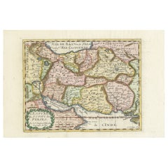
Map of Persia, the Caspian & India – Isaak Tirion, c.1730
$623.35
£463.06
€520
CA$865.59
A$944.56
CHF 495.44
MX$11,472.04
NOK 6,188.31
SEK 5,848.26
DKK 3,958.71
About the Item
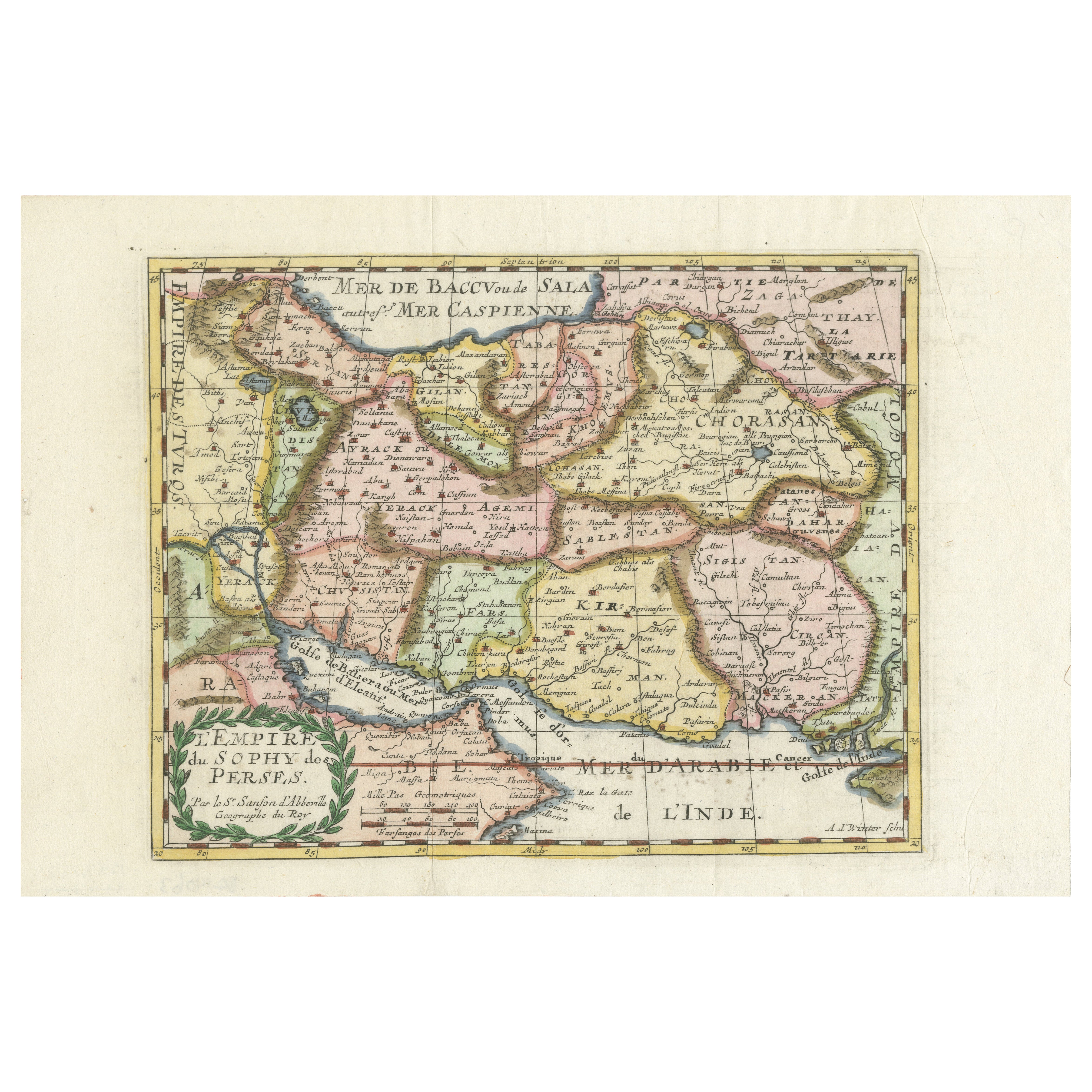
Map of Persia and Surrounding Regions – “Nieuwe Kaart van 't Ryck van Persie” by Isaak Tirion, Amsterdam, c. 1730
This finely detailed copperplate map titled “Nieuwe Kaart van 't Ryck van Persie” (New Map of the Empire of Persia) was published in Amsterdam around 1730 by the prominent Dutch cartographer Isaak Tirion. It offers a broad view of the Persian Empire and its surrounding territories at the height of Dutch Enlightenment cartography.
Centered on present-day Iran, the map stretches from the eastern shores of the Mediterranean and the Caspian Sea to the frontiers of India and Tartary, and from the Russian steppe in the north to the Persian Gulf and Arabian deserts in the south. Cities such as Isfahan, Shiraz, and Tehran are marked, along with extensive tribal and regional divisions, deserts (such as “De Woestijnen van Irak”), and mountain ranges rendered pictorially. Neighboring regions are labeled as the “Ryck van Usbeck,” “Turkije,” “Tartarie,” and “Mogolsche Ryk.”
Typical of Tirion’s maps, it features clear, legible Dutch-language place names and a fine engraving style. The inset at the top right provides a key for understanding symbols used to distinguish towns, fortresses, and caravan routes.
This map is significant for collectors interested in historical Middle Eastern cartography, reflecting early 18th-century European geopolitical understanding of Persia (modern Iran) and Central Asia. Tirion's work was widely admired for its accuracy, clarity, and decorative yet restrained aesthetic.
Condition: Very good impression with original folds as issued. Ample margins. Minimal toning with slight creasing to upper corners and a small tear to the extended right margin, well away from the printed area. Paper remains strong and stable.
Framing tips: A dark wood or black frame with a warm cream or ivory mat will complement the engraving’s tones and historical character. Consider UV-filtering glass to preserve the paper’s quality over time.
Technique: Copper engraving
Maker: Isaak Tirion, Amsterdam, circa 1730
- Dimensions:Height: 13.98 in (35.5 cm)Width: 17.33 in (44 cm)Depth: 0.01 in (0.2 mm)
- Materials and Techniques:Paper,Engraved
- Place of Origin:
- Period:
- Date of Manufacture:circa 1730
- Condition:Condition: Very good impression with original folds as issued. Ample margins. Minimal toning with slight creasing to upper corners and a small tear to the extended right margin, well away from the printed area. Paper remains strong and stable.
- Seller Location:Langweer, NL
- Reference Number:Seller: BG-11491-91stDibs: LU3054346155732
About the Seller
5.0
Recognized Seller
These prestigious sellers are industry leaders and represent the highest echelon for item quality and design.
Platinum Seller
Premium sellers with a 4.7+ rating and 24-hour response times
Established in 2009
1stDibs seller since 2017
2,641 sales on 1stDibs
Typical response time: <1 hour
- ShippingRetrieving quote...Shipping from: Langweer, Netherlands
- Return Policy
Authenticity Guarantee
In the unlikely event there’s an issue with an item’s authenticity, contact us within 1 year for a full refund. DetailsMoney-Back Guarantee
If your item is not as described, is damaged in transit, or does not arrive, contact us within 7 days for a full refund. Details24-Hour Cancellation
You have a 24-hour grace period in which to reconsider your purchase, with no questions asked.Vetted Professional Sellers
Our world-class sellers must adhere to strict standards for service and quality, maintaining the integrity of our listings.Price-Match Guarantee
If you find that a seller listed the same item for a lower price elsewhere, we’ll match it.Trusted Global Delivery
Our best-in-class carrier network provides specialized shipping options worldwide, including custom delivery.More From This Seller
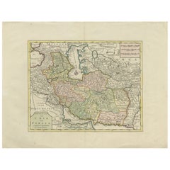
View AllMap of the Persian Empire circa 1750 by Tirion – Hand-Colored Dutch Map
Located in Langweer, NL
Map of the Persian Empire circa 1750 by Tirion – Hand-Colored Dutch Map
This finely detailed antique map titled "Nieuwe Kaart van 't Ryk van Persie" (New Map of the Empire of Persia...
Category
Antique 1750s Dutch Maps
Materials
Paper
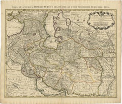
1742 Antique Map of the Persian Empire with Detailed Borders and Cartouche
Located in Langweer, NL
Title: 1742 Covens & Mortier Map of the Persian Empire by Guillaume De L'Isle
This remarkable 1742 map, "Carte de Perse," was originally designed by Guillaume De L'Isle, a preemin...
Category
Antique 1740s Dutch Maps
Materials
Paper
$1,553 Sale Price
20% Off
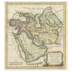
Old Map Depicting Turkey, Persia, Arab and Black Sea Etc, 1778
Located in Langweer, NL
Antique map titled 'Turquie d'Asie, Arabie, Perse, Tartarie Independante'.
Old map of Turkey in Asia. The map shows all of Turkey and the Black Sea, and extends east to include t...
Category
Antique 1770s Maps
Materials
Paper
$517 Sale Price
20% Off
Authentic Old Map of Persia with Original Border Coloring, 1745
Located in Langweer, NL
Title: "Kaartje van Persien na de stelling van den Heer Guillaume de L'Isle"
Translates to "Map of Persia based on the work of Mr. Guillaume de L'Isle." Guillaume de L'Isle was a p...
Category
Antique 1740s Maps
Materials
Paper

Map of the Persian Empire by Nicolas Sanson, Hand-colored, circa 1683
Located in Langweer, NL
Map of the Persian Empire by Nicolas Sanson, hand-colored, circa 1683
This finely detailed and delicately hand-colored map titled *L'Empire du Sophy des Perses* presents a late 17th...
Category
Antique 1680s Maps
Materials
Paper
Antique Map of Western Asia by Van Dùren '1752'
Located in Langweer, NL
Antique map titled 'Neue Geographische Vorstellung von Asien'. Original antique map of Western Asia. This map originates from 'Neue Sammlung der merkwürdigsten Reisegeschichten, inso...
Category
Antique Mid-18th Century Maps
Materials
Paper

$431 Sale Price
20% Off
You May Also Like
Map of Persia - Original Etching - Late 19th Century
Located in Roma, IT
This Map of Persia is an etching realized by an anonymous artist.
The state of preservation of the artwork is good with some small diffused stains.
Sheet dimension: 25.5 x 44
At t...
Category
Late 19th Century Modern Figurative Prints
Materials
Etching
Persiae, Armeniae, Natoliae et Arabiae Descriptio per Frederick deWit 1666 map
Located in Paonia, CO
Map of Persiae, Armeniae, Natoliae et Arabiae Descriptio per F de Wit 1688 engraving from: Atlas Contractus Orbis Terrarum Praecipuas ac Novissimas Complectens Tabulas. Amsterdam, N. Visscher, 1656-77. (Koeman III, Vis5-8) This highly decorative map of the Middle East is by the Dutch engraver, publisher, and map seller...
Category
1660s Realist Landscape Prints
Materials
Engraving

1718 Ides & Witsen Map "Route D'amsterdam a Moscow Et De La Ispahan Et Gamron
Located in Norton, MA
1718 Ides & Witsen map, entitled
"Route D'Amsterdam A Moscow Et De La Ispahan Et Gamron,"
Ric.b005
Subject: Eastern Europe and Central Asia
Period: 1718 (published)
Publicati...
Category
Antique Early 18th Century Dutch Maps
Materials
Paper

Antique French Map of Asia Including China Indoneseia India, 1783
Located in Amsterdam, Noord Holland
Very nice map of Asia. 1783 Dedie au Roy.
Additional information:
Country of Manufacturing: Europe
Period: 18th century Qing (1661 - 1912)
Condition: Overall Condition B (Good Used)...
Category
Antique 18th Century European Maps
Materials
Paper

$648 Sale Price
20% Off
Nova Persiae, Armeniae, Natoliae et Ara.. - Etching by Frederick de Wit - 1680ca
By Frederick de Wit
Located in Roma, IT
This double-page etching with contemporary coloring, entitled Nova Persiae, Armeniae, Natoliae et Arabiae, was realized by the cartographer Frederick de Wit for the famous Atlas publ...
Category
1680s Modern Figurative Prints
Materials
Etching
Southern Greece: A Large 17th Century Hand-colored Map By Sanson and Jaillot
By Nicholas Sanson d'Abbeville
Located in Alamo, CA
This large original hand-colored copperplate engraved map of southern Greece and the Pelopponese Peninsula entitled "La Moree Et Les Isles De Zante, Cefalonie, Ste. Marie, Cerigo & C...
Category
1690s Landscape Prints
Materials
Engraving

More Ways To Browse
Pair Of Danish Chairs
Veneer Dining Tables
1970 Italian Armchair
Furniture Uk
House Of Denmark Table And Chairs
Louis Marble Top Side Table
Antique Russian Rugs
Baker Furniture By
For Kids
Sterling Silver Flatware Set Service For 12
Tufted Bar
Pair Of French Antique Armchairs
1970s Brass Glass Coffee Table
Antique Column Base
Charles Rennie Mackintosh For Cassina
Glass Salt
Italian Modern Silver Vases
Vintage Resin Tables