Items Similar to One of the most influential maps of America ever made, 17th Century Willem Blaeu

Want more images or videos?
Request additional images or videos from the seller
1 of 21
One of the most influential maps of America ever made, 17th Century Willem Blaeu
$90,251
£66,817.60
€75,000
CA$124,958.83
A$136,425.13
CHF 71,522.12
MX$1,656,935.78
NOK 893,194.78
SEK 843,414.04
DKK 570,991.03
About the Item
A rare and important 17th Century Italian Engraving of Willem Blaeu's Great Wall Map of America, "America quarta pars orbis quam plerunq, nuvum orbem apellitant primo detecta est anno 1492 a Christophoro Columbo... ", engraved by Pietro Todeschi, circa 1670, and published circa 1673 probably by Giuseppe Longhi, Bologna, Italy.
The hand-colored engraved wall map on four joined sheets laid on old linen, mounted to board. Size: 33.9 x 43,3 inches.
[Nova et accurata totius Americae tabula auct. G. I. Blaeu] America quarta pars orbis quam plerunq, nuvum orbem apellitant primo detecta est anno 1492 a Christophoro Columbo...
We have only been able to trace four other copies of the present edition in sales records from the past hundred years, of which only one is also hand-colored.
This large, very rare, hand coloured copy of Willem Blaeu's famous wall map of the Americas, is considered "one of the most influential maps of America ever made" (Burden). The map is based on the latest explorations and shows everything known at the time about the American continent, as well as the north and south poles, which are included on two inset maps. As the wall map was in great demand, but expensive and difficult to transport, it was also printed by various French and Italian publishers for the local market. Like Blaeu's edition, the French and Italian editions are very scarce, as it is highly unusual for wall maps from this period to survive.
Willem Janszoon Blaeu (1571-1638) first published the wall map in 1608, together with similar maps of Asia, Africa, and Europe. He spared no expenses for this project and hired Hessel Gerritsz (1580-1632), a great cartographer in his own right, to both design the maps and research the latest sources exhaustively, to create the most accurate depiction of the continents possible. Although the Americas were drawn too wide due to the inadequate methods of determining longitude at the time, the shapes and most of the coastline are already very well defined. Central and South America were drawn according to Portuguese and Spanish sources, and "Nova Scotia" on the Atlantic coast was based on the voyages of Samuel de Champlain and Pierre Gua de Monts from 1604. After the first edition in 1608, the four continents were subsequently published in 1612, and in 1624 reissued by Hendrik Hondius and in 1655 by Nicholas Visscher. The third state included changes to the Strait of Magellan based on Le Maire's findings from his expedition in 1615-1617.
The map has been beautifully decorated with cartouches and small engravings. The cartouche in the lower right tells how the New World was discovered, and is flanked by the figures of Christopher Columbus and Amerigo Vespucci. Below are four roundels containing the portraits of the four circumnavigators: Ferdinand Magellan, Sir Francis Drake, Sir Thomas Cavendish, and Olivier Van Noort. The Atlantic features a beautiful depiction of King Philip III of Spain riding a sea chariot, supposedly on a figurative visit to his New World possessions. In the Pacific Poseidon, with his wife Amphitrite and son Triton, is found, amidst battle ships and sea monsters. Elephants, rhinoceroses, camels, and ostriches roam the continent. Some copies of the present map include a decorative border with illustrations of native people, and sometimes also a textual border with descriptions, which are not present here. It appears that these borders were engraved on separate copper plates and were not always included.
Blaeu's wall maps were first printed in Italy in 1646, probably by Stefano Mozzi Scolari (1598-1650) in Venice, which were based on the third state from 1624. The present copy was engraved by Pietro Todeschi (dates unknown) around 1670, and published in Bologna in 1673, probably by Giuseppe Longhi, who had worked on similar projects with Todeschi before. It closely resembles the Venetian edition, which was most likely used as the model. Todeschi's edition is, however, clearly recognizable because of the misspelling of Mar del Norte as Mar del Noi, and the fact that California has been drawn as an island. It is the only edition known to do so.
- Creator:Willem Blaeu (Designer)
- Dimensions:Height: 33.9 in (86.11 cm)Width: 43.3 in (109.99 cm)Depth: 0.1 in (2.54 mm)
- Style:Dutch Colonial (Of the Period)
- Materials and Techniques:
- Place of Origin:
- Period:
- Date of Manufacture:1673
- Condition:Replacements made: The present example is without the side cartouches present in the original map. There are areas of loss to the map that have been restored through facsimile. Areas have been trimmed, including the graticule borders. Additions or alterations made to the original. Repaired: The map has been reinforced on the back and is somewhat browned and stained. The surface has faded, but the work has been professionally restored. The colouring has been retouched, some losses have been filled in, and it has been toned and varnished. Wear consistent with age and use. Otherwise in good condition.
- Seller Location:ZWIJNDRECHT, NL
- Reference Number:1stDibs: LU9419246735672
About the Seller
No Reviews Yet
Vetted Professional Seller
Every seller passes strict standards for authenticity and reliability
Established in 2004
1stDibs seller since 2023
Typical response time: <1 hour
- ShippingRetrieving quote...Shipping from: ZWIJNDRECHT, Netherlands
- Return Policy
Authenticity Guarantee
In the unlikely event there’s an issue with an item’s authenticity, contact us within 1 year for a full refund. DetailsMoney-Back Guarantee
If your item is not as described, is damaged in transit, or does not arrive, contact us within 7 days for a full refund. Details24-Hour Cancellation
You have a 24-hour grace period in which to reconsider your purchase, with no questions asked.Vetted Professional Sellers
Our world-class sellers must adhere to strict standards for service and quality, maintaining the integrity of our listings.Price-Match Guarantee
If you find that a seller listed the same item for a lower price elsewhere, we’ll match it.Trusted Global Delivery
Our best-in-class carrier network provides specialized shipping options worldwide, including custom delivery.More From This Seller
View AllColored wall map of the WORLD
By Chambon
Located in ZWIJNDRECHT, NL
“Mappe Monde, contenant les Parties Connues du Globe Terrestre”
CHAMBON, Gobert-Denis (France, 17.. - 1781)
Paris, Longchamps et Janvier, 1754
Size H. 115 x W. 145 cm.
Gobert-Denis Chambon made copper engraving after the work of Guillaume De L’Isle, published in 1754 by Jean Janvier and S.G. Longschamps.
A huge wall map of the world in two hemispheres printed on two sheets, depicting the Eastern and Western hemispheres supported by two male figures, decorated at the bottom right and left with two celestial hemispheres (boreal and southern) and at the bottom in the middle with an armillary sphere, in addition.
This map is most notable for its depiction of the Sea of Japan labeled "Mer de Corée" and of "Mer de L'Ouest" or Sea of the West - a great sea, easily the size of the Mediterranean, to flow from the then-known Strait of Juan de Fuca...
Category
Antique Mid-18th Century French French Provincial Maps
Materials
Wood, Paper

Seminal guide to the East and West Indies, with 42 coloured maps and plates
By Jan Huygen van Linschoten
Located in ZWIJNDRECHT, NL
Seminal guide to the East and West Indies, with 42 double-page and folding plates, including 6 maps, all engravings beautifully coloured by a contemporary hand
LINSCHOTEN, Jan Huygh...
Category
Antique Early 17th Century Dutch Dutch Colonial Books
Materials
Paper

$270,753 Sale Price
25% Off
Free Shipping
A beautiful Celestial Table Globe produced by Gerard & Leonard Valk
By Gerard and Leonard Valk
Located in ZWIJNDRECHT, NL
A magnificent and very rare early 18th century celestial table globe produced by Gerard and Leonard Valk. Established at the end of the previous ...
Category
Antique Early 18th Century Dutch Dutch Colonial Globes
Materials
Other
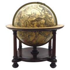
$192,669 Sale Price
20% Off
Free Shipping
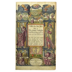
Hand-colored 16th century copy of the famous Moerentorf Bible
By Henry Moret
Located in ZWIJNDRECHT, NL
Publisher: Daniel Vervliet and Hendrik Swingen for Jan I Moretus & Jan I van Keerberghen
Place / Date: Antwerp, 1599
Biblia sacra. Dat is de geheele heylighe schrifture bed...
Category
Antique 16th Century Belgian Baroque Books
Materials
Wood, Paper
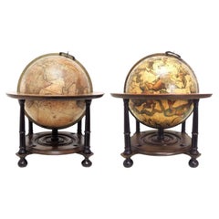
A pair of extremely rare Valk table globes
By Gerard and Leonard Valk
Located in ZWIJNDRECHT, NL
Title on the globes:
VALK, Gerard and Leonard. [Terrestrial globe:] Cosmotheore, caelesti nostro globo, par, et plane novus, hic terrestris ut existeret, certo scias, errore veterum ...
Category
Antique 18th Century Dutch Dutch Colonial Globes
Materials
Other
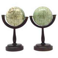
A fine pair of miniature globes on stands
By Karl Muller
Located in ZWIJNDRECHT, NL
A rare pair of miniature terrestrial and celestial globes.
by K. Müller, 1822
Karlsruhe, Germany
Diameter globes: 7 cm. Total high: 14,5 cm.
Each with 12 hand-coloured engraved p...
Category
Antique Early 19th Century German International Style Globes
Materials
Hardwood, Paper
You May Also Like
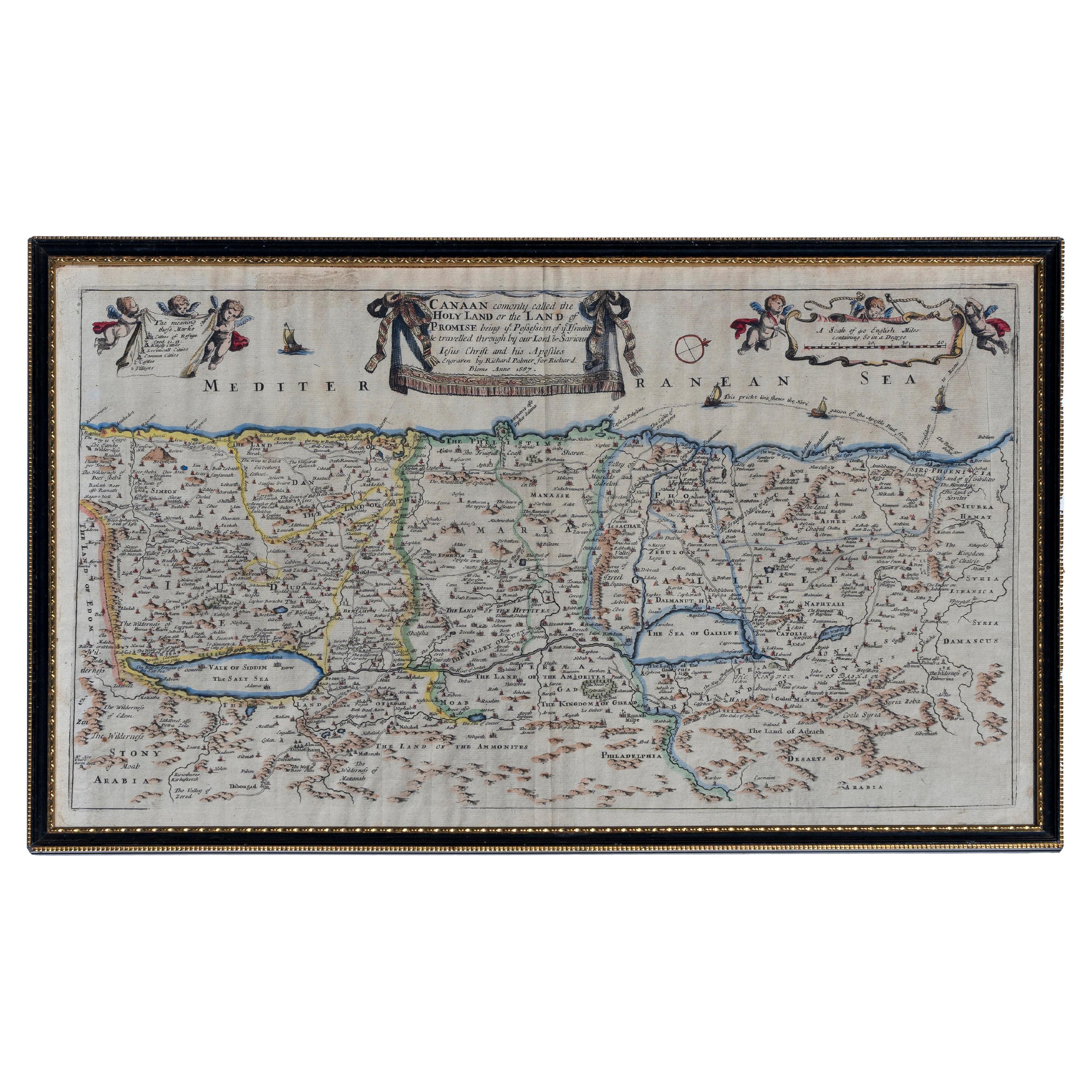
Map Holy Promise Land Canaan Richard Palmer Richard Blome 1687 Joseph Moxon
Located in BUNGAY, SUFFOLK
Canaan comonly called the Holy Land or the Land of Promise, being the Possesion of the Israelites & travelled through by Our Lord & Saviour Iesus Christ and his Apostles. Engraven by Richard Palmer for Richard Blome. 1687
Blome, Richard, 1641-1705. London. 283 x 452 mm. Copperplate.
Probably from an English Bible...
Category
Antique 17th Century British Baroque Maps
Materials
Paper

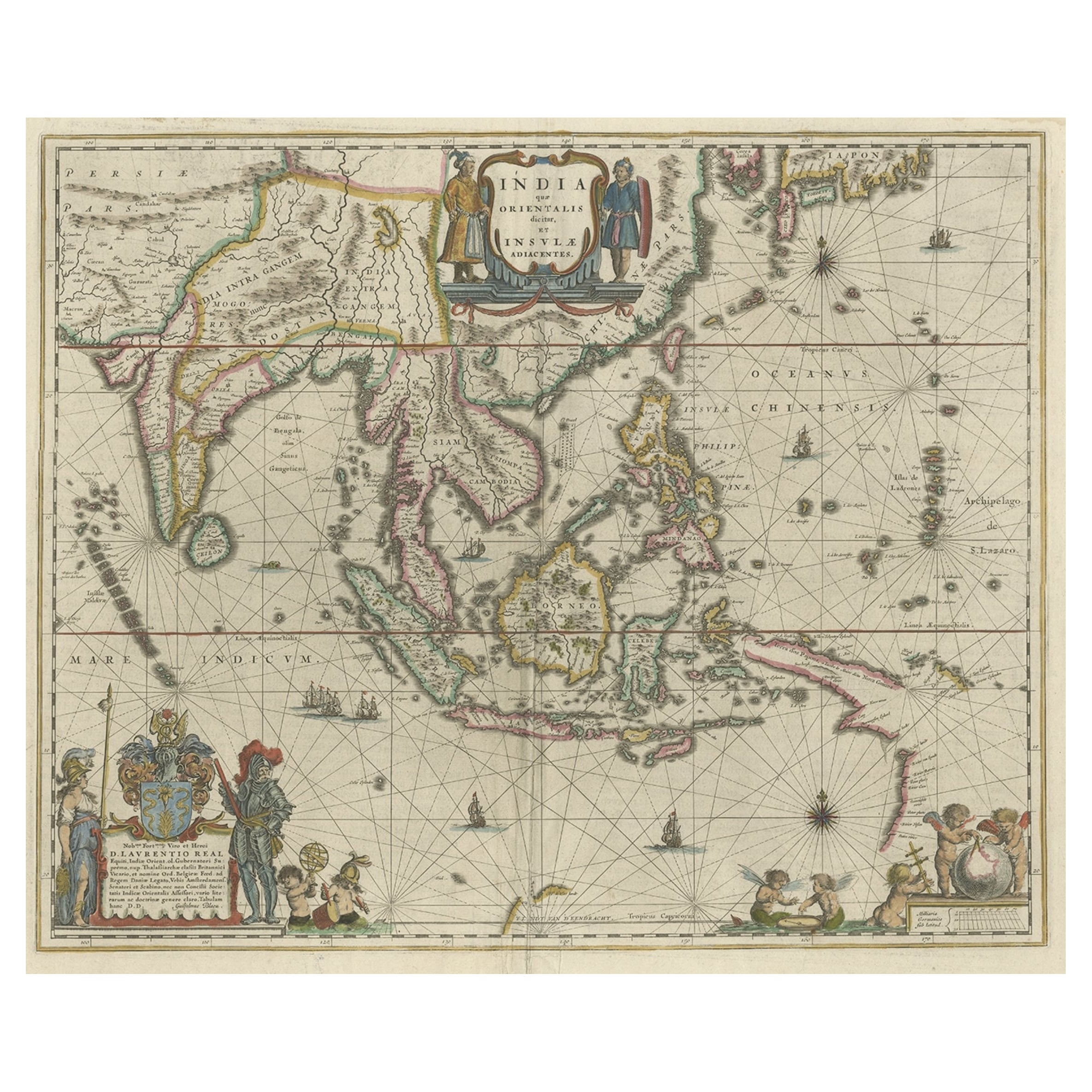
Original Blaeu Map of Southeast Asia from India to Tibet and Japan to New Guinea
Located in Langweer, NL
Antique map titled 'India quae Orientalis dicitur et Insulae Adiacentes'.
Beautiful map of Southeast Asia, extending from India to Tibet to Japan to New Guinea. It was the first po...
Category
Antique 1640s Maps
Materials
Paper
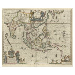
$3,369 Sale Price
20% Off
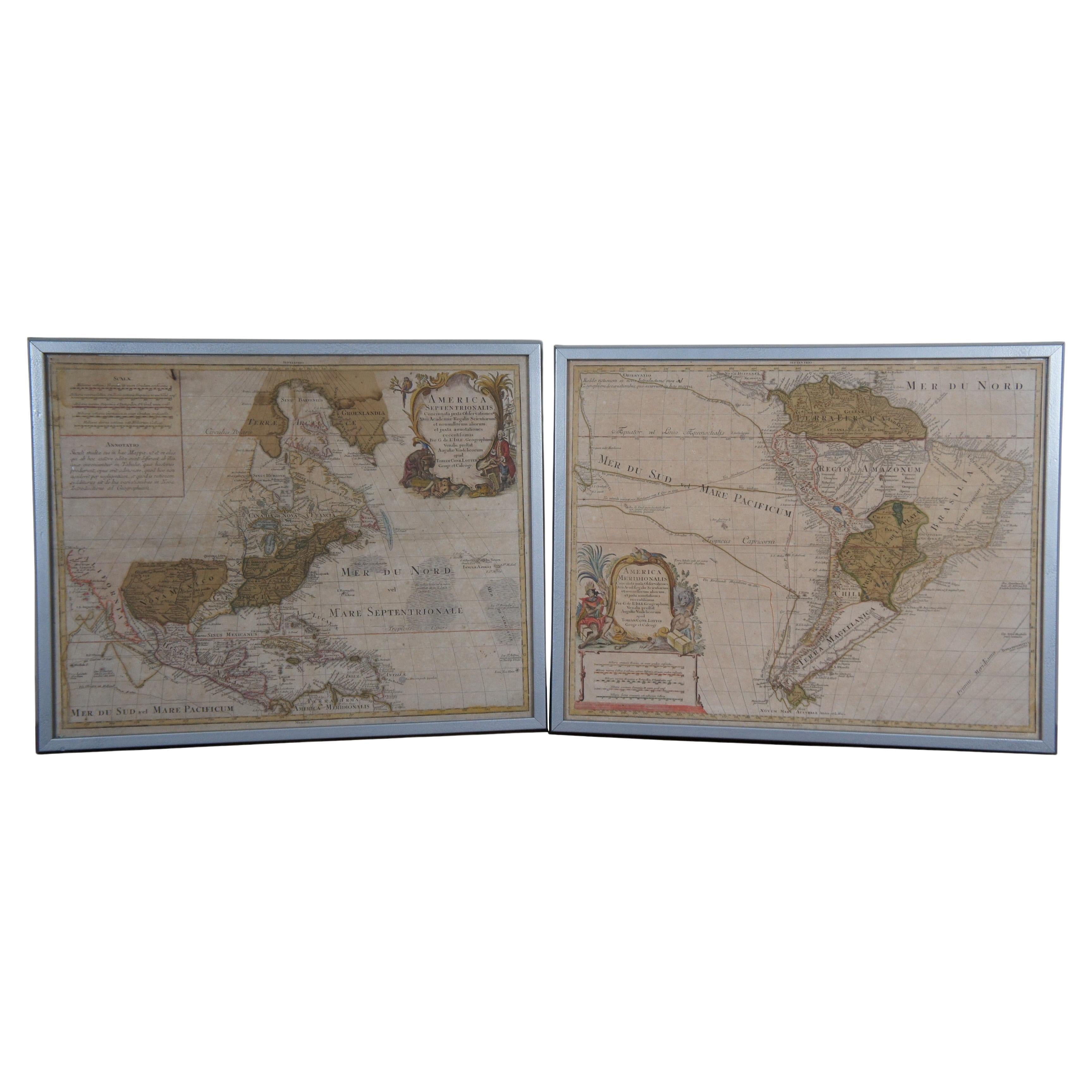
18th Century Antique Conrad Lotter Septentrionalis Meridionalis American Maps
Located in Dayton, OH
Pair of rare hand colored maps from the 1770's, depicting "America Septentrionalis" (North America), engraved by Georg Friedrich Lotter and America Meridionalis (South America), engr...
Category
Antique 18th Century Maps
Materials
Paper
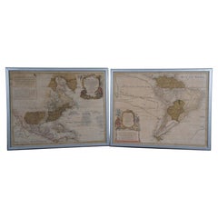
$2,400 Sale Price
20% Off
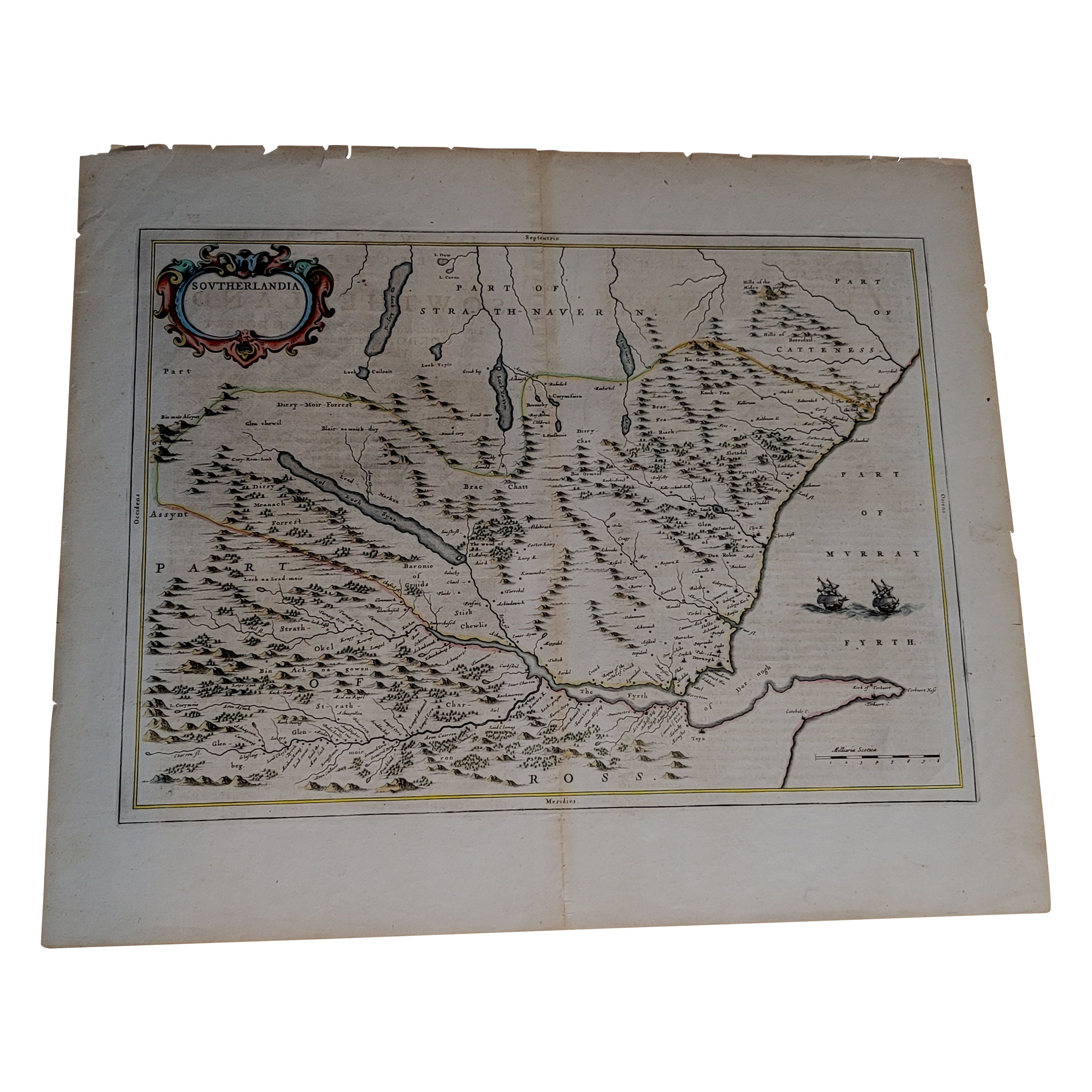
1654 Joan Blaeu Map the Sutherland, Scotland, Entitled "Southerlandia, "Ric0007
Located in Norton, MA
1654 Joan Blaeu map of the
Sutherland, Scotland, entitled
"Southerlandia,"
Hand Colored
Ric0007
Description:
Lovely map centered on Sedan and D...
Category
Antique 17th Century Dutch Maps
Materials
Paper

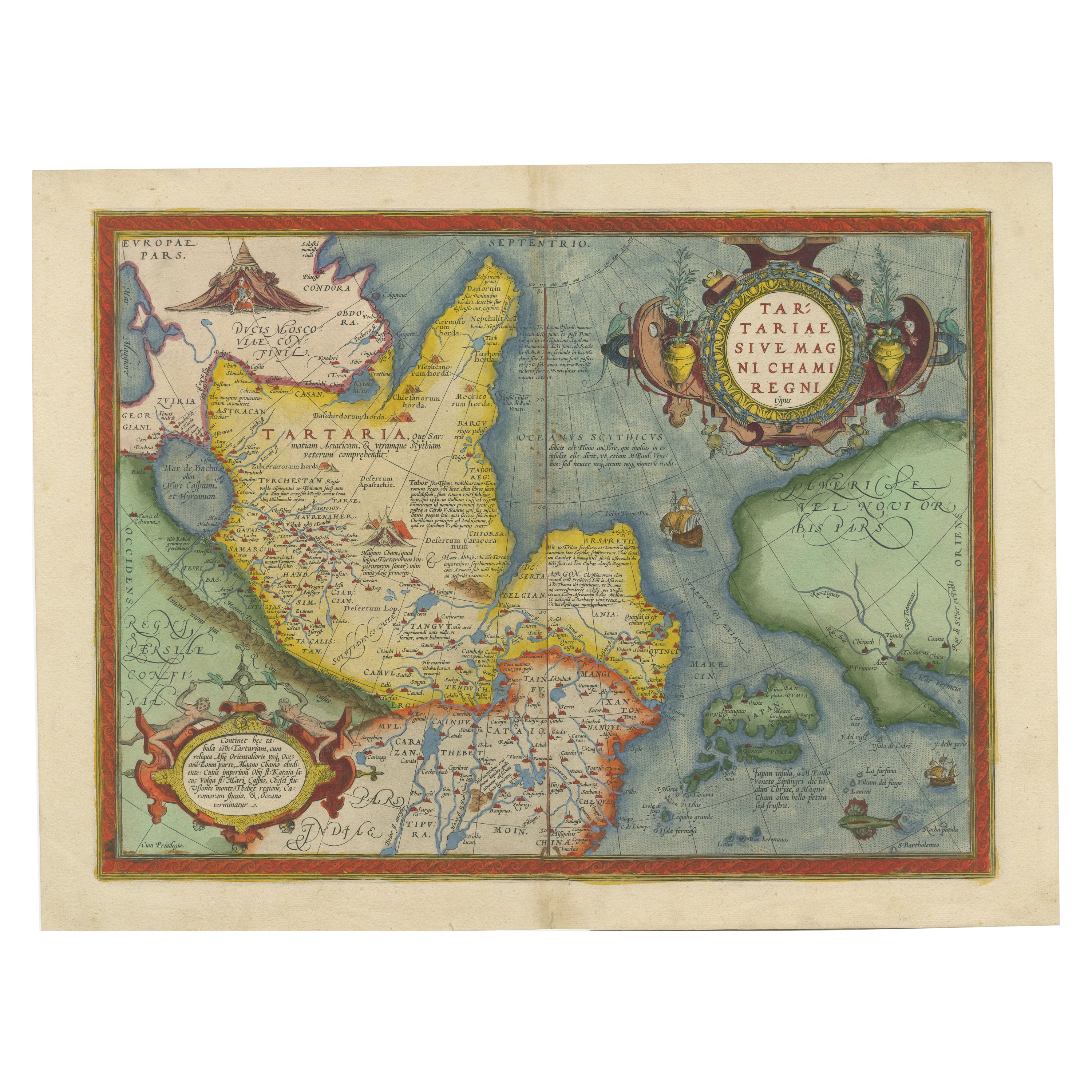
1573 Ortelius Map: First to Name California, Spanning Tartary to North America
Located in Langweer, NL
"1573 Abraham Ortelius Map of Tartary, Japan, and Western North America"
Description of the Map:
This is an outstanding example of Abraham Ortelius' map titled "Tartariae Sive Magn...
Category
Antique 16th Century Maps
Materials
Paper
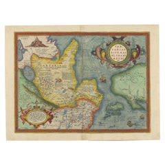
$2,312 Sale Price
20% Off
Antique Map of the Eastern Hemisphere by Valk & Chenk '1708'
Located in Langweer, NL
Antique map titled 'Hemispherium Orbis Antiqui, Cumzonis Circulis, Et Sity populorum Diverso'. Decorative example of Andreas Cellarius's map of the Eastern Hemisphere, illustrating with climatic zones ranging from Frigida Borealis to Torrida, with planetary details superimposed. The elaborate border includes fine scrollwork, numerous putti, and additional diagrams showing armillary spheres and climatic zones. Andreas Cellarius was born in 1596 in Neuhausen and educated in Heidelberg. He emigrated to Holland in the early 17th century and 1637 moved to Hoorn, where he became the rector of the Latin School. Cellarius' best known work is his Harmonia Macrocosmica, first issued in 1660 by Jan Jansson, as a supplement to Jansson's Atlas Novus. The work consists of a series of Celestial Charts...
Category
Antique Early 18th Century Dutch Maps
Materials
Paper

$4,061 Sale Price
25% Off