American Maps
Color: Beige
Place of Origin: American
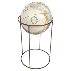
Mid-Century Modern 1970s Paul McCobb Style Brass Stand Replogle Globe
By Replogle Globes, Paul McCobb
Located in St. Louis, MO
Often attributed to Paul McCobb, because of the same brass tubing that McCobb used in his furniture. Circa 1970s Replogle globe is in very nice condition with raised topography and t...
Category
1970s Mid-Century Modern Vintage American Maps
Materials
Brass
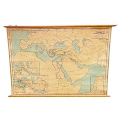
Antique Rand McNally & Company Schoolmap. Ancient Oriental Empires. Historical
By Rand McNally & Co.
Located in ROTTERDAM, ZH
This is a real unique map made by the famous Rand McNally Company. This rare schoolmap is probably made in the late 1920's. The map of all the ...
Category
1920s American Classical Vintage American Maps
Materials
Fabric, Paper
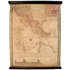
1847 Antique Map of Mexico, Texas and California by Samuel Augustus Mitchell
By Samuel Augustus Mitchell 1
Located in Colorado Springs, CO
Presented is the second edition of Samuel Augustus Mitchell's Map of Mexico, Including Yucatan & Upper California, an important map showing the progress of the Mexican-American War. ...
Category
1840s Antique American Maps
Materials
Paper
Large Custom Framed 1857 U.S. Coast Survey of the Chesapeake Bay
Located in Bridgeport, CT
An antique 1850's nautical map with hand-painted color accents entitled “Chesapeake Bay; Sheet no. 2: Head of the Bay to the Mouth of the Potomac River”....
Category
1850s American Classical Antique American Maps
Materials
Paper
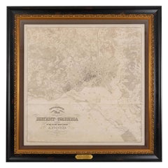
1861 Topographical Map of the District of Columbia, by Boschke, Antique Map
Located in Colorado Springs, CO
Presented is an original map of Albert Boschke's extremely sought-after "Topographical Map of the District of Columbia Surveyed in the Years 1856 ...
Category
1860s Antique American Maps
Materials
Paper
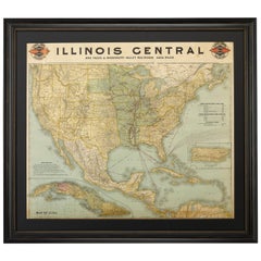
1899 Poole Brothers Antique Railroad Map of the Illinois Central Railroad
Located in Colorado Springs, CO
This is an 1899 railroad map of the Illinois Central and Yazoo and Mississippi Valley Railroads, published by the Poole Brothers. The map focuses on the continuous United States from the Atlantic to the Pacific Oceans, the Gulf of Mexico, and the Antilles. Remarkably detailed, the rail routes of the Illinois Central RR are marked in red, which each stop labeled. Major stops are overprinted in red, bold letters, with the short rail distances to New York listed above the stop and short rail distances to New Orleans listed below the name.
In addition to the Illinois Central network, numerous different rail lines are illustrated and the company running that line is noted along with many stops along each route. Sea routes from New Orleans to locations in Central America, the Caribbean, and Europe are marked and labeled with destination and distance, along with routes originating from Havana. Inset at bottom left is a map of Cuba; an inset map of Puerto Rico...
Category
1890s Antique American Maps
Materials
Paper
Related Items
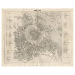
Antique Map of the City of Vienna by Balbi '1847'
Located in Langweer, NL
Antique map titled 'Vienne'. Original antique map of the city of Vienna, Austria. This map originates from 'Abrégé de Géographie (..)' by Adrien Balbi. Published 1847.
Category
Mid-19th Century Antique American Maps
Materials
Paper
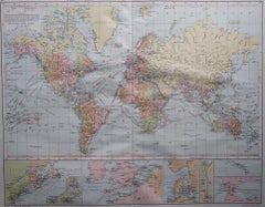
Large Original Vintage Map of The World, circa 1920
Located in St Annes, Lancashire
Great map of The World
Original color.
Good condition / minor foxing
Published by Alexander Gross
Unframed.
Category
1920s Vintage American Maps
Materials
Paper
Replogle Terrestrial Floor Globe
By Replogle Globes
Located in Asbury Park, NJ
This floor globe by Replogle floats within a ring of walnut, supported by four 'turned' chrome stiles, which connect to a base of walnut. The ...
Category
1960s Mid-Century Modern Vintage American Maps
2 Large Vols Antique Reference Book, Egypt - Historical and Picturesque, English
Located in Hele, Devon, GB
This is 2 large volumes of the antique reference book 'Egypt - Descriptive, Historical and Picturesque by G. Ebers. An English translation by Clara Bell, wi...
Category
Late 19th Century Victorian Antique American Maps
Materials
Textile, Paper
H 14.97 in W 12.01 in D 1.38 in
1950s Replogle Glass Illuminated Precision Globe
By Replogle Globes
Located in Brooklyn, NY
This 10" 'Precision' Globe was manufactured in the early 1950s by Replogle (Chicago, IL) and edited by cartographer, Gustav Brueckmann. Composed of paper gores over glass with a cast...
Category
1950s Mid-Century Modern Vintage American Maps
Materials
Metal, Brass
Large and Heavy Mid-Century Modern Tv-Tower Sculpture, 1970s
Located in Nürnberg, Bayern
Large and Heavy Mid-Century Modern Tv-Tower Sculpture, 1970s
Category
1970s Mid-Century Modern Vintage American Maps
Materials
Metal, Aluminum, Steel
1960s Replogle Globe World Classic Series
By Replogle Globes
Located in Chula Vista, CA
1960s Replogle Globe World Classic Series
15.5 h x 13.25 w x 11.5 d
made in USA
maker stamp
Preowned original unrestored vintage condition
Refer to images.
Category
1960s Mid-Century Modern Vintage American Maps
Materials
Metal
1960s Replogle Illuminated Glass Globe on Mahogany Stand
By Replogle Globes
Located in Brooklyn, NY
1960s Replogle (Chicago, IL) globe on stand composed of paper gores over glass with a cast metal meridian. Base is mahogany with brass feet and features a full 360 degree swivel acti...
Category
1960s Mid-Century Modern Vintage American Maps
Materials
Brass
Antique Ophthalmometer Eye Machine by General Optical Company
Located in Norwalk, CT
This Antique Universal Ophthalmometer Eye Exam Machine by General Optical Company is stamped “Pat Oct 24th 1911”. This is an optical optometrist device to mea...
Category
Early 20th Century American Maps
Historical American Civil War Era Wire Frame Magnifying Eye Glass Spectacles
Located in Philadelphia, PA
A delicate pair of handmade magnifying wire rim eye glasses from the American Civil War era, circa 1860.
A great looking historical conversation p...
Category
Mid-19th Century American Classical Antique American Maps
Materials
Metal
H 1.25 in W 5.5 in D 7 in
Replogle Standard Globe with Atlas, C.1950
By Replogle Globes
Located in San Francisco, CA
ABOUT
A replogle standard globe with a metal bracket mounted on a metal pedestal. The original atlas slides into the base.
CREATOR Replogle.
DATE OF MANUFACTURE c.1961-1964....
Category
Mid-20th Century Mid-Century Modern American Maps
Materials
Metal
Vintage Terrestrial Globe, 1970s, Czechoslovakia
Located in Prague 8, CZ
This Vintage Terrestrial globe was made in the 1970s in the former Czechoslovakia for school supply.
It's made of plastic, wood and cardboard. It´s in good Vintage condition.
M...
Category
Late 20th Century Mid-Century Modern American Maps
Materials
Iron
Previously Available Items
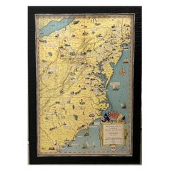
1932 "Principal Events in the Life of George Washington" Pictorial Map
Located in Colorado Springs, CO
Presented is the 1932 pictorial map of the principal events in George Washington’s life from the General Drafting Company. The map displays the eastern coastline of the United States...
Category
1930s Mid-Century Modern Vintage American Maps
Materials
Paper
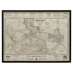
1906 "Tourists Guide to Colorado Springs, Manitou, Colorado City..." Map
Located in Colorado Springs, CO
Presented is "Clason's Guide Map to Colorado Springs, Manitou, Colorado City and Pike's Peak Region," published in Denver in 1906 by the Clason Map Company. Issued as a tourist map of the city, the map identifies roads, rivers, and lakes, offers topographical and elevation data, and marks all railroad routes, some of which are further outlined in dark red. In town, a key identifies tourist spots like hotels, sanitariums, hospitals, and churches, marking them with triangles, circled crosses, crosses, and arrows. The legend further differentiates between roads, street car tracks, railroads, wagon roads, and trails, for easy navigation.
The border panels around the map are printed with advertisements for the local businesses. Viewers of the map could peruse fine food and beverage offerings like Manitou Table Water and Ginger Champagne, Vincent’s Beet Sugar Syrup, and Kuner’s Pickles, find saddle horses for ladies at the Club Stables, or even consider a real estate purchase through Wills, Spackmen, and Kent.
This is a very scarce map of Colorado...
Category
Early 1900s Antique American Maps
Materials
Paper
Map of Nantucket by Austin Strong '1881-1952', circa 1925
Located in Nantucket, MA
Map of Nantucket by Austin Strong (1881 - 1952), circa 1925, an original print on paper whimsical map of Nantucket Island by Robert Louis Stevenson's...
Category
1920s Folk Art Vintage American Maps
Materials
Paper
Antique Map of Manhattan, New York City by Thomas Cowperthwait & Co. 1850
Located in San Diego, CA
A very nice antique map of Lower Manhattan, New York City by Thomas Cowperthwait & Co., circa 1850. The map itself measures 13" x 16" and is professionally presented in a nice black ...
Category
Mid-19th Century Antique American Maps
Materials
Paper
19th Century Nantucket Map by Rev, Ewer, circa 1886
Located in Nantucket, MA
19th century Nantucket map by Rev, Ewer, circa 1886, a small version of Ewer's celebrated 1869 original wall chart, done here for The Old Colony...
Category
1880s Victorian Antique American Maps
Materials
Paper
Mid-Century Modern 1970s Paul McCobb Style Brass Stand Replogle Globe
By Paul McCobb
Located in St. Louis, MO
Often attributed to Paul McCobb, because of the same brass tubing that McCobb used in his furniture.
This 1970s Replogle globe is in very nice condition with raised topography and ...
Category
1970s Mid-Century Modern Vintage American Maps
Materials
Brass
1862 Lloyd's New Military Map of the Border & Southern States
Located in Colorado Springs, CO
This hanging military wall map of the eastern half of United States was published by H.H. Lloyd & Co., in New York, in 1862. The map shows America during...
Category
1860s Antique American Maps
Materials
Paper
Antique Map "Routes Between New York & Washington" New York Baltimore Washington
Located in Colorado Springs, CO
This charming and colorful map depicts the east coast from New York City south to Washington D.C. highlighting the various direct routes a traveler may take. The folding pocket map o...
Category
1830s Antique American Maps
Materials
Paper
H 30.5 in W 9.75 in L 30.5 in
"Geographically Correct Map of the United States" Vintage Map, circa 1940
Located in Colorado Springs, CO
This large map of the United States was issued by Rand McNally and Company on behalf of the Union Pacific Railroad. The map embraces the whole of the United States, illustrating the ...
Category
1940s Vintage American Maps
Materials
Paper
1856 Antique Map of the Surveys of California
Located in Colorado Springs, CO
Offered is a Map of the Surveys of California dating to 1856. The work was issued by the U.S. General Land Office to accompany the Report of the Surveyor General. The map is highly d...
Category
1850s Antique American Maps
Materials
Paper
Map of Appomattox Court House, Antique Map from Surveys, 1867
Located in Colorado Springs, CO
Appomattox Court House from Surveys under the Direction of Bvt. Brig. Gen. N. Michler, Maj. of Engineers. By Command of Bvt. Maj. Gen. A.A. Humphreys, Brig. Gen. & Chief of Engineers, 1867. Surveyed and drawn by Maj. J. E. Weyss, assisted by F. Theilkuhl, J. Strasser & O. Thompson. Published by NY Lithographing, Engraving & Printing Co. Lithographed by Julius Bien.
This is a scarce large format plan of the battlefield and region around the famed Appomattox Court House, published by the U.S. War Department in 1867. This extensively surveyed and informative map extends south to Evergreen Station and north to the Bent Creek Bridge area. Noteworthy for a map of this time is the inclusion of dozens of landowners on the map, including Wilmer McLean. The map also identifies roads, bridges, railroads, drainage and woodlands, giving viewers a comprehensive impression of the battlefield. The map is drawn on a scale of 3 inches to 1 mile.
In April 1865, General Robert E. Lee and his army found themselves in Virginia, harassed mercilessly by Federal troops and continually cut off from turning south to reach Gen. Johnston's army in North Carolina. After a defeat at Five Forks, Lee’s only defensive move was to escape with his troops west along the Appomattox River, eventually arriving in Appomattox County on April 8th. His objective was the South Side Railroad at Appomattox Station where food supplies awaited. Union cavalry under Brig. Gen. George A. Custer reached them first, capturing and subsequently burning three supply trains. Lee hoped for more supplies further west at Lynchburg, so he refused written requests by Grant to surrender his army.
On the morning of April 9th, Confederate Maj. Gen. John B. Gordon’s corps attacked the Union cavalry blocking the road toward the railroad. Initially, Gordon had success in clearing cavalry from the road, but Union infantry moved in and he was unable to make further progress. Gordon sent word to Lee around 8:30 a.m. that he needed Lt. Gen. James Longstreet’s support to make additional headway. Upon receiving this request—and having watched the battle through field glasses—Lee then said, "Then there is nothing left for me to do but go and see General Grant, and I would rather die a thousand deaths." Messages were soon exchanged and Lee and Grant agreed to meet at the Wilmer McLean home at Appomattox Courthouse that afternoon. There, the surrender of the Army of Northern Virginia was signed. Three days later, a formal ceremony marked the disbanding of Lee's army and the parole of his men, ending the war in Virginia. The events here triggered similar surrenders across the south, ending the fighting of the Civil War.
Mounted in the frame along with the map is a print of Matthew Brady...
Category
1860s Antique American Maps
Materials
Paper
1874 Antique Map of Nebraska, Dakota, Montana, and Wyoming
Located in Colorado Springs, CO
Presented is an original map of Nebraska, Dakota, Montana, and Wyoming from 1874. This authentic map was issued as part of J. Davis Williams’s People’s Pictorial Atlas.
The map us...
Category
1870s Antique American Maps
Materials
Paper
Recently Viewed
View AllMore Ways To Browse
Greek Asia Minor
Antique Maps Canada
Antique Map Canada
Canada Antique Map
West Indies Map
Antique Portuguese Plates
Map Huge
Antique Maps Of Canada
Bali Map
Antique Map South Africa
Antique Map Of South Africa
South Africa Antique Map
Map Of West Indies
Belgium Army
Sweden Antique Map
Belgian Army
Cornelius Company
Antique Nautical Maps
