American Maps
Color: Black
Place of Origin: American
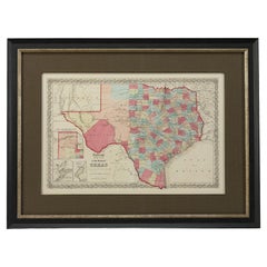
1859 "Colton's New Map of the State of Texas..." by Johnson & Browning
Located in Colorado Springs, CO
Presented is "Colton's New Map of the State of Texas Compiled from De Cordova's Large Map", published in Alivin J. Johnson’s “New Illustrated Family Atlas.” The map was published in ...
Category
1850s Antique American Maps
Materials
Paper
1873 "Map of the States of California and Nevada" by Chas. Drayton Gibbes
Located in Colorado Springs, CO
Presented is Warren Holt and Charles Drayton Gibbes' 1873 “Map of California and Nevada.” This map is considered to be one of the finest large-scale ...
Category
1870s Antique American Maps
Materials
Paper
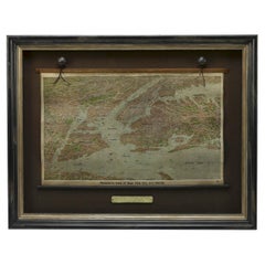
1912 "Panoramic View of New York City and Vicinity" by Jacob Ruppert
Located in Colorado Springs, CO
This is an attractive and very scarce map of New York, published by the Yorkville brewer Jacob Ruppert in 1912. The map shows an expansive view of the region reaching from Sandy Hook in the south and Yonkers to the north, to Hicksville in the east and past Newark to the west. This beautifully colored birds eye view shows waterways with all shipping traffic, boroughs, and clearly labeled railroad routes. It is presented on period dowels and backed on its original linen.
Jacob Ruppert was born in New York City in 1842 to Bavarian immigrants. His father owned a brewery in Manhattan where young Jacob learned the business of brewing. In 1862, Jacob established the Jacob...
Category
1910s Vintage American Maps
Materials
Paper
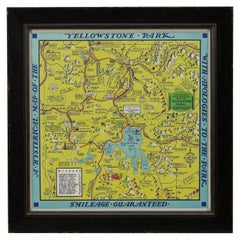
1948 "A Hysterical Map of Yellowstone National Park" by Jolly Lindgren, 2nd Ed.
Located in Colorado Springs, CO
Presented is a second edition printing of Jolly Lindgren’s “Hysterical Map of Yellowstone National Park.” This comical pictorial map highlights the famous Yellowstone National Park. ...
Category
1940s Vintage American Maps
Materials
Paper
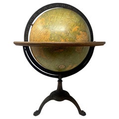
Antique American "Rand Menally Co." Chicago Table-Top Globe on Stand, Circa 1900
Located in New Orleans, LA
Antique American "Rand Menally Co.," Chicago table-top globe on stand with map made By "G.W. Bacon & Co." of London, England, Circa 1900.
Some normal wear and tear: per the last 2 ...
Category
Early 20th Century American Maps
Materials
Metal
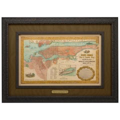
1855 "New-York City & County Map" by Charles Magnus
By Charles Magnus
Located in Colorado Springs, CO
This is a beautiful hand-colored map titled “New York City & County Map with Vicinity entire Brooklyn, Williamsburgh, Jersey City &c.” The work was published in 1855 by Charles Magnu...
Category
1850s Antique American Maps
Materials
Paper
1847 Ornamental Map of the United States & Mexico by H. Phelps
Located in Colorado Springs, CO
Offered is an original 1847 ornamental map of the U.S. entitled "Ornamental Map of the United States & Mexico" by Humphrey Phelps. The map was issued as an act of Congress by Phelps on Fulton Street, New York. The broadside is elaborately hand-colored.
This is a very detailed and graphic propaganda map of the United States expressing U.S. dominance of the North American continent. The hand-colored map proclaims the Manifest Destiny, with the recent acquisition of Upper California and Texas at the conclusion of the Mexican-American War. The newly acquired land is boldly colored, standing in stark contrast to the rest of the U.S. The map details a potential route for a railroad running from New York City, to Buffalo, to Chicago, then west along the Oregon Trail to Oregon City. This route anticipates the construction of the transcontinental railroad by nearly 20 years.
The map includes elaborately detailed renderings of George Washington, Hernan Cortez, and Montezuma at top to represent European expansion to the Americas. At bottom are four inset designs with text showing the following: a chronological history of the U.S. beginning from settlement to the U.S. victory in the Mexican-American war; an illustration of General Zachary Taylor with details on the Oregon Territory; an illustration of the Aztec Temple of the Sun in Tenochtitlan and a chronology of the Conquest of the Aztec Empire under Cortez; a portrait of General Antonio Lopez de Santa Anna...
Category
1840s Antique American Maps
Materials
Paper
1877 "Geological and Geographical Atlas of Colorado" by F. V. Hayden
Located in Colorado Springs, CO
This is F. V. Hayden's Geological and Geographical Atlas of Colorado and Portions of Adjacent Territory, an unmatched geological record for its time. Published by the Department of the Interior in 1877, the Atlas of Colorado consists of twenty double elephant sized sheets, divided into two series. The first series, four sheets, embrace the entire area on a scale of twelve miles to an inch, and include Triangulations, Drainage, an Economic Map, and a General Geological map...
Category
1870s Antique American Maps
Materials
Paper
Civil War Panorama of the Seat of War by John Bachmann, Antique Print circa 1864
Located in Colorado Springs, CO
Panorama of the seat of war. Bird's-eye View of Virginia, Maryland, Delaware and the District of Columbia.
This third state of this fascinating bird's eye view of the northernmost p...
Category
1860s Antique American Maps
Materials
Paper
Related Items
Collection of Evelyn Annenberg Hall, 640 Park Ave Christie's, NY, 2006, 1st Ed
Located in valatie, NY
Collection of Evelyn Annenberg Hall from 640 Park Ave: Christie's, New York, 17 May, 2006. Louis XIV, XV and XVI Furniture, Chinese Porcelains, 18th & 19th c bronzes, antique rugs an...
Category
Early 2000s American Maps
Materials
Paper
H 10.5 in W 8.25 in D 0.5 in
Original Antique Cricket Print, Circa 1900
Located in St Annes, Lancashire
Great image of a young cricketer
Chromo-lithograph
Original colour
Published C.1900
Unframed.
Category
Early 1900s Edwardian Antique American Maps
Materials
Paper
Vintage Style Ski Photography, Framed Alpine Ski Photograph, Panoramic View
Located in Oxfordshire, GB
'PANORAMIC VIEW', a modern framed and mounted black and white photograph after an original 1930's skiing photograph. The frame is black with burgundy undercoat, the glazing is clarit...
Category
1930s Sporting Art Vintage American Maps
Materials
Paper, Wood
H 15.75 in W 21.66 in D 0.89 in
Antique World Globe From Fleet Street London 1923 on Wooden Stand
Located in High Wycombe, GB
Antique Terrestrial Geographia of Fleet Street London 12"inch World Globe on handcrafted Wooden Three Legged Base 1923
Made 55 Fleet Street, London
Beautiful desktop globe, sho...
Category
1920s Art Deco Vintage American Maps
Materials
Wood, Paper
Alpine Ski Photograph, 'Panoramic View', Taken from Original 1930s Photograph
Located in Oxfordshire, GB
Vintage, antique Alpine Ski photograph.
'Panoramic View', a new mounted black and white photographic image after an original 1930s skiing photograph. Black and white alpine photos are the perfect addition to any home or ski lodge, so please do check out our other ski photos...
Category
1930s Sporting Art Vintage American Maps
Materials
Paper
H 14.97 in W 20.48 in D 0.04 in
"Drummer Boy" Tin-wind-up Toy by Louis Marx, New York City, circa 1940's
By Louis Marx and Company
Located in Incline Village, NV
This 1940's "Drummer Boy" brightly colored lithographed tin wind-up toy capitalizes on the popularity of marching bands, spawned from World War II and the preponderance of patriotism...
Category
1940s Folk Art Vintage American Maps
Materials
Tin
Large Antique Map of the State of Texas, 1861
Located in Langweer, NL
Antique map titled 'Johnson's New Map of the State of Texas' Large map of Texas, shows railroads, wagon roads, the U.S. Mail Route, rivers, ports, ...
Category
Mid-19th Century Antique American Maps
Materials
Paper
Floor Standing Globe On A Turned Hardwood & Brass Stand Model No 16
By Cram's
Located in High Wycombe, GB
Crams Imperial World Globe
Floor Standing Globe On A Turned Hardwood & Brass Stand Model No 16
Manufactured by George F Cram Co. Indiana, U.S.A
Sizes are guesstimates
Category
Early 20th Century Victorian American Maps
Materials
Brass
H 34.26 in W 15.75 in D 14.97 in
Antique English Pond Yacht from Leek, England on Original Stand c1900
Located in Chicago, IL
Antique English Pond Yacht purchased in the town of Leek, England over 25-years ago and just purchased from a serious collector. Pond Yachts date from the middle 1800’s and unfortuna...
Category
Early 1900s Country Antique American Maps
Materials
Brass
English Edwardian Brass Pivoting Magnifying Glass on Stand c.1900
Located in Bath, GB
A handsome antique English magnifying glass on stand which pivots on a ball and socket fitting, moving around with ease.
Dating to c.1900, it remains in excellent condition having b...
Category
Early 1900s Edwardian Antique American Maps
Materials
Brass
Free Shipping
H 8.25 in W 2.75 in D 2.75 in
Large Original Antique Map of Arkansas by Rand McNally, circa 1900
By Rand McNally & Co.
Located in St Annes, Lancashire
Fabulous monochrome map with red outline color
Original color
By Rand, McNally & Co.
Published, circa 1900
Unframed
Minor edge tears.
Category
Early 1900s Edwardian Antique American Maps
Materials
Paper
1 bid
No Reserve
H 20.5 in W 27.5 in D 0.07 in
Pictorial Vintage Map of New York City Showing Numerous Landmarks, 1939
Located in Langweer, NL
This pictorial souvenir map focuses on New York City and the site of the 1939 World's Fair. It was drawn by graphic artist George Annand and published by Sinclair Oil...
Category
1930s Vintage American Maps
Materials
Paper
Previously Available Items
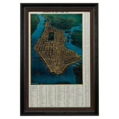
1945, "Supervue of New York City"
Located in Colorado Springs, CO
This bird’s eye view of New York City was published in 1945 by the Supervue Map and Guide Organization. The map shows the roads and major points of interest, which, coupled with a detailed index surrounding the map, helped tourists locate key attractions, historical sites, steamship piers, parks and squares, and bridges.
The map was originally issued folded into printed paper covers with black and white photographic images of the city. On the verso of the map are small black and white maps...
Category
1940s Vintage American Maps
Materials
Paper
1987 "the Ian Fleming Thriller Map" by Aaron Silverman and Molly Maguire
Located in Colorado Springs, CO
Presented is an original “Ian Fleming Thriller Map,” which features the travels of MI6 Agent 007, James Bond, from author Ian Fleming’s series of fourteen spy novels. The pictorial m...
Category
1980s Vintage American Maps
Materials
Paper
1828 "Map of the United States" by T. Ensign
Located in Colorado Springs, CO
Presented is Timothy Ensign’s “Map of the United States,” published in 1828. The map is one of the first to show the United States stretching all the way to the Pacific Ocean. The map’s area covers Oregon to the Atlantic Ocean and Canada to Mexico. It also features a very prominent engraved portrait of George Washington, with inset views and maps of the Capitol, Washington, DC, Boston and a small map of North America.
Because this map predates the Texas Revolution, the Mexican American War, and the 1846 Treaty of Guadalupe Hidalgo, Mexico comprises much of the southwest, including California, Arizona, New Mexico, Nevada, Utah, and Texas. And yet, by including the large expanse of territory between the Mississippi River and the Pacific, the map is a mirror of American expansionist ambitions of the time.
Territorial expansion of the boundaries of the United States westward to the Pacific and beyond was at its peak at the time of this map’s publication. In 1803, President Thomas Jefferson’s Louisiana Purchase doubled the size of the country and the Lewis & Clark expedition of 1803-1806 sparked interest in the exploration and settlement of the newly acquired land. Expansionists eager to acquire Spanish Florida were part of the drive for the War of 1812 and Andrew Jackson’s invasion of Florida in 1818 and the subsequent Adams-Onís Treaty established an American claim to the Pacific Northwest as Spain renounced its claim to the Oregon Country...
Category
1820s Antique American Maps
Materials
Paper
1847 "Pictorial Map of the United States" by Ensign and Thayer
Located in Colorado Springs, CO
Offered is a scarce map of the United States and Mexico by Ensign and Thayer. This pictorial map features a unique view of the U.S. with exquisite hand-coloring and well-defined terr...
Category
1840s Antique American Maps
Materials
Paper
1904 Map of the Denver and Rio Grande & Rio Grande Western System, Rand McNally
Located in Colorado Springs, CO
1904 Map of the Denver and Rio Grande and the Rio Grande Western System by Rand McNally & Co.
This map details the Denver & Rio Grande Western Railroad. First published in 1885, t...
Category
Early 1900s Antique American Maps
Materials
Paper
H 10.25 in W 28 in D 1 in
History of Old Kinderhook by Edward Augustus Collier
Located in valatie, NY
A History of Old Kinderhook by Edward Augustus Collier. G. P. Putnam's and Sons, NY, 1914 (original), reprinted by Higginson Book Co, MA. A reprinted hardcover. Including the Story o...
Category
1990s American Maps
Materials
Paper
"Jackson Hole Country, Wyoming" Vintage Pictorial Map by Harold Hopkinson, 1956
Located in Colorado Springs, CO
This is an attractive and rare 1956 pictorial view map of Jackson Hole, Wyoming, drawn by Harold Isadore Hopkinson. Oriented to the northwest, the map cov...
Category
1950s Vintage American Maps
Materials
Paper
H 30.5 in W 25.5 in D 1.5 in
1886 Skeleton Map of the Union Pacific Railway
Located in Colorado Springs, CO
This is a promotional skeleton map of the Union Pacific Railway, touted as “the most popular transcontinental line.” The map was published in 1886 by M...
Category
1880s Antique American Maps
Materials
Paper
Map of the Denver & Rio Grande Railroad System by S.K. Hooper, Antique Map, 1895
Located in Colorado Springs, CO
This map details the Denver & Rio Grande Railroad and was published in 1895. The map folds into a booklet titled "The Geography of Colorado and Rocky Mountain Regions with Map", whic...
Category
1890s Antique American Maps
Materials
Paper
H 24.75 in W 29.5 in D 2 in
"Historical Civil War Map" Antique U.S. Pocket Map by Asher and Co., 1862
Located in Colorado Springs, CO
This is Asher & Company’s second issue of the scarce pocket map of the Civil War. This map features the region involved in the Civil War with highlighted ba...
Category
1860s Antique American Maps
Materials
Paper
H 43.5 in W 42.75 in D 2.5 in
1846 Antique Map of Texas, Oregon, California, and Regions Adjoining by Mitchell
By Samuel Augustus Mitchell 1
Located in Colorado Springs, CO
This is a finely colored example of the 1846 version of Mitchell's seminal map of Texas, Oregon Territory, California, and the Transmississippi West. Published in 1846 from Philadelphia, Mitchell's map of the West was one of the first large-format commercially published maps to show the Transmissisippi West, after the annexation of Texas in 1845. The map was perhaps the single most popular map of the period, used by gold seekers, immigrants, and others whose lives, fortunes, and attentions were focused Westward at the outset of the Mexican-American War.
Beginning in 1846, the Transmississippi West was of particular interest to the American populace, as a result of two recent and related events. In 1845, Texas was admitted to the Union. This prompted Mexico to invade Texas in 1846, thus starting the U.S.-Mexican War. General curiosity about the new state as well as interest in the war led to Mitchell's timely map becoming quite popular.
As stated in the "Accompaniment to Mitchell's new map of Texas, Oregon and California...," in which the map was sometimes issued, Mitchell used the latest and best cartographic sources for the map, including Arrowsmith's 1841 map of Texas, Fremont's and Emory's maps of their explorations in the region, compiled data from the Lewis & Clark expedition, Nicollet's map of the region between the Mississippi and the Missouri, and Wilkes map of Oregon...
Category
1840s Antique American Maps
Materials
Paper
H 32.5 in W 31.5 in D 2 in
Antique Gettysburg Battlefield Print by J. Bachelder with Officer's Sword, 1863
Located in Colorado Springs, CO
This is one of the finest early depictions of the largest and bloodiest battle ever fought on American soil, believed by many to have marked the turning point of the Civil War. This large lithograph...
Category
1860s Antique American Maps
Materials
Steel
H 55 in W 55.5 in D 6 in
Recently Viewed
View AllMore Ways To Browse
Greek Asia Minor
Antique Maps Canada
Antique Map Canada
Canada Antique Map
West Indies Map
Antique Portuguese Plates
Map Huge
Antique Maps Of Canada
Bali Map
Antique Map South Africa
Antique Map Of South Africa
South Africa Antique Map
Map Of West Indies
Belgium Army
Sweden Antique Map
Belgian Army
Cornelius Company
Antique Nautical Maps
