American Maps
1
to
1
1
1
1
1
80
30
1
20
7
2
11
4
3
1
2
1
1
2
1
1
1
1
Period: 1930s
Place of Origin: American
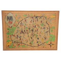
Art Deco Cartoon Style Map of Paris possibly by Arthur Zaindenberg circa 1930's
By Arthur Zaidenberg
Located in New York, NY
Art Deco cartoon style map of Paris possibly by Arthur Zaidenberg. The map depicts witty references to Parisians lifestyle, along with drawings of notable landmarks, circa 1930's. T...
Category
1930s Art Deco Vintage American Maps
Materials
Paper
Related Items
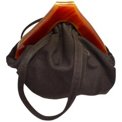
Art Deco Wool and Catalin Bakelite Slouch Ladies Bag, circa 1930
Located in Devon, England
Oh so smart is this wonderful ladies handbag, 1930s. There is no makers mark but was sourced in the US so likely to have originated from there originally. The body of the bag is slou...
Category
Mid-20th Century Art Deco American Maps
Materials
Wool, Silk, Bakelite
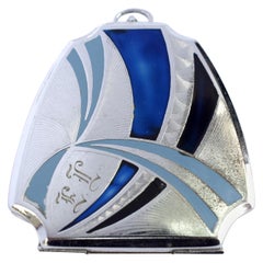
Art Deco Ladies Blue Enamel and Chrome Compact, circa 1930
Located in Devon, England
For your consideration is this highly styled Art Deco of American blue enamel compact dating to the 1930s. Originally it would have had a chain or tassel. Beautiful blue enamel color...
Category
Mid-20th Century Art Deco American Maps
Materials
Enamel, Chrome
Antique Map of Germany by T. Kitchin, circa 1780
Located in Langweer, NL
Attractive map with decorative cartouche from "A New Geographical, Historical, and Commercial Grammar and Present State of the Several Kingdoms of the World by William Guthrie, print...
Category
Late 18th Century Antique American Maps
Materials
Paper
French Map of Paris, Musuem Carnavalet Rossingol University Map, 1576
Located in Gardena, CA
French Map of Paris, Musuem Carnavalet Rossingol University Map, 1576.
Map of Paris, France - English: Map of Paris (1576) / museum Carnavalet Rossignol, it is the true fortrict o...
Category
16th Century Antique American Maps
Materials
Paper
Stylish Art Deco Velvet and Chrome Handbag Purse, circa 1930s
Located in Devon, England
For your consideration is this superbly stylish and rare 1930s black silk velvet clutch bag originating from England. Features a chrome frame and cla...
Category
Mid-20th Century Art Deco American Maps
Materials
Chrome
Art Deco Vintage Cord and Bakelite Handbag, circa 1930
Located in Devon, England
For your consideration is this wonderfully stylish English ladies handbag made from cord with a butterscotch coloured catalin Bakelite clasp. This is a totally authentic bag...
Category
Mid-20th Century Art Deco American Maps
Materials
Leather
Antique Map of Italy by R. Bonne, circa 1780
Located in Langweer, NL
Beautiful map of Italy, Corsica, Sardinia and Sicily. Highly detailed, showing towns, rivers, some topographical features and political boundaries. Published by R. Bonne, circa 1780.
Category
Late 18th Century Antique American Maps
Materials
Paper
Antique Map of Germany by T. Kitchin, circa 1770
Located in Langweer, NL
Antique map titled 'An Accurate Map of Germany (..) '. Drawn from the best Authorities by T.Kitchin Geogr." Rare edition, drawn and etched by Thomas Kitchin, published, circa 1770.
Category
Mid-18th Century Antique American Maps
Materials
Paper
Art Deco Black Suede Phenolic Bakelite Ladies Bag, circa 1930s
Located in Devon, England
For your consideration is this superbly stylish and rare 1930s-1940s Art Deco black suede bakelite grab bag. Labelled 'Made in France' to the inside. This bag feels lovely to use with its soft body and light weight. Beautiful shape and size, a genuine Art Deco 1940s vintage black suede with stunning bakelite clasp and decorative accent. A French made bag that comes to you in excellent vintage condition with no major issues inside and out. It is fully lined in black rayon that is great condition, this one is a stunner. The interior is very generous in size and perfect for modern day use. Plenty of room here for everything, the bag measures a healthy 12" (30 cm) wide and 9" (22.5 cm) high with the large cherry bakelite...
Category
Mid-20th Century Art Deco American Maps
Materials
Suede, Bakelite, Silk
Antique Map of Asia by A. Blondeau, circa 1800
Located in Langweer, NL
This is a fine circa 1800 map of Asia by Alexandre Blondeau. It covers the entire continent from Africa and the Mediterranean east to the Bering Sea and south as far as Java and New ...
Category
Early 19th Century Antique American Maps
Materials
Paper
Casket Art Deco from 1930
Located in Kraków, Małopolska
We present casket Art Deco from 1930
Every piece of furniture that leaves our workshop from the beginning to the end is subjected to manual renovation, so as to restore its origin...
Category
1920s Art Deco Vintage American Maps
Materials
Walnut
Art Deco Pair of Bakelite Bracelets America, 1930s
Located in Miami, FL
American vintage stunning pair of bakelite bracelets from the 1930s.
Measure: Circumference 9 inches.
Category
Mid-20th Century Art Deco American Maps
Materials
Bakelite
Previously Available Items
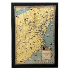
1932 "Principal Events in the Life of George Washington" Pictorial Map
Located in Colorado Springs, CO
Presented is the 1932 pictorial map of the principal events in George Washington’s life from the General Drafting Company. The map displays the eastern coastline of the United States...
Category
1930s Mid-Century Modern Vintage American Maps
Materials
Paper
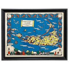
Whimsical Decorative Map of Nantucket by Jack Atherton, 1937
Located in Nantucket, MA
A wonderful vintage pictorial map of Nantucket Island, by Jack Atherton, 1937, simple and whimsical, showing the general lay of the land and feat...
Category
1930s Modern Vintage American Maps
Materials
Paper
1939 Vintage Map "The City of New York" by Richard Edes Harrison
By Richard Harrison
Located in Colorado Springs, CO
This 1939 Richard Edes Harrison map of New York City, published for an issue of Fortune Magazine, represents a triumph of the visual display of quantitative information. Its aesthetic impact is all the more impressive in its clear expression of municipal and demographic data, making this a map of the people of New York City, as much as of the physical city itself.
The map centers on Brooklyn and Manhattan, but includes much of the surrounding burrows. The color-coded detail of the map is nothing short of an impressive work for its time. The map is color coded by residential, industrial, business, parks and parkways, airports, cemeteries, public and private institutions, and Federal Government Property.
An inset map, “The Lower Half of Manhattan in Detail,” positioned below the title provides a more detailed street layout of lower Manhattan, from Central Park to Battery Park. Using a new color code for this inset map, Harrison marked the city’s most valuable real estate, including structures assessed at 5 million dollars or more.
In the lower right, two comparative insert maps show the difference between day and night population densities for the entire area shown in the main map. The map also has a very decorative and unique compass rose. Within the rose’s circuit is yet another inset map, showing the limit of the main map in the context of the greater metropolitan area and the surrounding states.
Harrison’s map of New York City is based mainly on a series of maps issued in 1933 by the City Planning Commission. Produced as an Emergency Relief Project, those 1933 maps illustrated the distribution of living and working populations, the age, type, and rental of buildings, and the use of land, existing streets, and waterways in great detail. Harrison’s street grid was reproduced directly from “Existing Streets 1935,” which in turn was based on the “Board of Estimate and Apportionment Map,” copyrighted in 1933 by Herman Smith. Harrison did the impressive work of designing the present map, bringing the material up to date, revising shorelines, and adding new construction from the past six years.
This map appeared in only one edition, as a supplement to the July issue of Fortune magazine. OCLC lists only five examples in institutional collections.
Richard Edes Harrison (1902- 1994) was an American cartographer and cartoonist. Harrison is credited with redefining cartography, by employing spherical perspective, bold shading, and graphic design to both make maps more publicly accessible. Born in Baltimore, Maryland, Harrison studied design at Yale, graduating in 1923. He relocated to New York City at the height of the Great Depression and worked in industrial design. Harrison created his first cartographic work while he worked a fill-in job at Fortune magazine. The success of his first project launched a long-standing collaboration with Fortune, including expertly executed WWII maps...
Category
1930s Vintage American Maps
Materials
Paper
1937 Hawaii Map "The Dole Map of the Hawaiian Islands" by Parker Edwards
Located in Colorado Springs, CO
This vintage map emulates a travel poster with its vibrant colors, encouraging tourism to the islands of Hawaii. The map depicts the Hawaiian Islands of Hawaii, Maui, Kahoolawe, Lana...
Category
1930s Vintage American Maps
Materials
Paper
1938 Historic and Scenic Reaches of the Nations Capital Map
Located in Colorado Springs, CO
This decorative and colorful map of mid Atlantic states was published by The National Geographic Magazine, in July 1938. The map accompanied the article "Roads from Washington," and contains a variety of interesting historical sites and notes on Maryland, Virginia, Delaware, and Pennsylvania. A legend at bottom right identifies battlefields, ruins, historic churches, monuments, towns with interesting sites, famous hunting and riding centers, and noteworthy architecture. The map also offers a beautiful charting of the Chesapeake Bay and it’s offshoots.
The map was completed in the Map and Art Studios of the National Geographic Society. It was designed by C. E. Riddiford. Research for the map was completed by W. Chamberlin and A.E. Holdstock. Relief was drawn by JJ. Brehm.
Surrounding this unique cartographic work is a decorative border with alternating scenes of nearby locations and portraits of historical figures. At top, from left to right are: Gettysburg, Matthew F. Maury, Valley Forge, James Madison, Mt. Vernon, John Peter Gabriel Muhlenberg, Philadelphia, George Washington, Williamsburg, Thomas Jefferson, New Castle, Cecil Calvert, Washington DC, Poe, Delaware, Benjamin Franklin, and Arlington. At bottom, from left to right are: U.S. Naval Academy, John Marshall, Warrenton, Cyrus McCormick, Chesapeake Bay, Walter Reed, Winchester, James Monroe, Charlottesville, Capt. John Smith, and Annapolis.
With its border of notable figures and places, this map of the Historic and Scenic Reaches of the Nation's Capital is as much a work of art as a map.
The frame is made from re-purposed 19th century window frame...
Category
1930s Vintage American Maps
"A Map of the Travels of George Washington" by National Geographic, 1931
Located in Colorado Springs, CO
This informative and descriptive map follows the travels of George Washington in the mid-Atlantic region of the United States, between 1731 and 1799. Compiled and drawn in the Cartog...
Category
1930s Vintage American Maps
Materials
Paper
1930s Weber Costello Globe with Cast Copper Mount
Located in Surrey, BC
Beautiful example of a classic globe from the 1930s and made by Weber Costello. The mounting mechanism is cast from copper.
The roots of what would bec...
Category
1930s Victorian Vintage American Maps
Materials
Copper
Framed Nautical Chart of Provincetown Harbor, 1935
Located in New York, NY
This nautical chart of Provincetown Harbor was created circa 1935 and depicts the coasts of Cape Cod and surrounding bodies of water The chart has been...
Category
1930s Vintage American Maps
Materials
Paper
Vintage Map of New York Harbor, Framed, circa 1930
Located in West Palm Beach, FL
Framed US Coast Guard map of the New York Harbor, stamped April 12, 1930.
Stock ID: D9417
Category
1930s Vintage American Maps
Materials
Glass, Wood, Paper
20 Drawer Tiger Oak Map Cabinet or Flat File with Original Brass Hardware
Located in New York, NY
Modular design. Smooth sliding. This can be seen at our 149 Madison Ave store in Manhattan.
Category
1930s Vintage American Maps
H 67.5 in W 30 in D 41.25 in
Primrose and Leaves Botany Chart
Located in Pound Ridge, NY
Original 1930's botany charts salvaged from Yale University. We have a few more in this series, framed and unframed
Category
1930s Mid-Century Modern Vintage American Maps
Recently Viewed
View AllMore Ways To Browse
Greek Asia Minor
Antique Maps Canada
Antique Map Canada
Canada Antique Map
West Indies Map
Antique Portuguese Plates
Map Huge
Antique Maps Of Canada
Bali Map
Antique Map South Africa
Antique Map Of South Africa
South Africa Antique Map
Map Of West Indies
Belgium Army
Sweden Antique Map
Belgian Army
Cornelius Company
Antique Nautical Maps
