Items Similar to Original Anitque Map of the Banda or Spice islands in the Dutch East Indies


Want more images or videos?
Request additional images or videos from the seller
1 of 6
Original Anitque Map of the Banda or Spice islands in the Dutch East Indies
About the Item
Dutch print with the title: Nieuw Caart der Eylanden van BANDA. Gemaakt door François Valentyn, J.van Braamen G.O. Linden
The map is taken from: 'Oud en Nieuw Oost-Indiën' van François Valentyn.
1) Ottens, Frederik (engraver / etcher)
2) Braam, J. van (publisher)
3) Linden, Gerard onder de (publisher)
This original antique map, "Nieuwe Caart der Eylanden van BANDA," is a cartographic gem crafted by François Valentyn. It showcases the islands of Banda, also know as the Spice Islands, captivating jewels nestled within the Indonesian archipelago. Valentyn's meticulous attention to detail and geographical precision illuminate the geography of these islands.
The map offers a vivid portrayal of the Banda Islands, renowned for their historical significance in the spice trade, particularly for nutmeg. It intricately delineates the archipelago's land masses, coastlines, and possibly notable landmarks or settlements on these exotic islands.
It also includes the Island of RUN.
Run, also known as Pulau Run, Pulo Run, Puloroon, or Rhun, represents one of the Banda Islands, nestled within the Moluccas archipelago in Indonesia. As one of the smallest islands within the Banda group.
In 1616, driven by apprehension of Dutch influence, the indigenous inhabitants of Run pledged loyalty to employees of the English East India Company, who acknowledged it on behalf of the Crown. Historian John Keay draws a parallel, likening Pulo Run's significance to the genesis of the British Empire, comparing it to Runnymede's role in British constitutional history. During the 17th century, this minuscule island held immense economic importance due to the precious spices it yielded, notably nutmeg and mace.
Crafted with precision and artistry, Valentyn's map might include cartographic elements such as compass roses, scale bars, or decorative embellishments, enriching its visual appeal and navigational utility.
Valentyn, a distinguished cartographer and historian, left an indelible mark with his comprehensive narratives. This map, likely a part of his works published in the 17th and 18th centuries, provides a historical window into the allure of the Banda Islands, reflecting their significance in the spice trade and the broader colonial history of the region.
Published between 1724-1726 in Dordrecht by Joannes van Braam and Gerard Onder de Linden as part of "Oud en nieuw Oost-Indiën," this captivating engraving forms part of François Valentyn's meticulous narrative. Offering a vivid portrayal of Dutch power in the region, it presents a rich tapestry of descriptions encompassing the Moluccas, the Dutch comptoir in Surat, and intriguing insights into the lives of the Great Moguls. An evocative piece, it invites you on a historical voyage through the treasures and maritime legacy of the Malabar Coast.
- Dimensions:Height: 13.19 in (33.5 cm)Width: 17.33 in (44 cm)Depth: 0 in (0.02 mm)
- Materials and Techniques:Paper,Engraved
- Period:1720-1729
- Date of Manufacture:1726
- Condition:Very good condition, especially considering its age. A view folding lines are visible. The coloring is from recent years on a slightly discolored sheet due to age. Study the image carefully.
- Seller Location:Langweer, NL
- Reference Number:Seller: BG-13424-61stDibs: LU3054337349092
About the Seller
5.0
Recognized Seller
These prestigious sellers are industry leaders and represent the highest echelon for item quality and design.
Platinum Seller
Premium sellers with a 4.7+ rating and 24-hour response times
Established in 2009
1stDibs seller since 2017
2,442 sales on 1stDibs
Typical response time: 1 hour
- ShippingRetrieving quote...Shipping from: Langweer, Netherlands
- Return Policy
Authenticity Guarantee
In the unlikely event there’s an issue with an item’s authenticity, contact us within 1 year for a full refund. DetailsMoney-Back Guarantee
If your item is not as described, is damaged in transit, or does not arrive, contact us within 7 days for a full refund. Details24-Hour Cancellation
You have a 24-hour grace period in which to reconsider your purchase, with no questions asked.Vetted Professional Sellers
Our world-class sellers must adhere to strict standards for service and quality, maintaining the integrity of our listings.Price-Match Guarantee
If you find that a seller listed the same item for a lower price elsewhere, we’ll match it.Trusted Global Delivery
Our best-in-class carrier network provides specialized shipping options worldwide, including custom delivery.More From This Seller
View AllOriginal Antique Map Southeast of the Banda or Spice Islands, Indonesia, 1726
Located in Langweer, NL
Antique map titled 'Kaart van de Zuyd-Ooster Eylanden van Banda'.
Map of the southeastern part of the Banda islands. This map originates from 'Oud en Nieuw Oost-Indiën' by F. Valen...
Category
Antique 1720s Maps
Materials
Paper

$713 Sale Price
20% Off
Antique Map of the Banda Islands or Spice Islands, Moluccas, Indonesia, 1697
Located in Langweer, NL
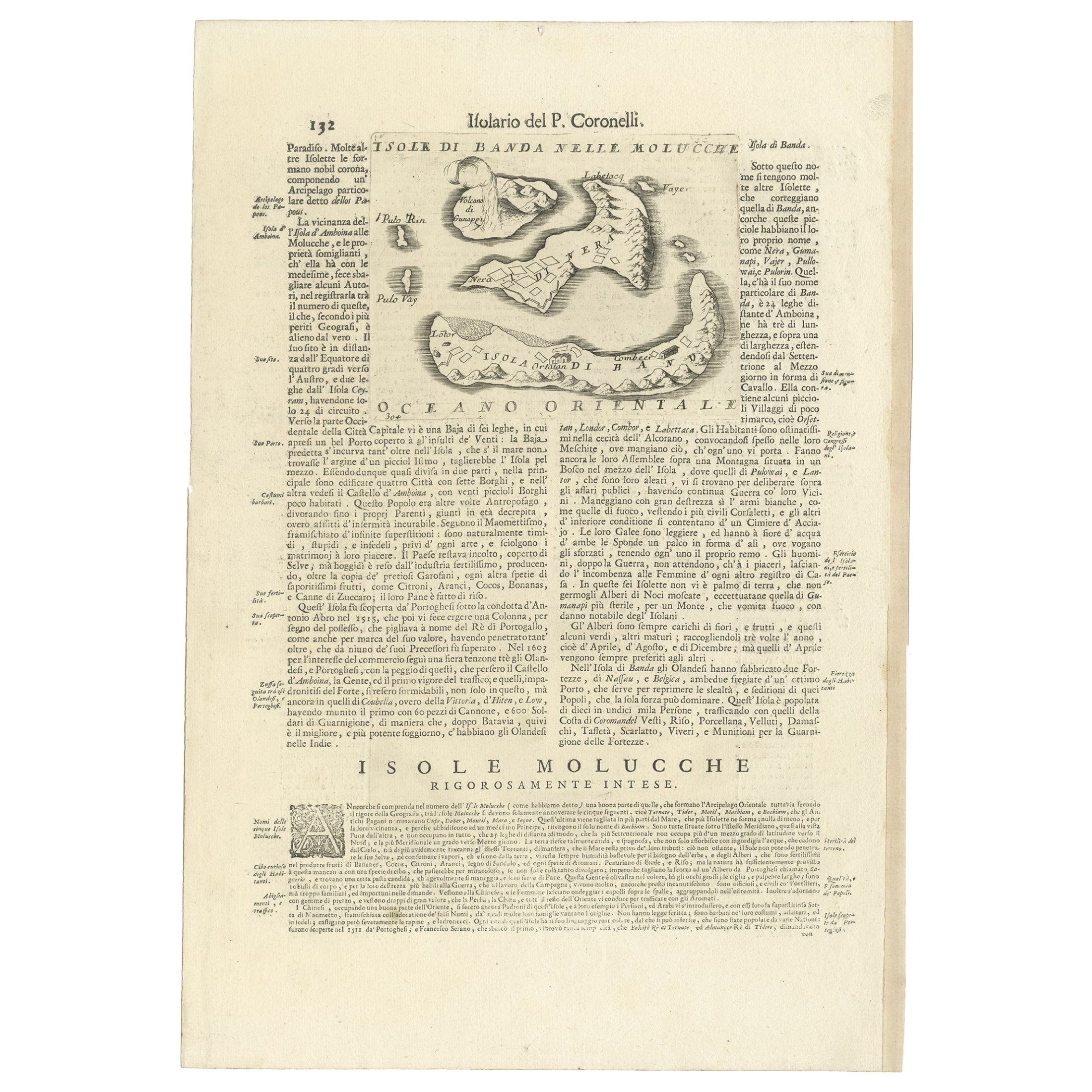
Antique map titled 'Isole di Banda Nelle Molucche'.
Engraved map of Isola di Banda, Nelle, Molucche. On verso: 'Isola di Solor'.
Artists and Engravers: Vincenzo Maria (Padre)...
Category
Antique 17th Century Maps
Materials
Paper
$416 Sale Price
20% Off
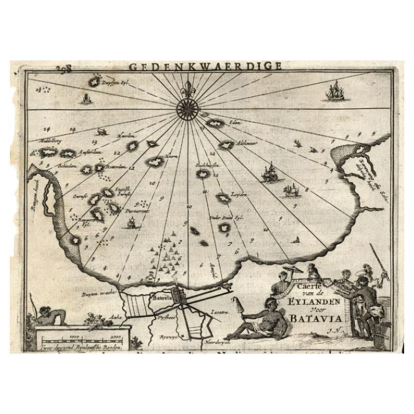
Antique Map of the Islands Near Batavia, Capital of the Dutch East Indies, 1682
Located in Langweer, NL
Antique map titled 'Caerte van de Eylanden voor Batavia.'
Map of the islands near Batavia, Indonesia. With scale, compass rose, cartouche and ships on the sea. Sheet with engraving...
Category
Antique 17th Century Maps
Materials
Paper

Original Old Map of the Environs of Batavia in the Dutch East Indies (Indonesia)
Located in Langweer, NL
Antique map titled 'Carte des Environs de Batavia'. Map of the environs of Batavia (now Jakarta), Indonesia. This print originates from volume 8 of 'Histoire générale des voyages'. P...
Category
Antique Mid-18th Century Maps
Materials
Paper

$277 Sale Price
20% Off
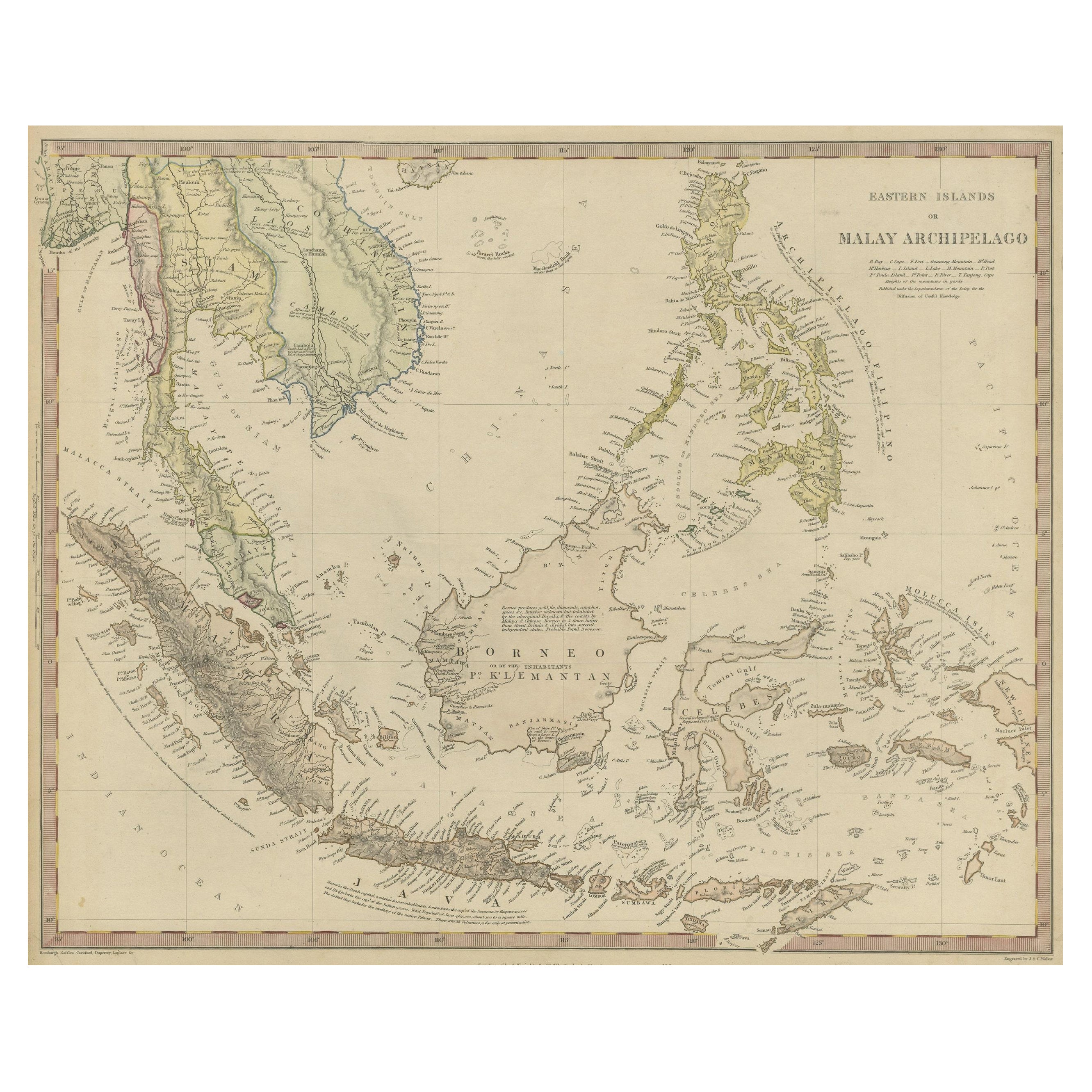
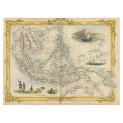
Decorative Antique Map of the Malay Archipelago or East Indies Island, 1851
Located in Langweer, NL
Antique map Indonesia titled 'Malay Archipelago, or East India Islands'. With vignettes of Victoria Mount, New Guinea, Nativaes of New Guinea an...
Category
Antique 1850s Maps
Materials
Paper
$1,018 Sale Price
20% Off
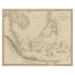
Original Antique Map of the Dutch East Indies, Nowadays Indonesia, ca.1840
Located in Langweer, NL
Original antique map of the East Indies including Borneo, Celebes, Java, Sumatra and surrounding islands. Published circa 1840.
Artists and Engravers: Engraved by J. & C. Walker....
Category
Antique 1840s Maps
Materials
Paper
$222 Sale Price
20% Off
You May Also Like
Large Original Antique Map of the The Windward Islands. 1894
Located in St Annes, Lancashire
Superb Antique map of The Windward Islands
Published Edward Stanford, Charing Cross, London 1894
Original colour
Good condition
Unframed.
Free shipping
Category
Antique 1890s English Maps
Materials
Paper

Large Original Antique Map of The Greek Islands. 1894
Located in St Annes, Lancashire
Superb Antique map of The Greek Islands
Published Edward Stanford, Charing Cross, London 1894
Original colour
Good condition
Unframed.
Free shipping
Category
Antique 1890s English Maps
Materials
Paper

Large Original Antique Map of The Falkland Islands. 1894
Located in St Annes, Lancashire
Superb Antique map of The Falkland Islands
Published Edward Stanford, Charing Cross, London 1894
Original colour
Good condition
Unframed.
Free shipping
Category
Antique 1890s English Maps
Materials
Paper

Large Original Antique Map of The Leeward Islands. 1894
Located in St Annes, Lancashire
Superb Antique map of The Leeward Islands
Published Edward Stanford, Charing Cross, London 1894
Original colour
Good condition
Unframed.
Free shipping
Category
Antique 1890s English Maps
Materials
Paper

Large Original Antique Map of The Canary Islands. 1894
Located in St Annes, Lancashire
Superb Antique map of The Canary Islands
Published Edward Stanford, Charing Cross, London 1894
Original colour
Good condition
Unframed.
Free shipping
Category
Antique 1890s English Maps
Materials
Paper

Large Original Antique Map of The West Indies by Sidney Hall, 1847
Located in St Annes, Lancashire
Great map of The West Indies
Drawn and engraved by Sidney Hall
Steel engraving
Original colour outline
Published by A & C Black. 1847
Unframed
Free shipping.
Category
Antique 1840s Scottish Maps
Materials
Paper

Recently Viewed
View AllMore Ways To Browse
Red Leather Swivel Chair
Rosewood Vintage Armchair
Rush Back Armchairs
Russian Propaganda Posters
Sheep Pillow
Sheffield Tea Sets
Silver Plate Art Deco Cocktail Shaker
Silver Wine Jug
Small Dining Table With Extension
Small Round 3 Leg Table
Society Silk
Square Club Chair
Sterling Condiment
Stickley Antique Table
Sugar Creamer Tray
Swivel Ottomans
Tartan Furniture
Tavolino Coffee Table