
Original Antique English County Map - West Yorkshire. J & C Walker. 1851
View Similar Items
Want more images or videos?
Request additional images or videos from the seller
1 of 5
Original Antique English County Map - West Yorkshire. J & C Walker. 1851
About the Item
- Dimensions:Height: 13.75 in (34.93 cm)Width: 17.25 in (43.82 cm)Depth: 0.07 in (1.78 mm)
- Style:Other (In the Style Of)
- Materials and Techniques:Paper,Other
- Place of Origin:
- Period:
- Date of Manufacture:1851
- Condition:Wear consistent with age and use.
- Seller Location:St Annes, GB
- Reference Number:1stDibs: LU1836334068302
About the Seller
4.9
Platinum Seller
Premium sellers with a 4.7+ rating and 24-hour response times
1stDibs seller since 2016
3,078 sales on 1stDibs
Typical response time: 1 hour
Associations
International Confederation of Art and Antique Dealers' Associations
Authenticity Guarantee
In the unlikely event there’s an issue with an item’s authenticity, contact us within 1 year for a full refund. DetailsMoney-Back Guarantee
If your item is not as described, is damaged in transit, or does not arrive, contact us within 7 days for a full refund. Details24-Hour Cancellation
You have a 24-hour grace period in which to reconsider your purchase, with no questions asked.Vetted Professional Sellers
Our world-class sellers must adhere to strict standards for service and quality, maintaining the integrity of our listings.Price-Match Guarantee
If you find that a seller listed the same item for a lower price elsewhere, we’ll match it.Trusted Global Delivery
Our best-in-class carrier network provides specialized shipping options worldwide, including custom delivery.More From This Seller
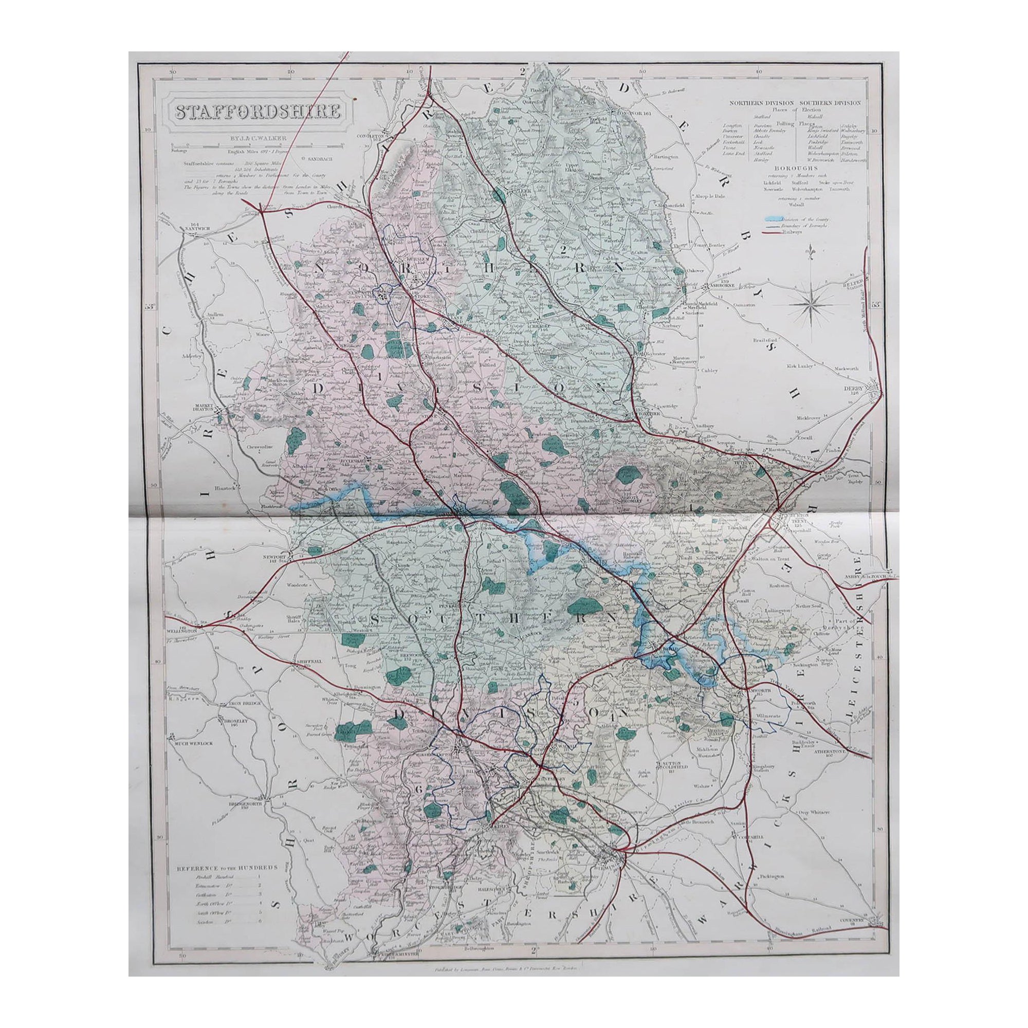
View AllOriginal Antique English County Map, Staffordshire, J & C Walker, 1851
Located in St Annes, Lancashire
Great map of Staffordshire
Original colour
By J & C Walker
Published by Longman, Rees, Orme, Brown & Co. 1851
Unframed.
Category
Antique 1850s English Other Maps
Materials
Paper
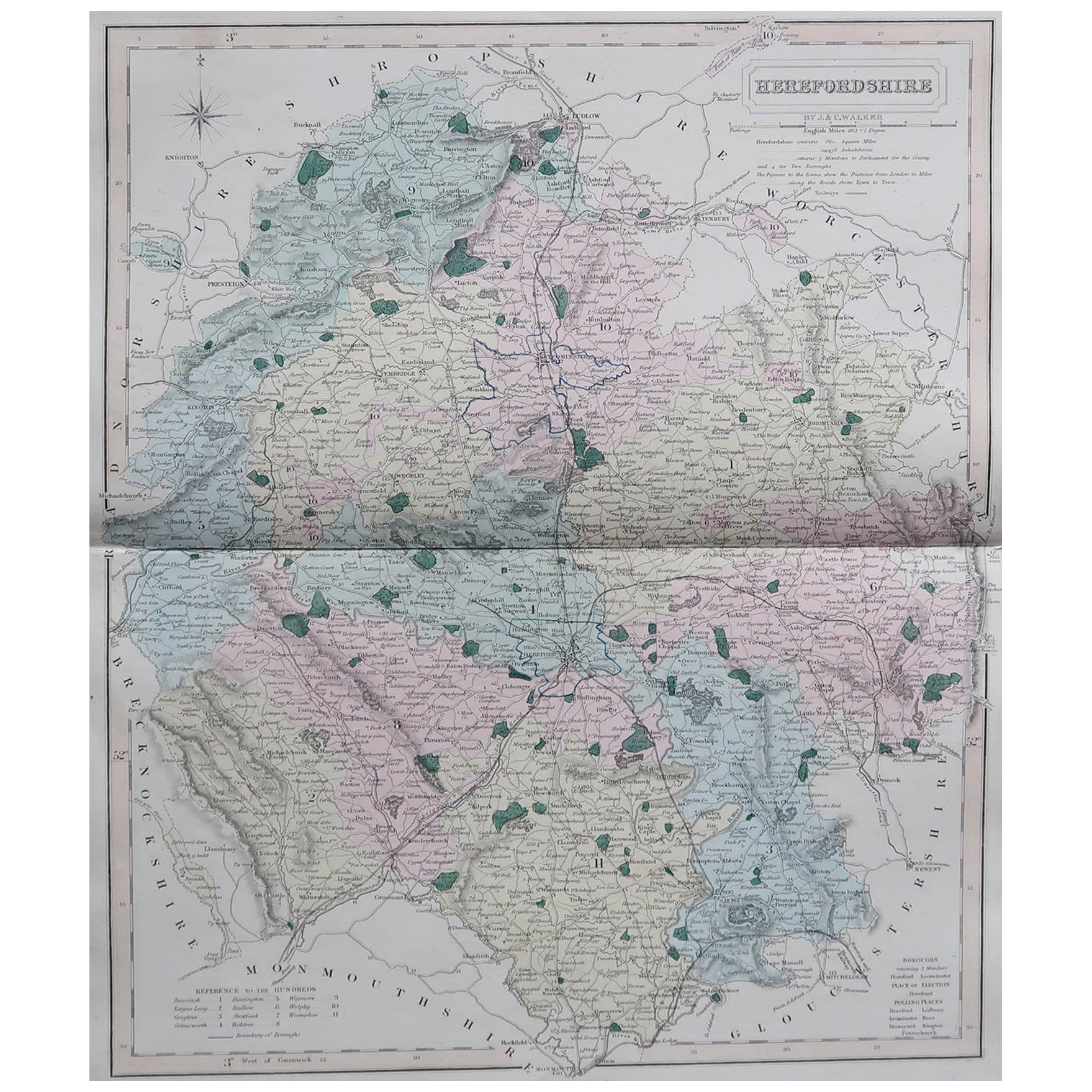
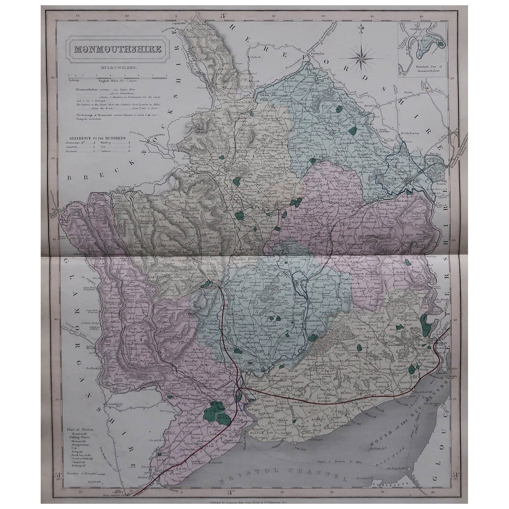
Original Antique English County Map, Herefordshire, J & C Walker, 1851
Located in St Annes, Lancashire
Great map of Herefordshire
Original colour
By J & C Walker
Published by Longman, Rees, Orme, Brown & Co. 1851
Unframed.
Category
Antique 1850s English Other Maps
Materials
Paper

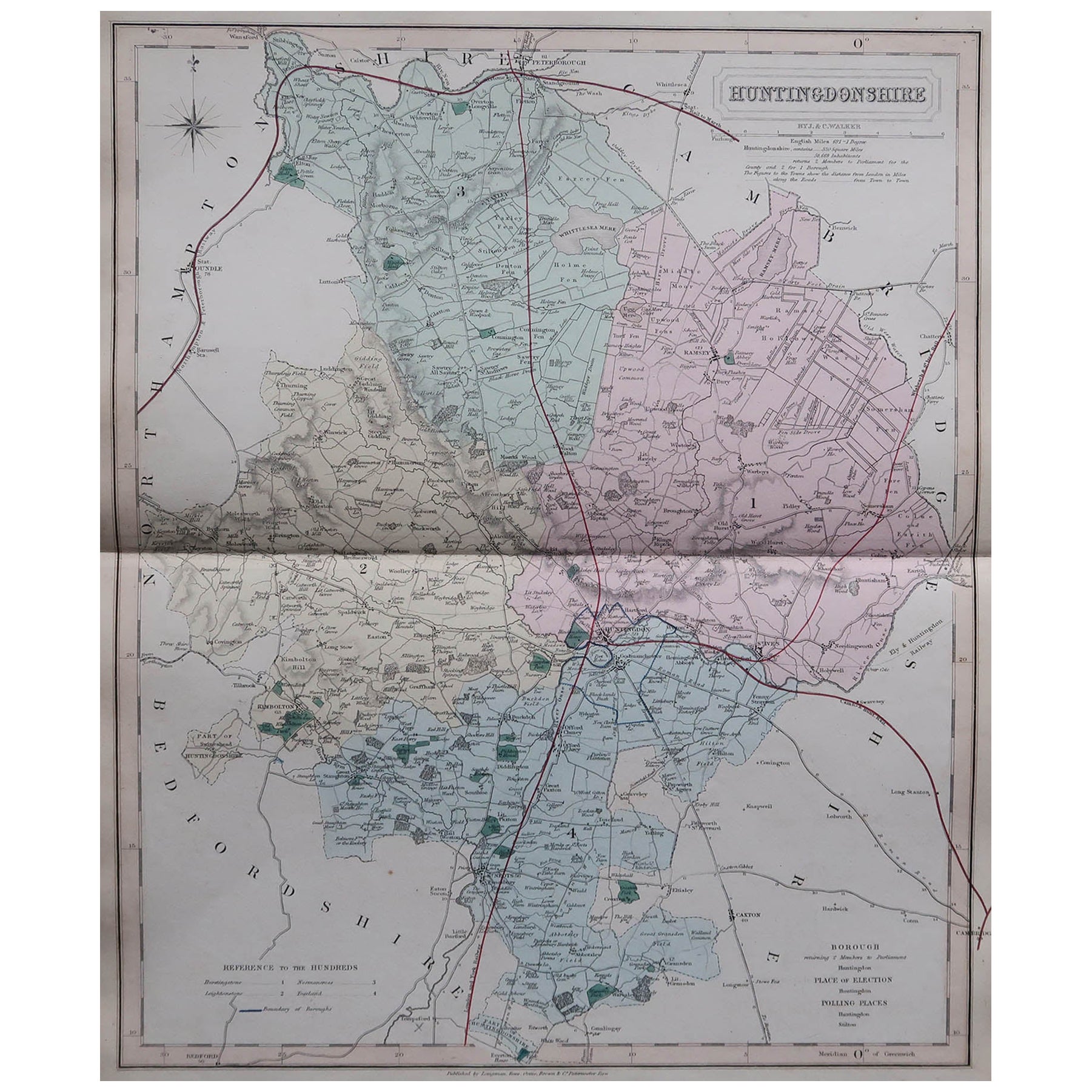
Original Antique English County Map, Huntingdonshire, J & C Walker, 1851
Located in St Annes, Lancashire
Great map of Huntingdonshire
Original colour
By J & C Walker
Published by Longman, Rees, Orme, Brown & Co. 1851
Unframed.
Category
Antique 1850s English Other Maps
Materials
Paper
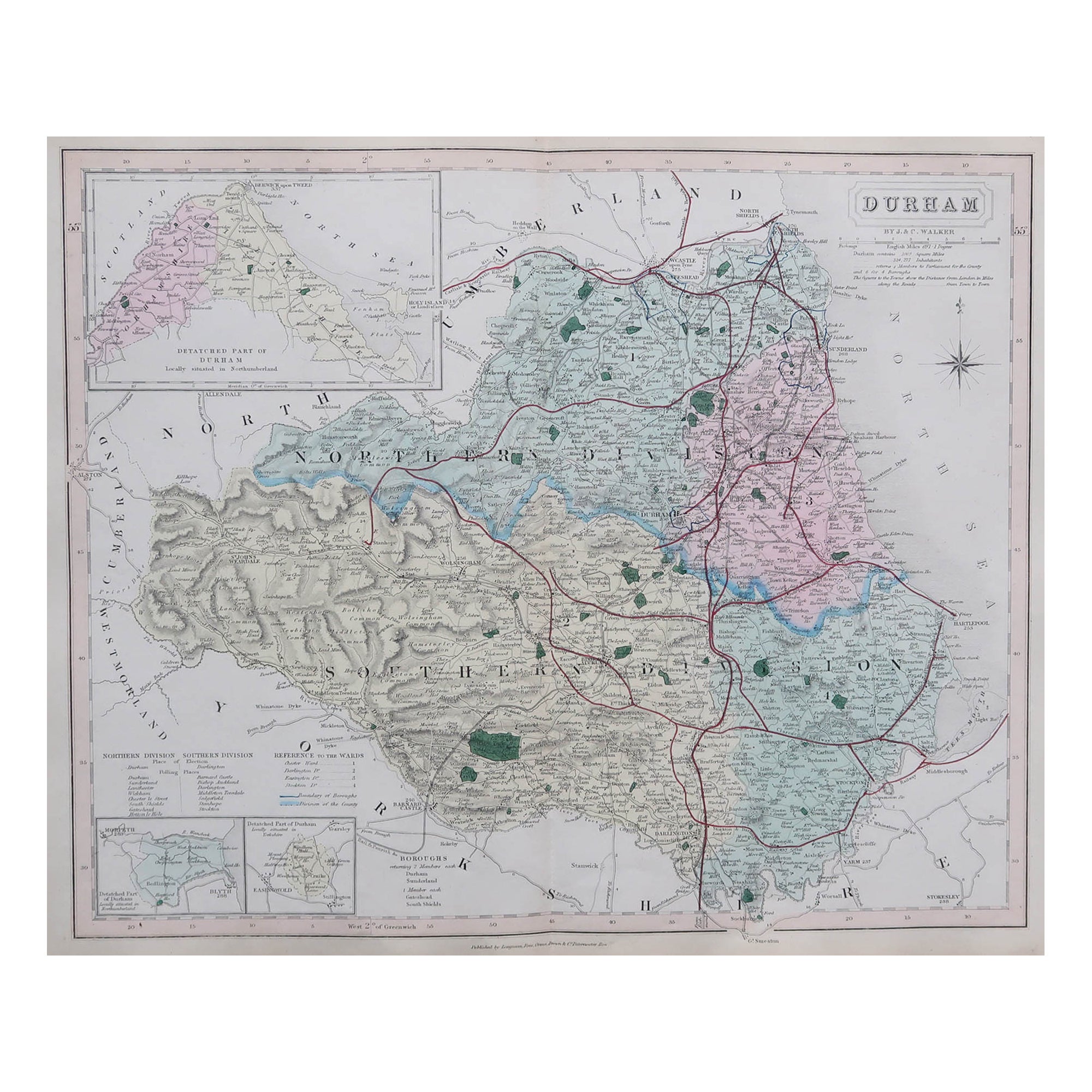
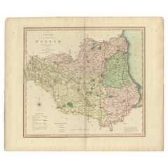
Original Antique English County Map, Durham, J & C Walker, 1851
Located in St Annes, Lancashire
Great map of Durham
Original colour
By J & C Walker
Published by Longman, Rees, Orme, Brown & Co. 1851
Unframed.
Category
Antique 1850s English Other Maps
Materials
Paper

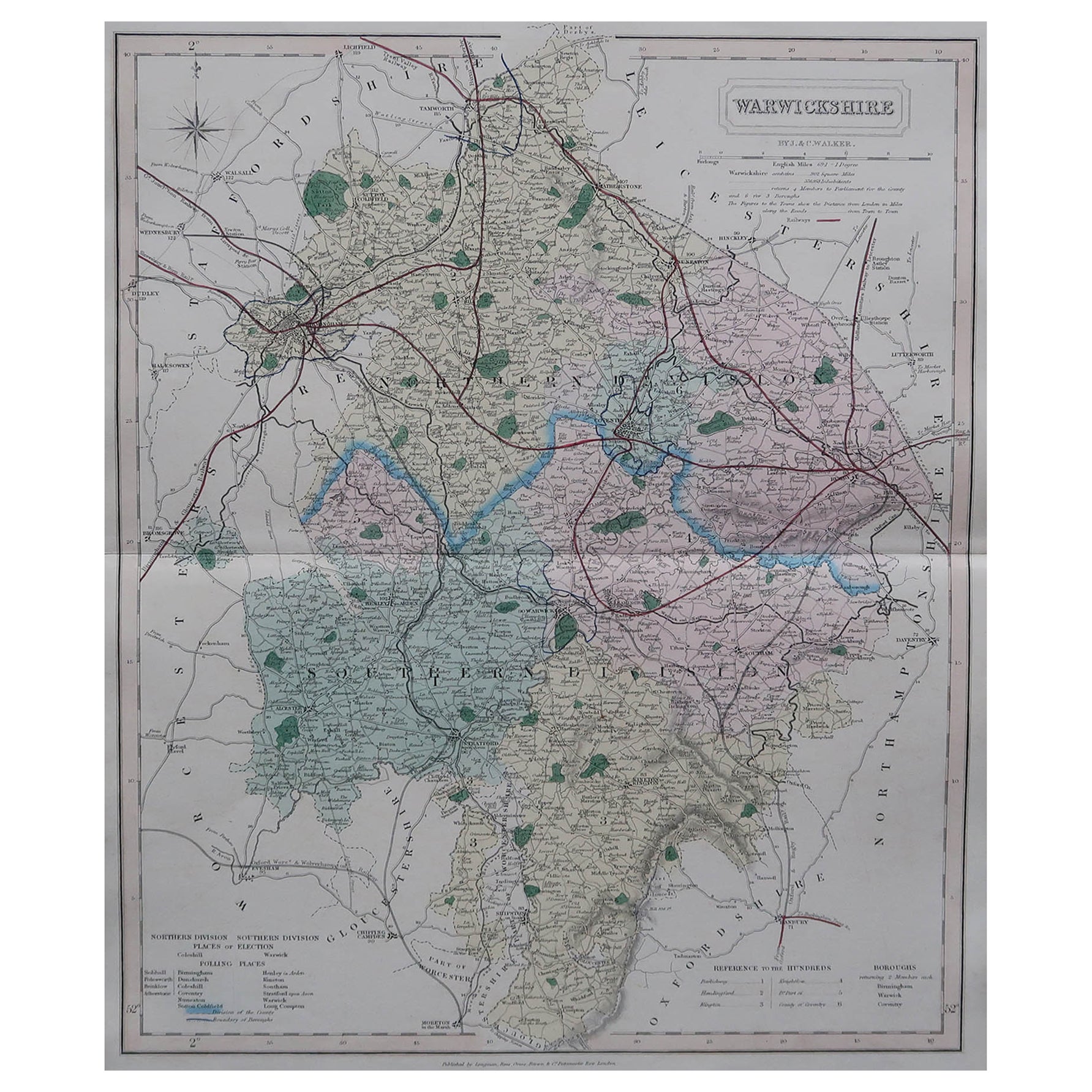
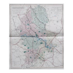
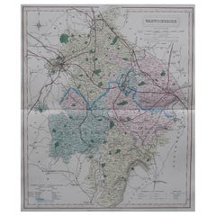
Original Antique English County Map, Warwickshire, J & C Walker, 1851
Located in St Annes, Lancashire
Great map of Warwickshire
Original colour
By J & C Walker
Published by Longman, Rees, Orme, Brown & Co. 1851
Unframed.
Category
Antique 1850s English Other Maps
Materials
Paper
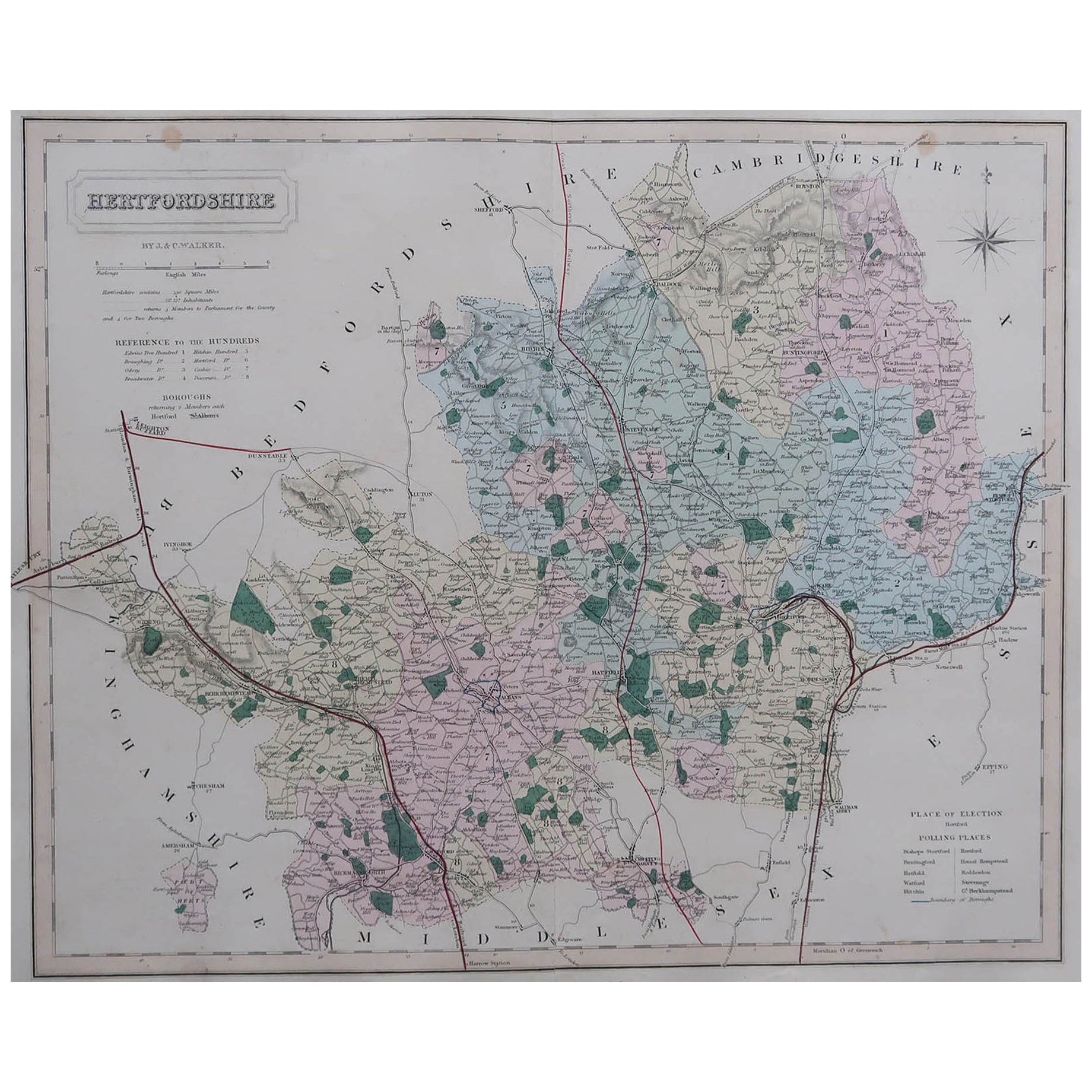
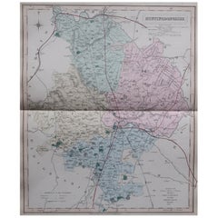
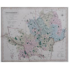
Original Antique English County Map, Hertfordshire. J & C Walker, 1851
Located in St Annes, Lancashire
Great map of Hertfordshire
Original colour
By J & C Walker
Published by Longman, Rees, Orme, Brown & Co. 1851
Unframed.
Category
Antique 1850s English Other Maps
Materials
Paper
You May Also Like
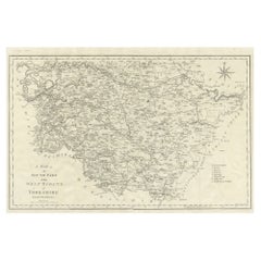
Large Antique County Map of the West Riding of Yorkshire 'South Part', England
Located in Langweer, NL
Antique map titled 'A Map of the South Part of the West Riding of Yorkshire from the best Authorities'. Original old county map of the south part of the West Riding of Yorkshire, Eng...
Category
Antique Early 19th Century Maps
Materials
Paper
$259 Sale Price
20% Off
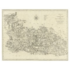
Large Antique County Map of the West Riding of Yorkshire 'North Part', England
Located in Langweer, NL
Antique map titled 'A Map of the North Part of the West Riding of Yorkshire from the best Authorities'. Original old county map of the north part of the West Riding of Yorkshire, Eng...
Category
Antique Early 19th Century Maps
Materials
Paper
$259 Sale Price
20% Off
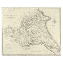
Large Antique County Map of the East Riding of Yorkshire, England
Located in Langweer, NL
Antique map titled 'A Map of the East Riding of Yorkshire from the best Authorities'. Original old county map of the East Riding of Yorkshire, England. Engraved by John Cary. Origina...
Category
Antique Early 19th Century Maps
Materials
Paper
$259 Sale Price
20% Off
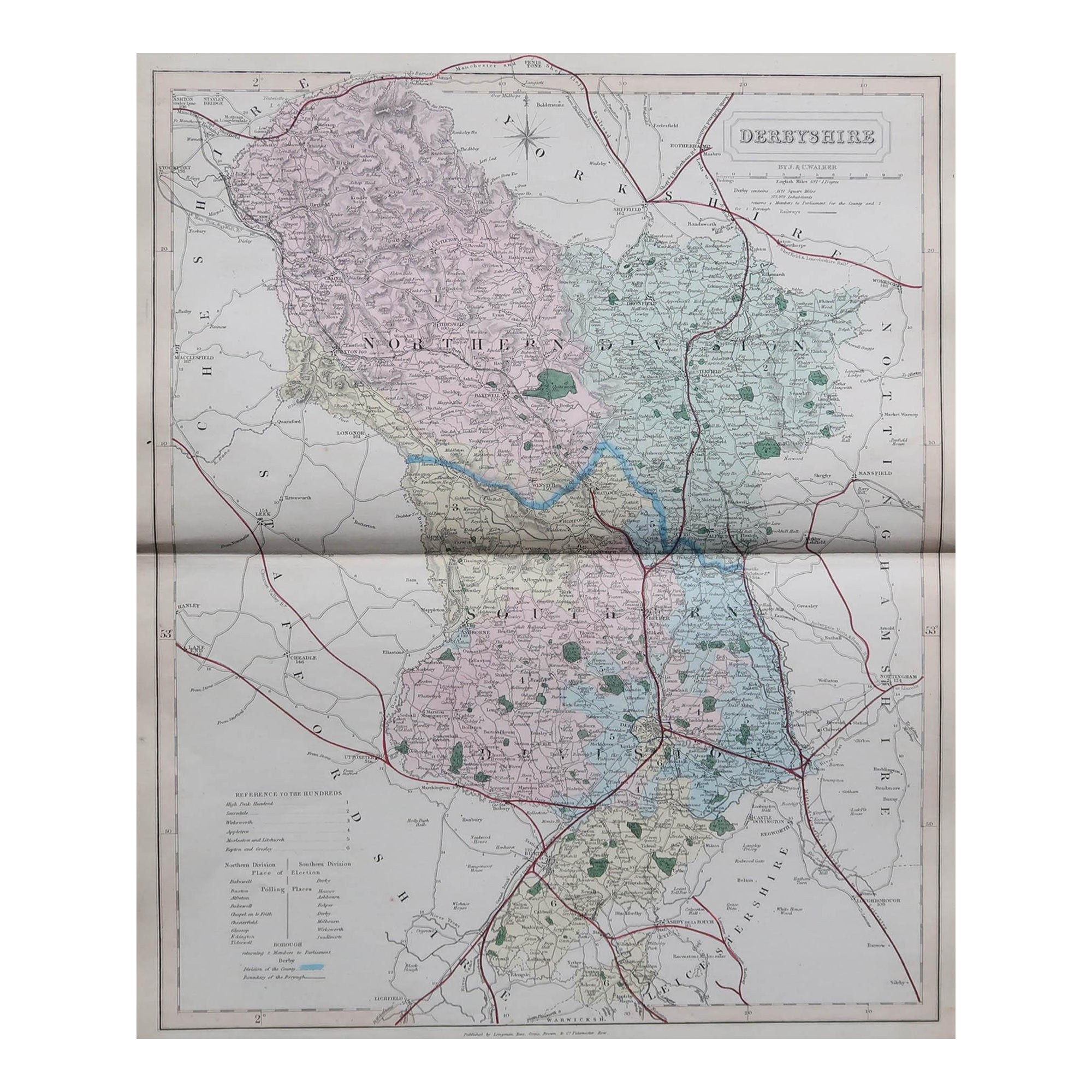
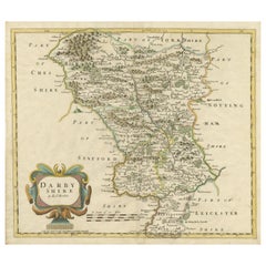
Original Antique County Map of Derbyshire, England
Located in Langweer, NL
Antique map titled 'Darbyshire'. Original antique map of the country of Derbyshire, England. Engraved by Robert Morden. Sold by Abel Swale, Awnsham and John Churchill...
Category
Antique Late 17th Century Maps
Materials
Paper
$509 Sale Price
20% Off
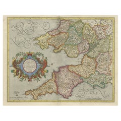
Original Antique Map of the English counties Cornwall, Devon, Dorset, etc, 1633
Located in Langweer, NL
Antique map titled 'Cornubia, Devonia, Somersetus, Dorcestria, Wiltonia, Glocestria, Monumetha, Glamorgan, Caermarden, Penbrok, Cardigan, Radnor, Breknoke et Herfordia'.
Old map of the English counties of Cornwall, Devon, Somerset, Dorset, Wiltshire, Gloucestershire, Herefordshire, Worcestershire etc. Originates from the 1633 German edition of the Mercator-Hondius Atlas Major, published by Henricus Hondius and Jan Jansson under the title: 'Atlas: das ist Abbildung der gantzen Welt, mit allen darin begriffenen Laendern und Provintzen: sonderlich von Teutschland, Franckreich, Niderland, Ost und West Indien: mit Beschreibung der selben.'
Artists and Engravers: Gerard Mercator (1512 - 1594) originally a student of philosophy was one of the most renowned cosmographers and geographers of the 16th century, as well as an accomplished scientific instrument maker. He is most famous for introducing Mercators Projection, a system which allowed navigators to plot the same constant compass bearing on a flat...
Category
Antique 1630s Maps
Materials
Paper
$1,064 Sale Price
20% Off
Original Hand-Colored Antique County Map of Durham, England, 1804
Located in Langweer, NL
Antique county map of Durham first published c.1800. Villages, towns, and cities illustrated include Gateshead, South Shields, and Darlington.
C...
Category
Antique Early 1800s Maps
Materials
Paper
$300 Sale Price
20% Off
Recently Viewed
View AllMore Ways To Browse
Bjorn Wiinblad Glass
Blue Art Deco Armchair
Blue Gold Pillow
Blue Plastic Chairs
Bluish Grey
Book Form Coffee Table
Boucle Bed
Boucle Daybed
Butter Bowl
Butterfly Coffee Table
Campaign Writing Desk
Cast Iron Bench
Charles Eames Red
Chesterfield Antique Chair
Chinese Vintage Crafted Frame
Chippendale Style Desk
Chrome And Brass End Table
Cobalt Plate Flowers