Items Similar to An Original Engraved Plan of the City & Castle of Batavia, The East Indies, 1740


Want more images or videos?
Request additional images or videos from the seller
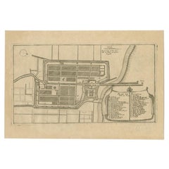
An Original Engraved Plan of the City & Castle of Batavia, The East Indies, 1740
About the Item
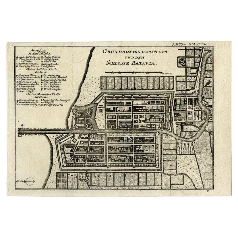
Herman Moll's antique map, "A Plan of the City and Castle of Batavia," crafted in 1740, offers a meticulous portrayal of the bustling city and its fortified castle. Known for his precision and cartographic expertise, Moll presents an intricate view of Batavia, a significant colonial hub in the Dutch East Indies, now Jakarta, Indonesia.
The map was published with Thomas Salmon`s "Modern History: or the Present State of All Nations, published London circa 1740.
This detailed map depicts the city's layout, encompassing its streets, landmarks, harbor, and the formidable fortress of Batavia Castle. Moll's artistry extends to the surrounding topography, highlighting coastal features and neighboring areas. The map provides insight into the city's strategic layout and the interplay between urban architecture and natural elements.
Embellished with fine details and labeled key points, Moll's cartographic masterpiece offers a historical glimpse into Batavia's prominent structures and surroundings during the 18th century. It served as a navigational aid and a reference for traders, navigators, and colonial administrators of that era, encapsulating the city's significance within the context of global trade and colonial expansion. Moll's map endures as both a cartographic gem and a historical artifact, preserving the essence of Batavia's urban landscape from the early 18th century.
Herman Moll, a renowned 18th-century cartographer and engraver, hailed from Germany. Settling in England, he became celebrated for his detailed maps, atlases, and globes. Moll's expertise in cartography extended to depicting regions worldwide, emphasizing accuracy and embellishing his works with artistic flair and geographic precision.
- Dimensions:Height: 12.6 in (32 cm)Width: 16.54 in (42 cm)Depth: 0 in (0.02 mm)
- Materials and Techniques:Paper,Engraved
- Period:1740-1749
- Date of Manufacture:1740
- Condition:Repaired: Two small pieces of archival tape on the reverse to prevent a split. Good condition. Later coloring. Some folding lines from the publication is was taken from and therefor also a short margin on the lower left, but image is intact, and therefor perfect for framing. Study image carefully.
- Seller Location:Langweer, NL
- Reference Number:Seller: BG-13468-41stDibs: LU3054337327622
About the Seller
5.0
Platinum Seller
These expertly vetted sellers are 1stDibs' most experienced sellers and are rated highest by our customers.
Established in 2009
1stDibs seller since 2017
1,956 sales on 1stDibs
Typical response time: <1 hour
- ShippingRetrieving quote...Ships From: Langweer, Netherlands
- Return PolicyA return for this item may be initiated within 14 days of delivery.
More From This SellerView All
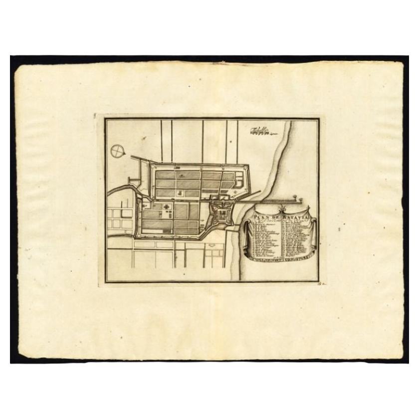
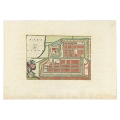
- Antique Plan of Batavia and the Castle in the Dutch East Indies, 1763Located in Langweer, NLAntique map titled 'Grundriss von der Stadt und dem Schlosse Batavia.' Plan of the city and the castle of Batavia in the Dutch East Indies / Indonesia. From 'Algemeine Welthistorie (...Category
Antique 18th Century Maps
MaterialsPaper
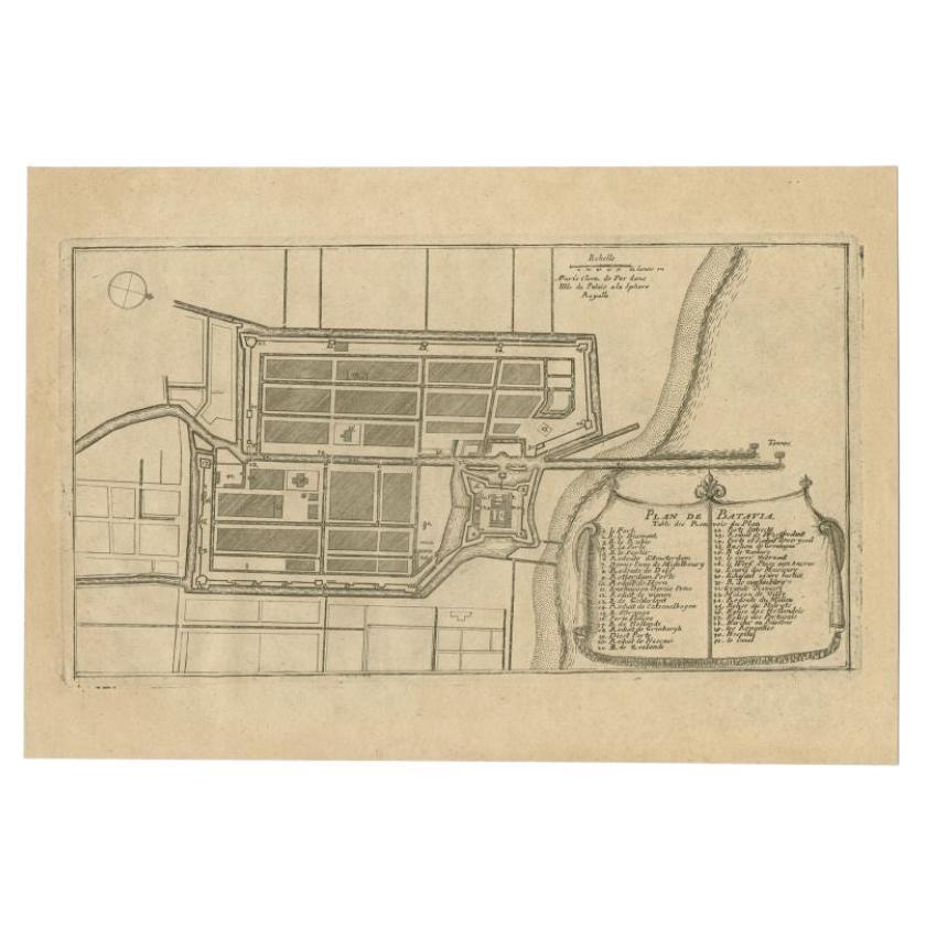
- Antique Plan of Batavia in the Dutch East Indies or Indonesia, circa 1695Located in Langweer, NLAntique print titled 'Plan de Batavia'. Plan of Batavia, Jakarta, Indonesia. Oriented with north to the lower right by a simple compass rose. French title and key cartouche in drape form. Artists and Engravers: Nicolas de Fer...Category
Antique 17th Century Maps
MaterialsPaper
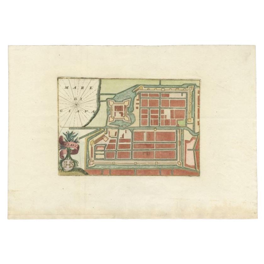
- Antique Plan of Batavia in the Dutch East Indies or Nowadays Jakarta, IndonesiaLocated in Langweer, NLRare plan of Batavia titled 'Batavia'. With 'IHS' monogram, symbolizing Jesus Christ. Source unknown, to be determined. Artists and Enrgavers: Anonymous. Condition: Very good,...Category
Antique 18th Century Maps
MaterialsPaper
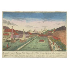
- Rare Print of the Pearl Bastion of Castle Batavia in the Dutch East Indies, 1770Located in Langweer, NLAntique print titled 'Prospect von der Bastion Perl langst der Courtine des Castells Batavia / Vue de la Bastion Perl de Batavie.' View of the Parel Bastion (Pearl Bastion) of Castle...Category
Antique 18th Century Prints
MaterialsPaper
- Antique Plan of Batavia, Capital of the Dutch East Indies, by Van Der Aa, 1725By Pieter Van Der AaLocated in Langweer, NLAntique map titled 'Plan de Batavia'. (Plan of Batavia.) This plate shows a plan of the city of Batavia / Jakarta in Indonesia. With extensive legend, compass rose and scale. This pl...Category
Antique 18th Century Maps
MaterialsPaper
- Original Old Map of the Environs of Batavia in the Dutch East Indies (Indonesia)Located in Langweer, NLAntique map titled 'Carte des Environs de Batavia'. Map of the environs of Batavia (now Jakarta), Indonesia. This print originates from volume 8 of 'Histoire générale des voyages'. P...Category
Antique Mid-18th Century Maps
MaterialsPaper


You May Also Like
- Original Antique City Plan of Kansas City, USA. 1894By Rand McNally & Co.Located in St Annes, LancashireFabulous colorful map of Kansas City Original color By Rand, McNally & Co. Published, 1894 Unframed Slightly reduced bottom margin. Free shipping.Category
Antique 1890s American Maps
MaterialsPaper
- Original Antique City Plan of Milwaukee, USA, 1894By Rand McNally & Co.Located in St Annes, LancashireFabulous colorful map of Milwaukee Original color By Rand, McNally & Co. Published, 1894 Unframed Free shipping.Category
Antique 1890s American Maps
MaterialsPaper
- Catalogue of Engraved Views, Plans, Etc., Of New York City, 1st EdLocated in valatie, NYA catalogue of engraved views, plans, etc., Of New York City, (The Collection of Percy R. Pyne II). Privately Printed by The De Vinne Press, New York, 1912. Limited to 100 copies. Gr...Category
Early 20th Century American Books
MaterialsPaper
- Large Original Antique City Plan of Baltimore, USA, 1894By Rand McNally & Co.Located in St Annes, LancashireFabulous colorful map of Baltimore Original color By Rand, McNally & Co. Published, 1894 Unframed Free shipping.Category
Antique 1890s American Maps
MaterialsPaper
- Large Original Antique City Plan of Detroit, USA, 1894By Rand McNally & Co.Located in St Annes, LancashireFabulous colorful map of Detroit Original color By Rand, McNally & Co. Published, 1894 Unframed Free shipping.Category
Antique 1890s American Maps
MaterialsPaper
- Utrecht city planLocated in UTRECHT, UT“Platte grond der Stad Utrecht vertonende alle Gragten, Straaten, Stegen, Gangen, Markten, en plaatsen der openbare Gebouwen”, engraving published by Johannes van Schoonhoven in Amst...Category
Antique 1770s Dutch Other Maps
MaterialsPaper


Recently Viewed
View AllMore Ways To Browse
Antique Map Of North And East Asia 1751
Map Of Mississippi
Bedfordshire Antique Map
Auge En Pierre
Covens & Mortier On Sale
Larousse Universel
Staffordshire Antique Map
Staffordshire Map
Tam Austria
Antique Furniture Manitoba
Nova Hollandia
William Wyld
Matthew Seutter On Sale
Menorca Map
Pierre Fran�ois Tardieu On Sale
Rand Mcnally Map Of Kansas
Sumba Map
1681 Moses Pitt