Original Map of Boston
View Similar Items


Want more images or videos?
Request additional images or videos from the seller
1 of 6
Original Map of Boston
About the Item
- Dimensions:Height: 31 in (78.74 cm)Width: 42 in (106.68 cm)Depth: 2 in (5.08 cm)
- Materials and Techniques:
- Period:
- Date of Manufacture:1900
- Condition:
- Seller Location:Norwell, MA
- Reference Number:Seller: 1028180291stDibs: LU1741212723971
About the Seller
5.0
Vetted Professional Seller
Every seller passes strict standards for authenticity and reliability
Established in 1967
1stDibs seller since 2015
397 sales on 1stDibs
Typical response time: 2 hours
Authenticity Guarantee
In the unlikely event there’s an issue with an item’s authenticity, contact us within 1 year for a full refund. DetailsMoney-Back Guarantee
If your item is not as described, is damaged in transit, or does not arrive, contact us within 7 days for a full refund. Details24-Hour Cancellation
You have a 24-hour grace period in which to reconsider your purchase, with no questions asked.Vetted Professional Sellers
Our world-class sellers must adhere to strict standards for service and quality, maintaining the integrity of our listings.Price-Match Guarantee
If you find that a seller listed the same item for a lower price elsewhere, we’ll match it.Trusted Global Delivery
Our best-in-class carrier network provides specialized shipping options worldwide, including custom delivery.More From This Seller
View All1891 Map of South Shore of Boston
Located in Norwell, MA
Original 1891 map showing Cohasset, Scituate, Marshfield, Duxbury, Kingston, Norwell, Hanover, Hingham, Hull, Holbrook, Weymouth, Hanson, Pembroke, etc. Framed with glass. Circa 1891.
Category
Antique 1890s North American Prints
Materials
Paper
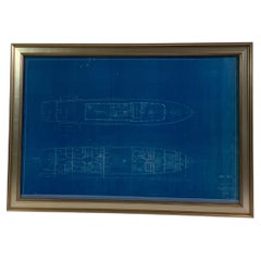
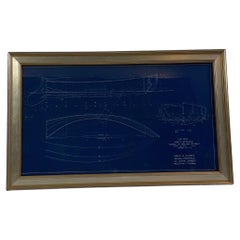
Original Yacht Blueprint P-201-2 by John Wells
Located in Norwell, MA
Original blueprint of a one hundred foot yacht by John Wells Incorporated of New York. The plan is a top view showing the top deck and cabin level. The top deck shows dining saloon, pilot house...
Category
Vintage 1940s Nautical Objects
Materials
Paper
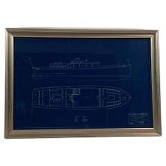
Original Blueprint for the Sailing Dingy “Burp” by John Alden
Located in Norwell, MA
Blueprint from John G Alden, naval architect, 131 State St, Boston. Plan is for No. 559, a class A sailing dingy named "Dunk.” Showing all hull lines in great detail. Rich blue color...
Category
Vintage 1930s Nautical Objects
Materials
Paper
Original 1891 Walker Map
Located in Norwell, MA
Original 1891 map of Massachusetts by Walker. Towns include Cambridge, Boston, Dedham, Ashland, Brookline, Newton etc... burl wood frame. Measures...
Category
Antique 19th Century Maps

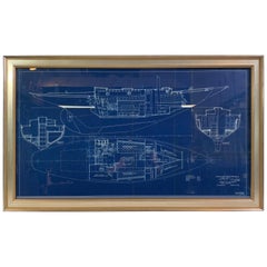
Yacht Blueprint of a Fifty Foot Yacht by Howard Chapelle
Located in Norwell, MA
Original blueprint drawing of a fifty foot "Express Cruiser" from the workshop of Eldredge-McInnis Inc. of Boston, Massachusetts. Interesting design...
Category
Vintage 1930s American Nautical Objects
Materials
Paper
John Alden Blueprint No. 583 of an Auxiliary Cruising Yawl
Located in Norwell, MA
Exceptional and stunning original yacht blueprint from John G Alden of Boston. The legend panel reads “Auxiliary Cruising Yawl” cabin plan. March 21, 1934. C.A. Alberg John G. Alden ...
Category
Vintage 1930s Nautical Objects
Materials
Paper
You May Also Like
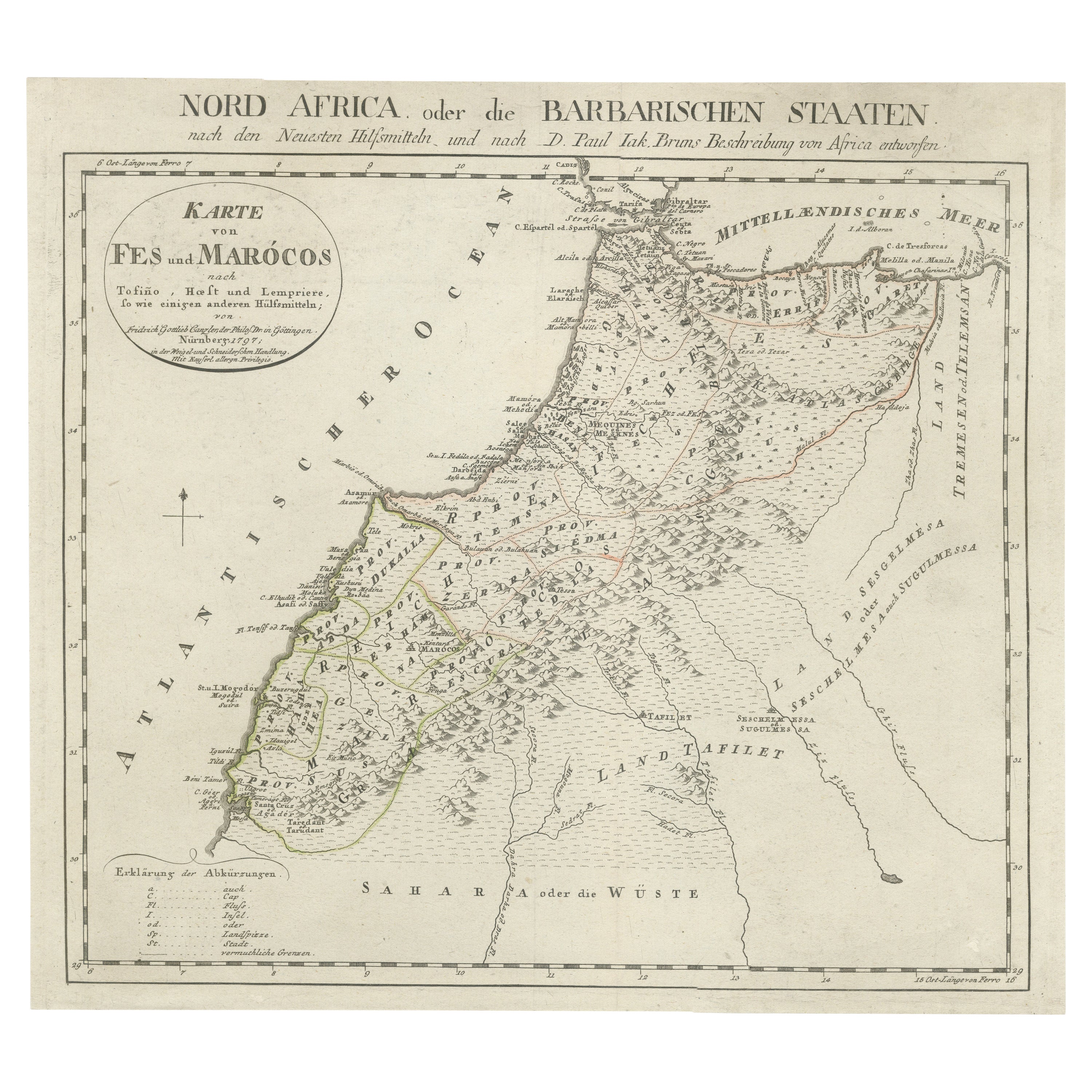
Original Antique Map of Africa
Located in Langweer, NL
Antique map titled 'Afrika'. Original antique map of Africa, drawn by Van Beusekom. Published by 'Seyffardt's Boekhandel' in Amsterdam, circa 1870.
Category
Antique Late 19th Century Maps
Materials
Paper

$314 Sale Price
20% Off
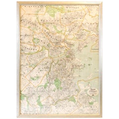
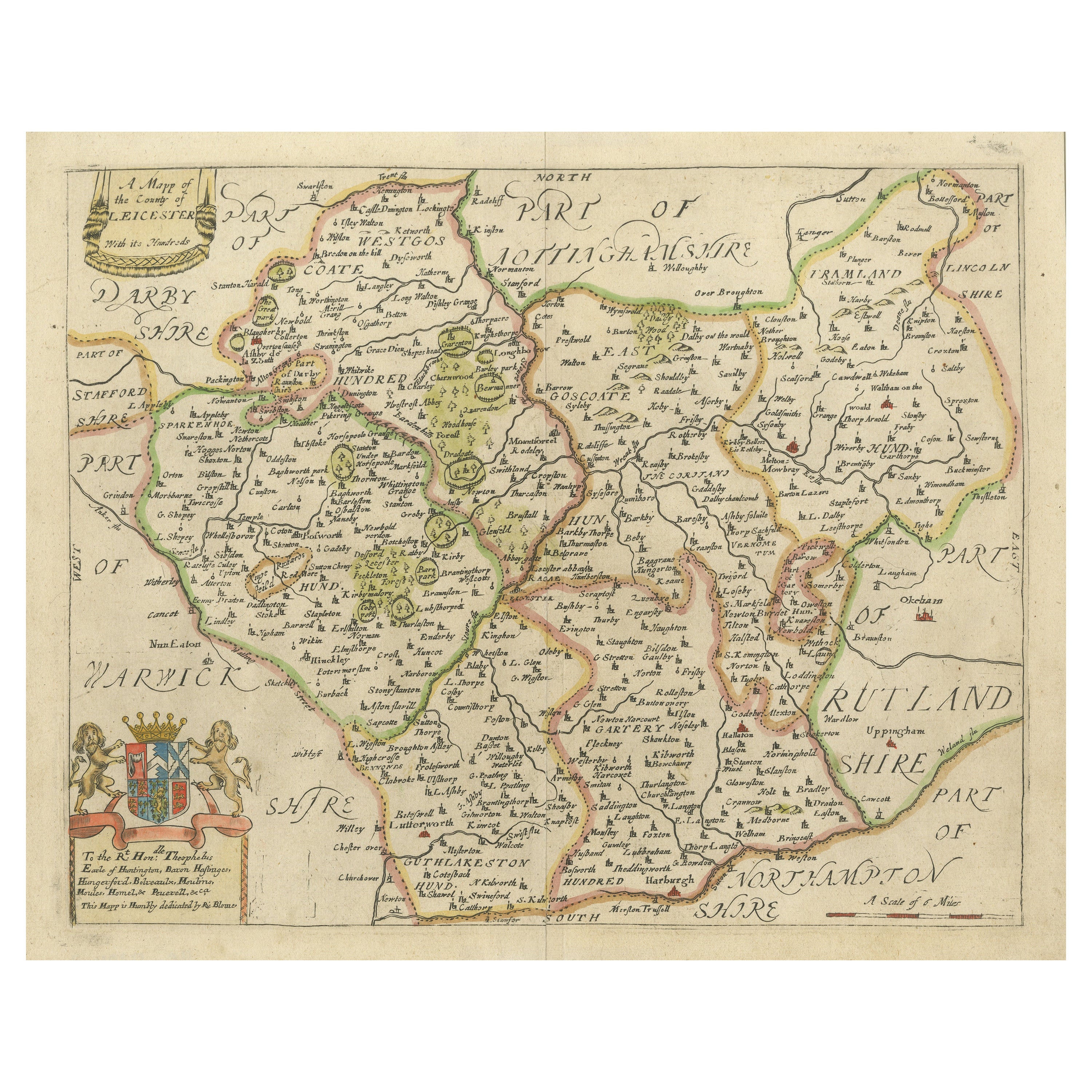
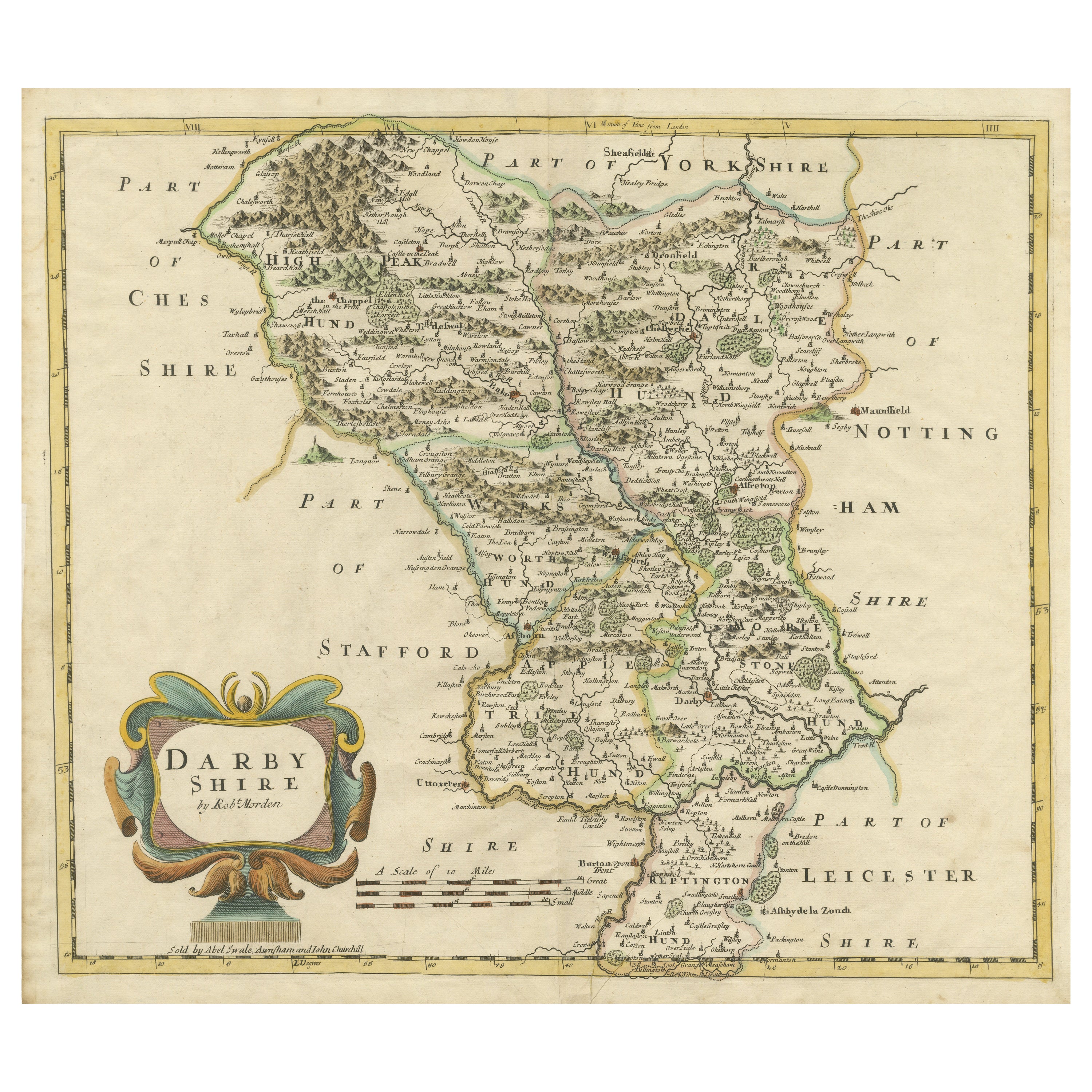
Original Antique Map of Leicestershire, England
Located in Langweer, NL
Antique map titled 'A Mapp of the Country of Leicester'. Original old map of Leicestershire, England. This map originates from 'Britannia: or, a Geographical Description of the Kingd...
Category
Antique Late 17th Century Maps
Materials
Paper
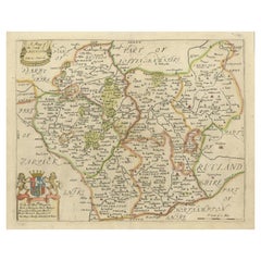
$407 Sale Price
20% Off
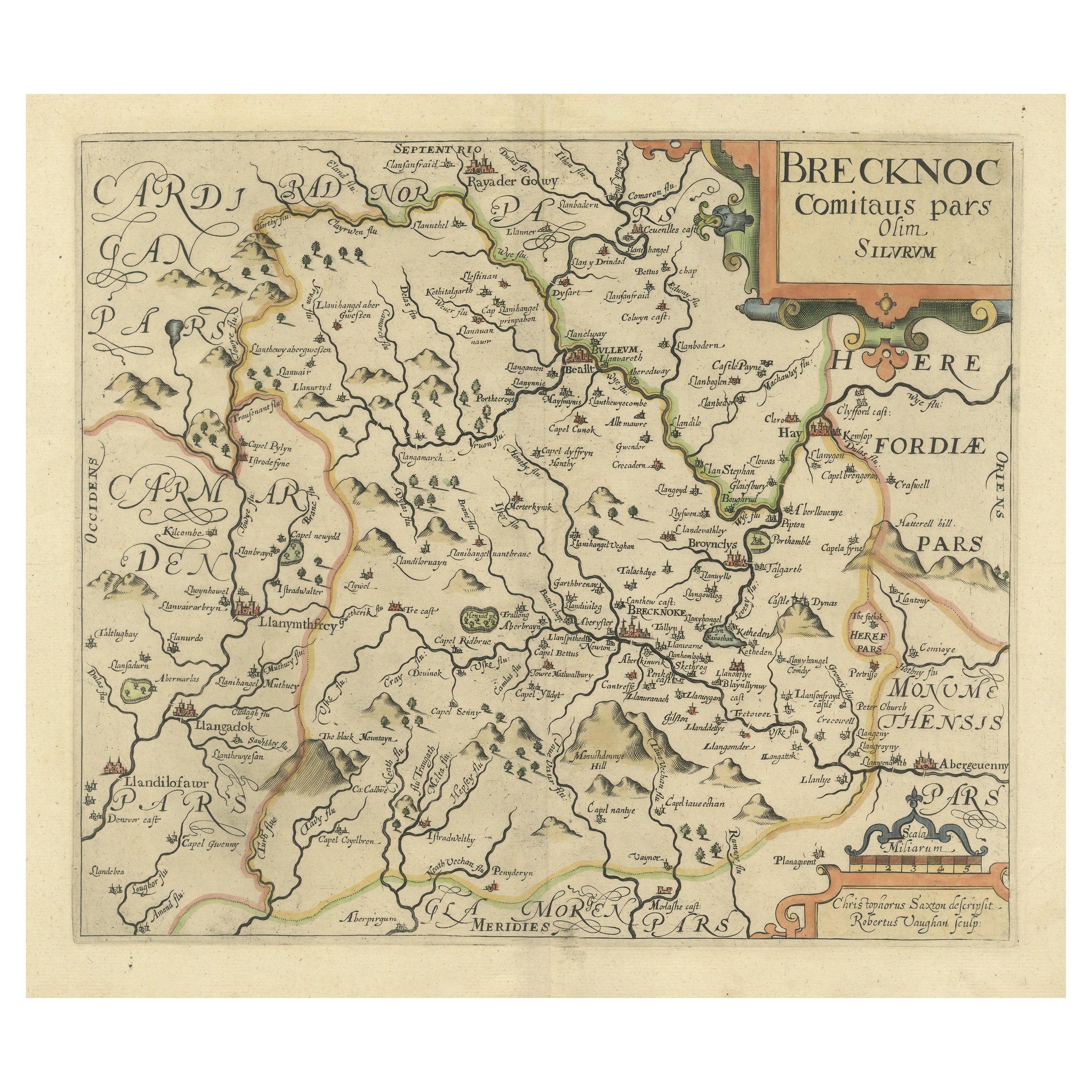
Original Antique Map of Brecknockshire, Wales
Located in Langweer, NL
Antique map titled 'Brecknoc comitaus pars olim silurum'. Original old map of Brecknockshire, Wales. Engraved by R. Vaughan after Christopher Saxton. Published circa 1640.
Category
Antique Mid-17th Century Maps
Materials
Paper
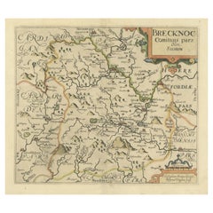
$407 Sale Price
20% Off
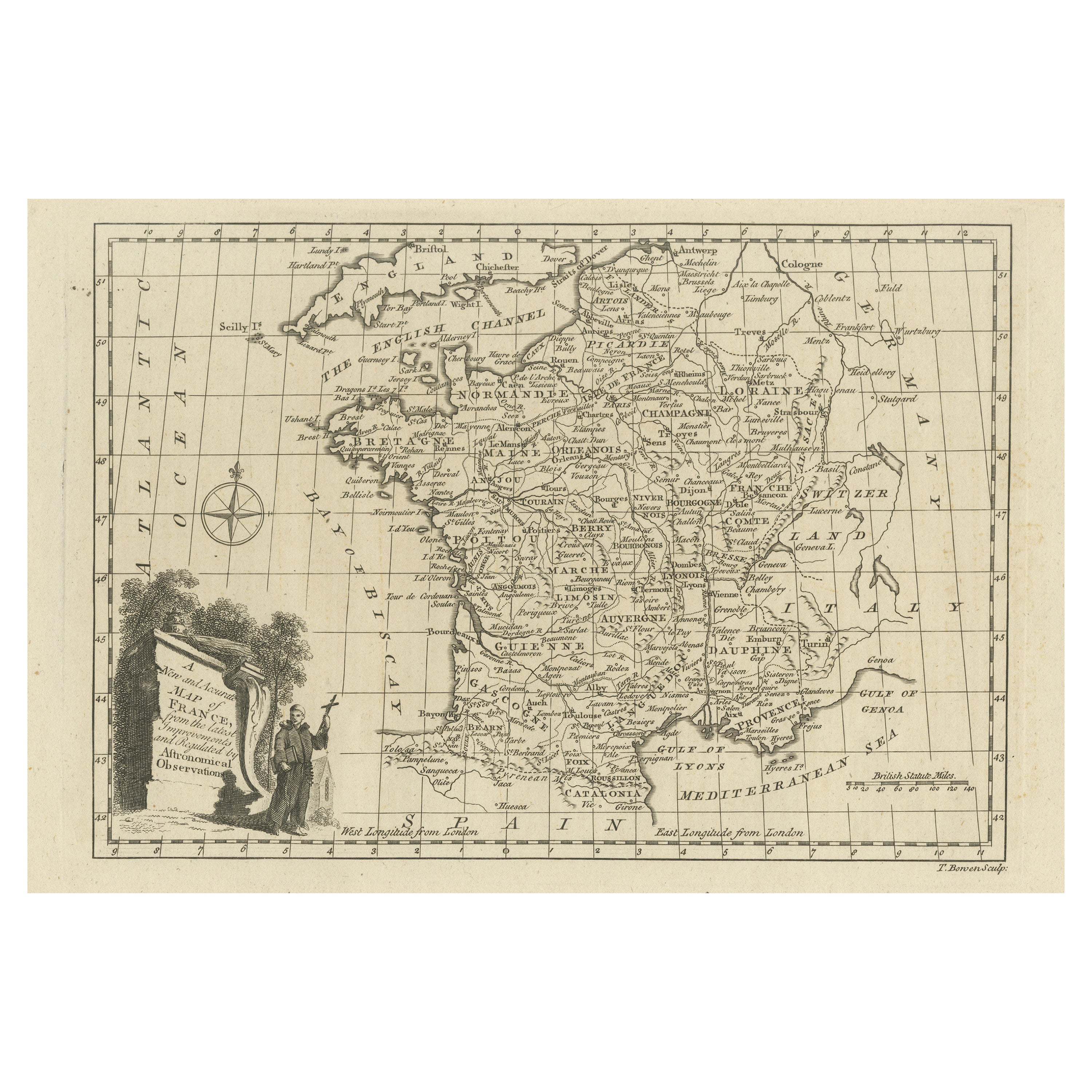
Original Copper Engraved Map of France
Located in Langweer, NL
Antique map titled 'New and Accurate Map of France from the latest improvements'. Original copper engraved map of France. Engraved by T. Bowen, published circa 1771.
Category
Antique Late 18th Century Maps
Materials
Paper

$314 Sale Price
20% Off
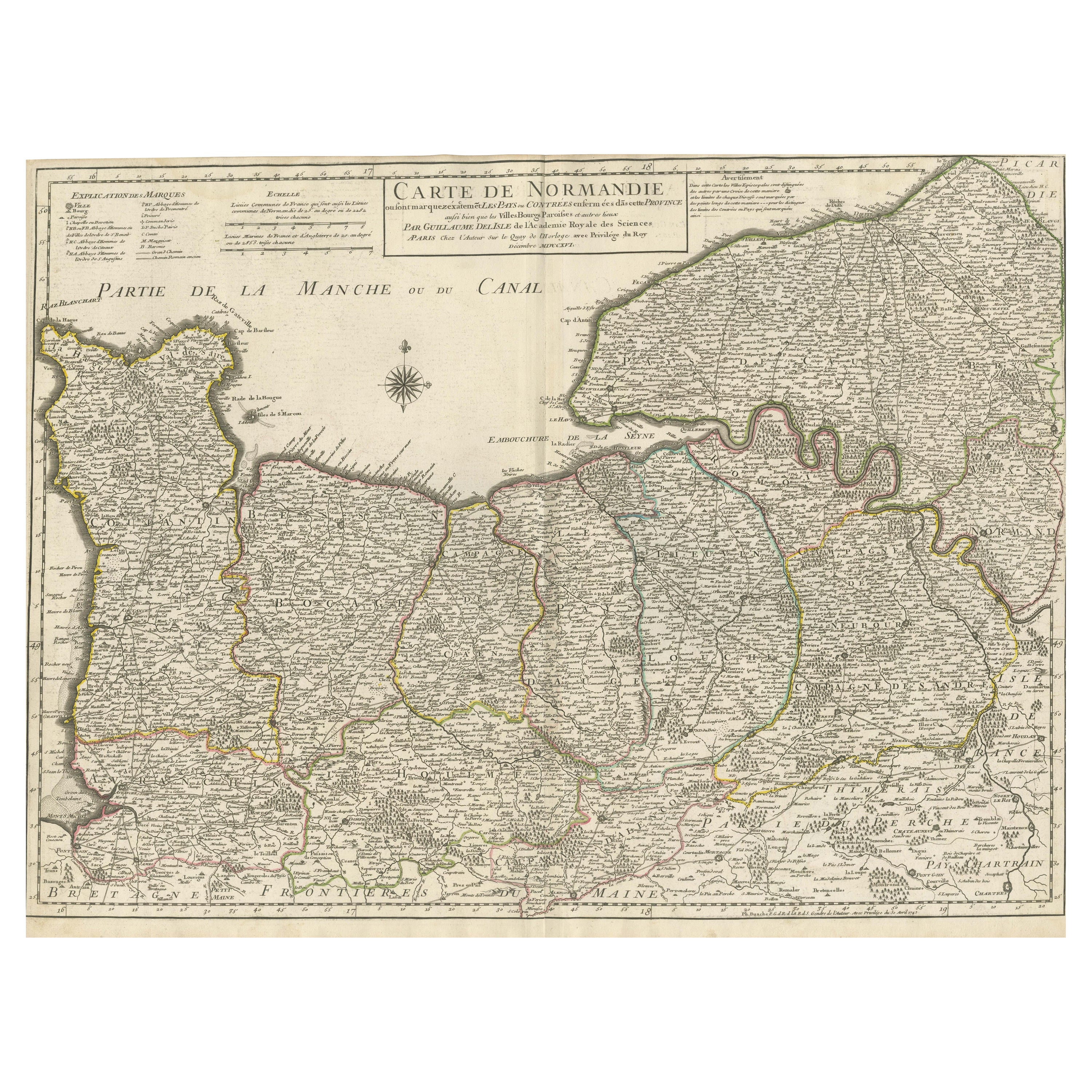
Original Antique Map of Normandy, France
Located in Langweer, NL
Antique map titled 'Carte de Normandie (..)'. Attractive map of Normandy, France. it depicts the former French Duchy of Normandy, covers the region fro...
Category
Antique Mid-18th Century Maps
Materials
Paper
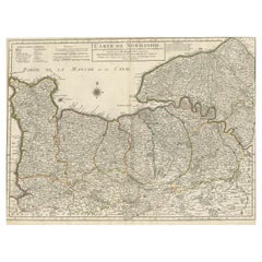
$731 Sale Price
20% Off
Original Antique Map of Northern India
By Jakob van der Schley
Located in Langweer, NL
Antique map titled 'Carte de l'Indoustan (..) - Kaart van Hindoestan (..)'. Original antique map of northern India. This map originates from 'His...
Category
Antique Mid-18th Century Maps
Materials
Paper

$203 Sale Price
20% Off