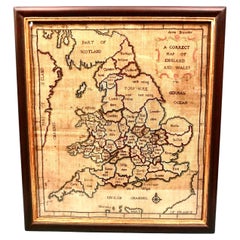
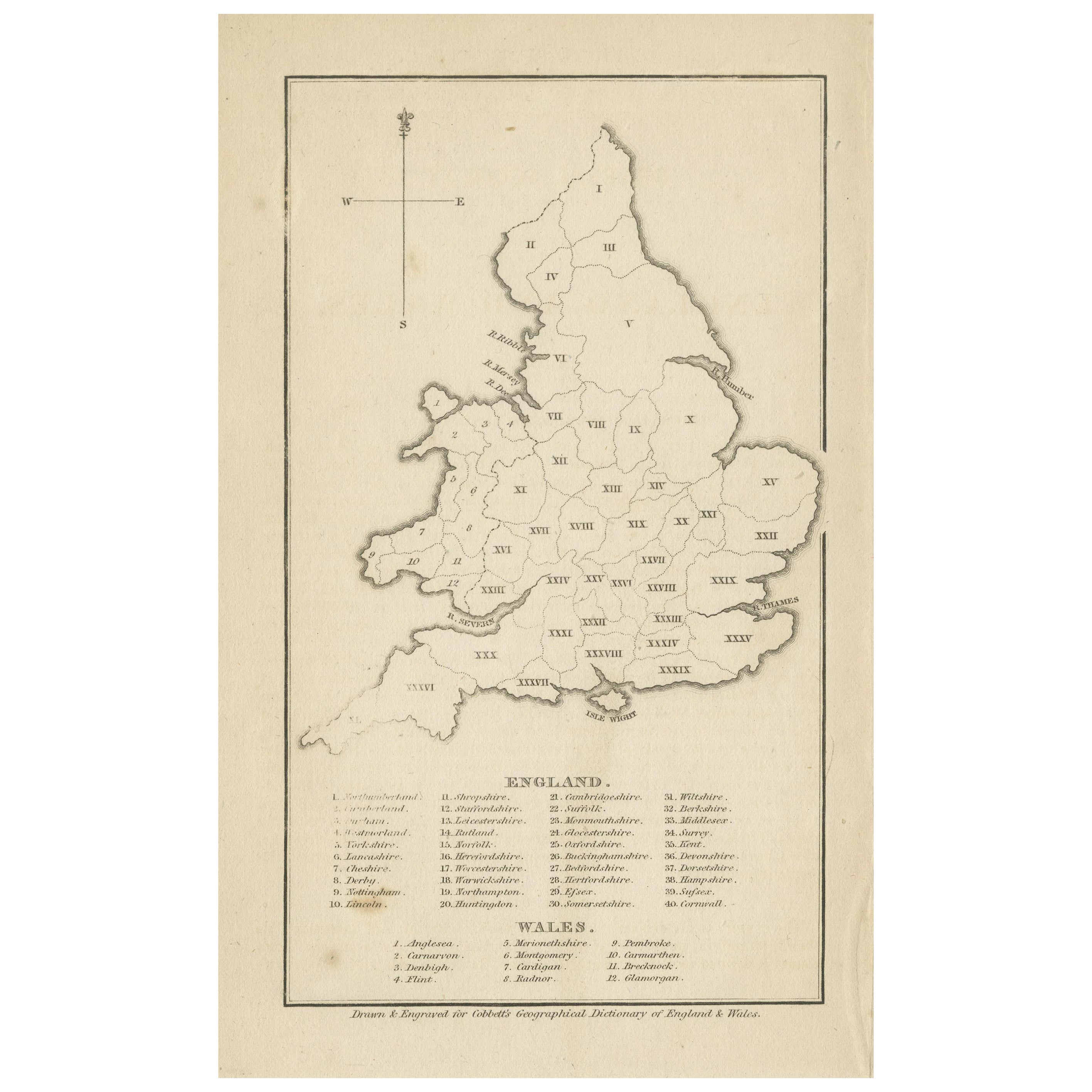
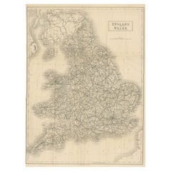
Silk Needlework Map of England and Wales Signed Anna Brewster Dated 1783
View Similar Items


Want more images or videos?
Request additional images or videos from the seller
1 of 13
Silk Needlework Map of England and Wales Signed Anna Brewster Dated 1783
About the Item
- Dimensions:Height: 24.5 in (62.23 cm)Width: 21.5 in (54.61 cm)Depth: 1.5 in (3.81 cm)
- Style:Georgian (Of the Period)
- Materials and Techniques:Canvas,Silk
- Place of Origin:
- Period:
- Date of Manufacture:1783
- Condition:Wear consistent with age and use. Minor structural damages. Minor fading.
- Seller Location:San Francisco, CA
- Reference Number:Seller: C323-131stDibs: LU855233930332
About the Seller
5.0
Recognized Seller
These prestigious sellers are industry leaders and represent the highest echelon for item quality and design.
Platinum Seller
These expertly vetted sellers are 1stDibs' most experienced sellers and are rated highest by our customers.
Established in 1982
1stDibs seller since 2008
312 sales on 1stDibs
Typical response time: 1 hour
Associations
The Art and Antique Dealers League of AmericaAntiques Associations Members
More From This SellerView All
- Scarce U.S. Coast Survey Map Depicting Entrance to San Francisco Bay Dated 1856Located in San Francisco, CAA fine example of the 1856 U.S. Coast lithographic survey nautical chart of the entrance to San Francisco bay and the city. Published in 1856 by the Office of the Coast Survey the of...Category
Antique Mid-19th Century American Maps
MaterialsPaper
 $1,036 Sale Price30% Off
 - Signed 19th Century Mahogany and Brass Telescope on Custom Oak Wall MountLocated in San Francisco, CAAn English mahogany and brass single draw telescope made and signed by William Bruce, Kings Head Court Shoe Lane London, circa 1830. This handsom...Category
Antique 1830s English Georgian Scientific Instruments
MaterialsBrass
- Letters of the Earl of Chesterfield to His Son in 4 Volumes Published 1787Located in San Francisco, CAEarl of Chesterfield's letters to his son and luminaries of the day in 4 volumes in their original full leather bindings, published London J. Dodsley 1787. The spines have raised ban...Category
Antique Late 18th Century English George III Books
MaterialsPaper, Leather
- Works of Alexander Pope Leatherbound in 9 Volumes Published 1757Located in San Francisco, CAA handsome set of the works of Alexander Pope (1688-1744) the famous English satirist and poet. Pope suffered various health issues throughout his life but with a fierce spirit and work ethic managed to produce a large volume of significant work. The volumes appear to retain their original full calf...Category
Antique Mid-18th Century English Georgian Books
MaterialsLeather, Paper
- Extraordinary and Unique Model of a Japanese Tea HouseLocated in San Francisco, CAA wonderful Japanese model of a traditional tea house, each room with latticework sliding doors, tatami mats and miniature decorations hanging on the walls,...Category
Antique 19th Century Japanese Architectural Models
MaterialsStraw, Wood, Paper
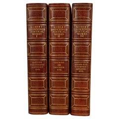
- The Poetic and Dramatic Works of Robert Browning Bound in Leather and ClothLocated in San Francisco, CAAn attractive leather bound set of the poetic and dramatic works of Robert Browning (1812-1889) published in 1906 by Houghton Mifflin and Company, New York and Boston. Top edges gilt...Category
Early 20th Century American Books
MaterialsLeather, Paper


You May Also Like
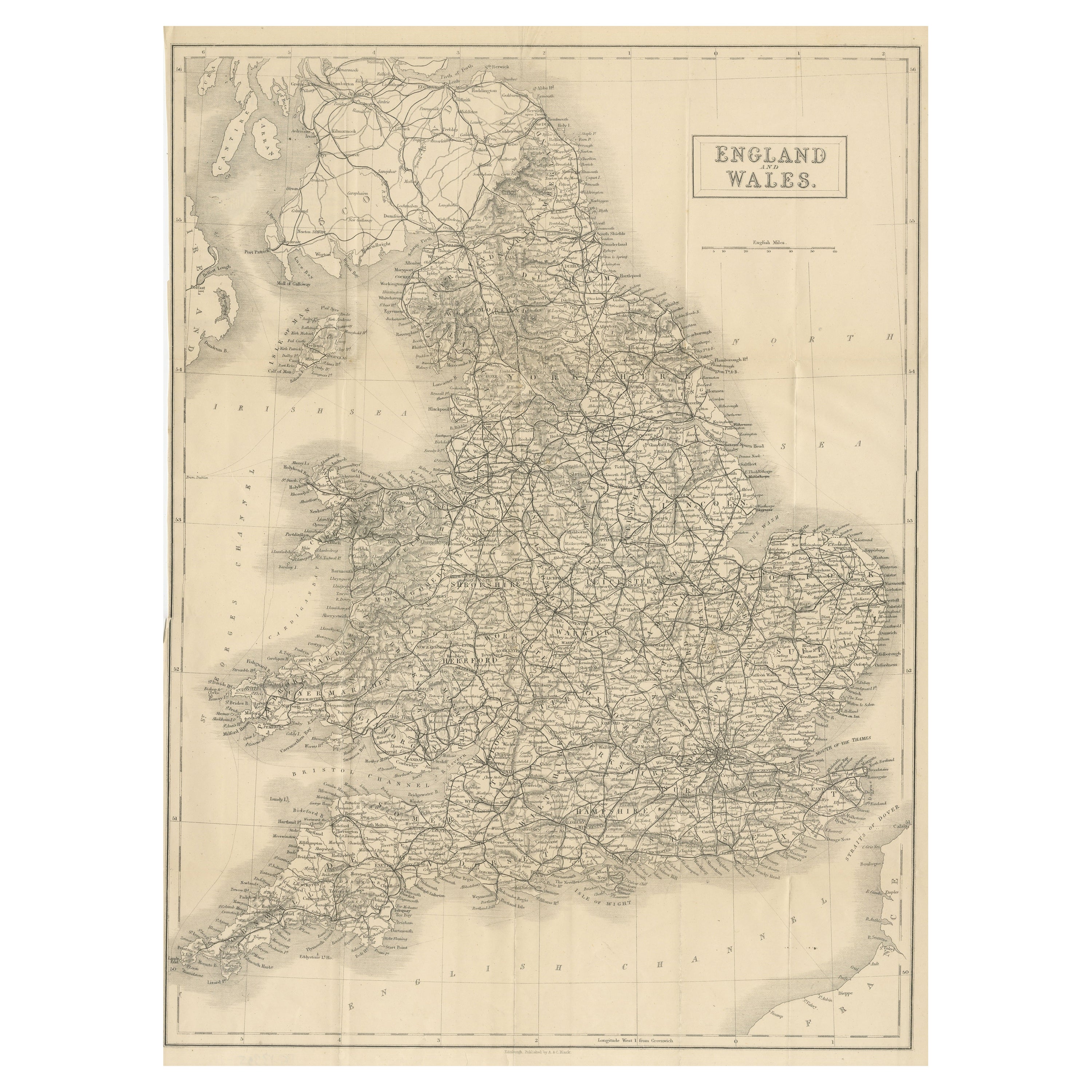
- Large Antique Map of England and WalesLocated in Langweer, NLAntique map titled 'An Accurate Map of England and Wales'. Original old map of England and Wales. Engraved by John Cary. Originates from 'New British Atlas' by John Stockdale, publis...Category
Antique Early 19th Century Maps
MaterialsPaper
- Miniature Antique Map of England and WalesLocated in Langweer, NLMiniature map titled 'England & Wales'. Original antique map of England & Wales. This map originates from 'Darton's New Miniature Atlas' publis...Category
Antique Early 19th Century Maps
MaterialsPaper
- Lithographed Antique Map of England and WalesLocated in Langweer, NLOriginal antique map titled 'Map XXIII England & Wales'. Lithographed map of England and Wales. Published by Fisk & See, circa 1890.Category
Antique Late 19th Century Maps
MaterialsPaper
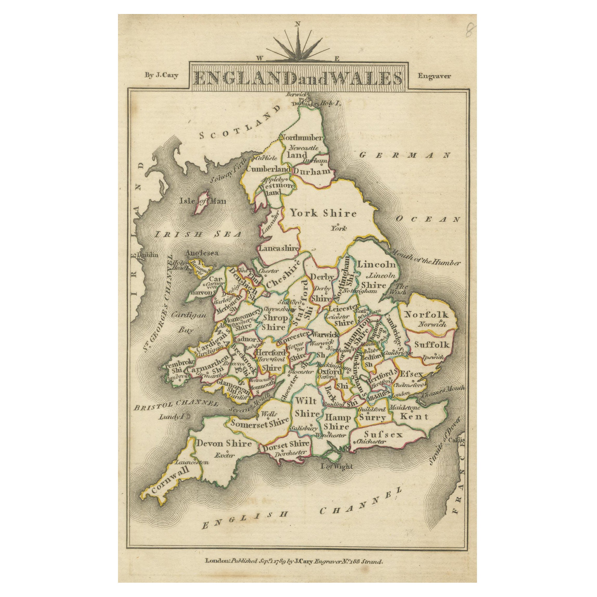
- Original Antique Map of England and WalesLocated in Langweer, NLAntique map titled 'A New and Correct Map of England and Wales from the Latest and Best Improvements'. Original antique map of England and Wales. Printed by Alex Hogg, London for George Henry Millar's 'New, Complete and Universal System...Category
Antique Late 18th Century Maps
MaterialsPaper
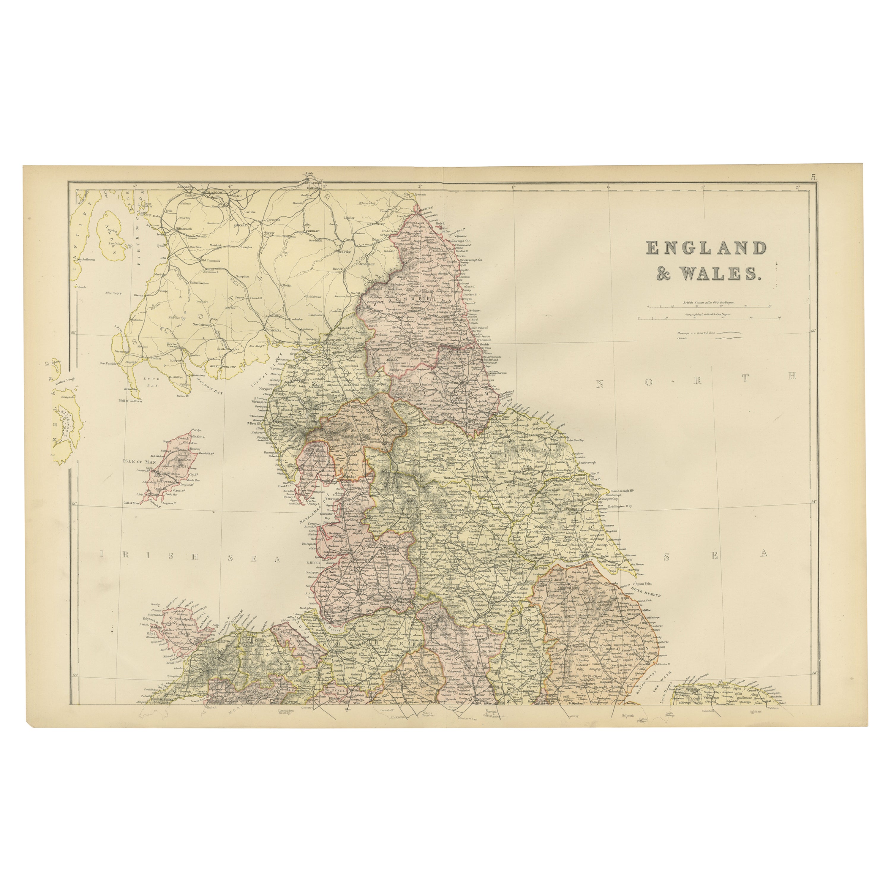
- Antique Folding Map of England and WalesLocated in Langweer, NLAntique map titled 'England and Wales'. Original folding map of England and Wales. Publishes by A. & C. Black, circa 1890.Category
Antique Late 19th Century Maps
MaterialsPaper
- Antique Map of England and Wales by Johnson '1872'Located in Langweer, NLAntique map titled 'Johnson's England and Wales'. Original map of England and Wales. This map originates from 'Johnson's New Illustrated Family Atlas of the World' by A.J. Johnson. P...Category
Antique Late 19th Century Maps
MaterialsPaper


Recently Viewed
View AllMore Ways To Browse
Antique Needlework
Silk Girl
Antique By Anna
Scottish Georgian
Samplers Antique
Antique Samplers
Antique Samplers Samplers
Sampler Antique
Antique Framed Sampler
Silk Sampler
Antique Maps Wales
Antique Map Of Wales
Antique Maps Of Wales
Antique Ireland Maps
Antique Ireland Map
Antique Irish Map
Antique Maps Ireland
Antique Map Ireland