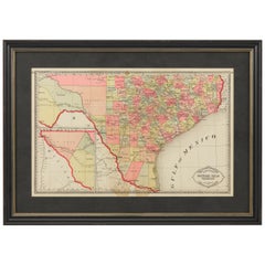
"Tunison's Southern Texas" by H.C. Tunison, circa 1885
View Similar Items


Want more images or videos?
Request additional images or videos from the seller
1 of 5
"Tunison's Southern Texas" by H.C. Tunison, circa 1885
About the Item
- Dimensions:Height: 19 in (48.26 cm)Width: 26.5 in (67.31 cm)Depth: 2 in (5.08 cm)
- Period:
- Date of Manufacture:1885
- Condition:Wear consistent with age and use.
- Seller Location:Colorado Springs, CO
- Reference Number:Seller: M2491stDibs: LU909713033222
About the Seller
4.9
Platinum Seller
These expertly vetted sellers are 1stDibs' most experienced sellers and are rated highest by our customers.
Established in 2010
1stDibs seller since 2011
402 sales on 1stDibs
More From This SellerView All
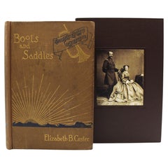
- Boots and Saddles by Elizabeth B. Custer, First Edition, 1885Located in Colorado Springs, COCuster, Elizabeth B. Boots and Saddles, Or Life in Dakota with General Custer. New York: Harper & Brothers, 1885. First edition. Octavo. Embossed brown cloth front boards with gilt a...Category
Antique 1880s American Books
MaterialsLeather, Paper
- 1908 "Map of Texas" by The Kenyon CompanyLocated in Colorado Springs, COPresented is an antique map of the state of Texas, printed as a pocket map in 1908 by The Kenyon Company. The state map is brightly colored by county, with principal cities and towns listed. The congressional districts are numbered and boldly outlined in red. Rivers, roads, and railroads all appear prominently on this fantastic map...Category
Antique Early 1900s American Maps
MaterialsPaper
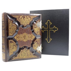
- The Holy Bible, Standard Edition, Illustrated Family Bible, 1885Located in Colorado Springs, COThe “Standard” Edition of The Holy Bible, Containing the Old and New Testaments and Apocrypha, Translated out of the Original Tongues, Together with Cruden’s Complete Concordance… and Revised New Testament, with Many Other Important and Useful Aids to the Study of the Holy Scriptures, All Written to Increase the Interest in and Simplify the Study of the Word of God. Syracuse: Bible Publishing House, 1885. Standard Edition. Illustrated with steel and wood engravings and chromolithographs. Large quarto, with original full leather carved and gilded boards. Gilded edges and pewter clasps. Presented with a custom-made archival clamshell box. Presented is a beautifully restored and exquisitely bound Holy Bible from 1885. This family bible was published by the Bible Publishing House, in Syracuse, New York. It contains both the Old and New Testaments, and the Apocrypha and Cruden’s Complete Concordance. It also boasts 100,000 marginal references and readings, Dr. William Smith’s “Standard Bible Dictionary,” a complete history of all the books of the bible, biblical scenery, and “Manners and Customs of the Ancients.” For studying, it includes “Bible Aids for Social and Private Prayer,” the history of translation of the bible, a history of all religious denominations, “Psalms in Meter,” and a “Teachers’ Bible Textbook.” It is decorated with stunning full and half page illustrations, printed as steel engravings, wood engravings, and chromolithographs, illustrating scenes in the life of Christ, bible text events from Genesis to Revelation, natural history, and several maps of the Holy Land engraved by L.B Folger. It also contains a stunning dedication page, a marriage license...Category
Antique 1880s American Late Victorian Books
MaterialsLeather, Paper
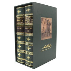
- Personal Memoirs of U. S. Grant, Two-Volume Set, 1885-86Located in Colorado Springs, COGrant, Ulysses S., Personal Memoirs of U.S. Grant. New York: Charles L. Webster and Co., 1885-1886. Two volume set. Octavo, beautifully rebound in quarter green leather and cloth boa...Category
Antique 1880s American Books
MaterialsLeather, Paper
- 1847 Antique Map of Mexico, Texas and California by Samuel Augustus MitchellBy Samuel Augustus Mitchell 1Located in Colorado Springs, COPresented is the second edition of Samuel Augustus Mitchell's Map of Mexico, Including Yucatan & Upper California, an important map showing the progress of the Mexican-American War. ...Category
Antique 1840s American Maps
MaterialsPaper
- 1859 "Colton's New Map of the State of Texas..." by Johnson & BrowningLocated in Colorado Springs, COPresented is "Colton's New Map of the State of Texas Compiled from De Cordova's Large Map", published in Alivin J. Johnson’s “New Illustrated Family Atlas.” The map was published in ...Category
Antique 1850s American Maps
MaterialsPaper


You May Also Like
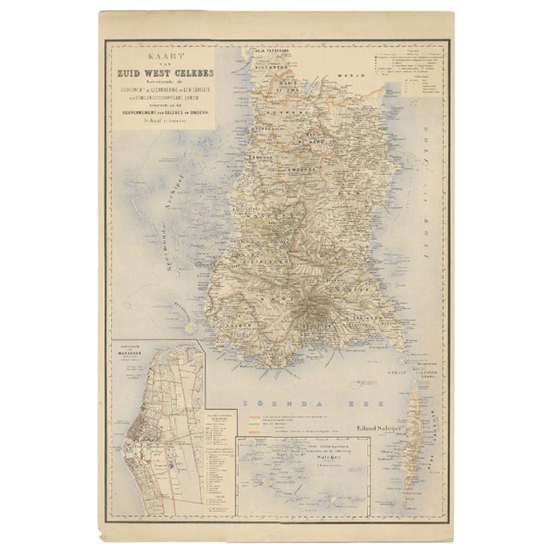
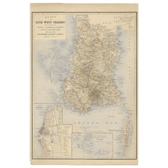
- Antique Map of Southern Sulawesi by Stemfoort, 1885Located in Langweer, NL"Antique map titled 'Kaart van Zuid West Celebes'. Old map of the southern tip of the southwestern part of Sulawesi. Includes a large inset map of the Makassar area, centered on Fort...Category
Antique 19th Century Maps
MaterialsPaper
- Antique Map of Southern Italy by J. Tallis, circa 1851Located in Langweer, NLDecorative and detailed mid-19th century map of Southern Italy which was drawn and engraved by John Rapkin (vignettes by A. H. Wray and J. Rogers...Category
Antique Mid-19th Century Maps
MaterialsPaper
 $241 Sale Price20% Off
 - Texas Made/Texas ModernBy PhaidonLocated in New York City, NYA compelling survey of Texas houses that draw both on the heritage of pioneer ranches and on the twentieth-century design principles of modernism. Helen Thompson and Casey Dunn, the writer/photographer team that produced the exceptionally successful Marfa Modern, join forces again to investigate Texas modernism. The juxtaposition of the sleek European forms with a gritty Texas spirit generated a unique brand of modernism that is very basic to the culture of the state today. Its roots are in the early Texas...Category
2010s Chinese Books
MaterialsPaper
 $50 / item
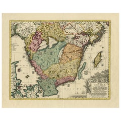
 - Antique Map of Southern Sweden by Covens & Mortier, 'circa 1720'Located in Langweer, NLAntique map titled 'Regni Gothiae (..)'. Detailed map of South Sweden. Embellished with beautiful title cartouche with scale and coats of arms. Published in Amsterdam by Covens & Mor...Category
Antique Early 18th Century Maps
MaterialsPaper
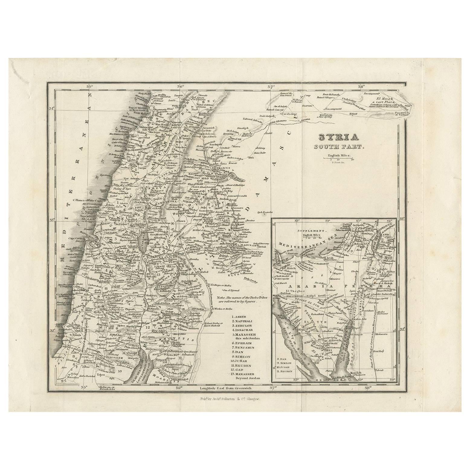
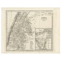
- Antique Map of Southern Syria by Fullarton & Co, circa 1860Located in Langweer, NLAntique map titled 'Syria south part'. Published by Fullarton & Co, Glasgow, circa 1860. - **Title**: Syria South Part - **Publisher**: Fullarton & Co, Glasgow - **Date of Publicati...Category
Antique Mid-19th Century Maps
MaterialsPaper
- Antique Map of Southern Germany by F. de Wit, circa 1680Located in Langweer, NLThis antique map depicts a portion of southern Germany that included the historic regions of Bavaria, the Palatinate, Prussia-Brandenburg, the Rhineland and Saxony. Regensberg, Freis...Category
Antique Late 17th Century Maps
MaterialsPaper
 $610 Sale Price20% Off
Recently Viewed
View AllMore Ways To Browse
Railroad Collectibles
Antique Map Mexico
Antique Mexico Map
Antique Map Of Mexico
Antique Maps Of Mexico
Mexico Antique Map
Antique Maps Mexico
Antique Texas Collectables
Antique Railroad Collectables
Antique Railroad Collectibles
Antique Railroad Collectibles Collectibles
Antique Furniture Wisconsin
Victorian Mexican
Antique Railroad Maps
Gold Framed Victorian Print
Map Railroad
Texas Victorian
Antique Maps Texas