Items Similar to Visible Side of the Moon Map – Detailed Lunar Crater Chart, Published in 1858
Video Loading
Want more images or videos?
Request additional images or videos from the seller
1 of 12
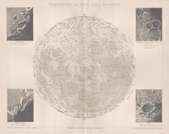
Visible Side of the Moon Map – Detailed Lunar Crater Chart, Published in 1858
$452.04
£334.88
€380
CA$621.76
A$691.57
CHF 362.80
MX$8,438.77
NOK 4,553.58
SEK 4,291.20
DKK 2,893.27
About the Item
Visible Side of the Moon Map – Detailed Lunar Crater Chart 1858
This fascinating antique print shows the visible side of the moon with incredible precision and detail. It depicts the lunar surface under full illumination, featuring named craters, seas (mare), and mountain ranges. The map is titled “Die sichtbare Seite der Mond-Oberfläche bei voller Beleuchtung” meaning “The visible side of the moon surface under full illumination,” based on C. F. Gauss and Mädler’s lunar chart. Surrounding the moon illustration are detailed lists of named features, ordered for scientific reference.
This print was published in 1858 as part of Adolf Stieler’s ‘Hand-Atlas über alle Theile der Erde und über das Weltgebäude’ issued in Gotha by Justus Perthes. Adolf Stieler was a renowned German cartographer, and his Hand-Atlas editions are highly regarded for their accuracy and quality. This lunar map is a copperplate engraving printed on paper and then delicately toned to enhance readability.
Its significance lies in its detailed mapping of the moon’s visible surface during a period when lunar cartography was advancing rapidly. The precision with which features such as Mare Imbrium, Mare Serenitatis, and prominent craters like Copernicus and Tycho are labelled reflects the 19th-century scientific drive to understand celestial bodies in preparation for later astronomical advances.
Condition summary: The print is in good condition with only mild toning consistent with age. There is no significant foxing - a few small spots- and one a light fold in the top right corner. Paper remains strong and the impressions are clear and sharp.
Framing tips: This lunar map will look striking in a dark wood or black frame to enhance the monochrome engraving, combined with a white or light grey mount to provide contrast. For best preservation, use UV-protective glass to maintain the paper’s quality and prevent future fading.
Adolf Stieler’s Hand Atlas Cover – Mid 19th Century German Atlas Board
This is the original cover board from Adolf Stieler’s renowned ‘Hand-Atlas über alle Theile der Erde und über das Weltgebäude’, mid-sized edition published in 1858 by Justus Perthes in Gotha. The cover is printed with the full atlas title, publication details, and a list of its 63 maps, including general world maps, European regional maps, and astronomical plates like the lunar map included in this set.
The cover typography features elegant mid-19th-century German typefaces and ornate corner flourishes, giving it a refined scientific and decorative appearance. Stieler’s Hand-Atlas was a leading cartographic publication of its time, widely used by scholars, universities, and educated households across Europe for its accuracy, detail, and clarity.
This board is significant as it evidences the original publication’s scope and the esteem in which Stieler’s cartography was held. It is printed via letterpress on heavy board, designed for durability over frequent consultation.
Condition summary: The cover board shows signs of age with scuffs, rubbing, and edge wear, particularly at corners, but retains its complete printed surface. There are surface marks and light staining, as visible in the images. Structurally solid.
Framing tips: Frame this cover as an antique decorative cartographic piece in a wide dark or ebonised wood frame to emphasise its academic look. A neutral cream mount will complement its aged paper tones. UV-protective glass is recommended to preserve the print against further light damage.
- Dimensions:Height: 14.77 in (37.5 cm)Width: 17.88 in (45.4 cm)Depth: 0.01 in (0.2 mm)
- Materials and Techniques:Paper,Engraved
- Place of Origin:
- Period:
- Date of Manufacture:1858
- Condition:The print is in good condition with only mild toning consistent with age. There is no significant foxing - a few small spots- and one a light fold in the top right corner. Paper remains strong and the impressions are clear and sharp.
- Seller Location:Langweer, NL
- Reference Number:Seller: BG-05552-21stDibs: LU3054345808292
About the Seller
5.0
Recognized Seller
These prestigious sellers are industry leaders and represent the highest echelon for item quality and design.
Platinum Seller
Premium sellers with a 4.7+ rating and 24-hour response times
Established in 2009
1stDibs seller since 2017
2,593 sales on 1stDibs
Typical response time: <1 hour
- ShippingRetrieving quote...Shipping from: Langweer, Netherlands
- Return Policy
Authenticity Guarantee
In the unlikely event there’s an issue with an item’s authenticity, contact us within 1 year for a full refund. DetailsMoney-Back Guarantee
If your item is not as described, is damaged in transit, or does not arrive, contact us within 7 days for a full refund. Details24-Hour Cancellation
You have a 24-hour grace period in which to reconsider your purchase, with no questions asked.Vetted Professional Sellers
Our world-class sellers must adhere to strict standards for service and quality, maintaining the integrity of our listings.Price-Match Guarantee
If you find that a seller listed the same item for a lower price elsewhere, we’ll match it.Trusted Global Delivery
Our best-in-class carrier network provides specialized shipping options worldwide, including custom delivery.More From This Seller
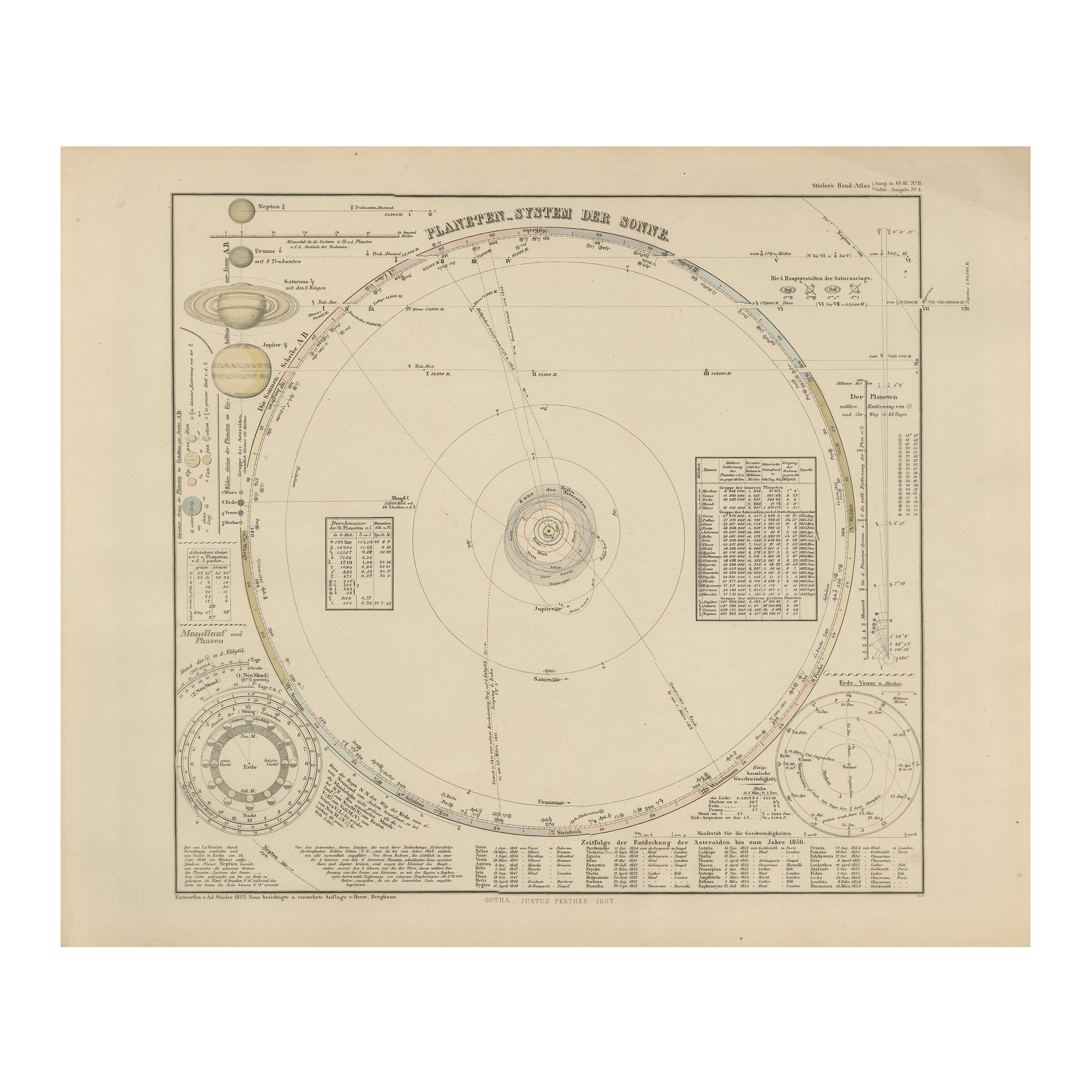
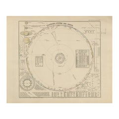
View AllSolar System Map – Planetary Orbits and Data Chart, Published in 1857
Located in Langweer, NL
Solar System Map – Planetary Orbits and Data Chart 1857
This antique print shows a detailed diagram of the solar system titled “Planeten-System der Sonne” meaning “Planetary System ...
Category
Antique Mid-19th Century German Maps
Materials
Paper
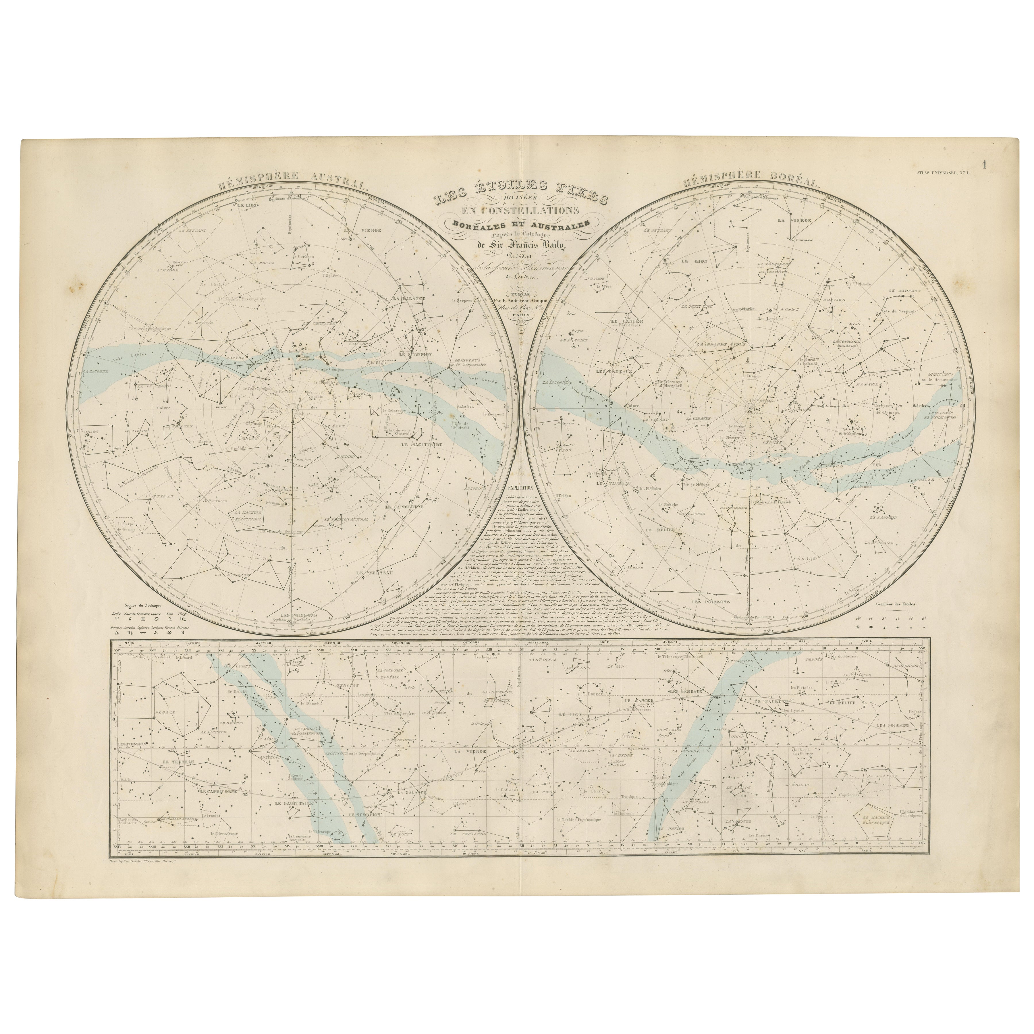
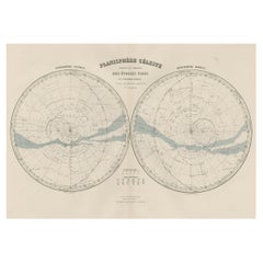
Antique Celestial Star Map – Northern & Southern Hemispheres, 1860
Located in Langweer, NL
Antique Celestial Star Map – Northern & Southern Hemispheres, Andriveau-Goujon 1860
This elegant antique celestial chart, published in Paris in 1860 by the noted French cartographer...
Category
Antique Mid-19th Century French Maps
Materials
Paper
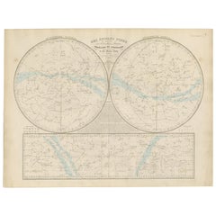
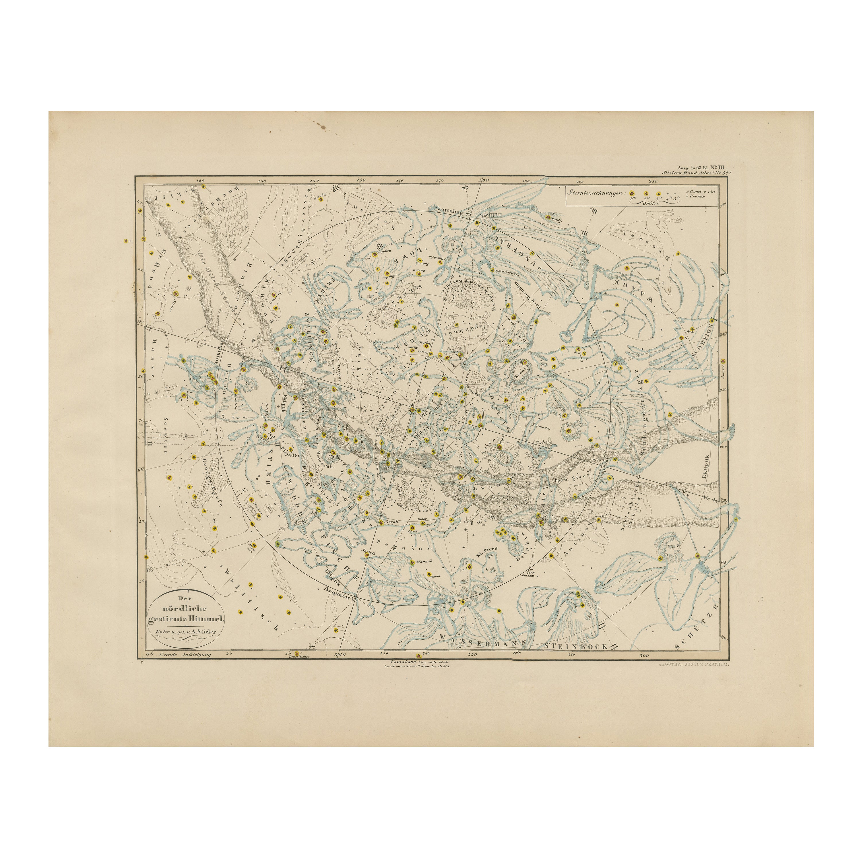
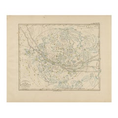
Northern Hemisphere Star Map – Constellations & Astronomical Chart, c.1858
Located in Langweer, NL
Northern Hemisphere Star Map – Constellations & Astronomical Chart c.1858
This attractive antique print shows the northern starry sky titled “Der nördliche gestirnte Himmel”, meanin...
Category
Antique Mid-19th Century German Maps
Materials
Paper
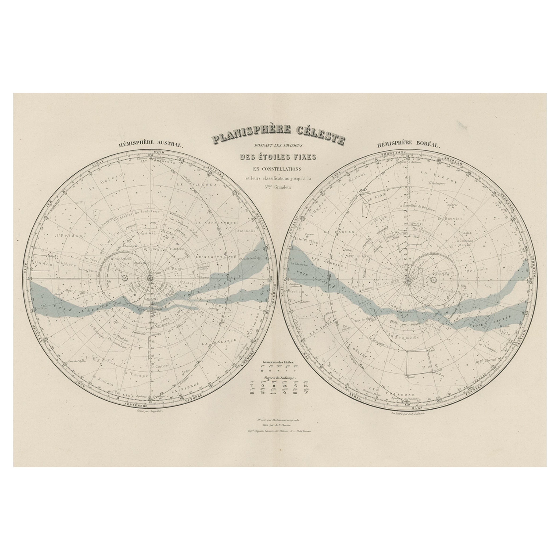
Antique Map of the Night Skies of the Northern and Southern Hemispheres, 1880
Located in Langweer, NL
Antique world map titled 'Planisphère en Céleste'.
This map depicts the night skies of both the northern and southern hemispheres. This map originates from 'Géographie Universell...
Category
Antique 1880s Maps
Materials
Paper
$275 Sale Price
20% Off
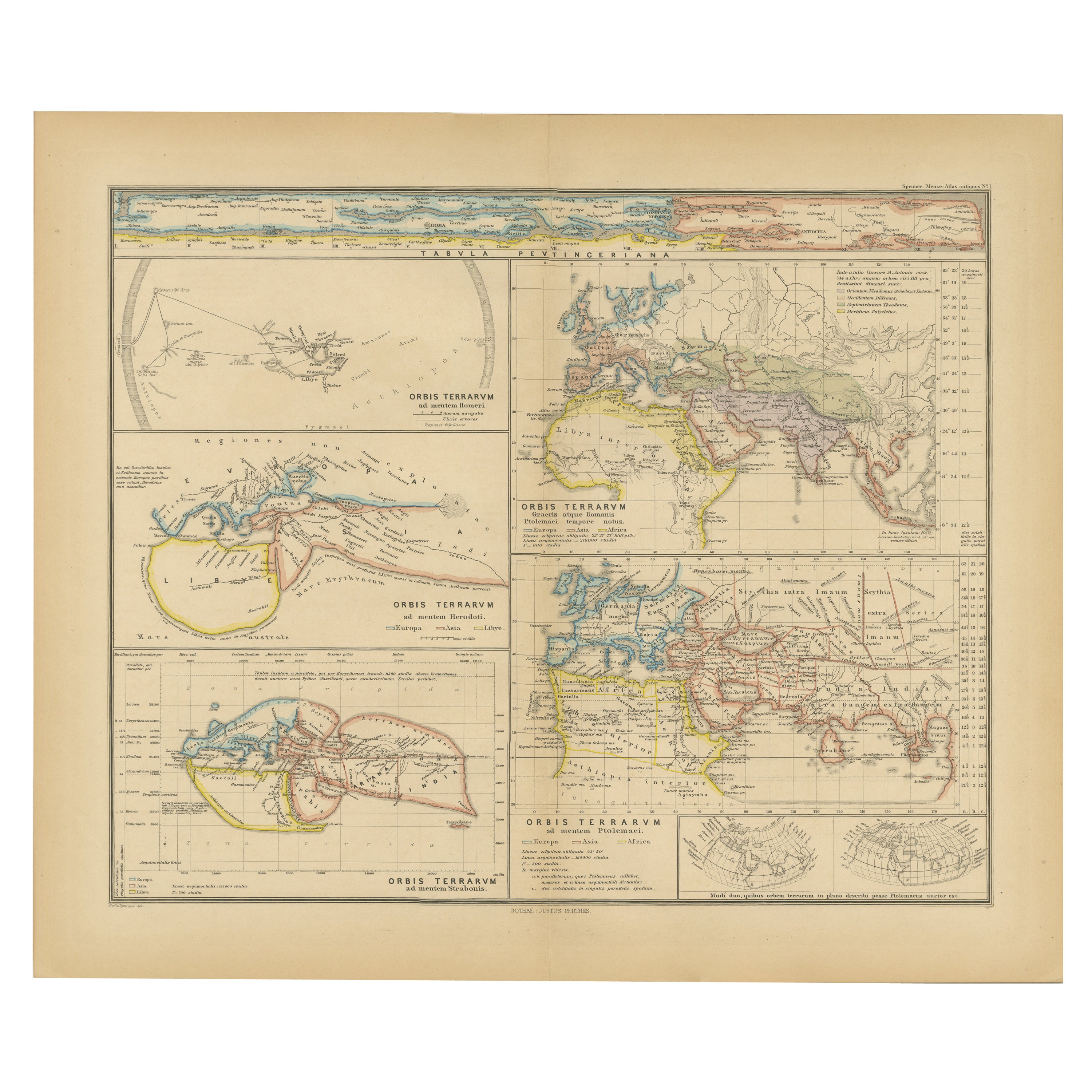
Original Old Composite of Several Maps of the Ancient World on One Sheet, 1880
Located in Langweer, NL
This original antique map is from Karl Spruner von Merz's "Atlas Antiquus", later edited by Theodorus Menke. The map is a detailed depiction of the ancient world. The atlas it comes ...
Category
Antique 1880s Maps
Materials
Paper
$352 Sale Price
20% Off
Free Shipping
Antique Hemisphere Map of the World 'Two on One Sheet' by Levasseur, '1875'
Located in Langweer, NL
Antique map titled 'Mappemonde projetée sur l'Horizon de Paris et de son Antipode - Mappemonde sur la projection polaire'. Large map with two hemisphere world maps...
Category
Antique Late 19th Century Maps
Materials
Paper

$327 Sale Price
44% Off
You May Also Like
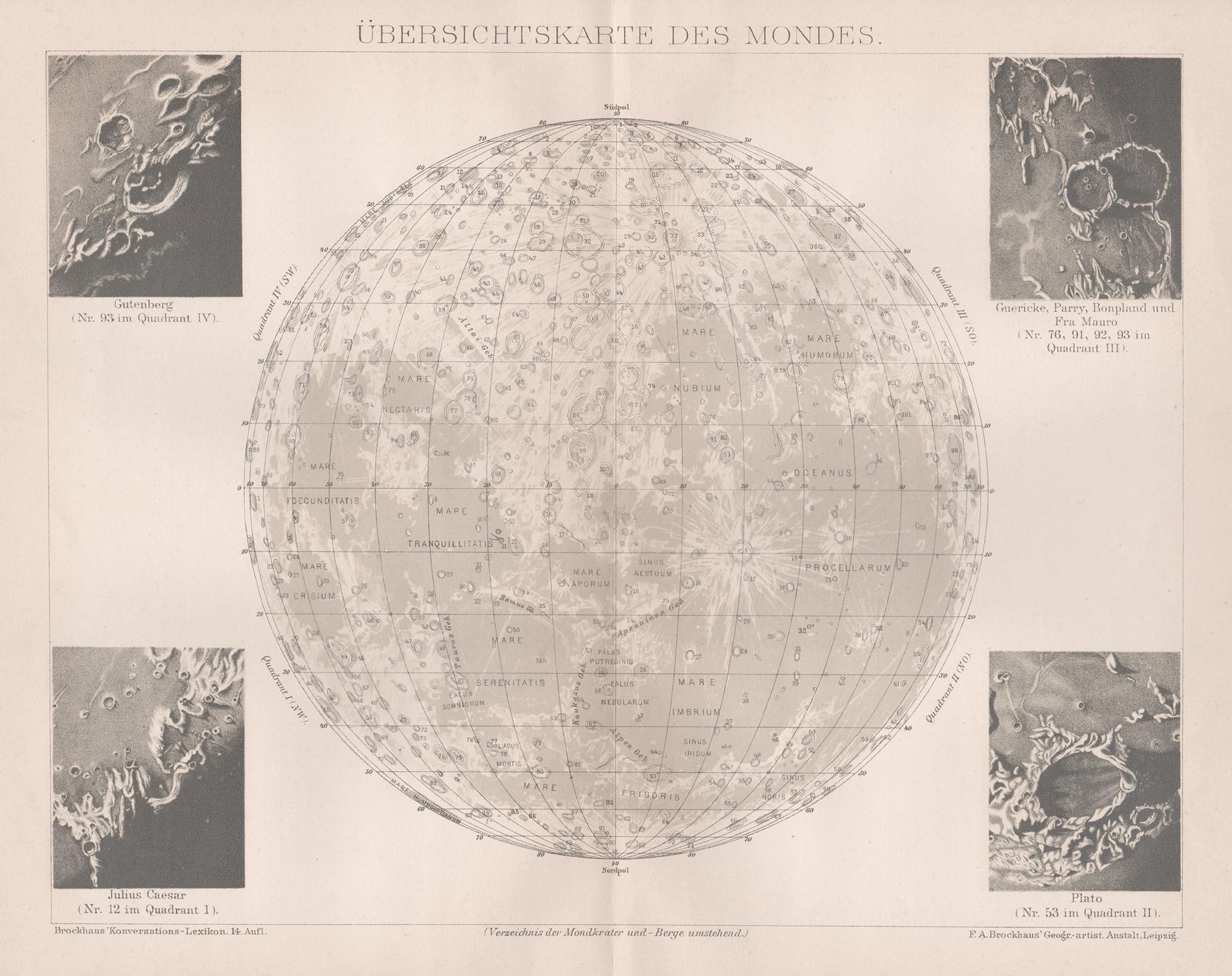
Ubersichtskarte Des Mondes (Overview Map of the Moon), antique astronomy print
Located in Melbourne, Victoria
'Ubersichtskarte Des Mondes'
(Overview Map of the Moon)
German chromolithograph, circa 1895.
245mm by 305mm (sheet).
Central vertical fold as issued.
Category
Late 19th Century Naturalistic Still-life Prints
Materials
Lithograph
1850 Old French Map Depicting the Entire Earth's Surface Divided into Two Parts
Located in Milan, IT
Geographical map depicting the entire earth’s surface divided into two parts that correspond to the two hemispheres or globes, the map deals with the latitudes and longitudes, the me...
Category
Antique Mid-19th Century French Maps
Materials
Glass, Wood, Paper

Original Antique Map of The Eastern Hemisphere by Dower, circa 1835
Located in St Annes, Lancashire
Nice map of the Eastern Hemisphere
Drawn and engraved by J.Dower
Published by Orr & Smith. C.1835
Unframed.
Free shipping
Category
Antique 1830s English Maps
Materials
Paper

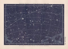
Star Chart. Antique Astronomy celestial print
Located in Melbourne, Victoria
Colour lithograph, 1890. 210mm by 285mm (sheet). From W Peck's 'A Handbook and Atlas of Astronomy', 1890. Sir William Peck FRSE FRAS (1862 – 1925) was a Scottish astronomer and scien...
Category
Late 19th Century Victorian More Prints
Materials
Lithograph
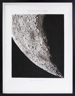
POSIDONIUS_ATLAS_CORNE BORÉALE. - Héliogravure of the Moon's Surface
Located in London, GB
Héliogravure after photographs by Loewy and Puiseux depicting the Moon’s surface, from Atlas Photographique de la Lune.
[Published: Imprimerie Nationale, Paris, 1899].
The finest a...
Category
1890s Naturalistic Black and White Photography
Materials
Other Medium
Original Large Antique Map of Paris, France by John Dower, 1861
Located in St Annes, Lancashire
Fabulous monochrome map of Paris.
Vignettes of St Germain En Laye, Saint Cloud, Versailles and Fontainbleau.
Unframed.
Drawn by J.Dower.
Lithography by Weller. 4 sheets joined to...
Category
Antique 1860s English Victorian Maps
Materials
Paper

More Ways To Browse
C Milder
Wood Minimalist Chair
Antique Imperial Furniture
Gold Modern Coffee Table
Large Side Tables
18th Century Gilded Furniture
Japanese Silver Ceramics
One Of A Kind Chair
Used Oak Dining Room Chairs
17th Century Plate
Childrens Vintage Poster
Chinese Ship
Nursery Art
Vintage Travel Poster Mid Century
Desk Key
Woven Silk Art
Carved Cabriole Table
Dark Antique Table