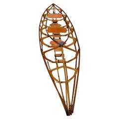
Kayak Boat Skeleton from East Germany that Collapses for Ease of Transport
View Similar Items


1 of 10
Kayak Boat Skeleton from East Germany that Collapses for Ease of Transport
About the Item
- Dimensions:Height: 206 in (523.24 cm)Width: 18 in (45.72 cm)Depth: 34 in (86.36 cm)
- Materials and Techniques:
- Place of Origin:
- Period:1980-1989
- Date of Manufacture:1980s
- Condition:Wear consistent with age and use.
- Seller Location:Madison, WI
- Reference Number:1stDibs: LU92352847782
You May Also Like
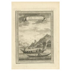
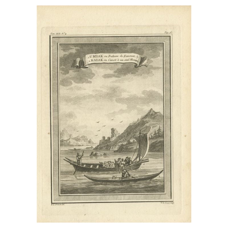
- Antique Print of a Woman's Boat Know as Imiak and a Kayak for Men, 1770By PrevostLocated in Langweer, NLAntique print titled '1. Umiak ou Bateau de Femmes 2. Kaiak ou Canot à un seul Homme'. Copper engraving of an Umiak or women's boat and a one man kayak or canoe. This print originate...Category
Antique 18th Century Prints
MaterialsPaper
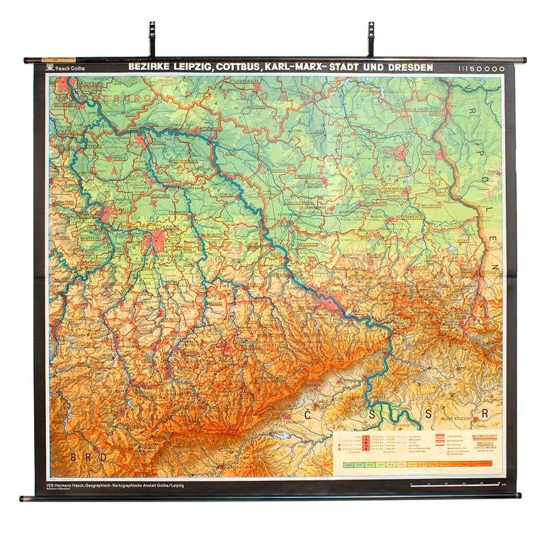
- East German MapBy VEB Hermann HaackLocated in Baltimore, MDA brilliantly colourful map of the Leipzig, Karl Marx Stadt and Dresden area in the former German Democratic Republic by VEB Hermann Haack of Gotha.Category
Vintage 1970s German Maps
 $295 Sale Price25% Off
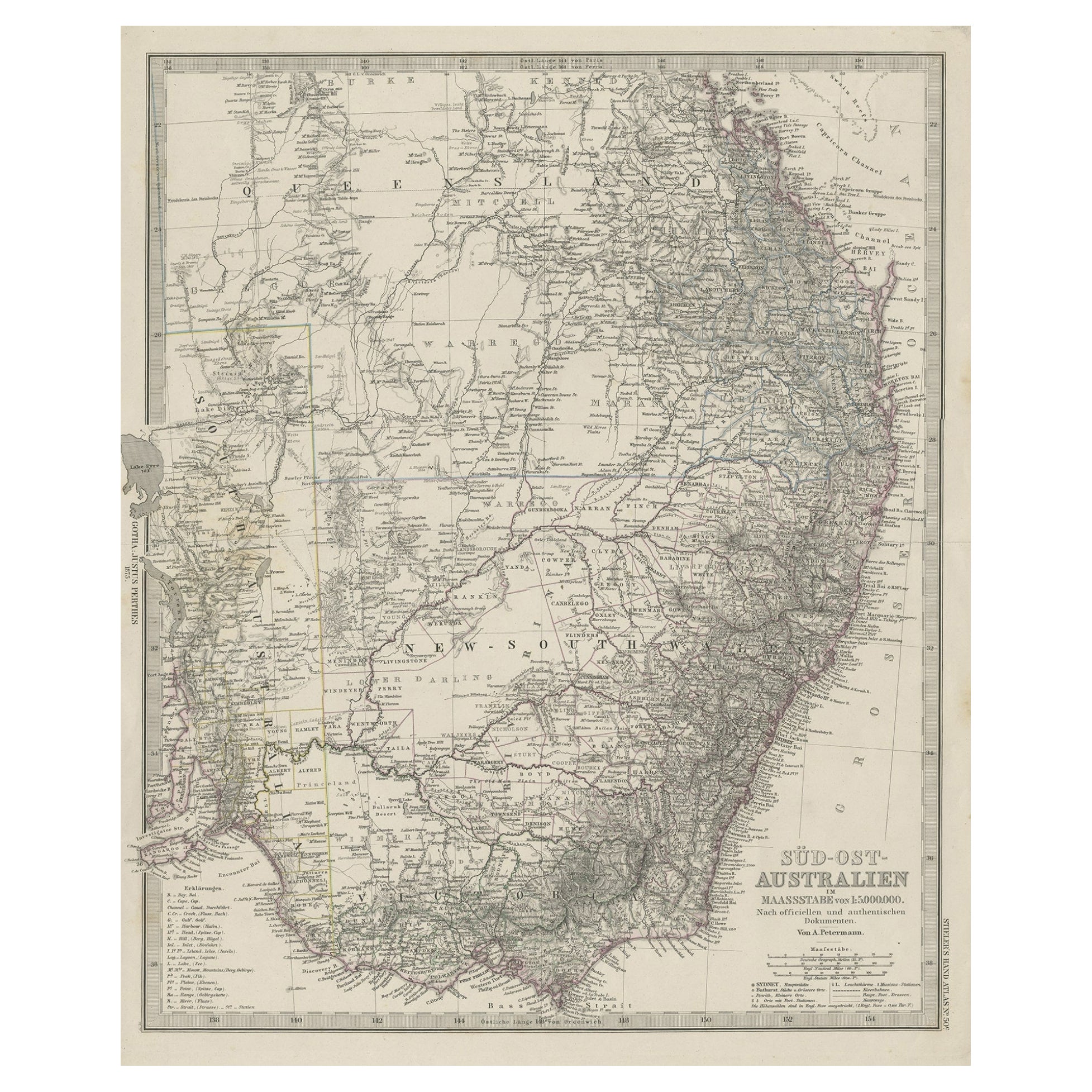
 - Antique Engraved Map of South East Australia from a German Atlas, 1848Located in Langweer, NLAntique map Australia titled 'Süd-Ost Australien'. Detailed map of South East Australia. Orginates from 'Stieler's Hand Atlas', published in Ge...Category
Antique 19th Century Maps
MaterialsPaper
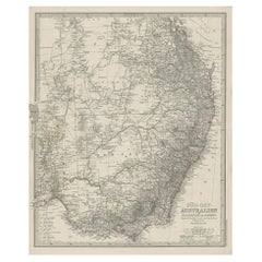 $71 Sale Price20% Off
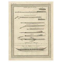
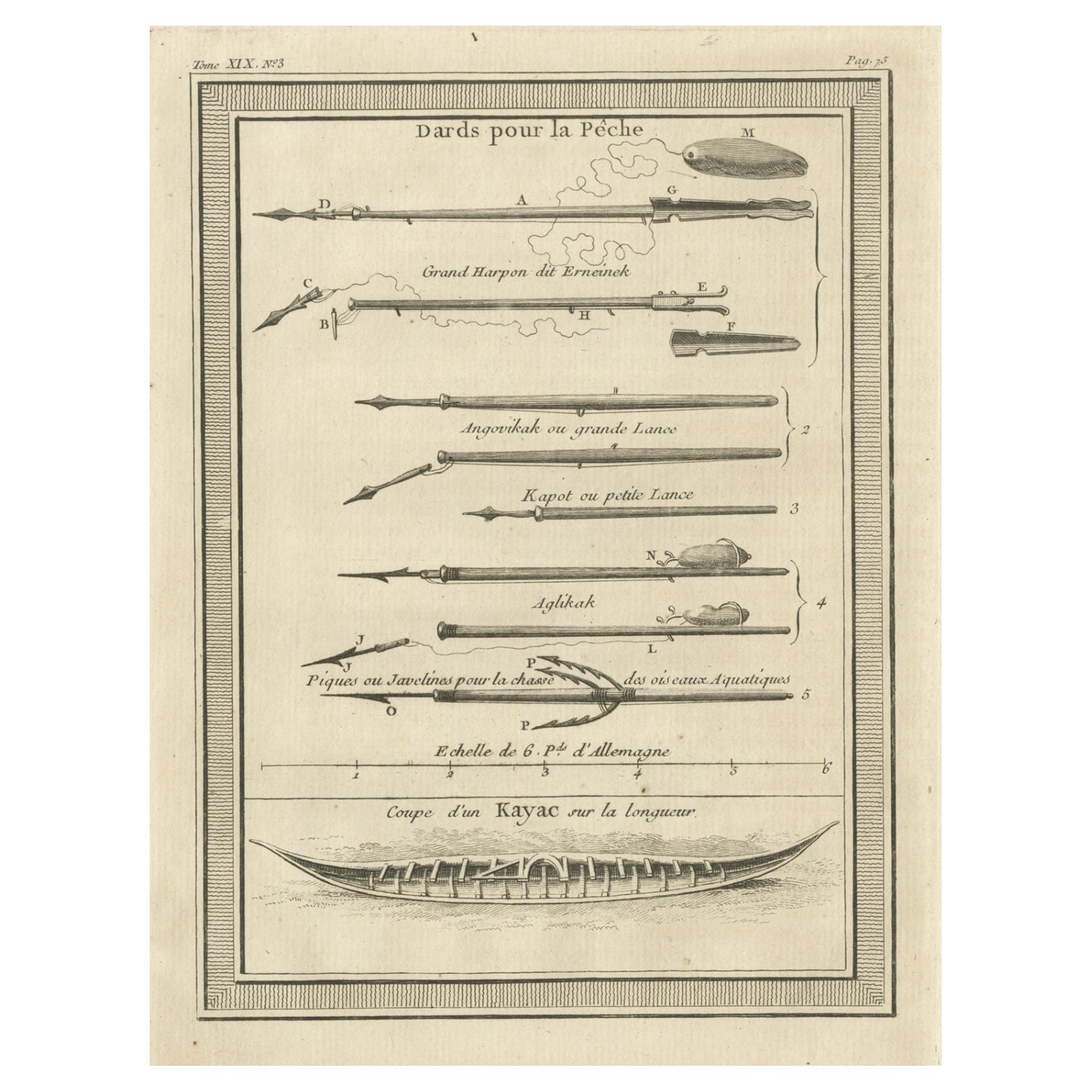
 - Antique Print of Darts for Fishing and Kayak, 1768Located in Langweer, NLAntique print titled 'Dards pour la Pêche (..)'. Copper engraving of darts for fishing and a kayak. This print originates from volume 18 of 'Histoire generale des voyages (..)' by An...Category
Antique 18th Century Prints
MaterialsPaper
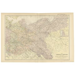
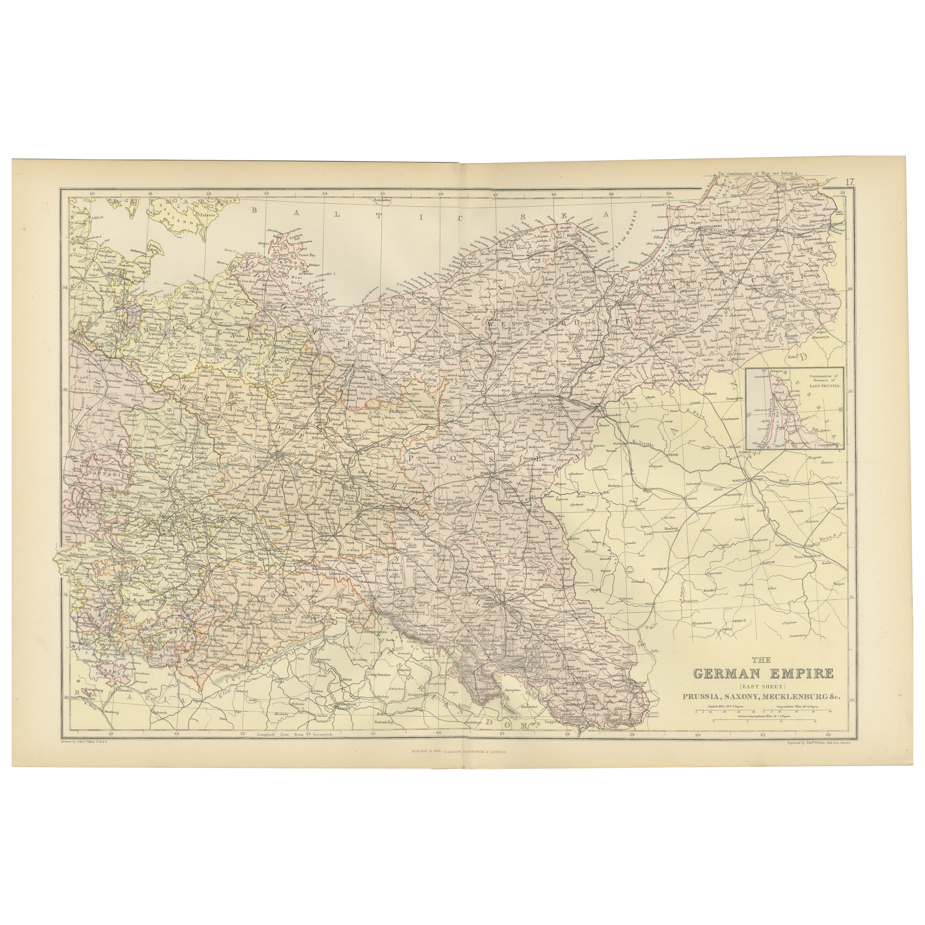
- Antique Map of The German Empire (East Sheet), 1882Located in Langweer, NLStep into history with an authentic Antique Map of The German Empire (East Sheet) from the esteemed 'Comprehensive Atlas and Geography of the World,' meticulously crafted in 1882. Th...Category
Antique 1880s Maps
MaterialsPaper
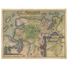
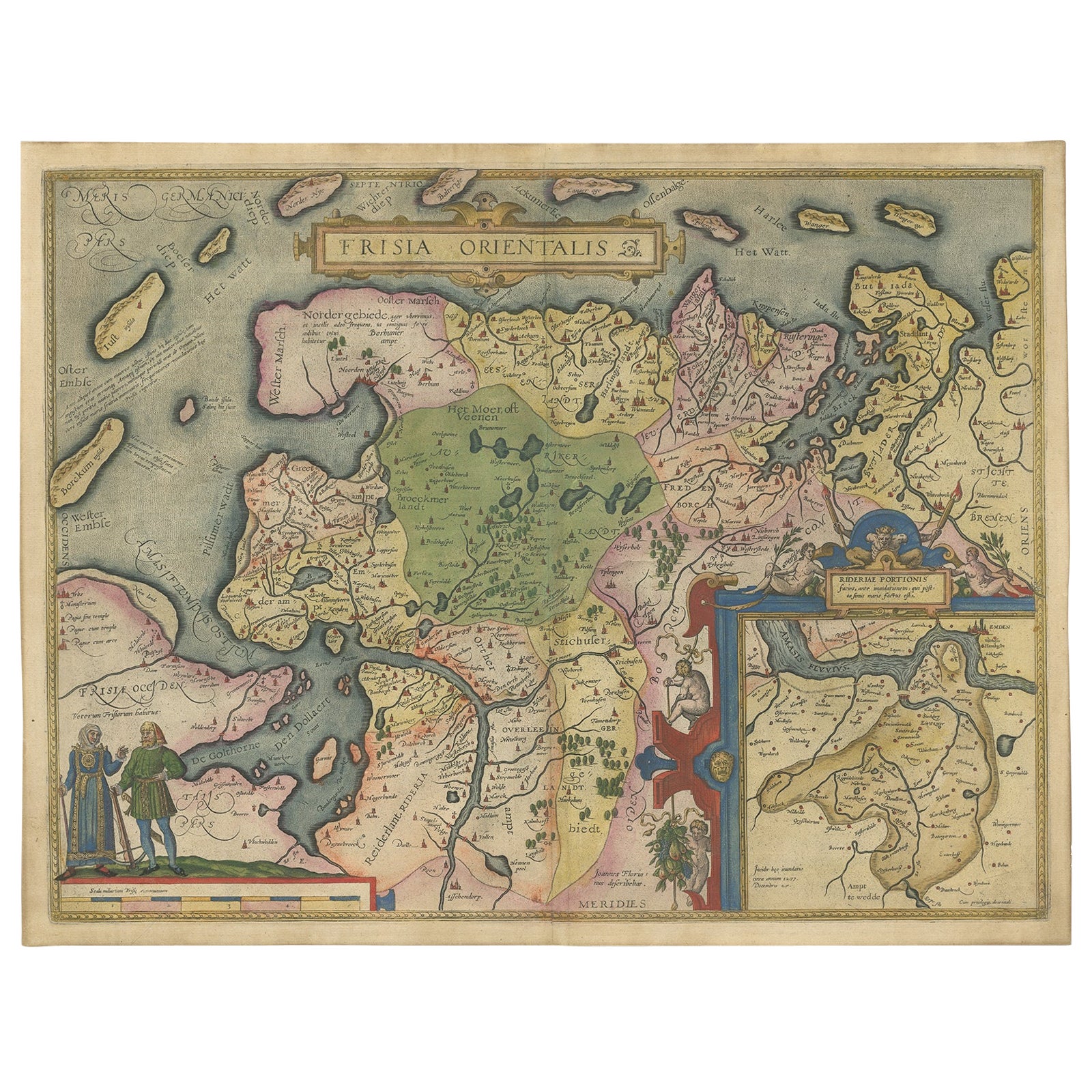
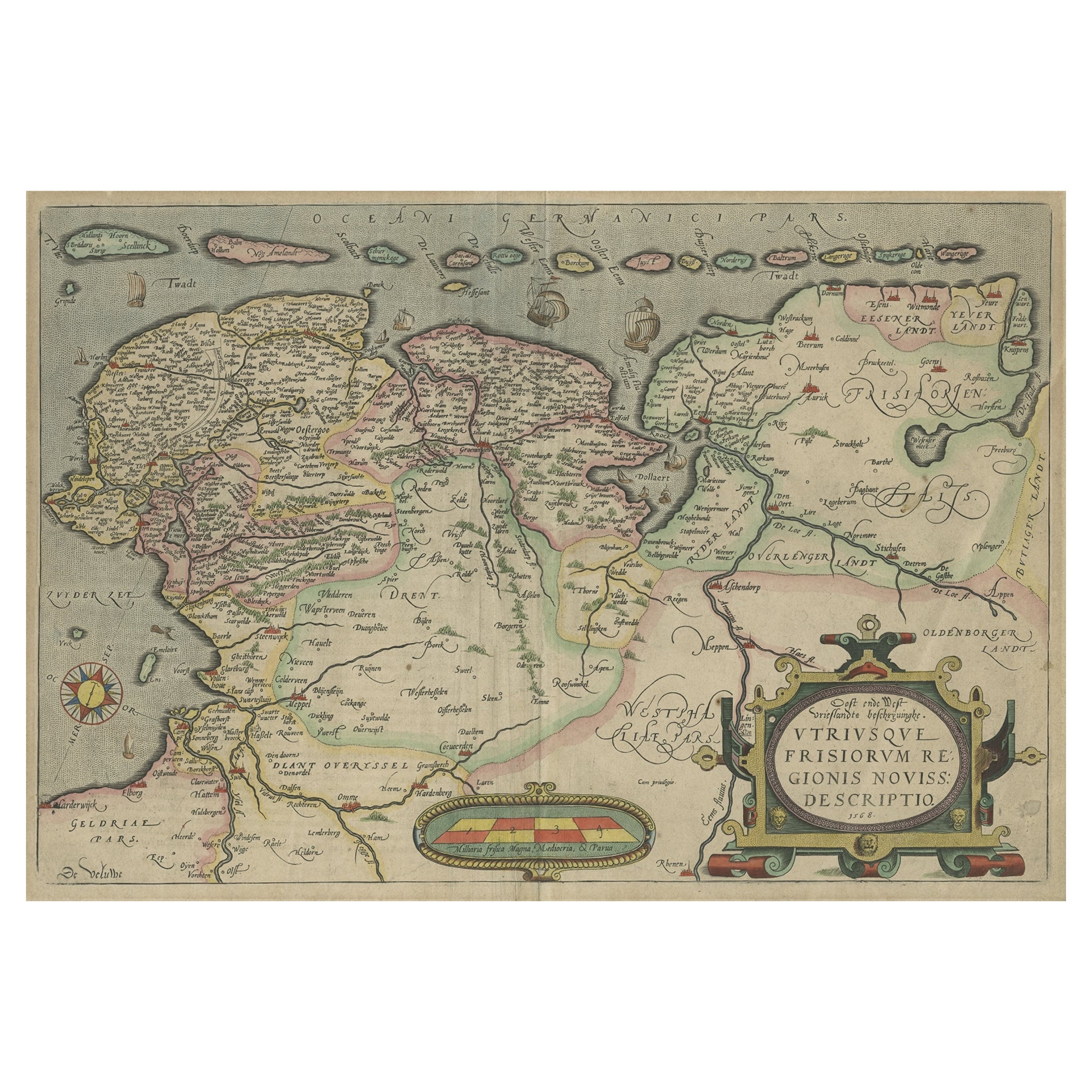
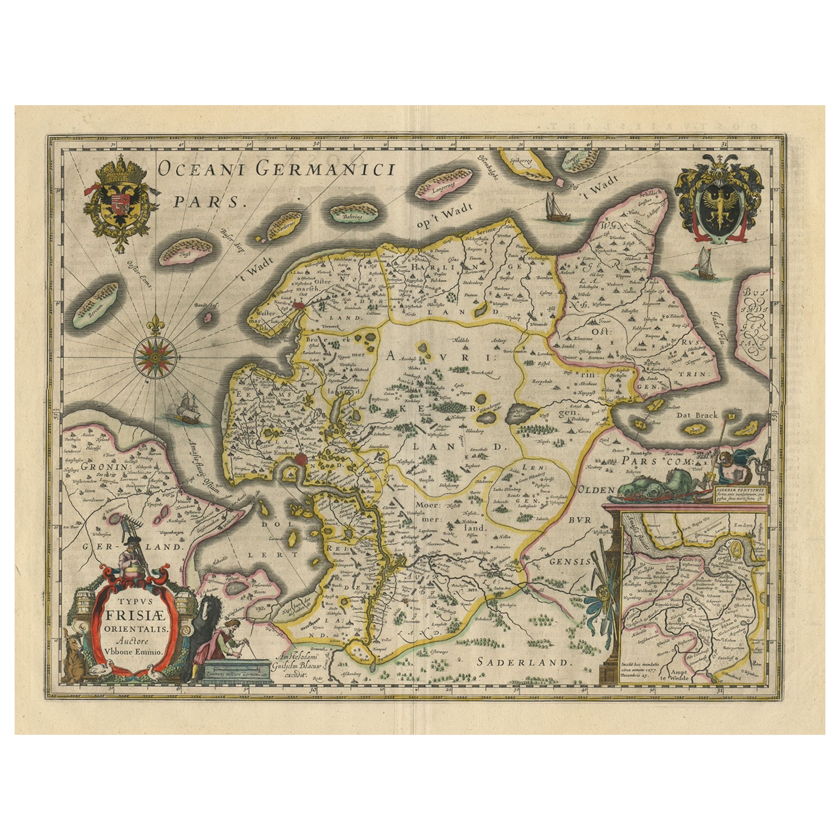
- Map of East Frisian Islands & Northwestern Tip of Germany, Ostfriesland, c.1595Located in Langweer, NLAntique map titled 'Frisia Orientalis'. Beautiful map of east Frisian islands and the northwestern tip of Germany, Ostfriesland. With people in local costumes. Ornamented inset of the Eems estuary. Based on a manuscript map...Category
Antique 16th Century Maps
MaterialsPaper