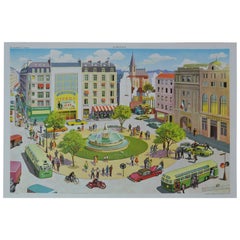
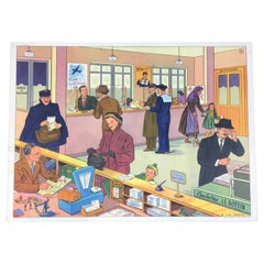
1950s School Chart, At the Square, Rossignol, Henri Mercier, France
View Similar Items

Want more images or videos?
Request additional images or videos from the seller
1 of 12
1950s School Chart, At the Square, Rossignol, Henri Mercier, France
About the Item
- Dimensions:Height: 22.05 in (56 cm)Width: 29.93 in (76 cm)Depth: 0.04 in (1 mm)
- Style:Mid-Century Modern (Of the Period)
- Materials and Techniques:
- Place of Origin:
- Period:
- Date of Manufacture:1950-1960
- Condition:Wear consistent with age and use.
- Seller Location:Antwerp, BE
- Reference Number:1stDibs: LU1474214791071
About the Seller
5.0
Gold Seller
These expertly vetted sellers are highly rated and consistently exceed customer expectations.
Established in 2011
1stDibs seller since 2015
439 sales on 1stDibs
Typical response time: 1 hour
More From This SellerView All
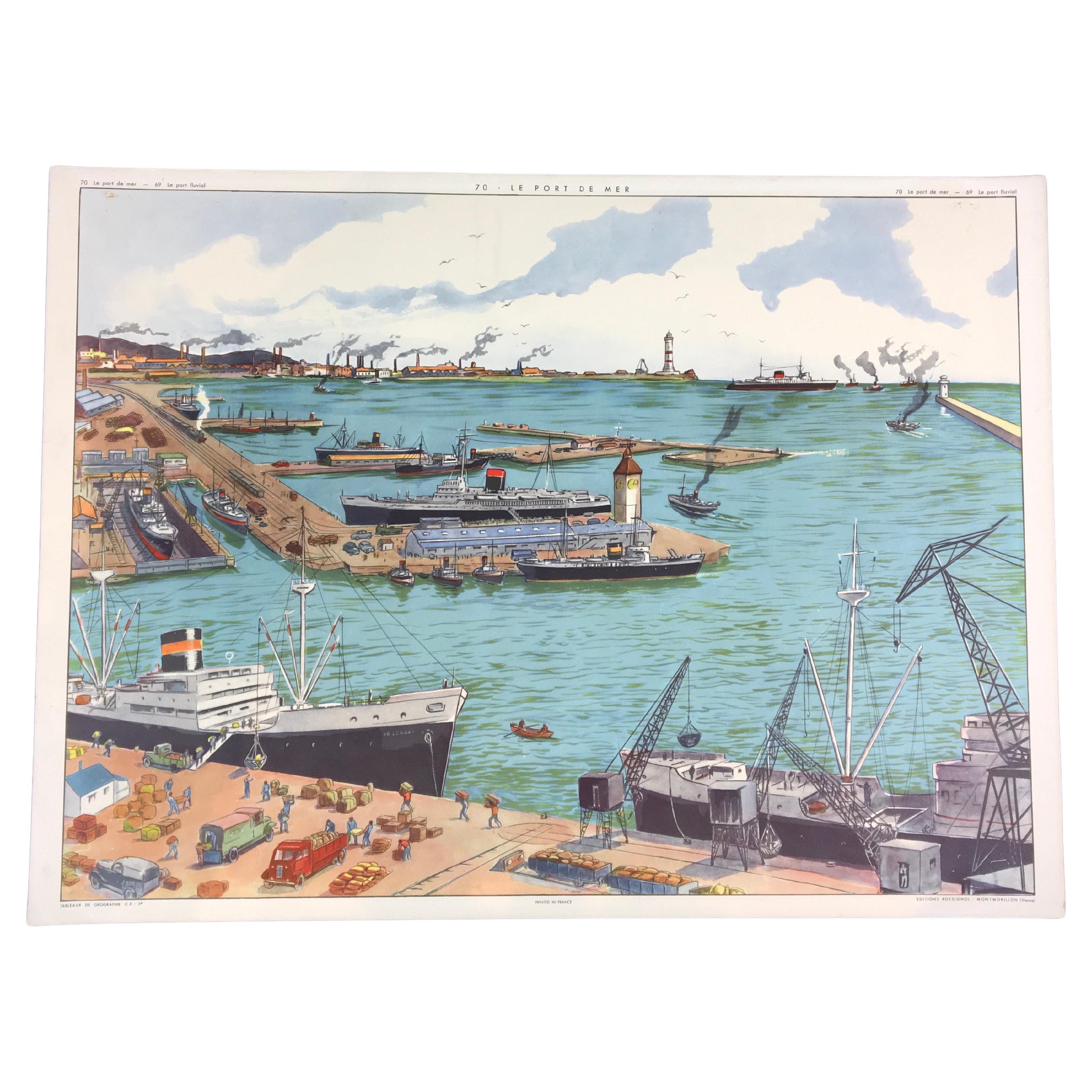
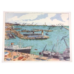
- School Chart At the Port by RossignolLocated in Antwerp, BEVintage school chart theme at the port - at the seaport - at the harbor. Detailled scenes and look on the daily activities at the port. French school chart - school poster by Rossi...Category
Mid-20th Century French Industrial Decorative Art
MaterialsPaper
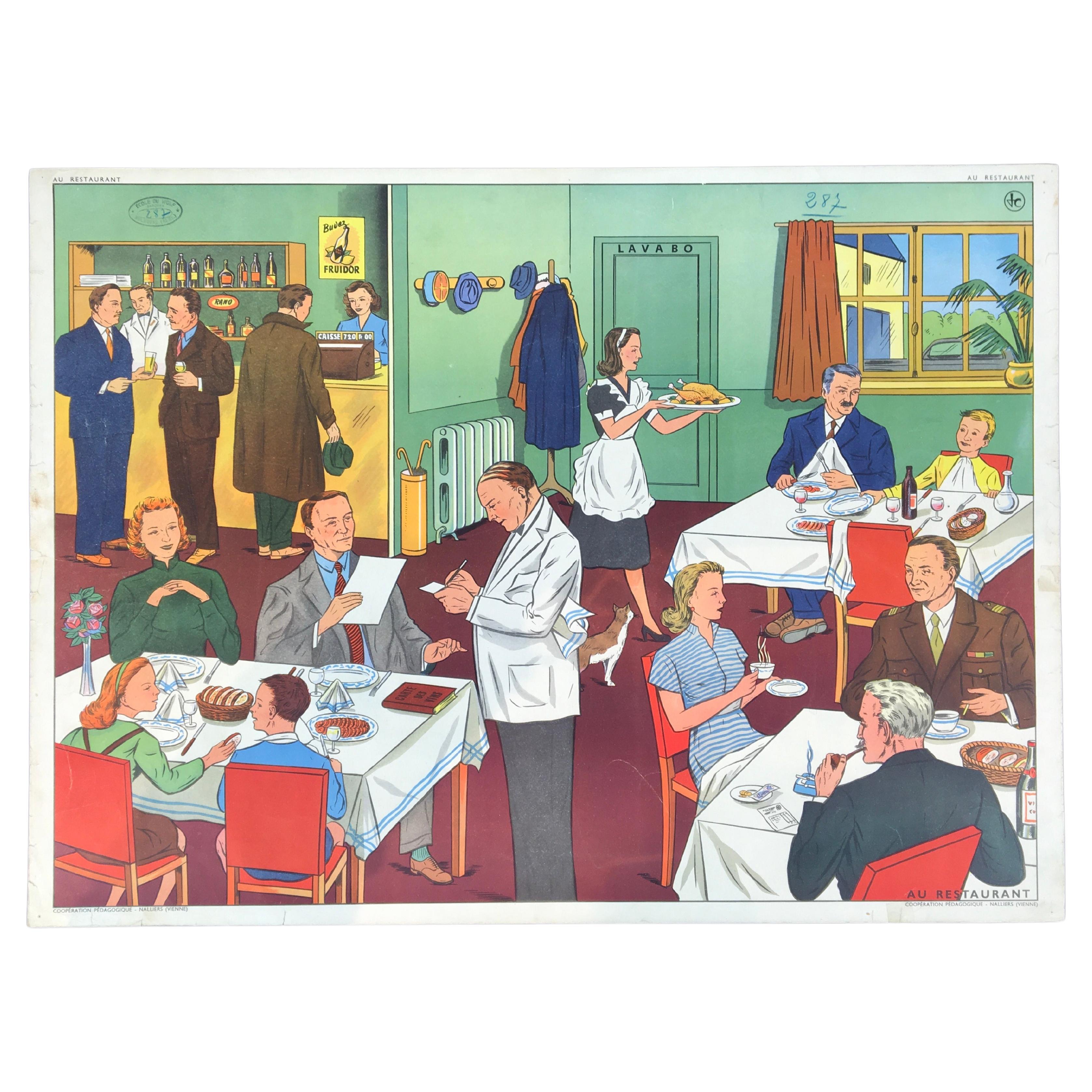
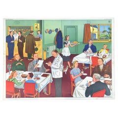
- Vintage School Chart, at the Restaurant, by RossignolLocated in Antwerp, BEVintage School Chart : at the restaurant. Beautiful school poster with lots of details and especially beautiful colors ! Mom and dad taking the children out for dinner , well dres...Category
Mid-20th Century French Art Deco Posters
MaterialsPaper
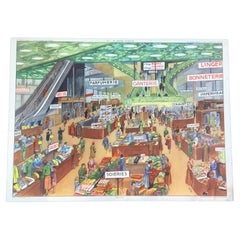
- French Department Store School Chart by RossignolLocated in Antwerp, BEVintage School Chart of a French Department Store. Stylish shopping in Paris in France in a large variety store or grand magasin like Galeries Lafayette, Bon Marché Rive gauche, Printemps Haussmann, Galeries Lafayette - Champs-Élysées etc .. This school poster has a beautiful design , look at all the details: Large Art Deco staircase...Category
Mid-20th Century French Art Deco Posters
MaterialsPaper
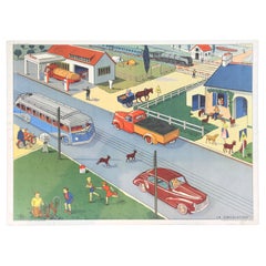
- Vintage School Chart Traffic Scene by Rossignol, FranceLocated in Antwerp, BEVintage school chart - school poster : view on the traffic - life next to the road. Vintage educational school poster printed in France on thick paper. Great wall decoration with be...Category
Mid-20th Century French Art Deco Decorative Art
MaterialsPaper
- Vintage School Chart at the Post OfficeLocated in Antwerp, BEVintage school poster - school chart at the Post Office. A beautiful poster with great colors and details by Rossignol France. Printed on thic...Category
Mid-20th Century French Mid-Century Modern Posters
MaterialsPaper
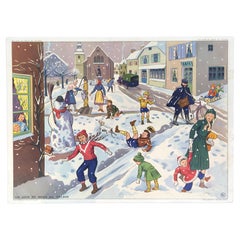
- Vintage School Poster Playing in the Snow by Rossignol, FranceLocated in Antwerp, BEVintage school poster - school chart playing in the snow - snow fun in the village. A beautiful school poster with great colors and details by R...Category
Mid-20th Century French Mid-Century Modern Decorative Art
MaterialsPaper
You May Also Like
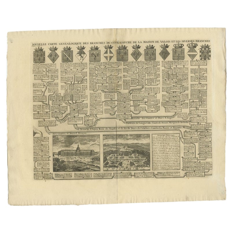
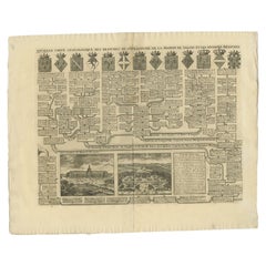
- Antique Genealogy Chart of the Valois House in France, 1732Located in Langweer, NLAntique print titled 'Nouvelle Carte Genealogique des Branches du Cote Gauche (..)'. Set of two prints with a chart of the left branch of the genealogy of the Valois House, and the various branches formed through alliances, each with its coat of arms including the Counts and Dukes of Alencon, Anjou, Naples, Calabria, Burgundy, Brabant. With inset engraved views of the Hotel des Invalides in Paris, the Trianon, Versailles and St. Cloud. This print orginates from 'Atlas Historique'. The House of Valois...Category
Antique 18th Century Prints
MaterialsPaper
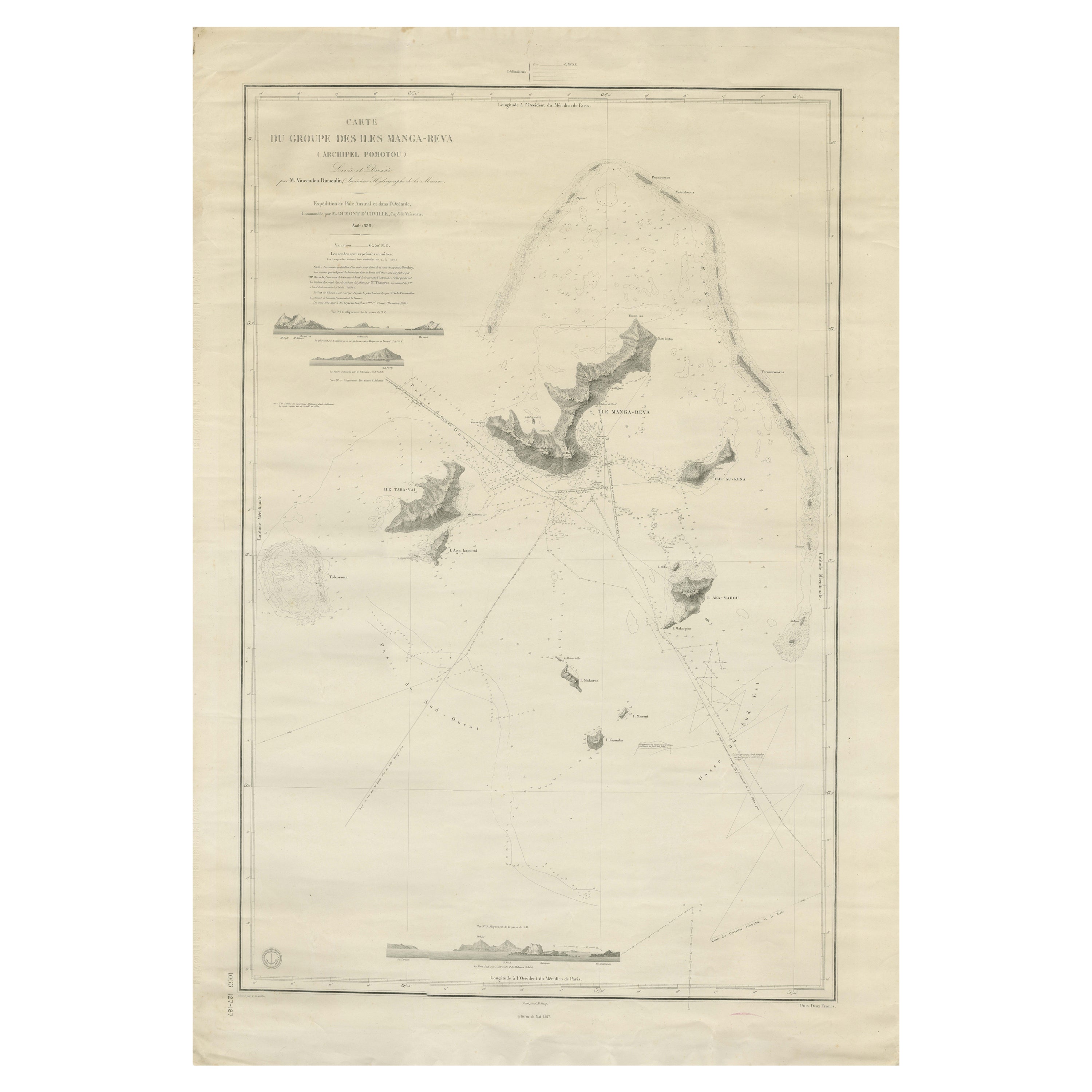
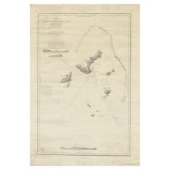
- Large Chart of the Gambier Islands, Tuamotu Archipelago, French PolynesiaLocated in Langweer, NLAntique map titled 'Carte du Groupe des Iles Manga-Reva (Archipel Pomotou)'. Large chart of the Tuamotu Archipelago, French Îles Tuamotu, also called Paumotu, island group of French ...Category
Antique Mid-19th Century Maps
MaterialsPaper
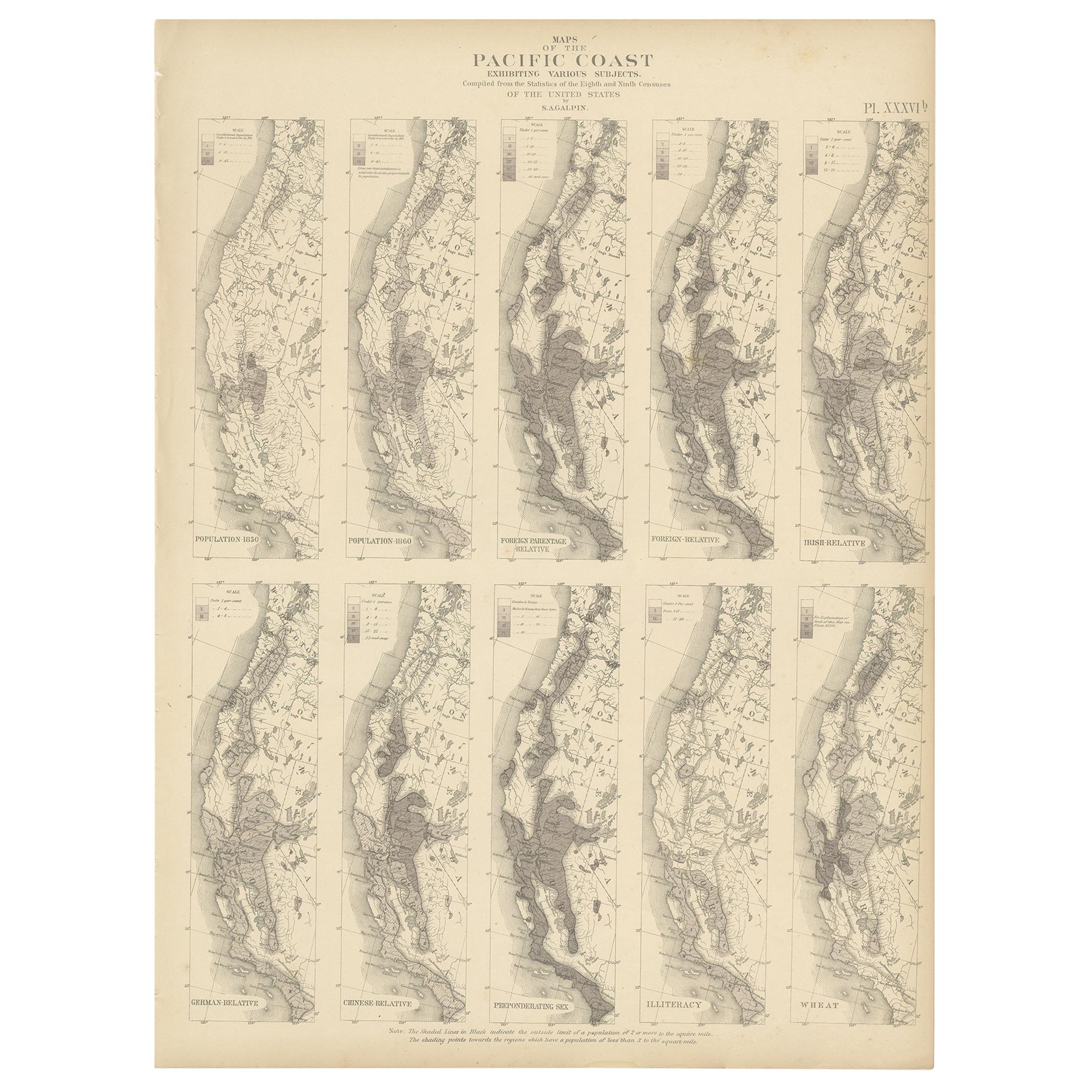
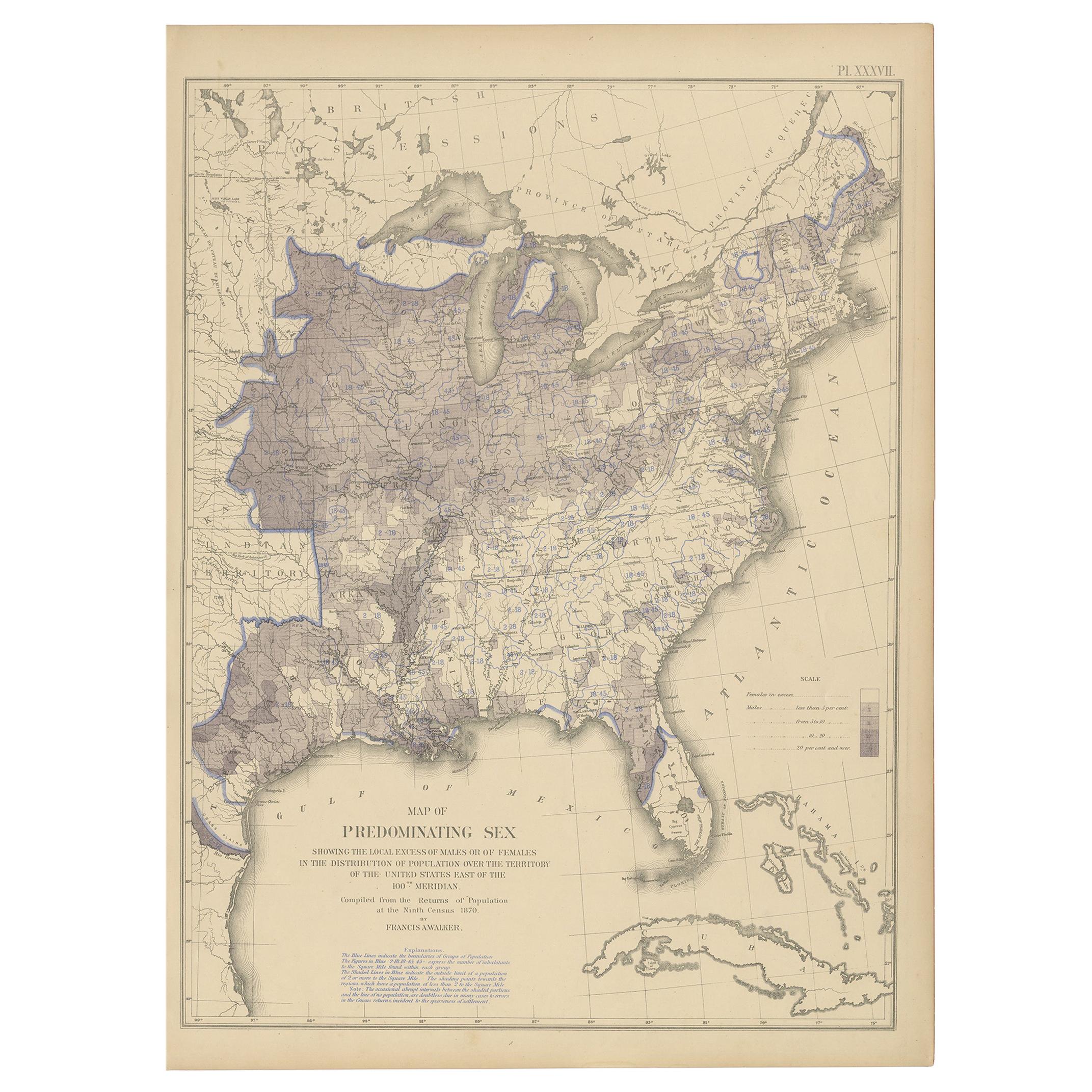
- Antique Chart of the Pacific Coast '1874'Located in Langweer, NLAntique chart titled 'Maps of the Pacific Coast exhibiting various subjects. Compiled from the statistics of the eight and ninth census of the United Sta...Category
Antique Late 19th Century Maps
MaterialsPaper
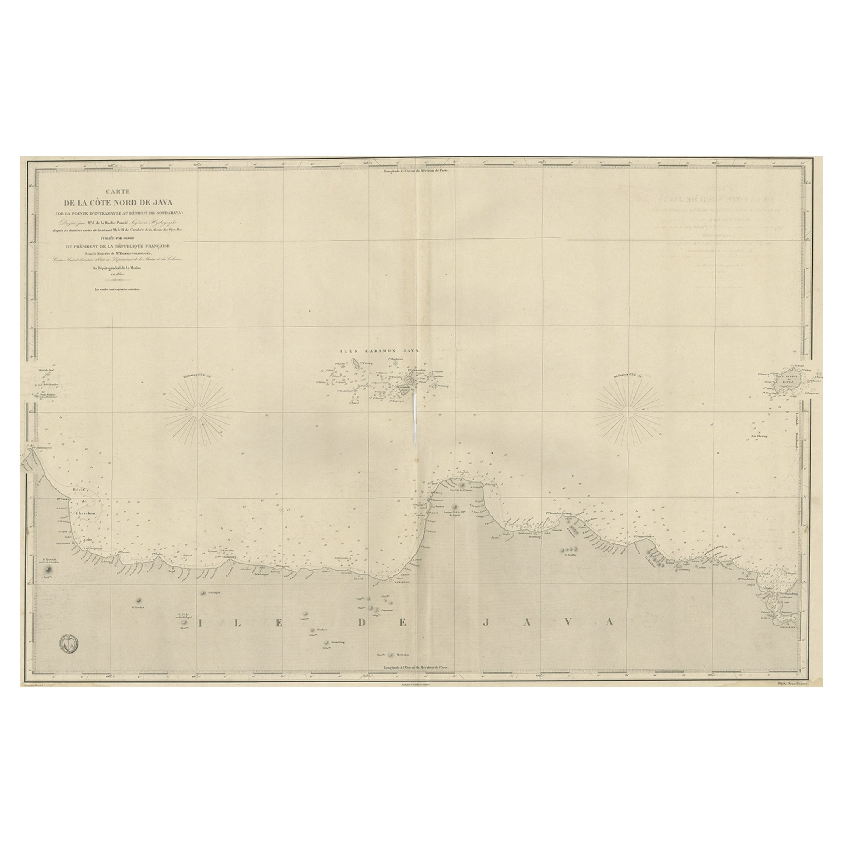
- Early French Nautical Chart of the Northern Coast of of Java, Indonesia, C.1850Located in Langweer, NLAntique map titled Carte de la côte Nord de Java. Early French nautical chart of the northern coast of the island of Java, Indonesia. It includes Ci...Category
Antique 1850s Maps
MaterialsPaper
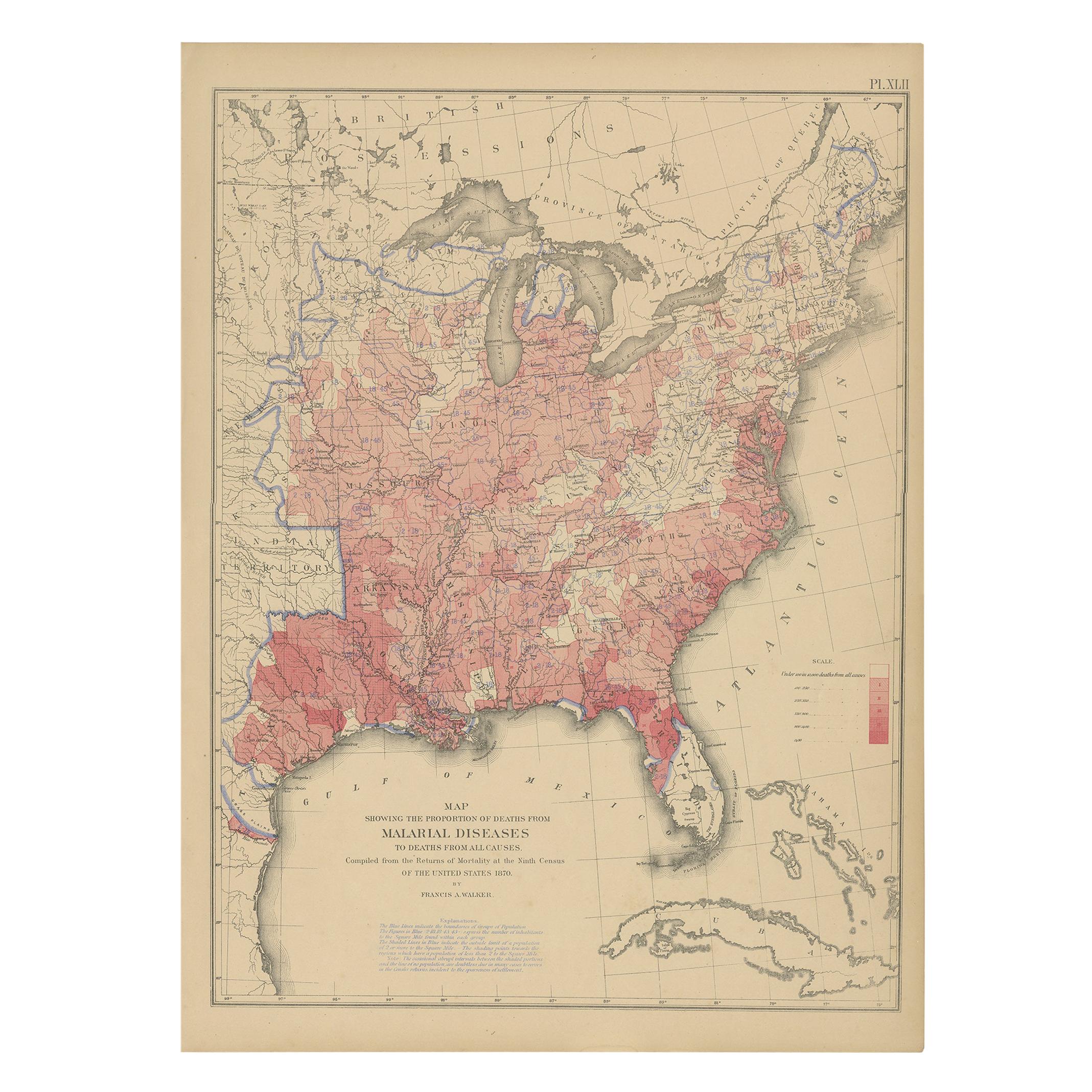
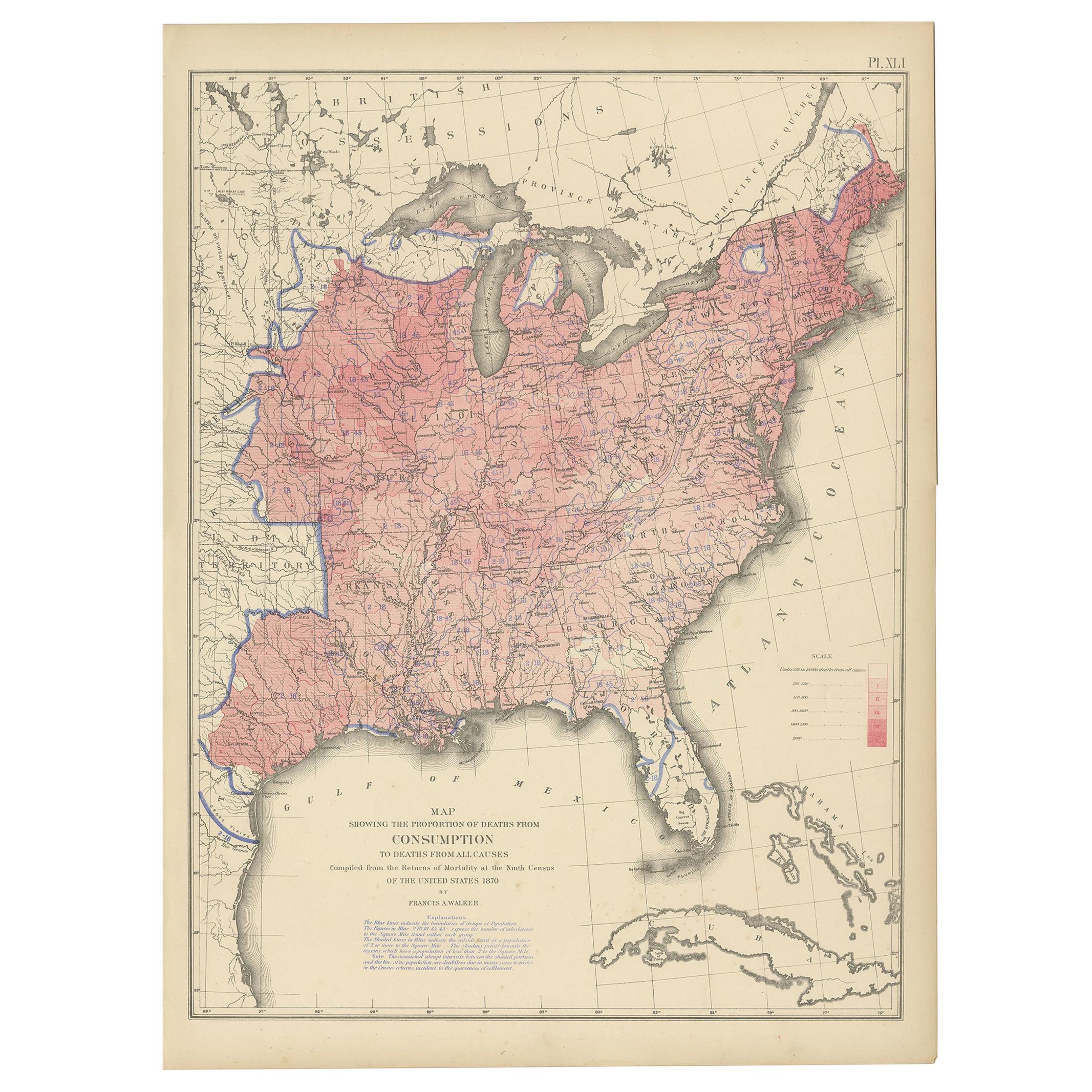
- Antique Chart of the US Malarial Deaths, '1874'Located in Langweer, NLAntique chart titled 'Map showing the proportion of deaths from malarial diseases to deaths from all causes. Compiled from the returns of mortality at th...Category
Antique Late 19th Century Maps
MaterialsPaper
 $440 Sale Price20% Off
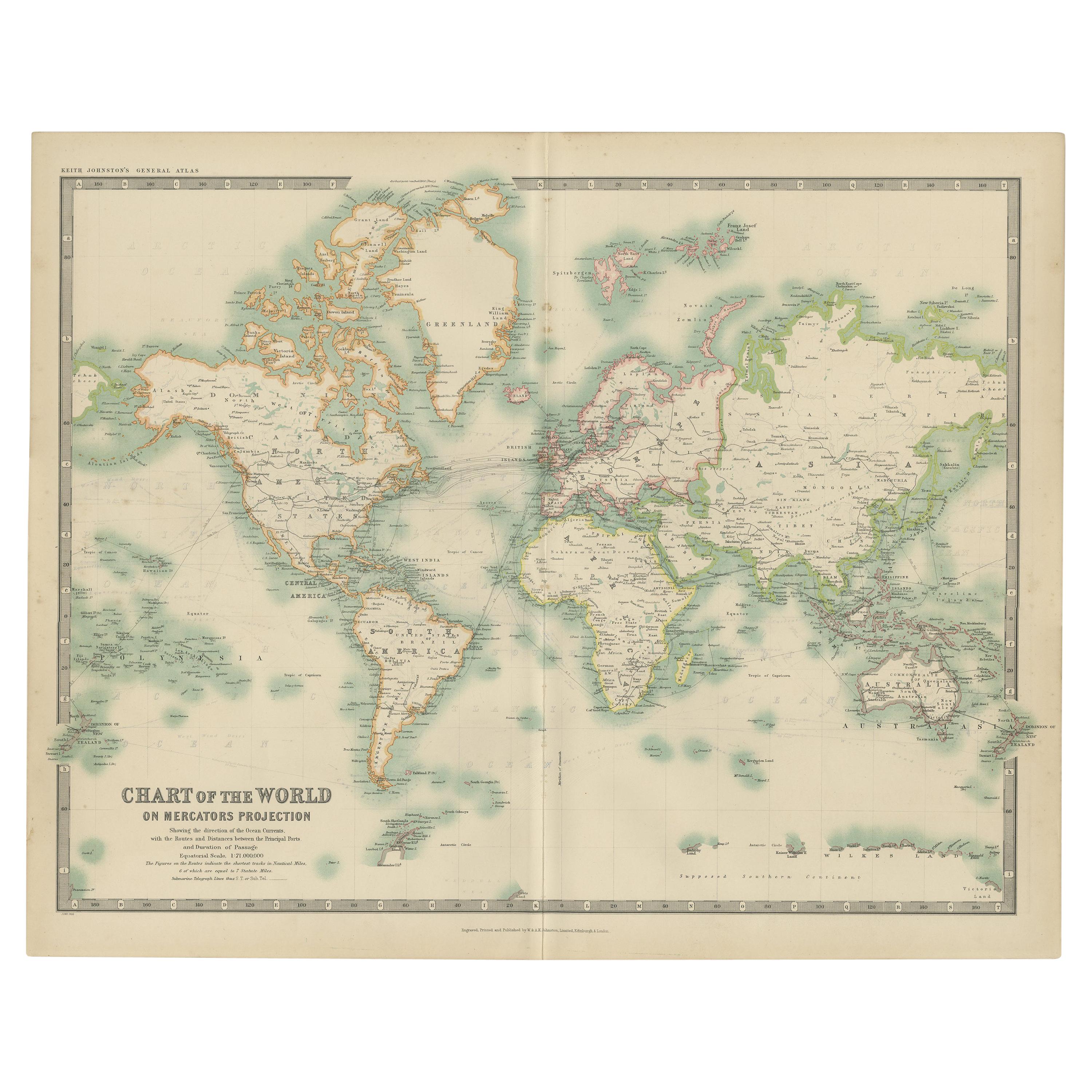
 - Antique Chart of the World by Johnston '1909'Located in Langweer, NLAntique map titled 'Chart of the World on Mercator's Projection Showing the directions of the Oceans Currents with the Routes and Distances Between Principal Ports'. Detailed map of ...Category
Early 20th Century Maps
MaterialsPaper

Recently Viewed
View AllMore Ways To Browse
French School Maps Vintage
Retro French Restaurant Signs
Retro French School Maps
Retro French School Map
Vintage Motorbike
Vintage Postal
Vintage Busses
French City Fountain
Used Traffic Signs
Mercy Vintage
Rossignol Vintage
French School Map
Henri Mercier
Antique World Map
World Map Antique
World Antique Map
Antique Map World
Antique Maps World