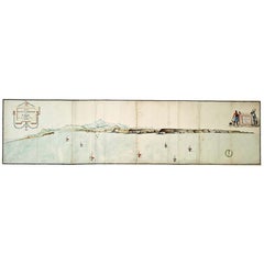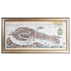
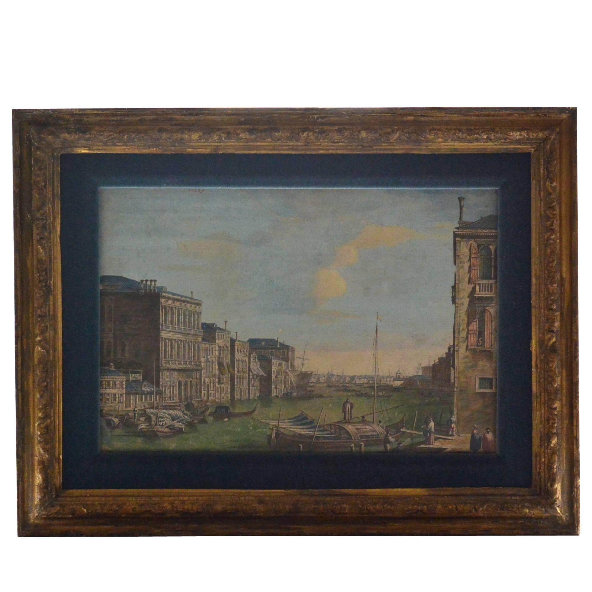
Hand Colored Lithograph of Venice
View Similar Items
Want more images or videos?
Request additional images or videos from the seller
1 of 5
Hand Colored Lithograph of Venice
About the Item
- Dimensions:Height: 22 in (55.88 cm)Width: 43 in (109.22 cm)Depth: 1 in (2.54 cm)
- Period:
- Date of Manufacture:Unknown
- Condition:
- Seller Location:Norwell, MA
- Reference Number:Seller: 1031180521stDibs: LU1741212555141
About the Seller
5.0
Vetted Seller
These experienced sellers undergo a comprehensive evaluation by our team of in-house experts.
Established in 1967
1stDibs seller since 2015
345 sales on 1stDibs
Typical response time: 2 hours
More From This SellerView All
- Ships Compass by John Hand of PhiladelphiaLocated in Norwell, MAWing bridge compass from a United States Navy vessel. The gray military paint has been stripped and the entire binnacle and compass have been meticulously polished and lacquered. The...Category
Vintage 1940s North American Scientific Instruments
MaterialsBrass
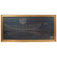
- Early 20th Century Blueprint by John AldenBy John G. AldenLocated in Norwell, MAEarly 20th century blueprint by John Alden of a General Seafoods Corp. trawler dated 2/24/37. Hull Lines are shown from bow, profile and bottom views. Nicely framed. Scale: 1/4 inch ...Category
Early 20th Century Drawings
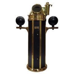
- Ships Binnacle by John Hand & SonLocated in Norwell, MAUnique style marine binnacle by American maker John Hand and Son of Philadelphia. With polished and lacquered brass hood, compass, base trim, and rarely fou...Category
Vintage 1930s North American Nautical Objects
MaterialsBrass
- 1865 Chart of the Islands of MadeiraLocated in Norwell, MARare James Imray chart from 1865 titled "Chart of the Islands of Madeira, Porto Santo and Dezerea" drawn from the survey made by Captain Ate Vidal Royal Navy, London. Published by Ja...Category
Antique 1860s European Maps
MaterialsPaper
- Map of Harwich, MassachusettsLocated in Norwell, MATurn of the century map of Harwich, Massachusetts. Plate from a Cape Cod County Map book showing the Barnstable county town of Harwich including Allens Harbor, Pleasant Lake, Harwich...Category
20th Century Maps
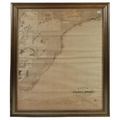
- Imray Ocean Chart of the Coast of Brazil 1876Located in Norwell, MAImray & Son 1876 Nautical chart of the Coast of Brazil between Cape Frio and the River Plate. Nicely framed. Overall Dimensions: 46" H x 56" W.Category
Antique 1870s Nautical Objects
MaterialsPaper


You May Also Like
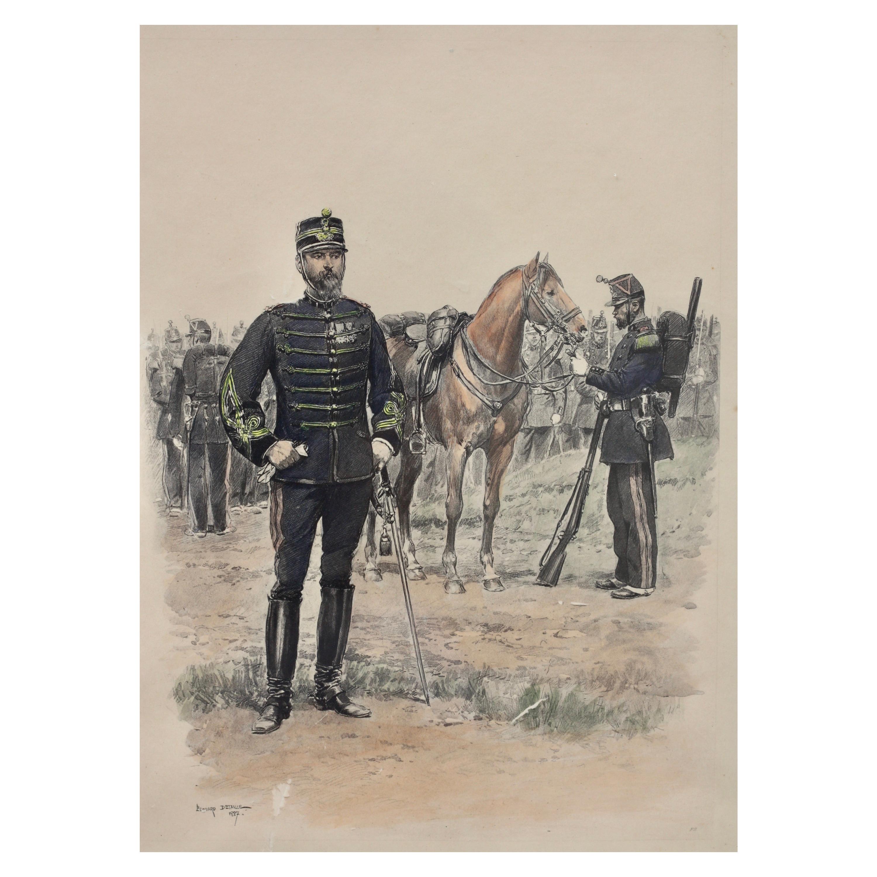
- Edouard Detaille Set of Four, Hand Colored LithographLocated in West Palm Beach, FLEdouard Detaille (1848-1912) "Soldiers with flag" Print-multiple, set of four, hand colored lithograph Measures: Framed height 20.5 in. (52.07 cm.), width 16.37 in. (41.57 cm.) W...Category
20th Century Drawings
MaterialsPaper
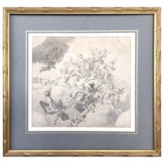
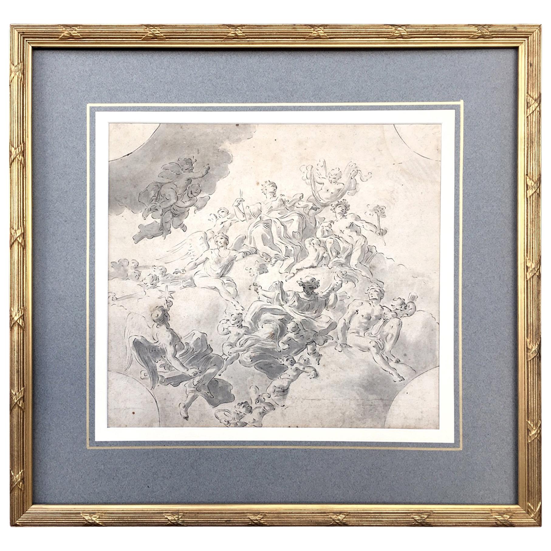
- Original Drawing, Circle of Giovanni Battista Tiepolo 1696-1770 Venice, ItalyBy Giovanni Battista TiepoloLocated in Vero Beach, FLOriginal Drawing, Circle of Giovanni Battista Tiepolo 1696-1770 Venice, Italy Although we offer this old master drawing as circle of Tiepolo, we are convinced, based on the composi...Category
Antique 18th Century Italian Rococo Drawings
MaterialsPaper
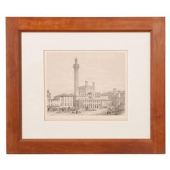
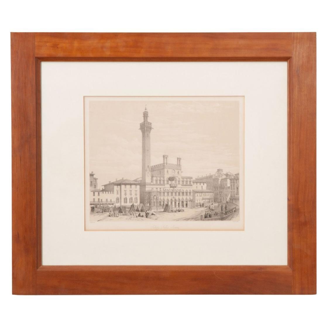
- Framed Italian Lithograph of VeniceLocated in Baton Rouge, LAThis Italian lithograph depicts the town hall palace in Sienna, Tuscany, the center of Venice, Italy. More formally known as “Palazzo Publico Sienna”,...Category
Antique 19th Century Italian Other Drawings
MaterialsFruitwood, Paper
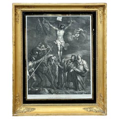
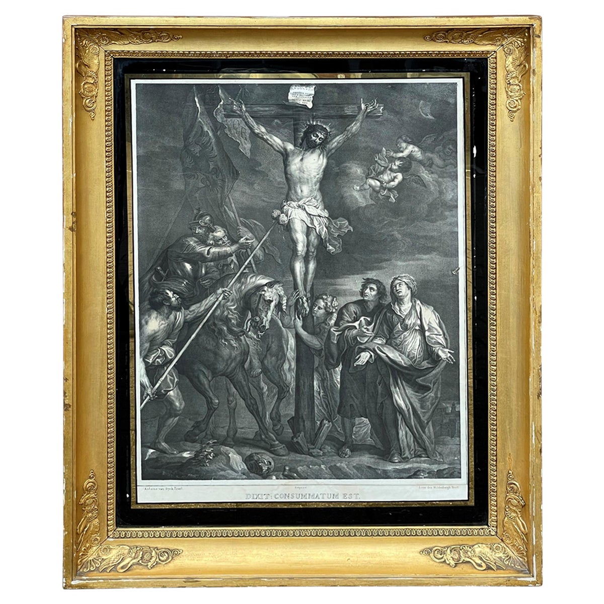
- Antique Lithograph of Christ on the Cross, Original Painting by Anthony Van DyckLocated in Lisse, NLAmazing lithograph of a 1630 van Dyck painting by lithographer L. van den Wildenbergh (1803-1857). The original painting of this rare antique lithograph (in its original early 19t...Category
Antique Early 19th Century Belgian Empire Revival Drawings
MaterialsWrought Iron, Copper
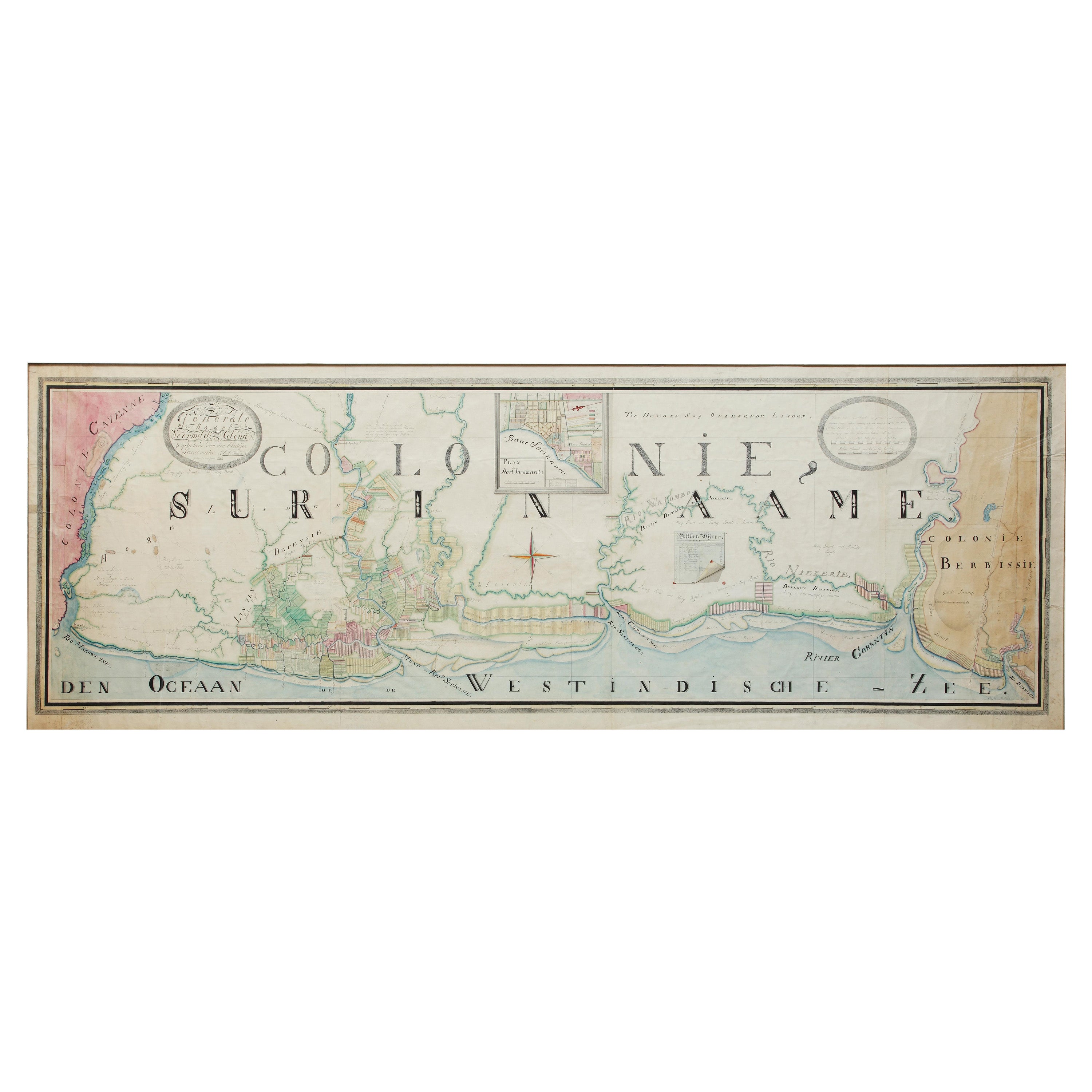
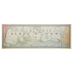
- Extremely Large Hand-Drawn Manuscript Map of Surinam, 1830, History of SlaveryLocated in Amsterdam, NLA unique large hand-drawn map of Surinam by Albrecht Helmut Hiemcke (German, 1760-1839) ? 'Colonie Surinaame', 1830 A large hand-drawn and coloured map of the colony of Suri...Category
Antique Mid-19th Century Surinamer Maps
MaterialsPaper
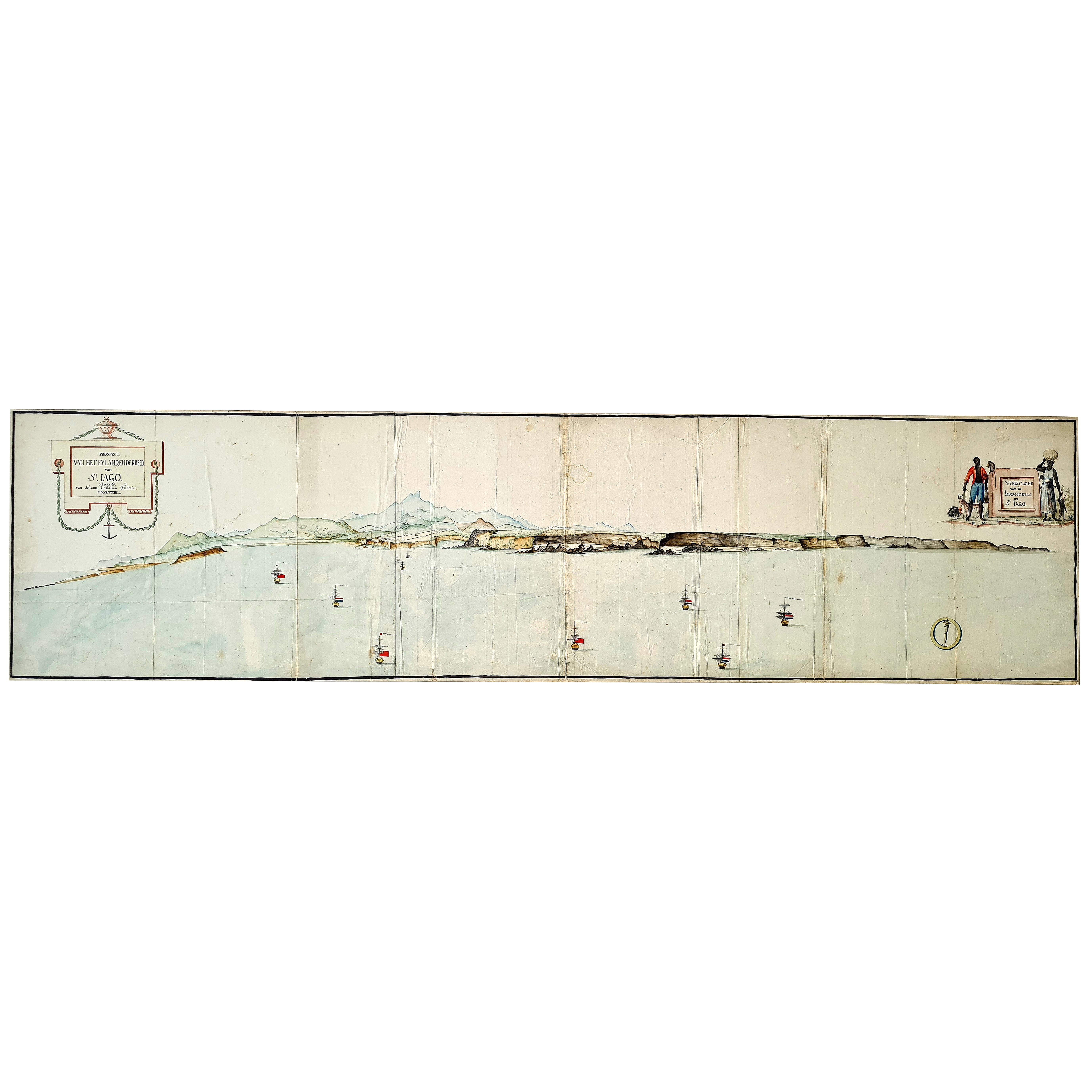
- Very Large Hand-Drawn View of St Iago Cape Verde, by Frederici, 1783Located in Amsterdam, NLJohann Christian Friderici [= Frederici] (Heldburg 1766 - Cape Town 1804) Prospect van het eyland, en de rheede van St. Iago. Geteekend van Johann Christian Friderici / Verbeelding van de inwoonders op St Iago (View of the island, and the roadstead of St. Iago. Drawn by Johann Christian Friderci / Depiction of the inhabitants on St Iago) ?Porto Praia, Cape Verde...Category
Antique Late 18th Century Cape Verdean Dutch Colonial Maps
MaterialsPaper