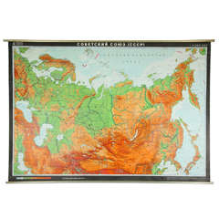
1984 German Map of the USSR
View Similar Items


Want more images or videos?
Request additional images or videos from the seller
1 of 9
1984 German Map of the USSR
About the Item
- Dimensions:Height: 65.5 in (166.37 cm)Width: 97 in (246.38 cm)Depth: 2 in (5.08 cm)
- Place of Origin:
- Period:
- Date of Manufacture:1984
- Condition:Wear consistent with age and use.
- Seller Location:Los Angeles, CA
- Reference Number:1stDibs: 130724992529
About the Seller
No Reviews Yet
Vetted Seller
These experienced sellers undergo a comprehensive evaluation by our team of in-house experts.
1stDibs seller since 2013
30 sales on 1stDibs
More From This SellerView All
- Large Bronze Architectural Plaque from New York CityLocated in Los Angeles, CAFrom the National American Building, formerly located at 340 Madison Avenue, New York City. This building was constructed in 1927 and was designed by the renowned architect Joseph H....Category
Early 20th Century American Neoclassical Revival Architectural Elements
MaterialsBronze
- 1940s Petite Six-Arm Marie Therese Chandelier CrystalsLocated in Los Angeles, CAClear crystal Marie Therese style chandelier with six arms from the 1940s. Please note, this item is located in our Los Angeles location.Category
Vintage 1940s American Chandeliers and Pendants
MaterialsCrystal
- Wrought Iron Frosted Glass 4 Light Floral ChandelierLocated in Los Angeles, CAWrought iron and frosted glass four light floral motif chandelier. Centre bowl is not lit. Please note, this item is located in our Los Angeles location.Category
20th Century Unknown Chandeliers and Pendants
MaterialsWrought Iron, Iron


You May Also Like
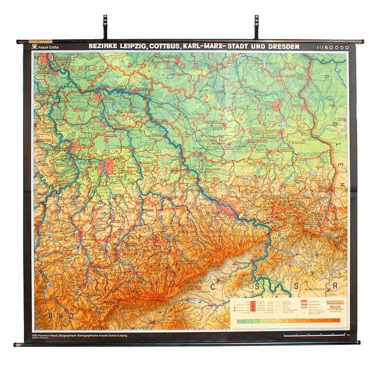
- East German MapBy VEB Hermann HaackLocated in Baltimore, MDA brilliantly colourful map of the Leipzig, Karl Marx Stadt and Dresden area in the former German Democratic Republic by VEB Hermann Haack of Gotha.Category
Vintage 1970s German Maps
 $295 Sale Price25% Off
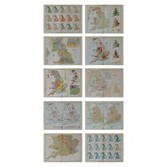
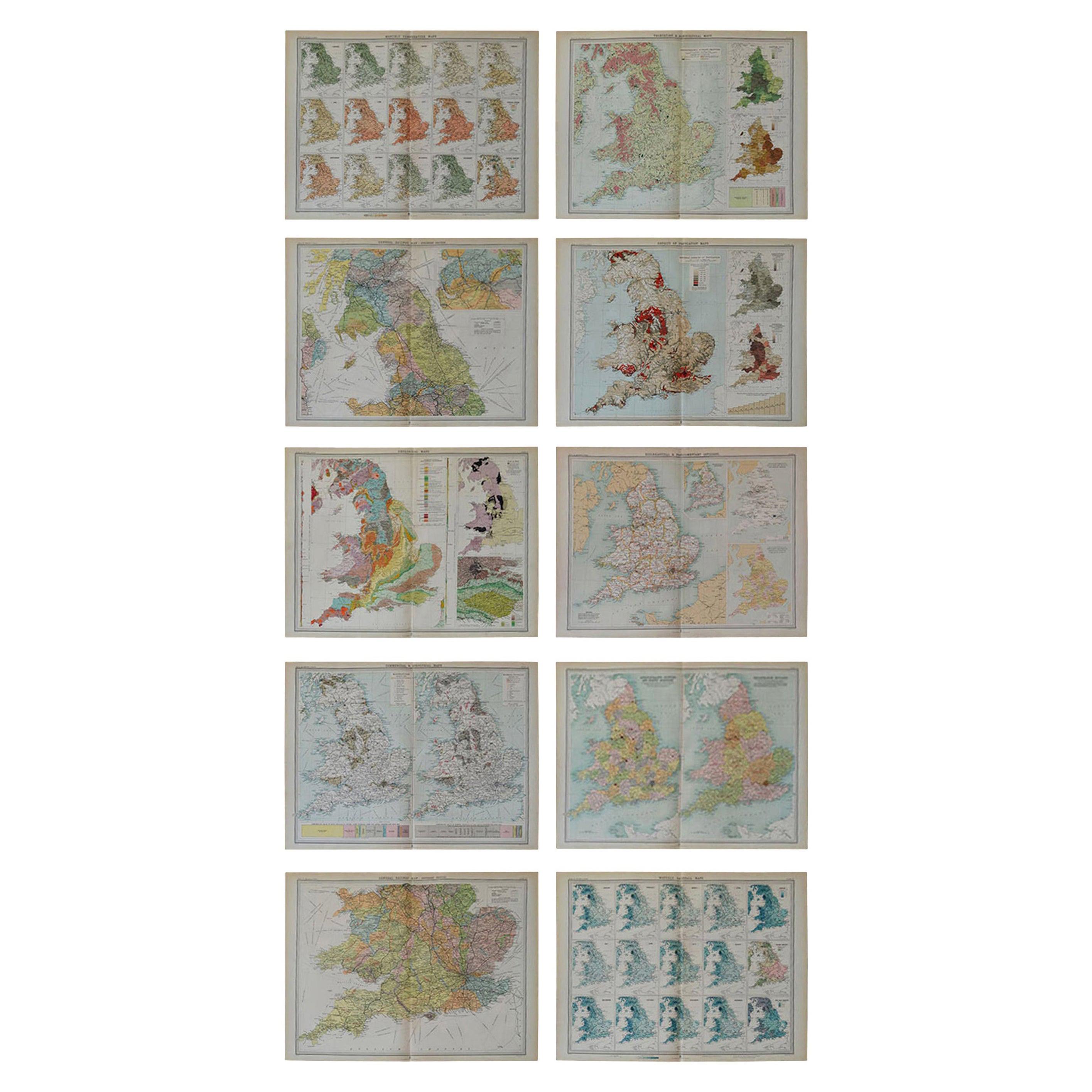
 - Set of 10 Large Scale Vintage Maps of The United Kingdom, circa 1900Located in St Annes, LancashireGreat set of maps of the UK Lithographs. By John Bartholomew & Co. Published by The Edinburgh Geographical Institute Unframed. The measurement ...Category
Antique Early 1900s English Maps
MaterialsPaper
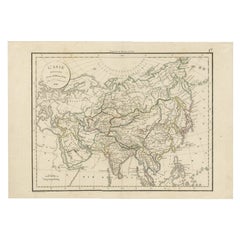
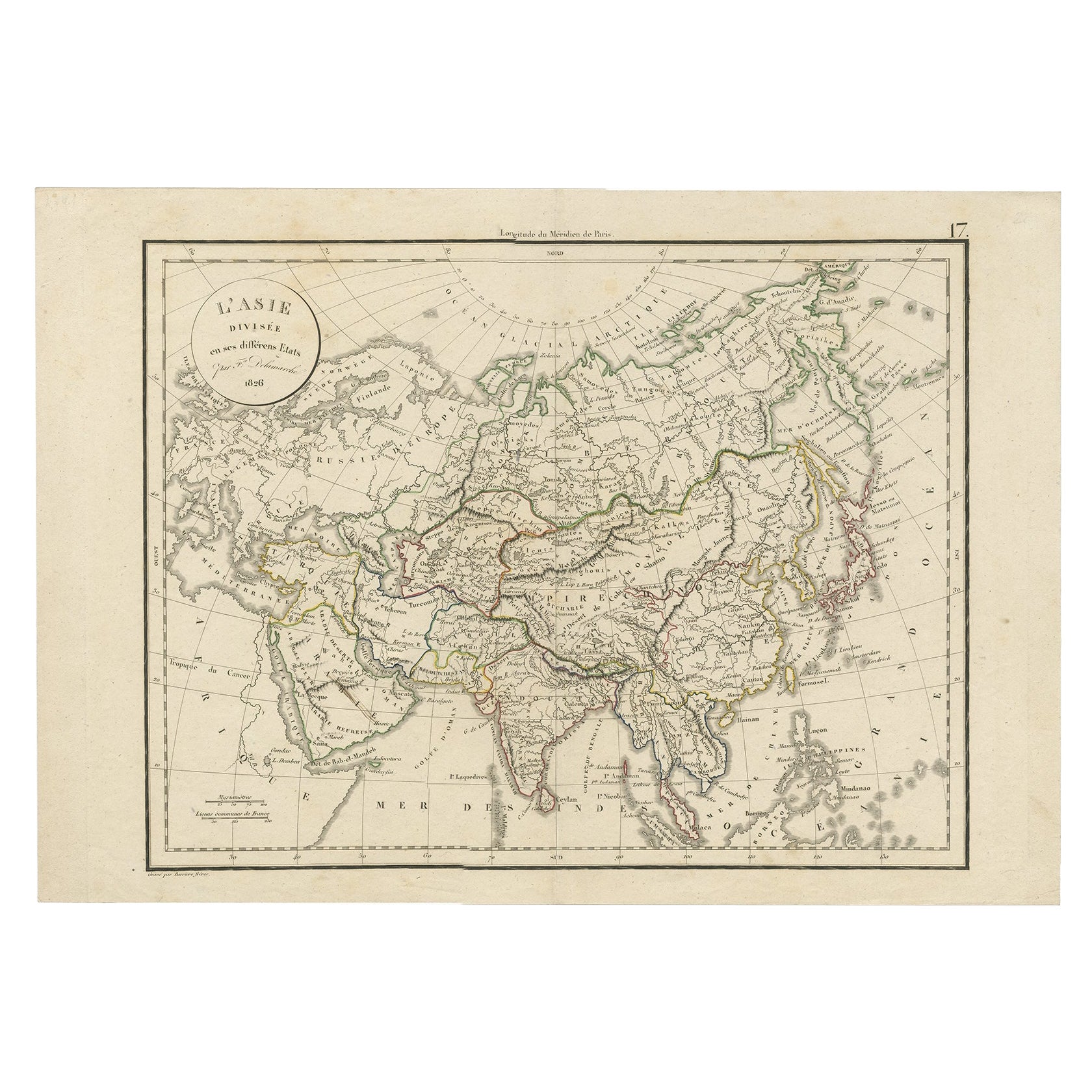
- Antique Map of Asia by Delamarche, 1826Located in Langweer, NLVaugondy's map plates and copyrights and later addes many plates from other sources as well. Charles Delamarche eventually passed control of the firm to his son Felix Delamarche (18t...Category
Antique 19th Century Maps
MaterialsPaper
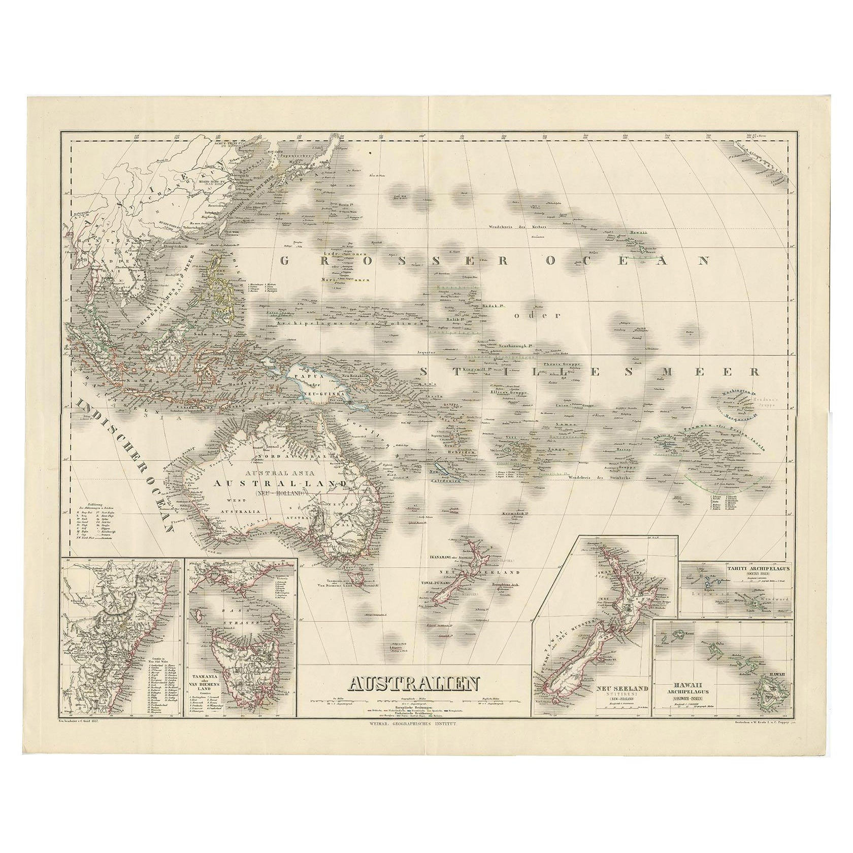
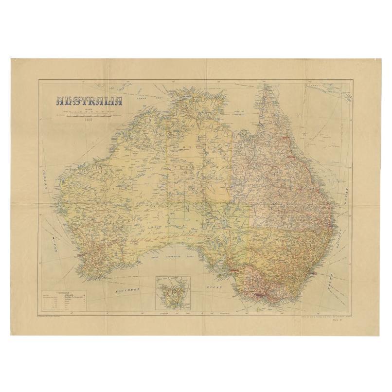
- Large Detailed Map of Australia Wint Inset of Tasmania, 1937Located in Langweer, NLAntique map titled 'Australia'. Large folding map of Australia. With inset map of Tasmania. Printed by L.F. Johnston, Canberra. Artists and Engravers: Compiled and drawn by Propert...Category
20th Century Maps
MaterialsPaper
 $307 Sale Price20% Off
 - Gilt Framed Vintage Wine Regions of France MapLocated in Alton, GBFramed French wine region map 1973. The print has been removed to clean the glass, the frame has minor damage in places but nothing that detracts from ...Category
Vintage 1970s French Posters
MaterialsPaper
- Large University Chart “Physical Map of Africa” by BaconLocated in Chillerton, Isle of WightLarge university chart “Physical Map of Africa” by Bacon W&A K Johnston’s Charts of Physical Maps By G W Bacon, This is colorful Physical map of North America, it is large lithograph set...Category
Early 20th Century Folk Art Posters
MaterialsLinen