Items Similar to 1796 Map of North Carolina by John Reid


Want more images or videos?
Request additional images or videos from the seller
1 of 7
1796 Map of North Carolina by John Reid
$1,500
£1,145.72
€1,310.12
CA$2,132.34
A$2,338.66
CHF 1,223.07
MX$28,257.39
NOK 15,346.01
SEK 14,465.47
DKK 9,778.12
About the Item
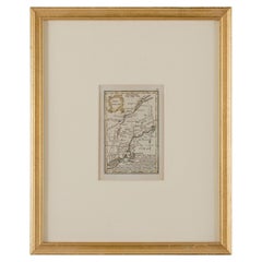
1796 Map of North Carolina by John Reid. A rare & important early map of the state based on the 1795 Lewis/Carey map for his "An American Atlas". Engraved by Benjamin Tanner. Old purchase documentation on back. Appears to be overall in very good condition; not examined out of the frame. By sight: 11.75" x 19". Framed: 19" x 26.5".
We are a family business that has been a major source for the selective buyer for over 90 years. We are one the finest antiques shop in the South and Mid-Atlantic, proclaimed the “Best Antiques Shop in the Mid-Atlantic” by Mid-Atlantic Antiques Magazine. With over 7,500 square feet of show room space in an impressive Italianate Villa setting, we are a must visit spot for antiques collectors, dealers and decorators alike!
We specialize in period 18th and 19th century English and Country French furniture, fine art, silver, porcelain, lighting, and all appropriate decorative accessories. You will also find pieces of American origin, from Continental Europe, Asia, and the Middle East and ranging in date and style from Baroque to Mid-Century Modern. In short, we are a treasure trove of unique items with an unprecedented selection for your home or collection!
- Dimensions:Height: 19 in (48.26 cm)Width: 26.5 in (67.31 cm)Depth: 1.25 in (3.18 cm)
- Materials and Techniques:
- Place of Origin:
- Period:
- Date of Manufacture:1796
- Condition:Wear consistent with age and use. Condition commensurate with age and use.
- Seller Location:Chapel Hill, NC
- Reference Number:Seller: WP-2575z1stDibs: LU6458245749442
About the Seller
4.9
Platinum Seller
Premium sellers with a 4.7+ rating and 24-hour response times
Established in 1930
1stDibs seller since 2022
345 sales on 1stDibs
Typical response time: <1 hour
- ShippingRetrieving quote...Shipping from: Chapel Hill, NC
- Return Policy
Authenticity Guarantee
In the unlikely event there’s an issue with an item’s authenticity, contact us within 1 year for a full refund. DetailsMoney-Back Guarantee
If your item is not as described, is damaged in transit, or does not arrive, contact us within 7 days for a full refund. Details24-Hour Cancellation
You have a 24-hour grace period in which to reconsider your purchase, with no questions asked.Vetted Professional Sellers
Our world-class sellers must adhere to strict standards for service and quality, maintaining the integrity of our listings.Price-Match Guarantee
If you find that a seller listed the same item for a lower price elsewhere, we’ll match it.Trusted Global Delivery
Our best-in-class carrier network provides specialized shipping options worldwide, including custom delivery.More From This Seller
View All1597 German Map of Alexandria by Georg Braun and Frans Hogenberg
By Georg Braun and Frans Hogenberg
Located in Chapel Hill, NC
1597 Map of Alexandria by Georg Braun and Frans Hogenberg, Germany. From "Civitas Orbis Terrarum", part 2, published in Cologne by Bertram Buchholz. Printed in 2 parts. Title: "Alexa...
Category
Antique 16th Century German Renaissance Maps
Materials
Paper

1562 Map of Toscana Nuova Tavola by Girolamo Ruscelli
Located in Chapel Hill, NC
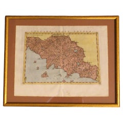
A 1562 map of Toscana Nuova Tavola by Girolamo Ruscelli. Tuscany is the heart of Italy & birthplace of the Italian language. Early hand-coloring. Copper plate engraving. Interestingl...
Category
Antique 16th Century Italian Renaissance Maps
Materials
Paper
$360 Sale Price
20% Off
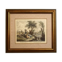
Early 19th Century Engraving "Luglio" from The Months by Giuseppe Zocchi
By Francesco Bartolozzi
Located in Chapel Hill, NC
Early 19th century engraving "Luglio" from The Months by Giuseppe Zocchi, Italian. Engraved by Francesco Bartolozzi, Italian, 1727-1815. Zocchi, 1711-1767. Hand colored. A celebratio...
Category
Antique Early 19th Century Italian Romantic Prints
Materials
Paper
$144 Sale Price
20% Off
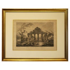
Late 18th Century French Print "Temple Herastyle Périptère de Pestum"
Located in Chapel Hill, NC
Late 18th century print "Temple Herastyle Périptère de Pestum", French. No 381, G.G., Gravé à L'eau-forte par Weisbret. Terminé par J. Miamet graveur du Roi. From "Voyage Pittoresque...
Category
Antique Late 18th Century French Neoclassical Prints
Materials
Paper
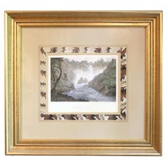
Late 18th Century English Engraving of the "Cascade of Terni"
By John Smith
Located in Chapel Hill, NC
Late 18th century engraving of the "Cascade of Terni", English. Drawn by J. Smith & engraved by W. Byrne & B.T. Pouncy. John (Warwick) Smith, OWS; England; 1749-1831. His watercolors...
Category
Antique Late 18th Century English Romantic Decorative Art
Materials
Wood, Paper
$180 Sale Price
20% Off
1752 "A View of Amsterdam" Print From George Balthasar Probst Lithograph
By Georg Balthasar Probst
Located in Chapel Hill, NC
A View of Amsterdam taken from the Old Rampart print published April 10, 1752, English. Published according to Act of Parliament. Old hand coloring. From the George Balthasar Probst ...
Category
Antique Mid-18th Century English Neoclassical Prints
Materials
Paper
You May Also Like
Antique 18th Century Map of the Province of Pensilvania 'Pennsylvania State'
Located in Philadelphia, PA
A fine antique of the colony of Pennsylvania.
Noted at the top of the sheet as a 'Map of the province of Pensilvania'.
This undated and anonymous map is thought to be from the Gentleman's Magazine, London, circa 1775, although the general appearance could date it to the 1760's.
The southern boundary reflects the Mason-Dixon survey (1768), the western boundary is placed just west of Pittsburgh, and the northern boundary is not marked.
The map has a number of reference points that likely refer to companion text and appear to be connected to boundaries. The western and southern boundaries are marked Q, R, S, for example. A diagonal line runs from the Susquehanna R to the Lake Erie P. A broken line marked by many letters A, B, N, O, etc., appears in the east.
There are no latitude or longitude markings, blank verso.
Framed in a shaped contemporary gilt wooden frame and matted under a cream colored matte.
Bearing an old Graham Arader Gallery...
Category
Antique 18th Century British American Colonial Maps
Materials
Paper

Original Antique Map of the American State of North Carolina, 1903
Located in St Annes, Lancashire
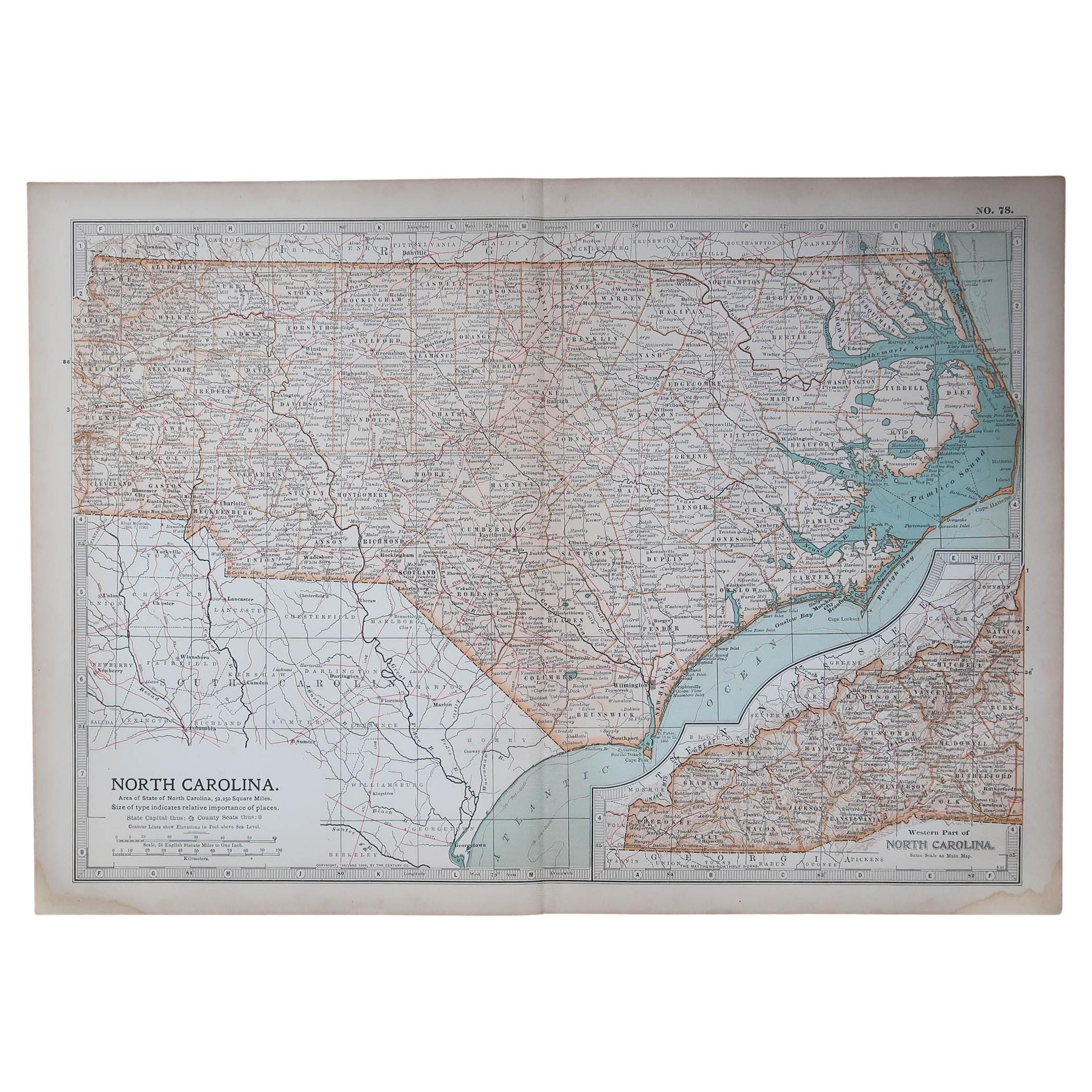
Antique map of North Carolina
Published By A & C Black. 1903
Original colour
Good condition
Unframed.
Free shipping
Category
Antique Early 1900s English Maps
Materials
Paper

Original Antique Map of the American State of South Carolina, 1903
Located in St Annes, Lancashire
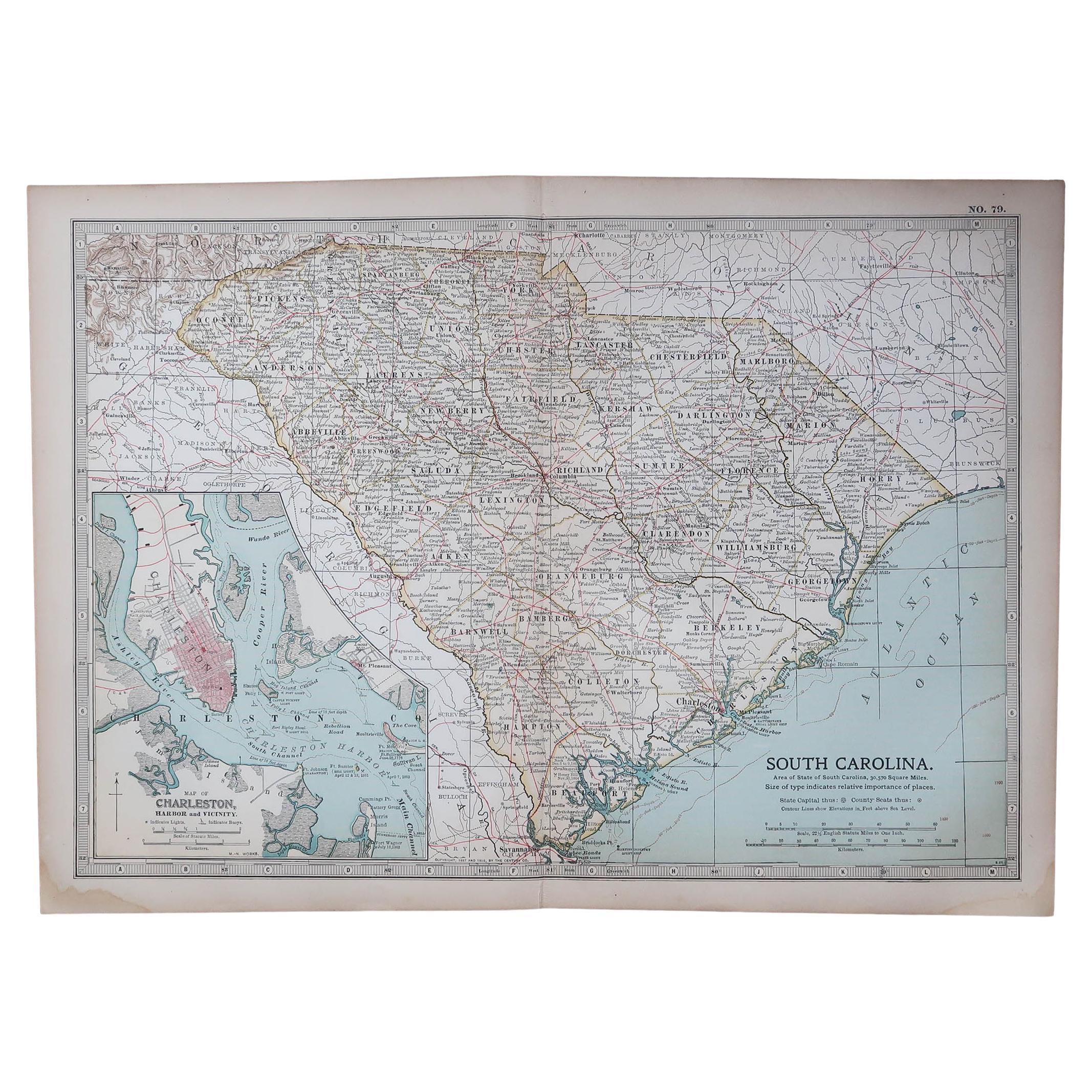
Antique map of South Carolina
Published By A & C Black. 1903
Original colour
Good condition
Unframed.
Free shipping
Category
Antique Early 1900s English Maps
Materials
Paper

Framed 17th Century Map of Cumberland, England by John Speed, 1610
By John Speed
Located in Middleburg, VA
A fascinating and richly detailed antique map of Cumberland County in northwest England, drawn and published by the celebrated English cartographer John Spe...
Category
Antique Early 17th Century English British Colonial Maps
Materials
Copper, Gold Leaf

John Gibson - Map of New England
Located in Savannah, GA
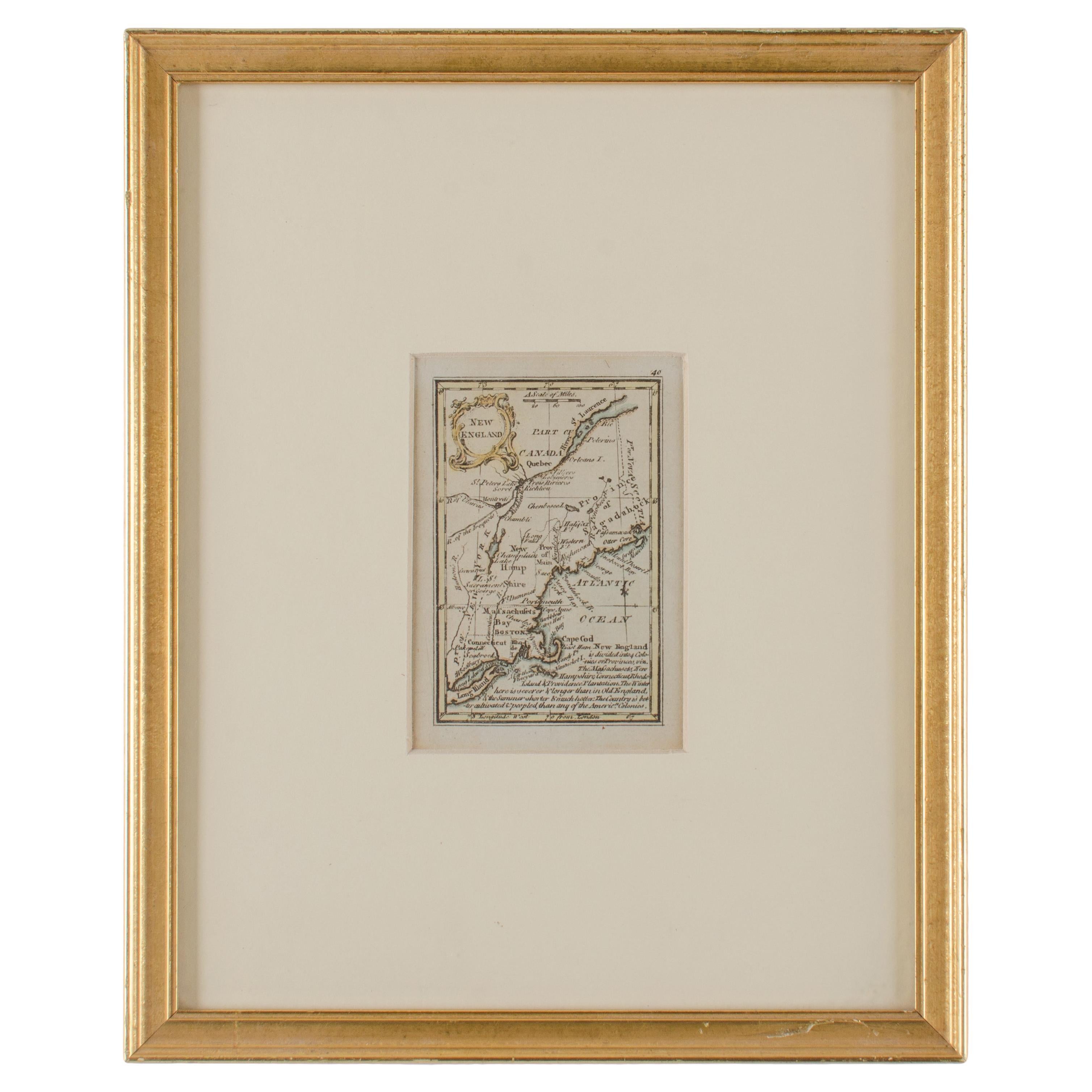
A miniature map of New England from John Gibson’s The Atlas Minimus published in 1758.
John Gibson worked in London from 1748-1773 as a geographer and engraver, producing numerous ...
Category
Antique 1750s British Other Prints
Materials
Glass, Paper
New Map of North America from the Latest Discoveries, 1763
Located in Philadelphia, PA
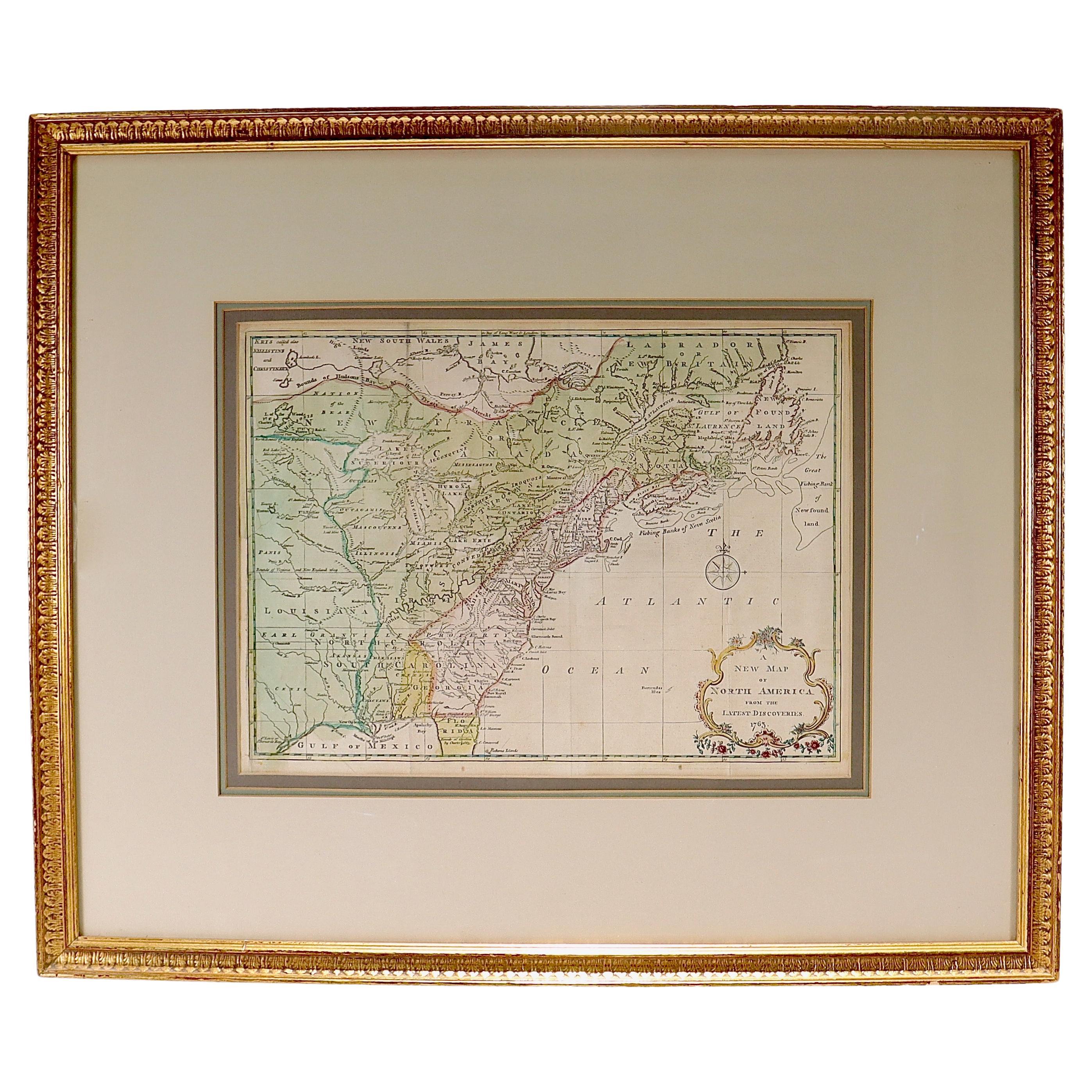
A fine antique 18th century map of the North American seaboard.
Entitled "A New Map of North America from the Latest Discoveries 1763".
By the Cartographer/Engraver - John Spil...
Category
Antique Mid-18th Century English Georgian Maps
Materials
Paper
