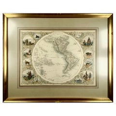
1850c J. & F. Tallis, Western Hemisphere Map, Fine Hand Color, Framed
View Similar Items


Want more images or videos?
Request additional images or videos from the seller
1 of 9
1850c J. & F. Tallis, Western Hemisphere Map, Fine Hand Color, Framed
About the Item
- Creator:Philippe Tallis (Artist)
- Dimensions:Height: 15.75 in (40 cm)Width: 19.49 in (49.5 cm)Depth: 1.58 in (4 cm)
- Style:High Victorian (Of the Period)
- Materials and Techniques:
- Place of Origin:
- Period:
- Date of Manufacture:1850
- Condition:Wear consistent with age and use. Minor marginal edge wear. Minor wear to frame.
- Seller Location:Norwich, GB
- Reference Number:1stDibs: LU7031229565912
About the Seller
No Reviews Yet
Vetted Professional Seller
Every seller passes strict standards for authenticity and reliability
Established in 1992
1stDibs seller since 2022
10 sales on 1stDibs
Typical response time: Several days
Authenticity Guarantee
In the unlikely event there’s an issue with an item’s authenticity, contact us within 1 year for a full refund. DetailsMoney-Back Guarantee
If your item is not as described, is damaged in transit, or does not arrive, contact us within 7 days for a full refund. Details24-Hour Cancellation
You have a 24-hour grace period in which to reconsider your purchase, with no questions asked.Vetted Professional Sellers
Our world-class sellers must adhere to strict standards for service and quality, maintaining the integrity of our listings.Price-Match Guarantee
If you find that a seller listed the same item for a lower price elsewhere, we’ll match it.Trusted Global Delivery
Our best-in-class carrier network provides specialized shipping options worldwide, including custom delivery.More From This Seller
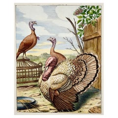
View All1673 Turkey, Poultry, Nicolas Robert, Folio Etching in Hand Color
Located in Norwich, GB
Gibber Coc dinde
Nicolas Robert (18 April 1614 – 25 March 1685)
Issued in the scarce work: Diverses oyseaux dessignées et gravées d'apres le naturel. Pa...
Category
Antique 1670s French Prints
Materials
Paper
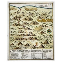
Map of Indonesia, Semarang, Kartasoera, Soerabaya by Schley
By Jakob van der Schley
Located in Norwich, GB
'Carte du Chemin entre Samarang et Cartasoera, kaart van den weg tusschen Samarang en Cartasoera'
Map of the Road between Semarang and Kartasura by Van Schley.
Published 1763.
...
Category
Antique 1760s Indonesian Georgian Prints
Materials
Paper
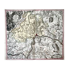
1750 Schaffhausen, Seutter, Large and Detailed Map Switzerland
By Matthew Seutter
Located in Norwich, GB
Sandrart Joachim, von (1606-1688)
Effigies antiquae Romae. redacta a Pyrrho Ligorio Romano, per XIIII Regiones, in quas Urbem divisit Imp. Caesar August.
Nuremberg, Germany, pu...
Category
Antique 1670s Italian Baroque Prints
Materials
Paper
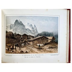
1850 Souvenir album, 19 toned lithographs of Bernese Oberland, Switzerland
Located in Norwich, GB
J[ean-Louis] Jacottet
Souvenirs del la Suisse [Bernese Oberland]. Velvey, G. Blanchoud. [c 1850].
Oblong, large 8vo [17.2 x 23.8 cm]. Illustrated ...
Category
Antique 1850s Swiss Prints
Materials
Paper
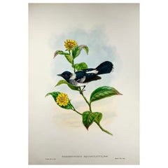
1888 Pied Flycatcher, John Gould 'B1804', Magnificent Hand Coloured Lithograph
Located in Norwich, GB
Gould, John and Richard Bowdler Sharpe.
The Birds of New Guinea and the Adjacent Papuan Islands.
Piezorhynchus Squalmulatus.
London, 1875-1888.
Paper Size:
380mm x 5...
Category
Antique 1880s English Victorian Prints
Materials
Paper
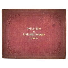
1830c Gottfried Mind, Juvenalia, “Fantasies”, with 12 Fine Aquatints
Located in Norwich, GB
Gottfried Mind (1768-1814)
OEUVRE DE GEOFROI MIND de Berne receuilli de différens Cabinets particuliers et publié par J.P. Lamy, Editeur d'Arts à Berne et Bâle. Livraison accompagnée d'une Notice historique er biographique du Peintre. Berne, Basle & Lausanne, 1816 (ca). Reissued in publisher’s cloth ca 1830.
Oblong quarto. (31 x 24.2 cm). Stipple engraved title with vignette, pp. 8. Publisher’s cloth with gilt to upper board: ‘Collection de Fantaisies’ - Overall very good. Binding a touch rubbed, some light spotting to text and age toning to plates.
Hand-colored aquatints (12). Playing children after Geofroi Mind, bound and mounted on cardboard. Each with blindstamp L.(Lamy) or JPL and with publisher's details in manuscript. Publisher’s engraved label to inner front board.
Exceedingly rare collection using the aquatints and and text first issued in 1816 but with a new publishers binding.
Gottfried Mind (1768 - 1814) was a talented Swiss artist and draftsman who specialized in children and animal motifs. Because of his successful cat drawings, he became known as Cat Raphael.
Mind grew up in modest circumstances, was physically handicapped and mentally retarded. Even as a child, he attracted attention with his talent for drawing and carving. Around 1775-1780 he lived in Johann Heinrich Pestalozzi's Neuhof educational and labour institution in Birr, where he showed talent in the field of fine arts, but was unable to learn to write or do arithmetic. After the Neuhof was closed in 1780, he was taken in by the family of the Bernese painter Sigmund Freudenberger...
Category
Antique 1810s Swiss Prints
Materials
Paper
You May Also Like
Antique Map of West Canada by Tallis 'c.1850'
Located in Langweer, NL
Antique map titled 'West Canada'. Original antique map of West Canada, with decorative vignettes titled Kingston and Falls of Niagara. This map originates from 'The History and Topog...
Category
Antique Mid-19th Century Maps
Materials
Paper

$273 Sale Price
20% Off
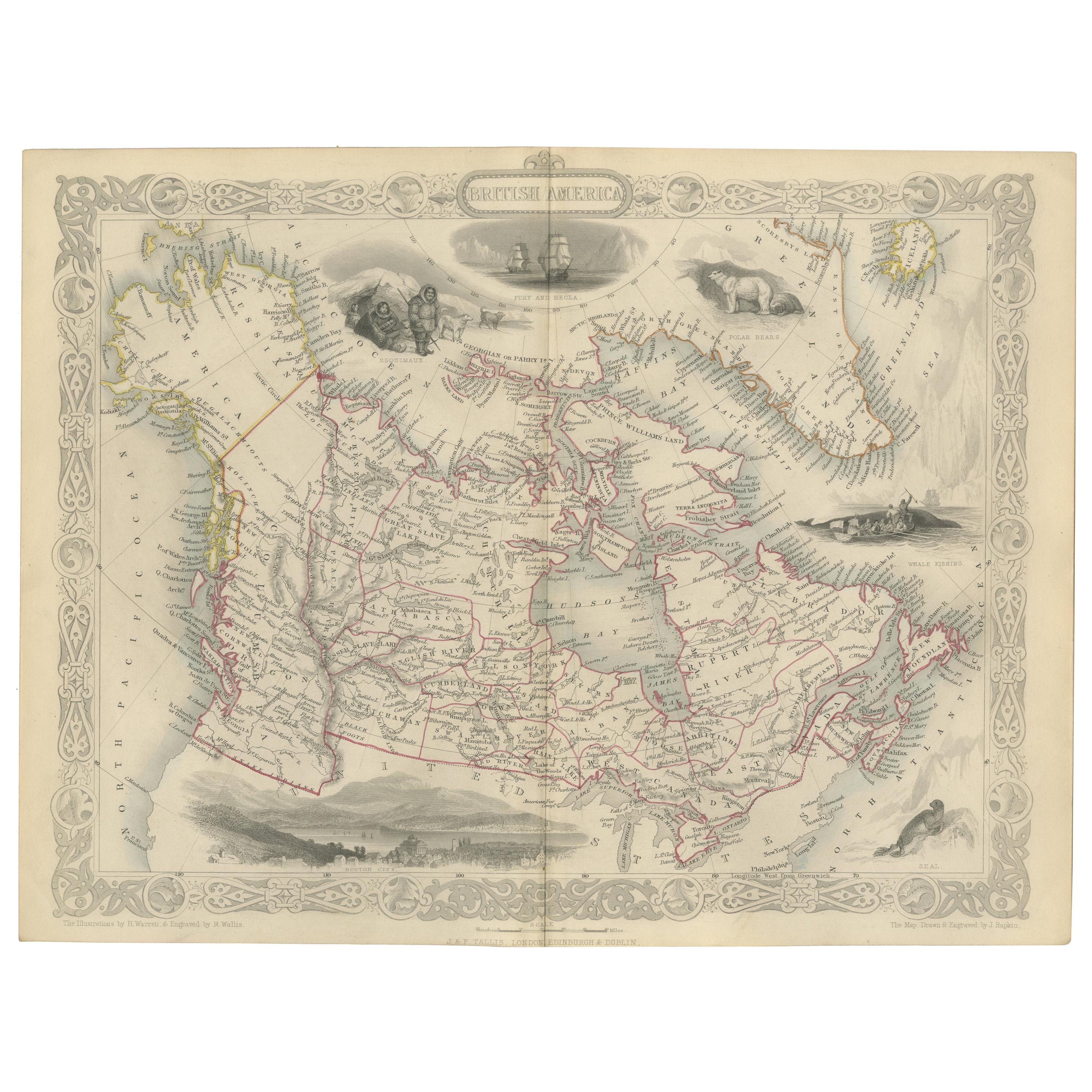
Antique Map of British America by Tallis 'c.1850'
Located in Langweer, NL
Antique map titled 'British America'. Decorative map of British America, with vignettes showing Whale Fishing, Montreal, Fury and Hecla ships asail. Thi...
Category
Antique Mid-19th Century Maps
Materials
Paper

$426 Sale Price
25% Off
Antique Map of the Western Hemisphere by Wyld '1845'
Located in Langweer, NL
Antique map titled 'Western Hemisphere'. Original antique map of the western hemisphere. This map originates from 'An Atlas of the World, Comprehending Separate Maps of its...
Category
Antique Mid-19th Century Maps
Materials
Paper

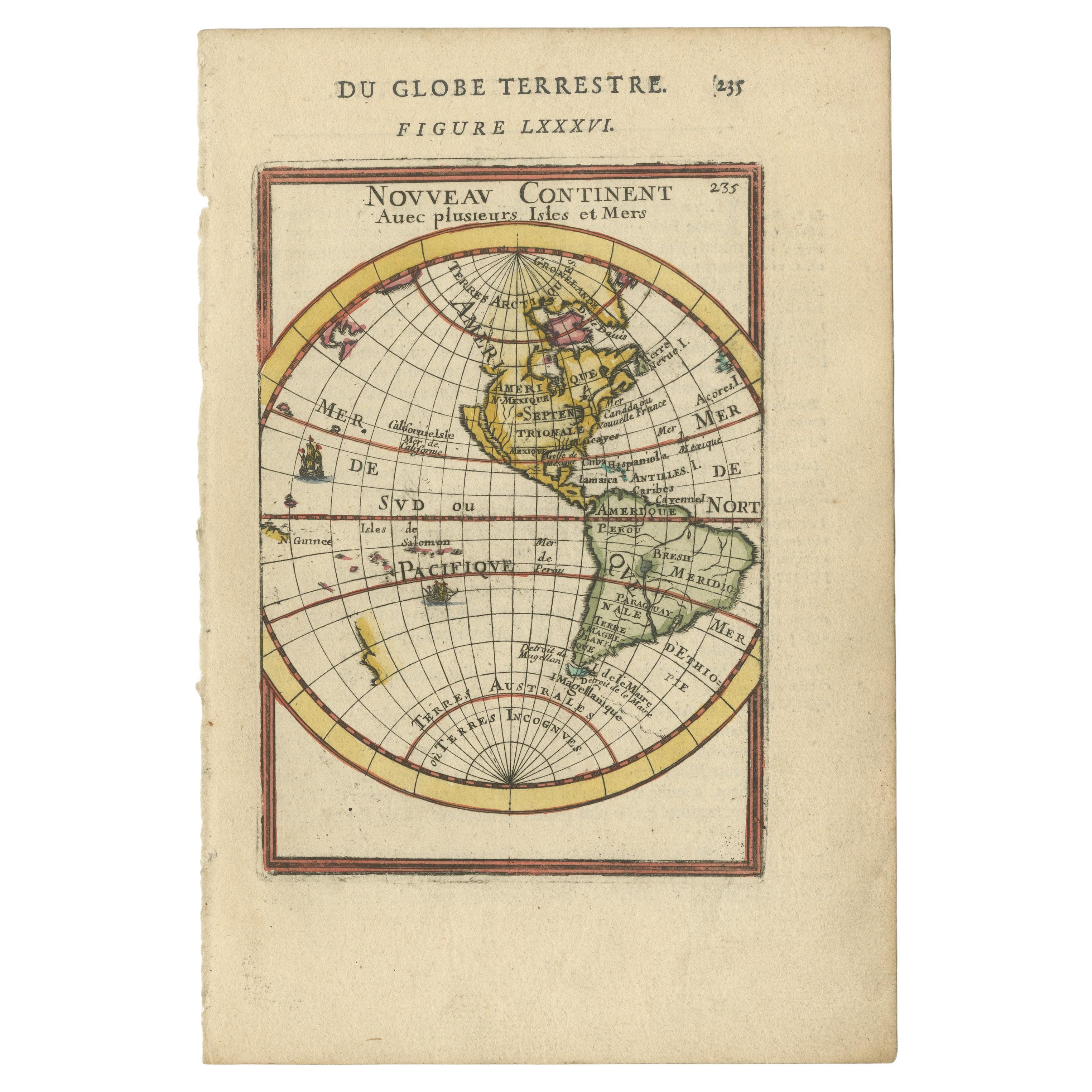
Antique Miniature Map of the Western Hemisphere, with California as an Island
Located in Langweer, NL
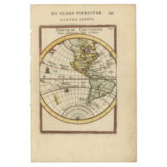
Antique miniature map titled 'Nouveau Continent avec plusieurs Isles et Mers'. Decorative map of the Western Hemisphere, published by Alain Manesson Mallet. The map shows California as an Island...
Category
Antique Late 17th Century Maps
Materials
Paper
Antique Map of the Eastern Hemisphere in Frame, 'circa 1683'
Located in Langweer, NL
Antique map titled 'Climats selon les Anciens'. Miniature map of the Eastern Hemisphere showing the climatic regions. This map originates from 'Description de l'Univers' by A.M. Mall...
Category
Antique Late 17th Century Maps
Materials
Paper

Antique Map of Switzerland by J. Tallis, circa 1851
Located in Langweer, NL
A decorative and detailed mid-19th century map of Switzerland which was drawn and engraved by J. Rapkin (vignettes by A. H. Wray & J. B. Allen) and published in John Tallis's Illustr...
Category
Antique Mid-19th Century Maps
Materials
Paper

$250 Sale Price
20% Off