Items Similar to Antique Litograph of a Combat Between French and British Ships, 1844

Want more images or videos?
Request additional images or videos from the seller
1 of 6
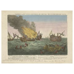
Antique Litograph of a Combat Between French and British Ships, 1844
About the Item
Antique print titled 'La Fregate la Courageuse et la Canonnière la Terréur'. This print illustrates the combat between French ships and the British ships.
Artists and Engravers: Lithographed after Jean Baptiste Henri Durand-Brager.
Condition: Good, general age-related toning. Two stamps an upper margin a bit short, please study image carefully.
- Dimensions:Height: 12.21 in (31 cm)Width: 20.28 in (51.5 cm)Depth: 0 in (0.02 mm)
- Materials and Techniques:
- Period:
- Date of Manufacture:1844
- Condition:
- Seller Location:Langweer, NL
- Reference Number:
About the Seller
5.0
Platinum Seller
These expertly vetted sellers are 1stDibs' most experienced sellers and are rated highest by our customers.
Established in 2009
1stDibs seller since 2017
1,922 sales on 1stDibs
Typical response time: <1 hour
- ShippingRetrieving quote...Ships From: Langweer, Netherlands
- Return PolicyA return for this item may be initiated within 14 days of delivery.
More From This SellerView All
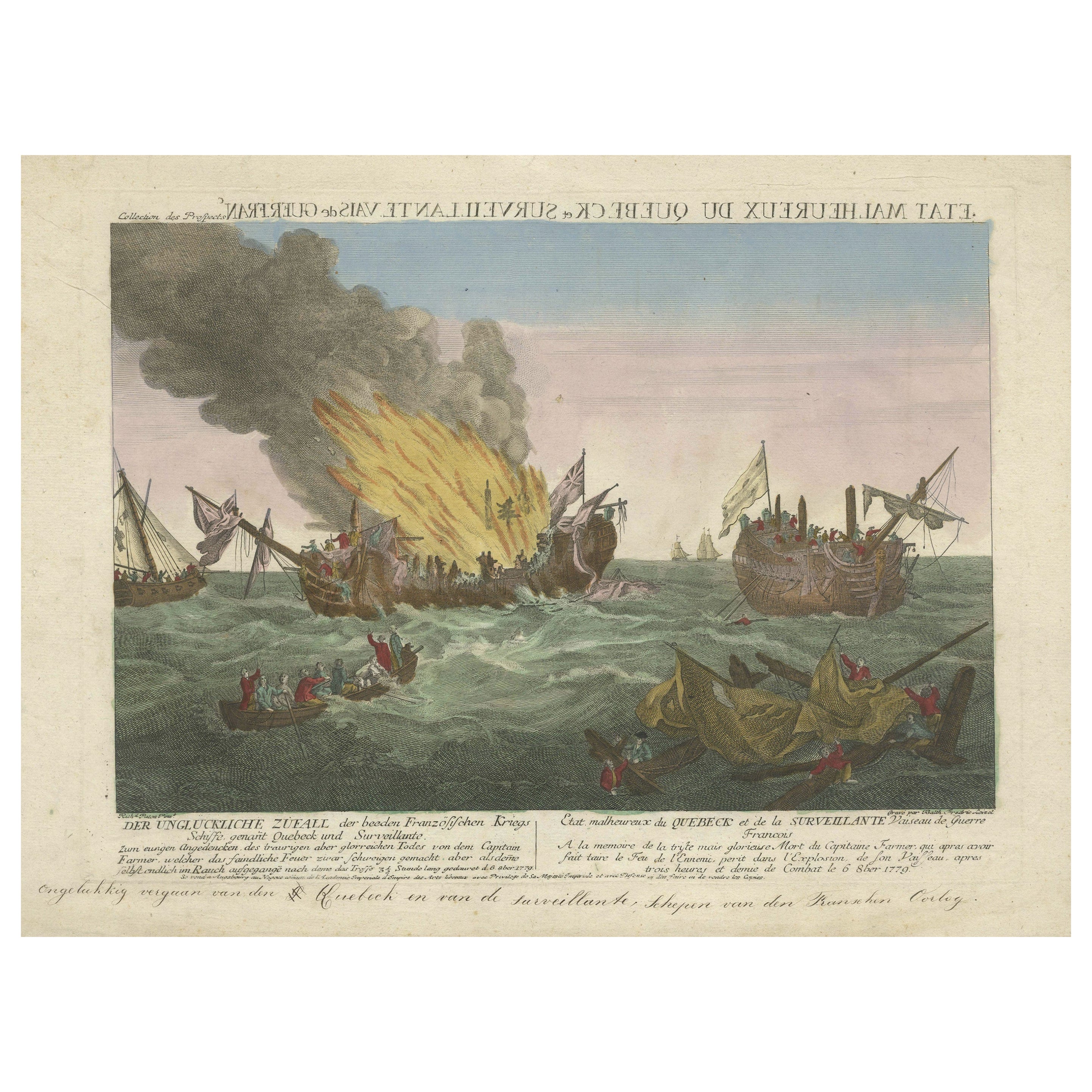
- Rare Engraving of a Famous Battle Near Ushant Between the French and BritishLocated in Langweer, NLAntique print titled 'Der ungluckliche Zufall der beeden Frazösischen Kriegs (..) - Etat malheureux de Quebeck et de la Surveillante (..)'. An engraving of a painting by Richard Paton of the three and a half hour long naval battle of 6 October 1779 which was fought off Ushant between HMS Quebec, under the command of Captain George Farmer, and the Surveillante, under the command of Captain Couédic de Kergoaler. The Quebec caught fire and exploded, and the British crew were rescued by the French. Captain George Farmer (b.1732) died in the battle. American War of Independence...Category
Antique Late 18th Century Prints
MaterialsPaper
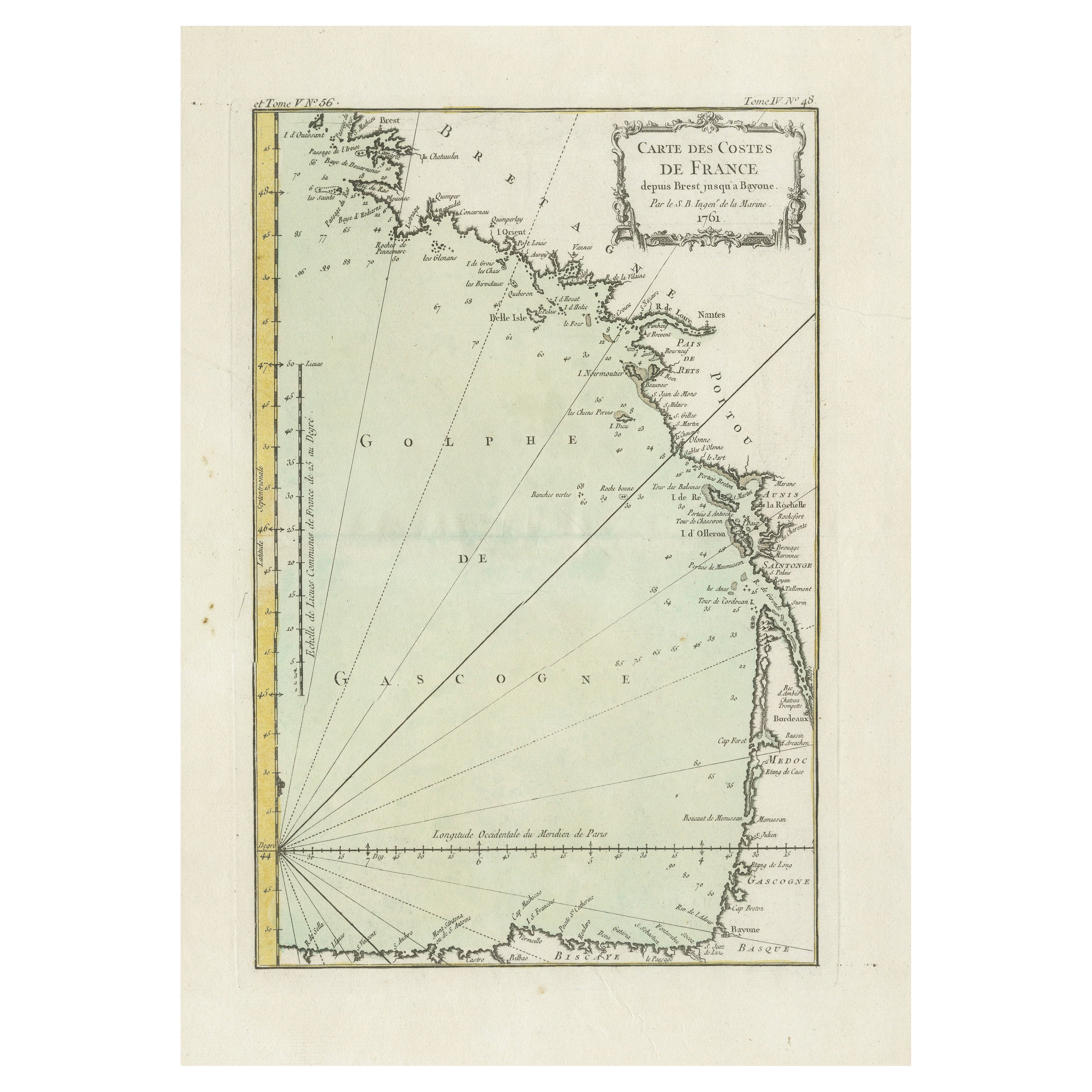
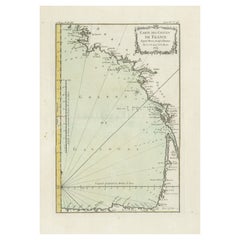
- Antique Map of the Coast of France Between Brest and BayonneLocated in Langweer, NLAntique map titled 'Carte des Costes de France depuis Brest jusquá Bayone'. Original old map of the coast of France between Brest and Bayonne. This map originates from 'Le Petit Atla...Category
Antique Mid-18th Century Maps
MaterialsPaper
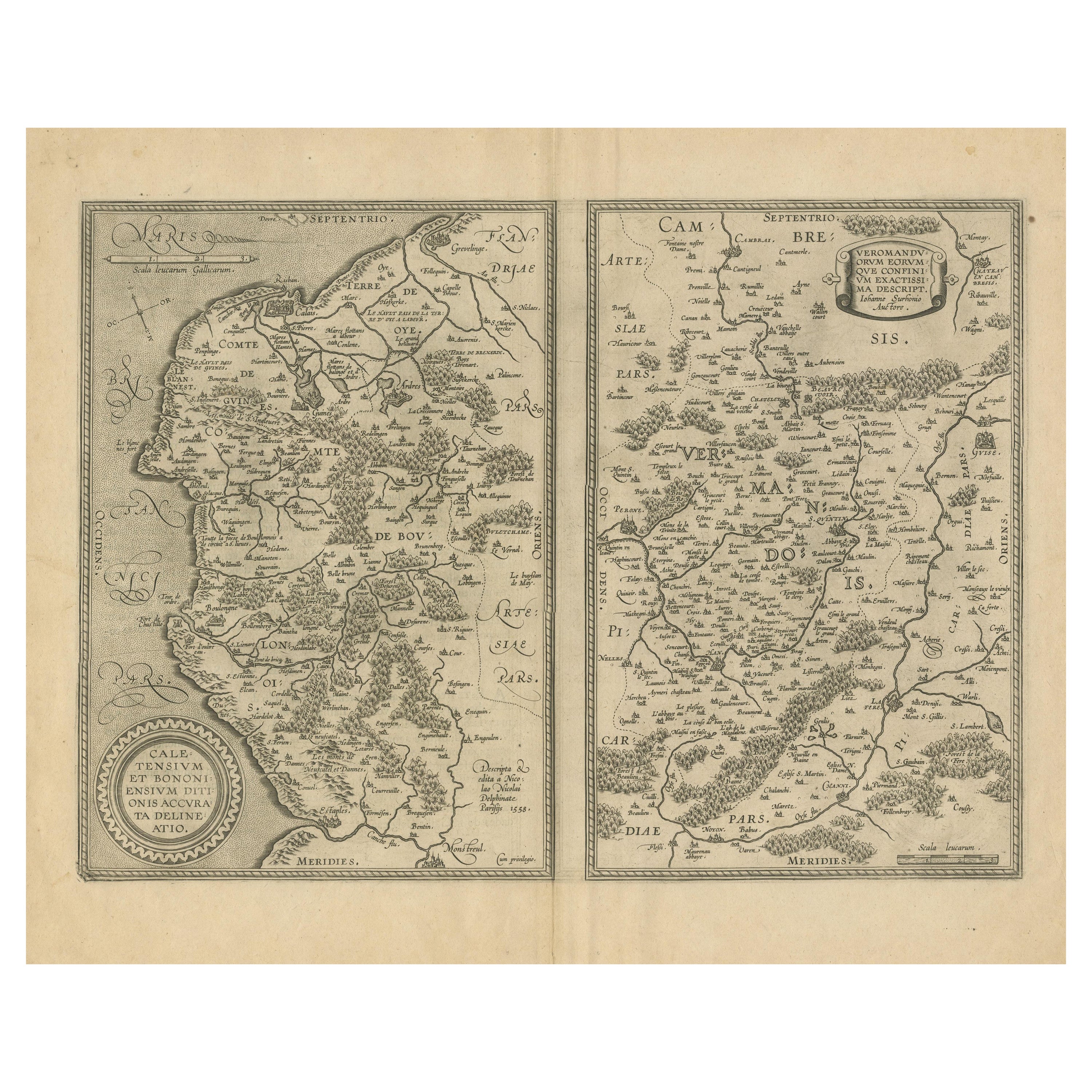
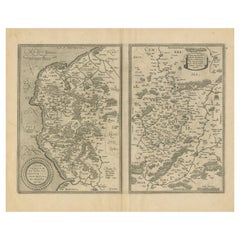
- Antique Map of the Coastline Between Calais and Estaples and Northern FranceLocated in Langweer, NLAntique map titled 'Caletensium et Bononiensium Ditionis Accurata Delinatio [on sheet with] Veromanduorum Eorumque Confinium Exactissima Discriptio'. Two maps on a folio sheet. Calentensium covers the coastline between Calais and Estaples based in part on a four-sheet map by Nicolas de Nicolay...Category
Antique Early 17th Century Maps
MaterialsPaper
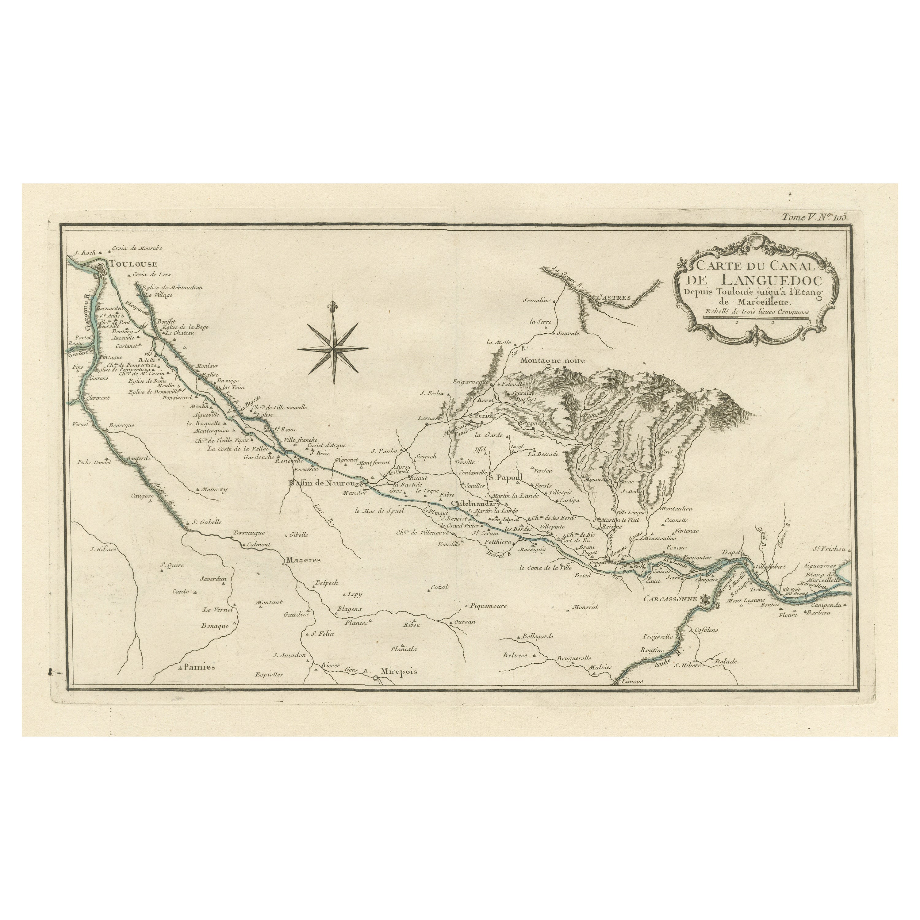
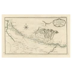
- Antique Map of the Languedoc Canal, Between Touloouse and Marseillette, FranceLocated in Langweer, NLAntique map titled 'Carte du canal de Languedoc depuis Toulouse jusqu'a I'etang de Marceillette'. Original old map of the Languedoc Canal, between Touloouse and Marseillette, France....Category
Antique Mid-18th Century Maps
MaterialsPaper
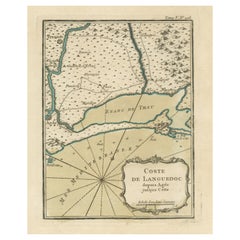
- Antique Map of the Languedoc Coast between Agde and Sète 'Cette', FranceLocated in Langweer, NLAntique map titled 'Coste de Languedoc depuis Agde jusqu'a Cette'. Original map of the Languedoc coast between Agde and Sète (historically Cette), France. This map originates from 'L...Category
Antique Mid-18th Century Maps
MaterialsPaper
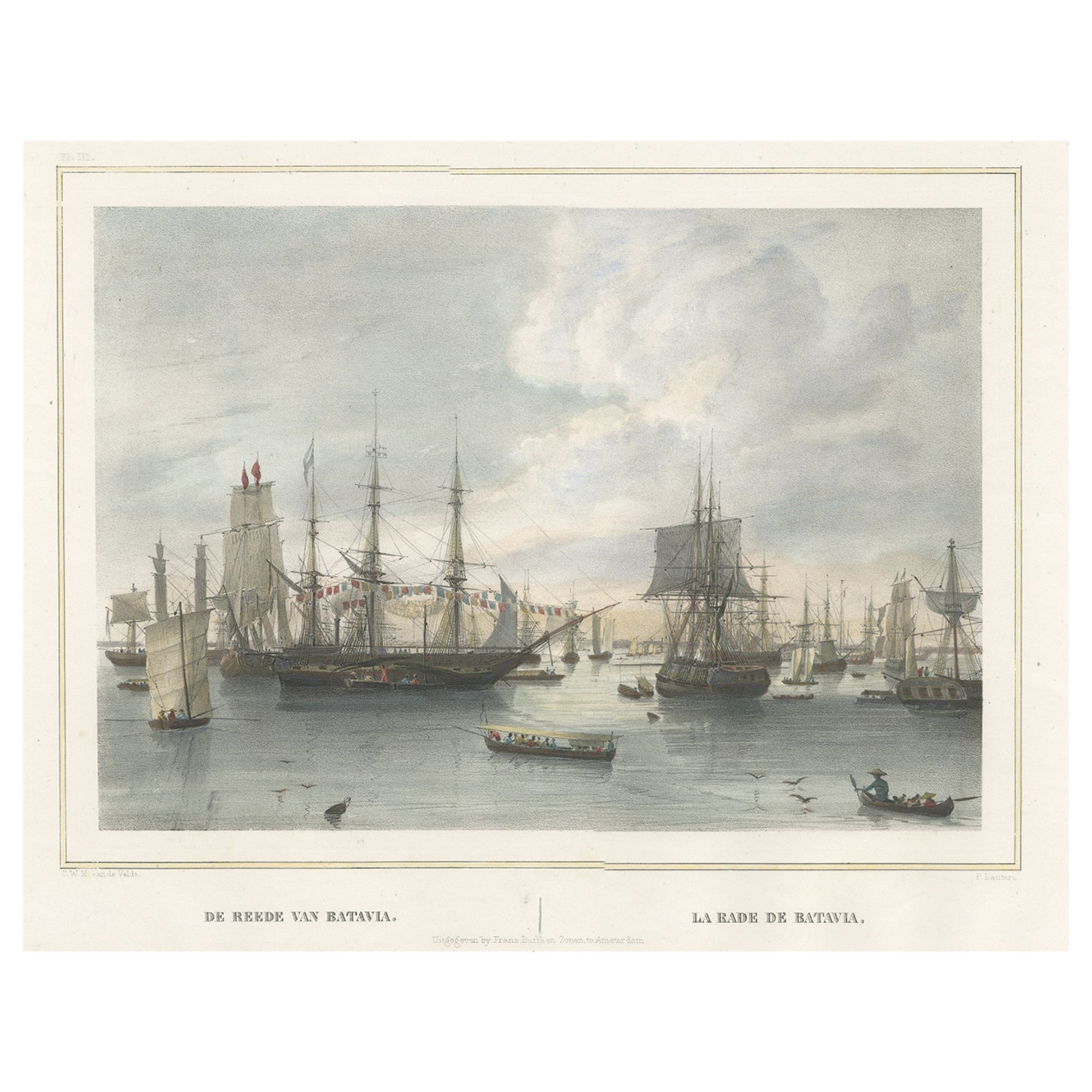
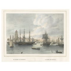
- Old Print of East India Merchant Ships Near Batavia 'Jakarta, Indonesia', 1844Located in Langweer, NLAntique print titled 'De Reede van Batavia - La Rade de Batavia'. Old print of East India merchant ships and some sloops near the harbour of Batavia, present day Jakarta, Indones...Category
Antique 1840s Prints
MaterialsPaper
You May Also Like
- 1844 French Antique Nautical Portolano of Golfe De St. Drely by Antoine RouxBy Antoine RouxLocated in Milan, ITAntique portolano, nautical map of Golfe De St. Drely engraved on a copper plate by Antoine Roux, Marseille France 1844, from his work Recueil des principaux plans des ports et de Ra...Category
Antique 1840s French Nautical Objects
MaterialsPaper
- George Washington by Henry Sadd, Antique Engraving, circa 1844Located in Colorado Springs, COThis is an 1844 engraving of President George Washington. The print was issued by G. Stuart in Albion, New York and engraved by H. S. Sadd. This standing portrait shows President George Washington in front of neoclassical columns. In his right hand, he holds a dress sword...Category
Antique 1840s American Prints
MaterialsPaper
- Original Antique Map of France, Arrowsmith, 1820Located in St Annes, LancashireGreat map of France Drawn under the direction of Arrowsmith. Copper-plate engraving. Published by Longman, Hurst, Rees, Orme and Brown, 1820 Unframed.Category
Antique 1820s English Maps
MaterialsPaper
- 1930s Antique Nautical Print Depicting Oceania ship by Adolfo Barabino GenovaLocated in Milan, ITLithograph on paper published by S.A.I.G, Adolfo Barabino Genova depicting the Oceania steamer. Title of the lithograph “America and Oceania Steamboats of the La Veloce Company, Auxi...Category
Vintage 1930s Italian Nautical Objects
MaterialsWood, Paper
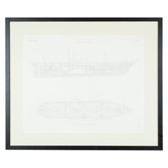
- "Ships of War - Screw Gun Boat" lithograph by Day & Son, 1864Located in London, GBA Victorian framed print of "SHIPS OF WAR - Screw Gun Boat" by Day and Son, Lithographers to the Queen. Plate 84: The Modern System of Naval Architecture, Joh...Category
Antique Mid-19th Century English Nautical Objects
MaterialsPaper
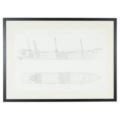
- Victorian Framed Print of a Steam Ship by Day & Son Dated 1864Located in London, GBA Victorian framed print of "SCREW STEAM SHIP WATER BALLAST HOLDS & CARGO TRADER" by Day and Son, Lithographers to the Queen. From John Scott...Category
Antique Mid-19th Century English Nautical Objects
MaterialsPaper


Recently Viewed
View AllMore Ways To Browse
Tapestry Scene
Antique Victorian Cross
Wall Mount Plaque
Wall Relief Wood
Locking Display Cabinet
Antique Glass Cupboard
Chinese Painted Cabinet
Painted China Cabinet
Lockable Display Cabinet
Display Cabinet Lock
Sliding Door Panels
Antique Shop Cabinets
Antique Shop Cabinet
Antique Shop Cabinet Cabinets
Victorian Designer
Antique Store Cabinet
French Woven Tapestry
Rectangular Cushion