Items Similar to Engraved Representations of North American Tribes around the Mississippi, 1787

Want more images or videos?
Request additional images or videos from the seller
1 of 9
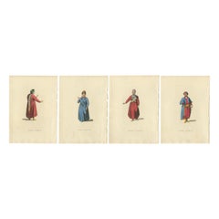
Engraved Representations of North American Tribes around the Mississippi, 1787
About the Item
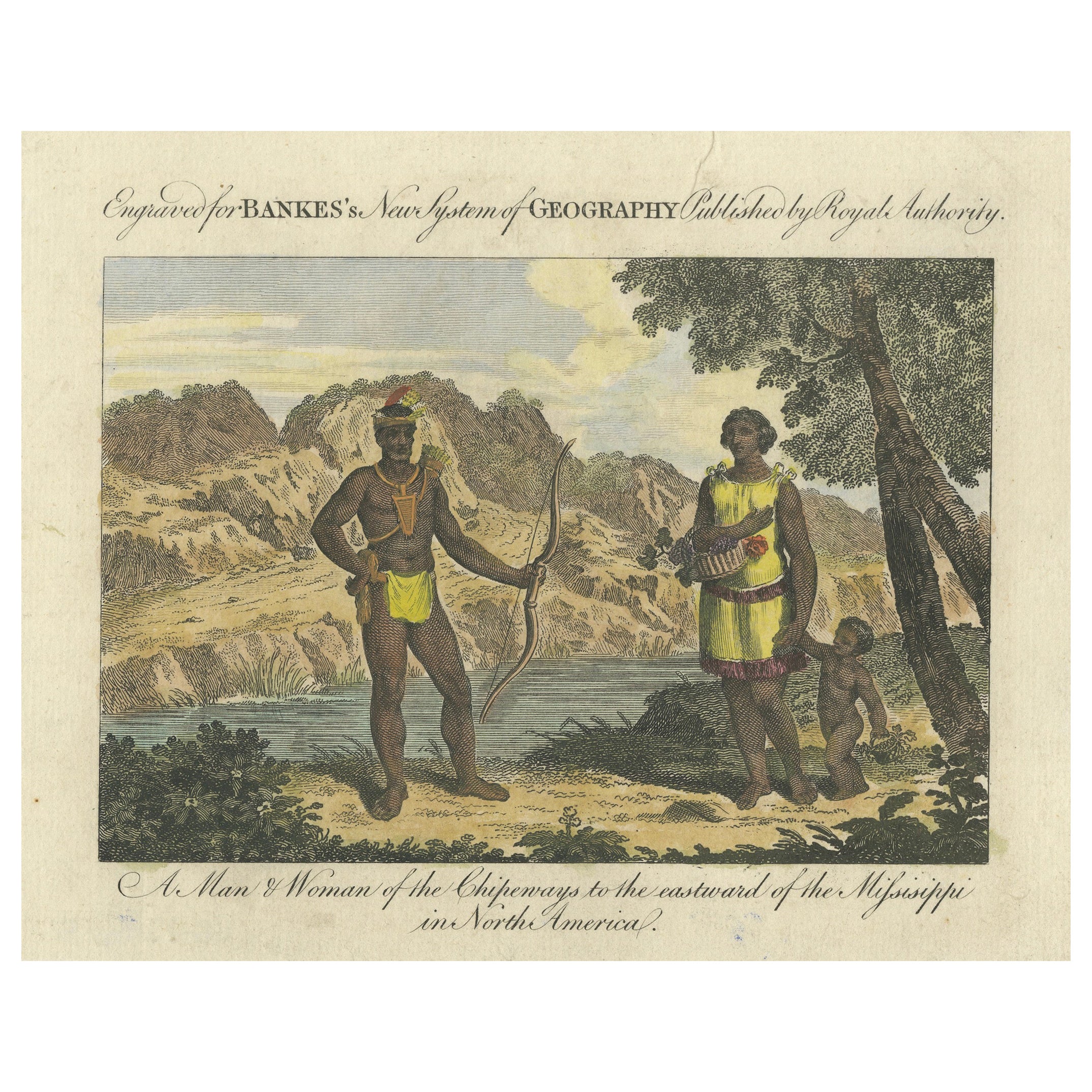
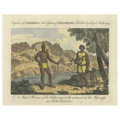
The original antique print is a pair of original engravings from "Bankes's New System of Geography." This work, as indicated by the title, was published by royal authority, suggesting it was produced with some level of official endorsement or patronage, which was a common practice for scholarly works in the 18th and 19th centuries.
The engravings depict two pairs of figures, each labeled with the names of Indigenous American tribes. The first illustration is titled "A Man & Woman of the Chipeways to the eastward of the Mississippi in North America." The Chippewa, more commonly known as Ojibwe, are a Native American people historically located in the Great Lakes region. The second illustration is titled "A Man & Woman of the Nawdowessies to the westward of the Mississippi in North America." The Nawdowessies refers to the Dakota, Sioux, or Nakota tribes, which were found mainly to the west of the Mississippi River.
These images serve as historical documentation of European perspectives on Indigenous peoples during the time of their production. They were intended to educate European readers about the diverse cultures of North America, although they often contained biases and inaccuracies due to the colonial viewpoint of the authors and illustrators.
The engravings were published in the late 18th century or early 19th century, a period during which such compilations of geography and ethnography were popular in Europe.
- Dimensions:Height: 15.36 in (39 cm)Width: 9.45 in (24 cm)Depth: 0 in (0.02 mm)
- Materials and Techniques:Paper,Engraved
- Period:1780-1789
- Date of Manufacture:1787
- Condition:Very good condition with wide marges. Light soiling and browning. Please study the images carefully.
- Seller Location:Langweer, NL
- Reference Number:
About the Seller
5.0
Platinum Seller
These expertly vetted sellers are 1stDibs' most experienced sellers and are rated highest by our customers.
Established in 2009
1stDibs seller since 2017
1,932 sales on 1stDibs
Typical response time: <1 hour
- ShippingRetrieving quote...Ships From: Langweer, Netherlands
- Return PolicyA return for this item may be initiated within 14 days of delivery.
More From This SellerView All
- A Chippeway Family to the Eastward of The Mississippi in North America, 1788Located in Langweer, NLOriginal antique and hand-colored engraving of people of the Chippewa tribe in American. The upper part of the print says, "Engraved for BANKES's New System of GEOGRAPHY Published b...Category
Antique 1780s Prints
MaterialsPaper
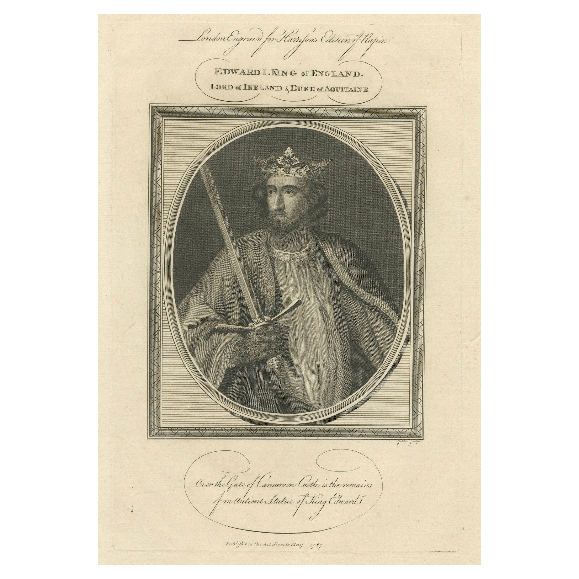
- 1787 Engraved Portrait of King Edward I - Hammer of the ScotsLocated in Langweer, NLAn engraved portrait of Edward I, also known as Edward Longshanks and the Hammer of the Scots, who was King of England from 1272 to 1307. The text beneath t...Category
Antique 1780s Prints
MaterialsPaper
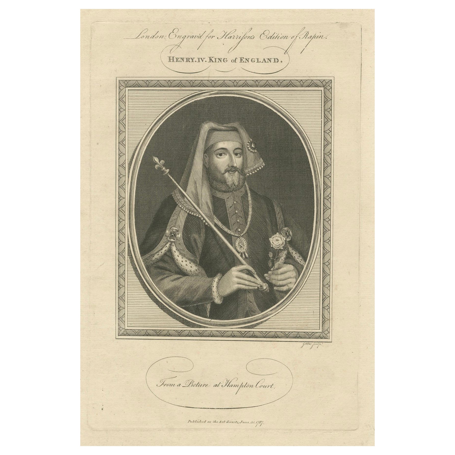
- 1787 Engraved Portrait of King Henry IV - Lancastrian SovereignLocated in Langweer, NLAn engraved portrait of Henry IV, King of England. Henry IV was the first English monarch from the Lancastrian branch of the Plantagenets and came to power after deposing his cousin Richard II in 1399. His reign was marked by the start of the 15-year civil strife known as the Wars of the Roses, numerous rebellions, and efforts to consolidate his power and legitimize his somewhat tenuous claim to the throne. The text mentions that the portrait is based on a picture at Hampton Court, which is a royal palace in the London Borough of Richmond upon Thames. Published as the act directs on June 18th, 1787, this engraving is part of the collection for "Harrington's Edition of Rapin's History of England." Henry IV's reign is notable for the rebellion led by the famous knight Henry Percy...Category
Antique 1780s Prints
MaterialsPaper
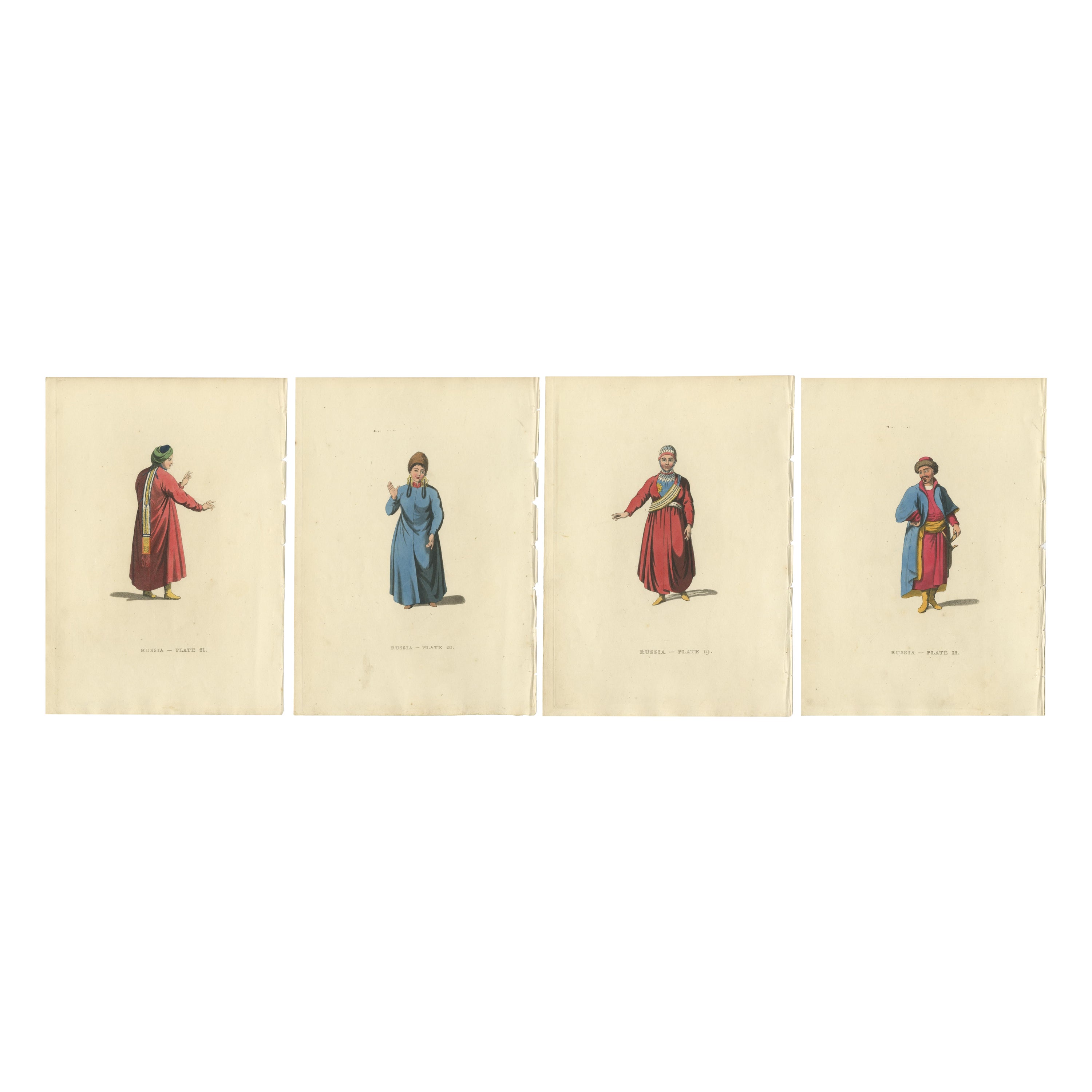
- Picturesque Representations of the Dress and Manners of the Russians, 1814Located in Langweer, NLSource these engravings: The publication "Picturesque Representations of the Dress and Manners of the Russians," which includes sixty-four colored engravings with descriptions. The w...Category
Antique 1810s Prints
MaterialsPaper
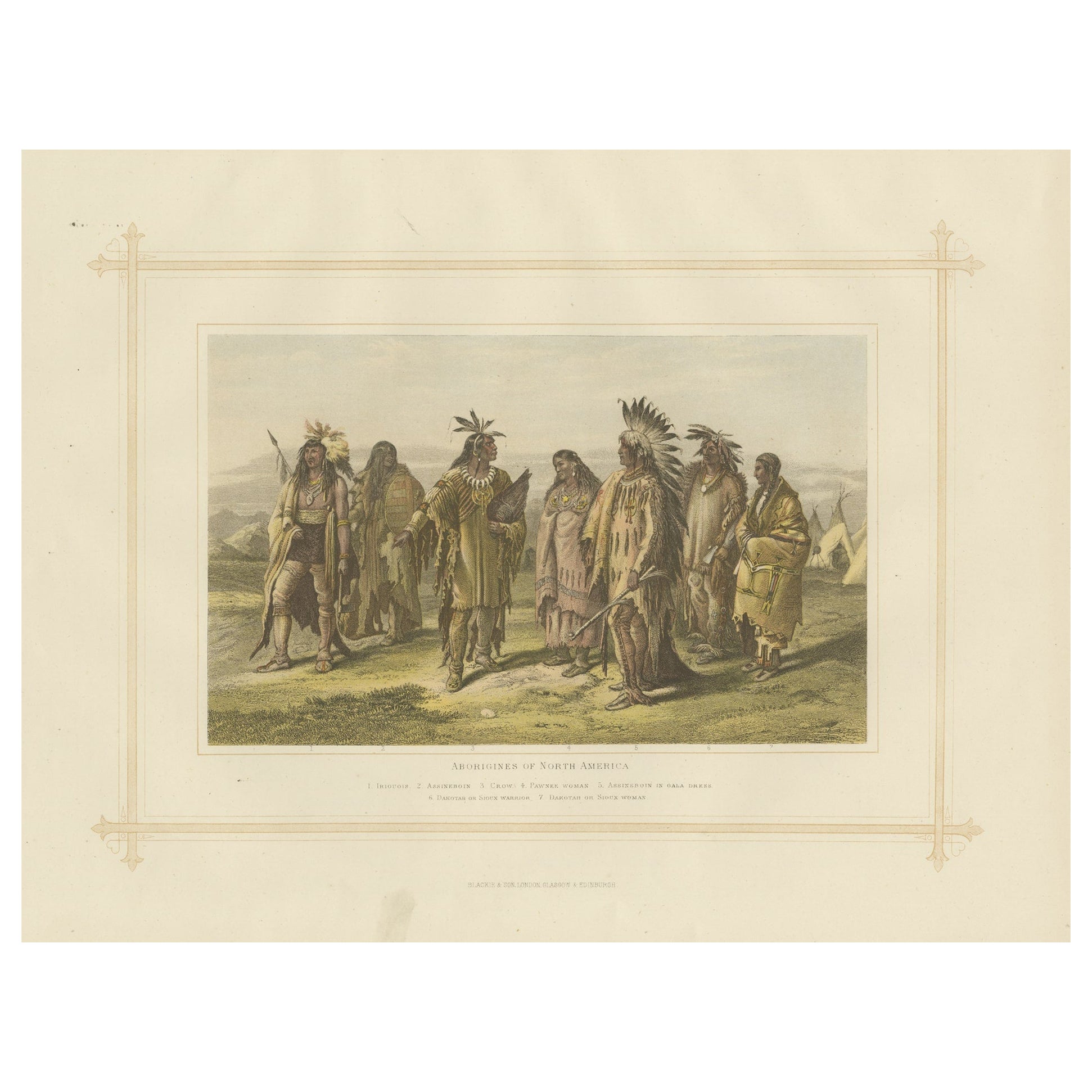
- Antique Lithograph of the Aborigines of North America, 1882Located in Langweer, NLExperience a captivating glimpse into the world of 19th-century ethnography with the "Aborigines of North America", an antique print from Blackie's Comprehensive Atlas and Geography,...Category
Antique 1880s Prints
MaterialsPaper
- Antique Map of the West Coast of North America & North East Coast of Asia '1772'Located in Langweer, NLAntique map titled 'Carte des nouvelles decouvertes/ Extrait d'une Carte Japonoise de l'Universe'. Map of the West Coast of North America and North-East Coast of Asia, based upon Buache's report of the various Russian Discoveries between 1731 and 1742 including the various explorers routes and notes. The lower map is based upon a Japanese map...Category
Antique Late 18th Century Maps
MaterialsPaper


You May Also Like
- New Map of North America from the Latest Discoveries, 1763Located in Philadelphia, PAA fine antique 18th century map of the North American seaboard. Entitled "A New Map of North America from the Latest Discoveries 1763". By the Cartographer/Engraver - John Spil...Category
Antique Mid-18th Century English Georgian Maps
MaterialsPaper
- Large Antique 1859 Map of North AmericaLocated in Sag Harbor, NYThis Map was made by Augustus Mitchell in 1859 It is in amazing condition for being 163 years old. This price is for the rolled up easy to ship version of this piece. I will be Frami...Category
Antique Mid-19th Century American Maps
MaterialsCanvas, Paper

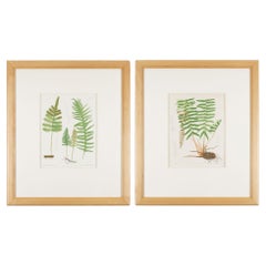
- Pair of prints from “The Ferns of North America" by Daniel Cady Eaton, 1879Located in Kenilworth, ILPair of American botanical chromolithographic prints from “The Ferns of North America” by Daniel Cady Eaton, published by S.E. Cassino. Mounted on eight ply archival mat and framed i...Category
Antique 1870s American Prints
MaterialsPaper
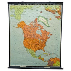
- Vintage Map Wall Chart Countries of North America Rollable Mural PosterLocated in Berghuelen, DEThe vintage pull-down school map illustrates the countries / states of North America. Published by Haack-Painke Justus Perthes Darmstadt. Colorful print on paper reinforced with canv...Category
Late 20th Century German Country Prints
MaterialsCanvas, Wood, Paper
- Original Antique Map of Ancient Greece- Boeotia, Thebes, 1787Located in St Annes, LancashireGreat map of Ancient Greece. Showing the region of Boeotia, including Thebes Drawn by J.D. Barbie Du Bocage Copper plate engraving by P.F T...Category
Antique 1780s French Other Maps
MaterialsPaper
- Original Antique Map of Ancient Greece, Phocis, Gulf of Corinth, 1787Located in St Annes, LancashireGreat map of Ancient Greece. Showing the region of Phocis, including the Gulf of Corinth Drawn by J.D. Barbie Du Bocage Copper plate engraving by P.F Tardieu Original hand c...Category
Antique 1780s French Other Maps
MaterialsPaper