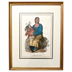
Items Similar to A Chippeway Family to the Eastward of The Mississippi in North America, 1788
Want more images or videos?
Request additional images or videos from the seller
1 of 8
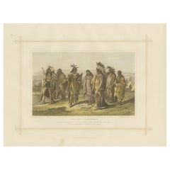
A Chippeway Family to the Eastward of The Mississippi in North America, 1788
About the Item
Original antique and hand-colored engraving of people of the Chippewa tribe in American.
The upper part of the print says, "Engraved for BANKES's New System of GEOGRAPHY Published by Royal Authority." This indicates that the image was engraved for a geography publication authorized by a royal entity, suggesting it was intended for educational or informative purposes, possibly during a time when such publications were sponsored by royal patronage.
Below the image, the text reads, "A Man & Woman of the Chippeways to the eastward of The Mississippi in North America." This description tells us that the subjects of the print are a man and a woman from the Chippewa (Ojibwe) tribe, located to the east of the Mississippi River in North America. The Chippewa are one of the many Native American tribes that inhabited North America before European colonization.
The print itself shows a man and a woman, presumably of the Chippewa tribe, in a natural landscape with mountains and a body of water in the background. The man is holding a bow, suggesting hunting as one of the activities of the tribe, and the woman is holding a container, which might be used for gathering or storing food. There is also a small child standing next to the woman, indicating a family scene. The clothing and accessories they wear might be indicative of their cultural attire during the time period when the print was made. The use of color in the print is also worth noting, as it adds depth and life to the scene.
Such prints were common in geographical works of the 18th and 19th centuries, aiming to illustrate the peoples and cultures from various parts of the world to European audiences. They often reflected the European perspective and understanding of these cultures during the period of their creation.
- Dimensions:Height: 6.7 in (17 cm)Width: 9.45 in (24 cm)Depth: 0 in (0.02 mm)
- Materials and Techniques:Paper,Engraved
- Period:1780-1789
- Date of Manufacture:1788
- Condition:Good. Chip of top corner is missing, but image and text are complete. One crease in the top, touching the text, otherwise fine. Study the images carefully.
- Seller Location:Langweer, NL
- Reference Number:
About the Seller
5.0
Platinum Seller
These expertly vetted sellers are 1stDibs' most experienced sellers and are rated highest by our customers.
Established in 2009
1stDibs seller since 2017
1,929 sales on 1stDibs
Typical response time: <1 hour
- ShippingRetrieving quote...Ships From: Langweer, Netherlands
- Return PolicyA return for this item may be initiated within 14 days of delivery.
More From This SellerView All
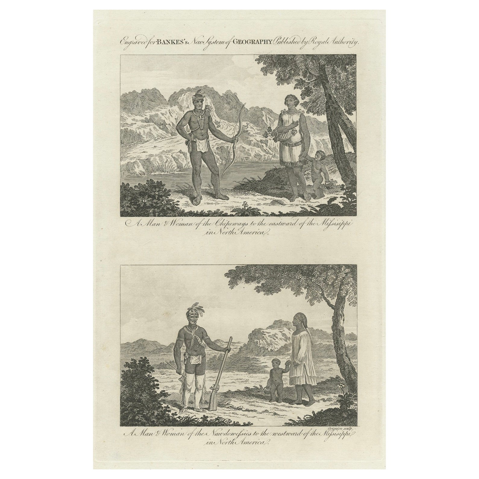
- Engraved Representations of North American Tribes around the Mississippi, 1787Located in Langweer, NLThe original antique print is a pair of original engravings from "Bankes's New System of Geography." This work, as indicated by the title, was published by royal authority, suggestin...Category
Antique 1780s Prints
MaterialsPaper
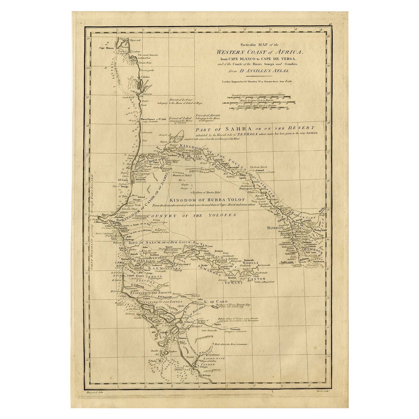
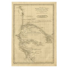
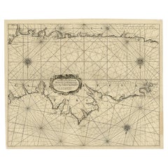
- Map of the West African coast from the North of Mauretania to Guinee, 1788Located in Langweer, NLAntique map titled 'Particular Map of the Western Coast of Africa, from Cape Blanco to Cape de Verga, and of the Course of the Rivers Senega and Gambia.' Map of the African coast...Category
Antique 1780s Maps
MaterialsPaper
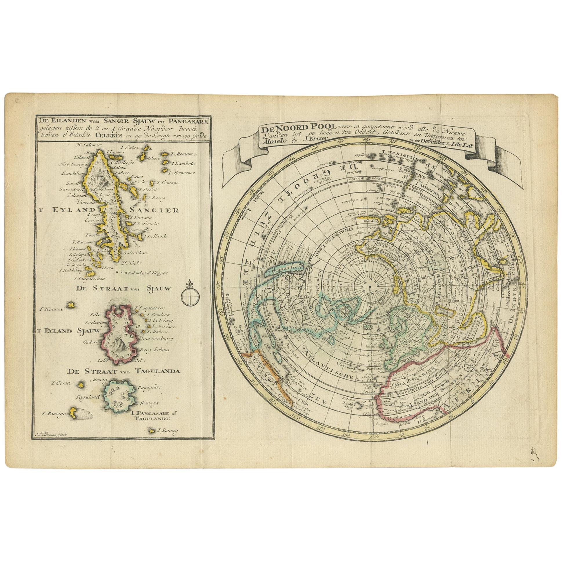
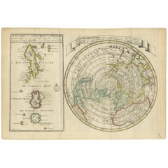
- Antique Map of the North Pole & Sangihe Archipelago by Keizer & de Lat, 1788Located in Langweer, NLAntique map titled 'De Noord Pool waar in aangetoont werd alle de Nieuwe Landen (..) - De Eilanden van Sangir Sjauw en Pangasare (..)'. Interesting map that includes a map of the Nor...Category
Antique Late 18th Century Maps
MaterialsPaper
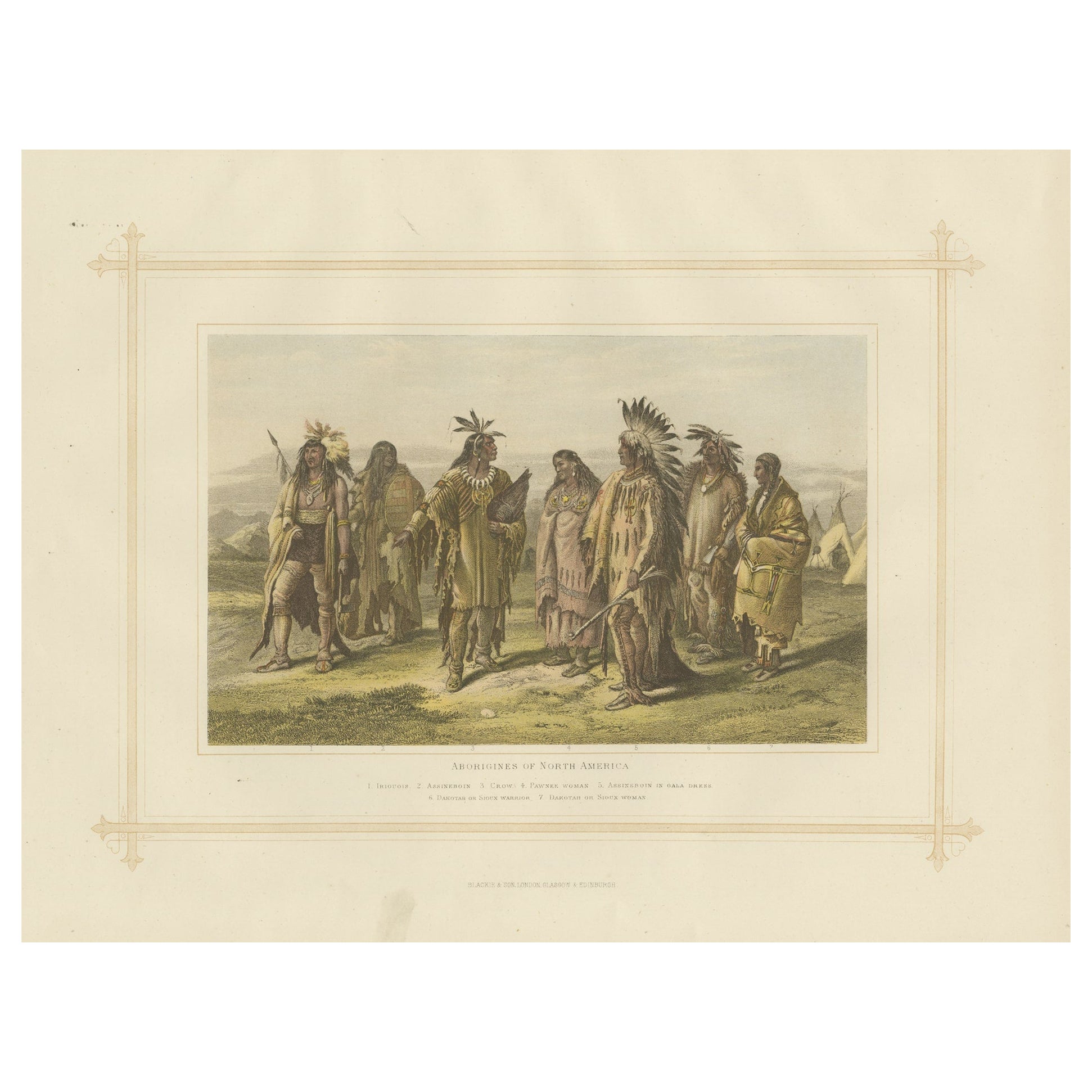
- Antique Lithograph of the Aborigines of North America, 1882Located in Langweer, NLExperience a captivating glimpse into the world of 19th-century ethnography with the "Aborigines of North America", an antique print from Blackie's Comprehensive Atlas and Geography,...Category
Antique 1880s Prints
MaterialsPaper
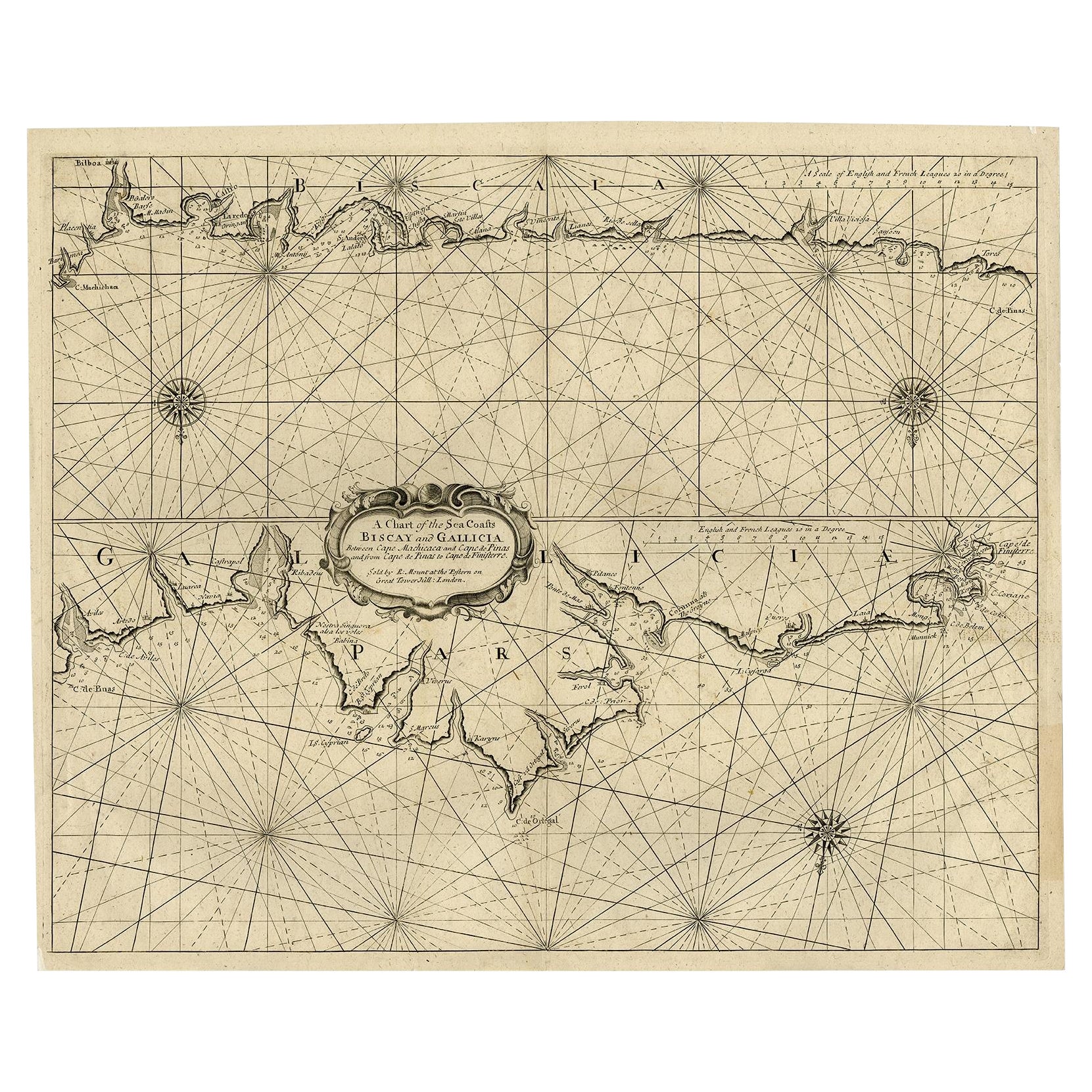
- Antique Chart of The Spanish Coastline from Bilbao Eastwards, C.1720Located in Langweer, NLAntique map titled 'A Chart of the Sea Coasts Biscay and Gallicia Between Cape Machicaca and Cape de Pinas and from Cape de Pinas to Cape de Finisterre.' Map of the Spanish coastline...Category
Antique 18th Century Maps
MaterialsPaper
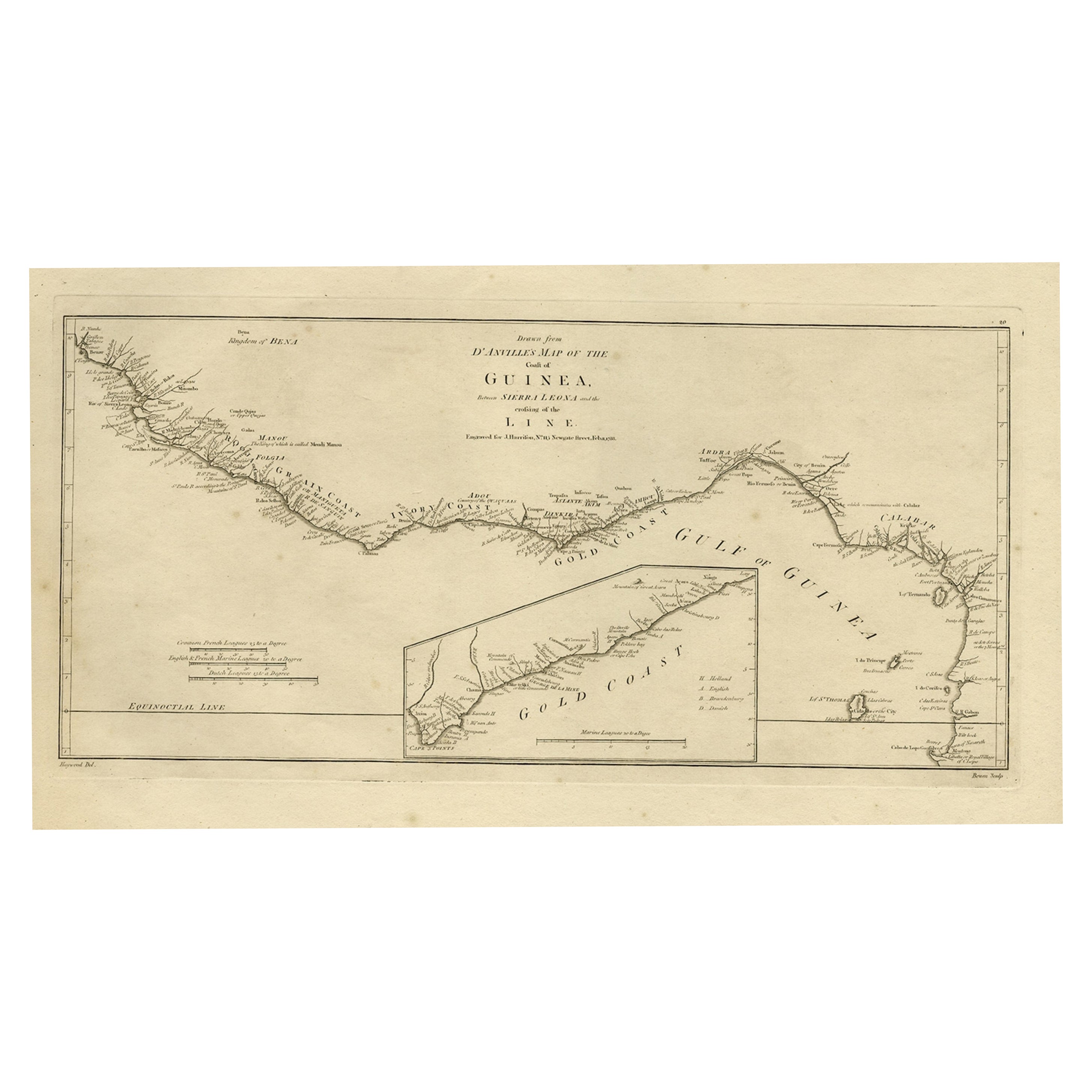
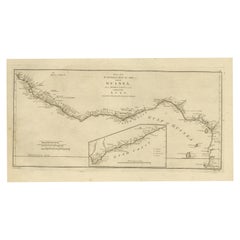
- Map of the African Coast, Gulf of Guinea, from Sierra Leone to Gabon, 1788Located in Langweer, NLAntique map titled 'Drawn from d'Anvilles Map of the Coast of Guinea, Between Sierra Leone and the crossing of the Line.' Map of the African coast, Gulf of Guinea, from Sierra Le...Category
Antique 1780s Maps
MaterialsPaper

You May Also Like
- New Map of North America from the Latest Discoveries, 1763Located in Philadelphia, PAA fine antique 18th century map of the North American seaboard. Entitled "A New Map of North America from the Latest Discoveries 1763". By the Cartographer/Engraver - John Spil...Category
Antique Mid-18th Century English Georgian Maps
MaterialsPaper
- Large Antique 1859 Map of North AmericaLocated in Sag Harbor, NYThis Map was made by Augustus Mitchell in 1859 It is in amazing condition for being 163 years old. This price is for the rolled up easy to ship version of this piece. I will be Frami...Category
Antique Mid-19th Century American Maps
MaterialsCanvas, Paper

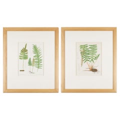
- Pair of prints from “The Ferns of North America" by Daniel Cady Eaton, 1879Located in Kenilworth, ILPair of American botanical chromolithographic prints from “The Ferns of North America” by Daniel Cady Eaton, published by S.E. Cassino. Mounted on eight ply archival mat and framed i...Category
Antique 1870s American Prints
MaterialsPaper
- Vintage Map Wall Chart Countries of North America Rollable Mural PosterLocated in Berghuelen, DEThe vintage pull-down school map illustrates the countries / states of North America. Published by Haack-Painke Justus Perthes Darmstadt. Colorful print on paper reinforced with canv...Category
Late 20th Century German Country Prints
MaterialsCanvas, Wood, Paper
- McKenney and Hall Hand-Painted Lithograph "Chippeway Widow", circa 1837By McKenney & HallLocated in Incline Village, NV"Chippeway Widow" hand-painted color lithograph on paper depicts a Native American Indian woman lamenting the death of her husband, presum...Category
Antique 1830s Native American Prints
MaterialsPaper
- Large Original Antique Print of the Holy Family, circa 1900Located in St Annes, LancashireWonderful image of The Holy Family Chromolithograph Published, circa 1900 Unframed.Category
Antique Early 1900s English Renaissance Revival Prints
MaterialsPaper