Items Similar to "Johnson's New Chart of National Emblems" Engraving by A. J. Johnson, 1870


Video Loading
Want more images or videos?
Request additional images or videos from the seller
1 of 13
"Johnson's New Chart of National Emblems" Engraving by A. J. Johnson, 1870
$2,250
£1,709.24
€1,968.77
CA$3,218.85
A$3,530.23
CHF 1,820.69
MX$42,171.54
NOK 23,091.83
SEK 21,662.76
DKK 14,708.20
About the Item
Presented is a hand-colored engraving of “Johnson's New Chart of National Emblems.” This print was created for “Johnson's New Illustrated Family Atlas of the World,” published by A.J. Johnson, in New York in 1870. The chart features 118 flags, standards, and signals associated with countries in Europe, Asia, Africa, South America, and the United States, as well as the ensigns of prominent merchant companies. The engraving is hand colored in red, white, black, blue, yellow, and green. Flag sheets and charts like this one were made primarily for the use of sea captains and ship chandlers to identify the nationality of ships in open waters.
The flags on this chart offer an interesting snapshot of the powerful nations of the mid-19th century, just after the American Civil War. Many countries have multiple flags depicted, including national and nautical flags. At top left is the American flag, represented with 37-stars, reflective of the admission of Nebraska to the Union in 1867. At top right is the "Royal Standard of the United Kingdom, Great Britain & Ireland," with the "Russian Standard" and "French Standard" at the bottom. There are 12 "Signals for Pilots," 6 on each side, in an inset chart in the middle. A “Portuguese Pennant” and a “Spanish Pennant” are featured at the bottom of the engraving.
CONDITION:
Very good condition. Engraving, with original hand-coloring. Paper has fold lines, from inclusion in atlas. Page 3 and Page 4 of atlas. Mild to moderate dampstaining and toning, but paper is stable. Bright colors, with little fading.
Artfully framed with acid-free mats and UV conservation clear glass in a custom-built frame.
Framed Dimensions: 24 3/4" H x 30 7/8" W x 1" D.
- Dimensions:Height: 24.75 in (62.87 cm)Width: 30.88 in (78.44 cm)Depth: 1 in (2.54 cm)
- Style:Victorian (Of the Period)
- Materials and Techniques:
- Place of Origin:
- Period:
- Date of Manufacture:1870
- Condition:Additions or alterations made to the original: Artfully framed with acid-free mats and UV conservation clear glass in a custom-built frame by Artem Art Services in Colorado Springs, CO in 2025. Wear consistent with age and use.
- Seller Location:Colorado Springs, CO
- Reference Number:Seller: PR5271stDibs: LU909747031732
About the Seller
4.9
Platinum Seller
Premium sellers with a 4.7+ rating and 24-hour response times
Established in 2010
1stDibs seller since 2011
467 sales on 1stDibs
Typical response time: 1 hour
- ShippingRetrieving quote...Shipping from: Colorado Springs, CO
- Return Policy
Authenticity Guarantee
In the unlikely event there’s an issue with an item’s authenticity, contact us within 1 year for a full refund. DetailsMoney-Back Guarantee
If your item is not as described, is damaged in transit, or does not arrive, contact us within 7 days for a full refund. Details24-Hour Cancellation
You have a 24-hour grace period in which to reconsider your purchase, with no questions asked.Vetted Professional Sellers
Our world-class sellers must adhere to strict standards for service and quality, maintaining the integrity of our listings.Price-Match Guarantee
If you find that a seller listed the same item for a lower price elsewhere, we’ll match it.Trusted Global Delivery
Our best-in-class carrier network provides specialized shipping options worldwide, including custom delivery.More From This Seller
View All1859 "Map of the United States of America..." by J. H. Colton
By J.H. Colton
Located in Colorado Springs, CO
Presented is an 1859 “Map of the United States of America, the British Provinces, Mexico, the West Indies and Central America with Part of...
Category
Antique 1850s American Maps
Materials
Paper

1856 "Map of the United States" by Ensign, Bridgeman, and Fanning
Located in Colorado Springs, CO
Presented is a scarce American wall map of the United States and Mexico issued by Ensign, Bridgman, and Fanning in 1856. As the title suggests, the map covers all of the United State...
Category
Antique 1850s American Victorian Maps
Materials
Paper

1864 Engraving of Lincoln's "Proclamation of Emancipation" by Charles Shober
Located in Colorado Springs, CO
This 1864 engraving features the Emancipation Proclamation in elaborate calligraphic text, with five patriotic vignettes and a small portrait of Lincoln. This is the second issue of ...
Category
Antique 1860s American American Classical Prints
Materials
Paper
1847 Ornamental Map of the United States & Mexico by H. Phelps
Located in Colorado Springs, CO
Offered is an original 1847 ornamental map of the U.S. entitled "Ornamental Map of the United States & Mexico" by Humphrey Phelps. The map was issued as an act of Congress by Phelps on Fulton Street, New York. The broadside is elaborately hand-colored.
This is a very detailed and graphic propaganda map of the United States expressing U.S. dominance of the North American continent. The hand-colored map proclaims the Manifest Destiny, with the recent acquisition of Upper California and Texas at the conclusion of the Mexican-American War. The newly acquired land is boldly colored, standing in stark contrast to the rest of the U.S. The map details a potential route for a railroad running from New York City, to Buffalo, to Chicago, then west along the Oregon Trail to Oregon City. This route anticipates the construction of the transcontinental railroad by nearly 20 years.
The map includes elaborately detailed renderings of George Washington, Hernan Cortez, and Montezuma at top to represent European expansion to the Americas. At bottom are four inset designs with text showing the following: a chronological history of the U.S. beginning from settlement to the U.S. victory in the Mexican-American war; an illustration of General Zachary Taylor with details on the Oregon Territory; an illustration of the Aztec Temple of the Sun in Tenochtitlan and a chronology of the Conquest of the Aztec Empire under Cortez; a portrait of General Antonio Lopez de Santa Anna...
Category
Antique 1840s American Maps
Materials
Paper

"The United States from the Latest Authorities" Antique Wall Map, 1835
Located in Colorado Springs, CO
This is a 1835 map of “The United States from the Latest Authorities” by Ezra Strong. A hand-colored engraved wall map of the eastern half of the United States, this map has a large inset of the "Oregon District" and several engraved city views and two portraits.
The primary map extends to Mexico Texas and the Missouri Territory, showing the course of the Missouri River to Ft. Mandan and Old Ft. Mandan, and noting many forts along the river. The territories to the east of Missouri Territory are separately delineated as Sioux District and Huron District. The western details of the map are very good for a map of this time period, with many Native American settlements, villages, forts and other details noted.
The map is bordered with vignettes of Boston, New York, Philadelphia, Hartford, Cincinnati, and Baltimore. Each vignette notes the date settled, primary settler, and the population as of 1830. Two portraits of LaFayette and George Washington are presented in full length with related biographical information.
A large inset map at lower right shows the Oregon District, centered on the Columbia River and extending to the Rocky Mountains. This is one of the earliest commercial appearances of a separate map of Oregon...
Category
Antique 1830s American Maps
Materials
Paper

1846 "North America" Map, Engraved by I. Dower
Located in Colorado Springs, CO
Presented is an original 1846 map of “North America.” The map was drawn and engraved by I. Dower and published in London by Orr & Company. The map depicts North America, to include G...
Category
Antique 1840s English Victorian Maps
Materials
Paper

You May Also Like
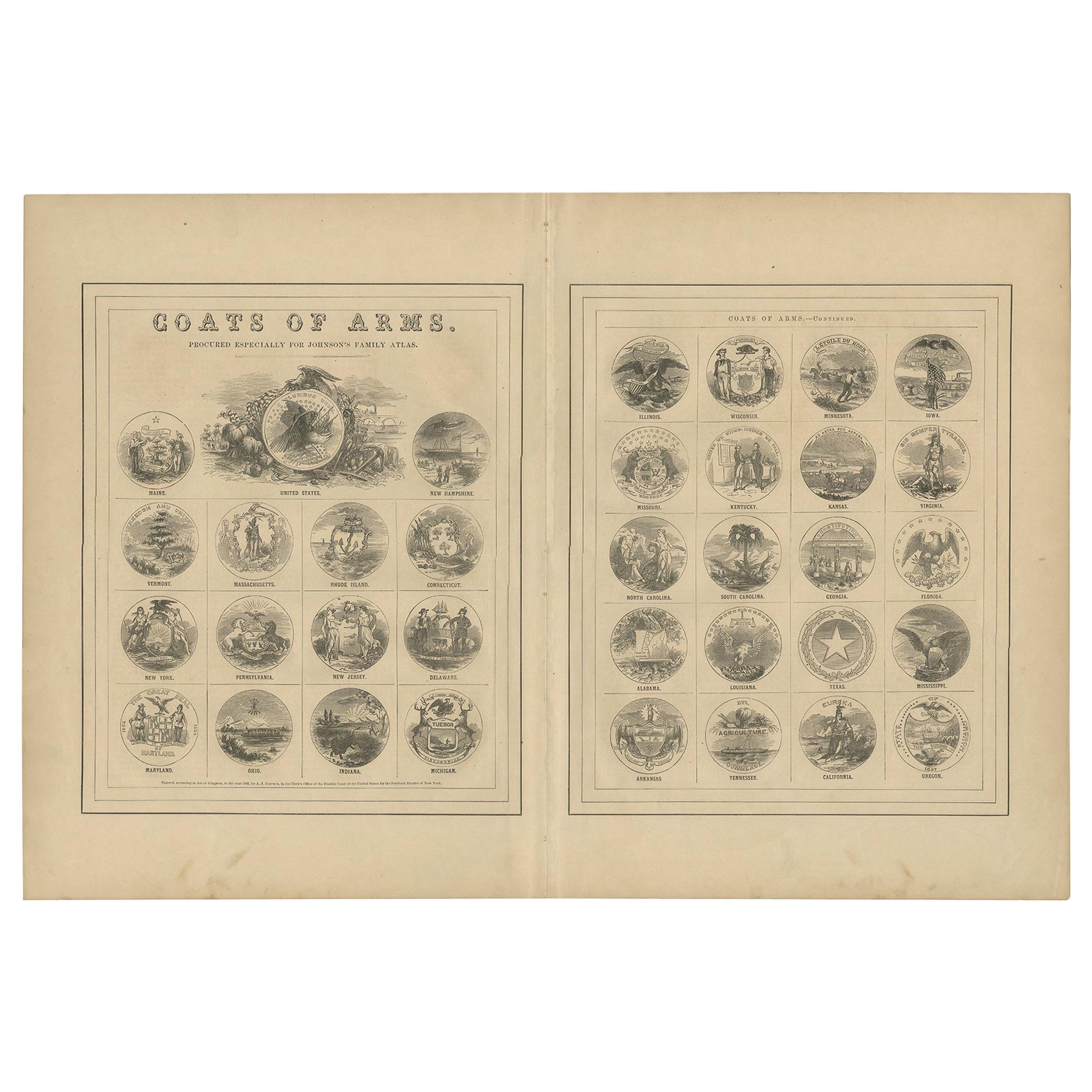
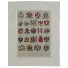
Mounted Print of National Coats of Arms by Tiffany & Co. from 1895 Encyclopedia
Located in Lincoln, Lincolnshire
This is a very good coloured Lithograph Print of National Coats Of Arms.
The print is mounted all ready for framing.
The external measurements of the mount are 12 W x 15 H and t...
Category
Antique Late 19th Century American Prints
Materials
Paper
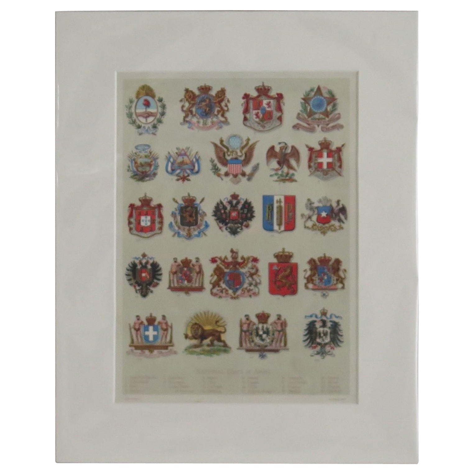
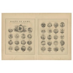
Antique Print of the United States Coats of Arms by Johnson, 1872
Located in Langweer, NL
Antique print titled 'Coats of Arms (..)'. Original print of the United States coats of arms. This print originates from 'Johnson's New Illustrated Family Atlas of the World' by A.J....
Category
Antique Late 19th Century Prints
Materials
Paper
$190 Sale Price
20% Off
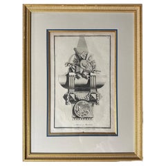
Collection of 18th-Century Engravings of Furniture & Decorative Arts
Located in Middleburg, VA
An extraordinary suite of eight masterful engravings, each a captivating marriage of artistry, craftsmanship, and cultural imagination! Created in the mid-18th century, these prints ...
Category
Antique Mid-18th Century French Neoclassical Drawings
Materials
Wood, Glass, Giltwood, Paper
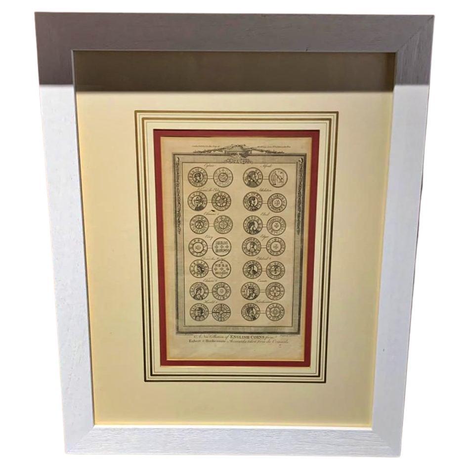
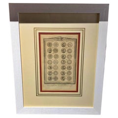
English Framed Print 19th Century "A New Collections of English Coins"
Located in Madrid, ES
English Framed Print 19th Century
"A New Collections of English Coins"
Measures: 55cm x 68cm
Very good condition.
Category
Antique 19th Century English Baroque Drawings
Materials
Paint
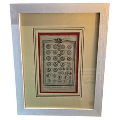
English Framed Print 19th Century "A New Collections of English Coins"
Located in Madrid, ES
English framed print 19th century
"A New Collections of English Coins"
Measures: 55cm x 68cm
Very good condition.
Category
Antique 19th Century English Baroque Drawings
Materials
Paint
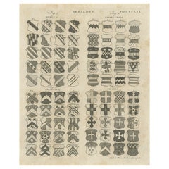
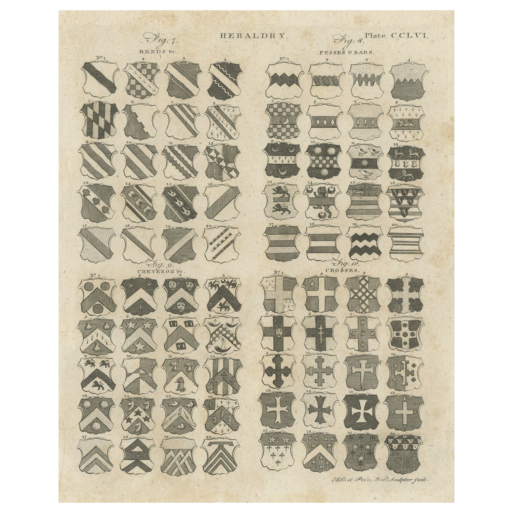
Original Antique Engraving of Coats of Arms from Heraldry Brittanica, c.1810
Located in Langweer, NL
Antique print titled 'Plate CCLVI Heraldry'. Old print depicting various coats of arms (heraldry). This print originates from 'Encyclopedia Britannica'.
Artists and Engravers: Engra...
Category
Antique 19th Century Prints
Materials
Paper