Items Similar to Map of the Lakes of the Globe 1856 – Comparative Chart of Inland Seas

Want more images or videos?
Request additional images or videos from the seller
1 of 10
Map of the Lakes of the Globe 1856 – Comparative Chart of Inland Seas
$330.69per item
£247.79per item
€280per item
CA$464.33per item
A$508.89per item
CHF 265.75per item
MX$6,106.10per item
NOK 3,336.97per item
SEK 3,143.30per item
DKK 2,132.70per item
Quantity
About the Item
Map of the Lakes of the Globe 1856 – Comparative Chart of Inland Seas
Description:
This remarkable 19th-century comparative chart is titled Comparative Form and Extent of the Inland Seas and Lakes of the Globe. It was published in 1856 by William Blackwood & Sons of Edinburgh and London, as part of the educational and scientific work The Physical Atlas by Alexander Keith Johnston. This hand-colored lithograph presents a fascinating side-by-side comparison of the world’s major lakes and inland seas, drawn to a uniform scale and annotated with elevations above sea level.
The print is divided by continent: North America, South America, Europe, Asia, and Africa are each represented with carefully rendered lakes shown in proportion to one another. Prominent bodies of water include the Great Lakes of North America, the Caspian Sea, Lake Baikal, the Dead Sea, the Aral Sea, Lake Titicaca, Lake Victoria, and many others. Each lake is labeled with detailed information such as depth, area, and elevation. The chart not only displays geographical features but also offers insight into 19th-century scientific understanding and comparative geography.
One of the most interesting aspects of this print is how it visualizes the scale and location of lakes relative to each other in a single frame. This method of comparison was a hallmark of Johnston’s Physical Atlas, which aimed to make complex scientific data accessible through visual clarity. At a time when global travel and mapping were still developing, this print would have offered viewers a rare opportunity to comprehend distant and diverse geographic phenomena side by side.
Alexander Keith Johnston was a pioneering Scottish geographer and cartographer. He held the title Geographer to the Queen for Scotland and was widely respected for the precision and clarity of his maps. His Physical Atlas, first published in 1848 and revised in the 1850s, was one of the earliest thematic atlases, influencing both cartographic design and geographic education.
Condition summary:
Very good condition. Light overall toning and a few small foxing spots near the margins. The hand-colored blue lake shading is clean and bright, and the paper remains strong and well-preserved.
Framing tips:
This visually structured print pairs well with a simple black or dark oak frame to enhance its scientific tone. A white or light ivory mat will provide contrast while maintaining a clean, archival presentation. UV-protective glass is advised to preserve color and clarity.
- Dimensions:Height: 10.79 in (27.4 cm)Width: 13.59 in (34.5 cm)Depth: 0.01 in (0.2 mm)
- Materials and Techniques:
- Place of Origin:
- Period:
- Date of Manufacture:1856
- Condition:Very good condition. Light overall toning near the margins. The hand-colored blue lake shading is clean and bright, and the paper remains strong and well-preserved. Folding line as issued.
- Seller Location:Langweer, NL
- Reference Number:Seller: BG-13207-31stDibs: LU3054345385802
About the Seller
5.0
Recognized Seller
These prestigious sellers are industry leaders and represent the highest echelon for item quality and design.
Platinum Seller
Premium sellers with a 4.7+ rating and 24-hour response times
Established in 2009
1stDibs seller since 2017
2,668 sales on 1stDibs
Typical response time: <1 hour
- ShippingRetrieving quote...Shipping from: Langweer, Netherlands
- Return Policy
Authenticity Guarantee
In the unlikely event there’s an issue with an item’s authenticity, contact us within 1 year for a full refund. DetailsMoney-Back Guarantee
If your item is not as described, is damaged in transit, or does not arrive, contact us within 7 days for a full refund. Details24-Hour Cancellation
You have a 24-hour grace period in which to reconsider your purchase, with no questions asked.Vetted Professional Sellers
Our world-class sellers must adhere to strict standards for service and quality, maintaining the integrity of our listings.Price-Match Guarantee
If you find that a seller listed the same item for a lower price elsewhere, we’ll match it.Trusted Global Delivery
Our best-in-class carrier network provides specialized shipping options worldwide, including custom delivery.More From This Seller
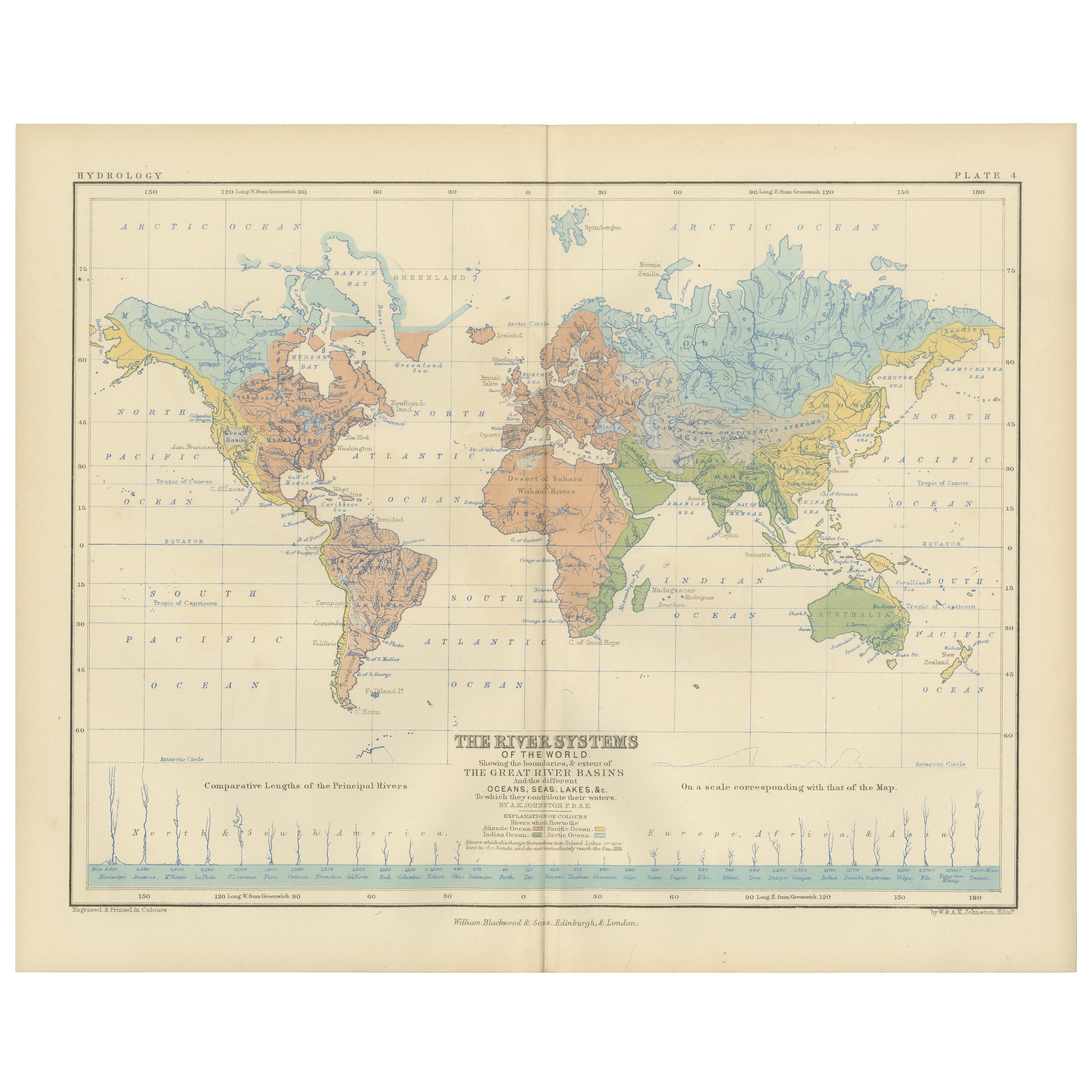
View AllRiver Systems Map of the World by A.K. Johnston – Educational Print 1852
Located in Langweer, NL
River Systems Map of the World by A.K. Johnston – Educational Print 1852
This striking 1852 map titled "The River Systems of the World" was created by the noted Scottish geographer ...
Category
Antique Mid-19th Century Scottish Prints
Materials
Paper

Antique Map of the River Systems of Europe and Asia by Johnston '1850'
Located in Langweer, NL
Antique map titled 'The River Systems of Europe and Asia showing the boundaries and comparative extent of the river basins'. Original antique map of the river systems of Europe and A...
Category
Antique Mid-19th Century Maps
Materials
Paper

$188 Sale Price
20% Off
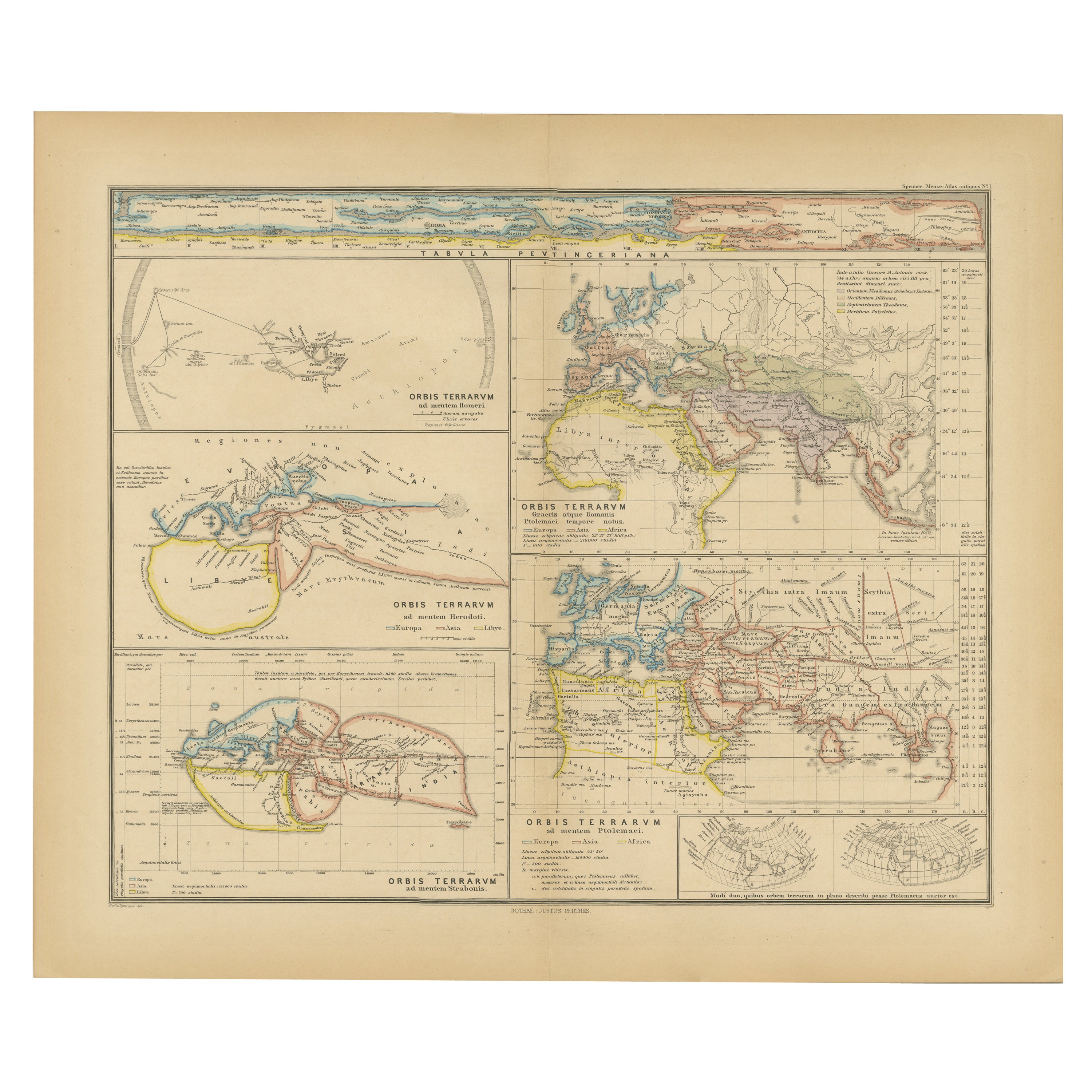
Original Old Composite of Several Maps of the Ancient World on One Sheet, 1880
Located in Langweer, NL
This original antique map is from Karl Spruner von Merz's "Atlas Antiquus", later edited by Theodorus Menke. The map is a detailed depiction of the ancient world. The atlas it comes ...
Category
Antique 1880s Maps
Materials
Paper
$349 Sale Price
20% Off
Free Shipping
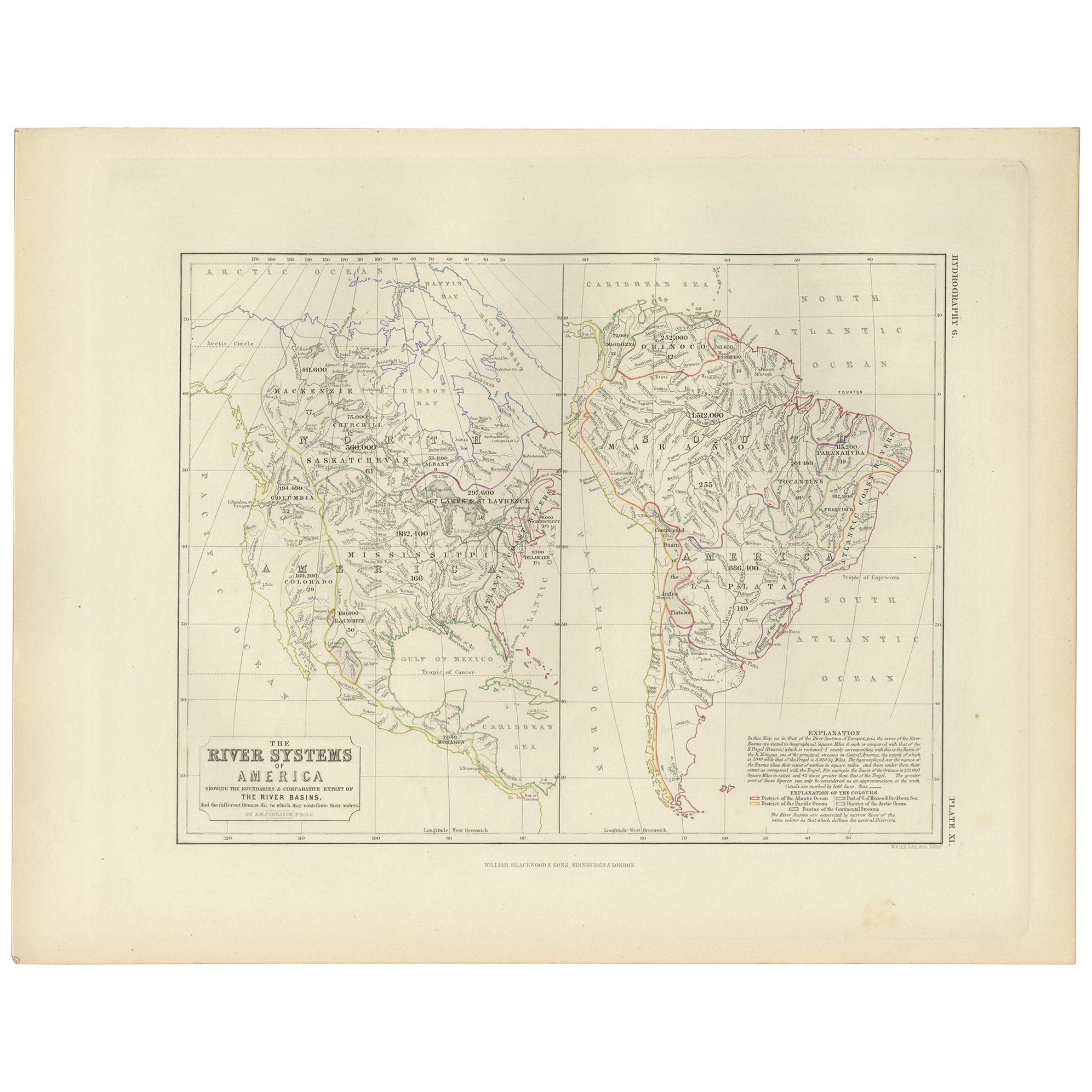
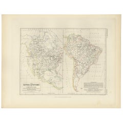
Antique Map of the River Systems of America by Johnston, '1850'
Located in Langweer, NL
Antique map titled 'The River Systems of America showing the boundaries and comparative extent of the river basins'. Original antique map of the river systems of America. This map or...
Category
Antique Mid-19th Century Maps
Materials
Paper
$188 Sale Price
20% Off
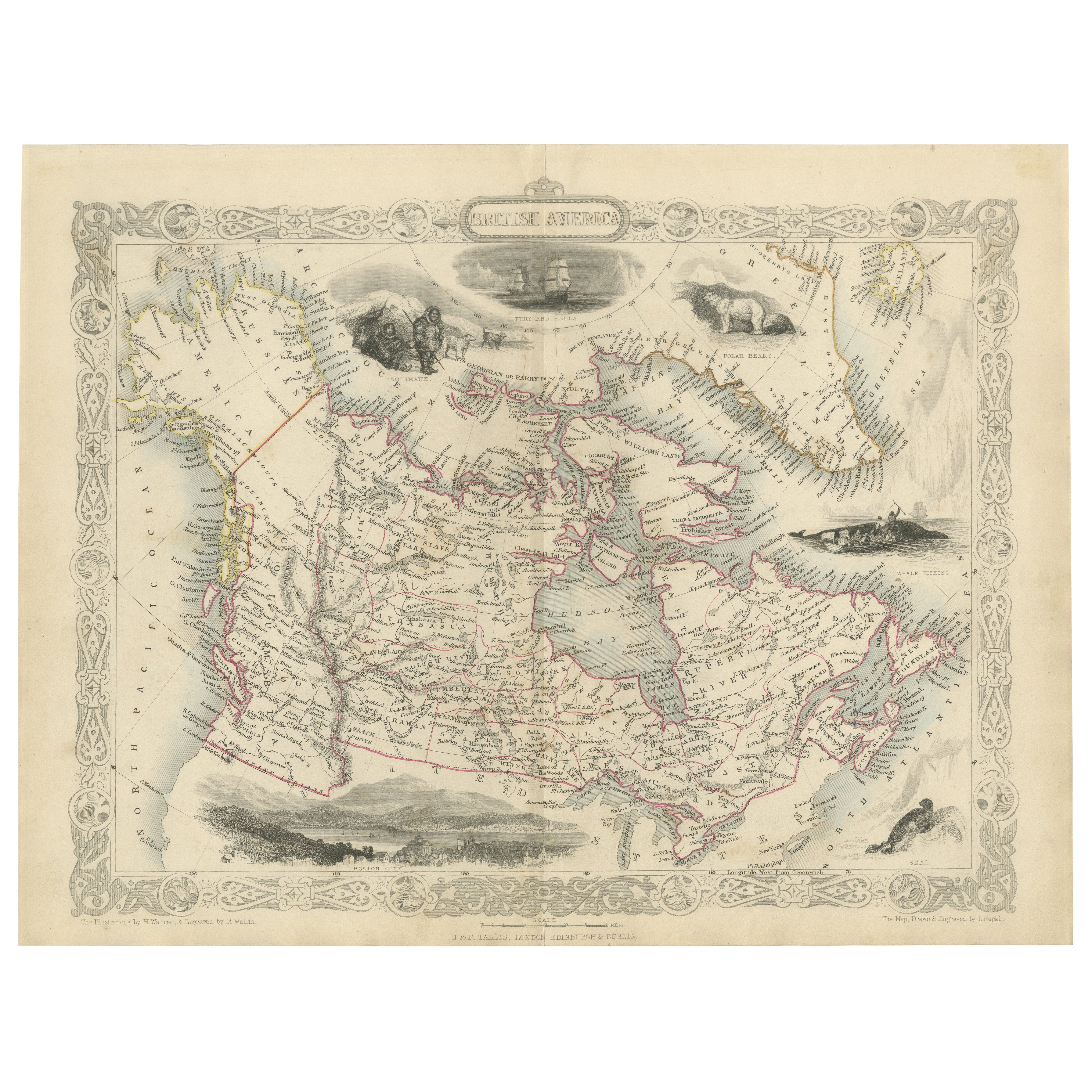
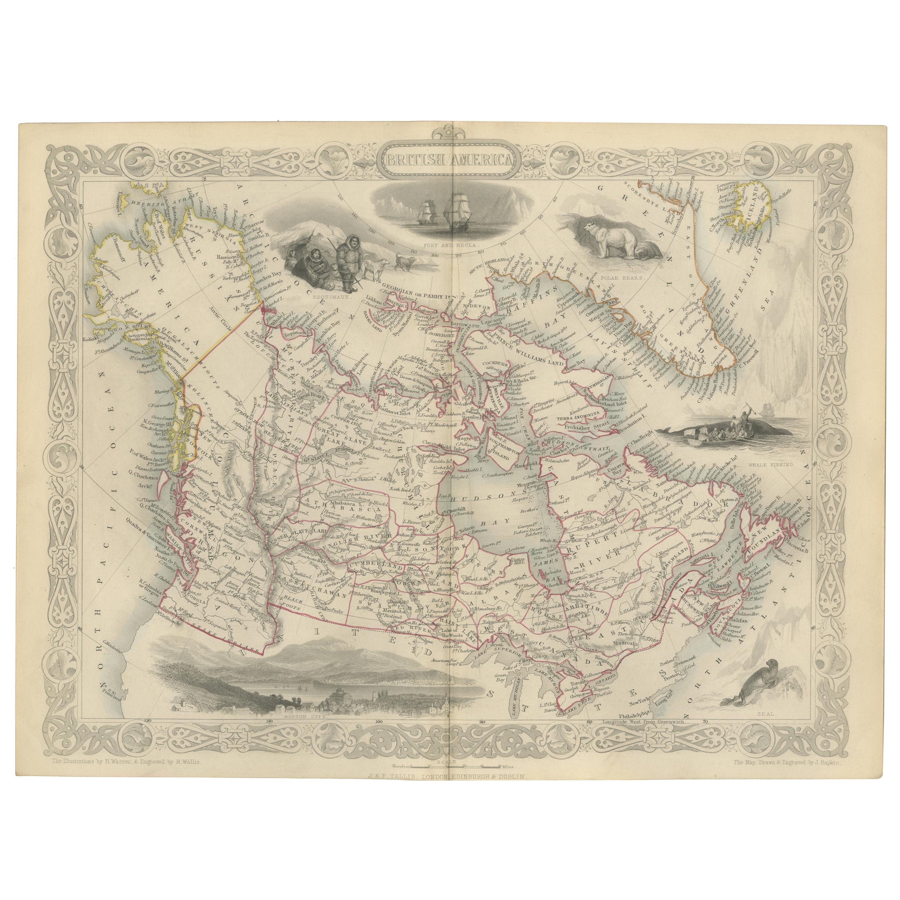
19th-Century Decorative Map of British America with Arctic and Pacific Vignettes
Located in Langweer, NL
19th-Century Decorative Map of British America with Arctic and Pacific Vignettes
This 19th-century map of British America, drawn and engraved by J. Rapkin and published by J & F T...
Category
Antique 1850s Maps
Materials
Paper

Antique Map of British America by Tallis 'c.1850'
Located in Langweer, NL
Antique map titled 'British America'. Decorative map of British America, with vignettes showing Whale Fishing, Montreal, Fury and Hecla ships asail. Thi...
Category
Antique Mid-19th Century Maps
Materials
Paper

$442 Sale Price
25% Off
You May Also Like
1864 Original illustrated planisphere - World Map - Geography
Located in PARIS, FR
Immerse yourself in the epic journey of the past with the Illustrated Historical Planisphere of 1864 by Charpentier! 🗺️ This cartographic treasure transports you through the intrica...
Category
1860s Prints and Multiples
Materials
Linen, Lithograph, Paper

Original Antique Map of North America by Dower, circa 1835
Located in St Annes, Lancashire
Nice map of North America
Drawn and engraved by J.Dower
Published by Orr & Smith. C.1835
Unframed.
Free shipping
Category
Antique 1830s English Maps
Materials
Paper

Manitoba, British Columbia and NW Territories, Canada. Century Atlas antique map
Located in Melbourne, Victoria
'The Century Atlas. Manitoba, British Columbia and the Northwest Territories, Canada, North America.'
Original antique map, 1903.
Central fold as issued. Map name and number printe...
Category
Early 20th Century Victorian More Prints
Materials
Lithograph

Large Original Antique Map of The World, Fullarton, C.1870
Located in St Annes, Lancashire
Great map of the World. Showing both hemispheres
From the celebrated Royal Illustrated Atlas
Lithograph. Original color.
Published by Fullarton, Edinburgh, C.1870
Unframed.
Rep...
Category
Antique 1870s Scottish Maps
Materials
Paper

Michigan, Northern Part. USA. Century Atlas state antique vintage map
Located in Melbourne, Victoria
'The Century Atlas. Michigan, Northern Part'
Original antique map, 1903.
Central fold as issued. Map name and number printed on the reverse corners.
Sheet 29.5cm by 40cm.
Category
Early 20th Century Victorian More Prints
Materials
Lithograph
North America. Century Atlas antique vintage map
Located in Melbourne, Victoria
'The Century Atlas. North America'
Original antique map, 1903.
Central fold as issued. Map name and number printed on the reverse corners.
Sheet 40cm by 29.5cm.
Category
Early 20th Century Victorian More Prints
Materials
Lithograph

More Ways To Browse
Bronze Black Panthers
Bronze Chinoiserie Clock
Bronze Marly Horses
Bronze Singing Bowl
Bronze Sparrow
Brutalist Horse
Brutalist Zodiac
Buddha Head On Black Stand
Buffalo Horn Furniture
Bugatti Sculpture
Buncheong Ceramics
Cabinets Anglo Indian Rosewood
Carrera Dining Table
Carved Bone Elephants
Carved Censer
Carved Indian Chest
Carved Jade Figure
Carved Shell Cabinet