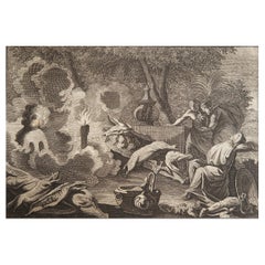
Items Similar to Mid-18th Century Engraving Depicting The Baptism of Russians, 1735
Want more images or videos?
Request additional images or videos from the seller
1 of 5
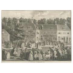
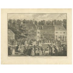
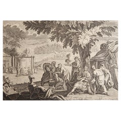
Mid-18th Century Engraving Depicting The Baptism of Russians, 1735
$345.58
$431.9820% Off
£254.85
£318.5720% Off
€288
€36020% Off
CA$477.24
CA$596.5620% Off
A$523.65
A$654.5620% Off
CHF 274.05
CHF 342.5720% Off
MX$6,444.36
MX$8,055.4520% Off
NOK 3,452.67
NOK 4,315.8420% Off
SEK 3,233.94
SEK 4,042.4320% Off
DKK 2,193.47
DKK 2,741.8420% Off
About the Item
Description: Antique print titled 'De Doop der Russen' (Dutch for 'Baptism of the Russians')
Old print depicting the baptism of Russians. This print originates from 'Hedendaegsche Historie of tegenwoordige Staet van alle Volken etc. Tegenwoordige Staat van Rusland' by I. Tirion.
Artists and Engravers: Published by Isaac Tirion, one of the leading Dutch map makers of the mid-18th Century.
Condition: Very good, please study image carefully.
- Dimensions:Height: 8.47 in (21.5 cm)Width: 10.24 in (26 cm)Depth: 0 in (0.02 mm)
- Materials and Techniques:
- Period:1730-1739
- Date of Manufacture:1735
- Condition:
- Seller Location:Langweer, NL
- Reference Number:Seller: BGI-01245 1stDibs: LU3054326498152
About the Seller
5.0
Recognized Seller
These prestigious sellers are industry leaders and represent the highest echelon for item quality and design.
Platinum Seller
Premium sellers with a 4.7+ rating and 24-hour response times
Established in 2009
1stDibs seller since 2017
2,618 sales on 1stDibs
Typical response time: <1 hour
- ShippingRetrieving quote...Shipping from: Langweer, Netherlands
- Return Policy
Authenticity Guarantee
In the unlikely event there’s an issue with an item’s authenticity, contact us within 1 year for a full refund. DetailsMoney-Back Guarantee
If your item is not as described, is damaged in transit, or does not arrive, contact us within 7 days for a full refund. Details24-Hour Cancellation
You have a 24-hour grace period in which to reconsider your purchase, with no questions asked.Vetted Professional Sellers
Our world-class sellers must adhere to strict standards for service and quality, maintaining the integrity of our listings.Price-Match Guarantee
If you find that a seller listed the same item for a lower price elsewhere, we’ll match it.Trusted Global Delivery
Our best-in-class carrier network provides specialized shipping options worldwide, including custom delivery.More From This Seller
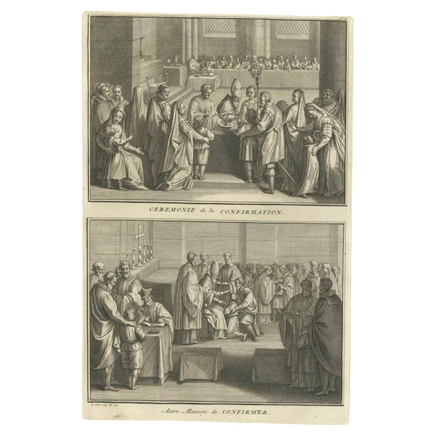
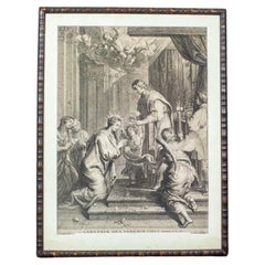
View AllAntique Print Illustrating the Ceremony of Confirmation by B. Picart, 1723
Located in Langweer, NL
This print originates from 'Naaukeurige beschryving der godtsdienst-plichten, kerk-zeden en gewoontens van alle volkeren der waereldt.', a Dutch edition or its French edition 'Ceremo...
Category
Antique Early 18th Century Prints
Materials
Paper
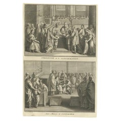
$153 Sale Price
20% Off
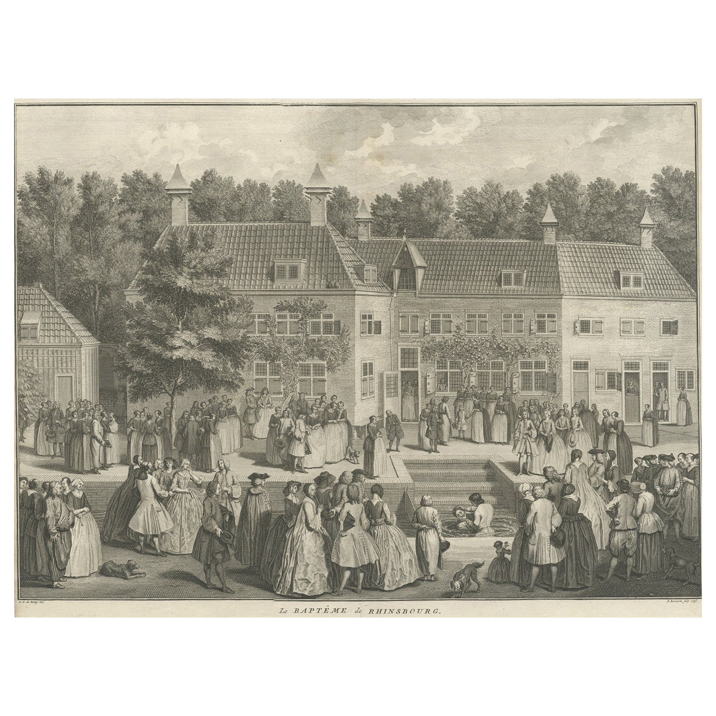
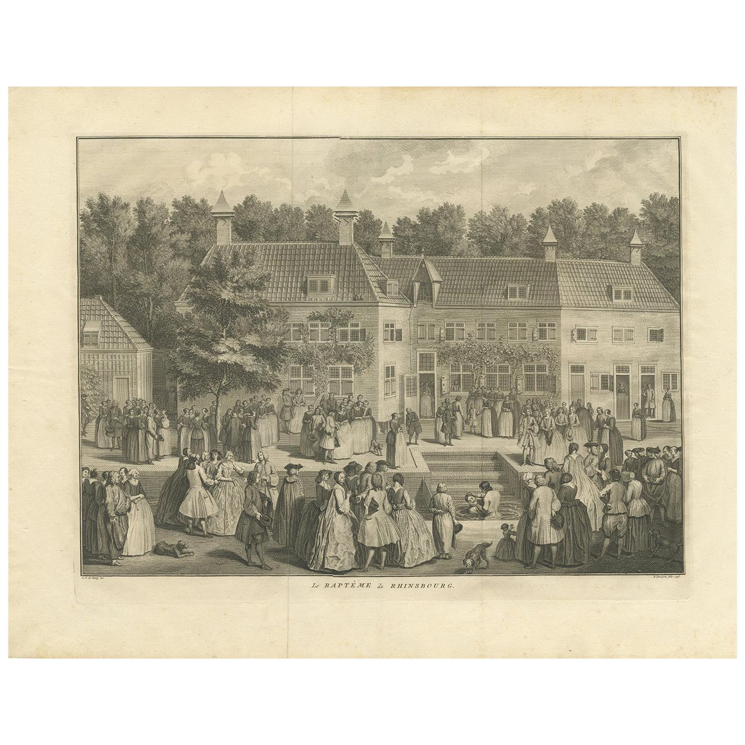
Original Antique Engraving of the Baptism of Christians in The Netherlands, 17
Located in Langweer, NL
Antique print titled 'Le Baptême de Rhinsbourg'. This print depicts the baptism of Christians in Katwijk-Rijnsburg in The Netherlands. Source unknown, to be determined.
Artists an...
Category
Antique 18th Century Prints
Materials
Paper
$460 Sale Price
20% Off
Antique Print of the Baptism of Christians by Bernaerts, 1736
Located in Langweer, NL
Antique print titled 'Le Baptême de Rhinsbourg'. This print depicts the baptism of Christians in Katwijk-Rijnsburg in The Netherlands. Engraved by B. Bernaerts.
Category
Antique Mid-18th Century Dutch Prints
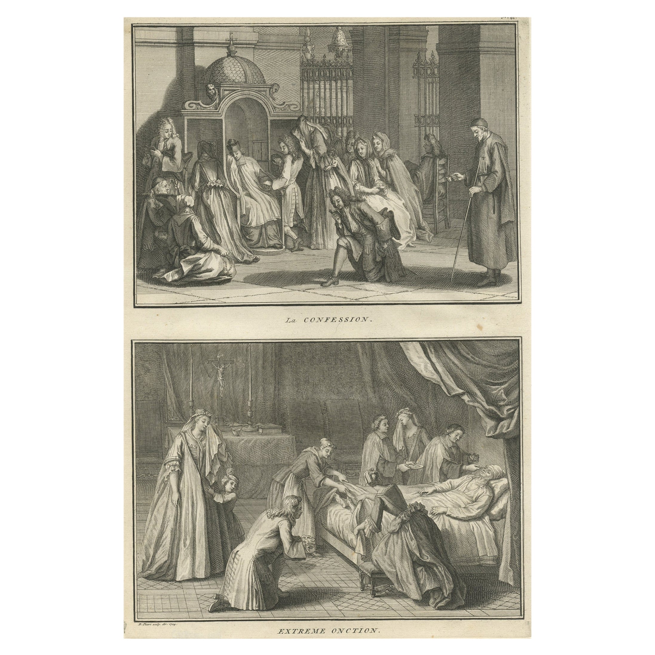
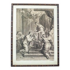
Antique Engraving Depicting the Confession & the Anointing of the Sick, 1724
Located in Langweer, NL
Two religious images on one sheet. The upper images depicts the confession and the lower image depicts the anointing of the sick. This print originates from 'Ceremonies et costumes R...
Category
Antique 1720s Prints
Materials
Paper
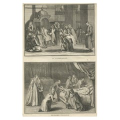
$172 Sale Price
20% Off
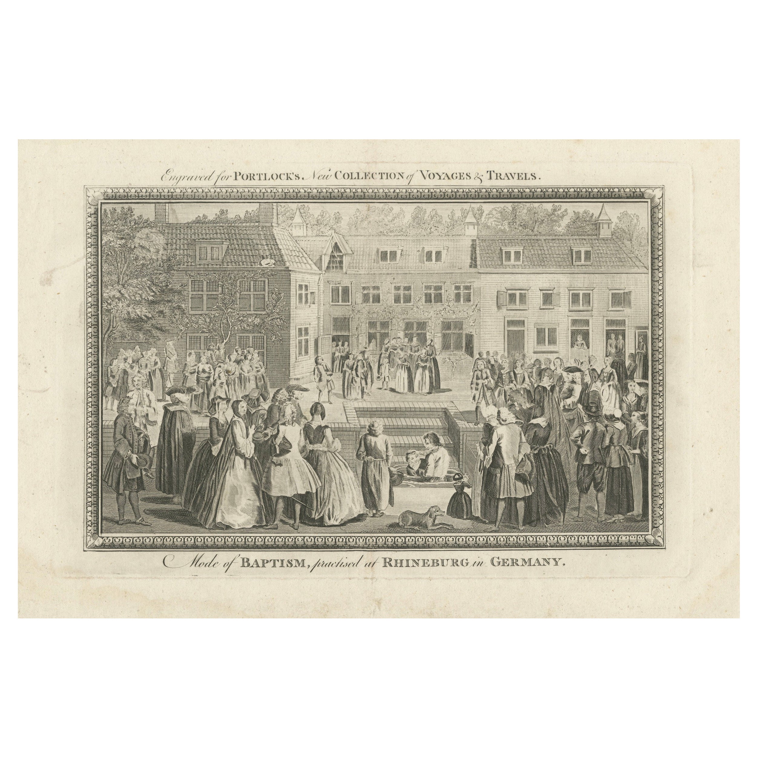
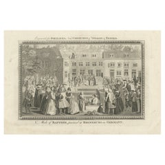
Baptism Ceremony of Rijnsburg Collegiants, Germany, Engraved for Portlock, 1790
Located in Langweer, NL
This copper engraving, titled "Mode of Baptism, Practised at Rhineburg in Germany", was created around 1790 and engraved for "Portlock's New Collection of Voyages and Travels."
The...
Category
Antique 1790s Prints
Materials
Paper
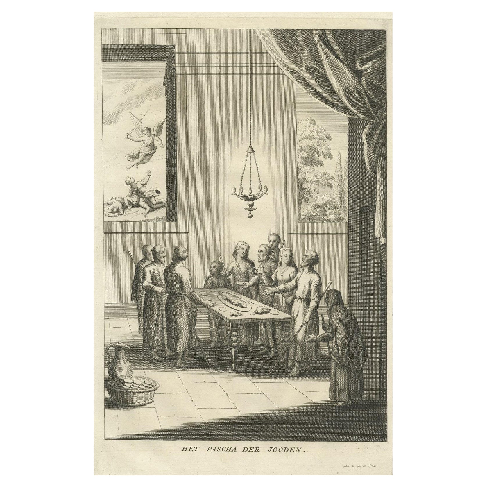
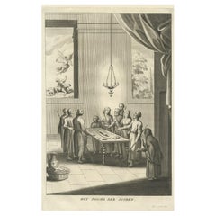
Antique Print of the Jewish Feast or Commemoration of the Passover, 1725
Located in Langweer, NL
Description: Antique print titled 'Het Pascha der Jooden'. Print of the Jewish Pesach / Passover.
Pascha, Passover, Hebrew Pesa? or Pesach, in Judaism, holiday commemorating the ...
Category
Antique 1720s Prints
Materials
Paper
$302 Sale Price
30% Off
You May Also Like
Original Antique Print after Jan Luyken, Amsterdam, Genesis XXXV, 1724
Located in St Annes, Lancashire
Wonderful copper-plate engraving after Jan Luyken
Published by Marten Schagen, Amsterdam. 1724
Text on verso
The measurement given is the paper size.
Category
Antique 1720s Dutch Renaissance Prints
Materials
Paper
18th Century Engraving Depicting a Religious Scene
Located in Opole, PL
We present you an engraving based on a painting by a Flemish painter, Erasmus Quellin (1607-1678).
The template was made by Schelte Adams Bolswert (1581-1659).
The whole is closed ...
Category
Antique 18th Century Belgian Prints
Engraving in Wooden Frame With Religious Scene - 18th Century
Located in Opole, PL
Engraving in Wooden Frame With Religious Scene - 18th Century
Print based on the painting of the Flemish artist Erasmus Quellin (1607-1678). The matrix was made by Schelte Adams Bol...
Category
Antique 18th Century Belgian Prints
Materials
Wood
$333 Sale Price
20% Off
Original Antique Print After Jan Luyken, Amsterdam. Genesis XVIII. 1724
Located in St Annes, Lancashire
Wonderful copper-plate engraving after Jan Luyken
Published by Marten Schagen, Amsterdam. 1724
Text on verso
The measurement given is the paper size.
Category
Antique 1720s Dutch Renaissance Prints
Materials
Paper
Original Antique Print After Jan Luyken, Amsterdam, Genesis XXXI, 1724
Located in St Annes, Lancashire
Wonderful copper-plate engraving after Jan Luyken
Published by Marten Schagen, Amsterdam. 1724
Text on verso
The measurement given is the paper size.
Category
Antique 1720s Dutch Renaissance Prints
Materials
Paper
Original Antique Print after Jan Luyken, Amsterdam, Genesis XV, 1724
Located in St Annes, Lancashire
Wonderful copper-plate engraving after Jan Luyken
Published by Marten Schagen, Amsterdam. 1724
Text on verso
The measurement given is the paper size.
Category
Antique 1720s Dutch Renaissance Prints
Materials
Paper