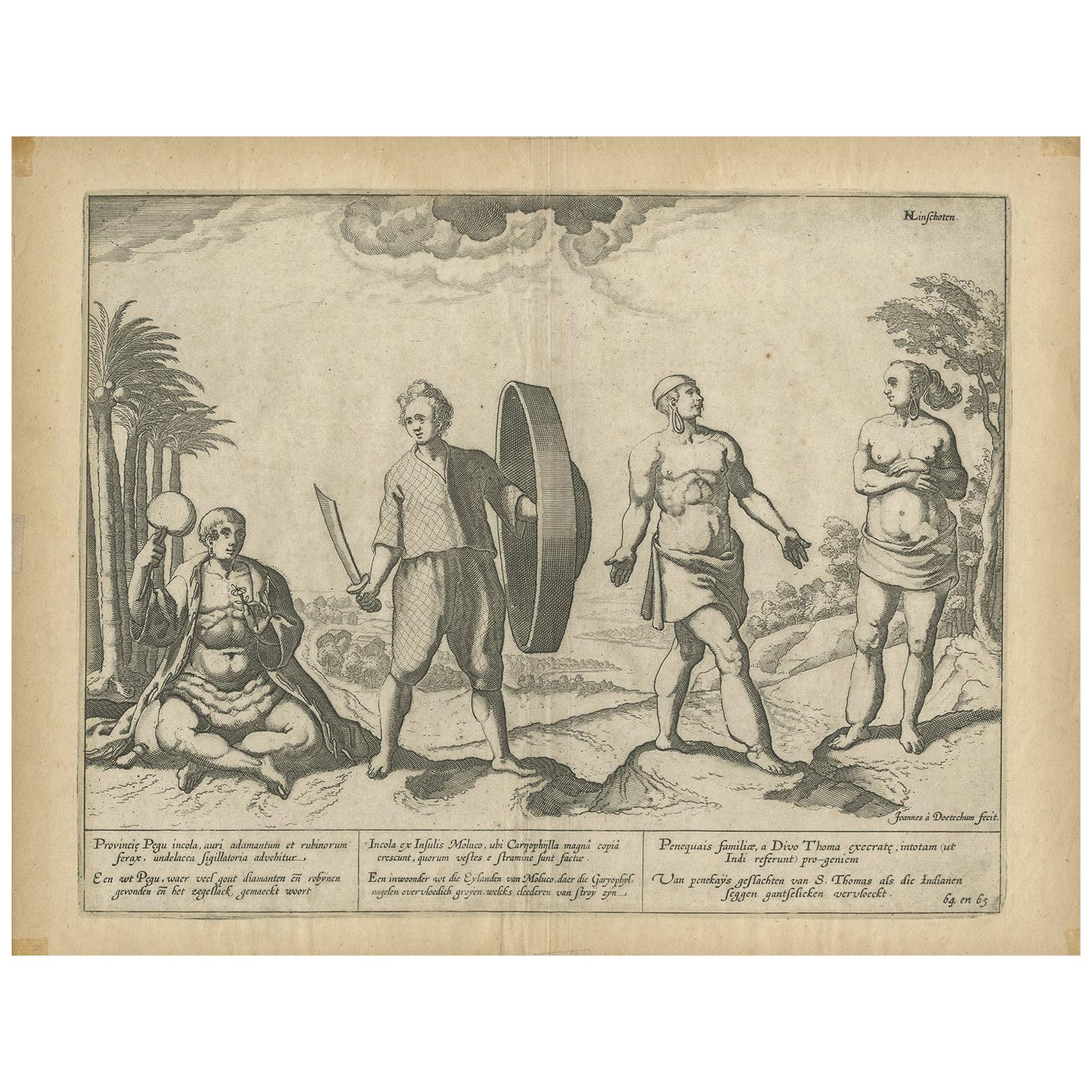
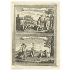
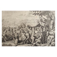
Items Similar to Natives from Pegu, the Moluccan Islands, Penequais Indians and St Thomas, c.1605
Want more images or videos?
Request additional images or videos from the seller
1 of 6
Natives from Pegu, the Moluccan Islands, Penequais Indians and St Thomas, c.1605
$342.32
$427.9120% Off
£254.92
£318.6620% Off
€288
€36020% Off
CA$472.63
CA$590.7820% Off
A$523.97
A$654.9720% Off
CHF 275.37
CHF 344.2120% Off
MX$6,412.59
MX$8,015.7420% Off
NOK 3,439.08
NOK 4,298.8520% Off
SEK 3,227.92
SEK 4,034.9020% Off
DKK 2,192.74
DKK 2,740.9220% Off
About the Item
Antique print titled 'Provincie Pegu incola (..) - Incola ex Insulis Moluco (..) - Penequais familiae (..)'.
Old print showing various figures including a man from Pegu, a man from the Moluccan islands, Penequais indians and inhabitants of S. Thomas. Illustration from an edition of Linschoten's Itinerario. This work informed Europeans of the 16th century Portuguese trade and navigation in southern Asia.
Artists and Engravers: Jan Huygen van Linschoten (1563 - 1611) was a Dutch Protestant merchant, traveller and historian. An alternative spelling of his second name is Huijgen. He is credited with publishing important information about Asian trade, such as the navigational routes that enabled the passage to the elusive East Indies to be opened to the English and the Dutch. This enabled the British East India Company and the Dutch East India Company to break the 16th century monopoly enjoyed by the Portuguese on trade with the East Indies.
- Dimensions:Height: 11.82 in (30 cm)Width: 13.98 in (35.5 cm)Depth: 0 in (0.02 mm)
- Materials and Techniques:
- Period:1600-1609
- Date of Manufacture:circa 1605
- Condition:Wear consistent with age and use. Condition: Fair, age-related toning. Minor wear and small defects. Blank verso. Please study image carefully.
- Seller Location:Langweer, NL
- Reference Number:Seller: JAK-274 1stDibs: LU3054326969942
About the Seller
5.0
Recognized Seller
These prestigious sellers are industry leaders and represent the highest echelon for item quality and design.
Platinum Seller
Premium sellers with a 4.7+ rating and 24-hour response times
Established in 2009
1stDibs seller since 2017
2,609 sales on 1stDibs
Typical response time: <1 hour
- ShippingRetrieving quote...Shipping from: Langweer, Netherlands
- Return Policy
Authenticity Guarantee
In the unlikely event there’s an issue with an item’s authenticity, contact us within 1 year for a full refund. DetailsMoney-Back Guarantee
If your item is not as described, is damaged in transit, or does not arrive, contact us within 7 days for a full refund. Details24-Hour Cancellation
You have a 24-hour grace period in which to reconsider your purchase, with no questions asked.Vetted Professional Sellers
Our world-class sellers must adhere to strict standards for service and quality, maintaining the integrity of our listings.Price-Match Guarantee
If you find that a seller listed the same item for a lower price elsewhere, we’ll match it.Trusted Global Delivery
Our best-in-class carrier network provides specialized shipping options worldwide, including custom delivery.More From This Seller
View AllAntique Print of Natives of Southern Asia by Linschoten, circa 1605
By Jan Huygen van Linschoten
Located in Langweer, NL
Antique print titled 'Provincie Pegu incola (..) - Incola ex Insulis Moluco (..) - Penequais familiae (..)'. Old print showing various figures including a man from Pegu, a man from the Moluccan islands, Penequais Indians and inhabitants of S. Thomas. Illustration from an edition of Linschoten's Itinerario. This work informed Europeans of the 16th century Portuguese trade and navigation in southern Asia.
Category
Antique Early 17th Century Prints
Materials
Paper

$190 Sale Price
20% Off
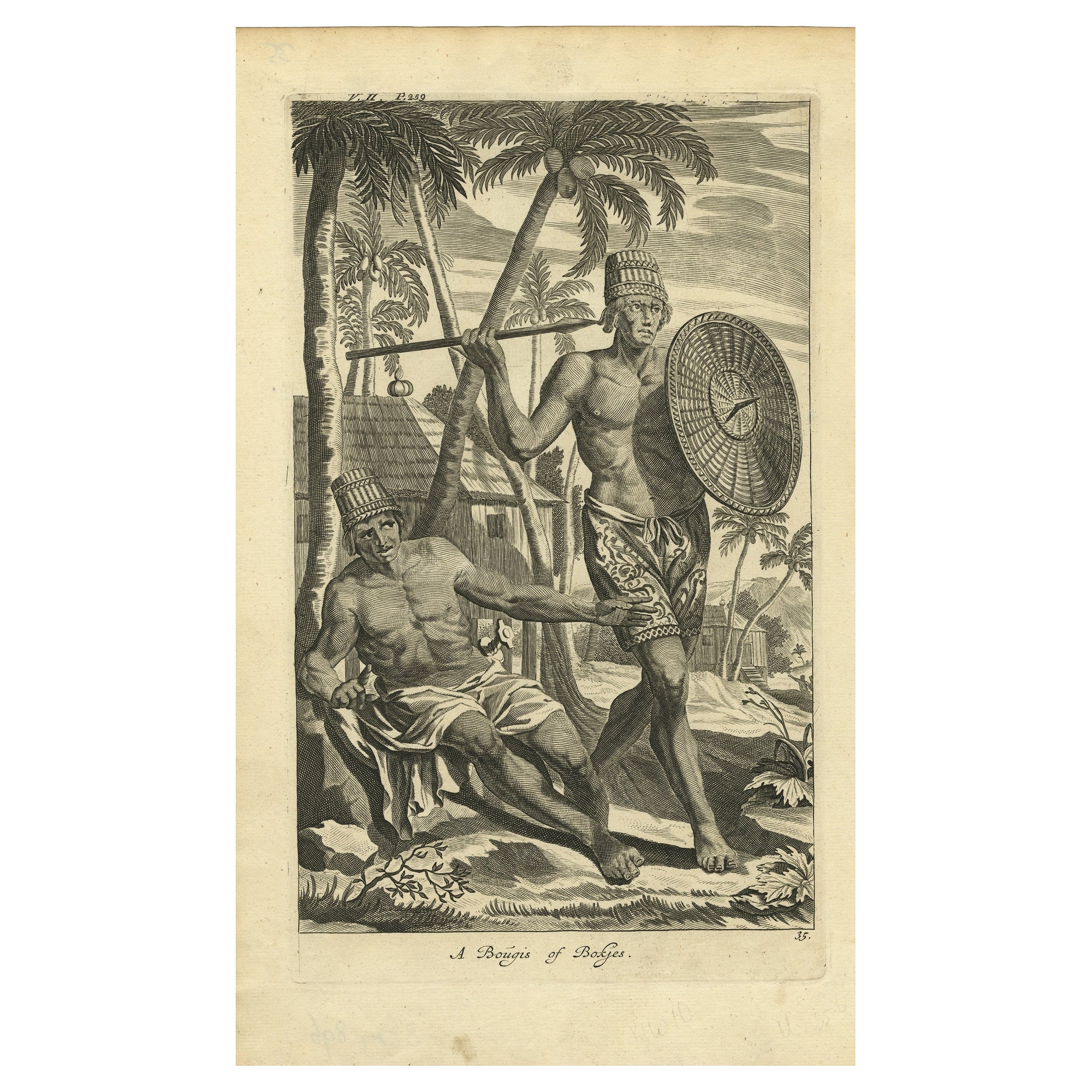
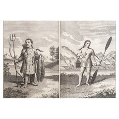
Engraving of Buginese people near Batavia, East Indies, Indonesia, 1744
By Philip Baldaeus
Located in Langweer, NL
Antique print, titled: 'A Bougis of Bokjes' - This plate shows Buginese people near Batavia, East Indies, Indonesia.
The Buginese people are an ethnic group - the most numerous o...
Category
Antique 18th Century Prints
Materials
Paper
$209 Sale Price
20% Off
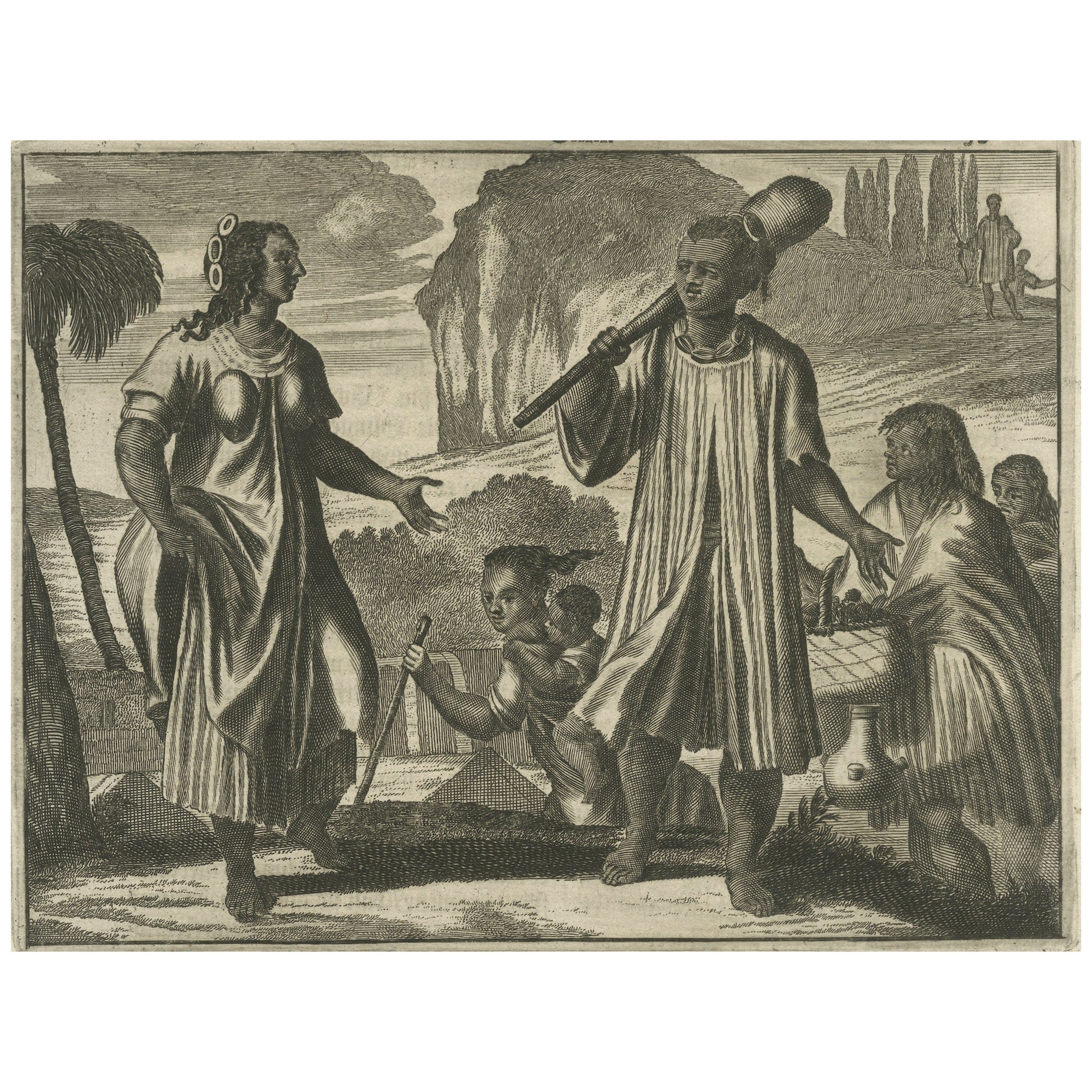
Scenes from 17th Century Chile: A Glimpse of Early Indigenous Cultures, 1673
Located in Langweer, NL
The image is a historical copper engraving from 1673, taken from the German edition of Arnoldus Montanus' work, which is known for its depiction of the Americas and the Southern land...
Category
Antique 1670s Prints
Materials
Paper
$427 Sale Price
20% Off
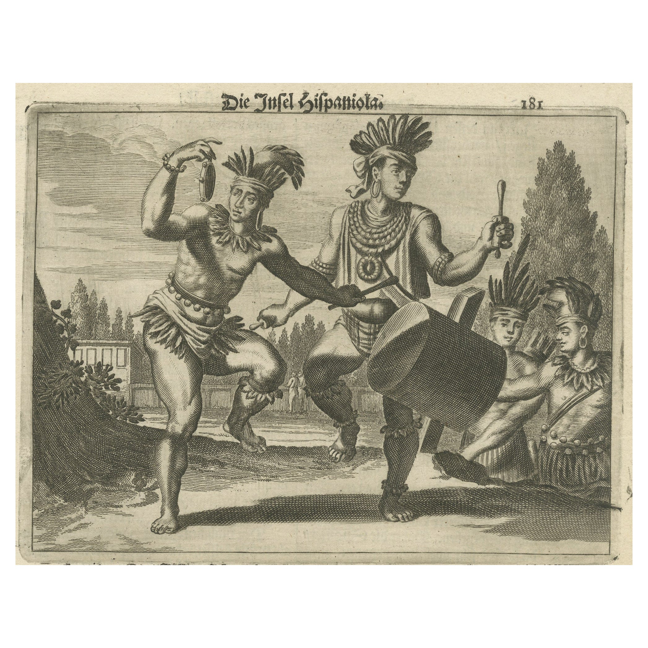
Copper Engraving of Hispaniola - Indigenous Life in America by Montanus, 1673
Located in Langweer, NL
This original copper engraving, extracted from the scarce German edition of Arnoldus Montanus' "Die Unbekante Neue Welt oder Beschreibung des Welt-teils Amerika und des Sud-Landes", ...
Category
Antique 1670s Prints
Materials
Paper

$401 Sale Price
24% Off
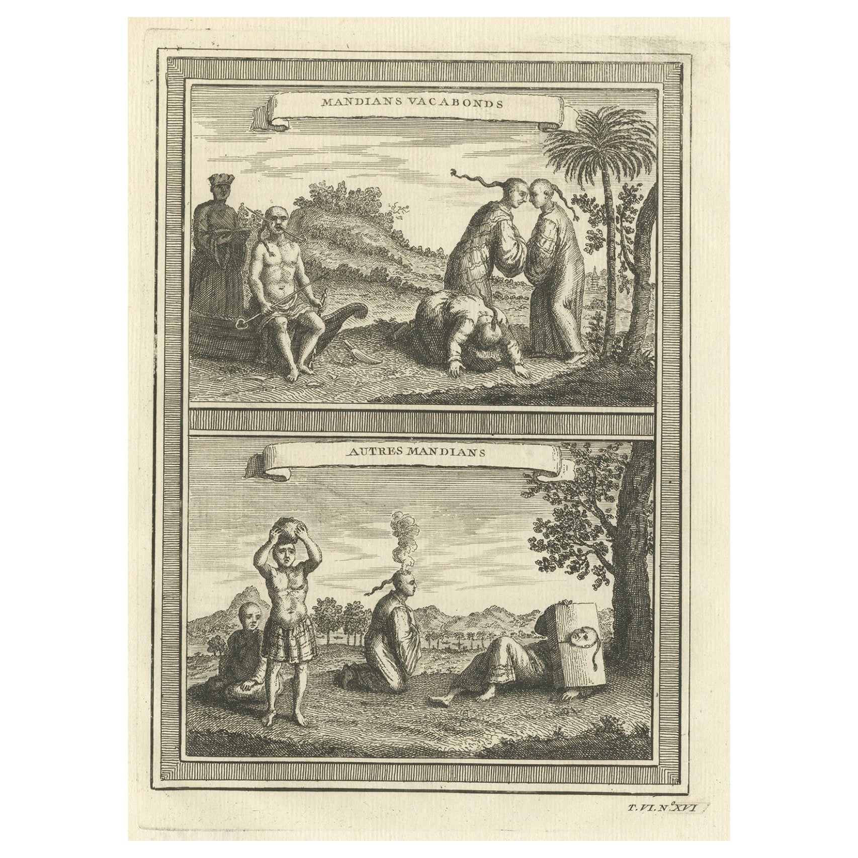
Antique Print of Chinese Vagabonds, 1748
Located in Langweer, NL
Antique print titled 'Mandians Vacabonds - Autres Mandians'. Two views of so-called 'Mandians,' either residents of the region in Anhui province, or some type of nomadic people. They...
Category
Antique 18th Century Prints
Materials
Paper
$209 Sale Price
20% Off
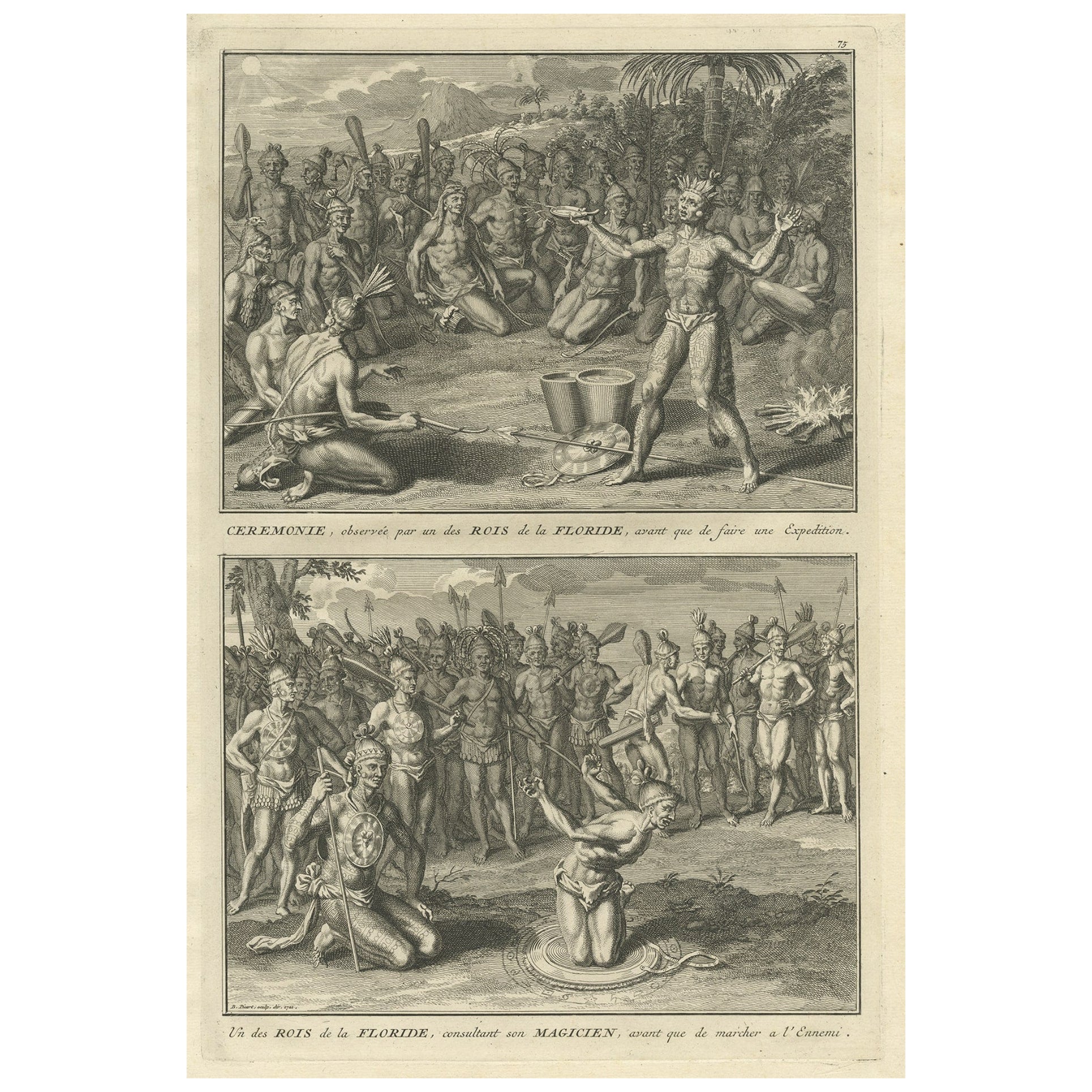
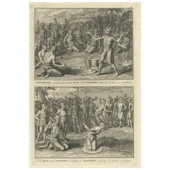
Two Engravings of an Florida King of the Indians in America, 1722
Located in Langweer, NL
Antique print titled 'Ceremonie, observée par un des Rois de la Floride (..)'.
Two images on one sheet.
1. A ceremony that takes place before they set...
Category
Antique 1770s Prints
Materials
Paper
$323 Sale Price
20% Off
You May Also Like
Original Antique Ethnographical Print of Indigenous Siberians. C.1780
Located in St Annes, Lancashire
Wonderful print of indigenous Siberians
Copper-plate engraving
Published C.1780
Unframed.
Category
Antique 1780s English Georgian Prints
Materials
Paper
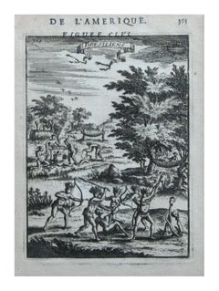
Native Civilians of America -- "De L'Amerique" Published Frankfurt / 1683
By Alain Manesson Mallet
Located in Soquel, CA
Wonderful etching, originally page 365 in a book De L'amerique by Alain Manesson Mallet, circa 1683, depicts the artist's concept of the appearance and activities of the native occupants of America in graphic detail. Unsigned. Displayed in a black and giltwood frame. Image, 6.5"H x 4.5"L.
1683 Manesson Mallet "Bresiliens" Amerindians, Indigenous Native Brazilians, Brazil, South America, Antique Print...
Category
1680s Realist Figurative Prints
Materials
Paper, Ink, Woodcut
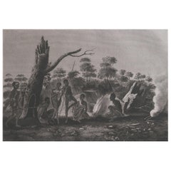
Original Antique Ethnographical Print, Figures, New South Wales, Australia, 1809
Located in St Annes, Lancashire
Wonderful ethnographical print.
A copper-plate engraving after Lesieur
Published by Sherwood, Neely & Jones. Dated 1809
Unframed.
Category
Antique Early 1800s English Folk Art Prints
Materials
Paper
Original Antique Print After Jan Luyken, Amsterdam, Genesis XXXI, 1724
Located in St Annes, Lancashire
Wonderful copper-plate engraving after Jan Luyken
Published by Marten Schagen, Amsterdam. 1724
Text on verso
The measurement given is the paper size.
Category
Antique 1720s Dutch Renaissance Prints
Materials
Paper
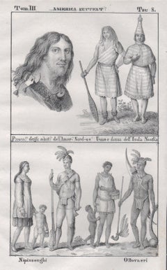
Indigenous People, North America, mid 19th century lithograph.
Located in Melbourne, Victoria
'Fisom degli abiti dell' America Nord-oe / Uomo donna dell' Isola Nootka' / 'Nipissonghi / Ottovaeri'
Italian lithograph, c1841. Originally from 'Galleria universale di tutti i popo...
Category
Mid-19th Century Naturalistic Figurative Prints
Materials
Lithograph
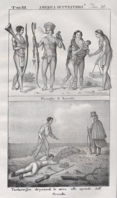
Caribbean Indigenous People / Orinoco, America, mid 19th century lithograph.
Located in Melbourne, Victoria
'Famiglia di Karaibi' / 'Tartarnughe deponenti le uova alle sponde dell' Orenoko''
Italian lithograph, c1841. Originally from 'Galleria universale di tutti i popoli del mondo' by Gi...
Category
Mid-19th Century Naturalistic Figurative Prints
Materials
Lithograph
More Ways To Browse
British East Indies
Agate Fish
Antique Bed Parts
Antique Buddha House
Antique Cast Iron Safe
Antique Cathedral Cabinet
Antique Chinese Black Lacquer Screen
Antique Chinese Watercolor Paintings
Antique Cloche
Antique Clock With Lion Heads
Antique Door Spindle
Antique Door Studs
Antique Double Secretary
Antique Drinking Bird
Antique Furniture Northumberland
Antique Haberdashery
Antique Heart Pine
Antique Horse Bit