Items Similar to Old Print with a View on the City & Castle of Batavia 'Jakarta', Indonesia, 1668
Want more images or videos?
Request additional images or videos from the seller
1 of 5
Old Print with a View on the City & Castle of Batavia 'Jakarta', Indonesia, 1668
$459.12
$573.9020% Off
£339.88
£424.8620% Off
€384
€48020% Off
CA$635.30
CA$794.1320% Off
A$700.41
A$875.5120% Off
CHF 366.43
CHF 458.0420% Off
MX$8,592.68
MX$10,740.8620% Off
NOK 4,612.63
NOK 5,765.7820% Off
SEK 4,313.54
SEK 5,391.9220% Off
DKK 2,925.08
DKK 3,656.3520% Off
About the Item
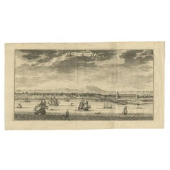
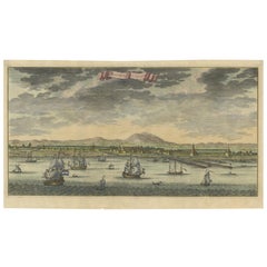
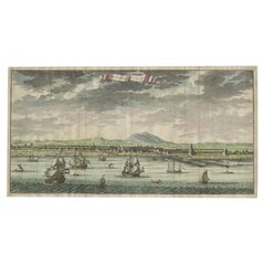
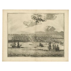
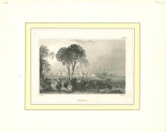
Antique print Indonesia titled ‘La ville de Batavie. De Stadt Batavia. Chateau de Batavia. ‘t Casteel van Batavia’.
Antique print with a view on the city of Djakarta, Indonesia. Below, a view from the sea on the Castle of Batavia with its ramparts. Several ships are depicted. This print originates from the Latin edition of Nieuhof's work titled 'Legatio batavica ad magnum Tartariæ chamum Sungteium (..)'.
Artists and Engravers: Johan / Jan / Johannes Nieuhof / Nieuhoff / Neuhof (1618-1672) was a Dutch traveler who wrote about his journeys to Brazil, China and India.
- Dimensions:Height: 12.21 in (31 cm)Width: 14.77 in (37.5 cm)Depth: 0 in (0.02 mm)
- Materials and Techniques:
- Period:1660-1669
- Date of Manufacture:1668
- Condition:Wear consistent with age and use.
- Seller Location:Langweer, NL
- Reference Number:Seller: BG-11795-4 1stDibs: LU3054326972862
About the Seller
5.0
Recognized Seller
These prestigious sellers are industry leaders and represent the highest echelon for item quality and design.
Platinum Seller
Premium sellers with a 4.7+ rating and 24-hour response times
Established in 2009
1stDibs seller since 2017
2,613 sales on 1stDibs
Typical response time: <1 hour
- ShippingRetrieving quote...Shipping from: Langweer, Netherlands
- Return Policy
Authenticity Guarantee
In the unlikely event there’s an issue with an item’s authenticity, contact us within 1 year for a full refund. DetailsMoney-Back Guarantee
If your item is not as described, is damaged in transit, or does not arrive, contact us within 7 days for a full refund. Details24-Hour Cancellation
You have a 24-hour grace period in which to reconsider your purchase, with no questions asked.Vetted Professional Sellers
Our world-class sellers must adhere to strict standards for service and quality, maintaining the integrity of our listings.Price-Match Guarantee
If you find that a seller listed the same item for a lower price elsewhere, we’ll match it.Trusted Global Delivery
Our best-in-class carrier network provides specialized shipping options worldwide, including custom delivery.More From This Seller
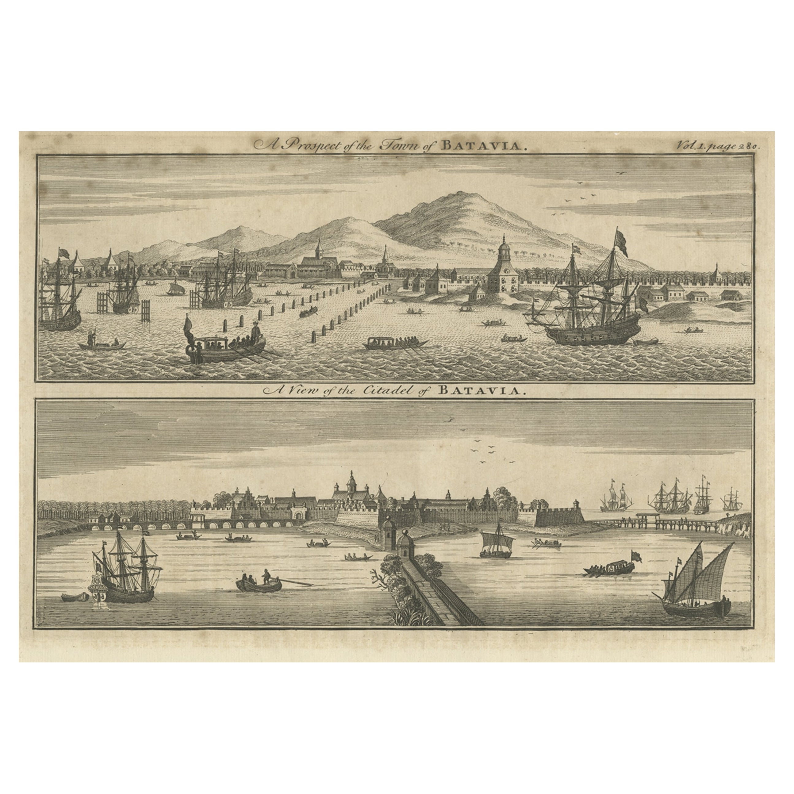
View AllAntique Print of Batavia 'Jakarta', in the Dutch East Indies, 1744
Located in Langweer, NL
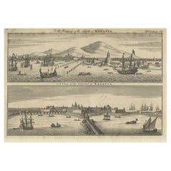
Two views on one plate titled 'A Prospect of The Town of Batavia (and) A View of the Citadel of Batavia'. Beautiful views of Batavia (Jakarta), Indonesia. The upper view shows the ci...
Category
Antique 18th Century Prints
Materials
Paper
$210 Sale Price
20% Off
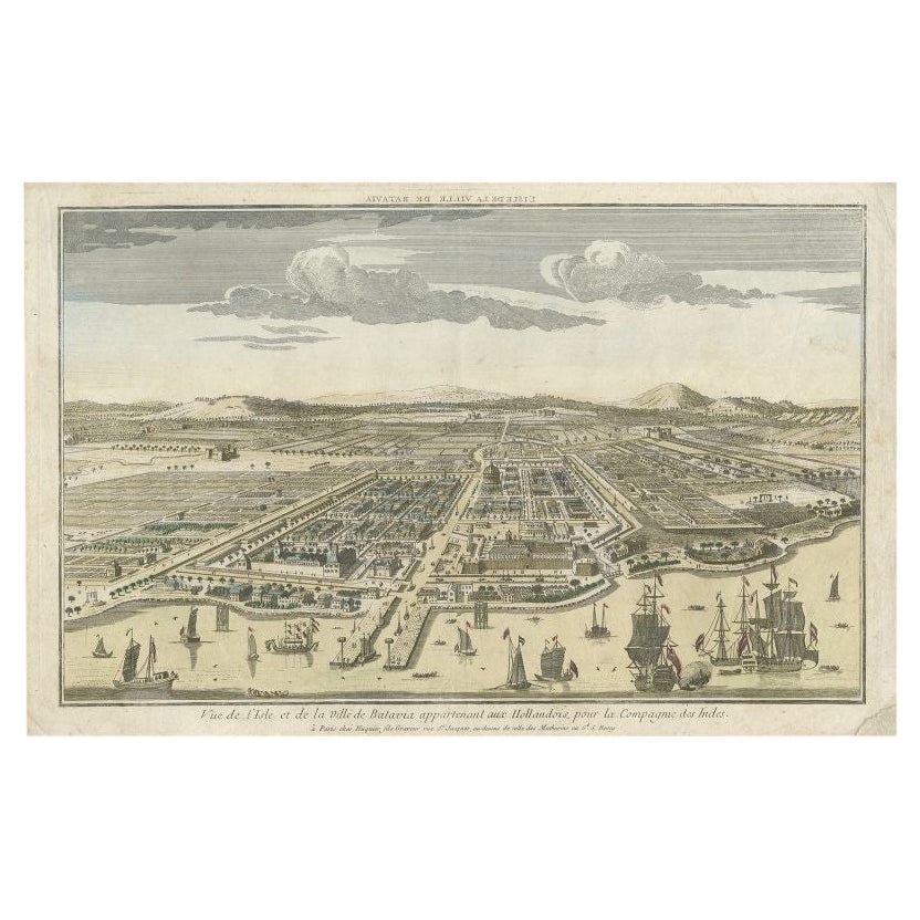
Antique Print of Batavia or nowadays Jakarta, Indonesia, c.1755
Located in Langweer, NL
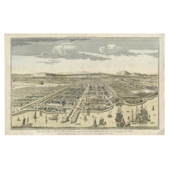
Antique print titled 'Vue de l'Isle et de la ville de Batavia appartenant aux Hollandois'. Beautiful view of the island and the city of Batavia belonging to the Dutch, for the India ...
Category
Antique 18th Century Prints
Materials
Paper
$698 Sale Price
20% Off
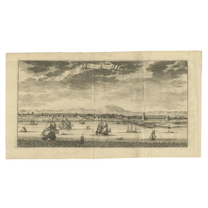
Antique Print of Batavia (Jakarta) in the Dutch East Indies, 1726
Located in Langweer, NL
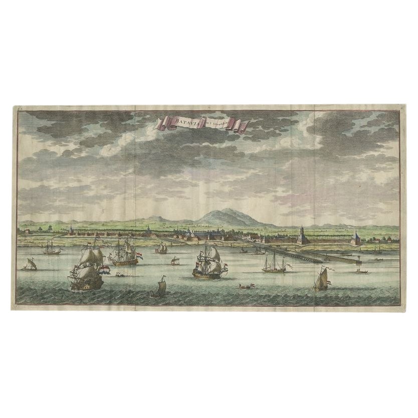
Antique print titled 'Batavia in 't Verschiet'. Attractive panorama view of Batavia, the pearl of the east. The bird eye's view shows the roadstead of the city, filled with VOC East Indiamen and Asian trading ships...
Category
Antique 18th Century Prints
Materials
Paper
$841 Sale Price
20% Off
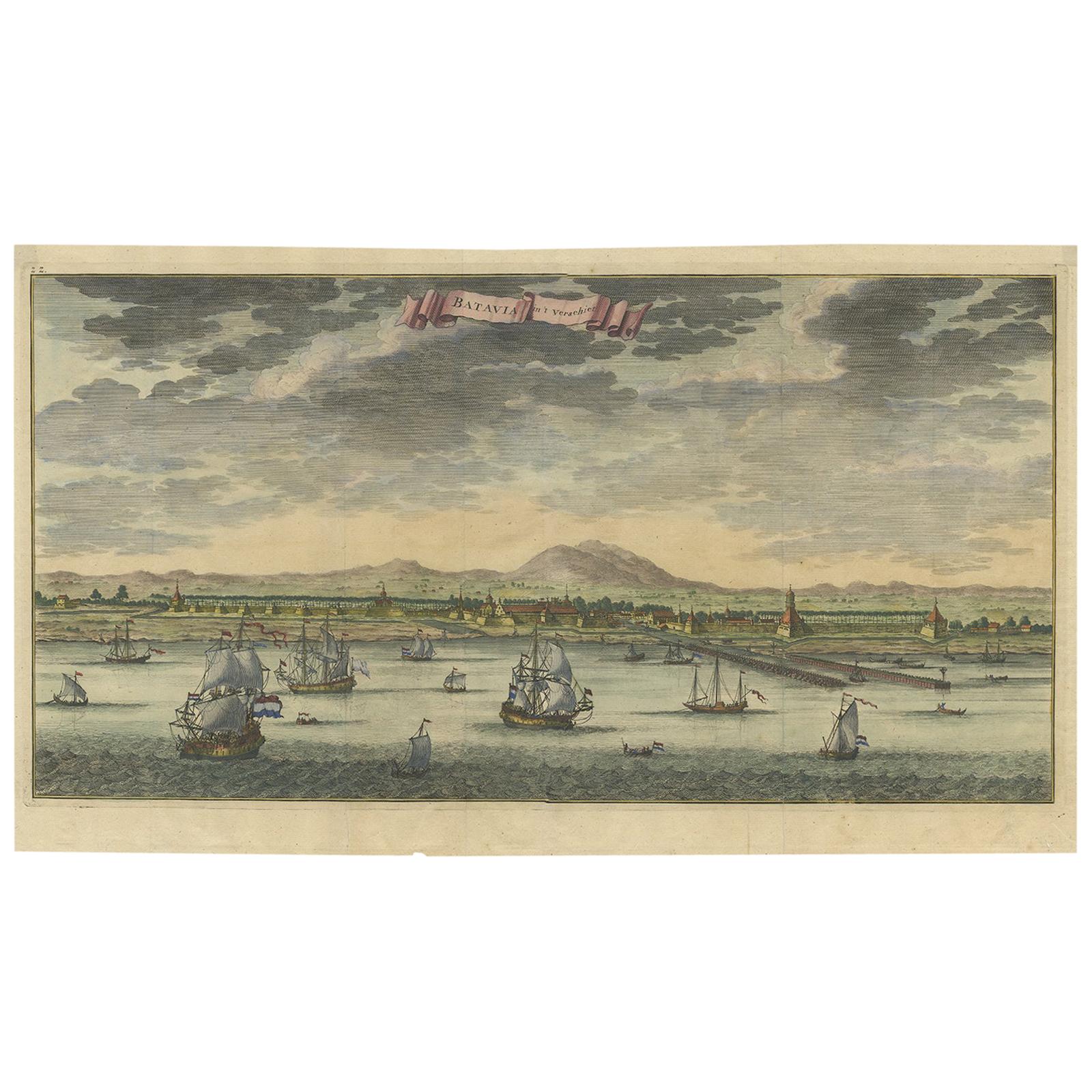
Antique Print of Batavia or Nowadays Jakarta, Indonesia, by Valentijn (1726)
By F. Valentijn
Located in Langweer, NL
Antique print Indonesia titled 'Batavia in 't Verschiet'. Large panoramic view on Batavia, present day Jakarta, Indonesia. Originates from 'Oud en Nieuw Oost-Indiën (..)' by François...
Category
Antique Mid-18th Century Prints
Materials
Paper
$908 Sale Price
20% Off
Antique Print of Batavia, Capital of the Dutch East Indies or Indonesia, '1726'
Located in Langweer, NL
Antique print Indonesia titled 'Batavia in 't Verschiet'. Large panoramic view on Batavia, present day Jakarta, Indonesia. Originates from 'Oud en Nieuw Oost-Indiën (..)' by François...
Category
Antique 18th Century Prints
Materials
Paper
$1,195 Sale Price
20% Off
Print of Makassar 'Ujung Pandang' in the Dutch East Indies 'Indonesia', c.1725
By Pieter Van Der Aa
Located in Langweer, NL
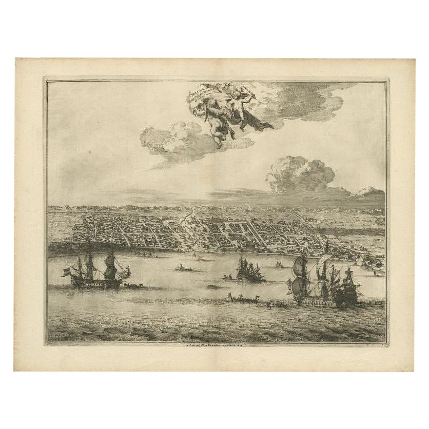
Antique print titled 'Macasar, Capitale du Roiaume de même nom'. This rare print shows Makassar, the present capital of South Sulawesi, Indonesia. In the foreground several VOC ships...
Category
Antique 18th Century Prints
Materials
Paper
$420 Sale Price
20% Off
You May Also Like
Ancient View of Batavia - Original Lithograph - Half of the 19th Century
Located in Roma, IT
Ancient View of Batavia is an original modern artwork realized in the first half of the 19th Century.
Original B/W Lithograph on Ivory Paper.
Inscripted on the lower margin in Ca...
Category
Early 19th Century Modern Landscape Prints
Materials
Lithograph
Antique Voc Print Holland Malaysia Old Map Melaka History, 1663
Located in Amsterdam, Noord Holland
From my own collection I offer this impressive Antique print of the city of Malakka
A very interesting piece for collectors . It is an museum piece from the Dutch Institute of Orien...
Category
Antique 17th Century European Paintings
Materials
Paper

$293 Sale Price
20% Off
Ancient View of Bombay - Original Lithograph - Half of the 19th Century
Located in Roma, IT
Ancient View of Bombay is an original modern artwork realized in the first half of the 19th Century.
Original B/W Lithograph on Ivory Paper.
Inscripted on the lower margin in Cap...
Category
Early 19th Century Modern Landscape Prints
Materials
Lithograph

Original Antique Print of Cairo, Egypt. Dated 1809
Located in St Annes, Lancashire
Wonderful image of Cairo
Fine copper-plate engraving
Published by Sherwood & Co.
Dated 1809
Unframed.
Free shipping
Category
Antique Early 1800s English Moorish Prints
Materials
Paper
Ancient View of Calcutta - Original Lithograph - Half of the 19th Century
Located in Roma, IT
Calcutta is an original modern artwork realized in the first half of the 19th Century.
Original B/W Lithograph on Ivory Paper.
Inscripted on the lower margin in Capital Letters: ...
Category
Early 19th Century Modern Landscape Prints
Materials
Lithograph
Ancient View of Lima - Original Lithograph - Early 19th Century
Located in Roma, IT
Lima is an original modern artwork realized in Italy in the first half of the 19th Century.
Original Lithograph on Ivory Paper.
Inscripted in capital letters on the lower central ...
Category
Early 19th Century Modern Figurative Prints
Materials
Lithograph
More Ways To Browse
Audubon Havell Edition
Audubon Havell
Aurelia In A Red Bonnet
Avi Kiriaty
Bernard Munch
Bjorn Wiinblad Lithograph
Botero Hand Signed
Calder Artist Proof
Carol Summers Vintage Prints
Chagall Circus Signed
Charles Cobelle Signed Lithograph
Charles T Bowling
Christian Choisy
Clyde Connell
Cobelle Lithograph
Cracked Gesso
Cy Twombly Gaeta
Elsie Rice