Items Similar to Set of 21 Antique Prints Illustrating the Travels to Cenderawasih Bay, 1875

Want more images or videos?
Request additional images or videos from the seller
1 of 21
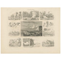
Set of 21 Antique Prints Illustrating the Travels to Cenderawasih Bay, 1875
$1,842.37per set
£1,371.99per set
€1,550per set
CA$2,543.64per set
A$2,820per set
CHF 1,482.02per set
MX$34,512.23per set
NOK 18,508.95per set
SEK 17,372.50per set
DKK 11,801.18per set
About the Item
Set of 21 antique prints illustrating the travels to Cenderawasih Bay, also known as Sarera Bay (Indonesian: Teluk Sarera) and formerly Geelvink Bay (Dutch: Geelvinkbaai), a large bay in northern Province of Papua and West Papua, New Guinea, Indonesia. This set includes:
1) C. von Rosenberg
2) Tombe van Dr. Bernstein op de begraafplaats te Ternate
3) Groote Mesigit te Ternate
4) Het Dorp Roemsaro op Mefoor
5) Het Dorp Warefondi op Soëk
6) De Rivier van Andai voorbij het Zendelingshuis met den arfak in het verschiet
7) De Top van den Arfak (..)
8) De Berg Sebela (..)
9) Kazuaris in het bosch (Cassowary bird)
10) Bewoners van Andai (Papua New Guinea)
11) Arfaksch Huis te Andai
12) Mannen van Hattam (Hatam)
13) Man van Hattam
14) Tanysiptera Carolinae (..) (Numfor paradise kingfisher)
15) Ptilopus Speciosus (..) (Yellow-bibbed Fruit-Dove)
16) Pachycephala Schlegeli (..) (Regent whistler)
17) Kop van den Casuarius Papuanus (Dwarf cassowary)
18) Kop van den Epimachus Vethii
19) Overeenkomst in vorm van Borneo met Celebes en Halmahera
20) Baai van Ansoes
21) Kaart der Groote Geelvink Baai (Cenderawasih Bay fold-out map)
These prints originate from 'Reistochten naar de Geelvinkbaai op Nieuw-Guinea' by C.B.H. von Rosenberg. Published by Martinus Nijhoff, 1875.
- Dimensions:Height: 11.03 in (28 cm)Width: 8.86 in (22.5 cm)Depth: 0.02 in (0.5 mm)
- Sold As:Set of 21
- Materials and Techniques:
- Period:
- Date of Manufacture:1875
- Condition:General age-related toning. Minor wear and foxing. The fold-out map is 4x the size of the other prints. Please study images carefully.
- Seller Location:Langweer, NL
- Reference Number:Seller: BG-123041stDibs: LU3054320283742
About the Seller
5.0
Recognized Seller
These prestigious sellers are industry leaders and represent the highest echelon for item quality and design.
Platinum Seller
Premium sellers with a 4.7+ rating and 24-hour response times
Established in 2009
1stDibs seller since 2017
2,609 sales on 1stDibs
Typical response time: <1 hour
- ShippingRetrieving quote...Shipping from: Langweer, Netherlands
- Return Policy
Authenticity Guarantee
In the unlikely event there’s an issue with an item’s authenticity, contact us within 1 year for a full refund. DetailsMoney-Back Guarantee
If your item is not as described, is damaged in transit, or does not arrive, contact us within 7 days for a full refund. Details24-Hour Cancellation
You have a 24-hour grace period in which to reconsider your purchase, with no questions asked.Vetted Professional Sellers
Our world-class sellers must adhere to strict standards for service and quality, maintaining the integrity of our listings.Price-Match Guarantee
If you find that a seller listed the same item for a lower price elsewhere, we’ll match it.Trusted Global Delivery
Our best-in-class carrier network provides specialized shipping options worldwide, including custom delivery.More From This Seller
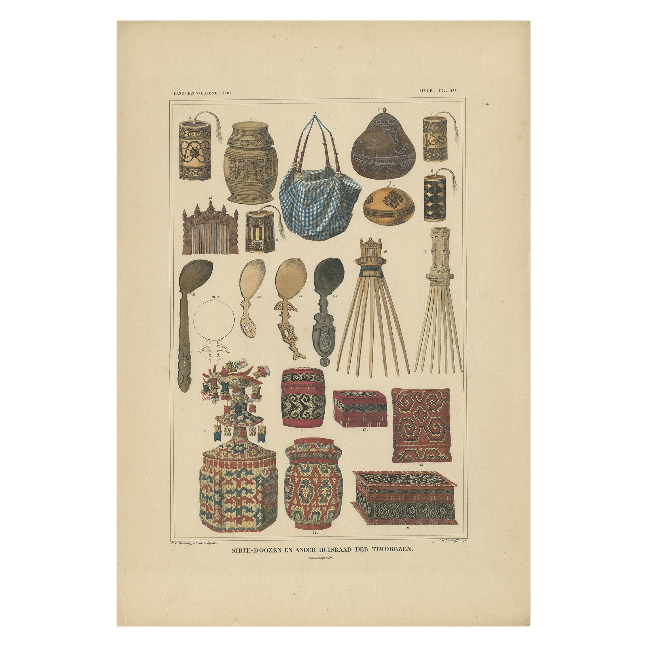
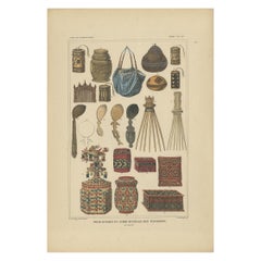
View AllSet of 7 Decorative Antique Prints of Borneo, Timor and Papua Culture, ca. 1840
Located in Langweer, NL
A collection of 7 Antique prints, with the following reference:
Antique Print with Various Furniture of Timor ‘Indonesia’, Temminck, circa 1840
Print with Weapons of Papua 'New G...
Category
Antique Mid-19th Century Prints
Materials
Paper
$2,614 Sale Price / set
20% Off
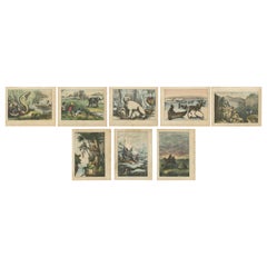
Set of 8 Antique Prints of Various Animals and Hunting Scenes 'circa 1880'
Located in Langweer, NL
Set of eight antique prints of various animals and hunting scenes including a snake, monkeys, polar bears, elephant hunting, seal hunting and others. ...
Category
Antique Late 19th Century Prints
Materials
Paper
$416 Sale Price / set
22% Off
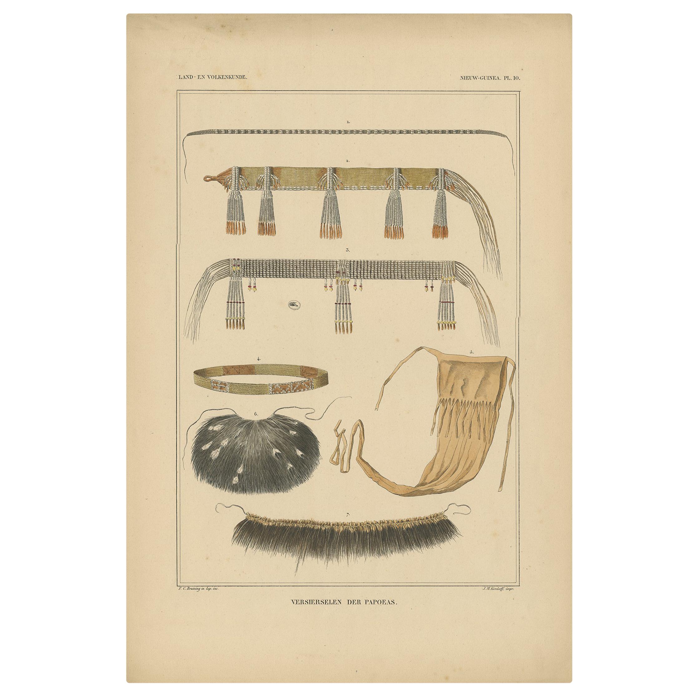
Antique Print with Decorations 'New Guinea, Indonesia' by Temminck, circa 1840
Located in Langweer, NL
Antique print titled 'Versierselen der Papoeas'. This print originates from 'Verhandelingen over de natuurlijke geschiedenis der Nederlandsche overzeesche bezittingen, door de Leden ...
Category
Antique Mid-19th Century Prints
Materials
Paper
$427 Sale Price
20% Off
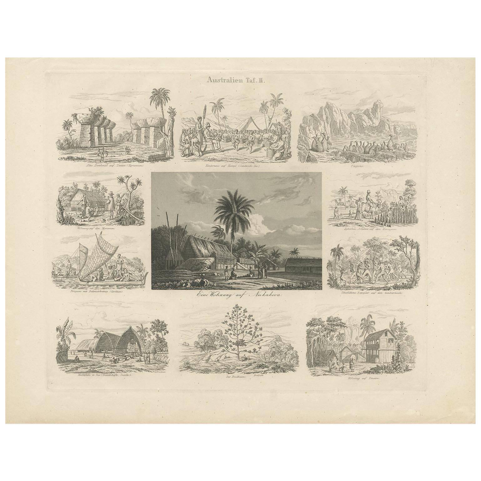
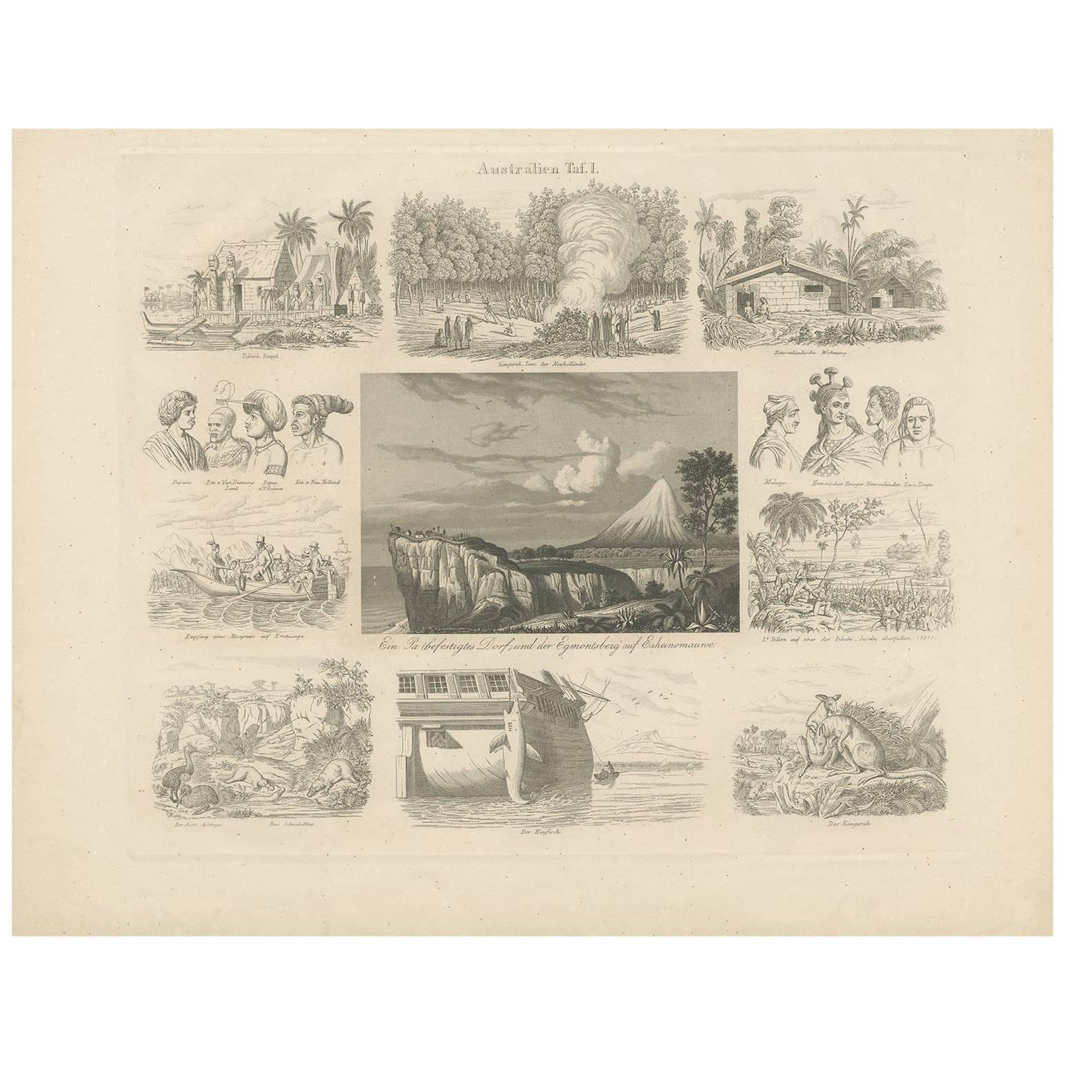
Antique Print with Views of Australia (II) by Rosmäsler, circa 1844
Located in Langweer, NL
Antique print with 11 scenes of Australia. Depicting for example a house in Nukahiwa, Pinguïns and many more. This print originates from 'Album für Freunde der Länder und Völkerkunde...
Category
Antique Mid-19th Century Prints
Materials
Paper

$152 Sale Price
20% Off
Antique Print with Views of Australia I by Rosmäsler, circa 1844
Located in Langweer, NL
Antique print with 11 scenes of Australia. Depicting for example a Kangaroo, a Temple various other animals and many more. This print originates from 'Album für Freunde der Länder un...
Category
Antique Mid-19th Century Prints
Materials
Paper
$152 Sale Price
20% Off
Set of 10 Antique Prints of Various Scenes, Figures and Objects of South America
Located in Langweer, NL
Set of ten antique prints depicting various scenes, figures, and objects of South America. These prints originate from 'Iconographic Encyclopaedia of the Arts and Sciences' by Johann...
Category
Antique Late 19th Century Prints
Materials
Paper
$475 Sale Price / set
20% Off
You May Also Like
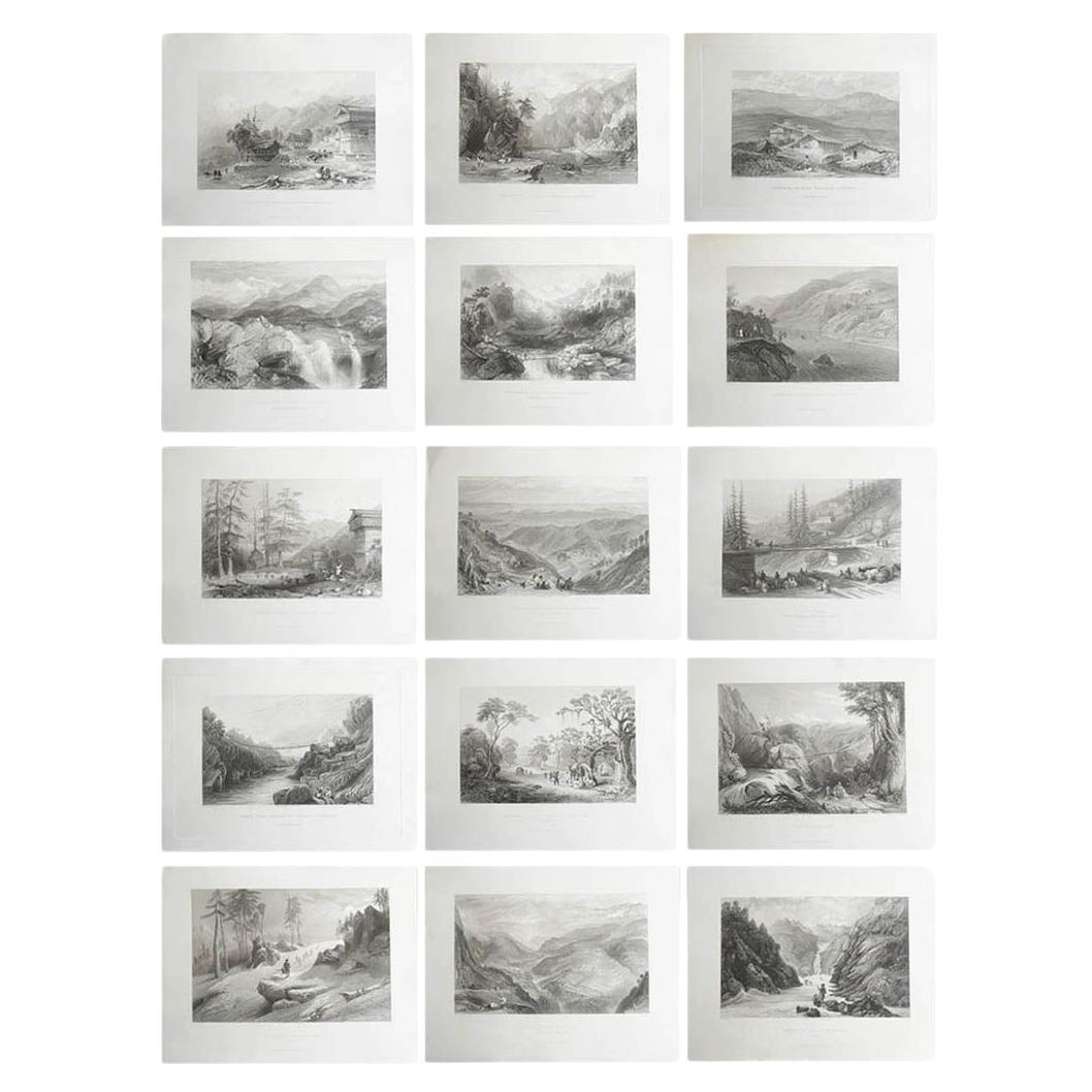
Set of 15 Original Antique Prints of The Himalayas, India, circa 1830
Located in St Annes, Lancashire
Wonderful set of 15 prints of the Himalayas
Steel engravings after Turner, Cox, Roberts, Allom etc.
Published by Fisher 1830-1840.
All dated.
Unframed.
Category
Antique 1830s English Anglo-Indian Prints
Materials
Paper
Set of 9 Original Antique Prints of Waterbirds After Francis Lydon, C.1880
Located in St Annes, Lancashire
Wonderful set of 9 antique prints of waterbirds
Lithographs after the original drawings by Alexander Francis Lydon
Original colour
Published by John C. Nimmo, Circa 1880.
Unframe...
Category
Antique 1880s English Folk Art Prints
Materials
Paper
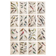
Set of 16 Large Original Antique Exotic Bird Prints, 1830s
Located in St Annes, Lancashire
Great set of bird prints
Lithographs after the drawings by Cpt. brown.
Original hand color.
Unframed
The measurement given below is for one print.
Category
Antique 1830s Scottish Folk Art Prints
Materials
Paper
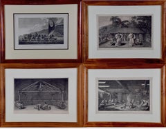
Four Koa Wood Framed 18th C. Engravings from Captain Cook's 3rd Voyage Journal
By John Webber
Located in Alamo, CA
A grouping of four framed engravings of Hawaii, Tahiti, Tonga and Vancouver Island from the atlas of the official British Admiralty sanctioned journal of Captain Cook's 3rd Voyage entitled "A Voyage to the Pacific Ocean Undertaken by the Command of His Majesty, for Making Discoveries in the Northern Hemisphere", published upon completion of the voyage in London in 1784 by Strahan & Cadell. These engravings were made from drawings by John Webber (1752-1793), who was the artist on Captain James Cook's 3rd and final voyage of discovery. The set of engravings includes: "A Canoe of the Sandwich Islands, the Rowers Masked", Plate 65 in the atlas; "A Dance in Otaheite" (Tahiti), Plate 28; "King of the Friendly Islands" (Tonga), plate 20; "Inside of a House in Nootka Sound" (Canada), plate 42.
These engravings are professionally framed in Koa wood, the same wood as was used to make the canoes of the ancient Hawaiians. Koa wood is legendary in Hawaii. Not only is this amazing wood native to Hawaii, but it is known for the deep rich colors and varied grain pattern. Koa has an honored heritage in Hawaii and is highly revered and sacred. The word “koa” means “warrior” in Hawaiian. The warriors of King Kamehameha the Great, created canoes and weapons from a wood plentiful on the Big Island of Hawaii. This wood became synonymous with the warriors themselves, and it became known as koa.
These four engravings would make a wonderful grouping for a display of 2, 3 or 4 prints. They may be purchased separately or in groups on 1stDibs. Their listing Reference #'s are: LU117324682432, LU117324682022, LU117324684052 and LU117324684062. A discount is available for a grouping depending on the number of items included.
Hawaii was discovered by Captain Cook (1728-1779) during this voyage. Hawaii was originally called The Sandwich Islands in honor of The Earl of Sandwich...
Category
1780s Other Art Style Landscape Prints
Materials
Engraving
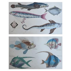
Original Antique Prints of Fish, 1847
Located in St Annes, Lancashire
Great images of fish
Unframed.
Lithographs after Cpt. Brown with original hand color.
Published, 1847.
The measurement is for 1 print
Free shipping
Category
Antique 1840s English Folk Art Prints
Materials
Paper
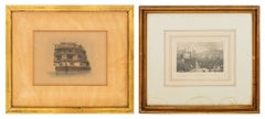
E.W. Cooke, Etc. European Maritime Etchings, 2
Located in Astoria, NY
Two European Maritime Engravings, comprising: E.W. Cooke (English, 1811-1880), "The (Circular) Stern of His Majesty's Ship Asia, 84 Guns", marked lower right and titled lower center ...
Category
19th Century Other Art Style Landscape Prints
Materials
Paper, Engraving
More Ways To Browse
Large Antique Prints Set
Mirror Framed Botanical Prints
School Blackboard Vintage
Trajan Column Print
Antique Polearms
Antique Trunk Lithographs
Christian Wagner
Grey Partridge
J Hinton
La Mode Illustree
Peter Bull
Shriners Hat
Vintage Porn
Adams Always Furniture
Antique Furniture St Albans
Eurasian Owl
Fornasetti Wall Paper
La Mode Illustree Prints Antique