Items Similar to The State of Rhode Island Map - Caleb Harris & Harding Harris, 1818
Want more images or videos?
Request additional images or videos from the seller
1 of 7
The State of Rhode Island Map - Caleb Harris & Harding Harris, 1818
$740
£566.43
€650.18
CA$1,057.27
A$1,160.19
CHF 600.70
MX$13,888.43
NOK 7,536.39
SEK 7,090.29
DKK 4,856.53
About the Item
Mathew Carey
(American/Philadelphia, 1760-1839)
The State of Rhode Island compiled from the surveys and observations of Caleb Harris by Harding Harris. Engraving with hand-coloring. Published by Mathew Carey, Philadelphia, 1818
sight: 10 by 14 ½ inches
frame: 16 ¾ by 21 ½ inches
- Dimensions:Height: 21.5 in (54.61 cm)Width: 1 in (2.54 cm)Depth: 16.75 in (42.55 cm)
- Style:Other (Of the Period)
- Materials and Techniques:
- Place of Origin:
- Period:
- Date of Manufacture:1818
- Condition:Wear consistent with age and use. Good overall; framed archivally in gold frame with gold filet. Map shows some foxing.
- Seller Location:Savannah, GA
- Reference Number:1stDibs: LU9288240126182
About the Seller
5.0
Gold Seller
Premium sellers maintaining a 4.3+ rating and 24-hour response times
Established in 2013
1stDibs seller since 2023
103 sales on 1stDibs
Typical response time: <1 hour
- ShippingRetrieving quote...Shipping from: Savannah, GA
- Return Policy
Authenticity Guarantee
In the unlikely event there’s an issue with an item’s authenticity, contact us within 1 year for a full refund. DetailsMoney-Back Guarantee
If your item is not as described, is damaged in transit, or does not arrive, contact us within 7 days for a full refund. Details24-Hour Cancellation
You have a 24-hour grace period in which to reconsider your purchase, with no questions asked.Vetted Professional Sellers
Our world-class sellers must adhere to strict standards for service and quality, maintaining the integrity of our listings.Price-Match Guarantee
If you find that a seller listed the same item for a lower price elsewhere, we’ll match it.Trusted Global Delivery
Our best-in-class carrier network provides specialized shipping options worldwide, including custom delivery.More From This Seller
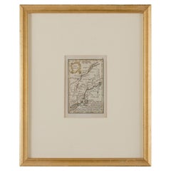
View AllJohn Gibson - Map of New England
Located in Savannah, GA
A miniature map of New England from John Gibson’s The Atlas Minimus published in 1758.
John Gibson worked in London from 1748-1773 as a geographer and engraver, producing numerous ...
Category
Antique 1750s British Other Prints
Materials
Glass, Paper
1872 Map of Hudson, Union and Essex Counties, New Jersey
Located in Savannah, GA
A hand-colored topographical map of New Jersey’s Hudson, Union and Essex Counties from the Atlas of New Jersey by F.W. Beers, published in 1872.
sight 15 by 22½ inches
frame 20 by...
Category
Antique 1870s American Prints
Materials
Glass, Wood, Paper

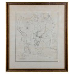
Silas Holman Map of Harvard
Located in Savannah, GA
A framed historic map of Harvard, as surveyed in 1831 by Silas Holman, reproduced circa 1920s.
frame: 29 by 32 inches
Category
Vintage 1920s Other Prints
Materials
Glass, Wood, Paper
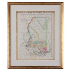
Map of Mississippi Carey & Lea, 1822
Located in Savannah, GA
Published in Philadelphia for the “Complete Historical, Chronological and Geographical American Atlas” by Henry Carey and Issac Lea, the map depicts Mississippi as it existed in 1822...
Category
Antique 1820s American Other Prints
Materials
Glass, Wood, Paper
Von Reilly Map of the Russian Empire, 1796
Located in Savannah, GA
A map of the Russian Empire in Europe by Von Reilly. Published in Vienna, 1796.
32 inches wide by 24 ½ inches tall
Category
Antique 1790s Austrian Prints
Materials
Glass, Wood, Paper

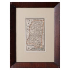
Map of Mississippi from Fanning's Illustrated Gazetteer, 1853
Located in Savannah, GA
A map of Mississippi from Fanning’s Illustrated Gazetteer, 1853.
sight: 5 by 8 ½ inches
frame: 12 ½ by 16 ½ inches
Category
Antique 1850s American Prints
Materials
Glass, Wood, Paper
You May Also Like
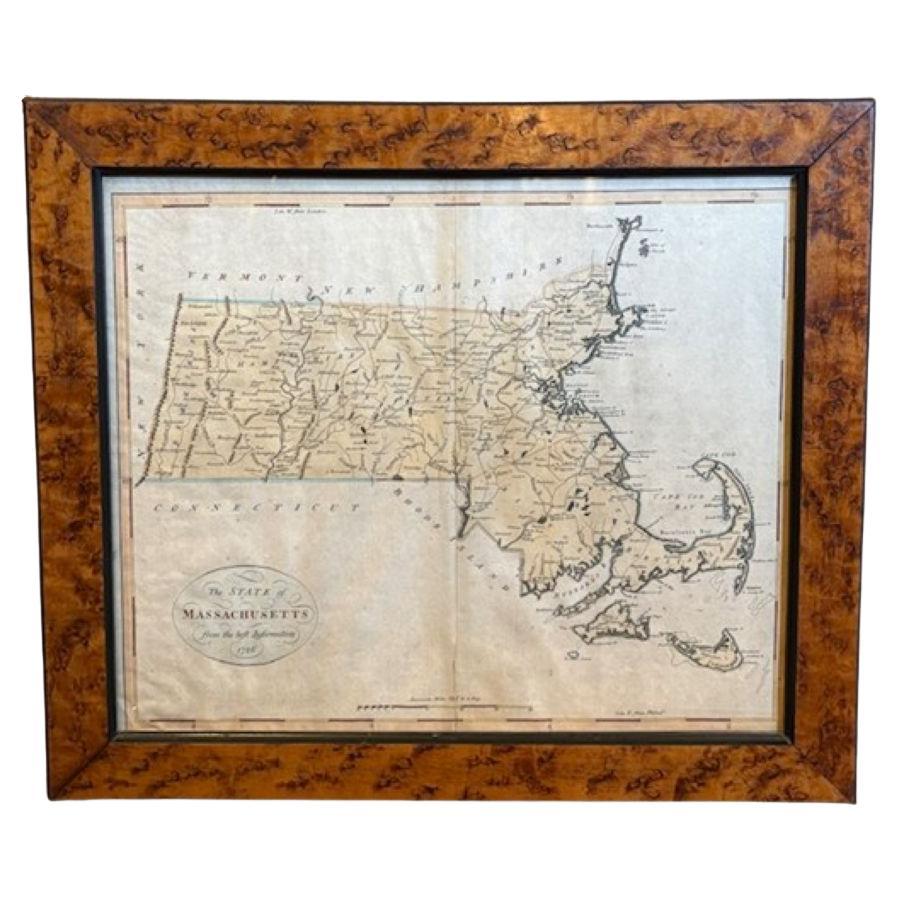
18th Century Hand Colored Map of The State of Massachusetts, 1796
Located in Nantucket, MA
18th Century Hand Colored Map of "The State of Massachusetts from the best information," 1796, by cartographer and illustrator John Reid published in his "American Atlas," a period e...
Category
Antique 1790s American American Colonial Maps
Materials
Paper

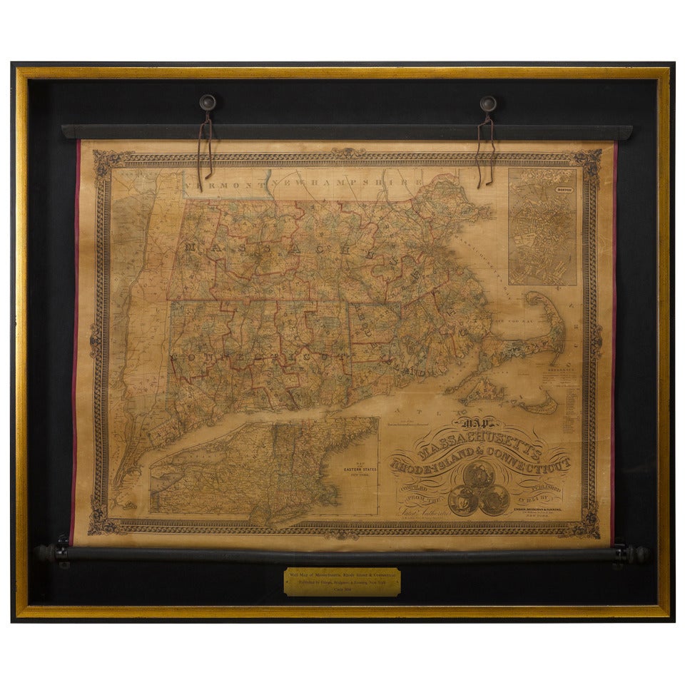
1854 Map of Massachusetts, Connecticut and Rhode Island, Antique Wall Map
Located in Colorado Springs, CO
This striking wall map was published in 1854 by Ensign, Bridgman & Fanning and has both full original hand-coloring and original hardware. This impression is both informative and highly decorative.
The states are divided into counties, outlined in red, green, and black, and subdivided into towns. Roads, canals, and railroad lines are prominently depicted, although they are not all labeled. The mapmakers also marked lighthouses, banks, churches, and prominent buildings, with a key at right. The map is an informative and comprehensive overview of the infrastructural development of New England prior to the Civil War. Physical geographies depicted include elevation, conveyed with hachure marks, rivers and lakes. The impression features an inset map of Boston...
Category
Antique 19th Century American Maps
Materials
Paper

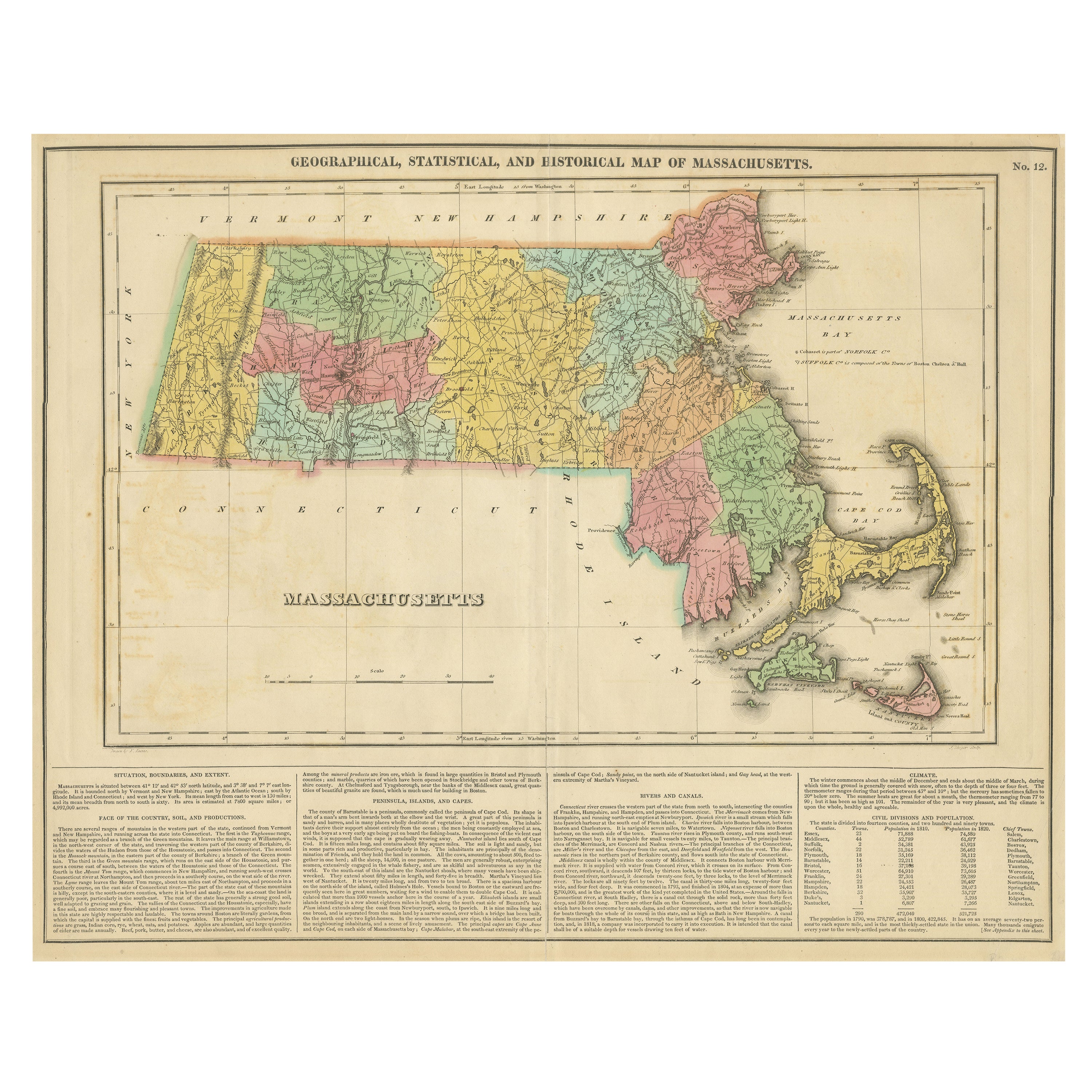
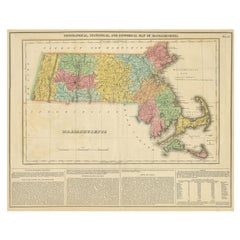
Antique Geographical, Historical and Statistical Map of Massachusetts, 1822
Located in Langweer, NL
This attractive map of Massachusetts presents a finely detailed overview of the state in the first quarter of the 19th century.
Transportation ...
Category
Antique 1820s Maps
Materials
Paper
$359 Sale Price
20% Off
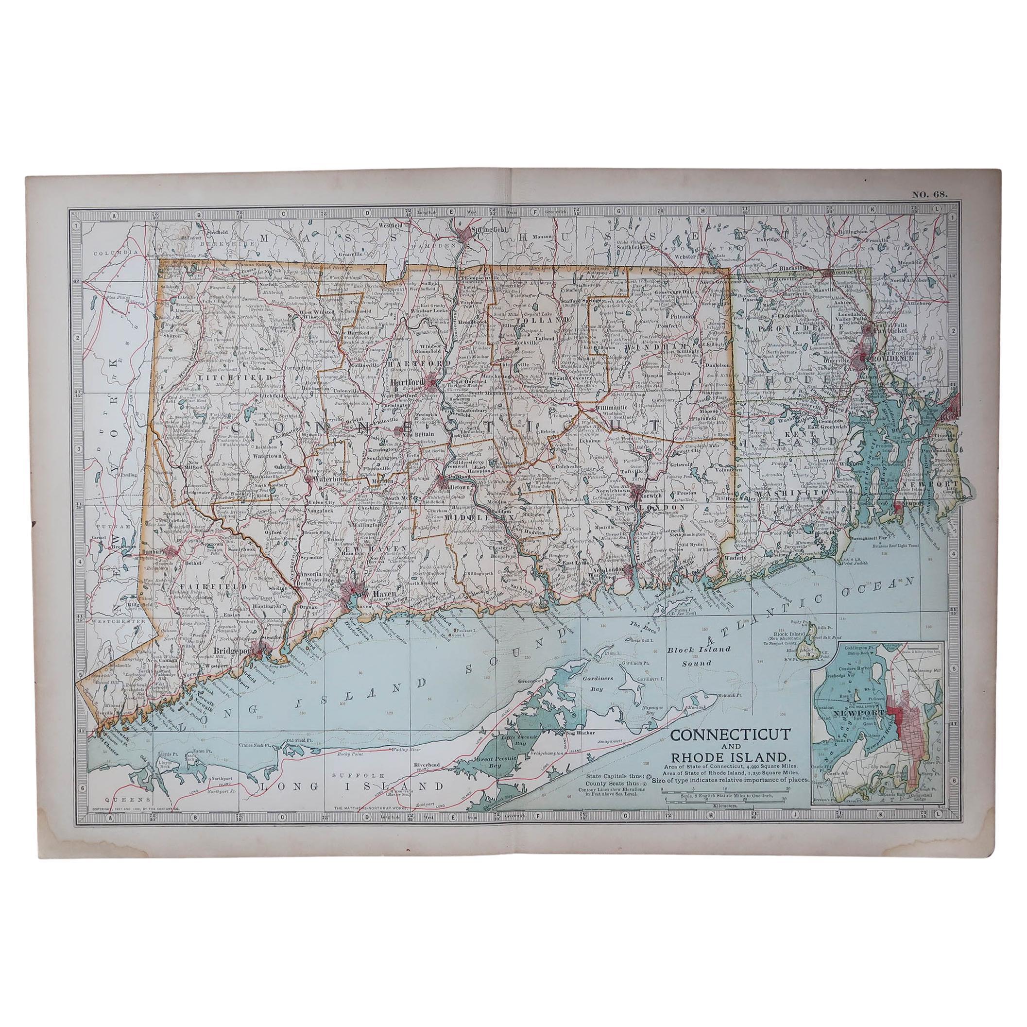
Original Antique Map of the American State of Connecticut & Rhode Island, 1903
Located in St Annes, Lancashire
Antique map of Connecticut and Rhode Island
Published By A & C Black. 1903
Original colour
Good condition
Unframed.
Free shipping
Category
Antique Early 1900s English Maps
Materials
Paper

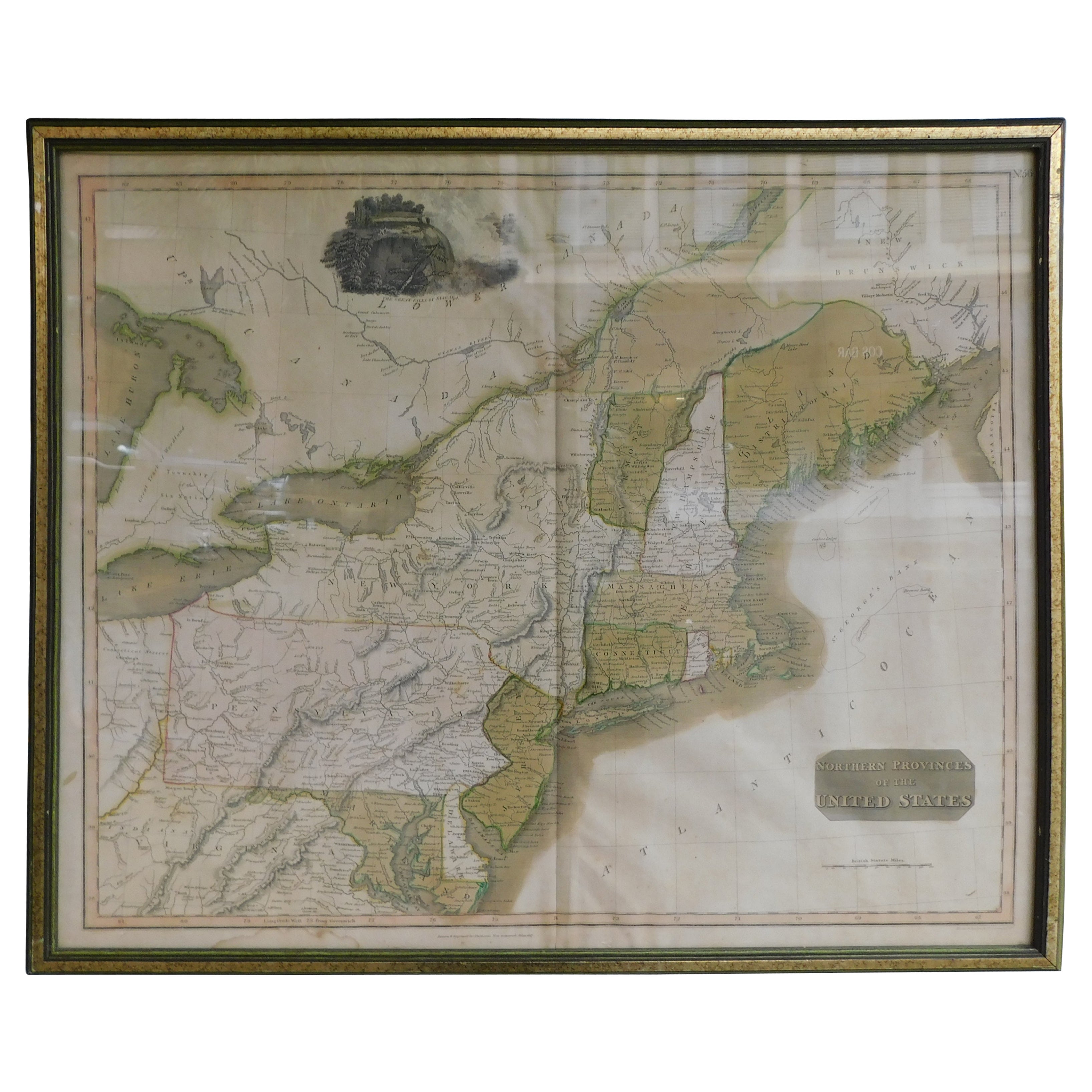
English Engraved Hand Colored Map of the North Eastern United States, circa 1817
Located in Charleston, SC
English copper engraved hand colored map of the North Eastern United States matted under glass in a gilt frame, Early 19th Century. Drawn and Engraved for Thomson's New General Atlas...
Category
Antique 1810s English George III Maps
Materials
Glass, Giltwood, Paint, Paper

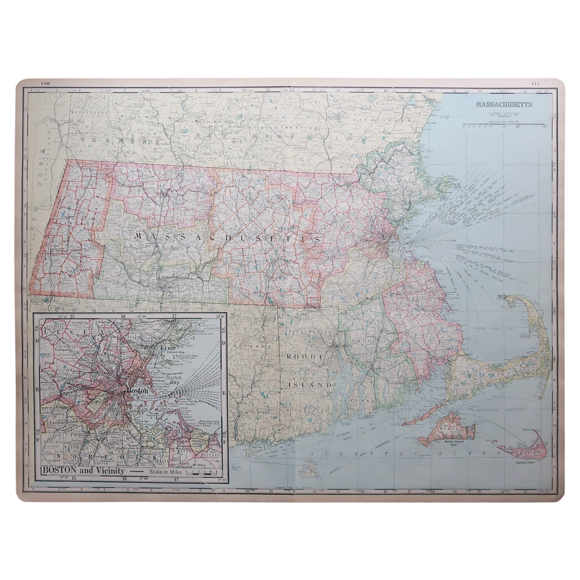
Large Original Antique Map of Massachusetts, USA, circa 1900
Located in St Annes, Lancashire
Fabulous map of Massachusetts
In 2 sheets. They can be joined but I have not done it
Original color
Engraved and printed by the George F. Cram ...
Category
Antique 1890s American Maps
Materials
Paper
