Items Similar to Map of Canonor - Etching by G. Braun/F. Hogenberg - 1575
Want more images or videos?
Request additional images or videos from the seller
1 of 2
Georg Braun and Franz HogenbergMap of Canonor - Etching by G. Braun/F. Hogenberg - 15751575
1575
About the Item
Etching realized by Georg Braun and Franz Hogenberg, belonging to the Suite "Civitates Orbis Terrarum".
The first volume of the Civitates Orbis Terrarum was published in Cologne in 1572. The sixth and the final volume appeared in 1617.
This great city atlas, edited by Georg Braun and largely engraved by Franz Hogenberg, eventually contained 546 prospects, bird-eye views and map views of cities from all over the world. Braun (1541-1622), a cleric of Cologne, was the principal editor of the work, and was greatly assisted in his project by the close, and continued interest of Abraham Ortelius, whose Theatrum Orbis Terrarum of 1570 was, as a systematic and comprehensive collection of maps of uniform style, the first true atlas.
The Civitates, indeed, was intended as a companion for the Theatrum, as indicated by the similarity in the titles and by contemporary references regarding the complementary nature of two works. Nevertheless, the Civitates was designs to be more popular in approach, no doubt because the novelty of a collection of city plans and views represented a more hazardous commercial undertaking than a world atlas, for which there had been a number of successful precedents. Franz Hogenberg (1535-1590) was the son of a Munich engraves who settled in Malines. He engraved most of the plates for Ortelius's Theatrum and the majority of those in the Civitates, and may have been responsible for originating the project.
Over a hundred of different artists and cartographers, the most significant of whom was Antwerp artist Georg (Joris) Hoefnagel (1542-1600), engraved the cooper-plates of the Civitates from drawings. He not only contributed most of the original material for the Spanish and Italian towns but also reworked and modified those of other contributors. After Hoefnagel's death his son Jakob continued the work for the Civitates. A large number of Jacob van Deventer (1505-1575), also known as Jacob Roelofszof, unpublished works, plans of towns of the Netherlands were copied, as were Stumpf's woodcuts from the Schweizer Chronik of 1548, and Munster's German views from the 1550 and 1572 editions of his Cosmographia. Another important source for maps was the Danish cartographer Heinrich van Rantzau (1526-1599), beter known under his Latin name Rantzovius, who provided maps of Northern Europe, specially of Danish cities. The Civitates provided a uniquely comprehensive view of urban life at the turn of the sixteenth century. Other sources were the maps of Sebastian Munster from around 1550 and , and of.
Braun added to the maps figures in local dress. This feature was anticipated in Hans Lautensack's etched view of Nuremberg, 1552, those groups of citizens in the rural foreground add further authenticity to the highly accurate topographical details of what was effectively Germany's cultural capital at that time. Braun's motives for adding figures to the views, however, went further: as stated in his introduction to book 1, he believed, perhaps optimistically, that his plans would not in consequence be scrutinized for military secrets by the Turks, as their religion forbade them from looking on representations of the human form.
The plans, each accompanies by Braun's printed account of the town's history, situation and commerce, form an armchair traveler's compendium, which the scholar Robert Burton in The Anatomy of Melancholy of 1621 asserted would not only provide instructions but would uplift the spirit as well.
- Creator:Georg Braun and Franz Hogenberg
- Creation Year:1575
- Dimensions:Height: 5.52 in (14 cm)Width: 6.3 in (16 cm)Depth: 0.04 in (1 mm)
- Medium:
- Movement & Style:
- Period:
- Framing:Framing Options Available
- Condition:Insurance may be requested by customers as additional service, contact us for more information.
- Gallery Location:Roma, IT
- Reference Number:Seller: J-718601stDibs: LU650313791972
About the Seller
4.9
Platinum Seller
Premium sellers with a 4.7+ rating and 24-hour response times
1stDibs seller since 2017
7,501 sales on 1stDibs
Typical response time: 2 hours
- ShippingRetrieving quote...Shipping from: Grasse, France
- Return Policy
Authenticity Guarantee
In the unlikely event there’s an issue with an item’s authenticity, contact us within 1 year for a full refund. DetailsMoney-Back Guarantee
If your item is not as described, is damaged in transit, or does not arrive, contact us within 7 days for a full refund. Details24-Hour Cancellation
You have a 24-hour grace period in which to reconsider your purchase, with no questions asked.Vetted Professional Sellers
Our world-class sellers must adhere to strict standards for service and quality, maintaining the integrity of our listings.Price-Match Guarantee
If you find that a seller listed the same item for a lower price elsewhere, we’ll match it.Trusted Global Delivery
Our best-in-class carrier network provides specialized shipping options worldwide, including custom delivery.More From This Seller
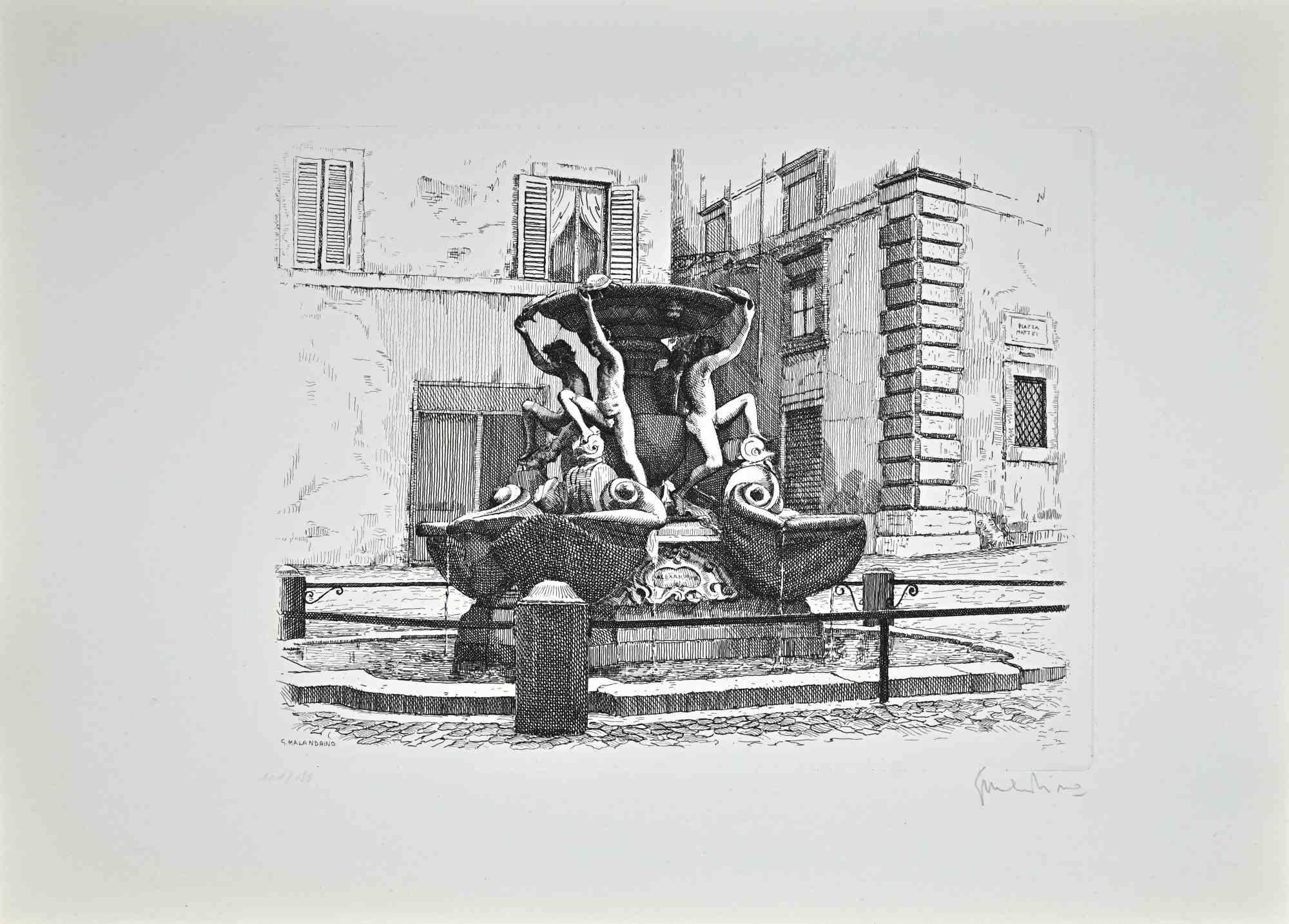
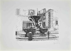
View AllFountain of the Turtles - Etching by Giuseppe Malandrino - 1970
By Giuseppe Malandrino
Located in Roma, IT
Fountain of the Turtles is an artwork realized by Giuseppe Malandrino.
Print in etching technique.
Hand-signed by the artist in pencil on the lower right corner.
Numbered edition ...
Category
1970s Modern Landscape Prints
Materials
Etching
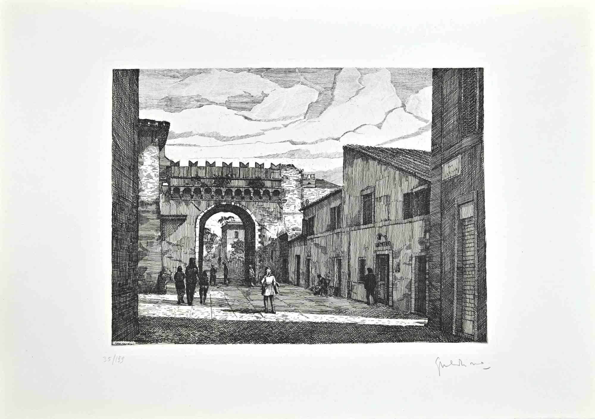
Roman View - Etching by Giuseppe Malandrino - 1970s
By Giuseppe Malandrino
Located in Roma, IT
Roman View is an artwork realized by Giuseppe Malandrino.
Print in etching technique and hand watercolored.
Hand-signed by the artist in pencil on the lower right corner.
Numbered...
Category
1970s Modern Landscape Prints
Materials
Etching
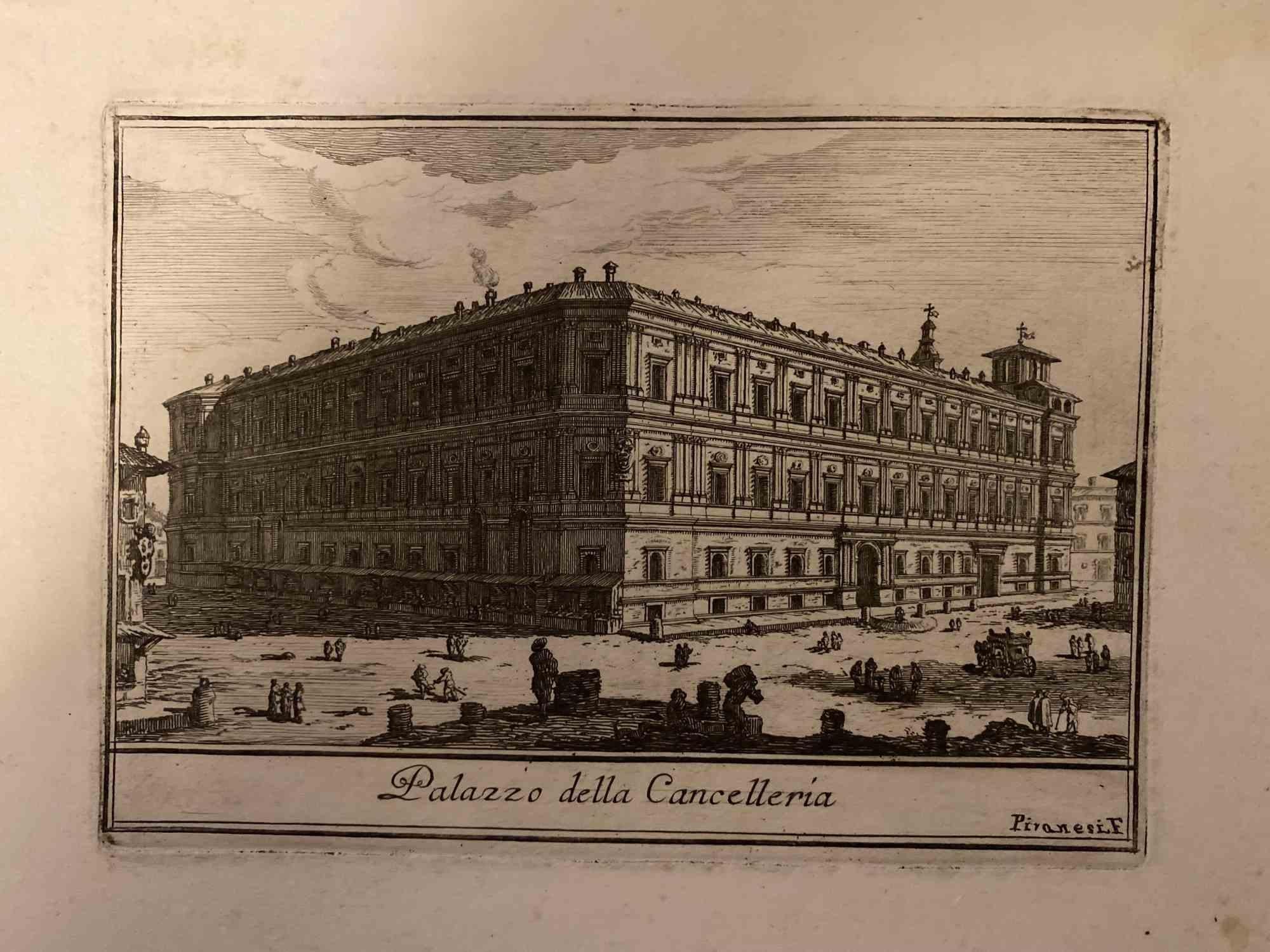
Palace of the Chancellery - Etching by G.B.Piranesi- 18th century
By Giovanni Battista Piranesi
Located in Roma, IT
Palace of the Chancellery is an original etching realized by the italian artist Giovanni Battista Piranesi in 18th century.
Signed on the plate on the lower.
Very good conditions
...
Category
18th Century Modern Landscape Prints
Materials
Etching

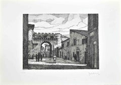
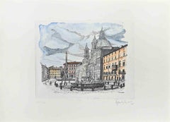
Navona Square - Etching by Giuseppe Malandrino - 1970s
By Giuseppe Malandrino
Located in Roma, IT
Navona Square is an artwork realized by Giuseppe Malandrino.
Print in etching technique.
Hand-signed by the artist in pencil on the lower right corner.
Numbered edition of 190 cop...
Category
1970s Modern Landscape Prints
Materials
Etching
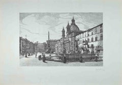
View of Piazza Navona - Etching by Giuseppe Malandrino - 1970s
By Giuseppe Malandrino
Located in Roma, IT
View of Piazza Navona is an original contemporary artwork realized in 1970 by the Italian artist Giuseppe Malandrino (Modica, 1910 - Rome, 1979).
Etching on cardboard.
Hand-sign...
Category
1970s Modern Landscape Prints
Materials
Etching
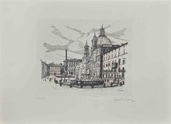
View of Piazza Navona - Etching by Giuseppe Malandrino - 1970s
By Giuseppe Malandrino
Located in Roma, IT
Navona Square is an artwork realized by Giuseppe Malandrino.
Print in etching technique.
Hand-signed by the artist in pencil on the lower right corner.
Numbered edition of 190 cop...
Category
1970s Modern Landscape Prints
Materials
Etching
You May Also Like
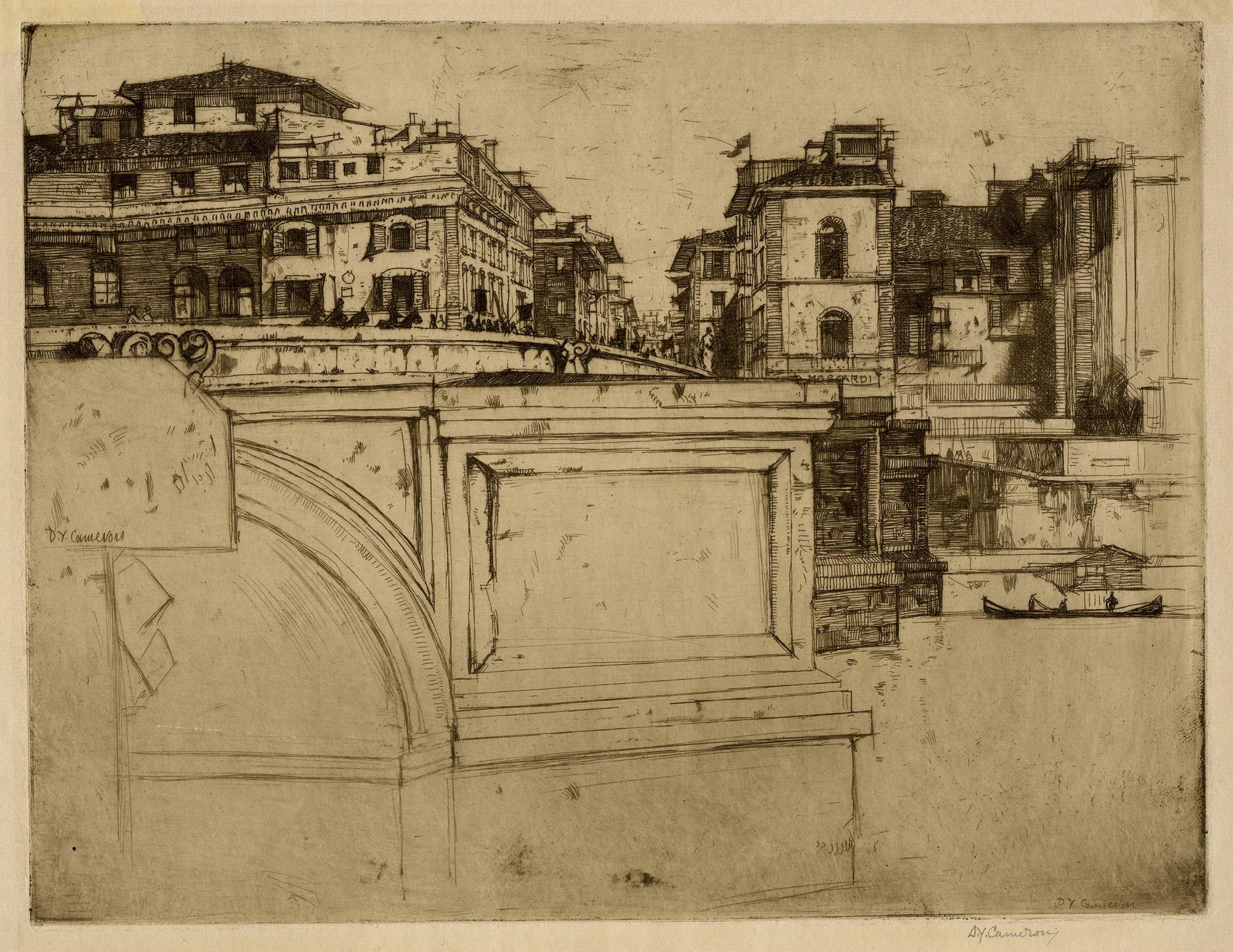
Ponte della Trinità, Florence
By David Young Cameron
Located in Middletown, NY
Etching and drypoint on tissue-thin cream laid paper, 6 5/8 x 8 1/8 inches (167 x 205 mm), full margins. Signed in pencil in the lower right margin, and inscribed "Ponte Trinità, Florence" in pencil the lower left margin. Non-archival paper tape tabs at the top right and left corners on the verso, with minor associated discoloration which presents on the recto. Minor, light mat tone, and some very small losses at the extreme corners, well outside of image area. The numerals "325" written in pencil in the lower right margin, in reference to the Rinder catalog number. A beautiful, silvery, early-state impression.
Rinder 325
[Rinder 325 iii/vii].
The son of a clergyman, Sir David Young Cameron was born in Glasgow in 1865. After a brief and unhappy dalliance in the fields of business and law, Cameron began attending the prestigious Glasgow School of the Arts in 1881, and later the Edinburgh School of the Arts. At first associated with the Glasgow Boys (John Lavery, Joseph Crawhall...
Category
Early 20th Century Modern Landscape Prints
Materials
Laid Paper, Drypoint, Etching

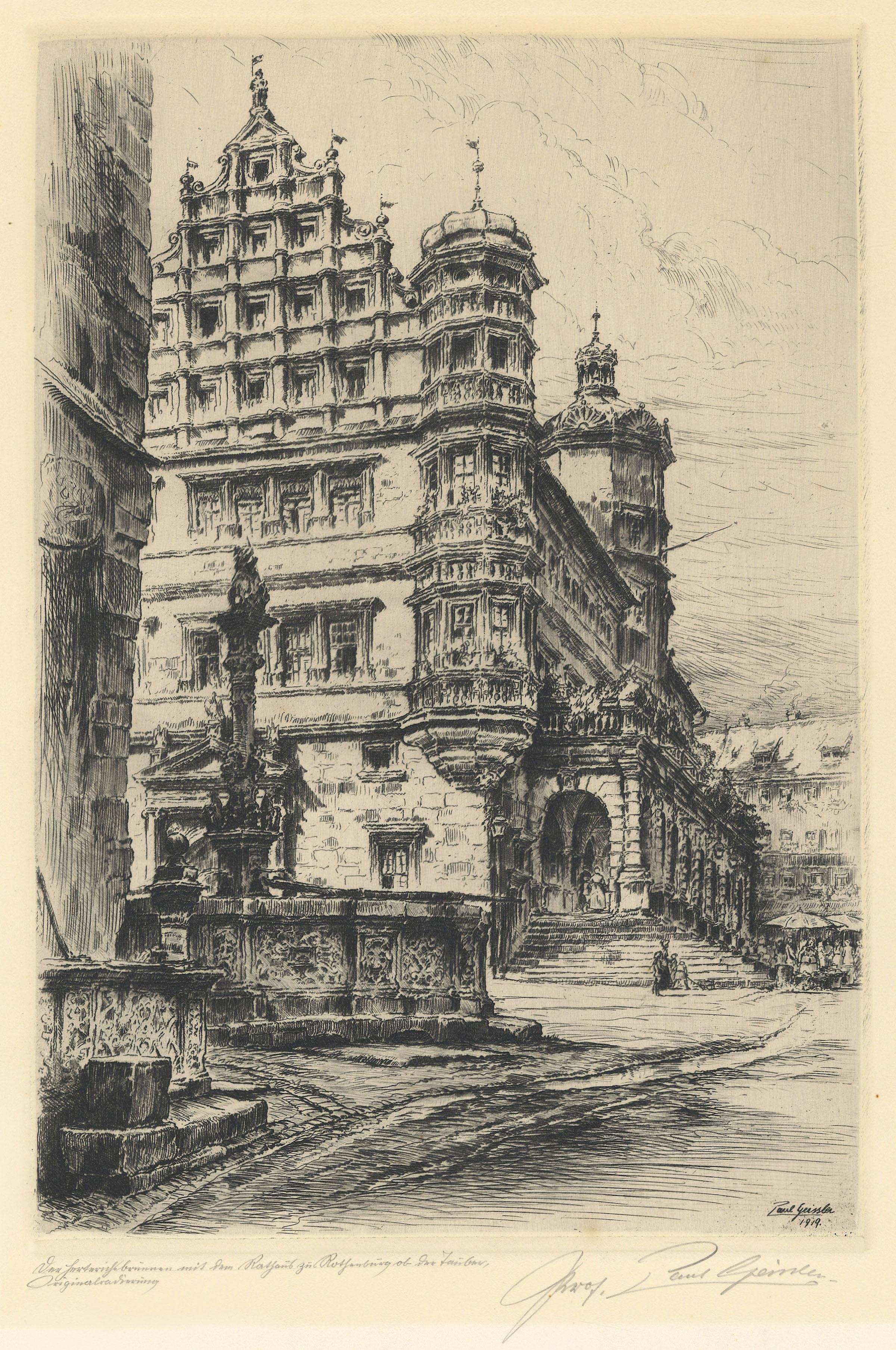
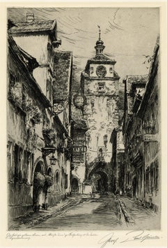
Market Square, Rothenburg, Germany
Located in Middletown, NY
Etching and drypoint on cream wove paper, 10 3/4 x 7 1/2 inches (270 x 190 mm), full margins. Signed, inscribed and titled in pencil, lower margin. In good condition with minor mat t...
Category
Early 20th Century Modern Landscape Prints
Materials
Handmade Paper, Drypoint, Etching
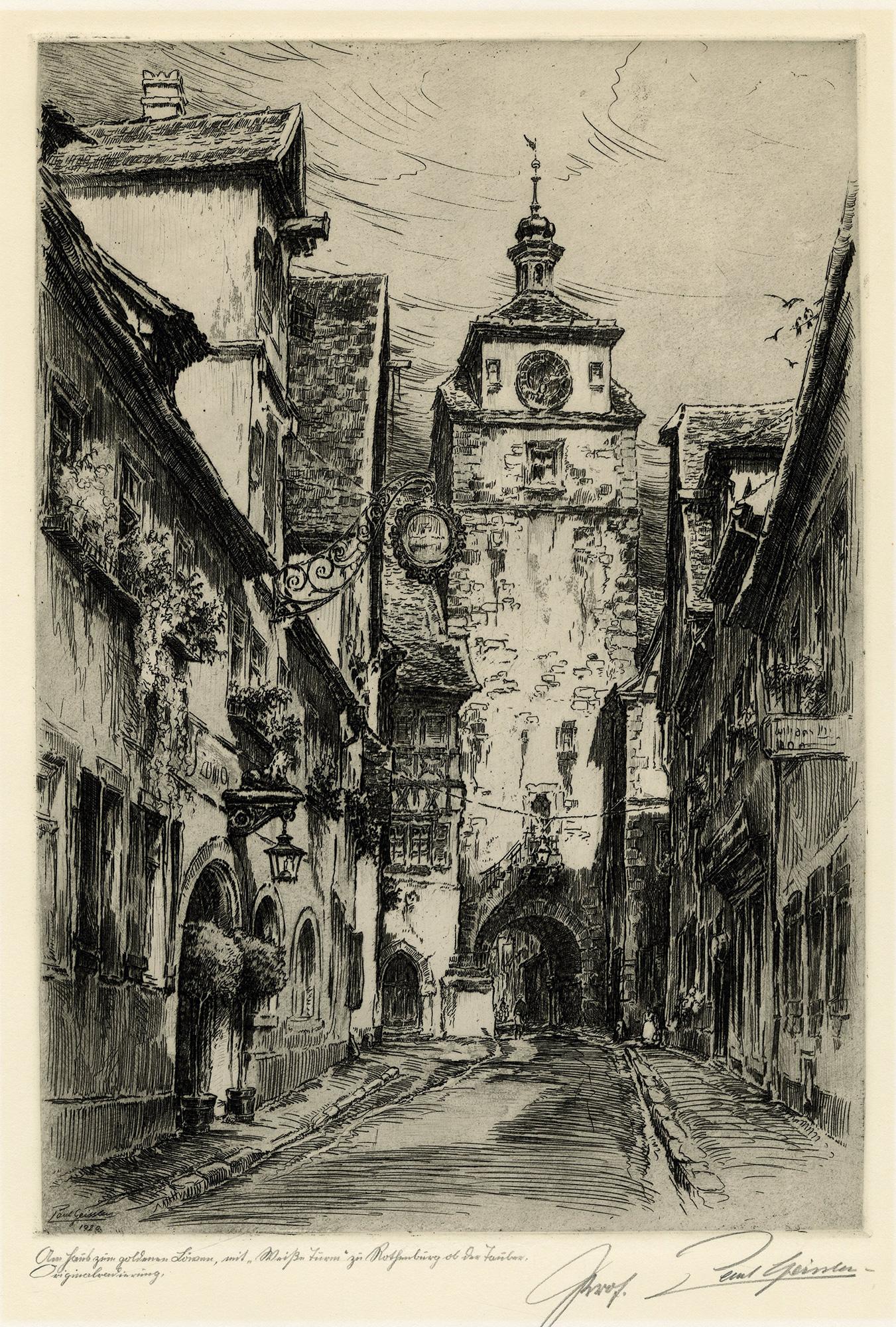
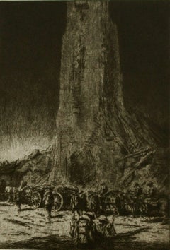
City Hall Tower, Rothenburg, Germany.
Located in Middletown, NY
Etching and drypoint on cream wove paper, 10 3/4 x 7 1/2 inches (270 x 190 mm), full margins. Signed, inscribed and titled in pencil, lower margin. Some small, scattered light spots...
Category
Early 20th Century Modern Landscape Prints
Materials
Handmade Paper, Drypoint, Etching

"The Caissons Go Rolling Along".
By Kerr Eby
Located in Storrs, CT
"The Caissons Go Rolling Along". 1929. Etching and sandpaper ground. Giardina 145. 17 3/8 x 9 1/2 (sheet 18 3/4 x 11 1/2). Edition 90. Slight mat line, otherwise find condition. A ri...
Category
1920s American Modern Landscape Prints
Materials
Drypoint, Etching
$1,250 Sale Price
28% Off
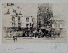
Chelsea Old Church, London
By William Walcot R. E. Hon. R. I. B. A.
Located in Storrs, CT
Chelsea Old Church. 1924. Etching, drypoint, and aquatint. Dickins 94. 5 3/8 x 8 (sheet 8 1/2 x 9 3/4). Edition 100 for The Print Collector's Club. A fine proof with tonal wiping, printed on cream wove paper. Signed and dedicated "W.R. Button from W. Walcot London 1930" in pencil.
Chelsea Old Church, also known as All Saints, is an Anglican church, on Old Church Street, Chelsea, London SW3, England, near Albert Bridge. It is the church for a parish in the Diocese of London, part of the Church of England. Inside the Grade I listed building, there is seating for 400 people. There is a memorial plaque to the author Henry James (1843–1916) who lived nearby on Cheyne Walk. To the west of the church is a small public garden containing a sculpture by Sir Jacob Epstein.
When he was seventeen,William Walcot began to study architecture under Louis Benois at the Imperial Academy of Art in Saint Petersburg. He went to Paris where he continued his studies at the Ecole des Beaux-Arts and the Atelier Redon. He practiced as an architect briefly in Moscow, designing the Hotel Metropole...
Category
Early 20th Century Modern Landscape Prints
Materials
Drypoint, Etching, Aquatint
$400 Sale Price
20% Off
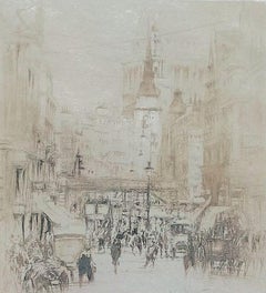
Ludgate Hill
By William Walcot R. E. Hon. R. I. B. A.
Located in Storrs, CT
Ludgate Hill. 1921. Etching, aquatint, and drypoint. Dickins 69. 5 5/8 x 5 1/8 (sheet 13 5/8 x 9 3/4). A fine proof with plate tone, printed on 'J Wha[tman] cream wove paper. Edition of 275 for the UK and 125 for the US. Signed in pencil.
Ludgate Hill is a street that runs west from St. Paul's Churchyard to Ludgate Circus (built in 1864), and from there becomes Fleet Street. The Ludgate Hill railway station, between Water Lane and New Bridge Street, is a station of the London, Chatham, and Dover Railway. It was closed before World War II and the railway bridge and viaduct between Holborn Viaduct and Blackfriars stations was demolished in 1990 to enable the construction of the City Thameslink railway station in a tunnel. This also involved the regrading of the slope of Ludgate Hill at the junction. About halfway up Ludgate Hill is St Martin, Ludgate church. This was physically joined to the Ludgate.
When he was seventeen, William Walcot began to study architecture under Louis Benois at the Imperial Academy of Art in Saint Petersburg. He went to Paris where he continued his studies at the Ecole des Beaux-Arts and the Atelier Redon. He practiced as an architect briefly in Moscow, designing the Hotel...
Category
Early 20th Century Modern Landscape Prints
Materials
Drypoint, Etching, Aquatint
$400 Sale Price
20% Off