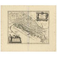
Items Similar to Dalmatia with the Adjacent Islands - Etching by Giovanni Cassini - 1792


Want more images or videos?
Request additional images or videos from the seller
1 of 8
Giovanni MignaniDalmatia with the Adjacent Islands - Etching by Giovanni Cassini - 17921792
1792
$541.40
£413.59
€460
CA$762.86
A$839.98
CHF 435.57
MX$9,947.69
NOK 5,529.24
SEK 5,167.71
DKK 3,504.37
About the Item
Dalmatia with the Adjacent Islands - Plate 42 is an original old master artwork realized by Giovanni Cassini in 1792
Handcolored etching.
Includes frame
- Creator:Giovanni Mignani
- Creation Year:1792
- Dimensions:Height: 18.51 in (47 cm)Width: 24.41 in (62 cm)Depth: 0.08 in (2 mm)
- Medium:
- Movement & Style:
- Period:
- Framing:Framing Options Available
- Condition:Insurance may be requested by customers as additional service, contact us for more information.
- Gallery Location:Roma, IT
- Reference Number:Seller: J-659701stDibs: LU650310983342
undefined
About the Seller
4.9
Platinum Seller
Premium sellers with a 4.7+ rating and 24-hour response times
1stDibs seller since 2017
7,816 sales on 1stDibs
Typical response time: 1 hour
- ShippingRetrieving quote...Shipping from: Monaco, Monaco
- Return Policy
More From This Seller
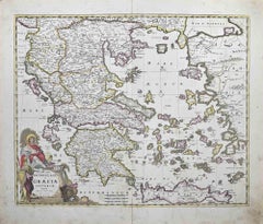
View AllMap of Greece - Original Etching by Antonio Zatta - 18th Century
Located in Roma, IT
This Map of Greece is an etching realized by Antonio Zatta, Cartographer, publisher and typographer.
The state of preservation of the artwork is good except for the worn paper and t...
Category
1780s Figurative Prints
Materials
Etching

Map of Ancient Greece - Original Etching by Antonio Zatta - 1785
Located in Roma, IT
This Map of ancient Greek is an etching realized by Antonio Zatta in Venice in 1785.
The state of preservation of the artwork is good expect for the worn paper.
Mounted on a cardbo...
Category
1770s Landscape Prints
Materials
Etching

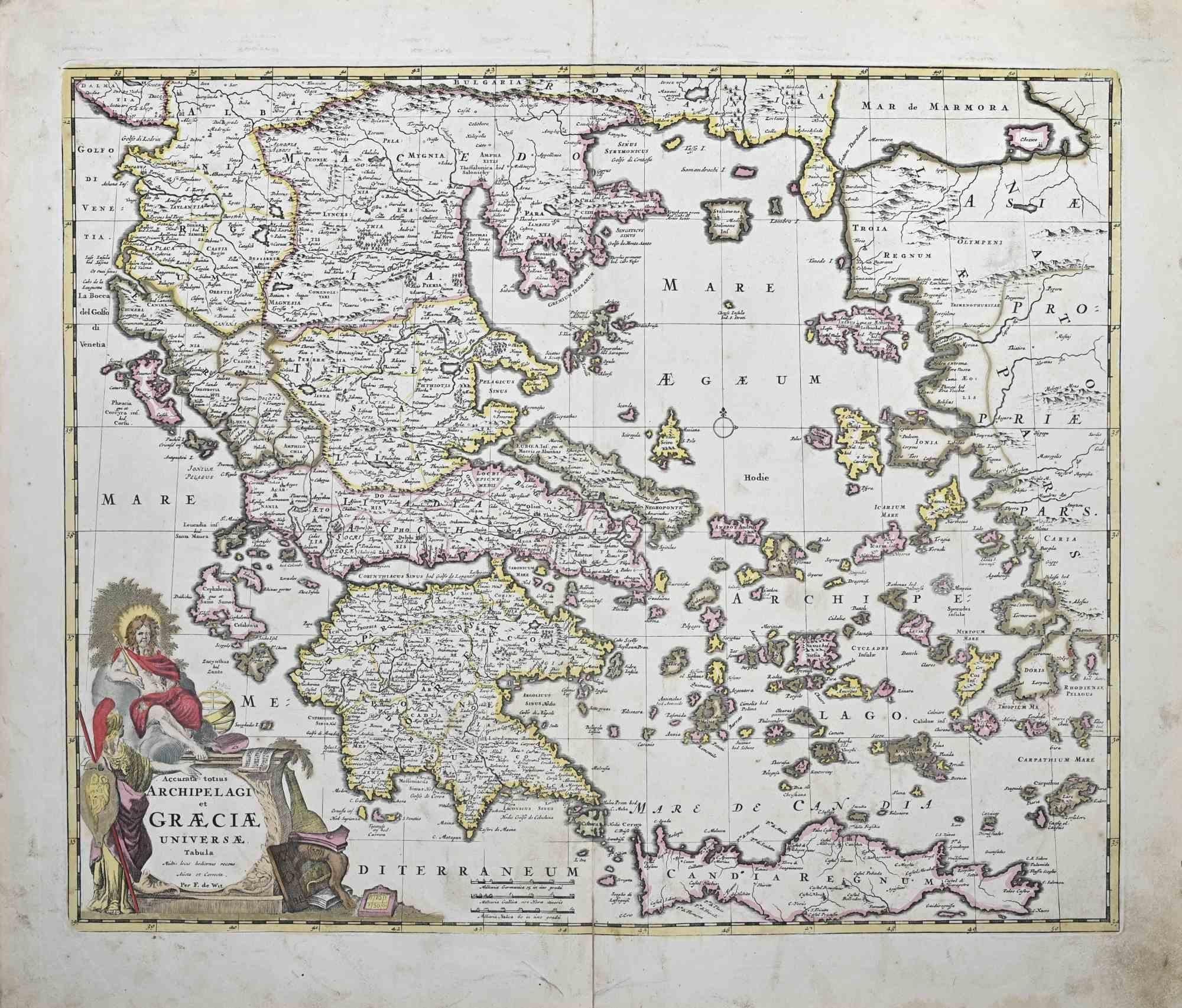
Accurata totius Archipelagi et Graeciae...- Etching by Frederick de Wit - 1680ca
By Frederick de Wit
Located in Roma, IT
This double-page etching with contemporary coloring, entitled Accurata totius Archipelagi et Graeciae Universae Tabula, was realized by the cartographer Frederick de Wit for the famo...
Category
1680s Modern Figurative Prints
Materials
Etching
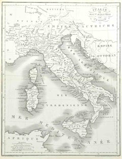
Map of Italy - Etching by Pierre François Tardieu - 1837
Located in Roma, IT
Map of Italy is an Etching realized in 1837.
Good conditions.
The artwork is realized in a well-balanced composition. the artwork and belongs to the suite suite "AtlasBatt" realize...
Category
1830s Modern Figurative Prints
Materials
Lithograph
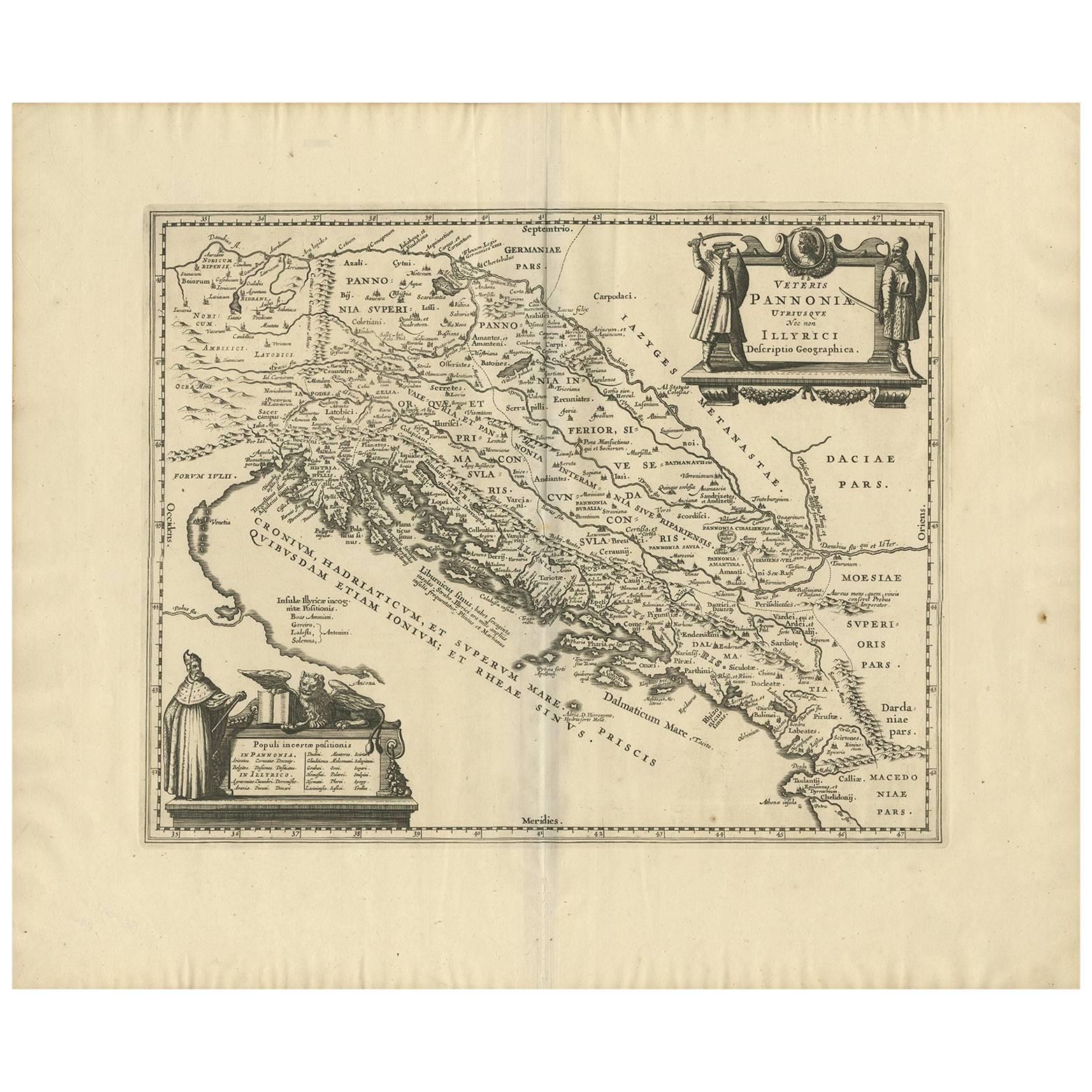
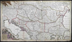
Regni Hungariae et Regionum - Etching by Frederick de Wit - 1680ca
By Frederick de Wit
Located in Roma, IT
This triple-page etching with contemporary coloring, entitled Regni Hungariae et Regionum, was realized by the cartographer Frederick de Wit for the famous Atlas published in Amsterd...
Category
1680s Modern Figurative Prints
Materials
Etching
Antique Map - Mar Di Athiopia - Etching by Johannes Janssonius - 1650s
By Johannes Janssonius
Located in Roma, IT
Antique Map - Mar Di Athiopia is an antique map realized in 1650 by Johannes Janssonius (1588-1664).
The Map is Hand-colored etching, with coeval watercolorang.
Good conditions wit...
Category
1650s Modern Figurative Prints
Materials
Etching

You May Also Like
Mediterranean and Adriatic Seas: Original 18th Century Hand-colored Map by Bowen
Located in Alamo, CA
This is an original 18th century hand-colored map entitled "An Accurate Chart of The Mediterranean and Adriatic Sea's; with the Archipelago & Part of the Black Sea. Exhibiting all th...
Category
Mid-18th Century Old Masters Landscape Prints
Materials
Engraving

Danube River, Italy, Greece and Croatia: A Hand-colored 18th C. Homann Map
By Johann Baptist Homann
Located in Alamo, CA
"Fluviorum in Europa principis Danubii" is a hand-colored map of the region about the Danube river created by Johann Baptist Homann (1663-1724) in his 'Atlas Novus Terrarum', publish...
Category
Early 18th Century Old Masters Landscape Prints
Materials
Engraving

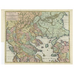
Antique Map of the Adriatic Sea and the Balkan by J. Janssonius, circa 1650
Located in Langweer, NL
Striking large-scale map of the Greater Balkans. Decorated with two large-scale cartouches, one showing two swordsman at odds with one another and the other ...
Category
Antique Mid-17th Century Maps
Materials
Paper
$894 Sale Price
20% Off
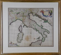
17th Century Dutch Map of Italy, Sicily, Sardinia, Corsica and Dalmatian Coast
By Theodorus Danckerts
Located in Alamo, CA
This hand colored 17th century Dutch map entitled "Novissima et Accuratissima totius Italiae Corsicae et Sardiniae Descriptio" by Theodore Danckerts depicts the Italian Peninsula in ...
Category
1690s Prints and Multiples
Materials
Engraving
Antique Engraved Map of the Northern Part of Greece and the Aegean Sea, Ca.1730
Located in Langweer, NL
Title: "GRÆCIÆ PARS Septentrionalis".
Hand Coloured Engraved map by G. Delisle of the northern part of the Aegean. In the top left corner a distance scale included.
Condition...
Category
Antique 1730s Maps
Materials
Paper
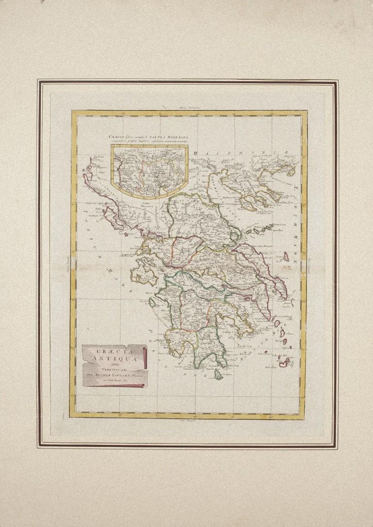
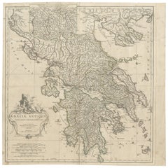
Large Scale Map of Greece, Extending to Cythera with Inset of Macedonia, ca.1786
Located in Langweer, NL
Antique map titled 'Graeciae Antiquae'.
Large scale map of Greece, extends south to the island of Cythera. Inset map shows details of Macedonia. Pu...
Category
Antique 1780s Maps
Materials
Paper
$583 Sale Price
20% Off
More Ways To Browse
Klimt Eisler
Le Coq Vintage
Lithograph On Board
Marilyn Monroe Lithograph
Matisse Odalisque
Moulin Rouge Lautrec
New York City Vintage Poster
Nicola De Maria
Pablo Picasso Limited Edition
Picasso 1965
Picasso Bullfight
Picasso Linoleum Cut
Picasso Marie Therese
Picasso Paix
Picasso Pique
Portrait Of Marguerite
Renoir Originals
Richard Wentworth