Items Similar to World Map - Etching by Hubert Nicholas-Jaillot - 1719

Want more images or videos?
Request additional images or videos from the seller
1 of 9
Hubert Nicholas-JaillotWorld Map - Etching by Hubert Nicholas-Jaillot - 17191719
1719
$1,014.87
£771.24
€860
CA$1,425.95
A$1,563.51
CHF 817.36
MX$18,726
NOK 10,310.79
SEK 9,671.52
DKK 6,553.23
About the Item
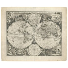
World map is an original modern artwork realized by Hubert Nicholas - Jaillot, printed by Louis Cordier in Paris 1719.
Etching on copper
The artwork depicts two hemispheres, continents with colored borders, the title at the top, arms of the dedicatee supported by two angels, in the center under the hemispheres cartouche with editorial data decorated with mermaids and dolphins, some stains in the panel of title, central fold, in a modern wooden frame.
Hand colored.
Includes Frame: 61.5 x 81 cm
Good condition except for some stains.
- Creator:Hubert Nicholas-Jaillot
- Creation Year:1719
- Dimensions:Height: 18.51 in (47 cm)Width: 26.38 in (67 cm)Depth: 1.58 in (4 cm)
- Medium:
- Movement & Style:
- Period:1710-1719
- Condition:Insurance may be requested by customers as additional service, contact us for more information.
- Gallery Location:Roma, IT
- Reference Number:Seller: T-1497791stDibs: LU650314771272
About the Seller
4.9
Platinum Seller
Premium sellers with a 4.7+ rating and 24-hour response times
1stDibs seller since 2017
7,787 sales on 1stDibs
Typical response time: 1 hour
- ShippingRetrieving quote...Shipping from: Grasse, France
- Return Policy
Authenticity Guarantee
In the unlikely event there’s an issue with an item’s authenticity, contact us within 1 year for a full refund. DetailsMoney-Back Guarantee
If your item is not as described, is damaged in transit, or does not arrive, contact us within 7 days for a full refund. Details24-Hour Cancellation
You have a 24-hour grace period in which to reconsider your purchase, with no questions asked.Vetted Professional Sellers
Our world-class sellers must adhere to strict standards for service and quality, maintaining the integrity of our listings.Price-Match Guarantee
If you find that a seller listed the same item for a lower price elsewhere, we’ll match it.Trusted Global Delivery
Our best-in-class carrier network provides specialized shipping options worldwide, including custom delivery.More From This Seller
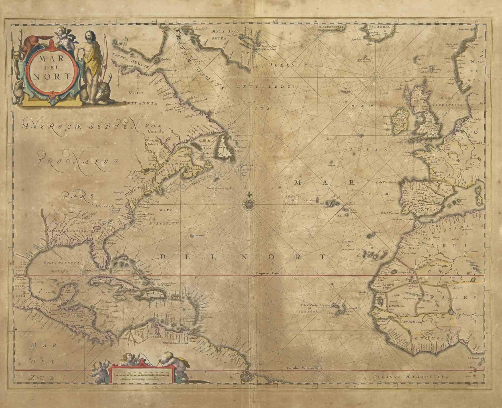
View AllMap of Mar Del Nort - Etching by Johannes Janssonius - 1650s
By Johannes Janssonius
Located in Roma, IT
Antique Map -Mar Del Nort is an antique map realized in 1650 by Johannes Janssonius (1588-1664).
The Map is Hand-colored etching, with coeval watercolorang.
Good conditions with sl...
Category
1650s Modern Figurative Prints
Materials
Etching

Antique Map - Mare Pacificum - Etching by Johannes Janssonius - 1650s
By Johannes Janssonius
Located in Roma, IT
Mare Pacificum is an antique map realized in 1650 by Johannes Janssonius (1588-1664).
The Map is Hand-colored etching, with coeval watercolorang.
Good conditions with slight foxing...
Category
1650s Modern Figurative Prints
Materials
Etching

Map of the World - Original Etching - 1820
Located in Roma, IT
Map of the World is an Original Etching realized by an unknown artist of 19th century in 1820.
Very good condition on two sheets of white paper joine...
Category
1820s Modern Figurative Prints
Materials
Etching

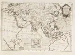
Carte Pour Servir a l'Histoire Philosophique.. - Etching by Rigobert Bonne- 1780
Located in Roma, IT
Etching on paper.
From Guillaume-Thomas Raynal, Histoire philosophique et politique des établissemens et du commerce des Européens dans les deux Indes, Geneva 1780.
This interestin...
Category
1780s Modern Figurative Prints
Materials
Etching
Antique Map - Mar Di Athiopia - Etching by Johannes Janssonius - 1650s
By Johannes Janssonius
Located in Roma, IT
Antique Map - Mar Di Athiopia is an antique map realized in 1650 by Johannes Janssonius (1588-1664).
The Map is Hand-colored etching, with coeval watercolorang.
Good conditions wit...
Category
1650s Modern Figurative Prints
Materials
Etching

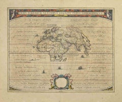
Orbis Terrarum - Etching by Johannes Janssonius - 1650s
By Johannes Janssonius
Located in Roma, IT
Antique Map - Orbis Terrarum is an antique map realized in 1650 by Johannes Janssonius (1588-1664).
The Map is Hand-colored etching, with coeval watercoloring.
Good conditions with...
Category
1650s Modern Figurative Prints
Materials
Etching
You May Also Like
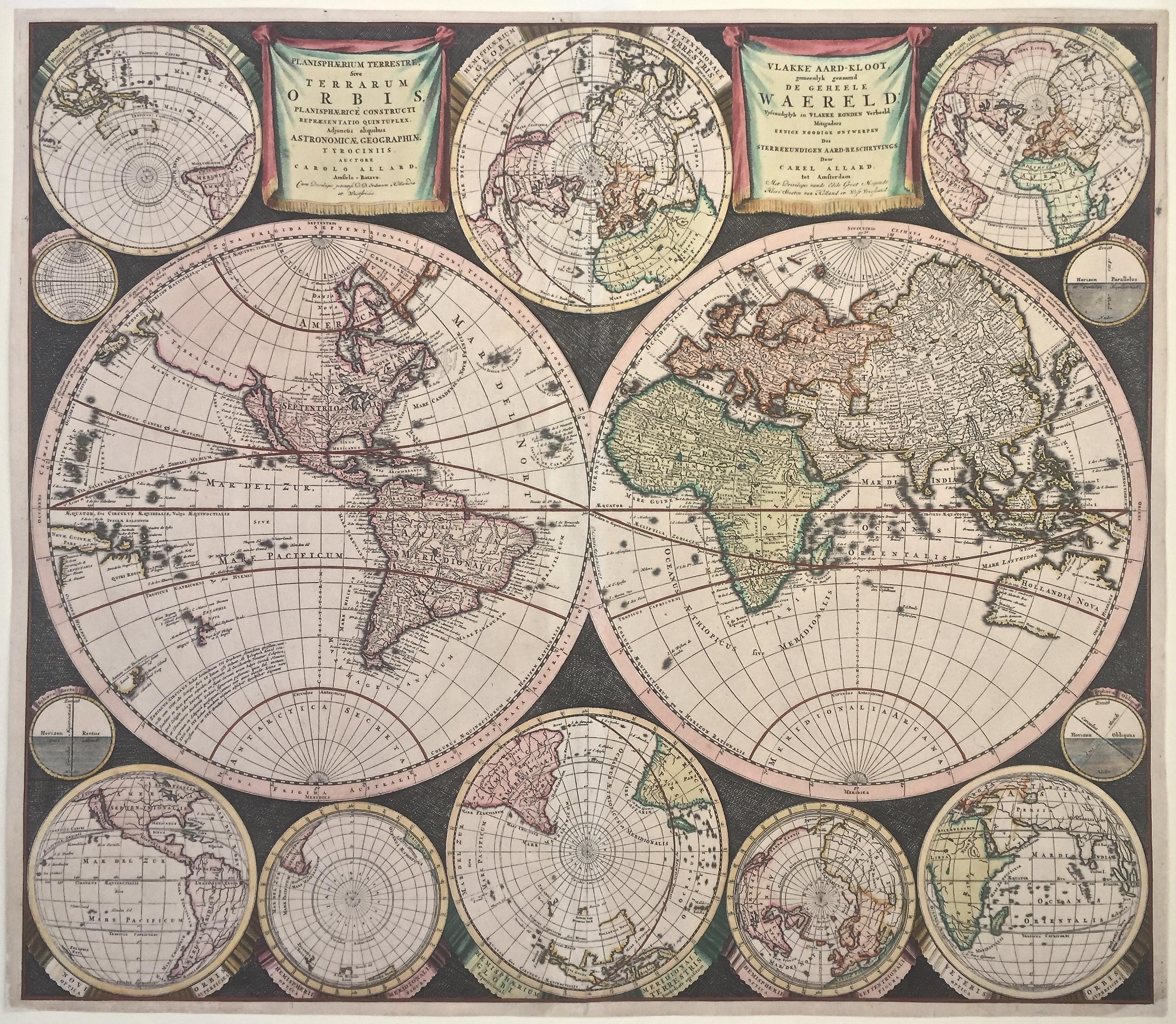
WORLD MAP - Planisphaerium Terrestre Sive Terrarum Orbis... 1696
By Carel Allard
Located in Santa Monica, CA
CAREL ALLARD (1648 – 1709)
PLANISPHAERIUM TERRESTRE SIVE TERRARUM ORBIS… 1696 (Shirley 578)
Engraving, 20 ½ x 23 ½”, sheet 21 x 24 1/8". A stunning double hemisphere World Map...
Category
17th Century Old Masters Landscape Prints
Materials
Engraving

Very Decorative Original Antique Map of the World, Published in France in c.1780
By Rigobert Bonne
Located in Langweer, NL
Antique map titled 'L'Ancien Monde Et Le Nouveau en Deux Hemispheres' - Double hemisphere map of the World, showing the contemporary geographical...
Category
Antique 18th Century Maps
Materials
Paper

$726 Sale Price
20% Off
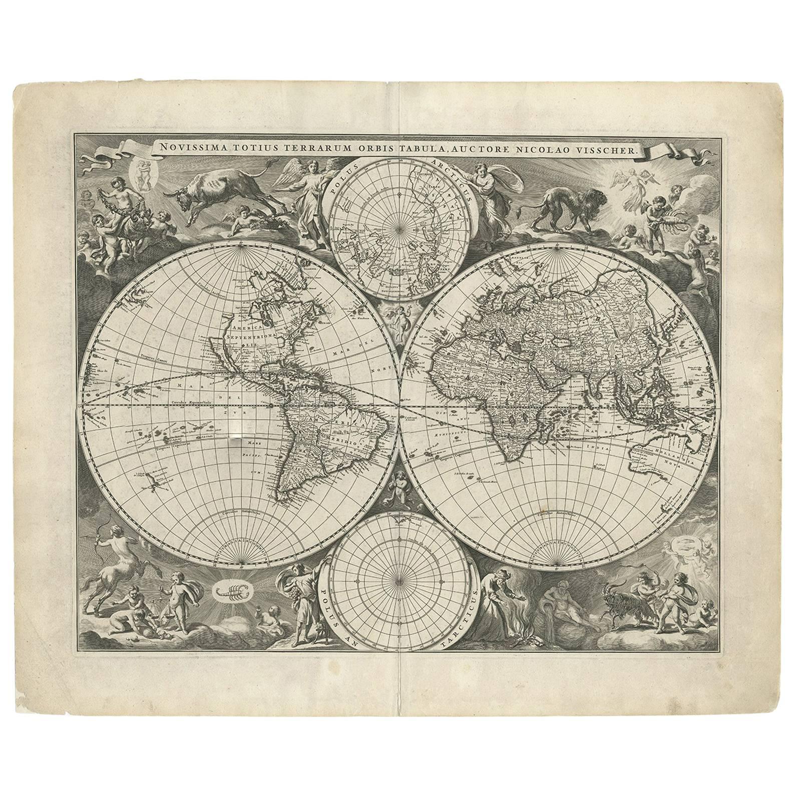
Gorgeous Antique World Map by the Dutch Mapmaker Visscher, published circa 1679
Located in Langweer, NL
Antique map titled 'Novissima Totius Terrarum Orbis Tabula, Auctore Nicolao Visscher'. Gorgeous example of Nicholas Visscher's World map, which appeared...
Category
Antique Late 17th Century Dutch Maps
Materials
Paper
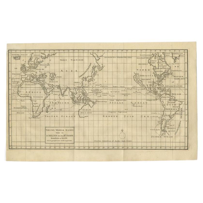
Antique Map of the World on Mercator Projection by Anson, 1749
Located in Langweer, NL
Antique map titled 'Nieuwe Wereld Kaart waar in de Reizen van den Hr. Anson rondsom de Wereld'. Original antique map of the world on Mercator'...
Category
Antique 18th Century Maps
Materials
Paper

$433 Sale Price
25% Off
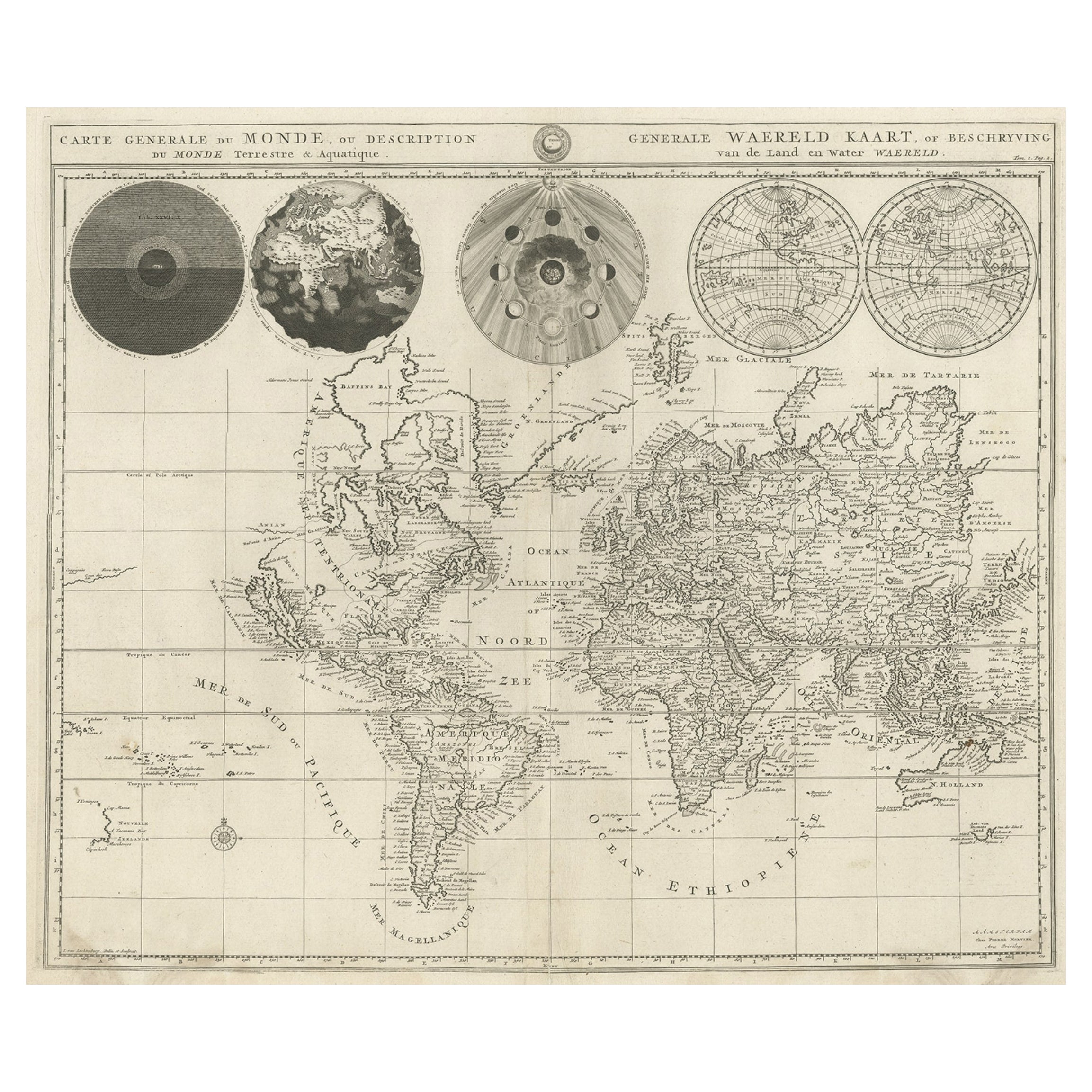
Antique World Map with Astronomical Spheres by Pierre Mortier, Amsterdam, c.1700
Located in Langweer, NL
Antique World Map with Astronomical Spheres by Pierre Mortier, Amsterdam, circa 1700
This fascinating antique world map titled "Carte générale du monde, ou description du monde terr...
Category
Antique 17th Century French Maps
Materials
Paper

$867 Sale Price
25% Off
Original Engraved Antique Map of the World, Colorful and Decorative, C.1780
By Pierre François Tardieu
Located in Langweer, NL
Antique map titled 'Mappemonde en Deux Hemispheres ou l'on a Indique les Nouvelles Decouvertes' - This handsome double hemisphere map presents a ...
Category
Antique 18th Century Maps
Materials
Paper

$443 Sale Price
20% Off
More Ways To Browse
Montreux Jazz Poster
Murakami Francis
Nuremberg Chronicle
Oreo Art
Orientalist Prints Art
Paul Mccrane
Peter Max Moon
Picasso Banderilles
Picasso Clown
Picasso Etching Vollard Suite
Picasso Les Dejeuners
Picasso Lithograph 1974
Picasso Silkscreen
Polo Antiques
Pop And Scott
Punk Original
R C Gorman Originals
Rene Magritte Poster