Items Similar to Map of Africa - Original Etching by C. Brue - 1820


Want more images or videos?
Request additional images or videos from the seller
1 of 5
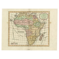
UnknownMap of Africa - Original Etching by C. Brue - 18201820
1820
$415.62
£316.19
€350
CA$583.05
A$636.21
CHF 329.15
MX$7,610.99
NOK 4,158.02
SEK 3,904.31
DKK 2,666.16
About the Item
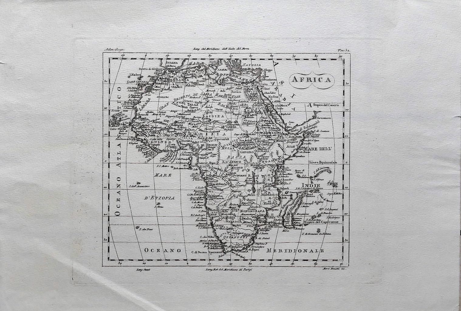
Map of Africa is an original etching realized by C.Brue in 1820.
The print comes from the Series "Atlas Universal" PL. 31.
The state of preservation of the artwork is good except for the folding line in the middle that is the sign of being repaired.
The artwork represents the geopolitical map of Africa.
- Creation Year:1820
- Dimensions:Height: 20.87 in (53 cm)Width: 27.17 in (69 cm)Depth: 0.04 in (1 mm)
- Medium:
- Movement & Style:
- Period:
- Framing:Framing Options Available
- Condition:Insurance may be requested by customers as additional service, contact us for more information.
- Gallery Location:Roma, IT
- Reference Number:Seller: M-1181801stDibs: LU65037979292
About the Seller
4.9
Platinum Seller
Premium sellers with a 4.7+ rating and 24-hour response times
1stDibs seller since 2017
7,802 sales on 1stDibs
Typical response time: 1 hour
- ShippingRetrieving quote...Shipping from: Roma, Italy
- Return Policy
More From This Seller
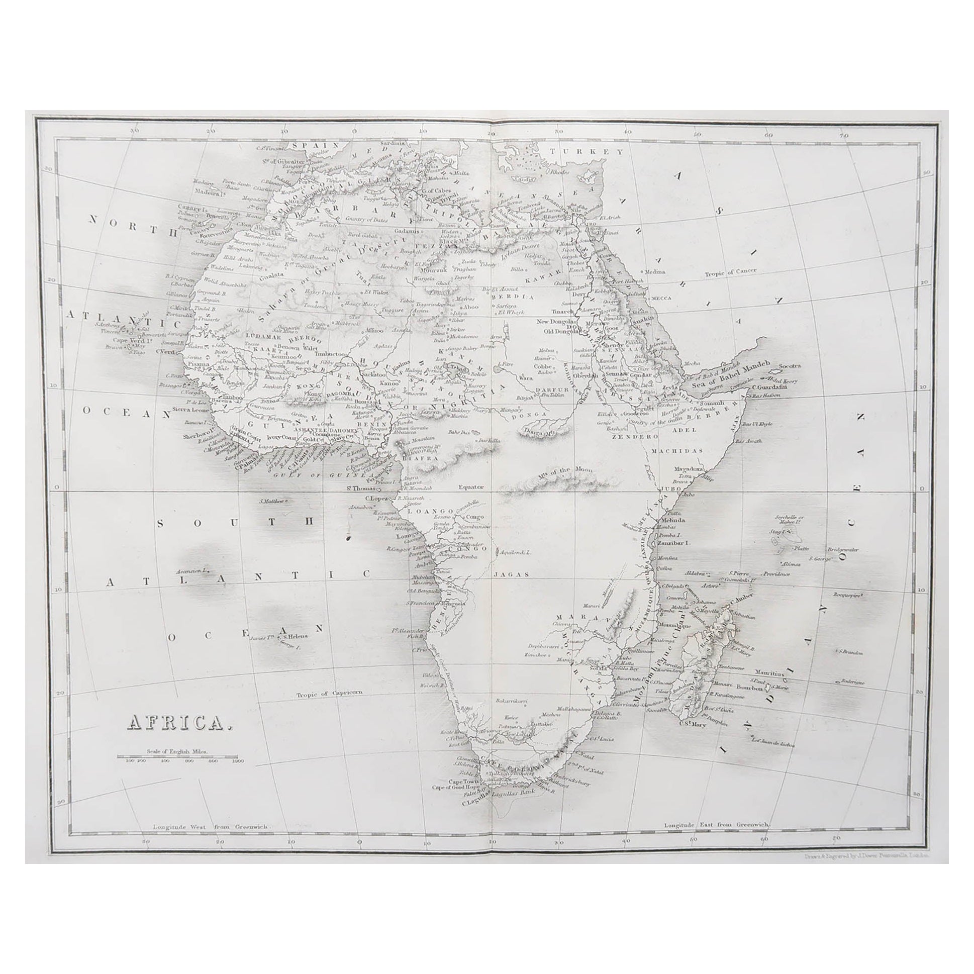
View AllAncient Map of Africa - Etching - 19th century
Located in Roma, IT
This Map of Africa is an etching realized in the 19th century.
The state of preservation of the artwork is good. At the top of the paper, the inscription “Longitudine del Meridiano ...
Category
19th Century More Prints
Materials
Etching
Map of the World - Original Etching - 1820
Located in Roma, IT
Map of the World is an Original Etching realized by an unknown artist of 19th century in 1820.
Very good condition on two sheets of white paper joine...
Category
1820s Modern Figurative Prints
Materials
Etching

Totius Africae Accuratissima Tabula - Etching by Frederick de Wit - 1680 ca
By Frederick de Wit
Located in Roma, IT
This double-page etching with contemporary coloring, entitled Totius Africae Accuratissima Tabula, was realized by the cartographer Frederick de Wit for the famous Atlas published in...
Category
1680s Modern Figurative Prints
Materials
Etching

Ancient Map of Senegal - Original Etching - 19th Century
Located in Roma, IT
Map of Senegal is an original etching realized by an anonymous engraver of the 19th Century.
Printed in series of "France Pittoresque" at the top center.
The state of preservation ...
Category
19th Century Figurative Prints
Materials
Etching

Map of South America - Original Etching - Late 19th Century
Located in Roma, IT
This Map of South America is an etching realized by an anonymous artist.
The state of preservation of the artwork is good with some small diffused stains.
Sheet dimension: 41.5 x 27
The artwork represents the map South America...
Category
Late 19th Century Modern Figurative Prints
Materials
Etching
Map of Campaign of 1814 - Etching by Pierre François Tardieu - 1837
Located in Roma, IT
Map of Campaign of 1814 is an Etching realized by Pierre François Tardieu in 1837.
Good conditions.
The artwork is realized in a well-balanced composition. the artwork and belongs ...
Category
1830s Modern Figurative Prints
Materials
Lithograph

You May Also Like
Antique Map of Africa by Lapie, 1842
Located in Langweer, NL
Antique map titled 'Carte d'Afrique'. Map of Africa. This map originates from 'Atlas universel de géographie ancienne et moderne (..)' by Pierre M. Lapie...
Category
Antique Mid-19th Century Maps
Materials
Paper

Antique Map of Africa by Dufour, circa 1834
Located in Langweer, NL
Antique map titled 'Afrique'. Uncommon map of Africa. Published by or after A.H. Dufour, circa 1834. Source unknown, to be determined.
Category
Antique Mid-19th Century Maps
Materials
Paper

Antique Map of Africa by Bordiga Fratelli 'circa 1818'
Located in Langweer, NL
Antique map titled 'Carta dell Africa'. Large and quite scarce Italian map of Africa, reflecting the then-current knowledge of the continent's geography, with large areas left comple...
Category
Antique Early 19th Century Maps
Materials
Paper

Original Antique Map of Africa by Dower, circa 1835
Located in St Annes, Lancashire
Nice map of Africa
Drawn and engraved by J.Dower
Published by Orr & Smith. C.1835
Unframed.
Free shipping
Category
Antique 1830s English Maps
Materials
Paper

Antique Map of Africa by Homann Heirs, '1804'
Located in Langweer, NL
Antique map titled 'Charte von Africa'. Large, original antique map of Africa by Franz Ludwig Güssefeld. Published by Homann Heirs, 1804.
Category
Antique Early 19th Century Maps
Materials
Paper

$1,424 Sale Price
20% Off
Antique Map of Africa by Delamarche, 1806
Located in Langweer, NL
Antique map titled 'L'Afrique'.
Decorative map of Africa by Robert de Vaugondy, revised and published by Delamarche. Source unknown, to be determined.
Artists and Engravers: Charl...
Category
Antique 19th Century Maps
Materials
Paper
$256 Sale Price
20% Off
More Ways To Browse
Map Of Africa
Antique Maps Of Africa
Pablo Picasso Raphael Et La Fornarina
Paradise 20 Dali
Parasol Howard Behrens
Patrick Nagel On Sale
Paul Iribe On Sale
Pegge Hopper
Penal Cross
Peter Doig Zermatt
Peter Forster
Peter Max 9 11
Peter Max Earth Day
Peter Max Friends
Peter Max Ladies
Peter Max World Cup
Peter Wever On Sale
Phyllis Lucas Gallery Old Print Center