


Want more images or videos?
Request additional images or videos from the seller
1 of 5
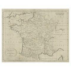
UnknownMap of France - Etching - 18201820
1820
$411.86
£313.98
€350
CA$581.73
A$636.05
CHF 332.53
MX$7,651.57
NOK 4,207.88
SEK 3,946.62
DKK 2,665.68
About the Item
Map of France is an Original Etching realized by an unknown artist of 19th century in 1820.
Very good condition on two sheets of white paper joined at the center.
The map is an etching,hand watercoloured.
No signature.
- Creation Year:1820
- Dimensions:Height: 18.12 in (46 cm)Width: 23.23 in (59 cm)Depth: 0.04 in (1 mm)
- Medium:
- Movement & Style:
- Period:
- Framing:Framing Options Available
- Condition:Insurance may be requested by customers as additional service, contact us for more information.
- Gallery Location:Roma, IT
- Reference Number:Seller: T-1320621stDibs: LU650310402612
About the Seller
4.9
Platinum Seller
Premium sellers with a 4.7+ rating and 24-hour response times
1stDibs seller since 2017
7,784 sales on 1stDibs
Typical response time: 1 hour
- ShippingRetrieving quote...Shipping from: Monaco, Monaco
- Return Policy
Authenticity Guarantee
In the unlikely event there’s an issue with an item’s authenticity, contact us within 1 year for a full refund. DetailsMoney-Back Guarantee
If your item is not as described, is damaged in transit, or does not arrive, contact us within 7 days for a full refund. Details24-Hour Cancellation
You have a 24-hour grace period in which to reconsider your purchase, with no questions asked.Vetted Professional Sellers
Our world-class sellers must adhere to strict standards for service and quality, maintaining the integrity of our listings.Price-Match Guarantee
If you find that a seller listed the same item for a lower price elsewhere, we’ll match it.Trusted Global Delivery
Our best-in-class carrier network provides specialized shipping options worldwide, including custom delivery.More From This Seller
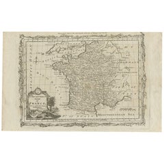
View AllMap of Germany - Original Etching - 1820
Located in Roma, IT
Map of Germany is an Original Etching realized by an unknown artist of 19th century in 1820.
Very good condition on two sheets of white paper joined at...
Category
1820s Modern Figurative Prints
Materials
Etching

Map of Campaign of 1814 - Etching by Pierre François Tardieu - 1837
Located in Roma, IT
Map of Campaign of 1814 is an Etching realized by Pierre François Tardieu in 1837.
Good conditions.
The artwork is realized in a well-balanced composition. the artwork and belongs ...
Category
1830s Modern Figurative Prints
Materials
Lithograph

Map of Vendée - Etching - 19th Century
Located in Roma, IT
Map of Vendée is an etching realized by an anonymous engraver of the 19t century.
Printed in series of "France Pittoresque" at the top center.
The state of preservation of the artw...
Category
19th Century Modern Figurative Prints
Materials
Etching

Map of Seine - Original Etching - 19th Century
Located in Roma, IT
Map of Seine is an original etching realized by an anonymous engraver of the XIX century.
Printed in series of "France Pittoresque" at the top center.
The state of preservation of ...
Category
19th Century Figurative Prints
Materials
Etching
Map of Deux Sèvres - Original Etching - 19th Century
Located in Roma, IT
Map of Deux Sèvres is an original antique etching realized by an anonymous engraver of the 19th Century.
Printed in series of "France Pittoresque" at the top center.
The state of p...
Category
19th Century Modern Figurative Prints
Materials
Etching

Map of Rhône - Original Etching - 19th Century
Located in Roma, IT
Map of Rhône is an original antique etching realized by an anonymous engraver of the 19th Century.
Printed in series of "France Pittoresque" at the top center.
The state of preserv...
Category
19th Century Modern Figurative Prints
Materials
Etching

You May Also Like
Antique Map of France by Balbi '1847'
Located in Langweer, NL
Antique map titled 'France'. Original antique map of France. This map originates from 'Abrégé de Géographie (..)' by Adrien Balbi. Published 1847.
Category
Antique Mid-19th Century Maps
Materials
Paper

$117 Sale Price
20% Off
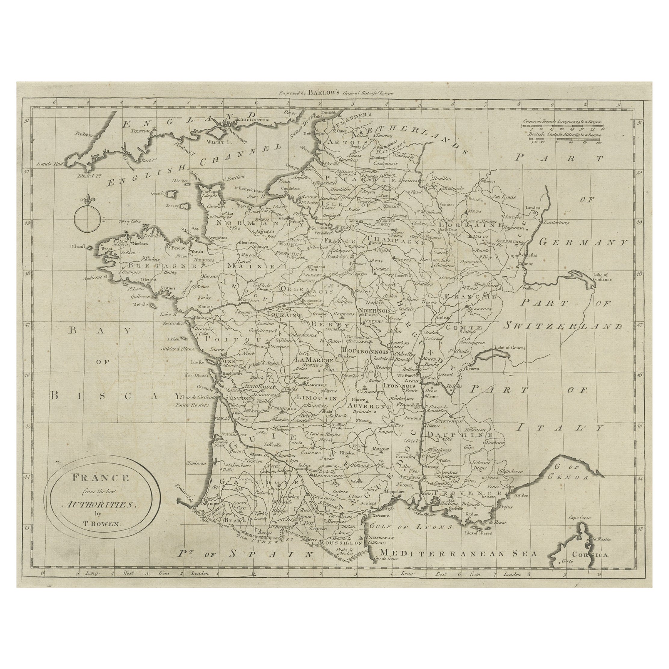
Antique Map of France by Bowen, c.1790
Located in Langweer, NL
Antique map titled 'France from the best Authorities'. Original antique map of France. Engraved for Barlow's General history of Europe. Published circa 1790.
Artists and Engraver...
Category
Antique 18th Century Maps
Materials
Paper
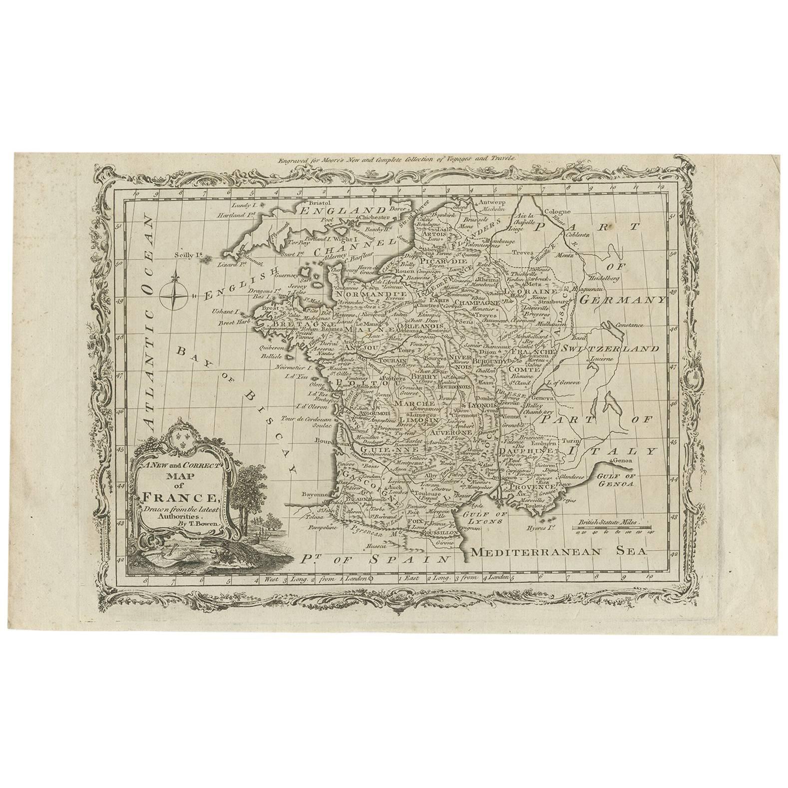
Antique Map of France by T. Bowen, 1785
Located in Langweer, NL
Decorative antique map of France titled 'A new and accurate map of France, Drawn from the latest Authorities by T. Bowen'. Engraved for Moore’s new and complete collection of Voyages...
Category
Antique Late 18th Century Maps
Materials
Paper
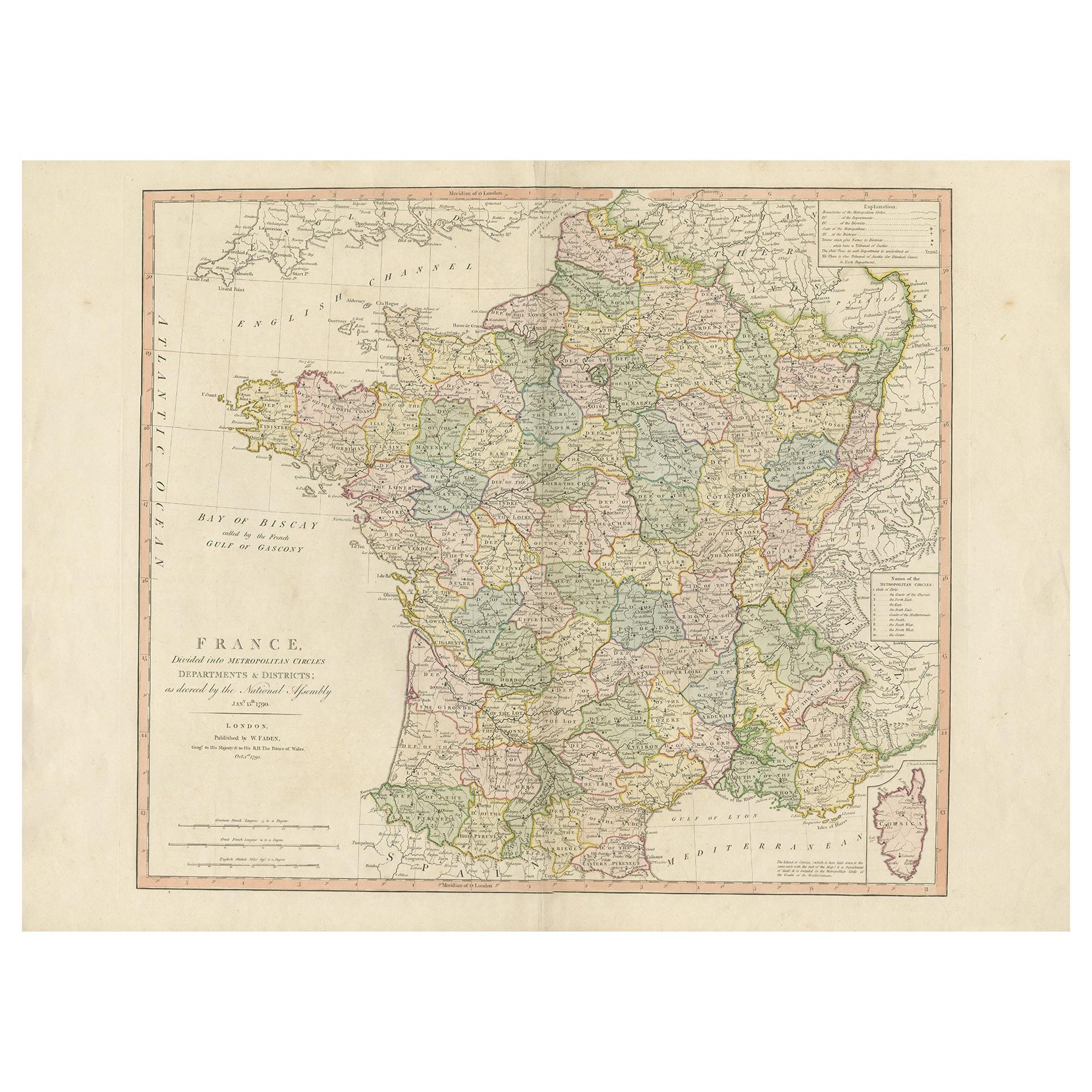
Antique Map of France by Faden '1792'
Located in Langweer, NL
Antique map titled 'France divided into Metropolitan Circles (..)'. Large, original antique map of France, with a small inset of the island of Co...
Category
Antique Late 18th Century Maps
Materials
Paper
$611 Sale Price
20% Off
Antique Map of France by Lapie, 1842
Located in Langweer, NL
Antique map titled 'Carte de France'. Map of France. This map originates from 'Atlas universel de géographie ancienne et moderne (..)' by Pierre M. Lapie and Alexandre E. Lapie. Pier...
Category
Antique Mid-19th Century Maps
Materials
Paper

Antique Map of France by Lapie, 1842
Located in Langweer, NL
Antique map titled 'Carte des Gaules'. Map of France. This map originates from 'Atlas universel de géographie ancienne et moderne (..)' by Pierre M. Lapie and Alexandre E. Lapie. Pie...
Category
Antique Mid-19th Century Maps
Materials
Paper

More Ways To Browse
Map Of France
Antique Maps Of France
Antique French Etching
Keith Haring Plate
Klimt Lithograph
Les Amours Cassandre
Manet Etching
Marc Chagall Bible 1958
Michel Delacroix Lithograph
Modes De Paris
Nue Modern
Pino Original
Pochoir Plates
Pop Art Mickey Mouse
Salvador Dali 1971
Salvador Dali Twelve Tribes Of Israel
Salvador Dali Venus
Takashi Murakami Flowerball