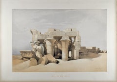
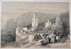
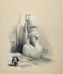
Items Similar to Colossi of Memnon, Thebes, Egypt. Early 19th century engraving, 1820

Want more images or videos?
Request additional images or videos from the seller
1 of 6
Colossi of Memnon, Thebes, Egypt. Early 19th century engraving, 18201820
1820
$750
£568.27
€652.04
CA$1,055.37
A$1,160.14
CHF 609.72
MX$14,088.36
NOK 7,606.08
SEK 7,206.23
DKK 4,866.35
About the Item
'Vue des Deux Colosses. Thebes, Memnonium'
Elephant folio engraving, by Baltard after Dutetre, from 'Description de l'Egypte', published after Napoleon's expedition to colonize Egypt in 1798.
Napoleon included a number of artists in his army, who were instructed to record modern and ancient Egyptian society. The resulting works formed an important historical account of Egypt, with detailed and accurate depictions of monuments, cities and architecture.
435mm by 605mm (platemark) 500mm by 685mm (sheet)
- Creation Year:1820
- Dimensions:Height: 19.69 in (50 cm)Width: 26.97 in (68.5 cm)
- Medium:
- After:FC Cecile (French)
- Period:
- Condition:Blind stamp to top right corner of platemark. A couple of short breaks in the paper at the edges of the sheet. A little discolouration top left corner of the sheet. A couple of small line marks in the image from the time of printing.
- Gallery Location:Melbourne, AU
- Reference Number:Seller: CL34401stDibs: LU1244215550652
About the Seller
5.0
Platinum Seller
Premium sellers with a 4.7+ rating and 24-hour response times
Established in 2005
1stDibs seller since 2019
613 sales on 1stDibs
Typical response time: <1 hour
- ShippingRetrieving quote...Shipping from: Melbourne, Australia
- Return Policy
Authenticity Guarantee
In the unlikely event there’s an issue with an item’s authenticity, contact us within 1 year for a full refund. DetailsMoney-Back Guarantee
If your item is not as described, is damaged in transit, or does not arrive, contact us within 7 days for a full refund. Details24-Hour Cancellation
You have a 24-hour grace period in which to reconsider your purchase, with no questions asked.Vetted Professional Sellers
Our world-class sellers must adhere to strict standards for service and quality, maintaining the integrity of our listings.Price-Match Guarantee
If you find that a seller listed the same item for a lower price elsewhere, we’ll match it.Trusted Global Delivery
Our best-in-class carrier network provides specialized shipping options worldwide, including custom delivery.More From This Seller
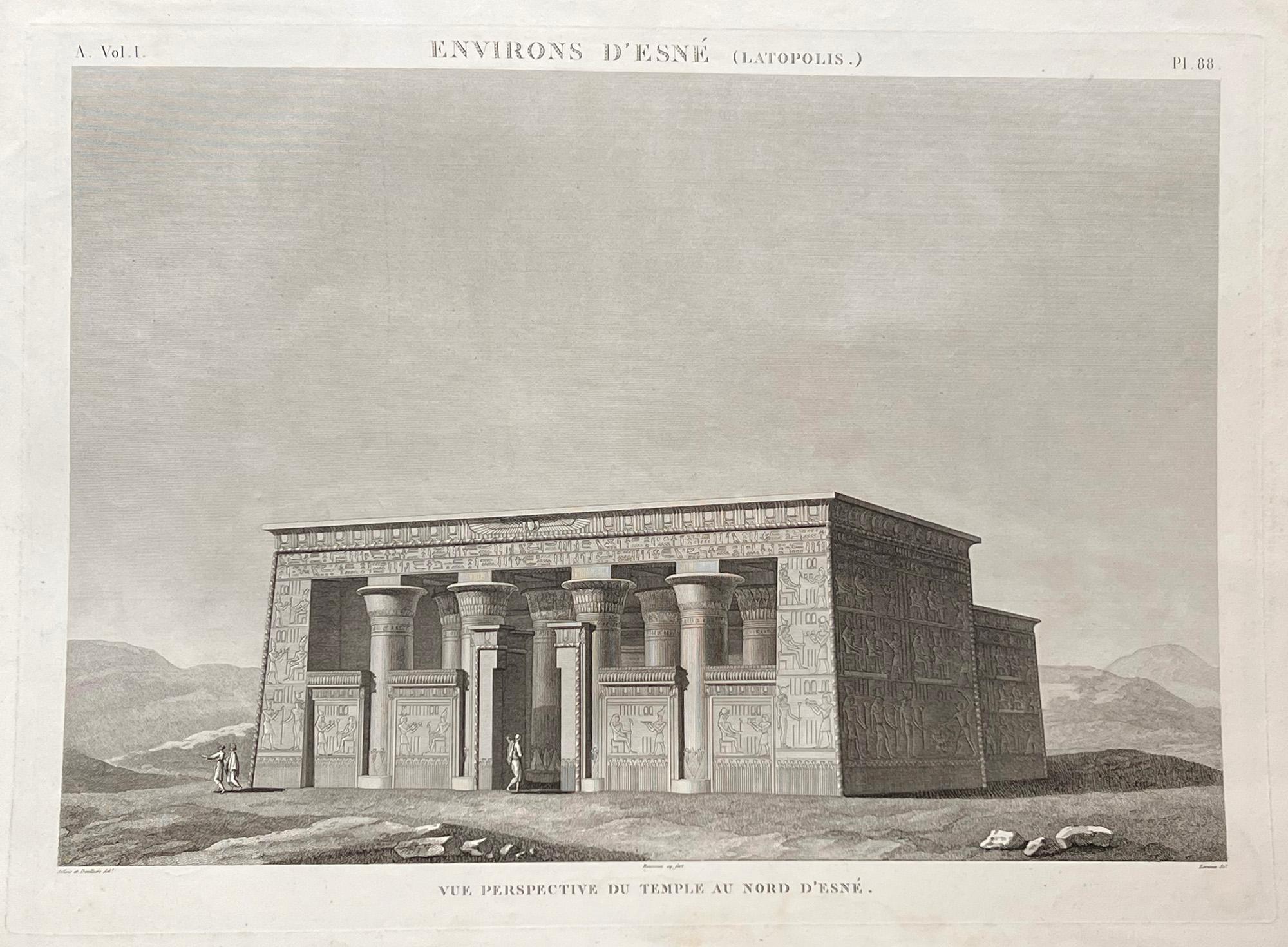
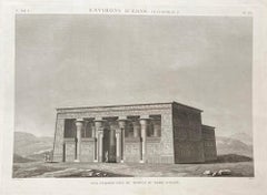
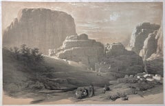
View AllTemple at Esne, Egypt. Engraving from Napoleon's Description of Egypt, 1820
Located in Melbourne, Victoria
'Vue perspective du temple au nord d' Esnee'
Engraving by Rousseau and Lorieux after Devilliers and Jollois, 1820.
View of the temple to the north of Esne. From Napoleon's Descript...
Category
Mid-19th Century Victorian Landscape Prints
Materials
Engraving
Medinet Abou, Thebes, Egypt. David Roberts Oriental lithograph, 1847.
By David Roberts
Located in Melbourne, Victoria
'Medinet Abou, Thebes', tinted lithograph by Louis Haghe (1806-1885) after David Roberts RA.
David Roberts (1796-1864) traveled throughout Egypt and the Holy Land in the late 1830s ...
Category
Mid-19th Century Victorian Landscape Prints
Materials
Lithograph
Entrance to the Temple of Amun, Egypt. David Roberts Oriental lithograph, 1841.
By David Roberts
Located in Melbourne, Victoria
'Entrance to the Temple of Amun, Thebes', tinted lithograph by Louis Haghe (1806-1885) after David Roberts RA.
David Roberts (1796-1864) traveled throughout Egypt and the Holy Land ...
Category
Mid-19th Century Victorian Landscape Prints
Materials
Lithograph

Remains of a Triumphal Arch, Petra, Jordan. David Roberts lithograph, 1849.
By David Roberts
Located in Melbourne, Victoria
'Remains of a Triumphal Arch, Petra', tinted lithograph by Louis Haghe (1806-1885) after David Roberts RA.
David Roberts (1796-1864) traveled throughout Egypt and the Holy Land in t...
Category
Mid-19th Century Victorian Landscape Prints
Materials
Lithograph
The Acropolis, Lower End of the Valley, Petra. David Roberts lithograph, 1849.
By David Roberts
Located in Melbourne, Victoria
'The Acropolis, Lower End of the Valley, Petra', tinted lithograph by Louis Haghe (1806-1885) after David Roberts RA.
David Roberts (1796-1864) traveled throughout Egypt and the Hol...
Category
Mid-19th Century Victorian Landscape Prints
Materials
Lithograph
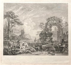
Les Bergers Romains, landscape with Roman ruins, 18th century engraving
Located in Melbourne, Victoria
Les Bergers Romains
Copper-line engraving by Jean Jacques Leveau (1729-1786) after Pierre Mettay (1728-1759). C1755.
Proof, before lettering. Laid, watermarked paper.
A landscap...
Category
18th Century French School Landscape Prints
Materials
Engraving
You May Also Like
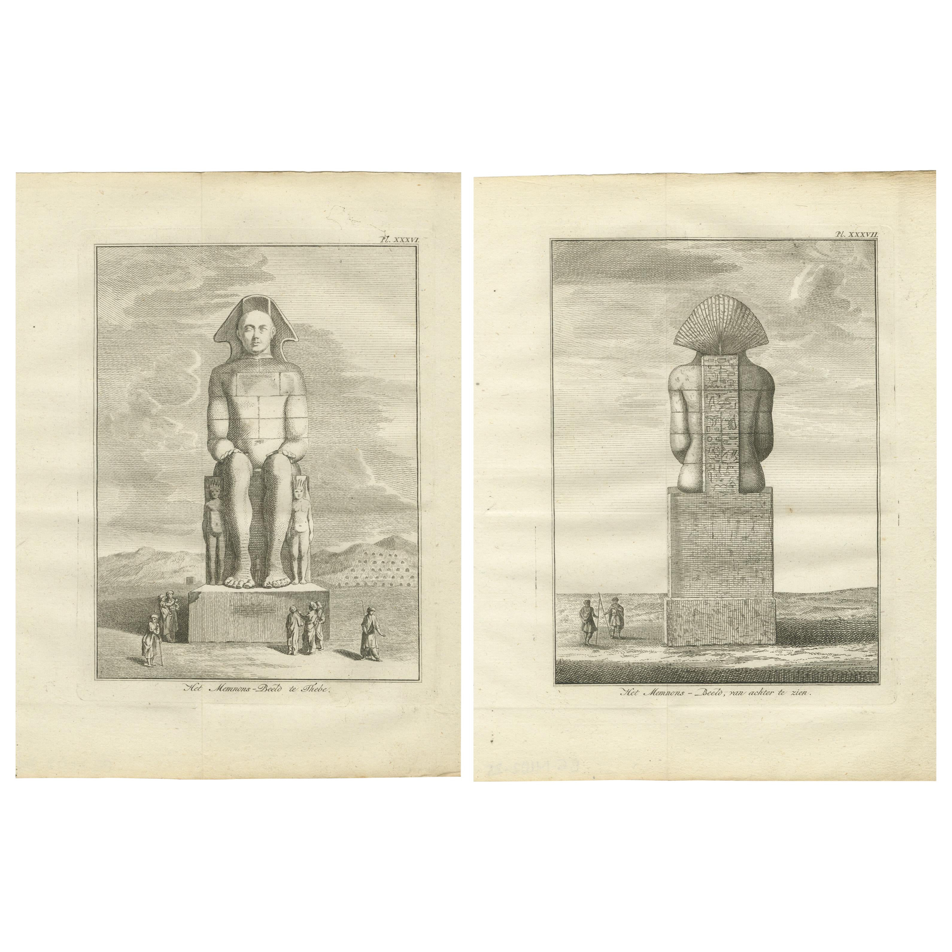
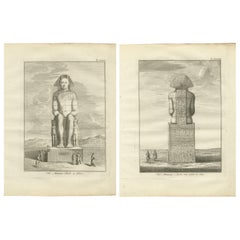
Colossus of Memnon at Thebes, Egypt – Antique Front and Rear Views, c.1776
Located in Langweer, NL
Colossus of Memnon at Thebes, Egypt – Antique Front and Rear Views, c.1776
Description:
This striking pair of antique engravings offers front and rear views of the Colossus of Memno...
Category
Antique Late 18th Century Dutch Prints
Materials
Paper
Colossal Statue Luxor, Egypt: Original 19th C. Lithograph by David Roberts
By David Roberts
Located in Alamo, CA
This is an original 19th century duotone lithograph entitled "A Colossal Statue at the Entrance to the Temple of Luxor" by David Roberts, from his Egypt and Nubia volumes of the larg...
Category
1840s Realist Landscape Prints
Materials
Lithograph
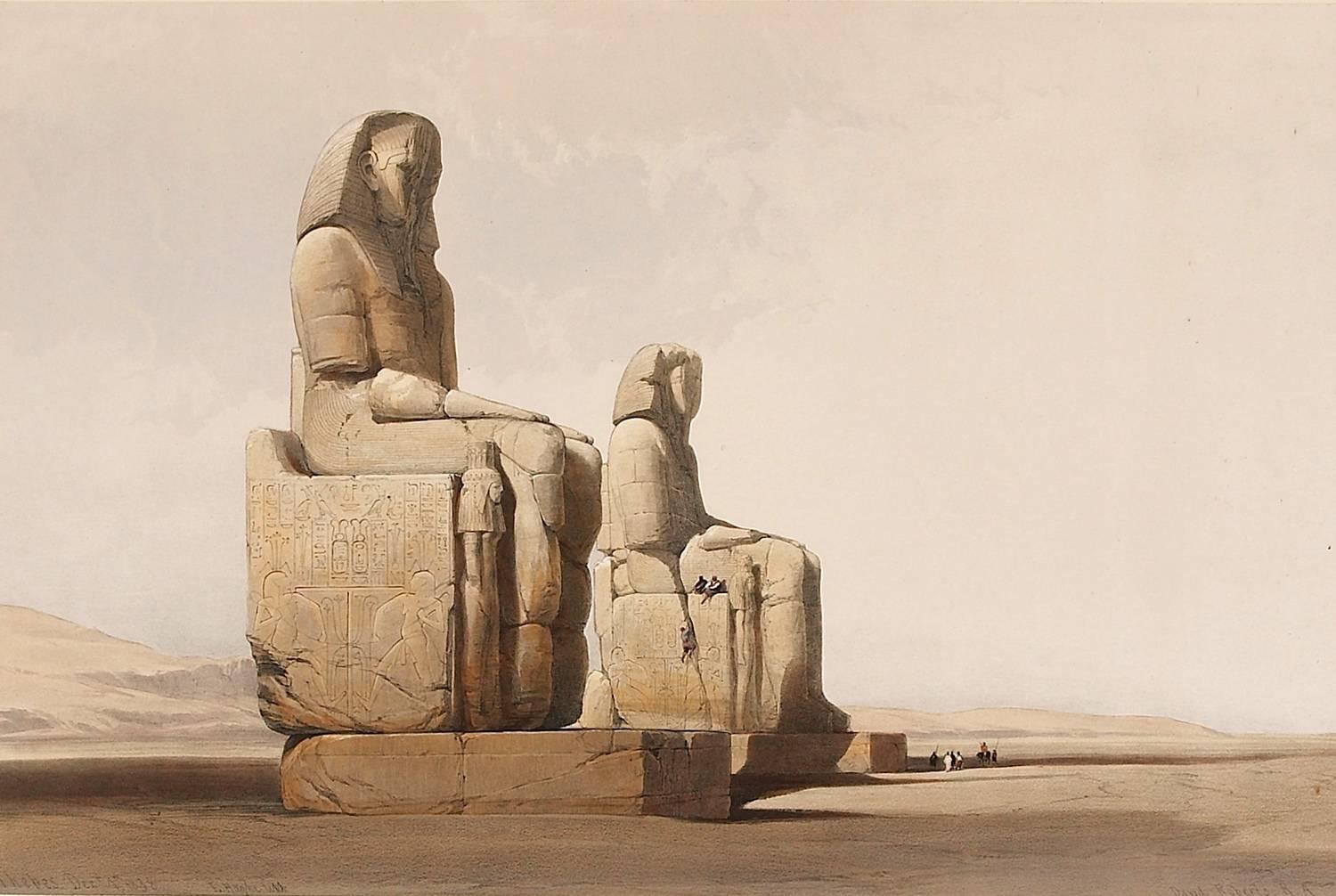
THEBES - COLOSSAL STATUES OF AMUNOPH III Many other Roberts lithographs availabl
By David Roberts
Located in London, GB
David Roberts R.A.
1796 - 1864
THEBES - COLOSSAL STATUES OF AMUNOPH III
First Edition lithograph
Full plate: 137
Presented in a acid free mount
Published by F.G. Moon & Son, Londo...
Category
Late 19th Century Victorian Landscape Prints
Materials
Lithograph

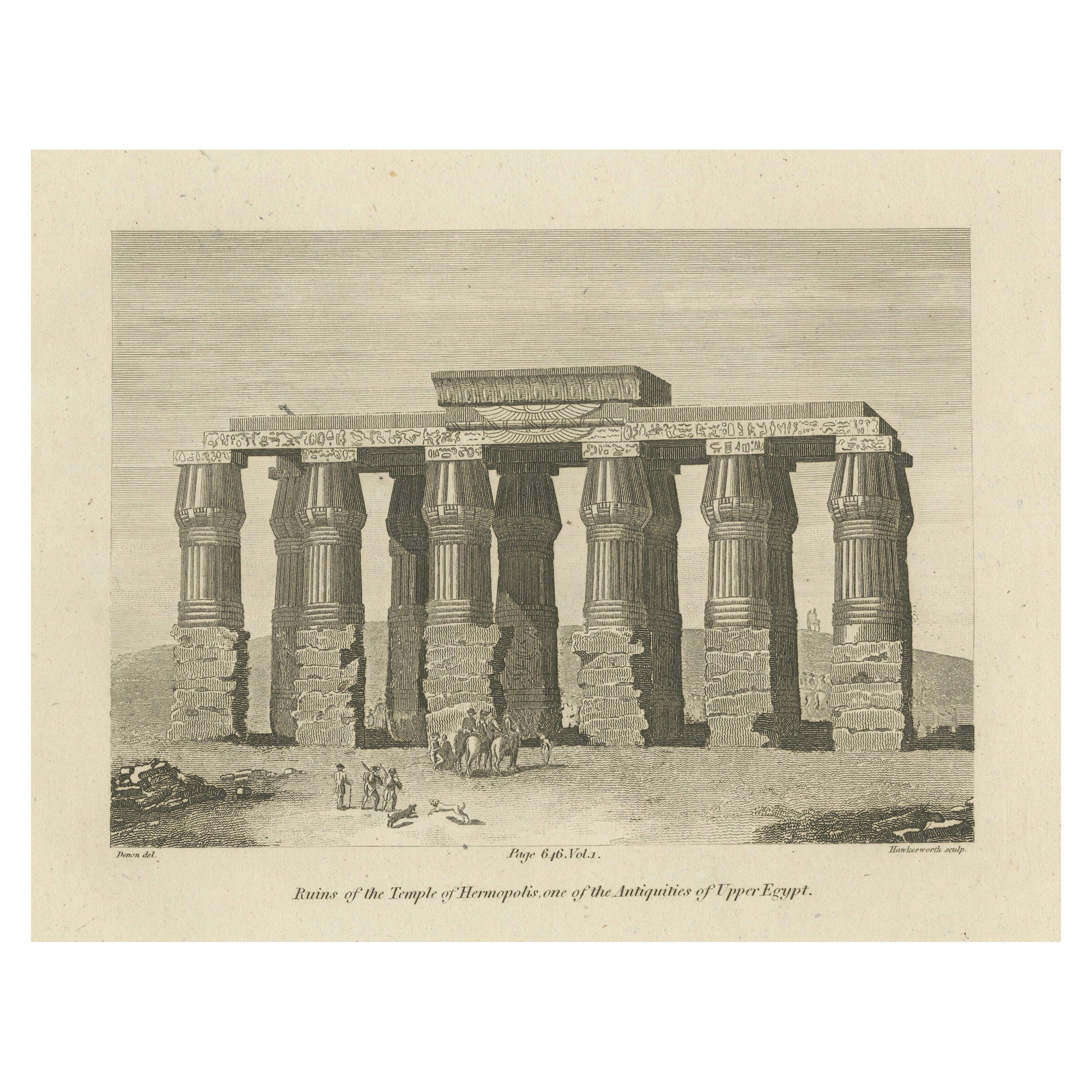
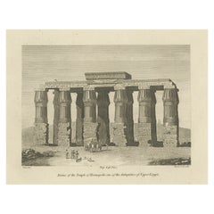
Antique Copperplate Engraving of Ruins of the Temple of Hermopolis, 1820
Located in Langweer, NL
This is an 1820 copperplate engraving by Denon, expertly crafted by Hawkesworth, depicting the ruins of the Temple of Hermopolis in Egypt.
Ruins of the Temple of Hermopolis, Upper ...
Category
Antique Early 1800s Prints
Materials
Paper
$449 Sale Price
20% Off
Free Shipping
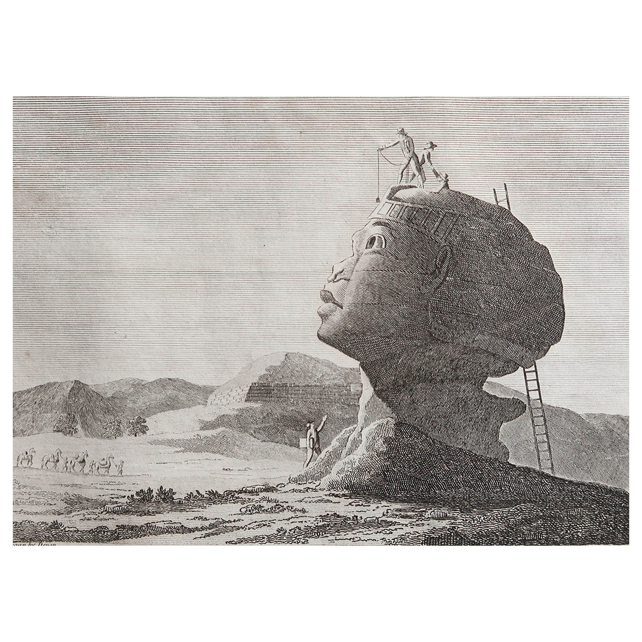
Original Antique Print of The Sphinx of Giza, Egypt. C.1810
Located in St Annes, Lancashire
Wonderful image of The Sphinx of Giza
Fine copper-plate engraving
Published C.1810
Unframed.
Free shipping
Category
Antique Early 1800s English Egyptian Prints
Materials
Paper

Ruins of the Temple of Kom Ombo, Egypt: A 19th C. Lithograph by David Roberts
By David Roberts
Located in Alamo, CA
This is an original 19th century duotone lithograph entitled "Ruins of Kom Ombo" by David Roberts, from his Egypt and Nubia volumes of the large folio edition, published in London by...
Category
1840s Realist Landscape Prints
Materials
Lithograph