Items Similar to England and the British Isles: A Large 17th Century Hand-colored Map by de Wit


Want more images or videos?
Request additional images or videos from the seller
1 of 13
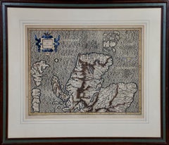
Frederick de WitEngland and the British Isles: A Large 17th Century Hand-colored Map by de Wit1680
1680
$1,175
£896.21
€1,020.56
CA$1,651.23
A$1,800.90
CHF 954
MX$21,590.26
NOK 12,149.67
SEK 11,109.98
DKK 7,624.62
About the Item
This is a large hand-colored 17th century map of England and the British Isles by Frederick de Wit entitled "Accuratissima Angliæ Regni et Walliæ Principatus", published in Amsterdam in 1680. It is a highly detailed map of England, Scotland, the Scottish Isles, the Isle of Wight and eastern portions of Ireland. The colorful cartouche in the upper right includes two putti holding a banner with the title of the map and de Wit's name and additional little angels are holding a colorful royal coat of arms.
The map is presented in a large attractive brown wood frame with red interior trim and gold highlight along the forward edge. The frame measures 35" high by 10.5" wide and 2" deep. There are a few small spots and some discoloration related to color transfer occurring over its centuries within an atlas.
Frederick de Wit (c.1630-1706) moved to Amsterdam from Gouda in 1646. He learned cartography from the famous Dutch cartographer, Willem Blaeu. De Wit opened his own map and printing business in 1654. His success gradually expanded his business and by the 1670's he was publishing atlases.
- Creator:Frederick de Wit (1630 - 1706, Dutch)
- Creation Year:1680
- Dimensions:Height: 35 in (88.9 cm)Width: 30.5 in (77.47 cm)Depth: 2 in (5.08 cm)
- Medium:
- Period:Late 17th Century
- Condition:
- Gallery Location:Alamo, CA
- Reference Number:Seller: # 43951stDibs: LU117325557591

Frederick de Wit
Frederick De Wit (1629-1706) was an engraver, cartographer and map dealer who ran a prominent and productive printing business in Amsterdam, founded in 1654 and initially called The Three Crabs and later The White Chart. He published his first atlas in 1662. In 1695 he purchased a large collection of the plates of the prestigious Blaeu publishing business. After his death in 1706, his wife Maria continued in the business for four years before selling it at the auction. A majority of the plates were purchased by Pieter Mortier. His thriving and growing business eventually became Covens & Mortier, one of the largest and most successful cartography and printing businesses of the eighteenth century.
About the Seller
5.0
Platinum Seller
Premium sellers with a 4.7+ rating and 24-hour response times
Established in 2011
1stDibs seller since 2019
298 sales on 1stDibs
Typical response time: 1 hour
- ShippingRetrieving quote...Shipping from: Alamo, CA
- Return Policy
More From This Seller
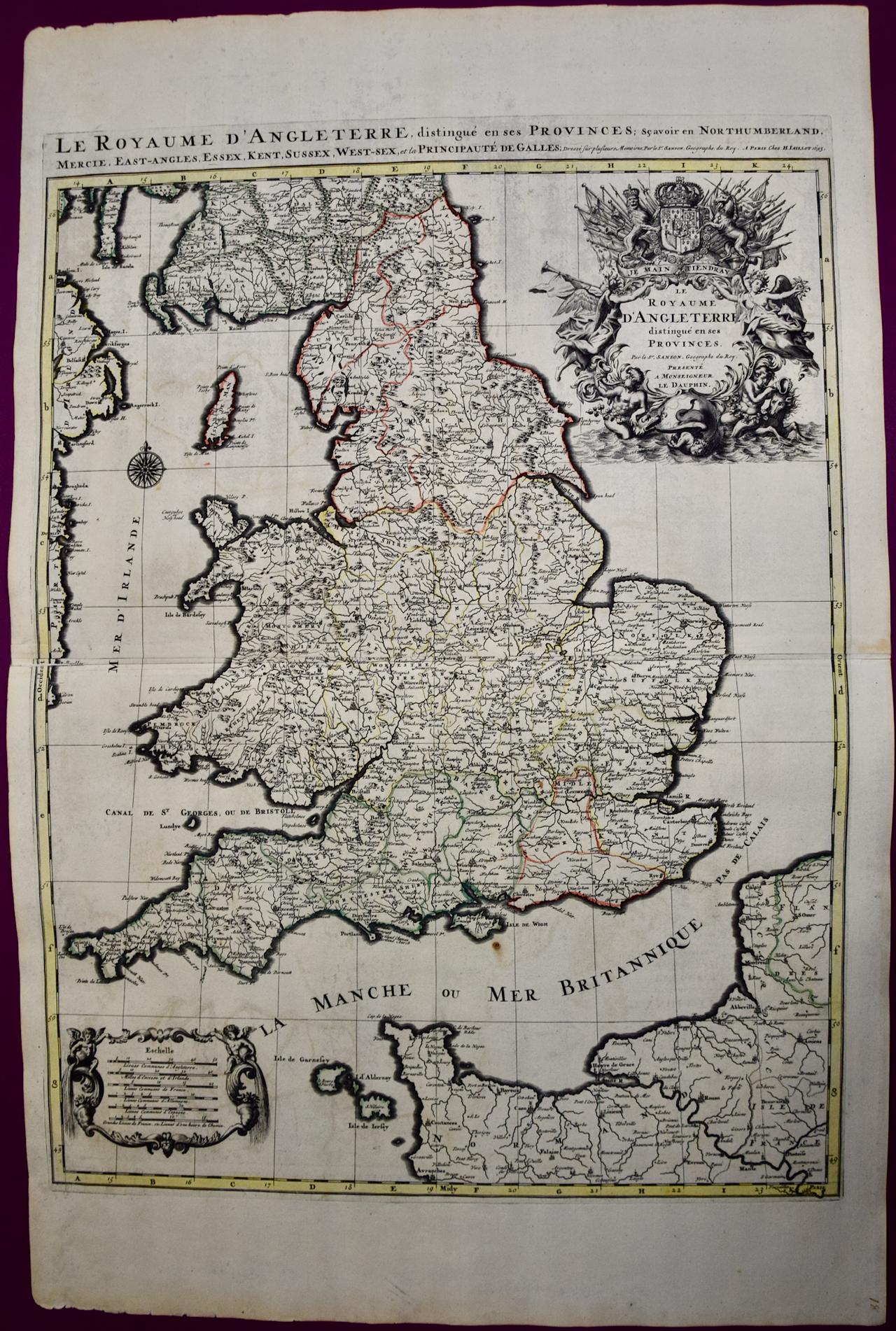
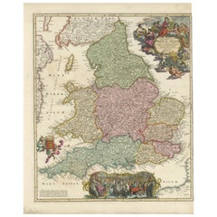
View AllGreat Britain, N. France: A Large 17th C. Hand-colored Map by Sanson and Jaillot
By Nicholas Sanson d'Abbeville
Located in Alamo, CA
This large hand-colored 17th century copperplate engraved map entitled "Le Royaume D Angleterre, distingué en ses Provinces. Par le Sr. Sanson. Geographe du Roy. Presenté A Monseigne...
Category
1690s Landscape Prints
Materials
Engraving

Southeastern England: A 17th Century Hand-Colored Map by Mercator and Hondius
By Gerard Mercator
Located in Alamo, CA
A 17th century copperplate hand-colored map entitled "The Sixt Table of England" by Gerard Mercator and Jodocus Hondius, published in Amsterdam in 1635 in 'Cosmographicall Descriptio...
Category
1630s Landscape Prints
Materials
Engraving
Northern Scotland: 17th Century Hand-colored Map by Mercator
By Gerard Mercator
Located in Alamo, CA
This is a framed hand-colored 17th century map of Northern Scotland by Gerard Mercator entitled "Scotiae pars Septentrionalis", published in Amsterdam in 1636. It is a highly detailed map of the northern part of Scotland, with the northwest Highlands and the cities Inverness and Aberdeen, as well as the Orkney Islands and the Hebrides. There is a decorative title cartouche in the upper left corner.
The map is presented in an antiqued brown wood...
Category
Mid-17th Century Other Art Style Landscape Prints
Materials
Engraving

$940 Sale Price
20% Off
L'Isle de France: A Hand-colored 17th Century Map by De Wit
By Frederick de Wit
Located in Alamo, CA
This colorful and detailed 17th century hand-colored copperplate map by Frederick De Wit was published in Amsterdam between 1666 and 1760. The map depicts the Île-de-France, which is one of the ancient provinces of France. Paris is located in the center of the map, with Versailles to the southwest The map extends from Rouen in the west to Reims in the east. The area around Paris, the Véxin Français, was the original domain of the king of France. Other areas were ruled by French feudal lords. For example, the Véxin Normand area was the domain of the Duke of Normandy...
Category
Early 18th Century Old Masters More Prints
Materials
Engraving

Northern Scotland: 16th Century Hand-colored Map by Mercator
By Gerard Mercator
Located in Alamo, CA
This is a framed hand-colored 16th century map of Northern Scotland by Gerard Mercator entitled "Scotiae pars Septentrionalis", published in Amsterdam in 1636. It is a highly detailed map of the northern part of Scotland, with the northwest Highlands and the cities Inverness and Aberdeen, as well as the Orkney Islands and the Hebrides. There is a decorative title cartouche in the upper left corner.
The map is presented in an antiqued brown wood...
Category
16th Century Other Art Style Landscape Prints
Materials
Engraving
Southeastern Ireland: A 17th Century Hand Colored Map by Mercator and Hondius
By Gerard Mercator
Located in Alamo, CA
A 17th century copperplate hand-colored map entitled "The Second Table of Ireland, Udrone" by Gerard Mercator and Jodocus Hondius, published in Amsterdam in 1635 in 'Cosmographicall ...
Category
1630s Landscape Prints
Materials
Engraving

You May Also Like
Antique Map of the British Isles by H. Chatelain, 1719
By Henri-Abraham Chatelain
Located in Langweer, NL
Beautiful hand colored large format map of the British Isles, with large insets of the Eastern and Western Hemispheres and the coats of arms for Engl...
Category
Antique Early 18th Century Maps
Materials
Paper

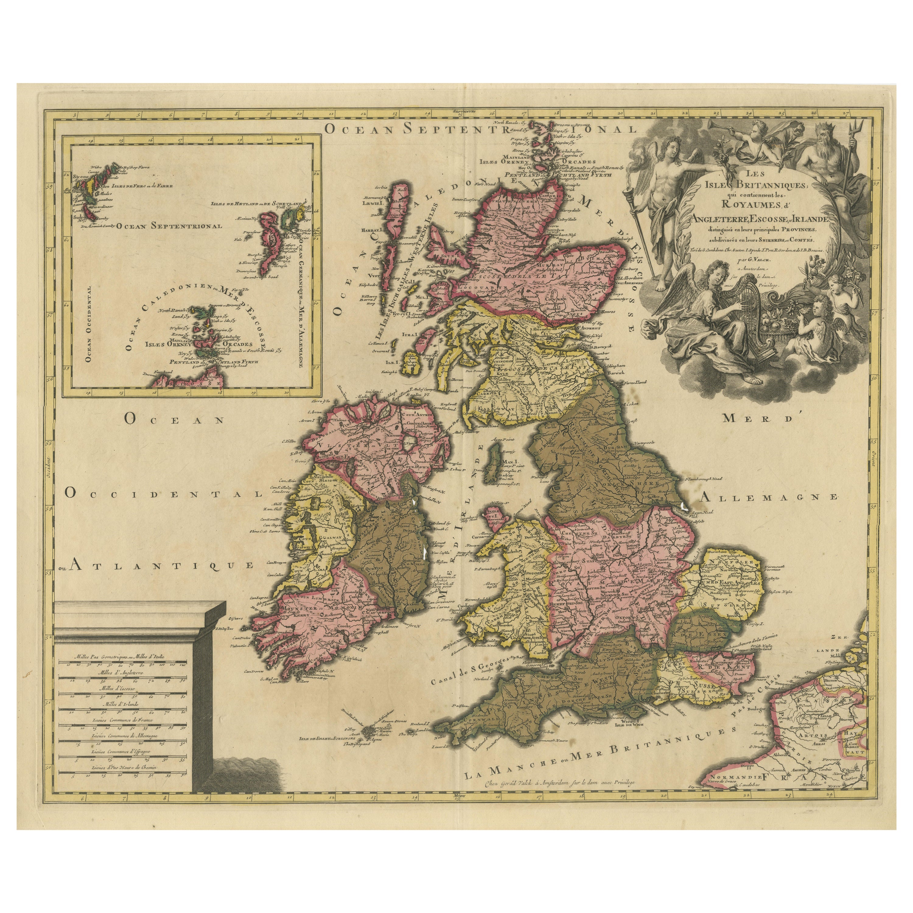
Rare Hand-colored Map of the British Isles by Gerard Valk, Published circa 1700
Located in Langweer, NL
Map of the British Isles by Gerard Valk circa 1700 – Hand-Colored Engraving
This elegant copperplate engraving titled *Les Isles Britanniques, qui contiennent les Royaumes d'Anglete...
Category
Antique Early 1700s Dutch Maps
Materials
Paper

Antique Map of England and Ireland by Lattre, 1789
Located in Langweer, NL
Antique map titled 'Les Royaumes d'Angleterre d'Ecosse et d'Irlande'. Original antique map of England and Ireland. Originates from 'Petit Atlas ...
Category
Antique 18th Century Maps
Materials
Paper

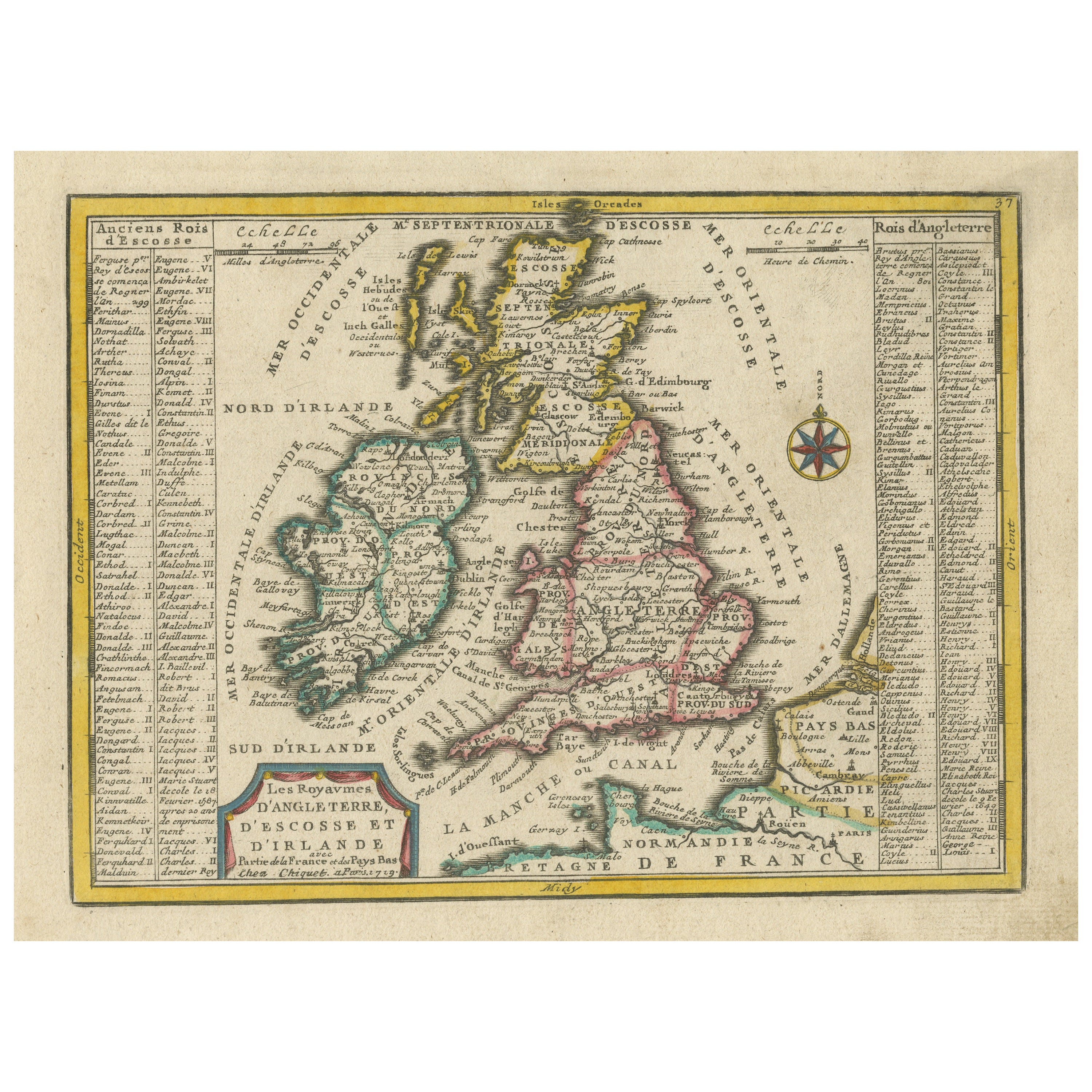
Small Antique Map of England, Wales, Scotland and Ireland with Original Coloring
Located in Langweer, NL
Antique map titled 'Les Royaumes d'Angleterre d'Escosse et d'Irlande (..)'. A lovely, small map of England, Wales, Scotland and Ireland with a portion of the coastline of France and ...
Category
Antique Early 18th Century Maps
Materials
Paper

$440 Sale Price
20% Off
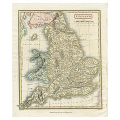
Original Antique Map of England with Hand Coloring
Located in Langweer, NL
Antique map titled 'Engand'. Original old map of England. Engraved by W. Milton. Published by John Mc. Gowan, circa 1829.
Category
Antique Mid-19th Century Maps
Materials
Paper
$210 Sale Price
20% Off
Rare 1690 Map of England by Nicolaes Visscher II – Heptarchy Depicted
Located in Langweer, NL
Map of England 1690 by Nicolaes Visscher II – Heptarchy and Counties Shown
Antique 1690 map of England by Nicolaes Visscher II, showing the Anglo-Saxon Heptarchy and detailed county...
Category
Antique Late 17th Century Dutch Maps
Materials
Paper
More Ways To Browse
Antique 17th Century Map
Map Of Britain
Antique Maps Of Britain
Scotland Map
Antique Maps Scotland
Little Angel
Antique Wayang Golek Puppets
Betsy Brown
Bronze Balloon
Cinque Terre
Clay Sculpture Nude
Contemporary Bronze Bust
Cupid Oil On Canvas
Frank Thomas
Goddess Kannon
Henley Regatta
Henry Russell
Humpback Whale