Items Similar to John Speede, Map of the County of Surrey, described and divided into hundreds


Want more images or videos?
Request additional images or videos from the seller
1 of 10
John SpeedJohn Speede, Map of the County of Surrey, described and divided into hundreds1650
1650
$707.36
£520
€606.99
CA$987.03
A$1,068.67
CHF 568.16
MX$12,888.85
NOK 7,144.94
SEK 6,661.12
DKK 4,533.45
About the Item
To see our other views and maps of England - including London, Oxford and Cambridge, scroll down to "More from this Seller" and below it click on "See all from this Seller" - or send us a message if you cannot find the view you want.
John Speed/Speede (1551/2-1629)
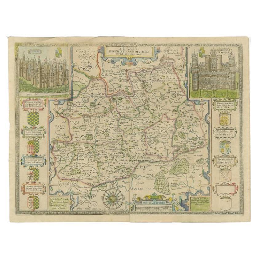
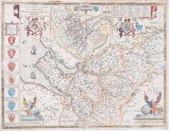
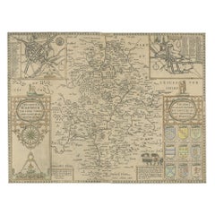
The County of Surrey Described and Divided into Hundreds
Engraving with later hand colouring and text to the reverse.
Dated to c.1650
36 x 49 cm
Probably the most famous early English mapmaker, John Speed's early life is somewhat of an enigma. He is believed to have trained as a rolling-press printer, but he was at heart an historian granted a sinecure in the Customs House by Queen Elizabeth to indulge his passion, later becoming a Fellow of the Society of Antiquaries. His first maps were historical, of the Holy Land 'Canaan as it was Possessed both in Abraham and Israels Dayes' and of England and Ireland recording 'all their Civill Warres since the Conquest'.
In 1611 he published his 'Hostory of Great Britaine' which he regarded as his magnum opus, but it was the companion atlas 'Theatre of the Empire of Great Britaine' that - as the first printed atlas of Great Britain - sealed his reputation. William Rogers engraved the first map, 'the County Palatine of Chester' in about 1600, but following his untimely death the task of engraving was passed to Jodocus Hondius of Amsterdam.
By 1612 the atlas was complete, the maps famed for their decorative elements. Many have town plans - Britain's first series of such plans - and descriptive text was printed to the reverse until the 1676 edition. Later printings (up until 1770) were issued without this text. By 1627 it has become a part of a world atlas 'Prospect of the Most Famous Parts of the World'. During the 17th century the plates passed through the hands of a series of publishers, the 1676 edition of Thomas Bassett and Richard Chiswell being regarded as its high point with the inclusion for the first time of a series of important maps. For the first half of the eighteenth century they were firmly established in the hands of the Overton family.
This particular edition originally featured in The Theatre Of The Empire Of Great Britaine. It features attractive inset views of the long-since destroyed Richmond and Nonsuch Palaces, compass rose, scale of miles, coats of arms and decorative strapwork. Its hand colouring also lends a bright charm to this map, highlight the fields and adding vibrancy to the coats of arms.
- Creator:John Speed (1552 - 1629)
- Creation Year:1650
- Dimensions:Height: 14.18 in (36 cm)Width: 19.69 in (50 cm)
- Medium:
- Movement & Style:
- Period:
- Condition:Generally very good, glued to mount (sold with frame), few creases.
- Gallery Location:London, GB
- Reference Number:1stDibs: LU795315665272
About the Seller
4.8
Vetted Professional Seller
Every seller passes strict standards for authenticity and reliability
Established in 2014
1stDibs seller since 2017
361 sales on 1stDibs
Typical response time: 13 hours
- ShippingRetrieving quote...Shipping from: London, United Kingdom
- Return Policy
More From This Seller
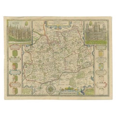
View AllJohn Speede Map The Countye Palatine of Chester with that most ancient citie
By John Speed
Located in London, GB
To see our other views and maps of England - including London, Oxford and Cambridge, scroll down to "More from this Seller" and below it click on "See all from this Seller" - or send...
Category
17th Century Realist Landscape Prints
Materials
Engraving
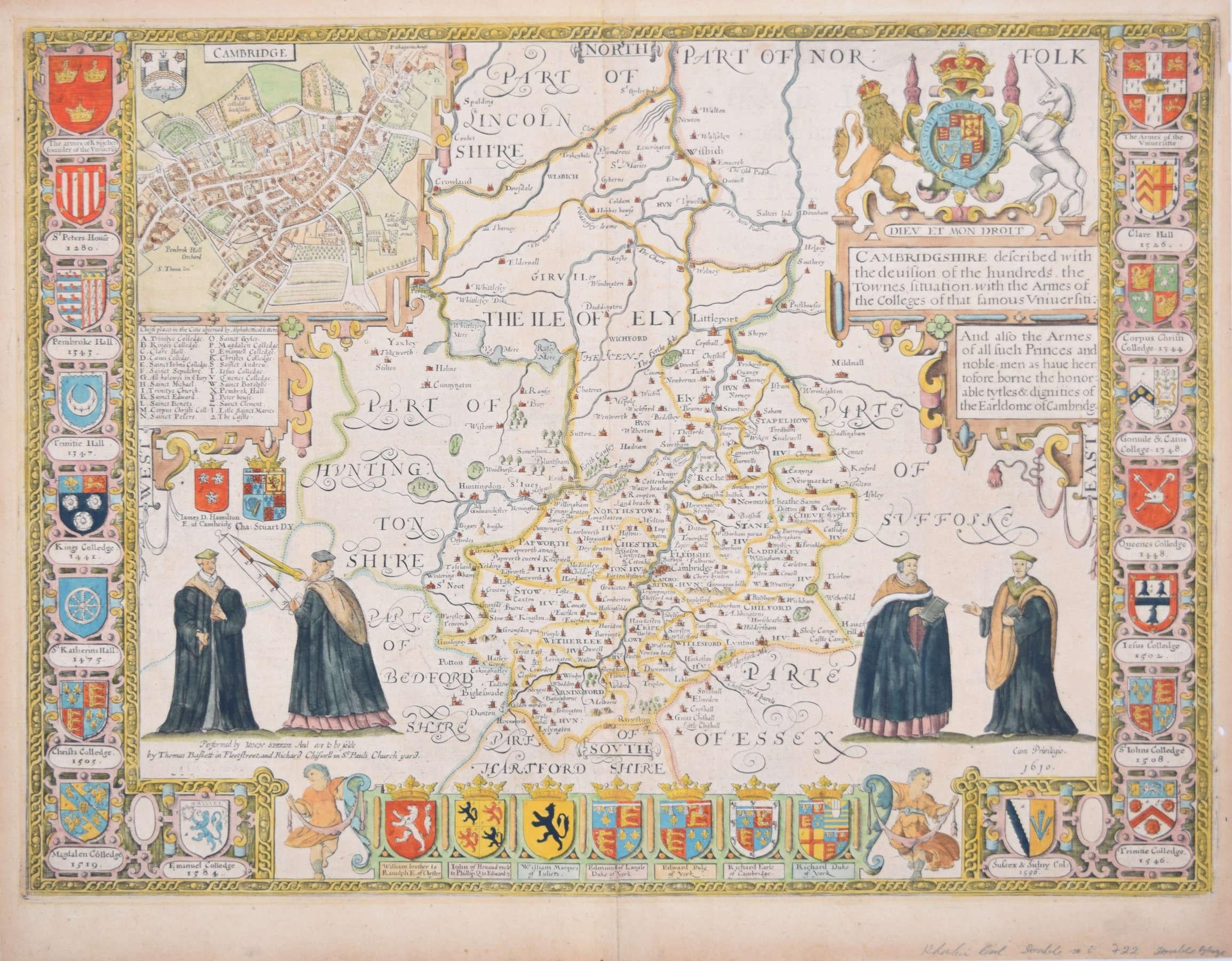
Cambridgeshire map 17th century engraving by John Speed
By John Speed
Located in London, GB
To see more, scroll down to "More from this Seller" and below it click on "See all from this Seller."
John Speed (1551 or 1552 - 1629)
Map of Cambridgeshire
Engraving with later hand colouring
39 x 53 cm
A beautifully coloured map of Cambridgeshire, with an antique description...
Category
1610s Landscape Prints
Materials
Engraving

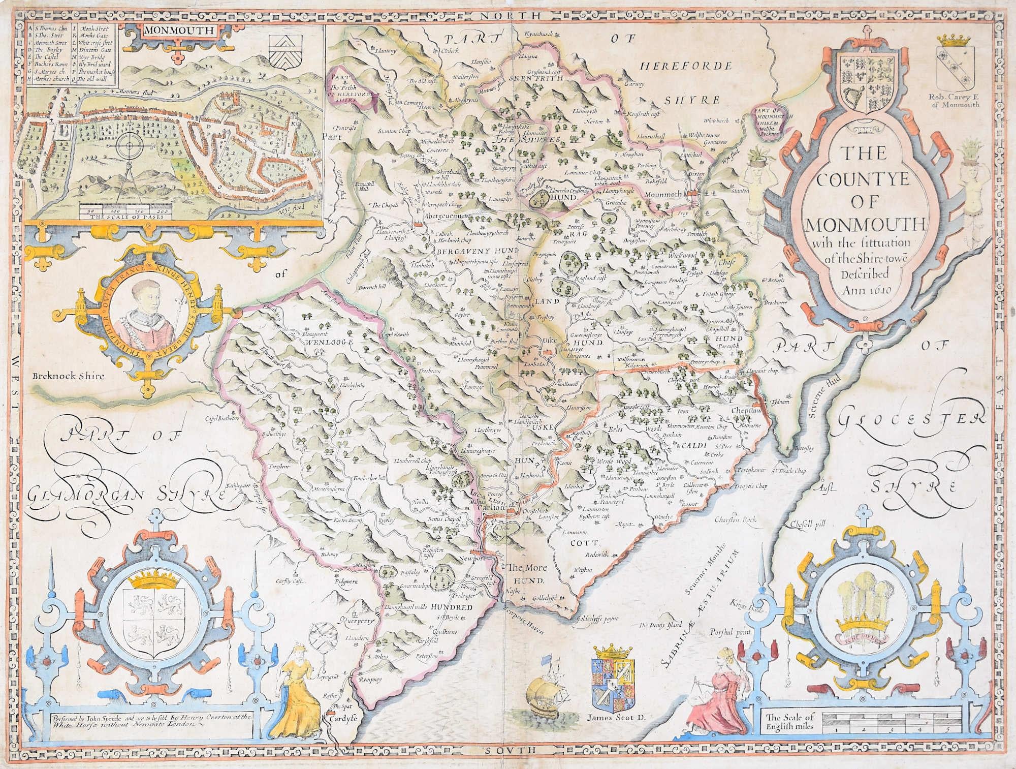
John Speede Map The Countye of Monmouth
By John Speed
Located in London, GB
To see our other views and maps of England - including London, Oxford and Cambridge, scroll down to "More from this Seller" and below it click on "See all from this Seller" - or send...
Category
17th Century Realist Landscape Prints
Materials
Engraving

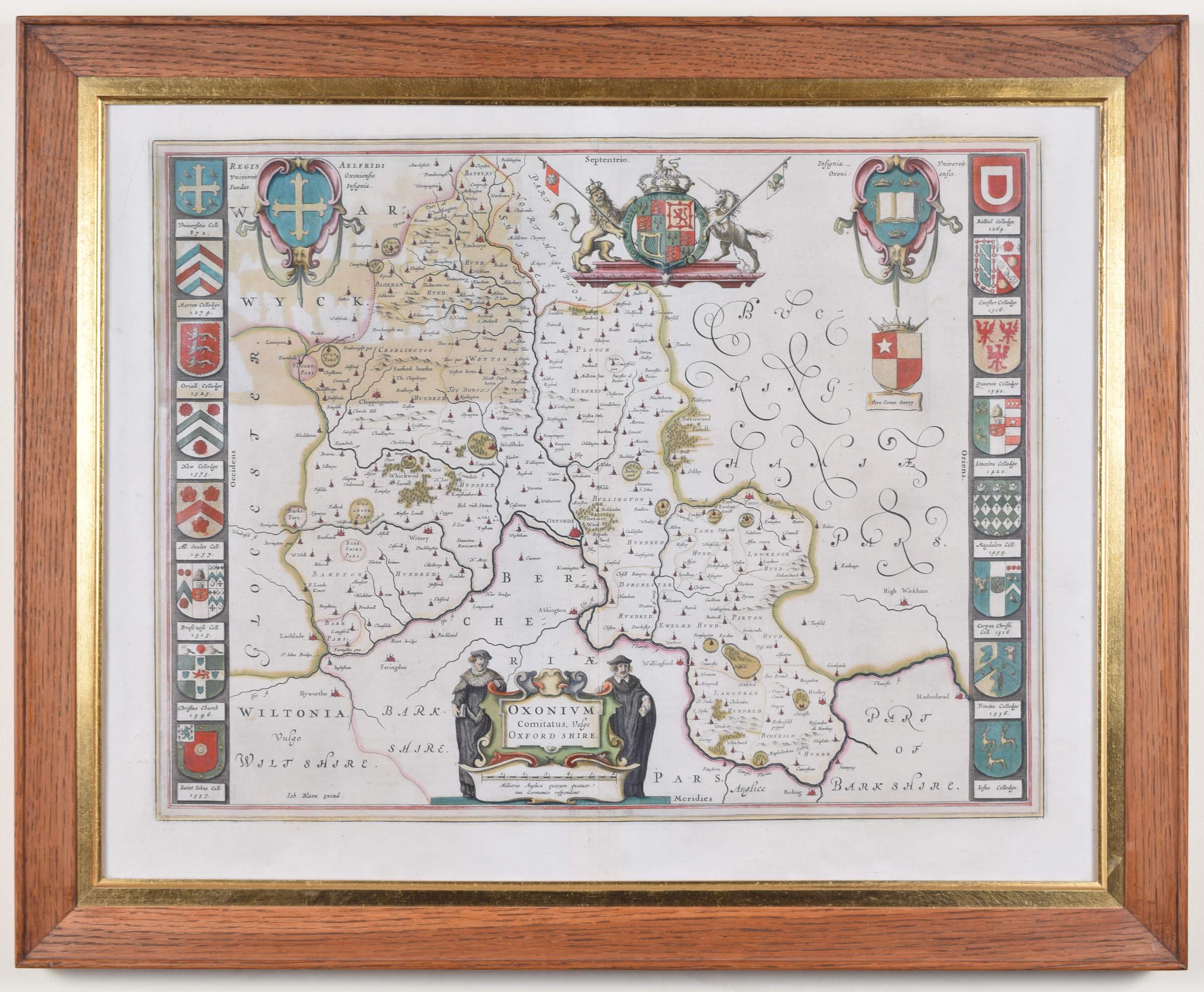
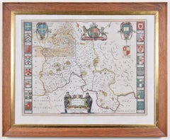
Map of Oxfordshire by Joan Blaeu with college crests
By Joan (Johannes) Blaeu
Located in London, GB
To see our other original maps, scroll down to "More from this Seller" and below it click on "See all from this Seller" - or send us a message if you cannot find the poster you want....
Category
1660s Landscape Prints
Materials
Engraving
Map of Oxfordshire coloured 18th century engraving by Thomas Kitchin
By Thomas Kitchin
Located in London, GB
To see our other original maps, scroll down to "More from this Seller" and below it click on "See all from this Seller" - or send us a message if you cannot find the poster you want....
Category
1760s Landscape Prints
Materials
Engraving

Cambridge map 17th century engraving after John Speed
By John Speed
Located in London, GB
To see more, scroll down to "More from this Seller" and below it click on "See all from this Seller."
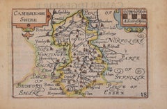
Pieter van den Keere (1571 - circa 1646) after John Speed (1551 or 1552 - 1629)
Map of Cambridgeshire
Engraving
8 x 12 cm
A beautifully coloured map of Cambridgeshire, with an antique description of the county to the reverse. The map, along with many others, was published in Speed's atlas, 'The Theatre of the Empire of Great Britaine', first published in 1611. This particular miniature edition of the 'Theatre' was published in miniature by George Humble in 1627, entitled 'England Wales Scotland and Ireland Described and Abridged With ye Historic Relation of things worthy memory from a farr larger Voulume. Done by John Speed.’ Speed's original map was likely engraved for this edition by Peter van den Keere. van den Keere's maps soon came to be known as "Miniature Speeds".
John Speed was an English cartographer, chronologer and historian. The son of a citizen and Merchant Taylor in London, he rose from his family occupation to accept the task of drawing together and revising the histories, topographies and maps of the Kingdoms of Great Britain as an exposition of the union of their monarchies in the person of King James I and VI. He accomplished this with remarkable success, with the support and assistance of the leading antiquarian scholars of his generation. He drew upon and improved the shire maps of Christopher Saxton, John Norden and others, being the first to incorporate the hundred-boundaries into them, and he was the surveyor and originator of many of the town or city plans inset within them. His work helped to define early modern concepts of British national identity. His Biblical genealogies were also formally associated with the first edition of the King James Bible...
Category
1620s Landscape Prints
Materials
Engraving
You May Also Like
Antique Map of Surrey by Speed, 1676
Located in Langweer, NL
Antique map titled 'Surrey described and divided into hundreds'. Map of Surrey, England. Includes inset elevations of Richmond and Nonsuch Palaces. This map originates from 'Theatre ...
Category
Antique 17th Century Maps
Materials
Paper
$465 Sale Price
20% Off
Antique Map of Hertfordshire in England by Speed, 1627
Located in Langweer, NL
Antique map titled 'Hartfordshire described the sittuations of Hartford (..)'.
Map of Hertfordshire, England. Includes inset maps of Hertford and the Roman settlement of Verolani...
Category
Antique 17th Century Maps
Materials
Paper

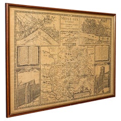
Vintage County Map, Middlesex, English, Framed 16th Century Print, John Norden
Located in Hele, Devon, GB
This is a vintage county map of Middlesex. An English, framed reproduction of the 16th century original by John Norden, dating to the late 20th century, circa 1980. A fascinating rec...
Category
Vintage 1980s British Elizabethan Maps
Materials
Glass, Paper
Antique Map of Warwickshire by Speed, c.1614
Located in Langweer, NL
Antique map titled 'The Counti of Warwick (..)'. Map of Warwickshire, England. Includes inset town plans of Warwick and Coventry. This map originates from 'Theatre of Great Britaine'...
Category
Antique 17th Century Maps
Materials
Paper
$446 Sale Price
20% Off
Antique Map of Essex by Overton, circa 1710
Located in Langweer, NL
Antique map titled 'Essex, devided into Hundreds, with the most antient and fayre Towne Colchester (..)'. Map of Essex, England. Includes an inset town pl...
Category
Antique Early 18th Century Maps
Materials
Paper

$903 Sale Price
20% Off
17th Century John Speed Map of the Barkshire Described, c.1616
By John Speed
Located in Royal Tunbridge Wells, Kent
Antique 17th century British very rare and original John Speed (1551-1629) map of the Barkshire Described, J. Sud and Georg Humble, publication (1616 or lat...
Category
Antique 17th Century British Maps
Materials
Paper
